We’ve all been there. That one thing that keeps you powering on, even when your legs and your mind say this is a really dumb idea.
For both J and me (and maybe daughter A and her boyfriend N – although i haven’t asked them) the man in the mist on Mt. Jefferson in New Hampshire’s White Mountains did just that.
It had taken us forever to find the trailhead, which seemed to veer off of Google maps onto some narrow dirt road. And once there, the hike up the rocky, fog-laden trail was more uncomfortable than awe inspiring. The one overlook was a bleak landscape of grey fog, with none of the autumnal offerings we were hoping for.
We’d just encountered a miserable family of four – two parents, two kids – one of whom was scampering up the rocky cliffs like an energizer bunny while his older sister wept below and threatened mutiny if forced to go further.
We knew we were near the top, but we were still in the fog, The goal was starting to seem less and less significant. A was making serious queries about the rationale for further climbing.
But just at that point – looking for all the world like an older Jamie from Outlanders – a figure emerged through the mist. In a vaguely European accent he said it was no more than 20 minutes to the summit and he had already come through the pass from the next mountain, which he summited already that morning. At that point, it was only the fact we’d all collectively seen him that reassured us we weren’t having individual delusions.
So we kept on climbing. It took us another 45, not 20, minutes but we got there. Sometimes it just takes a man in the mist. J claimed he was the spirit of adventure. Something most of us don’t get enough of in our lives.
Stok Kangri is a snow covered mountain 6153 meters, or 20,187 feet, high. Yes, that is a reference to Hemingway’s “Snows of Kilimanjaro” and I don’t expect to see a snow leopard, dead or alive, anywhere up there. It’s supposed to be pretty arid. And, it’s only partially snow covered. But Kilimanjaro is what started J and me on this summit journey, seven long years ago. God willing and the creek don’t rise, we’re off to Stok Kangri in the Kashmir region of India starting on June 24 of 2018.
To top it off – it’s not just the two of us, but our friend SB, from Alaska, is going too! I sent a casual Facebook post to him about our tentative plans, and within 72 hours he’d committed. SB is the person who gave me that last push – and I mean a literal push – to get up that last steep incline to the top of Mount Elbrus in the Caucuses region of Russia when I started this blog in 2014. Ever since, J and I have said how much we’d like to climb with him again – and now we are! He’s climbed Denali and Aconcagua and actually knows what he’s doing. Provides a lot of confidence for J and me.
This is going to be a first. We’ve made it to 19,347 feet on Cotopaxi in Ecuador in 2015. But we’ve never made it to that elusive 6,000 m/20,000 ft. peak. This is our one chance, before we go totally grey and spend our time sitting by the fire – although in Florida that would mean before a cool air conditioner. There will be a lot of more details to come.
It felt as though we’d already had a full day of activity – after all, we’d just peered at Everest from 18,200 feet at the summit of Kala Pattar – but we had hours of trekking ahead of us. After breakfast in Gorak Shep, we headed off to Pheriche, via Lobuche, where we had stayed two nights ago. We had lunch at the same tea house – the Oxygen Altitude. Such an appropriate name – M and S suffering a little bit – sometimes the way down is actually harder than the trek up.
After lunch in Lobuche, we traversed again past the memorials to the dead Everest trekkers (this time getting a photo of the one in honor of Scott Fischer – after all, his old company, Mountain Madness, has been responsible for a lot of our adventures), and then down what had been a very long uphill on the way to EBC. After a bit, we made a right turn and headed into previously unhiked areas toward Pheriche.
We descended into a wide flat valley with spring grasses and flowers sprouting up. The monsoon was starting early this year, and we experienced a bit of hail, followed by rain. The wind picked up, and we marched along stoically, picking our way amid puddles and piles of yak dung.
We finally reached the village of Pheriche and our abode for the night, the Himalayan Hotel. It was the nicest place we had stayed for a while. Each room had its own bathroom and there was a huge dining room. I had dahl bat for dinner. J and I were both exhausted after climbing Kala Pattar and then hiking five plus hours mostly in rain. But we were at a lower altitude and it’s amazing how well you can sleep lower than 16,000 feet – especially with an en suite bathroom.
I awoke without a headache for the first time in a while. For me, at least, altitude just does that. You learn to live with a low grade headache each morning – but two ibuprofen and two cups of coffee typically take care of it. We took our time and finally departed about 10. There was a lot of downhill and then up along the side of the valley with the milky river below.
Stopped for some bathroom breaks at various small villages; we were moving back into village culture. Mani stones and stupas were the order of the day again. At the Wind Horse Lodge – the elderly owners sat outside in the sun. The man had a mala in one hand and an individual prayer wheel in the other – as he spun it the mala beads slipped through his fingers, effortlessly counting his prayers. His wife wore the traditional apron over her brown skirt – topped by the ubiquitous down jacket that everyone wore.
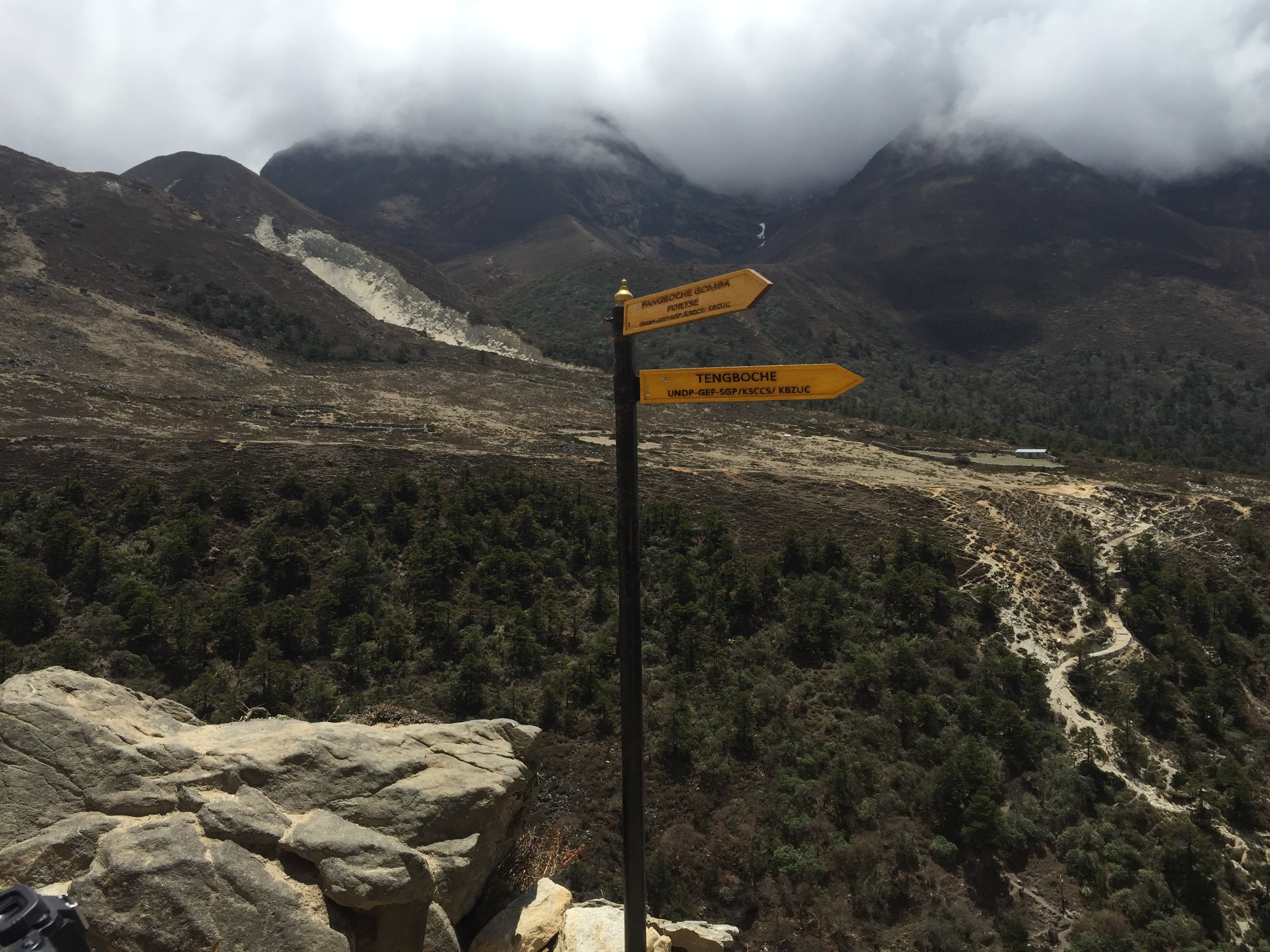
This time, instead of Upper Pangboche (home of the flying monk – recounted in Everest Base Camp Trek – Tengboche and Dingboche (or Lost Horizons)) we went through Lower Pangboche. It was an active little village, with juniper incense burning outside many of the tiny shops. By now blisters were running rampant and I was the cause of the next stop for foot care issues.
We had descended to the tree line now, and wild purple iris were starting to reappear. We crossed the river a couple of times, and then made our way up a long uphill through the rhododendron forest back to the placid setting of Tengboche. It truly was a Shangri La moment, and even more pink and purple spring flowers had bloomed since we were last here. We had lunch and hung out in the dining room, watching the grey mist settle in over the grazing cows and horses. Despite this, a group of monks in their crimson robes made their way across the meadow into the neighboring field for an energetic game of soccer. We did nothing so energetic. Instead, our little hiking group engaged in a lively game of snakes and ladders on one of the many board games in the dining room.
The next day we had to make our way to Namche. We’d walked this path before. But it looked totally different from the opposite direction. I think this is possibly the most beautiful part of the whole trek – and possibly any trek. It was nearly all rhododendron forest – crimsons of all shades, steep snow-capped mountains, clouds, and blue skies. The rhododendrons were so bright you could see splashes of colors in the distant mountains like fall leaves.
At one point we saw a musk deer, unusual for this area. They are hunted for their musk glands, and grow long canine teeth.
It was a relatively short hike to Namche and we were back at the now familiar Himalayan Culture Home by lunch. It seemed warmer this time. In the afternoon we climbed a series of hills to the rather dilapidated National Park Museum (most notable for the Tenzing Sherpa statue) and the Sherpa Culture Museum. It is an odd place. Owned by a man who had lost his hearing to meningitis, didn’t go forward with his education and instead opened the museum. He’d hosted Sir Edmund Hillary in his later years. We were ushered into a dank and moldy basement where we sat on folding plastic chairs and watched a 20 minute slide show about Sherpa culture projected on the wall. And the inspected the very impressive – but not updated – photos of every Sherpa Climber who had scaled Everest.
We had an early night that night (not that any weren’t early). The next day we had to make it all the way to Lukla. On the way, this had taken us two days and now we had to do it in one.
ALERT – photos will have to be uploaded later. I’m writing from Nepal – and am seriously wifi challenged at the moment!
After we exited our flying tin can (also known as a Twin Otter) in Lukla and had a cup of tea, we immediately started uphill. The first part of the EBC trek is nothing as much as a human highway connecting numerous small villages. There are no combustion vehicles of any types – no farm equipment, no cars, no trucks – and correspondingly, no roads. Instead there are yaks, gakyos (1/2 cow and 1/2 yak), and humans. Regardless of their size, they are all carrying huge packs. Yaks were carrying sacks of rice and blue containers of kerosene; one very small gentleman was carrying a load of rebar and another a full size freezer. Apparently the humans are paid by the amount of weight they are carrying. I have never seen such strong people – including at any gym I’ve ever been to.
Each little village has at least a mani stone – a large rock painted with mantras, frequently om mani padme hum. (I read a translation today at the Sherpa Cultural Center that said it meant “hail to the jewel of the lotus,” but I’m not sure how much stock to put in that.) You pass to the left of the stone, always clockwise. Many villages have prayer wheels, ornate cylinders also engraved with prayers that you run your hand along, turning them always clockwise. Some prayer wheels are powered by water. Sometimes bells ring as they turn.
A lot of places welcome you with a stupa. From the air it appears as a mandala. Generally, three terraces at the bottom represent the foundation of meditation. The dome is the womb of emptiness from which all comes. The box on top is painted with the eyes of the guardian Buddha. Some stupas, instead, have a statue of the Buddha in a glass enclosed niche. The 13 steps above represent the 10 levels of compassion and the 3 levels of tantric awareness. The umbrella is the sovereign sanctity of the Buddha mind and the crowning jewel in the top its wish fulfilling capacity. Buddhism is woven in to the fabric of everyday life here. On the return part of our trek I saw an old man sitting outside his tea house, running his fingers along his mala (a rosary of 108 beads) while spinning a handheld prayer wheel. His wife sat next to him, wearing the traditional long skirt with a woven apron on top, while their dog slept in the sun – all with the majestic mountains towering in the background.
Most fantastic – that first day at least – was Gauri Ghat monastery. An elaborate structure in the middle of the area, multiple prayer wheels under shelters decorated with paintings of the Buddha. A feeling of serenity throughout.
I had known before this trip that at some point I would encounter my nemesis – the swinging bridge of doom. It happened shortly after we left Lukla. For years my most frequent anxiety dream has involved a swinging bridge over a gorge where I can’t move forward or back. And that is exactly what I had to cross – following M’s white hiking shirt, feeling the bridge sway – at least 100 feet over the rapidly running river. I refused to look down or to the side (where I could tell the chain link fencing that formed the sides had been kicked out at the bottom, leaving a realistic possibility of slipping through). Saying mantras was a necessity.
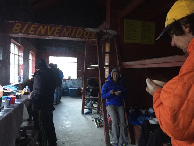
After three hours we reached Phak Ding and our first experience of tea house culture. The tea houses changed as we worked our way up to EBC and away from village into trekker culture. More on that later. But typically there’s a dining room that serves as a communal living area, common toilets (although our first two tea houses had “en suite” toilets – little did we know what a luxury that was!), and very cold small plywood pine rooms with twin beds, sheet and blanket, and if you were lucky, hooks and a light that would work after 6 pm. Ultimately we realized we needed to regard the rooms as a sophisticated version of a tent.
After lunch, we took a steep acclimatization hike through a pine forest and small fields of potatoes and onions and spinach to a monastery that was being repaired. The monks were painting elaborate designs in geometric and representational patterns in colors for each of the five elements (iron being the one I didn’t know about). The paint contained a special resin to make it shine.
We had to cross a second swinging bridge to get there – which made me no happier than the first – when who should appear but the guy who’d sat (slept) next to me on the plane. We recognized each other and exchanged pleasantries. Given my bitterness over the seat hogging, this was a fitting karma experience to accompany all the monasteries we had seen. And it’s not over yet.
The next day we trekked to Namche Bazaar (originally Nauche) where we were to spend two nights. Much of the route was along the Milky River, a mint green blue rapidly running river that accompanied us most of the way to EBC. Today involved not two but five swinging bridges. Fortunately M continued to wear the white hiking shirt so I still had my driste to focus on. We had a lovely lunch by the river and the trail got progressively steeper. Fabulous views of the Three Sisters along the way. A yak herder following his yaks, while carrying his dog down the mountain.
We reached NB suddenly. A pretty village of square stone buildings with a interesting mixture of trekker culture and village life. Trekking has been part of Nepalese life since the 1950s. What’s amazing is that every last thing has been carried here – by human or animal. Namche does have a small airstrip for cargo, but even then – everything has to be moved several miles to the village.
A very nice tea house with some beautiful woodwork in the dining room but COLD rooms. There was even a version of a shower with hot water (the last one we would see for days). Probably the prettiest tea house we stayed in. Unlike the very crowded places further along the route, we were the only people staying there.
After we arrived, we went to the nearby monastery. A stupa is being rebuilt and the monks, all in crimson robes, were conducting four days of prayers to bless the items that will be placed in the stupa. Plus, day 4 is Buddha’s Day and there will be a big celebration. Because 12 monks were needed the prayers were occurring in the common area instead of the actual monastery itself. All of them sat in a row; the leader chanted in a deep sonorous voice and the others chimed in with various instruments- symbols, something that looked like a clarinet and bells. At one point plates of food were brought out as offerings – they would ultimately be left for the animals. There was a huge gold Buddha on one wall and a monk folding prayer shawls.
We visited the upstairs museum, near the rooms in the upper galleries where the religious objects are taken care of. A monk asked us if we wanted to go to the actual monastery where the prayers normally occur. 300 years old, the walls were painted with images of Buddha. There was a shrine with statues of the past, present and future Buddha. Butter lamps lit, colors and patterns on every square inch, but a sense of peace emanating from the sensory overload.
For dinner S and I tried yak curry, although I think it is usually buffalo. More of the local spinach, rice, potatoes, dal and apple pie for dessert (which was almost like an apple baklava).
During our full day in NB, our acclimatization hike to the viewpoint at the Everest View Hotel allowed us our first view of Everest, Ama Dablam and Lhotse. We trekked gradually at first and then steeply up to about 12,600 feet, from pines to scrubby pines. Then down the other side of the valley to Kung Jung (sp) – tranquil, uncrowned, green rooves, and the home of the school founded by Sir Edmund Hillary.
After poking around NB in the afternoon, we had Sherpa Stew for dinner. A thick broth with dumplings and potatoes, ginger, spinach and carrots.
Twenty years ago, Husband J and I and our dear friends M and S used to sit in restaurants with small children in tow (who were frequently vying to see which of them could engage in the most dangerous dinner table activity involving condiments) and fantasize about the exotic trips we’d take once we were empty nesters. We started small – with St. Augustine, graduated to Iceland and discovered we actually made good traveling companions – and now I write this from Namche Bazaar in Nepal on our trek to Everest Base Camp.
But first things first. How did we get here? After enjoying a night at a hotel at the Hyatt, courtesy of our daughter A, we got up at the ungodly hour of 2:45 am to check in for our flight to JFK. At least we could return to our rooms after. At JFK we had the pleasure of the Airtrain tour of the whole airport since it turned out going from terminal 5 to 4 required visiting every other existing terminal first. Tours of the backsides of airports ended up being a theme of the trip.
Emirates lived up to its name, free drinks, good food and an unending supply of movies. After 12 long hours our gigantic Airbus descended in Dubai as gracefully as one of the egrets on Lake Ivanhoe. And we could even see the landing through the cameras affixed to the outside of the plane.
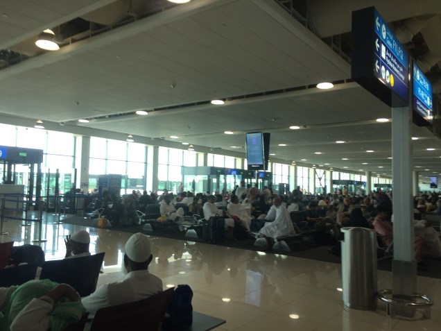
We took yet another airport tram – this time to circumnavigate the airport in a short 45 minute journey from terminal 3 to 2 with a visit to terminal 1 thrown in for good measure. Terminal 2 was a far cry from the rarified and modern Emirates terminal. It was teeming with people, all wearing every variety of regional dress of the Arab world imaginable. As usual, I realize how provincial we are in our outlook. Where were the groups of men in white robes, wrapped a bit the way the Masai wrap their cloaks, from? How about all the men in long cotton shirts, sitting barefoot in lotus position? And the group of ten or so women lying on the floor, completely encased in their black burkas, with one older woman awake and sitting guard over them?
Finally our four hour layover ended and we boarded FlyDubai for a four hour flight to Katmandu. I had the pleasure of sitting next to someone who immediately fell asleep and hogged the entire armrest, not to mention part of my chair. More about him later. There’s a karma story coming.
After finally getting some sleep on the plane, we landed on time in Katmandu. Fortunately we didn’t face another airport tour. Hint to travelers – get your visas before you arrive! It was the equivalent of a TSA pre. Our duffel bags all arrived as did our guide, Z.
Katmandu traffic is insane. The city was packed, people selling wares along the street, tiny shop after tiny shop. Hordes of motorcycles weaved between vans and vehicles, for all the world like a motorcycle gang out of Mad Max.
It took close to an hour for what we learned the next day was only a 20 minute drive. Finally turned into what I think was a more elegant section of town (it was dark) and to the very nice Yak ‘n Yeti Hotel. We had a lovely quick meal at the bar – and then spent another hour repacking and reweighing everything to get our luggage down to 15 kg. They are serious about the weight on the flight to Lukla.
A 5 am we journeyed back to the airport. It was a scene of chaos. Trekkers, guides and monkeys (yes, monkeys) running through the airport getting ready to board the 20 person flights to Lukla. Well, not the monkeys. Went through at least three metal directors and M and I kept getting relegated to the special women’s line – but never had to remove shoes and no one worried about liquids.
The plane ride lived up to its reputation. 20 people, 10 a side and an open cockpit. It turned out we were one of the last flights out – the rest were canceled for weather reasons. We flew between sharp green mountains , clouds floating around us, and eventually a glimpse of the high snow covered Himalayan peaks, pasted against the sky like white jagged metal.
Landing in Lukla is like landing on an aircraft carrier. The runway is short and if the pilot doesn’t make an immediate right turn you’ll run into the side of the mountain.
We deplaned, found the bathroom (first rule of travel – go to the bathroom whenever you get the chance), and had a cup of tea at a nearby tea house. We were ready to trek.
No photo in tbis blog. I’ve been too busy. I started this post with five days to go. And now I’m staying in the hotel at the airport in preparation for a 6 am flight, followed by 24 hours plus of traveling.
I’ve faced my usual paranoia that the ridiculous hours I’ve been working in order to garner 2 1/2 weeks off will have so impeded my training I’ll find myself coughing as soon as I hit 10,000 feet, only to have a so far unexperienced asthma attack, get pulmonary edema, and expire somewhere at an unimpressive 12,000 feet. Matters have not been helped by the death of Ueli Steck a few days ago on Everest.
One can’t help but wonder about the possibilities. But more important than the possibilities – however tantalizing they may be – at least for those of us who have some great need for adrenaline – is figuring out why you’re going up the damn mountain in the first place.
The busyness – business of our lives has taken over. I don’t know about you, but if one more person asks me to do one more thing, I might just combust. I’m called upon every hour multiple times per hour to make decisions. Some small; some large. Whether my recommendation affects one or thousands – you know what? It’s just as important if it affects one person’s working life as it is if it affects many. Jobs are important to people.
Back to topic. I’ve been training for this trek since we came down from the last. And I really, really need to get away from that busyness – business. I’m hoping that somewhere in Nepal, on the way to Everest, there’s some fabulous lost horizon that’s going to give that sense of peace.
It’s certainly not the glamorous part of scaling summits or long distance trekking, but without it, neither of the former would happen. And so with the close of a holiday season that unfortunately held as much in the way of work as it did gift giving and merriment, it is time to jump back on the training horse and start to ride. OK, that may not be an apt analogy but you get the picture.
I’ve been scraping by with a 5K here or there and a few sets of weightless stair climbs in my building over the last few weeks. Yoga fell by the wayside entirely. So wrong. You’d think after as many years as I’ve been doing this I’d know better. But it’s hard to get your head into the necessary place even to start to exercise when the world is swirling around you with demands on every aspect of life – from family to social to work.
In fact, for inspiration today I even found myself changing my Facebook profile picture to one of me sitting on our front porch after a five mile run with a look of what I thought showed grim determination. But after one of my friends commented that it looked like I was saying “get off my lawn!” I decided I better swap it out.
So, with Nepal and Everest Base Camp beckoning – and some deadlines now met – it’s time to take that proverbial deep breath and just start. (Note I resisted the “Just do it” slogan.) Due to some changes in yoga class times I’m going to have to revamp last year’s schedule. I figure if I can write up a five page work to do list, surely I can assemble a seven day training schedule.
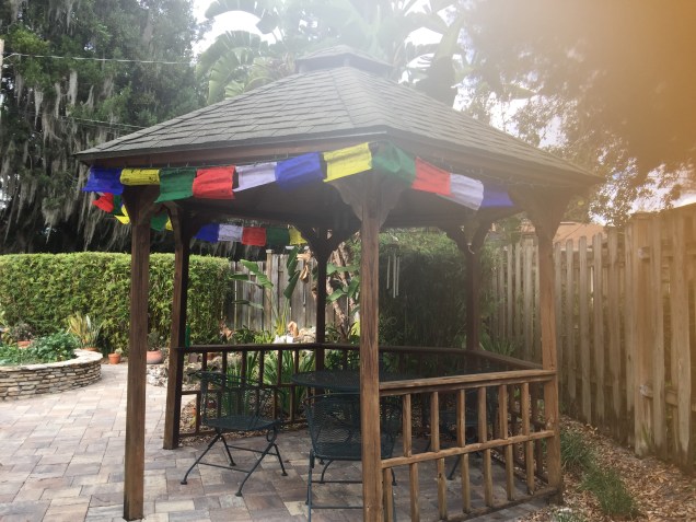
I’ll take any inspiration I can get. Right now those Tibetan prayer flags are helping. Just under four months.
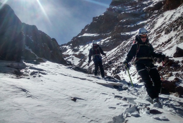
What goes up must come down. And after our guide R put the kabosh on my secret plan to snail my way ever so slowly up the glacier to the top, timing be damned, the down is what faced us. We started off at a good clip. Ever since my way too long climb down Mt. Elbrus in 2014, I’ve focused on descents, with some modicum of success. R put me at the front of the rope on the way down the canalone – it’s certainly the safest place to be, but it’s also the spot where you get to pick out the route and match all the mixed up steps in front of you to create some semblance of a path down. I could tell I hadn’t acclimatized well because as I descended I felt more and more energetic – and we moved much better as a team than we had at any point on the way up.
We finally made our way back to the scree field, and R went on ahead of us. J and I managed to pick our on way down, albeit with some wrong turns that increased the difficulty of the route. At one point we found ourselves on an 18 inch ledge with a sheer drop on one side. I’m sure that is not exactly the trail we were supposed to be taking. But at least the 18 inch ledge didn’t coincide with the increasingly high wind gusts. Two separate times I was literally knocked off my feet. There was a steady 30 plus mile an hour wind with gusts blowing harder. I didn’t slip – I was simply slapped down.
Finally we made it back to the strange stone aqueduct that led to the hut. Apparently at one point there had been a grandiose plan to work with water and drainage on Orizaba, leading to the construction of a now defunct aqueduct feature that forms the first part of the trail up the mountain.
And, how, you may wonder, were the other teams doing? Well, as mentioned, the Italian hadn’t even made it to the glacier before altitude overcame him. When we left the edge of the glacier, we could see three teams of two each inching their way up its stark white. They were no more than little black doodles on a white sheet of paper. It was hard to tell who was who, and it wasn’t until we were back at the hut and the two Russian teams showed back up without reaching the summit that we realized the top most team battling the high high winds was our own teammate G and our guide D!
I wanted to wait to greet them when they returned, hopefully after a successful summit, but after we’d packed up and they still weren’t down, it was clear it was going to be a lot longer. We’d already been climbing for about 8 or 9 hours, and the green of the forest below was starting to seem inviting.
And this is where the people part of the trip became bizarre enough to rival the uniqueness of our natural surroundings. We’d heard rumors that the Russian team included a high ranking politician and others – but how high ranking we didn’t realize until R arranged for us to hitch a ride down the mountain to the village in their two jeeps while he waited for G and D. There was one free spot in each van. J went with the politician and his fiancée; she hadn’t climbed but still looked pretty wind blown. When we say high ranking, we are talking cabinet level. I know; I figured out names and Googled everyone. Google images helped confirm I’d locate the right bios. Who expects to spend a night sleeping in the freezing cold on wooden platforms in a hut in remotest Mexico with government officials from Russia.
My jeep mates were equally illustrious in Russian political and academic ranks. Perhaps even more so for a would be mountaineer, as one of them had been a professional climber who had summited Everest in 1992 (where he and Scott Fisher of Mountain Madness fame had argued about placement of fixed ropes) and climbed K2 in 1996. He was also a snow leopard – meaning he had summited all of the highest peaks in Russia, no mean feat. (I found that last bit out through Google.) Anyway, we had a fascinating conversation on the way down, and it certainly added an international flair to the trip.
Luxury accommodations compared to the hut
Back at the hostel, we read and had a very late lunch. Eventually G and D showed up, with the glow of the summit still surrounding them and only a few bruises and battle scars to show. They had battled unbelievably high winds, and even though they couldn’t even stand upright on the summit, had the glory of being the only two climbers to make it to the the top that day. I just kept hoping a little of that karma would wear off on me.
We had one more night in the hostel. A whirlwind of Mexico City comes next.
Pico de Orizaba. From the steep scree slope that starts the climb to the glacier to our multi-national companions in the Piedra Grande refuge – this trip had enough twists and turns for any best selling novel.
After our day of rest at the Hacienda Santa Barbara, we packed up and drove a couple of hours through farmland and small villages into the heart of rural Mexico. We were aiming for the Orizaba Mountain Guides hostel, located in, I believe, Tlachichuca. It’s a very small village. One gigantic house, protected by an elaborate gate and wall, dominates the streetscape. We understood it to be a vacation house owned by people from Mexico City. Corn was drying on the rooves of many of the village houses, which a couple of days later was being fed into a machine that stripped off the kernels. A lot of houses had large gates leading into courtyards not visible from the road. Again, I was struck by the interior nature of life here – little looks out on the street. Everything is directed toward the private family life behind the walls.
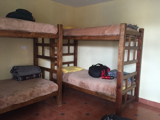
G, our team mate, husband J and I had a room with two sets of bunk beds, perfectly adequate, but cold. My light weight down jacket was practically glued to my body by then. We all went out and took a look at the mountain when it appeared between clouds – and it looked steep! No two ways around it.
Lunch was late – and filling. Pasta with a cheese sauce, followed by chicken breasts stuffed with ham and cheese. I decided we were just carbo loading. The afternoon was for rest and a few hours later it was time to eat again – this time steak. My mountain reading this trip was the Elena Ferrante Neapolitan novels quartet, and My Brilliant Friend was a good companion in the freezing room.
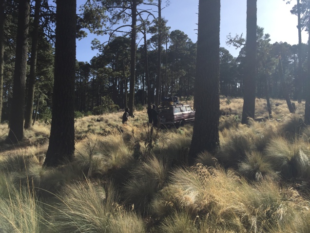
The trusty 4×4
Next morning we changed vehicles from the van to a beat up 4 wheel drive jeep that is de rigueur for the drive up to the mountain hut. Through an old growth forest to the tree line, continuing on a rutted road to the hut at about 14,000 feet. We were well aware that the wind forecast was very high.
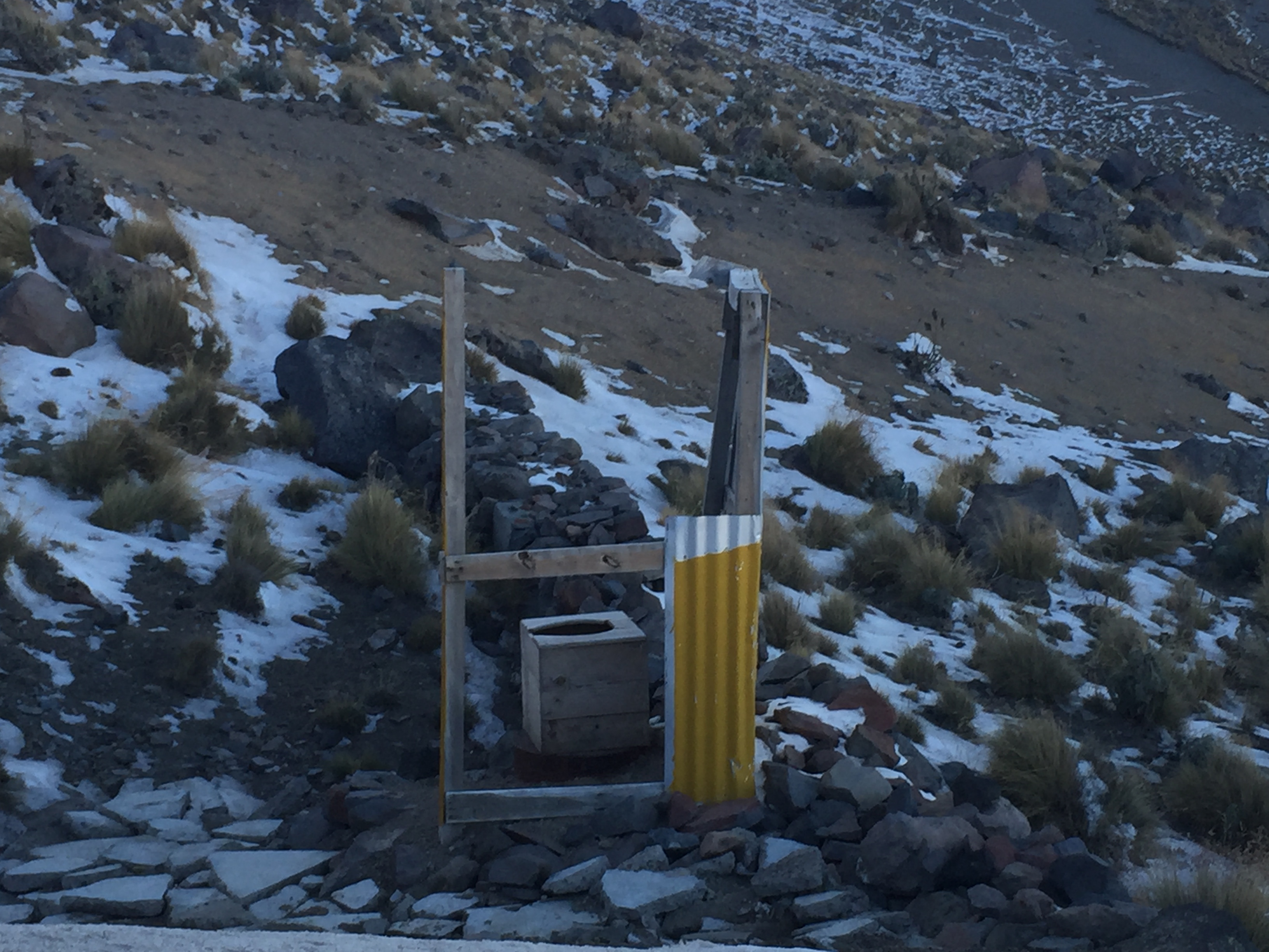
Outhouses around the world
The hut contained three levels of simple wood platforms and two counters for cooking and meal preparation for whatever teams had shown up. The outhouses were rivalled those at Mt. Elbrus in the Cacausus Mountains in Russia. These had even fewer walls, but an equally commanding view. We commandeered a lower level platform as soon as we arrived, and immediately afterwards were sent up on an acclimatization hike to high camp. We’d had a lot of conversation beforehand about whether to spend the night at high camp – which would have meant starting off with heavy packs and trying to sleep in tents – or whether to have a day with more altitude gain – but sleep in the hut and be better rested for summit day. In light of the wind forecast, we opted for the acclimatization hike to high camp and sleeping in the hut.
Made it to high camp
Our guide, R, decided to take everyone’s pulse ox (measures oxygen saturation) in the hut. Except for one time on Kilimanjaro at 16,000 feet, I’ve never had that done before. It’s not really clear what the measurements mean, and it can freak you out a bit. As it did me. G, our ironman companion, was well in the 90s; J was about 89; and I registered a whopping 84. Nope; not acclimatized.
But after our acclimatization hike scrambling up the scree field to high camp for a couple of hours, I could tell I was breathing better and better the more elevation I gained. Sure enough, by the the time we descended and were eating dinner and ready for our paltry hours of sleep before summit attempt, I was back up to 90. I think even our guides were surprised. But the fact is, I think the extra days of altitude I’d had in in Ecuador really helped me Eachieve that Cotopaxi summit.
Here are the players in the hut: our team: G, whom you’ve already met through this blog – Ironman triathlete and corporate executive, J, me, and our guides D and R. Next was an Italian climber, athletic, into snow boarding, with a Mexican guide. He read a paperback novel much of the afternoon before our summit attempt. A German woman with her American friend who walked from the hostel to the hut, arriving in late afternoon. We’d helped out by taking their wheeled suitcases from the hostel in our jeep and they were going for the summit the day after us. Possibly the first wheeled suitcases the hut had ever seen. I kept envisioning them pulling the suitcases up that rutted road. Then there was the group of Russians and their guides. More on them later. For you mountaineers out there – suffice it to say – Snow Leopard.
We had whatever hours of sleep could be snatched between the howls of the wind and arose at 2 am. You sleep pretty much in what you’re going to climb in so base layers were already on. For some reason, R thought we should hold off on putting on our climbing harnesses until we needed them higher up – never again will I do that. I’ve always put my harness on before starting a climb and that’s a lot easier than fighting with it in the side of a mountain.
It was unbelievably windy as we started, and the night stars glowed like sparklers. We headed up the same steep scree slope we’d just climbed that afternoon. But it felt even steeper and more exposed at night, and I also quickly realized that my resistance to putting new batteries in my headlamp (they were fine in Malinche? they are lithium?) was just dumb. It was definitely dimmer than everyone else’s and that makes a difference on a mountain, at night.
It was clear from the start that we were at a different pace than G, and not long after we began he and D, one of our two guides, took off up the mountain.
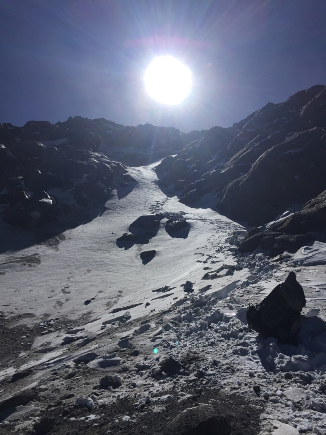
Finally, trudging away, we passed high camp, where we’d been just a few hours before, and kept going along a slightly less steep area to the canalone (spelling unknown), fighting wind every inch of the way. We knew in advance we weren’t going to attempt the Labyrinth, a steep outcropping of rock. It was too icy, and the canalone, a smooth flow of snow, was accessible. Only at that point did I start to feel that smooth movement where you are just putting one foot in front of the other and your breathing falls into rhythm.
By then we’d roped up and were in crampons – and I had been way too over confident in my ability to don crampons without practice, relying only on my success in July with them. Some things you just need to do over and over. At some point the Italian climber and his guide headed down. Apparently he’d had altitude issues and didn’t make it to the top of the canalone. The smooth slope up of the canalone quickly changed and we were back to rock and ice and deep steep snow up toward the glacier.
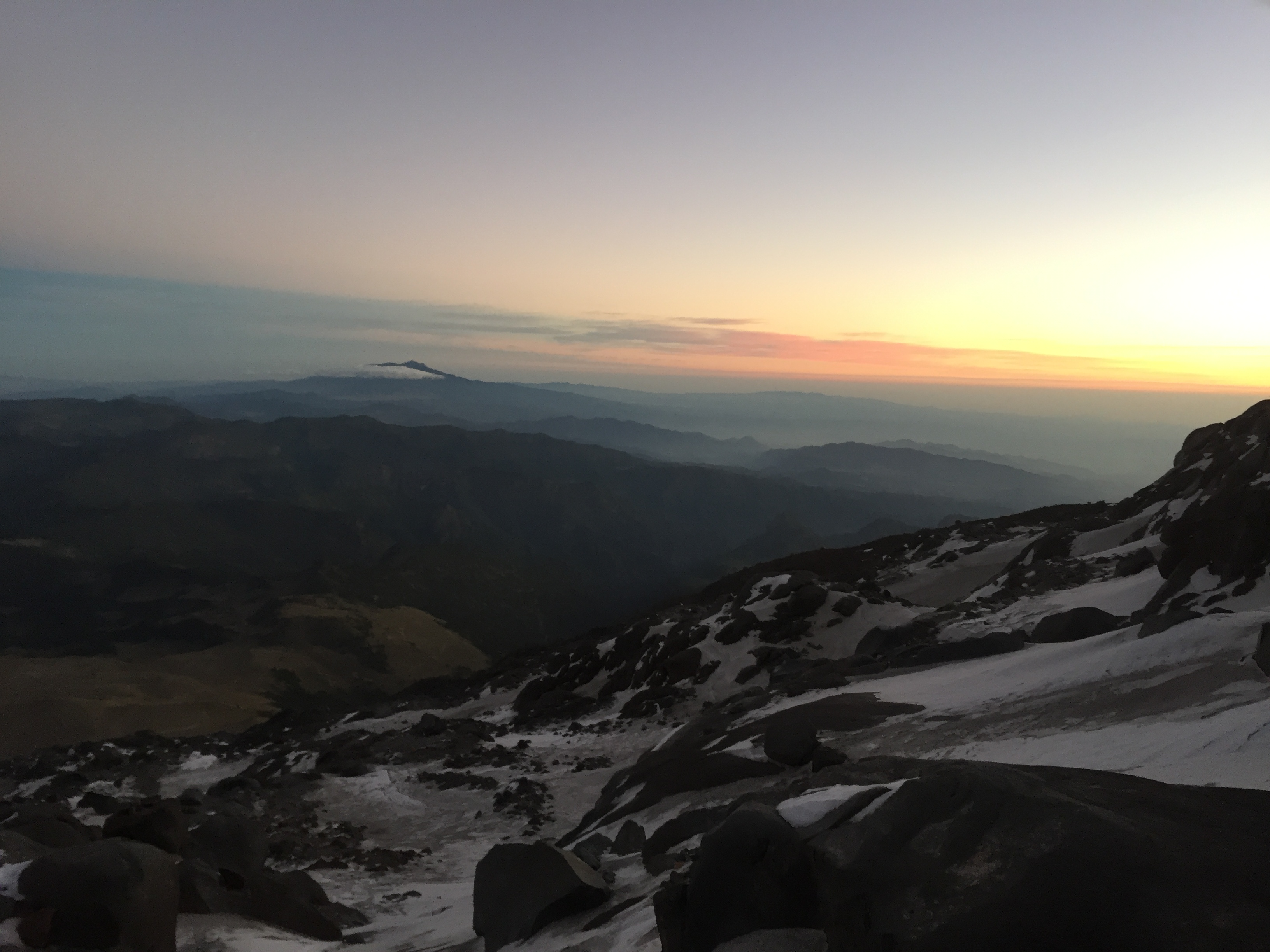
Sunrise over Orizaba
By then the winds were increasing even beyond what they had been, and it was pretty clear a summit attempt was not a realistic possibility. We were just too slow. I wasn’t properly acclimatized, and while small steps were manageable and I could get a rhythm, each time big step up required a real effort that then wiped me out for the next few steps. The wind was blowing; the sun glinting.
But you know, I probably would have kept plowing away forever, at whatever snail’s pace I was going. And I think R, our guide, realized that, because when we finally reached the glacier at about 16,000 feet he simply announced that was all for the day. I think he thought otherwise I would just keep putting one foot in front of the other, however many hours it was going to take. The glacier was beautiful. A steep field of snow, the summit peering down. Way up on that steep white meadow we could see the others on the mountain who’d passed us. There was G and D, from our team, and two groups of the Russians. All in all, we had reached the glacier, the Italian team had returned, and there were six climbers left on the mountain.
Next up – how we battled winds on the way down, hitching a ride to the village, and who got to the top of the mountain.
According to one of our guides, the mountain of Malinche, officially 14,636 feet but higher when measured by GPS, is home to one of the world’s highest forests. It’s a mix of tree and rocky trail, shielded forest glades and exposed ridges. Almost a metaphor for our entire trip to Mexico. The name given he mountains by the Tlaxcaltecs was Matlalcueyetl, which means “lady of the green skirts,” a goddess of rain and wind.
After our visit to the Teotihuacan pyramids, we drove several hours further, southeast toward Malinche, located in the state of Tlaxcala. On the way, stopped for lunch at restaurant where lamb tacos and rabbit were high on the list of menu choices. Venturing further and further into rural Mexico was a time machine experience. We soon left behind the truck stops – rows and rows of non chain cafes (except for the ubiquitous Oxxo – the Mexican version of 7-11) – and were driving through fields of nopales – the cactus that is the base for incredible salads.
There wasn’t a tractor to be seen. Men were plowing the land with horses and donkeys. Each small village had several shrines on the side of the road occupied by ornately dressed saints. And there were similar smaller shrines adorning the gates of many houses.
Eventually we reached the IMSS cabins in the park surrounding Malinche, at an altitude of about 10,000 feet. As I understand it, they are operated by the ministry of health or some other equally unlikely branch of government. They are two room cabins with a bathroom, nice tile but some unusual features. A refrigerator, but no stove? The bathroom leading off of the bedroom, railroad car style? One electrical outlet? No heat of course, and we were all wearing our lightweight down jackets (which had become like a second skin by the end of the trip).
We had quesadillas made with Oaxaca cheese for dinner, and went to bed early in preparation for a before dawn start up Malinche.
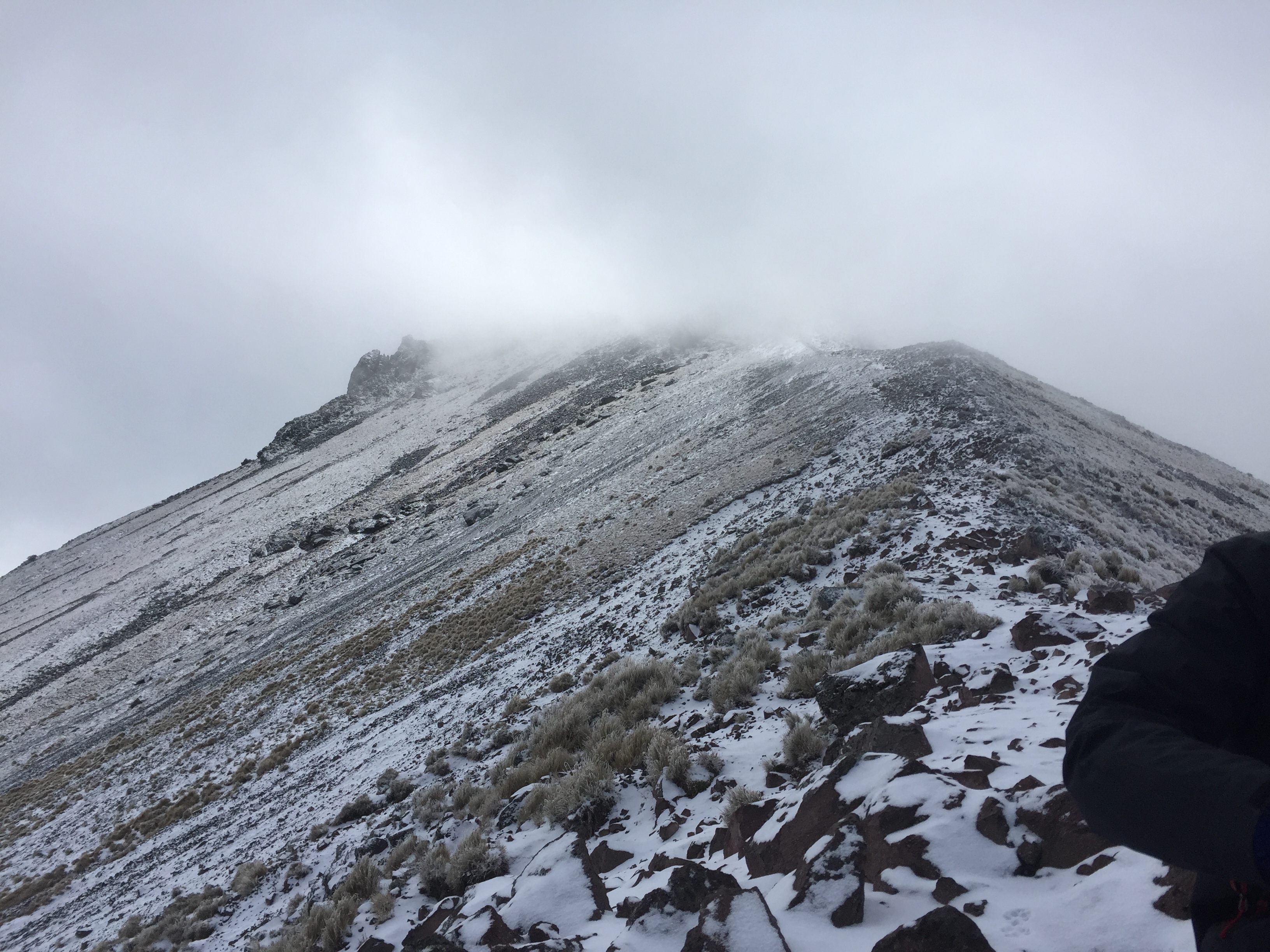
We started walking about 6, accompanied by three dogs who were our travel companions all the way to the summit. They clearly did this everyday, and seemed to be in excellent shape, so their presence didn’t cause my animal loving heart any angst. The first part of the Malinche hike is through beautiful forest that we could just make out by the glow of our headlamps. As the sun rose, the trail got progressively steeper. There had been frost, and drops of water sparkled on the grasses and bluebells still blooming here and there.
Eventually we reached the tree line, crossed a brief grassy section and moved onto steep rock and scree. Close to the top, you traverse a ridge, narrow in some points, and finally up a steep rocky section to the summit.
The wind died down just a bit so we, together with our dog companions and a couple of other climbers, could enjoy the partial views we got when the sun briefly appeared. It was surprisingly comfortable in the grey cloud at the summit – as if we were in a nest of cotton, safe at the top of our mountaintop tree. The dogs scratched the snow away and made beds for themselves on the warmer dirt. They were getting ready for the long trek down.
It took us about 5 hours to reach the summit – appoximately 4500 feet of elevation gain. We came down fast, running at times, in just under three hours.
Once down, we drove a short distance to the Hacienda Santa Barbara. Built in the 1600s, the hacienda is huge, yet only a few rooms are available for guests. J and I were in a large room, high ceilings and a small bathroom inserted into one corner. Heated by only a very small stove, we definitely needed all the blankets from the two beds. The floor was stone, and the window – which locked by way of a giant beam that slid across it – looked out in more ruins of outbuildings. Meals were in a dining room occupied by one large long table. And in the morning we had atole, as well as coffee, a hot drink made from corn and tasting like chocolate. Dinner was chiles rellenos, hot enough to warm us up even in that frigid dining room.
It was now Tuesday night. We knew Pico de Orizaba awaited.