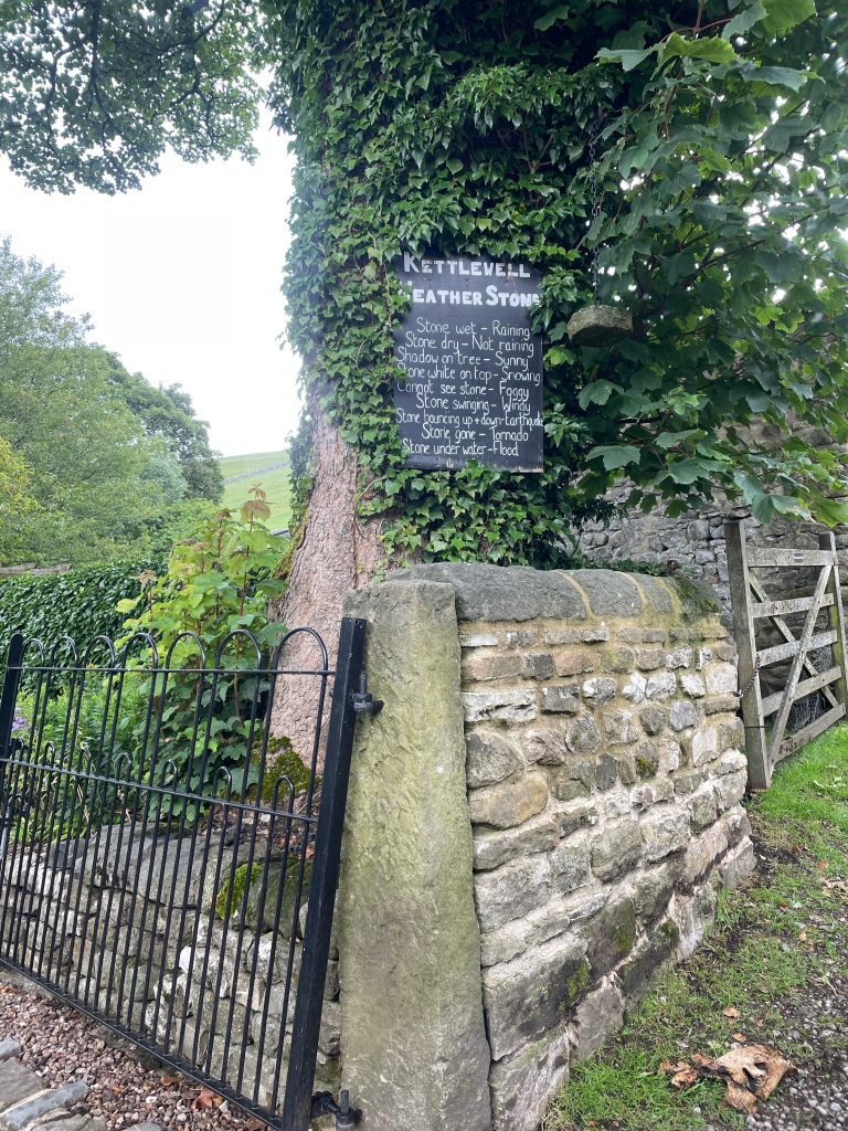
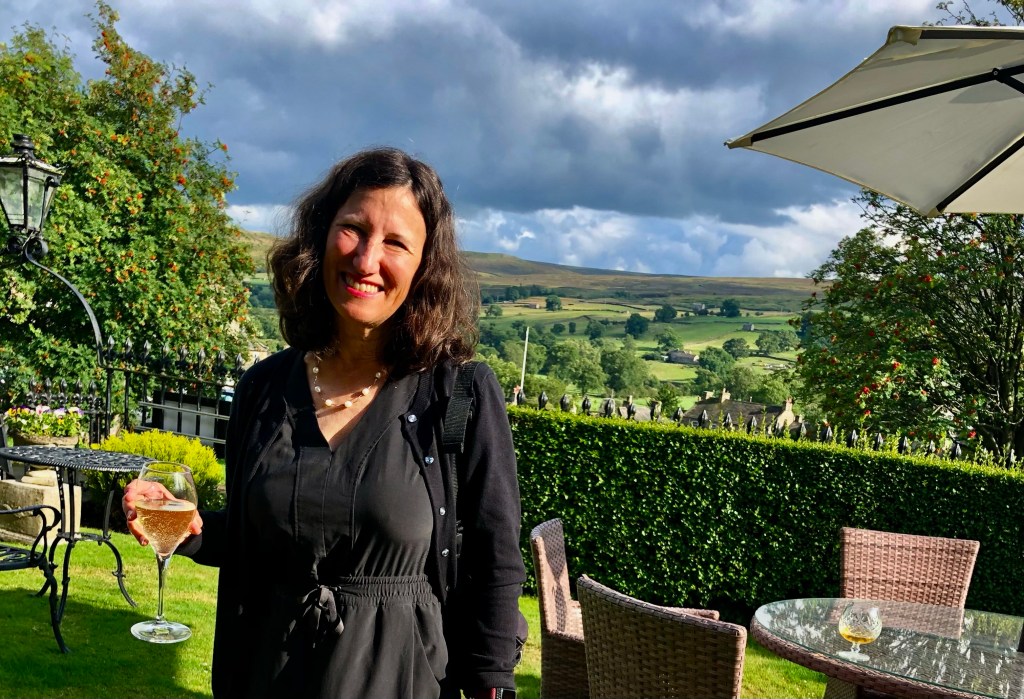
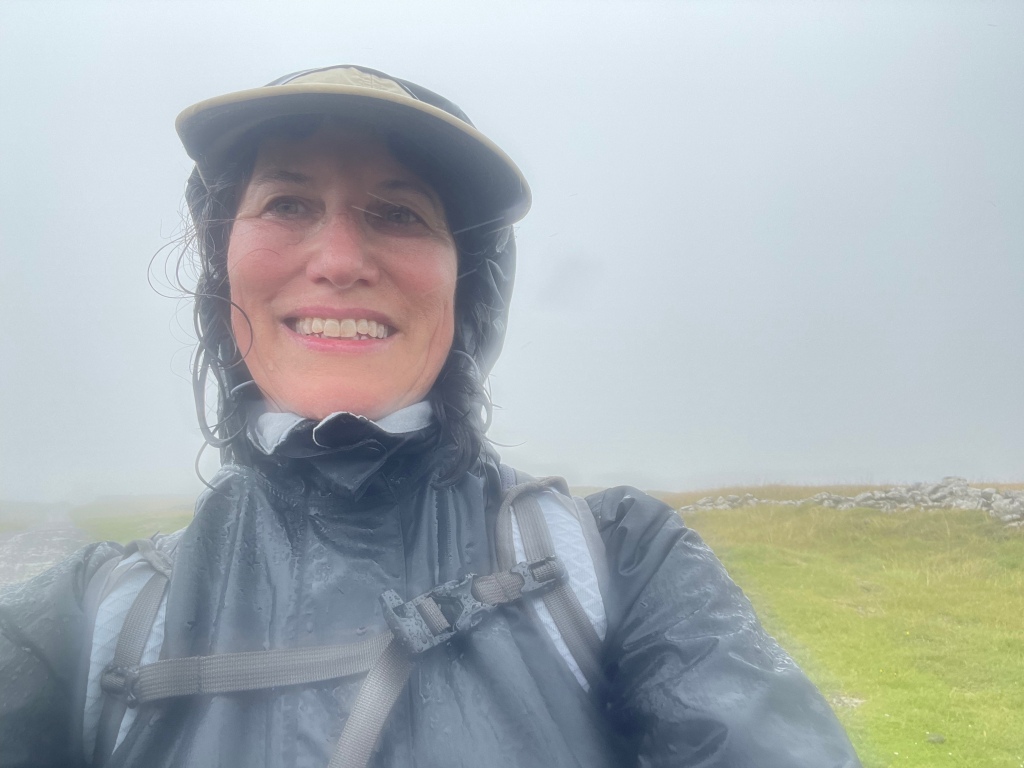
When last I left this blog, J, S, M and I had just completed our 77 mile hike through the Yorkshire Dales. After our celebration in Kettlewell (where I am pretty sure I inadvertently donated my now no longer manufactured hiking baseball hat to the Bluebell Inn) and an overnight in Grassington, the next day we took a horribly crowded train back to King’s Cross in London. Our original train was canceled, which led to mass confusion on the next train for those who had reserved seats versus those who didn’t or originally did or….you get the picture.
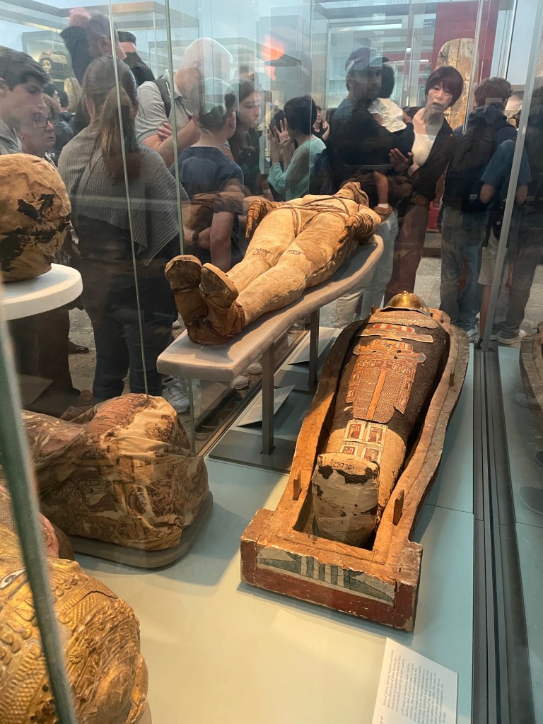
Once in London, M and S’s daughter, B (of Balkans fame) ( https://fromswamptosummit.com/2019/07/20/things-we-brought-to-the-balkans-were-on-our-way/ ) joined us and we all enjoyed a “cruise” down the Thames to Greenwich where S could indulge all of his astronomical interests by standing on either side of the Greenwich meridian at the Royal Observatory. J and I also had a look at the British Museum (incredibly crowded and apparently mummies are much more popular now than when I used to go inspect them in the 1970s). Also, the entire first floor is set up like a quasi shopping mall, which does cast the whole experience in a different light.
Regardless, I loved London as much as ever and J and I spent two of our three nights there going to the theater – Aspects of Love (really strange Andrew Lloyd Webber musical based on a novella by David Garnett) and a classic English comedy/farce, The Play That Goes Wrong.
Our final phase of the trip left a little to be desired. On an airline that shall not be named the following happened:
(1) Reached Orlando at the time of a massive thunderstorm that closed the airport;
(2) Circled Orlando until we were close to running out of fuel;
(3) Landed in Melbourne to refuel;
(4) Sat on tarmac because storm moved to Melbourne and it was too dangerous to refuel;
(5) So many hours had passed our crew was no longer legally able to work;
(6) Alternate crew was to be sent from Orlando via taxi;
(7) Were permitted into a secured hallway of airport (we hadn’t gone through customs) where the local airport officials doled out the world’s worst junk food from large cardboard boxes (think Combos filled with pizza cheese) – it was a bit like being one of the animals at feeding time in the zoo;
(8) After 6 hours in Melbourne the new flight crew arrived (to sardonic applause from the passengers);
(9) Flew 15 minutes at under 6000 feet to Orlando and landed;
(10) Were informed that we were so late that all the customs officers at the glitzy Terminal C had gone home;
(11) Taxied around the airport looking for a parking place (think looking for a spot at the mall during the Christmas shopping season [back when malls were a thing]); and
(12) Were finally welcomed at Terminal A in one of the Spirit gates. You know you’ve reached a new low when that’s your home port.
Regardless, a wholly successful phase one of sabbatical. Phase two was to start only two weeks later. The changing of the guards seems an apt metaphor for phase 2 – our U.S.A. Road Trip.
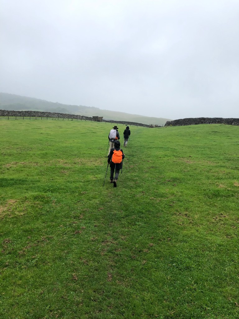
As we’d had several long and steep hiking days, we decided to knock off a couple of miles by avoiding a loop around something called Apedale Moor (which we couldn’t locate on any map anyway) on our way from Reeth to Bolton Castle and on into Aysgarth Falls.
This meant having the nerve to stray from the ever present blue GPS line that was our North Star to take a paved road called Hargill Lane practically the whole way. Just because it was paved, however, did not mean that it didn’t go up and down, and unfortunately, it was a quintessential long slog shin splint generator. Hargill Lane crossed windy, windy moors with absolutely nothing around but sheep and occasional cars that operated at the same speed as all the bus drivers – that is to say, fast.
Eventually the road descended into the conservation area for the Bolton Estate, lands that are still owned by the same family that held them hundreds and hundreds of years ago. There were many beautiful wildflowers, but they were interrupted by lots of warning signs for the quarry works on the other side of the road.
We reached the very well preserved Bolton Castle right at lunch time and had a nice meal in the tea room. The castle, built between 1378 and 1399, is quite intact, and M and I enjoyed the diagram that showed what each level of the structure was used for. There was also a lot of information about the castle’s architect, John Lewyn. Who knew castles had architects!
The walk from the castle to Aysgarth Falls was lovely. We did cross a field with another bull, which was actually starting to lunge at a couple on the other side of a wall who had a dog with them. (Incidentally, everyone in the Dales has dogs, and they are welcome guests in restaurants, pubs, shops, etc.) They had some long story about someone they knew who had recently been charged at by a bull and had to throw his dog over a wall….in any event, it turned out my bull fears were not unwarranted! While the bull was occupied with them, J, M, S and I managed to sneak over another section of the wall, unnoticed.
On the way, we also suddenly heard a huge roar overhead that practically shook the stone walls surrounding the fields. Two Typhoon RAF jets zoomed by, and made several passes. We soon learned that war had not actually broken out while we were in the solitude of the Dales, but that this was a popular location for the RAF to do low altitude training.
The Aysgarth Falls themselves were pretty, but by then we’d seen so many waterfalls, we were somewhat jaded, and just as glad to keep on moving up a steep hill to our next guest house — the newly renovated Aysgarth Falls Hotel. Despite three flights of stairs (thank God for those backpack straps on my suitcase!), it was really nice and we thoroughly enjoyed their pub and dinner and breakfast food.
That was good, because the next and final day turned out to be the most challenging yet.
The plan was to walk from Aysgarth Falls to Kettlewell, where we would meet a taxi at 5:30 that would transport us back to Grassington, for our travel to London the next day. We wisely chose the 12.6 mile route rather than the 15.3…..
We started with some easy walking through fields and what was described as some “unavoidable” road walking. But there was little traffic, and the flowers were pretty as we basically hiked the length of the valley. Despite its remoteness, a number of little cottages bore signs of construction.
Eventually the valley ended, and so did the road. A very nice farmer gave us directions (the blue line becoming somewhat cryptic at that point), and we were able to cross the river and start what was described as a “big up.”
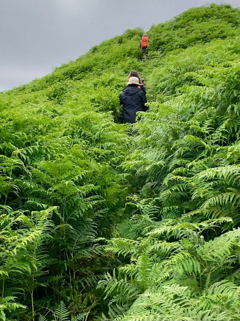
We were completely distracted from the steepness of our ascent because the almost imperceptible trail started to lead us through fields of five plus foot high ferns. They literally towered over us and I found I was using my body as a battering ram to push through. It felt way more like an Amazon jungle than the Yorkshire Dales.
Part of the way up, we realized there may have been a slightly more trodden path, but we were too busy bushwhacking and trying not to be swallowed by the ferns to have seen it.
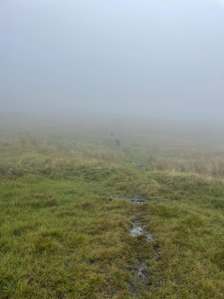
We finally cleared the fern field and continued to ascend. It was a very rapid elevation gain. Suddenly we found that we were no longer below the low hanging cloud we’d been observing all day, but were actually in it!
Yet still we continued to climb up. Visibility was starting to close and navigating the blue line was like flying a plane on instrumentation only. We encountered one group of young scouts using maps who were clearly doing some sort of orienteering exercise….they seemed infinitely better equipped for the challenge than we were.
We had no choice but just to stick to the GPS line as much as we could and aim toward the cairns and waymarkers that we could see. Finally, the scout leader passed us asking if we’d seen his charges anywhere – we were relieved to see him as proof that civilization existed somewhere in the direction we were aimed.
Visibility continued to get worse and the wind was whipping. We stopped for a brief break by a the first stone wall we’d even seen. But by then I was simply dedicated to getting down as fast as we could because it really was starting to feel unsafe. I was beginning to feel like a character in one of those Sierra Club magazine articles about what can go wrong while hiking….they usually end with hypothermia or broken bones.
Anyway, we finally reached what the itinerary termed a “snappy descent.” To the dismay of my fellow hikers, I actually found that part sort of fun – skipping around and over rocks, but with lots of grass cushioning on either side. Plus we were going down.
But we were still in the cloud, and M and S were just dots in the mist. All I could think about was that we had to maintain visual contact. You really could have gotten lost up there.
Finally we were below the cloud, and the world started to come back into focus. We could see the village of Starbotton at the bottom of the peak we were descending, and the wind that had whipped us as we crossed the ridges of the moors died down.
A steep descent down a stone road, and we were back in the valley, only 2 1/2 miles from Kettlewell. We had a quick bite of our sandwiches, and then walked through the fields that lined the valley for a straight shot to Kettlewell.
We had made it – all 77 plus miles! We walked through the village to the Blue Bell Inn where we were to meet the taxi in an hour or so. We had a celebratory drink to toast our most recent adventure. And even the fact that the taxi was an hour and a half late picking us up didn’t really matter.
Rooms at the Herriot Guest House were quite small, but that was by far compensated for by their very good breakfast and homemade jams and marmalade. That provided enough to fortify us for a slightly easier – and hopefully drier – day 3 ahead.
The Mac’s Adventure itinerary called for us to be transported by taxi to Keld, which truly is a blip on the map. The taxi took us through the Buttertubs Pass – a location I was last in with my family in 1972 when we lived in England for my father’s sabbatical.
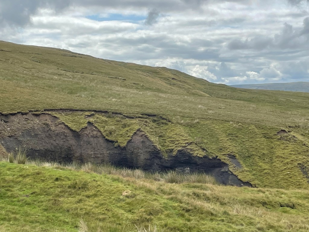
After an early arrival in Keld, we got on the road to walk to the Tan Hill Inn, famous for being the highest pub in England. About a 4.5 mile hike, over lots of moorland and gigantic ravines, where erosion peeled back the top layer of heather to reveal dark soil and rocks. For all of its age, just like the fossilized Jurassic coast in Dorset, this is an ever-changing landscape.
It was rewarding to see the inn suddenly appear in the distance, but the place itself was crowded with day trippers and there was nary a place to sit. Nonetheless, there were picnic tables outside, and we were able to make a nice lunch out of the Double Gloucester cheese and crackers that I had been carrying around since Manchester, alongside the middle aged men’s motorcycle group who were similarly shut out of the pub.
J and I chose to take the longer route back and crossed the valley, which was low and filled with green rushes, over to the next other ridge. The top flattened into a golden prairie-like meadow. We saw at least four or five “bouquets” of pheasants suddenly take off. On the ground they were perfectly camouflaged, soft brown speckles and beige. We would hear five short whistles and suddenly they would take off at top speed, looking for all the world like a group of feather dusters taking flight.
We could never capture a pheasant in flight, but at least I found some feathers!
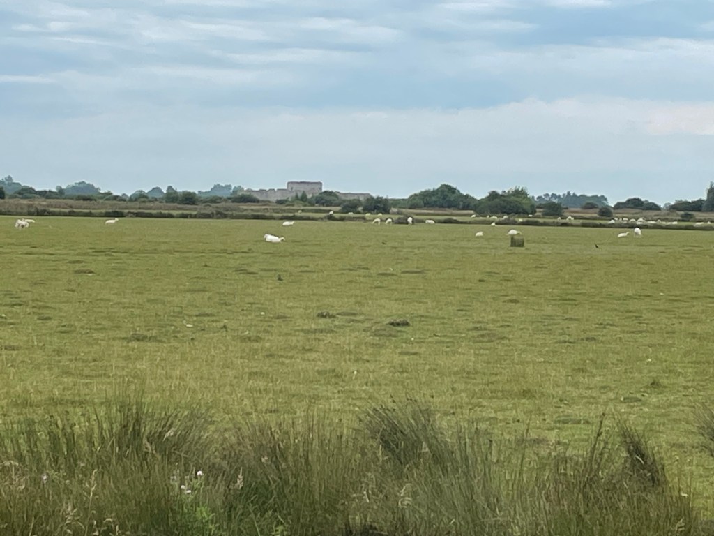
Our path took us by the rather large farming establishment of of the so-called “Yorkshire Shepherdess” of TV fame (although I’d never heard of her). She’s apparently one of those “leave the city behind, become a farmer, and write about it and develop a TV series” people. We did see two men, one on an ATV, which seems to be the farm vehicle of choice here, herd a group of cows into a barn. We had to wait until they were in before we could pass.
I know these are sheep, not cows, but I didn’t have a pic of the cows!
We were almost back in Keld when we managed to make a critical navigation error and ended up going the wrong way toward the small hamlet of West Stonesdale. It’s a true farming community, with working sheep dogs sleeping in their cages, and big agricultural equipment everywhere. Fortunately, I soon realized I was looking at the famous GPS blue line backwards, and we were able to correct our course and make it back to Keld about 5, just as S and M were starting to question where we were.
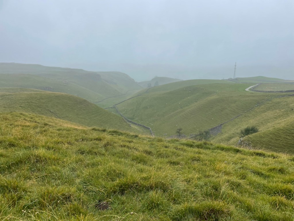
View from the Keld Lodge
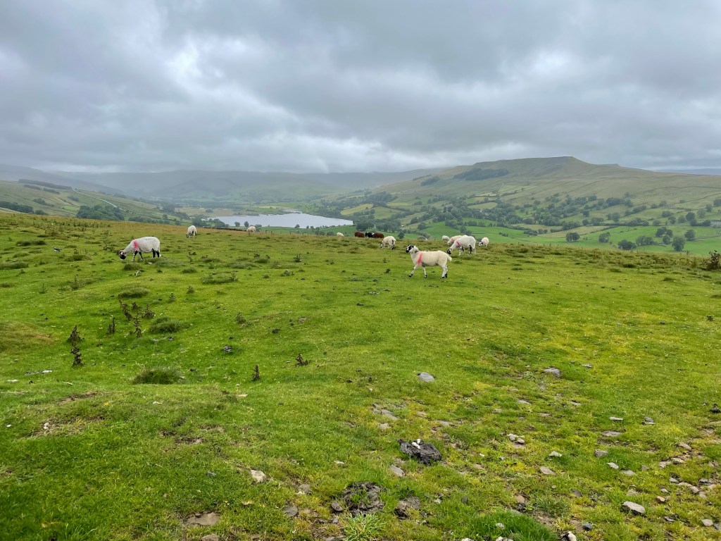
After an overnight at the Keld Lodge, the next day, Day 4, we were to trek to our next destination of Reeth. We had a choice between the “high” route, which would mostly be on the famous Coast to Coast trail, or the low route, which ran along the river. We fortunately chose the high route – and it did indeed provide some of the best summits and sights of the whole trip.
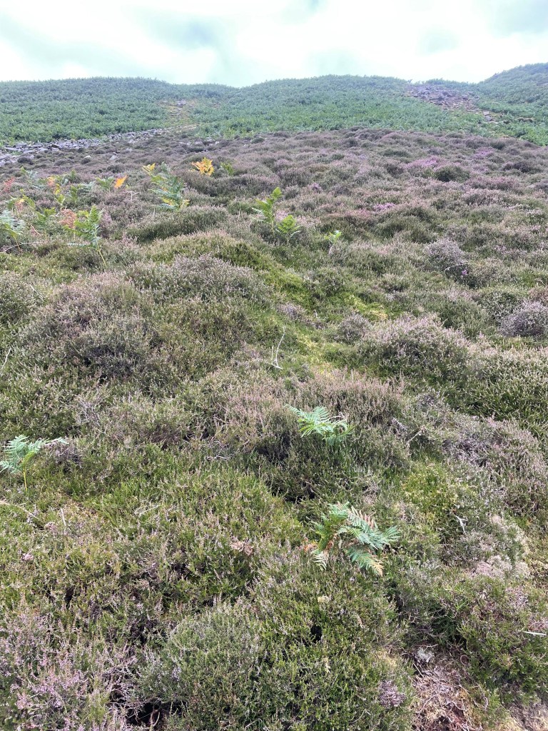
The first part was over moors, which were blanketed in blooming purple and sometimes white heather, waterfalls galore. There were lots of steep sections, including some fun scree fields to scramble through, and I was happy get to use some of my basic mountain skills. They are pretty common sense: always lean into the mountain and your uphill pole.
A steep descent into the valley, and we were in the midst of the ghostly ruins of lead mining works. Lead mining was very big in the Dales back in the 1830s. It’s now just a shadow land, and it’s hard to imagine the hundreds of men that would have lived and commuted to these now remote and desolate areas to work the mines.
It looked like some gravel quarrying still continued and we ascended back up the valley to a moonscape of rock and gravel.
Once we crossed the moonscape, we found a nice spot for lunch, where we chatted with a mother and daughter combo who we had seen in Keld that very morning. They must have been uber athletes based on their speeds up and down.
I bonded with this sheep. It was the cleanest one we saw!
After about 12 miles or so and a few more ascents and descents – and a lot of what we believe to be grouse – we made it to the pretty town of Reeth. As always that final last mile or so is the hardest.
We were staying at the Burgoyne Hotel, which seemed positively opulent after the Herriot Guest House. Nothing like a drink in a front garden after a hard day of hiking.
As foreshadowing, let me start by saying that I spent a lot of time on day 2 of our trek through the Yorkshire Dales thinking of synonyms for the word waterlogged. But I digress.
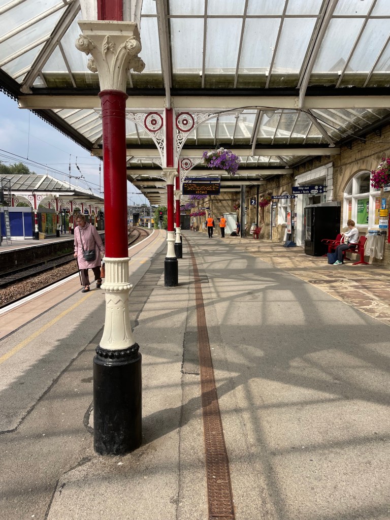
After a two night sojourn in Manchester spent catching up with family friends (by the way, we really liked Manchester and its bustling vibe…), J and I successfully navigated our way to Grassington. This started with two trains, which delivered us to the charming town of Skipton, which had one of the prettiest rail stations we’d seen.
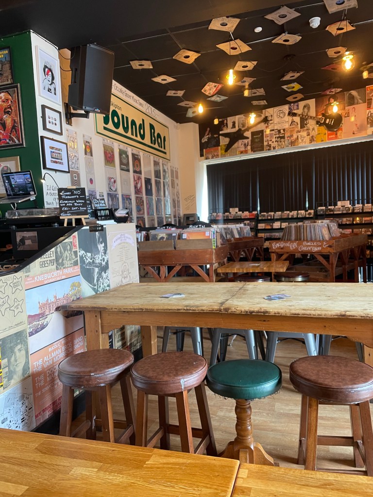
From there we planned a bus ride to Grassington. Of course, the rail station and bus station were not contiguous, so this involved a ten minute jaunt, luggage in tow, but we were able to use our two hours of waiting time to visit the “Sound Bar.” An independently owned combination vinyl record store, coffee shop, and pub that also featured live music on the weekends. The walls were plastered with tickets, posters and other promotional materials for concerts and bands dating back 50 years – really fun spot and not what we expected to find!
Despite the fact that the driver operated the bus to Grassington as though he were auditioning for Mr. Toad’s Wild Ride, he safely delivered us to just outside the Black Horse Hotel where we met up with pals and long time travel partners M and S. They’d arrived a day earlier, fortunately managing to take one of the only trains running on a day of “industrial action” (aka strike day) from London to the north. Unfortunately, the room reserved for J and me had electrical problems. After a couple of hours of waiting around in their very cozy bar, management gave up and sent us across the street to an equally nice inn, the Devonshire, which was graced with a mention somewhere in one of James Herriot’s books.
For those of you not aware, practically all of the Dales is Herriot country – there’s a Herriot Way walk, hotels name their rooms after the characters (both human and animal), and more memorabilia than you can imagine.
After a filling breakfast, the first day of the walk went smoothly. It was only about 11 miles – slightly shorter than the original itinerary because we were to stay in Buckden instead of Cray, which was a couple of miles further down the road. Of course, that did have implications for day 2, as I’m sure any discerning reader will have figured out.
There was a light, misty rain much of the time but it was really nothing more than what you experience with a mister at a Disney theme park. A few steep uphills at the beginning until we reached a ridge line. We then descended through what must have been a planted forest of tall conifers, stripped of their lower branches, and down to a river that was contained in its banks (foreshadowing again – unlike day 2).
We reached the village of Kettlewell where we stopped at the first spot we saw for lunch and an ale (after all, this was billed as an “Ales and Dales” trek). It turned out it was the owner’s first day open, and his manager had quit that very morning. We were happy to support the new endeavor and enjoyed hearing his take on English politics and who should or should not be King….
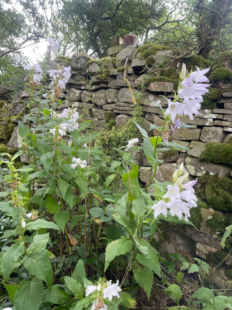
Much of the rest of the walk was on or near the river. It was edged with fantastic wild flowers, thistles, foxgloves, and bluebells. We crossed open fields, or sometimes were sandwiched on narrow paths running between stone walls, flowers and ripening berry brambles on each side.
We reached the tiny village of Buckden (chief feature, a village store that took cash only) in good time. Home for the night was the lovely Buck Inn.
We knew in advance that the repercussion of our shorter day was a longer one….so were prepared for at least 16.5 miles on day 2, and had ordered packed lunches the night before.
We knew things were not off to a propitious start when, as we were departing, a man in the lobby volunteered that he had just come from Askrigg, and everything on the way was flooded. He also cast some dubious looks at the four Floridians blithely heading off into the Yorkshire Dales….
It was indeed raining, and continued to do so for nearly the whole day, veering from light to stinging. We started with a long uphill slog, and learned the first rule of Mac’s Adventure trekking – NEVER veer from the blue GPS line on the app, NO MATTER WHAT. The sign posting (other than for the well-known, main trails) is awful, and that blue line becomes your Bible (or yellow brick road, whichever metaphor you prefer).
Our first issue really started as we descended into Cray, which was where the original itinerary had called for us to spend the night. We reached a roaring river, which we were apparently to cross with the assistance of stepping stones. But the stones were under the white water rapids of a flooded river, and we were not about to start day 2 with an encounter with the river gods. There was a bridge just a few feet away – but to access it we would have to go through private property that lined the river bank.
There was little choice. To the bemusement of the elderly men on the other side of the river who were eating sandwiches and drinking tea from flasks, and having a good time observing our adventure, we all managed to climb a stone wall, scale the wire at the top (avoiding barbed wire on the sides), and make our way to the bridge. (S had ventured along the river edge, clinging to the wall, to see if there was a way to less obviously trespass, but soon gave up the attempt to avoid lawlessness.)
I wish I had pictures, but we were somewhat preoccupied.
We trudged on some more, and reached a turn off that sent us above the fields into bleak and desolate moors, inhabited only by sheep. We did encounter a group of scouts with an older guide who made dire predictions about the water yet to come. More uphill, reached a stretch of paved road, only to find that portions of it were under up to a foot of water. That required another venture into the fields at the side, although by then we were so wet it hardly made a difference.
From the road we were back onto a bridle way running through the moors. As M pointed out – we were experiencing both swamp and summit simultaneously. Many impromptu waterfalls had formed, and it would have been spectacular without the rain, or the wind that had by then kicked up. The conditions defined the word bleak, and the moors were, to use M’s phrase, both desolate and disorienting.
The moor was interspersed by sheep fields every now and then – but my favorite was the pasture guarded by a very large bull with a ring at the end of his nose. I was first in our little parade, and memories of bull running and Pamplona caused me some anxiety as I considered the effect of my orange back pack. But I moved slowly, J edged in close so the back pack wasn’t as visible, and Senor Bull deigned to let us pass without exacting tribute. Nonetheless, once we’d exited his domain, he stood his ground by the gate, staring at us to make sure we really had left.
The rain lightened and we found ourselves on some country lanes, with a couple of houses that seemed to have been built at the edge of the world, so we pulled out our sandwiches and ate on the go. About mid-afternoon, we finally reached the charming village of Askrigg – home to pretty gardens and a 15th (or earlier) century church, St. Oswald’s.
Exiting Askrigg, we hiked through a lovely enchanted forest high above a rushing river. The path ran along the top bank, a stone wall on one side and trees and river below on the other. It was emerald and mossy green, and surely home to a pantheon of forest fairies.
Path finding through the muddy, sodden fields became more difficult and the wind picked up. Things were not helped by the hundreds (thousands?) of sheep we encountered and we spent a lot of time trying to avoid their leavings. Very occasionally we would go through a “clean field,” i.e., one without sheep!
I thought I could see our destination of Hawes in the distance, but couldn’t know for sure. We hiked and hiked through field after field, finally making a left and seeing a sign marked “Hawes Circular Walk.” It was getting late at that point, and I haven’t been so glad to see a town since J and I descended Stok Kangri in Indian in 2018!
We reached the Herriot Guest House in Hawes completely drenched. Both ourselves and our possessions, despite rain pants and back pack covers (turns out passports dry pretty well). To add insult to injury, somehow the luggage that was being transported from inn to inn had managed to get wet as well.
We changed quickly and went the The White Hart for an excellent (and well-deserved) Sunday Roast.
Sodden, waterlogged, drenched, soaking. I’m sure there are a few adjectives that I’m missing but you get the picture. However, you could equally apply: challenging, invigorating, exhausting, stimulating, and most of all – absorbing.
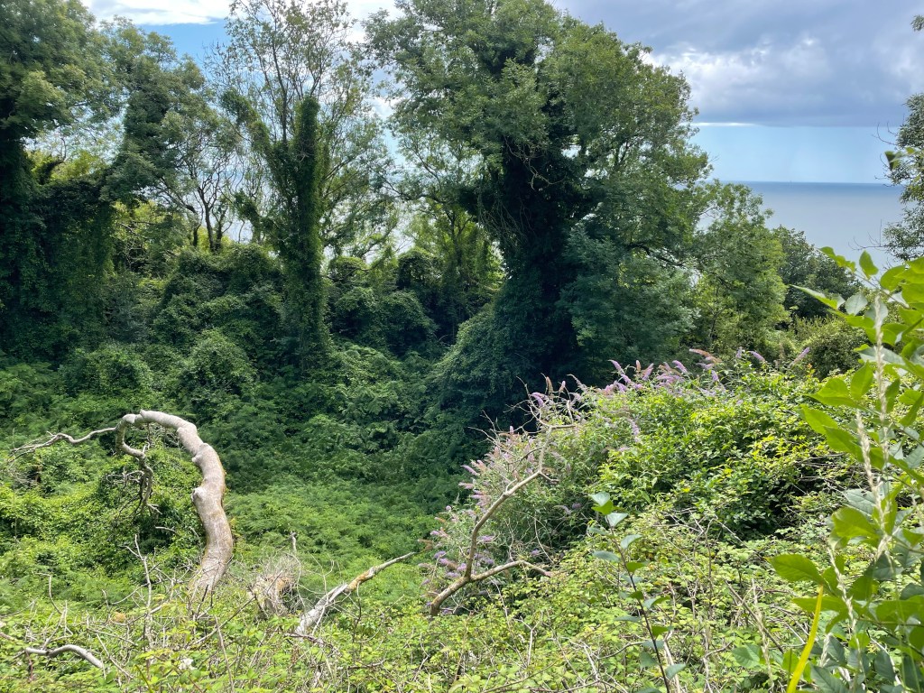
On July 21, 2023 a massive landslide (aka as a “land slip” in England) moved tons and tons of cliff side onto the Seatown beach, dividing it in half. About seven miles away, on Christmas Eve, 1839, the same thing happened; that time dumping 45 acres of meadowland into the ocean at Lyme Regis, creating what is now called the Undercliff. The fallen land has been conserved since the 1960s, and allowed to revert to wilderness, creating a walk way running between the bare chalk walls rising above and the forested ravines below.
It is the area featured in Lyme Regis resident John Fowles’ The French Lieutenant’s Woman. It was Fowles’ description of the Undercliff that drew us to a three night stay at Lyme Regis. Fowles wrote: it is “cut by deep chasms and strange bluffs and towers of chalk and flint, which loom over the lush foliage around them like the walls of ruined castles *** People have been lost in it for hours, and cannot believe, when they see on the map where they have been lost, that their sense of isolation – and if the weather be bad, desolation – could have seemed so great.”
After a first night at the Nag’s Head Inn, whose pub was inhabited by elderly men watching cricket, and dinner at the very nice Royal Lion Hotel (fyi, to get free Wi-Fi you have to sign up for a million mailing lists and my gmail account is paying the price…), the next day was designated for the Undercliff Walk. The Undercliff is also part of the South West Coast Path, so it fit nicely into our theme of walking at least parts of “the greatest hits of English paths.”
The beginning of the walk is very poorly posted. We finally found a small marker by the Lyme Regis Bowling Club, which seemed a popular place to be that particular morning. I had strong memories of my great-uncle taking us to his bowling club in Skegness back in the early 1970s – but now women also get to play! Men and women alike were wearing the requisite (mostly) white outfits.
The walk starts with a never ending series of steps up to what appears to be a top ridge. but at some point you realize that you are really traversing the half way line of the land slip, with cliffs towering both above and below.
After the land slip occurred in 1839, it became a huge tourist attraction. People took boats to gaze upon it from the sea, and a “Landslide Quadrille” was even written in its honor. No one, however, seems to remember the composer!
Since then, woodland and grasslands have grown up. The woods are dense and dark and mysterious. Green tunnels formed by arched trees and wild roses run through the woods. Wildflowers, including white bindweed, yellow wild snapdragons, red berries of Italian arum, and simple wild roses create patterns in the deep carpets of ferns.
Now and then the views opened up, either to see the chalk cliffs above or the ravines below and the sparkling English Channel.
It was very steep and muddy, and even though it didn’t rain, beads of water resident on the high hedgerows created their own fairy mist.
After about 7 miles, we entered into an area of very rare grasslands. If you looked closely, you could find lavender chalk fragrant orchids and pink everlasting peas enjoying the sun brushing the golden fields.
The path turns away from the sea, and ends, oddly enough, with a stroll down the middle of golf links and down a steep hill into the very small harbor town of Seaton. Apparently we began with bowls and ended with golf.
We caught the bus back to Lyme Regis. A double decker bus ride whizzing along the narrow hedge lined lanes is an experience not to be missed.
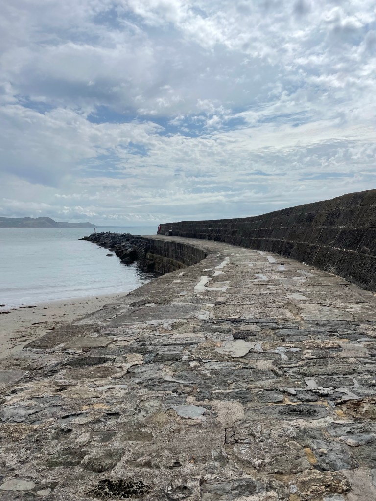
Our final full day in Lyme Regis was dedicated to visiting the Cobb and embarking on a fossil hunt. The Cobb is a stone breakwater that thrusts into the sea to protect the harbor. No one really knows why it is called the Cobb. The first mention of it is in 1294, and after being destroyed on a number of occasions it was almost completely rebuilt in 1817. Fishing boats, mostly for tourist trips, still leave from the Cobb, and we watched fishermen mending their nets.
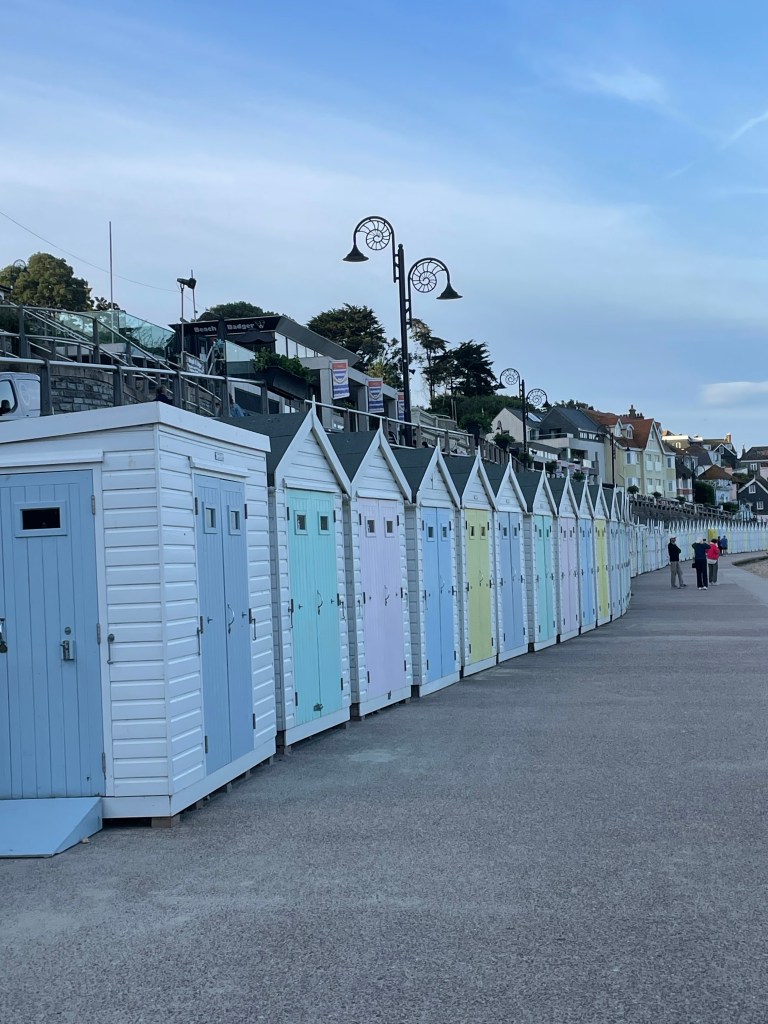
The seaside itself is lined with colorful bathing huts. We were lucky enough to see the interiors of some of them, whose residents had their doors open….featuring kettles for boiling water, shelves for holding snacks, and I’m sure there was local ale somewhere there also. Or at least canned cocktails, which seem to have taken over in England. By the way, look at the lamp posts. They are modeled after fossilized ammonites.
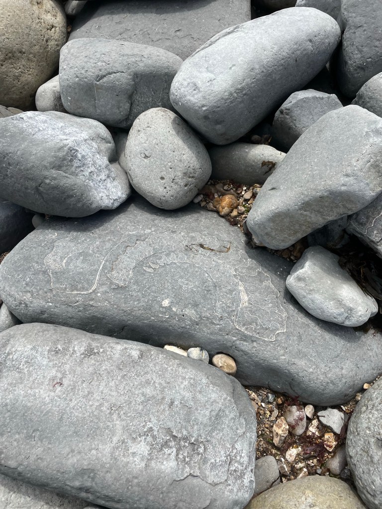
On the other side of the Cobb is rocky Monmouth Beach. Instead of seashell hunters, it is populated by amateur fossil hounds wielding mallets, this being one of the greatest spots to find fossils. Hence the name, Jurassic Coast. (In fact, in the Undercliff the various stone levels are dated, including back to Jurassic times.) Even if you don’t find one yourself (I like to think a half inch, grey ridged rock we found was one), ammonites are etched into all of the big rocks, creating a mural of fossils running along the beach floor.
After a long session of fossil hunting, we walked up the steps to the Jane Austen Garden and the Langmoor and Lister Gardens, which offer stunning sea views. They were surprisingly tropical and and natural – as was the Undercliff itself – as opposed to formal and contained.
Finished up our stay in Lyme Regis with a relaxing afternoon and some great Indian food.
Lyme Regis is full of history and tradition and fossils. But this coast is constantly evolving, as evident from the landslip just a couple of weeks ago. I keep contrasting this natural progression to what’s been happening this summer where much of the coral in parts of South Florida died in two weeks after ocean waters increased to bath water temperatures.
The land slip that formed the Undercliff was a force for creation and change and new life. That’s the sort of evolution that happens when the land is conserved and preserved and allowed to revert back to its raw, beautiful self.
I’m actually writing this from the tiny hamlet of Keld in the Yorkshire Dales, but chronology (and geography) beckon so first I have to get us to the British Isles….
The remainder of our time in Basque Country consisted of a beach day followed by a Bilbao day.
Beach days are sort of the same wherever the beach. It was hot that day, and the beach was extremely crowded. Umbrellas everywhere; no one uses the portable rooms that are so popular on U.S. shores. That evening we splurged with a tasting menu at a fancy restaurant – highlights ranged from foie gras to octopus to some of the best steak I’ve had. The real treat, however, was at 10 p.m. (or later) seeing all the children run down the street following a person in a bull costume with some device that shot sparklers from his rear! A kid’s version of the running of the bulls.
We were supposed to follow our R&R day with a cultural day – the Guggenheim Museum in Bilbao. Frank Gehry’s building itself is stunning. While constructed from metal it has a soft feeling, with undulating curves, and I kept wanting to touch it. But the inside is different – it’s intersected by angular catwalks and bridges that to me added an element of stress to the interior.
I also loved the live flower rendition of the West Highland white terrier. As I’m still in mourning for the loss of Malcolm and Duncan, what better tribute…It was supposed to be a temporary installation, but the good folks of Bilbao fell in love with their giant Westie.
We really should have started with the permanent collection on the top floor and worked our way down. Instead we started on the bottom floor with an installation of moving vertical lights that created the impression you were moving downward – I got so dizzy I had to hold J’s arm to exit. We followed that with the Richard Serra maze installation – a series of coppery/brown mazes that are supposed to invoke deep thoughts about time, but for daughter S and me invoke claustrophobia. But the modern art and other temporary installations were stunning, and for those of you from Orlando, you’ll know what I mean when I say it was interesting to see a real Basquiat.
Made from liquor bottle caps….
A and N had to wake up very early for their flight back, i.e. 4 a.m., which also woke up the rest of the household and made us very aware of the invasion of mosquitoes that had gradually been underway over the last few days. I spent much of the rest of the night with the sheets over my head trying to create a breathing hole. I am in the market to start an international screen company, so if anyone has interest let me know!
Plentzia beach from the air
Transitions to follow – J and I left about 8 or so to drive to Bilbao to return the rental car and hop on a plane to London. The drive was so beautiful we kept thinking Google Maps must have given us the wrong directions. To our delight no questions were asked about the dings on the car, which I know were there when we picked it up….I did notice that the parking places at the rental car return were extremely small and practically every car seemed to have an array of scratches large and small.
The next order of business was: (1) plane to Gatwick’s North Terminal; (2) shuttle to South Terminal; (3) extremely crowded train to Clapham Junction (where we picked up sandwiches – I am becoming a big fan of prepackaged egg mayo and watercress); (4) train to Axminster; (5) bus to Lyme Regis; (6) walk up very steep hill pulling our suitcases to the Nag’s Head Inn; and (7) walk up two flights of stairs to our room. Glad I have the backpack straps on my suitcase.
So the family part of the trip was now over – I wish it had been longer. But it was time now to explore Dorset’s Jurassic Coast and ever changing landscape. As John Fowles wrote, “People have been lost in it for hours, and cannot believe, when they see on the map where they have been lost, that their sense of isolation – and if the weather be bad, desolation – could have seemed so great.”
We ended up in Rye because J googled “weekend getaways from London.” And thus we found ourselves on a Friday night along with an abundance of other middle aged merry-makers in the excruciatingly quaint town of Rye, a small town in East Sussex.
It’s only 60 miles or so from London, and easily reached by train, one change only, from St. Pancras. Incidentally, if you’ve reached your 60s, the BritRail pass with the senior discount is a beautiful thing. St. Pancras itself is something to behold. The old Victorian train station I remember as the start of our trips up to Sheffield/Rotherham remains in exteriors only. The ticket office is now a high end restaurant, and the entire station is occupied by shops and cafes – more like an airport than anything else.
We arrived in Rye too early to check in, so found a nice cafe – Jempson’s – where I had a “cheese lattice” and J a chicken and mushroom pie. It was only about his 5th small meal of the day.
The AirBnb was down a narrow alleyway close to Landsgate, a 1339 or so guard tower. It had two rooms, separated by very steep stairs and facing the Queens Head pub. Only downside was late night noise from revelers across the street, and a 5 a.m. wake-up call by screeching gulls that apparently save their party time for early morning.
Rye itself is near the English Channel. It used to be on the English Channel (the “Rye Camber”), but over the centuries, storms and reclamation of the bay have resulted in the water silting up, creating huge salt marshes. Seemed very apropos for the swamp part of this blog. There were a plethora of half-timbered buildings, quaint shops and pubs, and women on week-end breaks all wearing summer dresses and straw hats – and shopping.
J and I had a drink in a garden pub, and then went to the very funky Queens Head across the street. Food was cheap and excellent – ranging from roast chicken (me) to Korean kebabs (J). We waited around for the live music, a very over the top cover band that played everything from ZZTop to John Denver, and brought the mostly middle-aged crowd out onto the dance floor.
I was interested in the intellectually challenged young man who seemed to hang out at the pub on a regular basis. The manager let him help out with everything, and he was clearly a fixture (I saw him there the next morning also from our vantage point across the street). It was nice to see how he was an accepted part of the fabric of everyday life.
Our one full day in Rye was reserved for a hike to the Rye Nature Preserve, the, or one of the, largest coastal preserves in the U.K. After some difficulty finding the beginning point, we finally started the hike. Through narrow corridors lined with hedges, into marshy salt marshes – small islands outlined with rushes.
We made our way to the very new Discovery Center where we ate sandwiches. There was one strip of beautiful long sandy beach (Camber Sands) – that then turned into a shingle beach – what seemed like miles of rock beach, consisting of perfectly round stones that angled sharply into the water. It was like walking over stone sand dunes. It was hard going and we soon returned to the trail.
The skies darkened, grey against white, and we pulled out our rain gear just in time. The trail crossed the marshes and then blended into sheep pastures, with lots of stiles and gates. We were a little unsure of our location on our by then battered and wet brochure map….the Camber Castle, set apart atop a slight plateau, never seemed to get any further away.
But finally we ended up with the Brede River on our left and the Brede Locke straight ahead, the end of our 8 or so mile excursion in sight.
On the way back we stopped at the Waterworks Micropub. It’s been everything from waterworks to public toilets. I had a half pint of a local cider, Tenterden. Cider is a big deal here and I’ve never seen so many real, hand pulled ales.
After washing the grime off, we went to a Turkish restaurant on the High Street for dinner. We walked up to and around St. Mary’s, where we found an absolutely lovely pub, Ypres Castle, nestled in its lower walls. Met a very interesting fellow from Manchester who had been living in Rye but was about to move to Belgium. It was his last night in town, but he was nonetheless as welcoming to two tourists as could be.
Actually, everyone we encountered in Rye was remarkably friendly. It seemed to presage good things to come as we got ready for the next leg of our trip – to the Basque Country in Northern Spain.
I actually wrote this aboard a train from Rye (via Hastings) to Gatwick. But, as all good travel blogs must, I have to go several days back to start the Six Month Sabbatical Saga.
After packing some and packing more, J and I journeyed off to Orlando Airport’s Terminal C. It is so much better than A and B it doesn’t bear comparison. I can only liken it to the international vs. domestic terminals at the airport in Dubai. After a very nice preflight snack and drinks at Cask and Larder, we made our way onto our Norse Airlines plane – the new budget airline with flights hundreds of dollars less than their competitors.
The planes are lovely, but they have definitely crammed a lot of seats in them. The middle one on Row 38, which was to be my abode, would have been all right but for the fact that Row 38 had no windows at all. I could see a slight sliver of the sky from the window in front of us, but not sunrise over the Atlantic. Avoid Row 38!
Generously speaking, we might have had a couple of hours sleep.
Landed at Gatwick and took a train to Victoria, underground to Green Park, change to the Piccadilly Line, and on to Russell Square. There’s still a lift there, no escalators, to ascend to the surface. London, or at least parts thereof, is filling up with skyscrapers worthy of one of the Asian capitals of the world but still looking somewhat out of place in what I think of as a human scaled city. There are cranes everywhere. But the parts I remember well, namely Bloomsbury and around the British Museum, are still as I recall.
Every time I come to London I have this eerie sense of familiarity. Perhaps that’s natural given that I was born here – at University of London hospital and within the sound of Bow Bells – and spent my first year plus living in Brunswick Gardens near Kensington.
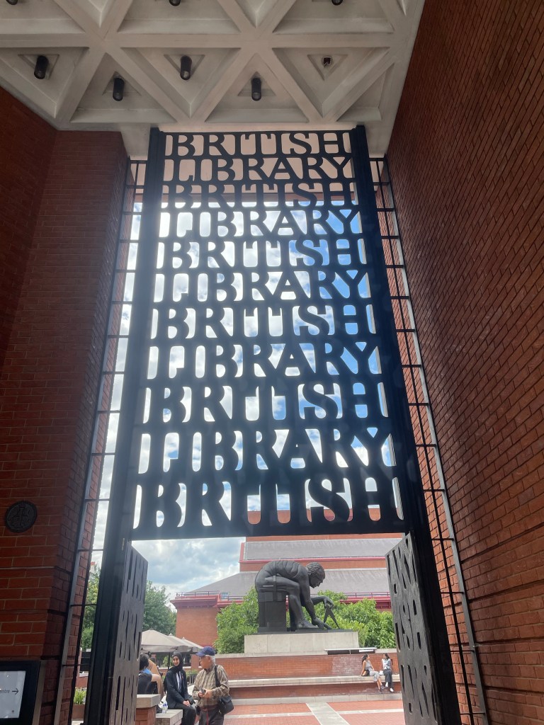
We checked into the Tavistock Hotel, where we were given a small front room with a view of the square. Despite the lack of sleep, we couldn’t let even a jet lagged day go to waste. After a brief rest, we made our way to the British Library. The old reading room at the British Museum – where my parents spent many hours working on their dissertations both before and after my arrival – is now located there. It’s free admission (as seem to be all the museums here) and well worth a visit. It houses the Magna Carta – there are actually two – a very damaged original one, and the actual charter from a couple of years later, which is in much better condition. There’s a Gutenberg Bible as well, but I was equally interested in the illuminated manuscripts and modern books. Lots of ideas for calligraphy projects to come. I still think I would have been quite happy as a monk whose mission in life was to copy and illustrate books!
An interesting walk back. We went past my mother’s old residence hall at University College (Campbell Hall) which she says still looked the same, and through Brunswick Gardens (the actual gardens, not the street in Kensington where I lived as a baby).
After a drink at the Woolf (as in Virginia) and Whistle Bar at our hotel – the Tavistock Hotel, on the site of a former Woolf residence – we had an Italian meal at the restaurant across the street and collapsed.
Next day – truly an exploration of my origins. We started with coffee and croissant that we ate at Tavistock Gardens (surrounded by pigeons attracted by crusts someone else had left – we felt we needed a sign saying “it wasn’t us” after 30 plus birds arrived). Incidentally, we are finding London very inexpensive compared to the U.S., which is a pleasant surprise. Inspected the statue of Mahatma Gandhi in the center of the square and all the benches in memory of those dedicated to peace, socialism, and against nuclear bombs.
Our next stop was the Victoria and Albert Museum, which is where my mother started to go into labor with me in 1961. I’m not sure what that says about either me or her!
Child rearing techniques? No, Achilles and his mother
On our quest to find “Britain 1790-1900” we managed to see every bit of glass at the V&A, plus architectural designs, galleries full of Victorian casts of famous sculptures from around the world, thousands of pounds of Rodin, and ironworks. Finally we realized the staircases up went to different parts of the museum, found the correct one, and located Britain 1900. Starting with the Arts and Crafts movement, we wound our way back in time – an interesting way to view things.
After we were museumed out, we realized we had way too little time to walk to Portobello Market, as was our original plan, and instead wandered around South Kensington, window shopping at all the expensive shops.
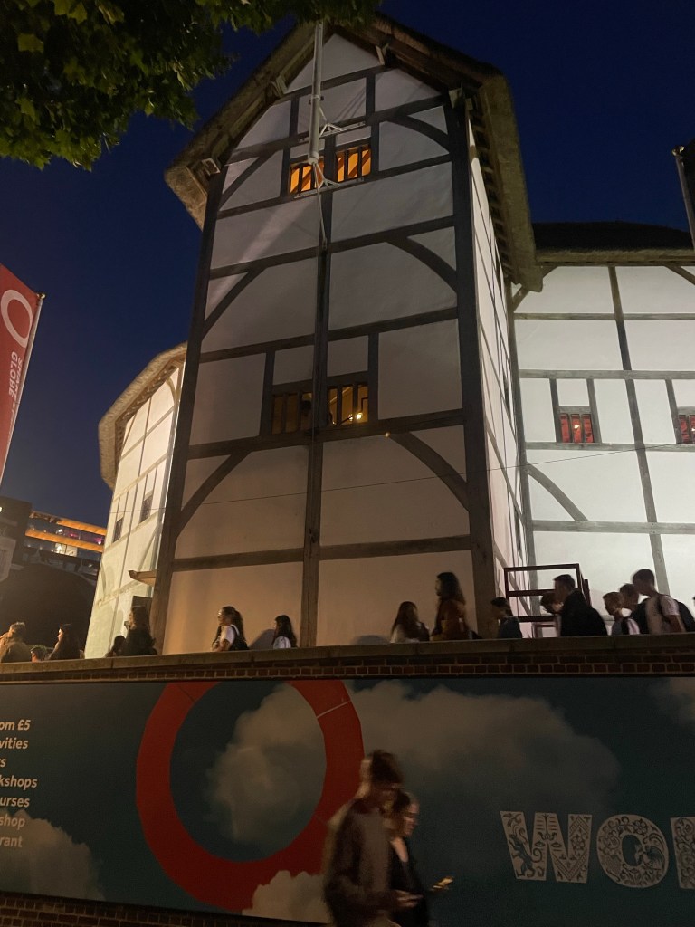
After a quick dinner at a local pub we hopped on the underground again to Blackfriars, and crossed the river over the Millenium Bridge to reach the Globe Theatre – the recreation of the Shakespeare’s theater. We were last at these spots in 2000 – the Millenium bridge had just opened and was still bouncing! They had to close it immediately after for repairs. It’s quite sturdy now, and gives a good view of St. Paul’s.
We saw “A Midsummer’s Nights Dream” – interesting production, with nearly all the roles played by women. Best line – “from now on I want to be known as ‘Bo-toom’”. (For you English majors out there. Think Heather “Bou-Kay” in Keeping Up Appearances.) Also “pro-luge” and “epi-luge.”
Does life ever seem as though it’s comprised of a neverending series of events designed to frustrate your ultimate purpose? Or, at the least, to insert various stumbling blocks along the way? And many times it’s the mechanical objects that take on the worst human qualities imaginable in an apparently intentional fashion to stymie whatever you’re trying to accomplish.
As we work our way through the checklist required for the upcoming six months of adventures, consider the following examples:
1. The new oven conspired with the outdoor lighting to malfunction. The oven issue involved a series of beeps at seemingly random times, possibly chirping displeasure over whatever was currently on television – except for the fact they also occurred in the depths of night. After a few hundred dollars and a new computer key pad (who knew ovens had such things) it appears to be somnolent. For the moment. At least the outdoor lighting was a silent malfunction, resulting from cut wires. Thanks, lawn service.
2. The bank that shall remain nameless who does not know how to receive a $10.43 cent payment. We are still battling that one. Who knew it would take over 30 days to release a lien for a home equity loan that hasn’t been in use for years?
3. The car that has decided to have a voice and buzzes out its grievances every time I go over one of our brick roads. This one is on going. I’m just trying to get used to it, and think of it as background percussion.
4. The pond project. A weeks long repair job to repair a leaking pond (that had already killed off our generations of tiny Lake Ivanhoe fish). Finally, a success story. After massive internet research, and several Ace Hardware trips, a product was found. Layers of scraping, vacuuming, epoxying, patching, stop, repeat, and finally we have a pond that appears to hold water. We’ll see. I’m not going out to catch fish in Lake Ivanhoe to transplant to it until the weather has become a bit more tolerable.
I’m sure I could add to the list. But right now my mind is on finishing up work – only 3 days left! Live-in house sitters assembled, S’s cat Boudin is ensconced in the addition as his summer residence, and Kira our own cat has been informed of the upcoming plans. First stop is London, followed by Rye, and then on to San Sebastián, Spain. But who knows what the next few days could hold – funny things always happen on the way out of town.
And welcome 2023! As we leave 2022 in our rear view mirror, the new year is already underway with a vengeance. And what a year this promises to be for FromSwamptoSummit and friends.
It needs to start with seriously getting back into shape – at least the sort of shape that will allow for some regular 15 mile hiking days. To that end, I’m trying to convince J, and our faithful training partners S and M to sign up for something called the Mammoth March.
It’s a serious of hikes held throughout the country – this one is 20 miles to be accomplished in 8 hours and takes place in the Charles H. Bronson State Forest here in Central Florida. We are already familiar with that location – you’ll recall we hiked there in 2020, as recounted in Lost in Florida – Staring Down Charles Bronson (a decent title if I do say so myself). While I think that speed and distance quite doable, it’s definitely going to take some practice. You can see from the below it’s not a straightforward path, and there are a fair amount of saw palmettos and other natural dangers to avoid.
J staring down Charles Bronson
Now, careful readers will have noted the teaser above and will be asking but why the need to train for 15 mile hikes. Well, because the latter half of this year will hold many opportunities for travel – J will be on sabbatical! To take this one step at a time, our plans for July have ranged from Egypt and Morocco to the Shetland Islands….and now we seem to have settled on Edinburgh, a hike through the Yorkshire Dales that includes portions of the Coast to Coast and the Pennine Way, followed by time in London, and then another hike that circumnavigates Guernsey, which is one of the Channel Islands.
The dales hike in particular has some long days, including two 15 milers. It’s time to resurrect the hiking poles and get out there. As I was running errands today I happened by what was once one of the premier malls in Orlando. It can’t even be described as being on death’s doorstep – it’s clearly crossed the threshold. Anchored now by a low end Macys, a Dillard close out store, and some sort of flooring or tile place. I don’t want to end up like that mall – it’s time for some adventure.
While not a mountaintop, I think that the dales can count as a summit and the island of Guernsey as a swamp! Of course, the below isn’t Guernsey; it’s a view of Lake George in New York, taken this past summer.