Letting Up the Pressure – Running and Walking Through the Holidays

Mt. Elbrus from the Baksan Valley

I started running in 2014. We had just summited Mt. Elbrus, but I felt I was too slow on the descent and needed to increase my cardio training. True, some of it could have been due to the third degree sunburn I had managed to achieve. But, regardless, we knew there were a number of higher mountains in our future – the Ecuadorian volcanoes were on the burner for 2015 – so the cardio was essential.

Making our way up Cotopaxi

I started slowly; fast I am not. And over the next several years I worked my way from a 5k to a bit over 7 miles. There were times I felt I could have gone further, but I just didn’t. My standard was a 5k on the treadmill Wednesday nights before yoga and a 5 to 6 mile run on Saturday mornings.

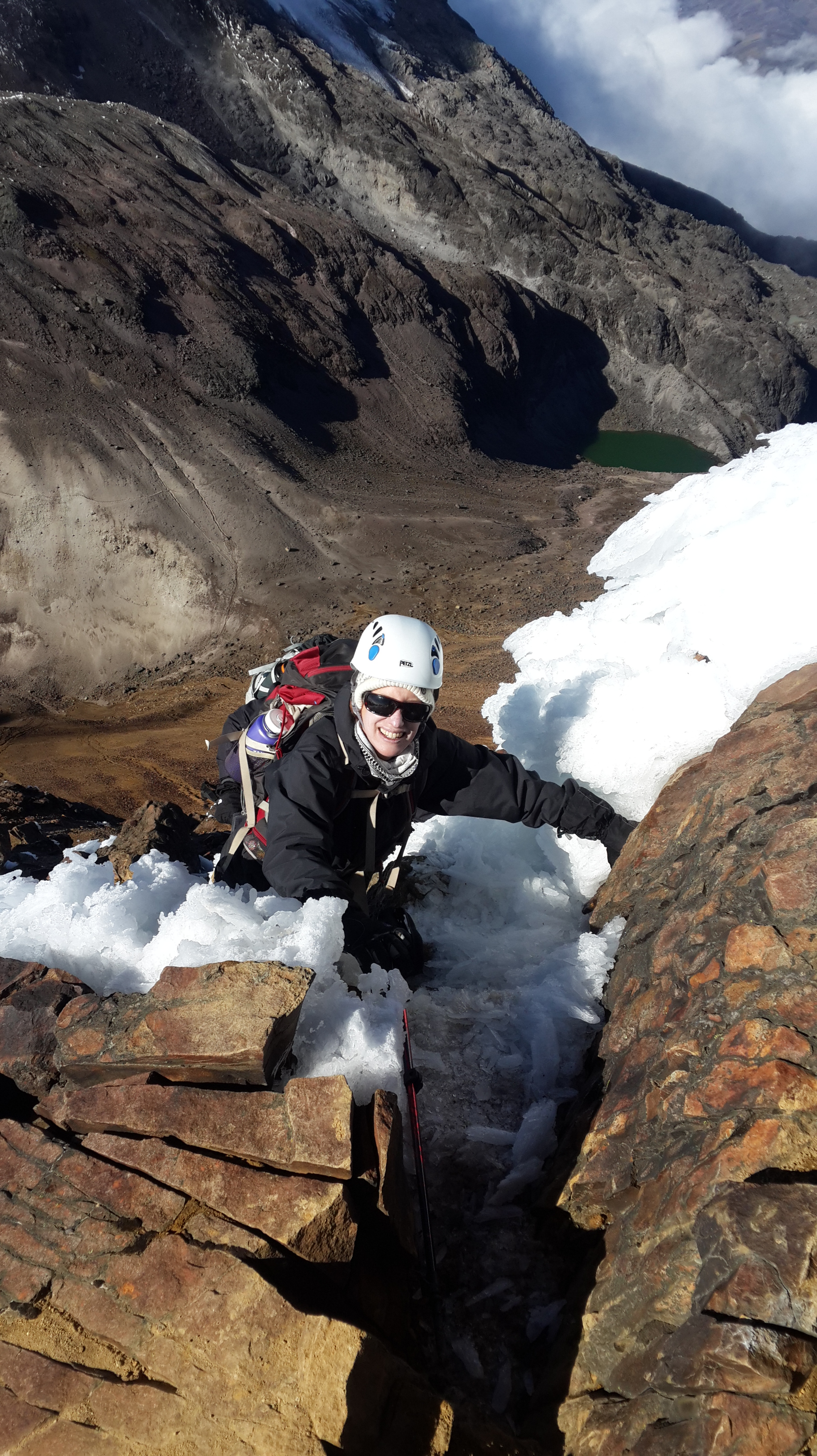
But all things change. This past summer we actually achieved our goal of summiting an over 20,000 foot mountain – Stok Kangri in Ladakh, India. My Wednesday yoga class time was moved up to 7 pm, making it practically impossible to get a 5k in between yoga and work. And more importantly, I felt I was getting slower and slower.

For Type As like me that means that Friday nights started to be filled with an existential dread (ok, not quite that bad) of how my run would be the next day. Could I achieve under 12 minute miles consistently? Why didn’t I ever get an under 11 minute like I used to? What’s wrong with me? Can 4 years of aging make a difference? What does this say about my next climbing or trekking expedition? You get the picture.

Then, a few weeks ago, I just stopped. I simply made the conscious decision, somehow justified in my head, that what I really needed to improve was my general walking speed. So I would just become a fast walker.

I started with a very brisk three mile walk to meet a friend for (of all things) a stroll through a “fairy door” exhibition in a nearby park, and realized I could keep my “splits” at 15 minutes per mile or less. After a few sessions of that, I decided to “walk” to the Y before a Saturday yoga class. And as I took off down the road, on what felt like a crisp day, at least to us Floridians, I suddenly realized I wanted to run. So I did. And it felt good to let my legs move freely without obsessing about what my Fitbit was showing. I’d run to the end of the block or the next tree or whatever the mark was and then keep going at a walking clip for a while – and then run again, whenever I felt like it. And ironically, I discovered that when I run I’m running faster than I did and overall end up with 13 to 14 1/2 minute miles and a decently elevated heart rate.

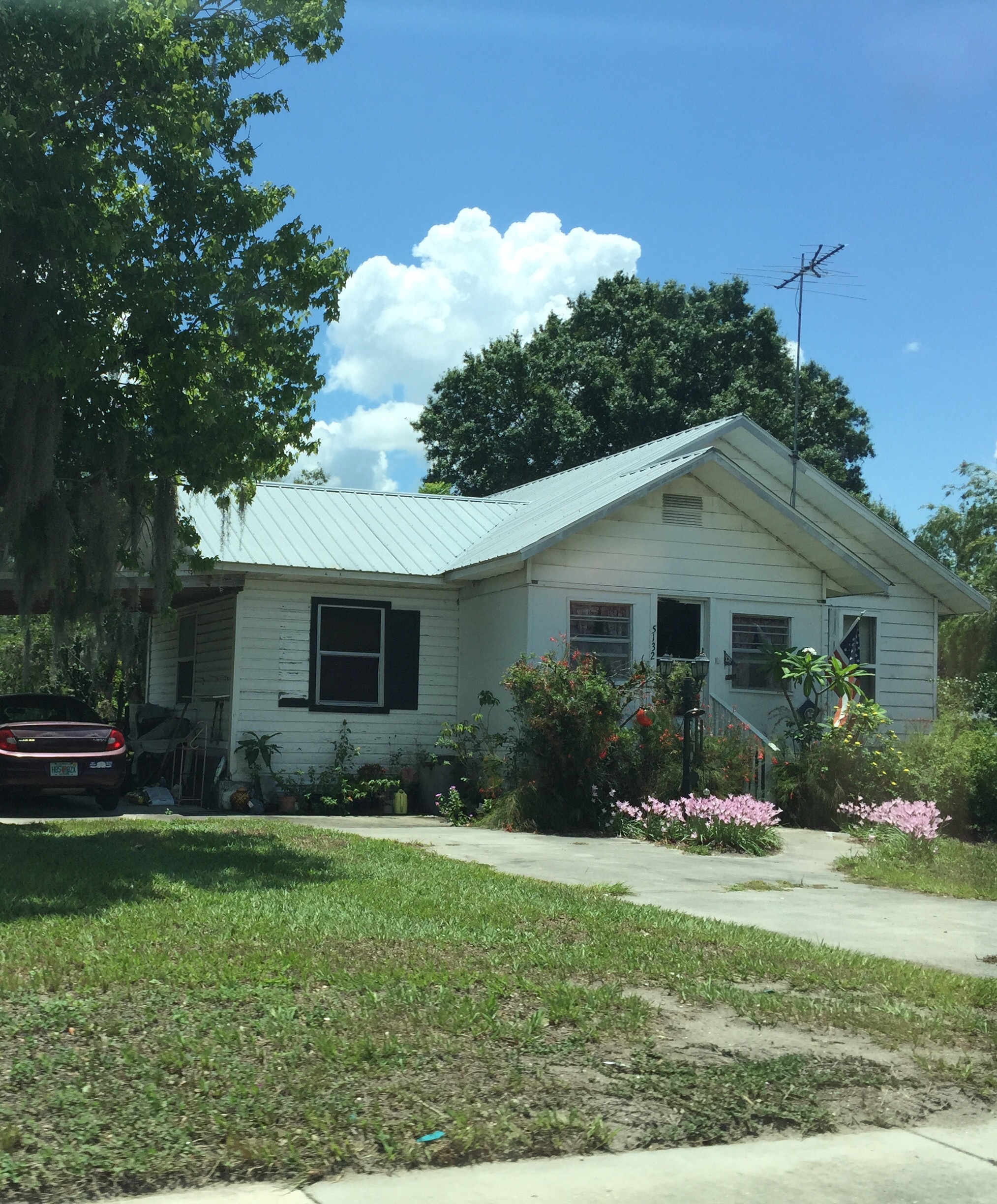
I’ve been using this run- walk technique for a few weeks now. And I’m looking forward to my Saturday morning training sessions again. Friday nights aren’t filled with worry. As I wend my way through the neighborhood, I’m noticing more things – a new home renovation project, which trees are blooming, the latest development in the never-ending series of drainage construction projects by the lake where we live.

It was like letting the air out of a balloon. But not in a disappointing way. Letting up on all that pressure let me enjoy it all again. I’m going to try to remember that as we enter the upcoming Thanksgiving to Christmas marathon.

Seen on the edge of the lake

Gear I Haven’t Used – A Closet of Dreams?

image

All of us have those Purchases that seemed very logical to buy at the time. And perhaps they were, but life happens and the intended event for which said Purchase would have been just perfect never occurs. And now the Purchases sit there in a closet or a duffel or a garage as homage to lost hopes and dreams.

Granted, a bit melodramatic. But my climbing/hiking storage space is full of such items.

The rope. We carefully ordered on line the exact specifications identified in the gear list for our July 2015 trip to Ecuador. Our local hiking/climbing store didn’t carry the precise dimensions and we were sure those few millimeters would make the difference between success and failure. Alas, it turned out the rope wasn’t going to be necessary unless we actually climbed Chimborazo, and once there, we made the wiser choice of allowing our summit of Cotopaxi to be our crowning glory.  Shifting Winds Lead to Cotopaxi Summit.  The rope lies curled in waiting. One day.

The stove. This was to accompany us on our multi day backpacking trip along the Muliwai trail in the Big Island in Hawaii In 2013. Those plans were kaboshed when J came down with the flu and was told by the doctor he’d have to be helicoptered out if he tried it. I did the first couple of hours in my own, but there was hardly a need for a stove. Ah well, the alternative we found – the Mauna Kea hike – was pretty spectacular. Journey to Another Planet – Mauna Kea

The tent.  See The Stove.

Odd square pieces of aluminum foil, carefully folded. I think they relate to the stove. Highly unclear what they were for or why I saved them.

Long and skinny gaiters. These were on sale at some point and were apparently so cheap because no one else could figure out what they were for either. They haven’t really gone to waste because I used them to wrap my crampons in. Actually that didn’t work very well and they too are now relegated to the pile of great unuse.

Those are just the gear items that come to mind. I’m only now putting everything away from our January Orizaba trip, in preparation for getting a lot of it out again for our Scottish Highlands hike, which starts 60 days from today.

There’s still room to realize all the dreams of the unused gear.


What It Is Like To Start A High Altitude Climb

image
Cotopaxi sunrise

This week I’d planned to write a warm, witty post that would be a detour from swamps and summits and instead would celebrate the fifteenth birthdays of my two West Highland white terriers. Entitled “A Dog’s Life” or some such similar name.

But life overwhelmed, and as I find myself on an evening flight to Cleveland, yes, Cleveland, looking down on the ribbons of light that carve up the great American Midwest, and in the midst of December’s party giving and party going, the present purchasing, and the travails of travel logistics….such plans fell by the wayside.

Instead, I find myself focused completely on the seven days that J and I will have in just four weeks as we take our sea level lungs back up into the clouds, and, I hope, reach the great height of 18,491 feet at the summit of Pico de Orizaba.

In the midst of the December chaos, it’s the anticipation of the complete silence that surrounds you when you start a high altitude climb that’s serving as my reality check. It’s a world unto itself. It’s the period between sentences.

You rise at 1 a.m. or so, struggle into whatever layers you didn’t sleep in, clamber into your climbing harness, and strap on your helmet. You eat as much breakfast as you can force down at that godforsaken time, and hope that instant coffee will have enough caffeine to keep you going. Everyone is always tense. The guides are making quick forays outside the hut to check on conditions and temperature. No one knows exactly what either the mountain or your own body has in store for you.

Finally, hoping you’ve wasted only an hour or so, gear assembled and backpacks on, you venture out into what you hope to be a clear black night. The stars are as sharp as the lights of a laser pointer. If you’re lucky, there’s no wind. Ahead of you is the white glacier and the steep slope up. Eventually it’s time to rope up. It’s still totally silent and you don’t talk except for necessary instruction. You’re high above the clouds and your heart is pumping at a speed it never would normally. But you find a rhythm in the deep silence and time stands still. Minutes pass and you’re surprised when it’s time for the every hour break.

That feeling isn’t always with you on the mountain. Lots of times, and especially as the summit draws closer and you’re at the increasingly vertical slope leading up to a summit ridge, the rhythm goes, and it’s just kick and step and plant ice axe with every muscle of your body calling out loudly. Silent, that’s not.

But much as I love the summit, I treasure those quiet moments in the dark at the beginning.  There’s nothing to do but to climb, one foot in front of another, knowing that sunrise is waiting.

Books for High Places – What to Read at 18,000 Feet

The
The “Old” Library

When most people think of climbing gear, they have in mind ice axes, crampons, helmets, and the other accoutrement needed to maintain life and limb at high altitude. But to me, an equally vital piece of equipment is whatever book I’ve selected to accompany me in whatever arduous spot I find myself in.

Believe it or not, there are a lot of opportunities to read while climbing high mountains. You’re typically going to bed as early as 7, especially if you are aiming for a midnight or 1 am departure for the summit. And that’s just summit day. On a lot of acclimatization days you find yourself collapsed in a hut or hacienda by mid afternoon following your first few forays over 14,000 feet. And, if you’re like me, you can’t sleep unless you’ve first consumed at least a few pages of a novel.

Now books for such trips must meet certain requirements, at least in my mind. First and foremost, they have to be available on a Kindle.  When every ounce you carry can make a difference, lugging paper around doesn’t seem like a particularly wise choice. They have to be of sufficient length to engage you. I love short stories but somehow they seem more suited for an evening jaunt in the neighborhood – not a multi-day expedition. And they have to be engaging. If your goal is to blot out an altitude headache, to forget how cold you are each time a part of you inadvertently slips out of the sleeping bag, and to screen out the assorted snores and noise of your fellow hut dwellers, you need something that transports you into some alternate world. The odd thing is that life on a mountain can be so surreal that the imaginary world of some novels can seem a more likely reality than the one you’re in.

The
The “New” Library

So, what are some of my top choices for high places?

Our first trek, in 2011, to Kilimanjaro, was accompanied by Abraham Verghese’s Cutting For Stone. The story of a doctor and his twin brother it globe trots from Africa to New York, and kept me enthralled at Crater Camp on the Western Breach, where we camped at 18,000 feet. It’s 690 pages long. Of course, I would have been in no shape to write a scholarly analysis of it at that altitude, but it was a good read.

On this summer’s trip to Ecuador I relied on the fantastic creatures and characters of Clive Barker’s Weaveworld to get me up the steep slopes of Cotopaxi. Yes, I do like science fiction and some fantasy, and the alternate reality of Weaveworld and its 768 pages (now you see why a Kindle is essential) fit the bill. Years ago, on a much tamer trip to California I read Barker’s Imagica, and I think it would be a equally suitable high altitude choice.

Some others? Consider:

And the Mountains Echoed by Khaled Hosseini – a story of a family in Afghanistan and elsewhere, covering multiple generations and places.

The Dust series by Hugh Howey – a post apocalyptic world – or is it? Be prepared.

The Flamethrowers: A Novel by Rachel Kushner – I will never forget the opening description of speed racing on the Bonneville salt flats.

These are only a few. What do you take with you on your travels? Let’s share.

Cotopaxi, Ecuador…..And the Volcano Erupted

20150701_074249
Cotopaxi viewed from Illiniza Norte

On July 3, 2015 J, our guide Ossy, and I stood on top on top of Cotopaxi, one of the highest active volcanoes in the world, blithely ignoring the sulfur fumes that had fortunately blown in a direction away from us. And on August 14, 2015, that very same volcano sent a two mile plume of ash, hot glass and fumes into the air, creating an ash shower for all the surrounding villages, some of which are now being evacuated.  (Apparently it is called a “pyroclastic flow.” Great name.)

This same weekend, I’ve read about a mountain guide who suffered a serious spinal injury while rock climbing in Ecuador. I believe that he’s someone we crossed paths with when we were in Ecuador – he was one of the guides working with the Climbing 4 My Donor team that we met both at Rucu Pichincha and Illiniza Norte.  (The Climbing 4 My Donor team consisted of heart/lung transplant recipients from the U.K. who were climbing in honor of their donors.  They were pretty inspirational.) There is a GoFundMe page for his medical expenses (Sebastian Carrasco).

E353138C-B7E6-4867-A66A-74F0156750CE
Rock climbing on Illiniza Norte

But recent dangers don’t appear to be limited to the summit. Down here in the swamp, this past week in Central Florida saw an absolutely horrendous accident — a woman swimming at a popular spot on a local river was pulled under by an alligator and lost her arm.

I tend to ignore the fact that my particular version of swamp to summit carries with it some degree of danger.  Even these recent events really only affect me in the sense of “oh wow, can you believe we were just there” or “we were just doing that.”  I think that’s part of the  journey – the danger is a given and it just becomes part of the landscape.  It certainly helps ratchet up the adrenaline, but when you’re on the mountain, you’re not thinking danger; you’re just thinking the immediacy of the moment and how to handle that which is in front of you.  Rock climbing up Illiniza Norte was a particularly good example of that.  In fact, I usually end up feeling more fear of physical failure than I do of external, more objective dangers.

For various reasons my Saturday run this week took me from downtown Orlando along a service road that parallels the now constantly under construction interstate.  It’s becoming increasingly overgrown, with many vacant lots.  I did briefly wonder whether this was actually the best place to be running by myself.  But the answer wasn’t to turn around.  I simply ran a bit faster.

Crossing Florida

Historical Florida
Historical Florida

The beauty of taking a road trip under the guidance of Google maps is that, Dr. Seuss-like, you’ll never guess the places you’ll go – or the things that you’ll see. And such was the case this weekend when Google maps itook us off I 4
and routed us onto Florida Road 570 and 540 – and then continued to take us down 17 South cutting across the great state of Florida – until we finally met up with I 75 near the Gulf and made our way to Naples, location of my law firm retreat.

One of my favorite parts of Google maps on this particular adventure was its insistence that we were traveling north – despite all indications to the contrary, including road signs, Google’s own moving map, and the location of the Gulf of Mexico itself ahead of us.

Living in metropolitan Central Florida it’s easy to forget that Florida still has vast swathes of rural land.  Cows graze in brownish green meadows and rest in the shade of the curtains of Spanish moss that cascade down from clusters of live oaks. The land has just a little roll to it, just enough to envision it once as the sandy floor of a lapping ocean.

image

Every few miles you happen upon yet another small town. Most of them seem to have escaped the scourge of McDonalds, Chick-Fil-A and Burger King. In fact, the one time we really only had time for fast food all we could find was slow food. The Double JJ Restaurant, the Pioneer Cafe, Smokin’ Joe’s BBQ.  It wasn’t until we returned to the interstate that the familiar chains showed up again.

image

Small town USA no longer looks like Archie Bunker’s US of A.  Smokin’Joe’s is right next to the Taqueria and the place that specializes in wiring money to Mexico.  In towns like Zolfo Springs and Bowling Green and Cleveland, the Pioneer Restaurant is across the street  from the Acapulco Cafe and the Mercadio. In the fields growing who knows what, converted school buses were busy delivering migrant farm workers to do the back breaking picking of whatever it is that we only encounter in the pleasant coolness of the produce sections in our local grocery stores.

image

After passing through Polk, Hardee and DeSoto counties, as we neared the Gulf, stucco walls surrounding golf communities started to partition the wide open spaces. The old Florida cracker tin rooves gave way to the repetitive Florida idea of Mediterranean tile. Funny how those Mediterraneans had garages as a central feature of the facade of their houses.

Despite all that nothing beats the glassy lake of the gulf or its sugar sand that was waiting for us in Naples.

We returned home the same way. We stopped to eat a quick picnic lunch in a small park across from the DeSoto County Courthouse. Somehow that seemed an appropriate way to end a law firm retreat. And what better way to prepare for the mountains of Ecuador in three weeks than to really experience the Flatlands of Florida.

DeSoto County Courthouse

Cotopaxi and Chimborazo – Where We Are Going

Volcanoes of Ecuador

So I did it. Last week, on Tuesday to be precise.  I emailed Mountain Madness, our trekking company, and just said yes to the Chimborazo extension. Now I recognize that some of you were pushing for the Galopagos Islands, but I simply couldn’t escape the fact that there will be no other point at which husband J and I stand a better chance of actually climbing a 20,000 foot mountain. I think I can manage the Galopagos in future years.

As I continue the grueling process of forcing  myself to run at ever faster paces and climb stairs with increasing amounts of weight – and of finding the time to do so – it occurs to me that I have not really described the two mountains that are engendering such passion (or foolhardiness). I’ve referred to them by name, but without much explanation.

Here’s what is inspiring me.

Both mountains are part of Ecuador’s Avenue of Volcanoes, named by 19th century German scientist Alexander Van Humboldt.  Due to a location just above and below the equator, the scenery is supposed to be reminiscent of the Scottish highlands or the Arctic tundra, at least according to our trekking company.  Both were first summited (at least by westerners) in 1882 by Edward Whymper, for whom some of the passes are named.

Cotopaxi last erupted in 1940 and some consider it the world’s highest active volcano.  It stands at 19,347 feet (5897 meters) and is located near Quito, which at 9400 feet is itself one of the world’s highest cities.  Cotopaxi has been worshipped as a sacred mountain, a bringer of rain and fertility.

We will acclimatize for the altitude first with a climb up Guagua Pichincha (just outside Quito, standing at 15,696 feet, last eruption 2004) and then what is described as an “enjoyable rock scramble” up Illiniza Norte (16,818 feet), with trekking, camping and stays at haciendas in between. Mules are supposed to help at certain points as we travel between and up the various mountains.  Once we are at Cotopaxi, summit day (summit night is a more accurate description) begins at 15,749 feet, where we will have been staying at the Jose Ribas Hut.  The glacier starts at about 17,000 feet, and according to Mountain Madness, we will be crossing snow bridges, avoiding large crevasses, and climbing “short, steep sections.”  Once at the summit of Cotopaxi, we should be able to peer into a perfectly round caldera, the origin of the steam you apparently can sometimes see boiling up.

I have found a lot less written about Chimborazo. It is famous for being the point closest to the sun, due to the bulge of the earth at the equator. As I mentioned before, I hope our attempt to climb it is not too Icarus like. It is currently inactive, with a last eruption in 550 A.D. or so.  It reaches a whopping 20,564 feet (6268 meters) and is the highest mountain in Ecuador. Chimborazo can sometimes be in very bad condition – with unstable snow, big crevasses and high risk of rock fall. The itinerary states that if Chimborazo is not climable, we are to attempt Antisana. It’s only 18,714 feet high, but from what I’ve read is even more technically challenging, as it is completely covered by glaciers, and is not climbed very frequently.

Despite all this, you may still be left wondering – but “why?” Well, a summit goal, for me at least, gives me something to focus on, look forward to, and lifts me out of the drab tension of the day to day working world.  And the other reason is simply a variation of the “because it’s there” phrase – because there is something about standing on a summit that gives a high that doesn’t come from anything else.

A Walk on the West Orange Trail

Cement plant amid abandoned orange groves

Training has to be in earnest now. The long Martin Luther King weekend  provided the impetus for our first hike with weight since – oh, probably when we were training for Elbrus last year. But with Cotopaxi and still maybe Chimborazo looming a mere six months away, it’s time to ramp up.

Orlando has been working on its urban and semi-urban trails for a number of years, and the West Orange Trail was one of the first. It stretches 22 miles from Killarney to Apopka, running mostly along abandoned railroad tracks.  It passes through suburbia, a high end residential enclave, abandoned orange groves, and, every now and then, glimpses of the pine forests and palm hammocks that graced the state before development threatened to turn it into one giant subdivision.

Husband J and I had hiked the segment from Killarney to Winter Garden last year, so we were already familiar with the classic car show that takes place in Winter Garden on Saturdays. People from all walks of life sit on lawn chairs with everything from Model Ts to 1967 Mercury Cougars on display. Somehow I don’t think my 10 year old Sebring convertible would have qualified.

So this time we decided to load up the backpacks with about 25 pounds and walk the next segment, from Winter Garden to about three miles beyond the Chapin Station by Chapin Park, for a nine mile round trip. Before Ecuador this summer we are going to try to walk the whole length in one day. Hey, if the Romans could march over 20 miles every day, why can’t we?

Not really a walk on the wild side

The first part of the trail cuts through several housing developments. One of the most striking features is the lengths and lengths of white vinyl fences that line the trail. The fences finally stop and you’re treated to a view of backyard after backyard – all of which blend into one another with barely any delineation. Talk about peer pressure to mow your lawn! Notably, I saw not one soul sitting outside on any of these neatly manicured grass strips, even on a beautiful Saturday afternoon. Finally, housing developments give way to abandoned orange groves. As we passed the one with the cement plant rising up out of the middle (see photo above), we heard what at first sounded like a loud rant of some hellfire and brimstone preacher. But as we got closer, in the distance we could just hear an amplified broadcast of MLK’s I Have a Dream speech. Somehow very fitting for the weekend, the trail and our training.

West Orange Trail - J's trademark shadow in the corner
West Orange Trail – J’s trademark shadow in the corner

The next segment did move into something approaching nature, although the sound of the highways nearby was never too far away. A hawk almost strafed our heads as we paused on the bridge shown above, and then settled into the trees, its plump belly blending into the mottled deep green black leaves.  We passed by a specialty crop garden tended by a local high school, as well as what looked like an uninhabited barnyard with a big sign saying sustainable farming.  And at one point, from a warehouse al out hidden by the trees, we could hear the throbbing bass of a rock band practicing. On the way back, it seemed to have transformed into something that sounded like a mariachi band. Same band? Or rented space?

The West Orange Trail even has a few hills – at least by Florida standards. I just kept thinking to myself, “imagine it’s 10 degrees farenheit, it’s a 35 degree slope, and you are at 18,000 feet.” You’ve got to have some imagination to train in Florida.

There's a hawk somewhere in there - use your imagination!
There’s a hawk somewhere in there – use your imagination!

Training Up on the Roof


Up on the roof - with hibiscus below
Up on the roof – with hibiscus below

In passing, I’ve previously mentioned a fear of heights – in fact, it played a role in the decision not to climb the Grand Teton. I’ve downplayed it to avoid the inevitable queries about why someone with any such concern would decide mountain climbing was for them. But occasionally that fear rears its head again, like the proverbial dragon waking up in its cave. And I realize that each time I set off for a new summit, vertical drops provide their own very special form of challenge (or torture).  It goes back to kindergarten when on my way to the second floor of the building I somehow slipped between the steps of the fire escape style metal staircase, just catching myself before I fell. I was a skinny child. I didn’t say much to anyone about it, but I remember it to this day.

Year later, when I was about 13, my family made a trip to Grandfather Mountain in North Carolina, where my father walked my brother and me over the swinging bridge that crosses a gorge several hundred feet below. I still have never told anyone how completely paralyzed I felt on that bridge, but one of my repeated anxiety dreams (aside from the one where you have to take an exam in a class that you forgot to attend) is of being on a high, narrow bridge with no rails, unable to move forward or back.

So, yesterday when my husband (now known as J) and I decided the time had come to clean the skylights on our house, I clambered up the ladder after him. (The roof really is a bit steeper than the photo shows.)  As soon as I put my foot down on the sloping roof every fear I’d had was triggered – what in the world would prevent me from simply sliding right back down and onto the patio below. I started to think about the angles of Cotopaxi – and, if we do it, Chimborazo – and thought, well, if you’re having a hard time on your own roof top you aren’t going to do very well there. So I took a deep breath, trusted in the grip of my tennis shoes, and bribed myself with the promise of the great view I would have of the neighborhood and everyone else’s backyards.

And it worked. By the time we were done I was skipping around on the roof – if not like a mountain goat at least like one of those mules that go up and down the Grand Canyon.

But, you know what? Last night I still dreamed about walking on a narrow ledge at the very top of a multi-level mall. I had to hold on to some sort of rope and half way along the ledge drop one rope and pick up another. I did really well on one side of the mall, but when I had to cross the ledge on the other side, I found myself saying to the anonymous, but stern, guides, I’d just prefer to do this tomorrow.

Still some work to be done before Cotopaxi!


Blue Springs – Mysteries of a New Year

Manatees in the emerald waters of Blue Springs State Park

We celebrated the day before New Year’s Eve with a very tame hike along the boardwalk at Blue Springs State Park to see the manatees. Just daughter #1, her boyfriend, the husband and me. Oh, and in celebration of 2015 and six months of writing this blog, I’ve decided the husband can now have – if not a name – at least an initial. Perhaps a little Kafkaesque, but “J” does have a certain ring to it. Perhaps the daughters will obtain their own initials at some point.

I’d like to say that Blue Springs is a hidden treasure – but it has clearly been discovered, as demonstrated by the hordes of eager manatee watchers who were out in force on an overly hot winter’s day.  Blue Springs has always been “discovered”: it has been a tourist spot – or at least, a layover – since the pre-train days of 19th century Central Florida. The house of the original settlers still stands – a couple from Brooklyn, New York, who migrated to Florida to establish what became a steamboat stop on the St. John’s River in the 1870s or so. As steamboats gave way to trains, the place evolved into a weekend resort for hunters and fishers. The tourism that seems so out of place in the apparent wilderness is actually an authentic part of Blue Springs.

Blue Springs is also tremendously accessible to anyone with any physical challenges. A smooth boardwalk runs the length of the river, which not only helps walkers who need some assistance but also protects the plant life. The place itself is one of the most beautiful in Central Florida. The spring – one of the largest in North America – pumps out water from the Florida aquifer at a staggering 100,000,000 gallons per day. The water is a brilliant clear emerald color, and through it you can see long nosed gar wending their way down the river, as well as the large cow-like blobs that are the manatees themselves. Legend has it that manatees were the original mermaids, but it would take many days at sea for one of them to resemble Ariel!

One of my favorite parts of Blue Springs is the fact that somewhere hundreds of feet down the spring connects to the limestone caves that permeate Florida’s substructure.  As I understand it, many of these underwater caves are unexplored (and probably can’t be explored). Frankly, as much as I can imagine scaling summits of mountains, the idea of going underwater into a subterranean cave is unfathomable. But just knowing of the existence of those deep dark places – who knows, perhaps inhabited by goblins mining for the fairy queen’s jewels – adds an appropriate level of mystery for this New Year’s Eve.

Because who knows what 2015 will bring? It should bring our climb up Cotopaxi, but that’s just one of the many summits I’m sure I’ll encounter. 2015 is stretching out before me like those underground passageways below Blue Springs – and it will just take a little imagination  to realize its possibilities. Here’s to exploration in the New Year!