Road Trip U.S.A. – Zipping Our Way Over the Plains, Via A World Class Art Museum

One of the nice things about road trips is the freedom to stop where you want. OK, we did have certain set spots where our arrival time was sacrosanct (e.g., our campsite in Yellowstone), but between here and there there was a bit of flexibility.

One of those unplanned adventures resulted from our last minute decision to visit the Crystal Bridges Museum of American Art located in, of all places, Bentonville, Arkansas. Created by Alice Walton of Wal-Mart fame, it is the repository of an immense collection of American art of all genres and periods, and since there is free admission, it is an enormous gift to the public. One of her goals was to give access to art to those who had not had it before, and the visitors to the museum are a truly eclectic group.

Getting there entailed a trip through the mountain ranges bordering Hot Springs, the first being the Ouachita Mountains (and national forest). A sign aptly described the roads as “steep and crooked.” The mountains were heavily wooded, but occasionally opened up for vistas of multiple levels of ridges. Reminiscent of the Blue Ridge Mountains, except the color scheme was dark green textured against a blue sky. I don’t have any photos of the drive – I was too preoccupied with hanging on for dear life! The Ouachita were followed by another set of mountains – the Boston Mountains (who knows the reason for the name?) – which were still steep but with more gradual curves. The Boston Mountains took us into Bentonville, where we made a beeline for the museum.

Bentonville was surprisingly interesting. The museum area is a city unto itself, replete with apartment buildings, retail, sports fields, something called the Scott Family Museum (or Amazeum?), and, of course, the Wal-Mart Museum. But Crystal Bridges was our goal. It’s being doubled, if not more, in size, so there’s a lot of construction going on. The structure – low buildings bordered by lagoons and flowing water, blends into the landscape like a Frank Lloyd Wright building – sort of the opposite of the Guggenheim in Bilbao. The interior feels warm in tone and the art is thematically organized by great motifs in American art. There are also hiking trails and sculpture gardens, none of which we had time to sample – we had to reach Wichita!

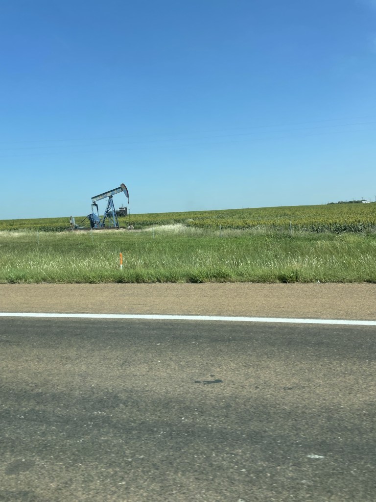
If you wonder why the eagerness to reach Wichita, one of our non-negotiable times was to make it to Golden, Colorado for a party our friends D & D were hosting. And Wichita looked like the mid-point. Miles and miles of corn fields, peppered with occasional oil drills. I never thought of oil drilling as a family business before….but I guess that’s the whole Beverly Hillbillies idea . . . Blue sky backed the fields and prairies. It was an exciting moment when we encountered a curve in the road.

It turns out Kansas has great rest stops – probably because there are so few towns. My favorite was the one apparently erected in honor of the Benders, a 19th century family who lured unsuspecting travelers, and served them a meal in front of a curtain. In the meantime, one of the family would hide behind the curtain, cosh the unfortunate guests, and steal all their possessions. After the mysterious disappearance of a number of travelers the Benders went on the lam and no one knows what happened to them.

We stayed at a motel in Wichita just off the interstate. It was still too hot to pop up the rooftop tent and try our luck. We were so sick of driving by this point that we walked to the “Irish” pub next door. the only thing Irish was Guinness on tap. All the food was Mexican.

We got an early start the next day – there were still a lot of hours to go before Golden. More and more Kansas fields – we stopped in the charming town of Selina, which had some of the best Art Deco architecture I’ve seen anywhere. Lots of restaurants and a 1931 movie theater still operating as a theater. And we were able to purchase a “Tomahawk” steak as a house gift for D & D. Somehow that seemed an appropriate choice coming from Kansas.

Miles and miles more of driving, with little traffic until we hit Denver, where rain and a navigational error didn’t make it any easier.

But we made it to Golden just in time for the party which featured one of D & D’s friends, singer/songwriter Lynn Drury of New Orleans, who performed with the beautiful mountains in the background.

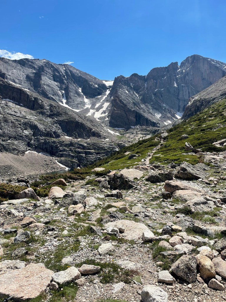
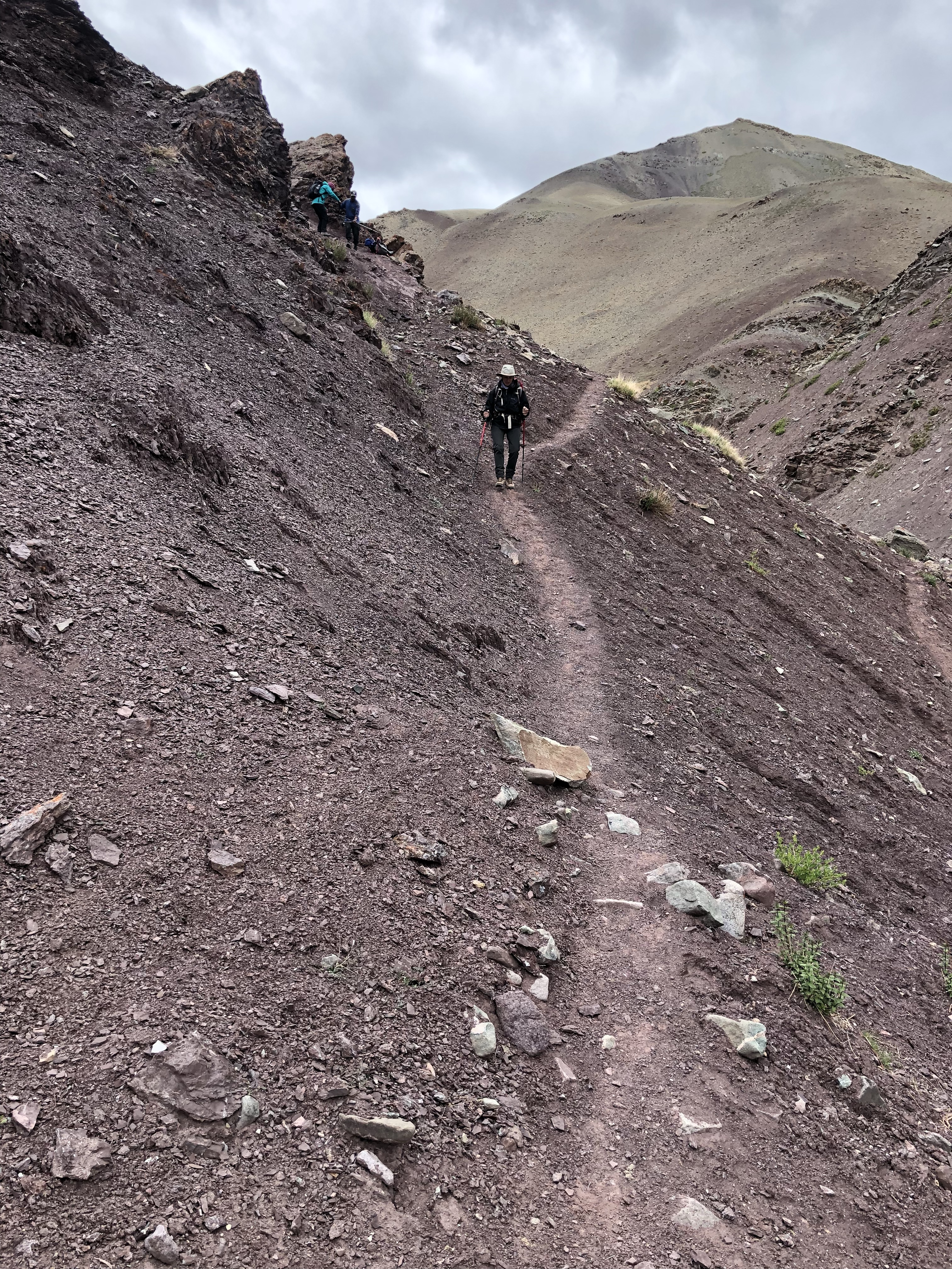
What better spot for a brief hiatus with friends before hitting the Wild West of Wyoming.

Long’s Peak – Down Down Down in Colorado

Since you can’t stay at the top of a mountain forever (or near the top, in our case), it was time to start the clamber down through the rock boulders. Being significantly shorter than the others in our group, I have developed a wedge yourself into a crack, slide down, squat and start it all over again technique. It’s not fast but it’s undoubtedly safe. The sun was scorching down on the reddish rocks and we were all glad when we finally reached the Boulderfield. J managed to get totally dehydrated but was better after some electrolyte tablets.

Once we packed up the tents and ourselves, we finally got on the “road”. We had another 4 plus miles to our next campsite, but at least the trajectory was downward, which certainly helped ease the weight of the packs. We climbed over and through lots of rock, and then emerged onto a broad expanse of rocky grasslands. We stopped for lunch where we were joined by another hiker we had met at the Boulderfield- he had gotten to about 100 feet below the summit but had to stop at that point because of ice. A number of large and well fed looking marmots also participated in our dining activities – or attempted to!

We reached the Boulder Brooks campsite in decent time. It’s situated by a rushing stream and consists of three very spread apart sites. Of course, as soon as we got the tents up it started to pour with a hard rain, which seemed to be the pattern of this trip. J and I hunkered down in the tent and I finished my book. My kindle is truly worth the extra few ounces on trips like these.

The location was beautiful and I sat outside for a bit in the early evening. Unfortunately a multitude of mosquitoes found it equally enjoyable and ultimately chased me back into the relative safety of my tent, where an early bedtime – combined with more rain – made for a very good nights sleep.

The next morning our tents and any possessions stored outside were all quite soggy. We had stayed dry inside but the exteriors were soaked. After a pancake breakfast we dried everything out as best we could and then started a three mile trek out to the pick up point.

The trail followed the same creek we had camped by and we criss-crossed it several times on narrow log bridges just above the water. A far cry from the high swinging bridges of the Himalayas. The Douglas firs soon gave way to silvery white barked aspens. Although they are beautiful I appear to be allergic to them and snuffled and snorted my way the last few miles to the pick up point.

Made it!

The guide company van met us, and delivered a gourmet picnic lunch which we devoured at a nearby state park. The drive back to Estes Park went quickly, and we were deposited at the back of The Stanley Hotel, of The Shining fame, where we were to spend the night. S, J and I were each given a large black garbage bag to serve as a receptacle for the by now extremely dirty contents of our backpacks. The rooms weren’t ready yet so we and our very muddy and smelly possessions found a discrete corner on the porch of the hotel to while away a few hours. We met back up with M and her sister D, who politely refrained from too much commentary on our bedraggled state.

I couldn’t help but think that a haunted hotel was just the right spot to conclude the first part of a magical trip.

Stanley Hotel. Redrum.

Long’s Peak – Through the Keyhole

See the Keyhole in the background

I felt like Alice. Going through the Keyhole was as though we’d walked through the looking glass, only to find ourselves in the netherworld. But we aren’t there yet on this journey – let me resume where I left off, at the Goblins Forest.

We woke up on time, about 6 am after an adequate nights sleep – except for the part where I thought J’s shadow as he reached for a drink of water was a bear…

After a filling breakfast of eggs, bacon, and potatoes we started hiking about 8:10. The first section was what we had done the day before – but this time with over 35 pound packs. As I had feared, an 18 inch step up is a lot harder with 35 pounds on your back – especially as you are working your way up a couple of thousand feet of elevation gain.

It took about five hours to get to the next campsite – the infamous Boulderfield, the real start of the Keyhole Route. We started by disassembling our tents etc, and once fully laden with our packs and the ever constant bear cans, started to hike, up, up, and more up. We made decent time to the junction we’d reached the day before, but definitely slowed down after that and as we went above the tree line.

Weather was moving in, and we all got out our rain gear. The sky turned progressively grayer as the thunderclouds rolled in. The rain came first. Then, just as we reached an even more exposed traverse, the hail started. This was larger than the Twin Sisters hail – almost buckshot sized pellets aiming at us as if fired from shotguns.

The stone steps kept going up and up. I only kept going by focusing on my office building stair training – each time there was a brief leveling out I pretended I was on a landing.

Eventually the stairs turned into an uphill field of boulders, and after a few wrong turns we finally made our way to the “campsite.” It consisted of a square gravel and sand base outlined by small rock walls. Stark, to say the least. No vegetation to speak of except for a few clumps of grass peeking up between the rocks – leading one to wonder what in the world all the marmots are surviving on.

Once there, we got the tents up just before the next rain storm arrived. J was very dehydrated and we just hunkered down in the tent. I amused myself by trying to video the tent interior as he slept. Eventually our guide T delivered carrots, hummus, and cheese to each tent for a mid afternoon lunch – which revived J considerably.

Finally the rain stopped and we emerged from our tents to take in our surroundings. Our guides had suggested in lieu of the Keyhole we could climb Mt Lady Washington if we wanted. After we asked what it looked like and they pointed to a high pile of what can only be described as a rubble heap, there was not even any discussion among the three of us. The Keyhole it was!

We were up at 4:30 am on what appeared to be a true bluebird day. The Keyhole is visible from the Boulderfield and each clamber up another boulder brought it closer and closer. Just below the Keyhole is a stone monument to the first woman to summit Longs Peak in winter – she died on the way down.

I wasn’t even aware of the precise moment I went through the Keyhole – it’s a steep bit and you’re looking down. But once through, suddenly a previously unseen mountain range spreads out before you, towering over a dark, stony valley. It was as if we had entered another world, some magical kingdom populated by giants and goblins and ghosts.

We ventured out onto the Ledges, the next section of the route. There’s a fair degree of exposure, but I felt comfortable- able to lean into the wall and move fluidly. We followed the bulls eye markers almost to the end of the Ledges section, which is marked by a piece of rebar. At that point you have to step around a fairly intense rock – it was slippery and you have to move around it without being able to see to the other side. It was clear our guides weren’t going to let the 60 year olds under their charge go any further.

But the elation of reaching that other world – paired with a lot of adrenaline and endorphins, I’m sure – brought back all my summit experiences. It always makes it worth it.

But – we couldn’t stay there forever. The descent had to begin.

Long’s Peak and a Little Bit of Karma

Lily Lake, Rocky Mountain National Park

Flush with our success on Twin Sisters, we decided that our final day before the Longs Peak push should be easy. We were to meet our guide that afternoon, pack up, and generally do all the things you need to do before a four day backpacking trip – like laundry.

Hence, we started our day with a gentle couple of miles walk around Lily Lake, which is at the base of Twin Sisters and shares the same parking lot.

But the best laid plans and all that. After completing the circuit it became clear that M had a knee injury, probably exacerbated on Twin Sisters, that simply wasn’t going to permit her to do the Keyhole Route. After batting about various options, ultimately her sister, who was in dire need of her own vacation from the pandemic, was able to fly out from the west coast. S also managed to wangle the only free hotel room in Estes Park over the July 4th weekend. So while we missed having our full foursome for Long’s Peak, at least karma kicked in and a good time could be had by all. Just another life lesson – roll with the punches. I’ve never been quite sure what that means but it seems apropos here.

Late in the afternoon we met our guide in the parking lot of the gear store. It turned out we were also getting a trainee guide, who was extremely experienced in her own right (e.g., such things as living in the wilds building trails for six months). So with a ratio of 2 guides to 3 hikers we thought we should be well set.

However, in yet another one of those moments to test your flexibility, our guide, T, informed us that there was still significant snow in the Trough section of the route, and the rangers were warning folks not to try to summit without crampons and ice axes, which we did not have. We had always known this was a possibility as we were early in the season, but still….anyway, the ultimate decision was that we would simply go as far as was safe.

The next day dawned, and about 8 am a large van rolled up, piled with food, tent parts, sleeping bags, bear cans, and various and sundry other items to be crammed into our already full packs. We were mostly using the trekking company’s gear, on the theory that was easier than lugging it from Florida.

The night before J, S, and I had already eliminated about half of what we had planned to take, once we saw the size of our packs. Mine was 70 liters, J and S were both carrying 90 liters. Did I really need two pairs of hiking pants? No. How about that extra shirt? Absolutely not.

T left us to our own devices to begin to stuff the packs. She quickly realized that while J and I may have climbed a lot of mountains, our trips have typically been supported, and animals or other people help carry stuff on these very long treks. This became very evident when J managed to explode his water bladder while it was in his pack before we had even left the Airbnb. It was a good thing we had a dryer.

By the way, I had always wondered what a bear can was. For those of you with a similar lack of knowledge – it is a large plastic barrel with a locking top that should be left about 100 feet or so from a campsite. In it goes food and anything with a scent, even toothpaste. Bears are apparently not very discriminating.

Still fresh at the start!

Packs finally packed at weights of 35 pounds, 43 pounds, and 47 pounds, we were underway. Once at the trailhead the first destination was a couple of miles to Goblins Forest campsite, elevation 10,120 feet. It was slow going with our first day of heavy pack carrying; we went up, up, up the pine and fir lined trail and suddenly were at camp. We were the only campers there – well, except for the mosquitoes.

After setting up camp, the plan was to hike, sans packs, to Chasm Lake. We would be hiking that same route the next day, only with our big packs. There were multiple boulders to pick your way through and over, extremely high steps, and I spent a lot of time imagining what this was going to be like with an extra 35 pounds and an additional couple of miles to go. Daunting, to say the least.

This was an easy part of the trail

We didn’t make it quite to Chasm Lake but turned around after a respectable distance, at about 11,000 feet. Dinner that night was a chicken curry. We, and the mosquitoes, all settled in. We knew the next day was going to be five or so miles, at altitude, with weight, on our way to Boulderfields, elevation 12,760.

My journal entry ends with the cryptic note – “I’m feeling the altitude more than I usually do.” More to come.

S at Goblins Forest

Colorado – Up, Up, and Away in Estes Park

On the road

After the angst of packing and extracting ourselves from work, we were finally on our way to the Rockies. Despite all the horror stories of Uber unavailability and cost, we obtained one with no issue and made it to the airport with time to spare. In fact, we were there ahead of M and S, which is an unusual circumstance, to say the least.

We had a relatively uneventful flight to Denver, which is always a good thing. The airport entry into Denver is surprisingly industrial, and looks more like Elizabeth City, New Jersey in the ‘80s than a gateway to the Rockies (no offense meant toward New Jersey). It’s not helped by the massive interstate construction project that has created a literal bombscape for much of the way.

But very shortly the cloudscapes of mountains start to appear in the distance. We took a toll-free route that led us right through Boulder (I kept thinking of Mork and Mindy), where we had a nice lunch of ceviche tostados at Wahoos. Not sure why I opted for a salad with tofu.

It wasn’t too far from Boulder to Estes Park, at elevation 7522’. The directions to our Airbnb were confusing, to say the least, but after many twists and turns, largely centered around looking for the Bank of Estes – which was the main landmark – we found our way to a very nice small house, just a short walk to town, with mountain views and a great night vista of the illuminated Stanley Hotel.

Estes Park itself is populated by throngs of tourists of all shapes and sizes, small restaurants, and an extraordinary number of candy shops (indulgence in which did not seem like a good idea as a precursor to Longs Peak). There’s a lovely river walk that goes along the banks of the Big Thompson and Fall Rivers, and ultimately we ended up at a pizza place just off the river for dinner. The pizza offered some truly unusual toppings. I treated myself to smoked trout, capers, and cream cheese, while S experienced a little bit of Hawaii with pineapple and red sauce. J and M had something more conventional.

The next day it was time to start some acclimatization hiking in preparation for the Keyhole Route. S had picked out the Twin Sisters trail, which reaches just over 11,000 feet with about 2475’ of elevation gain. Rocky Mountain National Park has timed reserved entries from 9 to 3, so it’s key to get there early – and that’s a necessity for Colorado weather anyway – as you’ll see.

We hiked up a dirt road from the parking area to the trail head. The beautifully maintained trail starts in tall Colorado pines and firs, with a sprinkling of wildflowers. Each uphill stretch was met with a period of relatively flat recovery, a far cry from the straight up treks in the Balkans.

We finally broke through the tree line and the terrain turned rocky, but it was still easy to pick our way through the boulders. Walking through clouds we reached the saddle between the two small summit peaks that were a few feet higher and just a short scramble. But we decided the saddle was summit enough as we started to hear the first claps of thunder.

Being good Floridians and heeding the warnings about exposure and lightning we decided it was time to go down. We were a little concerned about the youth group that we encountered close to the top. They’d broken up into several dispersed groups and the last we saw of them the youngest seemed to be scrambling to the summit as the rain started. Apparently they didn’t take to heart our admonitions that they might want to think about starting down.

Just as we approached the tree line, the real rain started. We managed to get our raincoats on but not our rainpants. Soon the rain turned to pellets of hail, which was to become a weather theme for our trip, although we didn’t know it then. It turns out hail really hurts when it starts to hit your face and hands.

J and I moved fast through three different sessions of hail, all the way to the bottom where, naturally, the sun was now emerging from the clouds. M and S were slightly ahead and we were all soaked. Fortunately the house had good laundry equipment which we took full advantage of.

We had a late lunch at a very informal spot called The Local. I tried the elk stew, which seems to be a specialty of the area. It was good, but frankly anything would have tasted good by then.

We managed to relax in the afternoon as more rain poured down, and did some additional gear shopping (which seems to be an integral part of such trips). I scored a great $13 long sleeved hiking shirt. It helps when you can fit into a boys large.

Despite large lunches we forced ourselves to choke down a good dinner at Claire’s, a nice restaurant where we could sit at the bar without a wait. We had read that Twin Sisters was a great training hike for Longs Peak, and were pretty pleased with our prowess. We were all feeling very ready to go. Were we?

12, er, 13 miles….Cady Way Cadences

Beginning the Cady Way

Recent training hikes have exhibited peculiarities just odd enough to suggest the world is out of kilter. Perhaps it’s the general euphoria of creeping out of the slough in which we’ve all been dwelling during the year of Covid.

But a week ago or so, J and I decided it was time to return to the Cady Way Trail for a full 12 miles. After all, June 30 and Colorado is getting ever closer. Encumbered by 30 pound packs, we set off, if not bright and early, at least at the respectable hour of 10 (or so). I had a workshop lined up at 4 that I didn’t want to miss. We knew the weather was going to be relatively cool, so that seemed eminently doable, and we were even ambitiously talking about how we’d fit in a quick lunch at one of our favorite breweries.

But alas, things did not turn out as planned. Turned out my Charge 4 Fitbit lost its GPS Bluetooth connection (who else has this chronic and annoying problem) and was underestimating how far we’d walked. Combine that with the fact that neither of us actually recalled whether the six mile mark was on the other side of the concrete mixing plants or by the little bridge where the two teenagers were murdered. Yes, Cady Way has its own sordid stories, mixed with industrial charm.

Anyway, we plowed along, blisters getting ever worse, when suddenly we realized we were at the Seminole County line, by a new public restroom and trailhead, and about to embark on the Cross Seminole Trail! The mileage marker read 7.2.

At that point we also realized I’d forgotten to pack the plastic bag with the energy bars . We were in good shape for water, but not a bite to eat. Plus there are no shops for miles and J had left his wallet behind anyway.

At that point it was also equally clear that we were going to have to achieve a very rapid pace if I was to have a prayer of attending my workshop on time. We exchanged barely a word on the return trip except for my pointing out that any cyclists (of which there were many) could just go around me as my energies were completely concentrated on putting one foot in front of the other. Most mysterious was the biking couple who seemed to pass us, only to show up again behind us and pass us yet again. It was as though they knew of some Cady Way Trail wormhole which we certainly could have used by that point.

Fortunately it turned out we hadn’t started at the absolute beginning of the trail and had only walked an extra mile and a half or so, making the total trek somewhere just over 13.

We got back home with no time to spare. I grabbed a yoghurt and attended the workshop while sitting on my yoga mat nursing my blistered feet.

After, I felt I more than deserved a martini while we sat on the porch. Only suddenly to feel a sharp sting on my forehead and realize I’d been bitten by a wasp. Not our most successful training hike. But let’s hope all that bad karma manifests itself now and not at 14000 feet while class III scrambling on the Keyhole Route at Longs Peak. Maybe we will be too high up for wasps.

Long’s Peak Loop, Colorado – Here We Come!

I’ve been promising an announcement – and here it is – Long’s Peak in Rocky Mountain National Park is to be this summer’s adventure!

This is Ladakh, India but I couldn’t find a free Longs Peak photo to use!

When J and I began mountain climbing and trekking in 2011, we saw no point in starting with something small. So Kilimanjaro, at over 19,000 feet and the highest mountain in Africa, was our poison of choice. We’ve never been to Colorado or climbed a 14-er either – so why not start with one of the most difficult – Long’s Peak via the Keyhole route!

While not the tallest of the so-called 14-ers, at 14,254 feet this summit presents a number of segments of class 3 scrambling. The trail is broken up into sections, each labeled with forbidding names such as the Boulder Field, Ledges, Narrows, the Trough, and the Home Stretch.

J and I have watched any number of YouTube videos, many of which are taken with GoPros and whose goal appears to be to strike terror in the eye of the beholder. My favorite is an 8 minute long one, where the climber repeats at least three times, “it’s not really as bad as the GoPro video makes it out to be.”

While this plan may be slightly insane, we are not so insane as to try this on our own without a guide. We are returning to Wildland Trekking – the company we used for an absolutely perfect trek down the Grand Canyon back in 2013 – see fromswamptosummit.com/2017/02/20/journey-through-time-in-and-about-the-grand-canyon-part-2/

And intrepid hikers M and S will be accompanying us on this latest adventure. Last Saturday after an urban hike we all sat in the porch trying to get our heads around the amount of exposure on this hike – no easy feat when you are looking out at an ever so gentle slope down to a lake and only Florida flatlands beyond.

But where there is will there are ways, and yesterday’s foray to Blue Swan Boulders was the start of a new aspect of training designed to get us to the top. Aside from climbing a rock wall on a cruise ship (remember those?) many moons ago, neither J nor I has ever done any indoor climbing. An indoor bouldering gym consists of multiple walls at various inclines reaching up 15 or 20 feet or so, ornamented with hand and foot holds color coded by level of difficulty. There are no ropes – and you spend a lot of time practicing how to fall.

Only drew blood a couple of times.

Although we were clearly the oldest people there we loved it! Talk about a mindfulness practice – as you swing your center of gravity toward that next handhold while reaching with your foot – not much else you can think about. On day 1 we limited ourselves to yellow and beginning green routes – and may not advance much further – but mastering those should translate well for Long’s Peak scrambling.

We ended up with a few scrapes and are pretty sore today but plan to return on Monday. And the craft beer we rewarded ourselves with at the Ivanhoe Park Brewery afterwards was pretty good too!

Ivanhoe Park Brewing Company