I’m interrupting the tranquil narrative of last October and November’s European excursion. And what could make me do that, you ask?
A spur of the moment bucket list trip….to Morocco! J has always wanted to climb Mount Toubkal, the highest mountain in North Africa, in the Atlas Mountains. It’s way shorter than its gigantic sibling, Kilimanjaro, in Tanzania – which is what, of course, started us off on this crazy mountain climbing binge we’ve been engaged in for the last 13 years. And it seems a particularly good choice given that I grew up in North Carolina and the Atlas Mountains were originally part of the Appalachian Range. Who knew?
So when we saw KE Adventures had somewhat reduced its price for an 8 day trekking adventure, and our calendars looked relatively clear….what was to stop us from signing up? Of course, there is that little detail about the trip starting in four weeks and the fact that we had hardly been training to climb an almost 14,000 foot mountain, four days of trekking at altitude (13 mile days or so), and some with a LOT of elevation gain….
It’s back to the stairs for me. And the ten mile clay loop in Clermont tomorrow.
It does sound a bit like “I Had Trouble in Getting to Solla Sollew,” for those of you who remember the 1965 Dr. Seuss book…but Fuschl am See was our next destination after our couple of nights in Vienna. (“See” means lake; “am” means “at the”.) This entailed trains and buses and trails, oh my, and a few wrong turns along the way.
Actually, we were about to embark on the hiking phase of our trip — about a week exploring the hills surrounding the Salzburg Lake District. Our adventure started with the subway to the main train station in Vienna, a long wait, and then a train to Salzburg. Fortunately, it was easy to find the bus from Salzburg to Fuschl am See, although getting off the bus proved more difficult.
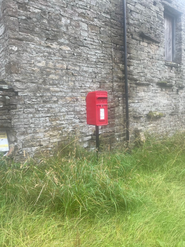
We bought tickets for the 2:15 bus and boarded almost immediately, except for the delay occasioned by some woman who insisted we put our suitcases in the cargo area below. I knew we must be in the right place, since one of the few passengers on board was wearing a native green Austrian hat, festooned with feathers and insignia. See photo above. We clearly weren’t in Kansas anymore.
We had looked at all the stops listed on the electronic display on the bus and there seemed to be only one Fuschl stop. Although this was not consistent with my previous research, we thought we better go with the real time indication on the bus and get off at that one. I should have relied on my research, as we ended up disembarking a full four stops too soon. It turns out that having Fuschl in the name of a place was not much of an indicator…there were multiple stops labeled Fuschl and the electronic display simply hadn’t shown them yet!
Anyway, we exited the bus at what was a suspiciously remote stop on the side of a highway, after making quite a production since the bus driver had to help us get the suitcases out from the cargo hold. The fact no one else got off should have been another hint. It didn’t take more that a couple of minutes before it was clear something was terribly wrong. I checked GPS (which, by the way, works without cell data or Wi-Fi) and realized we were a good three miles from our destination. Since pulling our luggage along the side of a two-lane highway without sidewalks didn’t seem like a very good idea we were happy to learn the next bus was only 20 minutes away. The bus driver rolled his eyes when we got back on but let us use the same tickets…clearly chalking it up to incompetent Americans. This time we did not put our suitcases in the cargo hold!
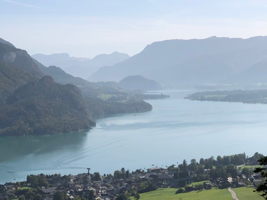
After three more stops, we arrived at the correct Fuschl stop and located the Hotel Jakob (which also seemed to have a moniker of the Triathlon hotel). And indeed it was aimed at triathletes and cyclists, with bikes on display and biking gear for sale. The town was quite small – on a beautiful lake surrounded by mountains. J and I strolled through town and had a gin and tonic at a nice lakefront cafe, and made a dinner reservation for the attached restaurant, which was recommended for local fish.
The temperature dropped; we returned to the hotel to change. This is when we figured out that Austrians, at least in the country, eat early – between 6 and 7 p.m.! I can only describe the restaurant as staid, lots of older people (it was a weeknight in the off season), all seated at tables lined up around the sides of the room so we could all inspect everyone else as they ate their meals….I had three types of fish all from the lake – a filet whose name I didn’t catch, arctic char, and perch, served with carrots and leeks.
The next day we finally started the hike, but only after an amazing breakfast buffet featuring salmon, cold meats, cheeses, breads. I managed to mess up the coffee machine by using too small a cup for my latte (you can imagine what happened), but discovered that the coffee machines in Austria rivaled those in Spain. America needs these!
After we checked out of the hotel, we started to follow the “blue line” on our downloaded GPS map, just as we had done in the Yorkshire Dales. The first part, through a valley, was a trail themed around gnomes, with little signs up everywhere telling a story of some ill fated gnome. The landscape really does explain where the Brothers Grimm got their tales.
It was only about a five miles to our next stop, although there was a decent uphill and down, and I did miss my hiking poles – but there was no way to fit them into the luggage. One thing to get used to were all the Catholic shrines and chapels along the trails. Every couple of miles there would be a shrine with candles lit, typically for the Virgin Mary. I’m assuming the candles were battery operated.
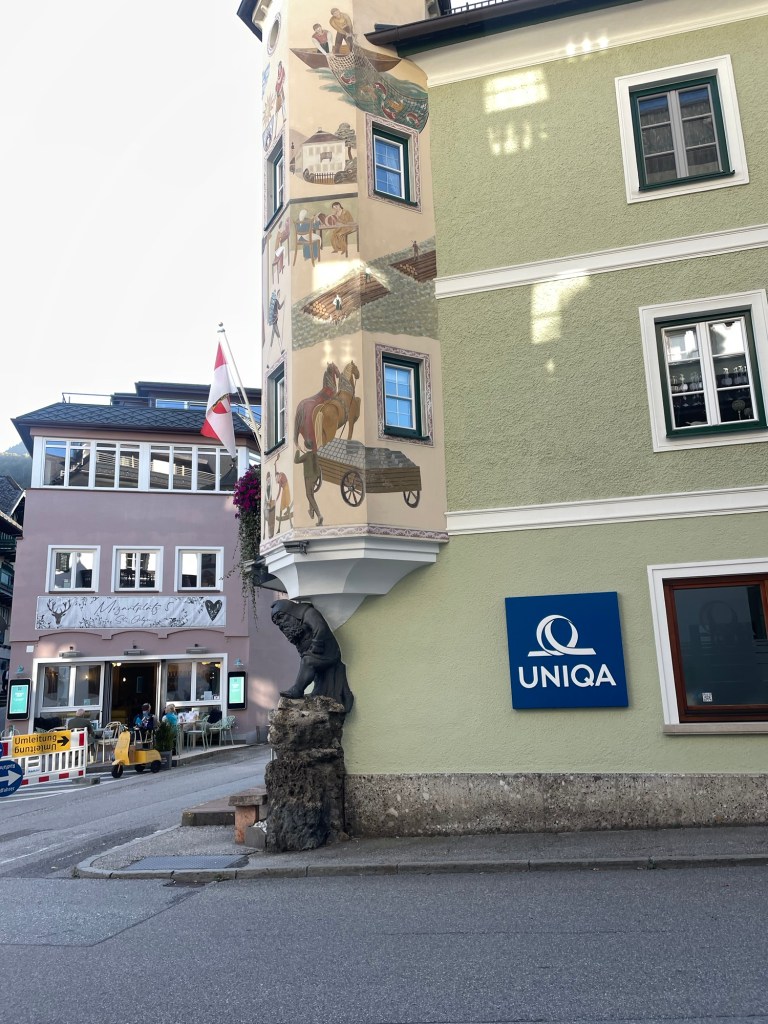
After some good scrambling and beautiful views from Mozartblik, we descended into St. Gilgen, which is on Lake Wolfgang. It’s a very wealthy summer town, but many places were closed for the season, which had ended a couple of weeks before. It was almost too quaint, painted buildings and Austrian architecture.
We had lunch by the lake, followed by a power nap, since we still weren’t exactly on the right time zone. After a long walk through town, we capped off the day with a drink at a bar across the street, which featured someone wearing lederhosen along with many tattooed bikers. That theme continued at dinner – again, the restaurant was practically empty by 7 – where we enjoyed watching four very elderly men, clearly on their weekly outing, each wearing lederhosen with the appropriate jackets.
J and I retired early. The next day was going to introduce yet a new mode of transportation – a lake ferry.
As we’d had several long and steep hiking days, we decided to knock off a couple of miles by avoiding a loop around something called Apedale Moor (which we couldn’t locate on any map anyway) on our way from Reeth to Bolton Castle and on into Aysgarth Falls.
This meant having the nerve to stray from the ever present blue GPS line that was our North Star to take a paved road called Hargill Lane practically the whole way. Just because it was paved, however, did not mean that it didn’t go up and down, and unfortunately, it was a quintessential long slog shin splint generator. Hargill Lane crossed windy, windy moors with absolutely nothing around but sheep and occasional cars that operated at the same speed as all the bus drivers – that is to say, fast.
Eventually the road descended into the conservation area for the Bolton Estate, lands that are still owned by the same family that held them hundreds and hundreds of years ago. There were many beautiful wildflowers, but they were interrupted by lots of warning signs for the quarry works on the other side of the road.
We reached the very well preserved Bolton Castle right at lunch time and had a nice meal in the tea room. The castle, built between 1378 and 1399, is quite intact, and M and I enjoyed the diagram that showed what each level of the structure was used for. There was also a lot of information about the castle’s architect, John Lewyn. Who knew castles had architects!
The walk from the castle to Aysgarth Falls was lovely. We did cross a field with another bull, which was actually starting to lunge at a couple on the other side of a wall who had a dog with them. (Incidentally, everyone in the Dales has dogs, and they are welcome guests in restaurants, pubs, shops, etc.) They had some long story about someone they knew who had recently been charged at by a bull and had to throw his dog over a wall….in any event, it turned out my bull fears were not unwarranted! While the bull was occupied with them, J, M, S and I managed to sneak over another section of the wall, unnoticed.
On the way, we also suddenly heard a huge roar overhead that practically shook the stone walls surrounding the fields. Two Typhoon RAF jets zoomed by, and made several passes. We soon learned that war had not actually broken out while we were in the solitude of the Dales, but that this was a popular location for the RAF to do low altitude training.
The Aysgarth Falls themselves were pretty, but by then we’d seen so many waterfalls, we were somewhat jaded, and just as glad to keep on moving up a steep hill to our next guest house — the newly renovated Aysgarth Falls Hotel. Despite three flights of stairs (thank God for those backpack straps on my suitcase!), it was really nice and we thoroughly enjoyed their pub and dinner and breakfast food.
That was good, because the next and final day turned out to be the most challenging yet.
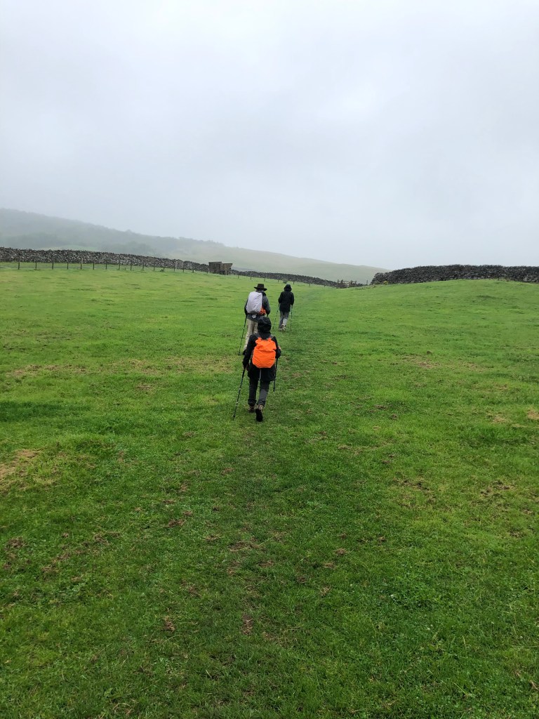
The plan was to walk from Aysgarth Falls to Kettlewell, where we would meet a taxi at 5:30 that would transport us back to Grassington, for our travel to London the next day. We wisely chose the 12.6 mile route rather than the 15.3…..
We started with some easy walking through fields and what was described as some “unavoidable” road walking. But there was little traffic, and the flowers were pretty as we basically hiked the length of the valley. Despite its remoteness, a number of little cottages bore signs of construction.
Eventually the valley ended, and so did the road. A very nice farmer gave us directions (the blue line becoming somewhat cryptic at that point), and we were able to cross the river and start what was described as a “big up.”
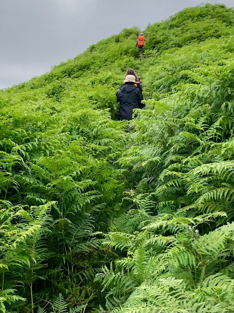
We were completely distracted from the steepness of our ascent because the almost imperceptible trail started to lead us through fields of five plus foot high ferns. They literally towered over us and I found I was using my body as a battering ram to push through. It felt way more like an Amazon jungle than the Yorkshire Dales.
Part of the way up, we realized there may have been a slightly more trodden path, but we were too busy bushwhacking and trying not to be swallowed by the ferns to have seen it.
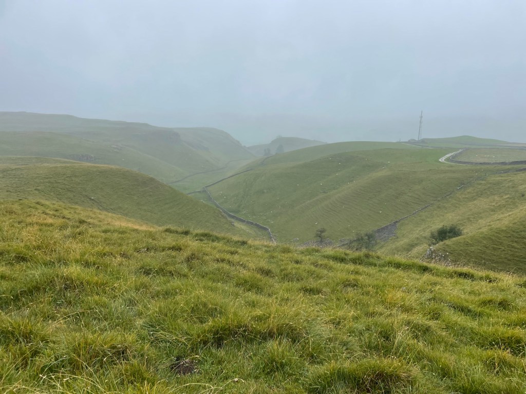
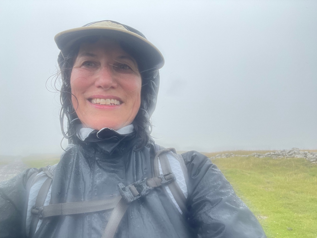
We finally cleared the fern field and continued to ascend. It was a very rapid elevation gain. Suddenly we found that we were no longer below the low hanging cloud we’d been observing all day, but were actually in it!
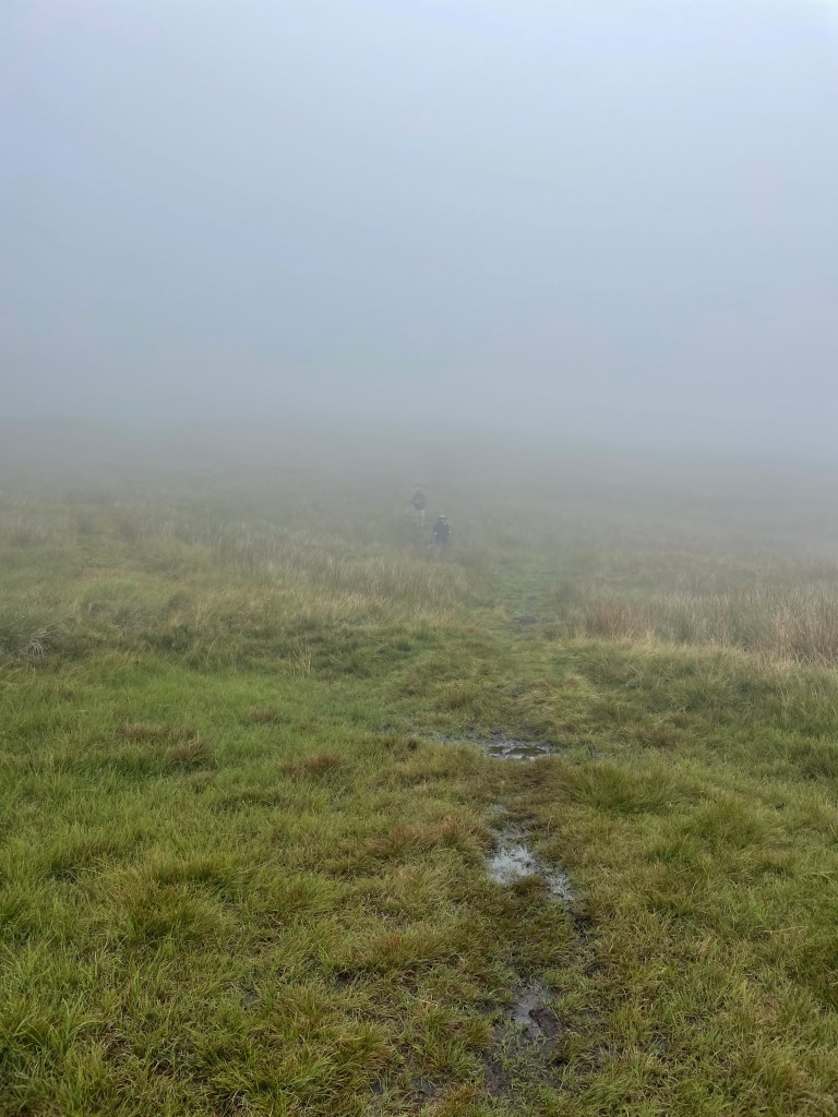
Yet still we continued to climb up. Visibility was starting to close and navigating the blue line was like flying a plane on instrumentation only. We encountered one group of young scouts using maps who were clearly doing some sort of orienteering exercise….they seemed infinitely better equipped for the challenge than we were.
We had no choice but just to stick to the GPS line as much as we could and aim toward the cairns and waymarkers that we could see. Finally, the scout leader passed us asking if we’d seen his charges anywhere – we were relieved to see him as proof that civilization existed somewhere in the direction we were aimed.
Visibility continued to get worse and the wind was whipping. We stopped for a brief break by a the first stone wall we’d even seen. But by then I was simply dedicated to getting down as fast as we could because it really was starting to feel unsafe. I was beginning to feel like a character in one of those Sierra Club magazine articles about what can go wrong while hiking….they usually end with hypothermia or broken bones.
Anyway, we finally reached what the itinerary termed a “snappy descent.” To the dismay of my fellow hikers, I actually found that part sort of fun – skipping around and over rocks, but with lots of grass cushioning on either side. Plus we were going down.
But we were still in the cloud, and M and S were just dots in the mist. All I could think about was that we had to maintain visual contact. You really could have gotten lost up there.
Finally we were below the cloud, and the world started to come back into focus. We could see the village of Starbotton at the bottom of the peak we were descending, and the wind that had whipped us as we crossed the ridges of the moors died down.
A steep descent down a stone road, and we were back in the valley, only 2 1/2 miles from Kettlewell. We had a quick bite of our sandwiches, and then walked through the fields that lined the valley for a straight shot to Kettlewell.
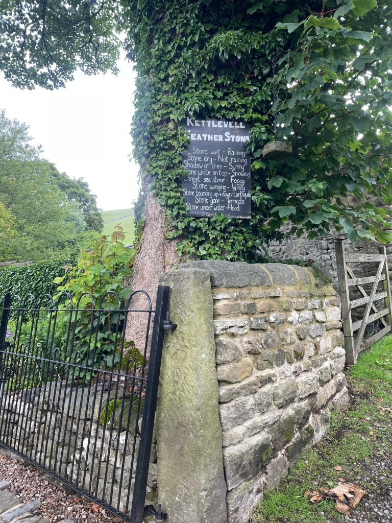
We had made it – all 77 plus miles! We walked through the village to the Blue Bell Inn where we were to meet the taxi in an hour or so. We had a celebratory drink to toast our most recent adventure. And even the fact that the taxi was an hour and a half late picking us up didn’t really matter.
Rooms at the Herriot Guest House were quite small, but that was by far compensated for by their very good breakfast and homemade jams and marmalade. That provided enough to fortify us for a slightly easier – and hopefully drier – day 3 ahead.
The Mac’s Adventure itinerary called for us to be transported by taxi to Keld, which truly is a blip on the map. The taxi took us through the Buttertubs Pass – a location I was last in with my family in 1972 when we lived in England for my father’s sabbatical.
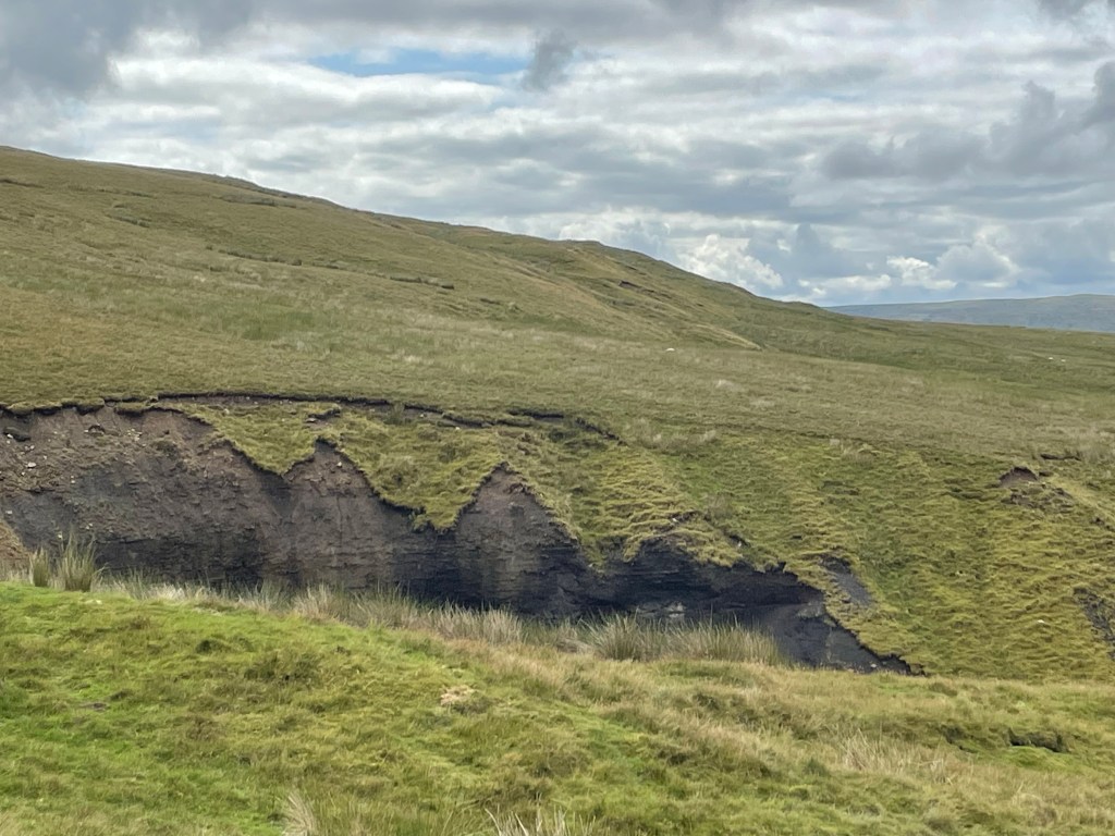
After an early arrival in Keld, we got on the road to walk to the Tan Hill Inn, famous for being the highest pub in England. About a 4.5 mile hike, over lots of moorland and gigantic ravines, where erosion peeled back the top layer of heather to reveal dark soil and rocks. For all of its age, just like the fossilized Jurassic coast in Dorset, this is an ever-changing landscape.
It was rewarding to see the inn suddenly appear in the distance, but the place itself was crowded with day trippers and there was nary a place to sit. Nonetheless, there were picnic tables outside, and we were able to make a nice lunch out of the Double Gloucester cheese and crackers that I had been carrying around since Manchester, alongside the middle aged men’s motorcycle group who were similarly shut out of the pub.
J and I chose to take the longer route back and crossed the valley, which was low and filled with green rushes, over to the next other ridge. The top flattened into a golden prairie-like meadow. We saw at least four or five “bouquets” of pheasants suddenly take off. On the ground they were perfectly camouflaged, soft brown speckles and beige. We would hear five short whistles and suddenly they would take off at top speed, looking for all the world like a group of feather dusters taking flight.
We could never capture a pheasant in flight, but at least I found some feathers!
Our path took us by the rather large farming establishment of of the so-called “Yorkshire Shepherdess” of TV fame (although I’d never heard of her). She’s apparently one of those “leave the city behind, become a farmer, and write about it and develop a TV series” people. We did see two men, one on an ATV, which seems to be the farm vehicle of choice here, herd a group of cows into a barn. We had to wait until they were in before we could pass.
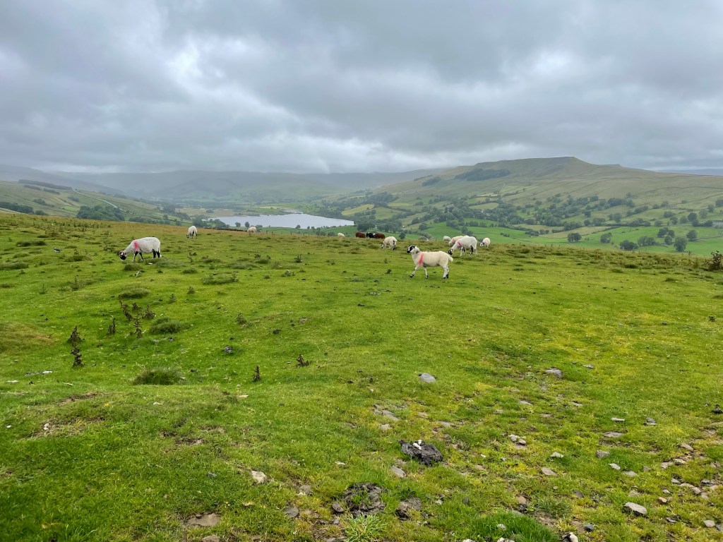
I know these are sheep, not cows, but I didn’t have a pic of the cows!
We were almost back in Keld when we managed to make a critical navigation error and ended up going the wrong way toward the small hamlet of West Stonesdale. It’s a true farming community, with working sheep dogs sleeping in their cages, and big agricultural equipment everywhere. Fortunately, I soon realized I was looking at the famous GPS blue line backwards, and we were able to correct our course and make it back to Keld about 5, just as S and M were starting to question where we were.
View from the Keld Lodge
After an overnight at the Keld Lodge, the next day, Day 4, we were to trek to our next destination of Reeth. We had a choice between the “high” route, which would mostly be on the famous Coast to Coast trail, or the low route, which ran along the river. We fortunately chose the high route – and it did indeed provide some of the best summits and sights of the whole trip.
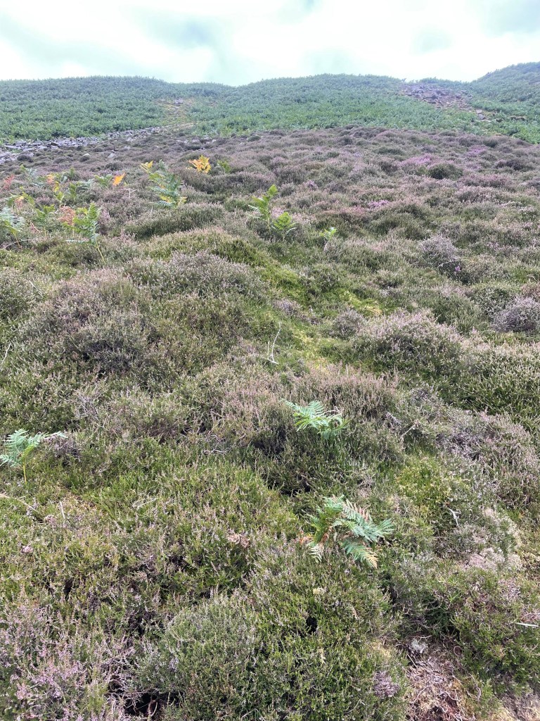
The first part was over moors, which were blanketed in blooming purple and sometimes white heather, waterfalls galore. There were lots of steep sections, including some fun scree fields to scramble through, and I was happy get to use some of my basic mountain skills. They are pretty common sense: always lean into the mountain and your uphill pole.
A steep descent into the valley, and we were in the midst of the ghostly ruins of lead mining works. Lead mining was very big in the Dales back in the 1830s. It’s now just a shadow land, and it’s hard to imagine the hundreds of men that would have lived and commuted to these now remote and desolate areas to work the mines.
It looked like some gravel quarrying still continued and we ascended back up the valley to a moonscape of rock and gravel.
Once we crossed the moonscape, we found a nice spot for lunch, where we chatted with a mother and daughter combo who we had seen in Keld that very morning. They must have been uber athletes based on their speeds up and down.
I bonded with this sheep. It was the cleanest one we saw!
After about 12 miles or so and a few more ascents and descents – and a lot of what we believe to be grouse – we made it to the pretty town of Reeth. As always that final last mile or so is the hardest.
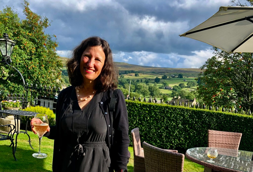
We were staying at the Burgoyne Hotel, which seemed positively opulent after the Herriot Guest House. Nothing like a drink in a front garden after a hard day of hiking.
As foreshadowing, let me start by saying that I spent a lot of time on day 2 of our trek through the Yorkshire Dales thinking of synonyms for the word waterlogged. But I digress.
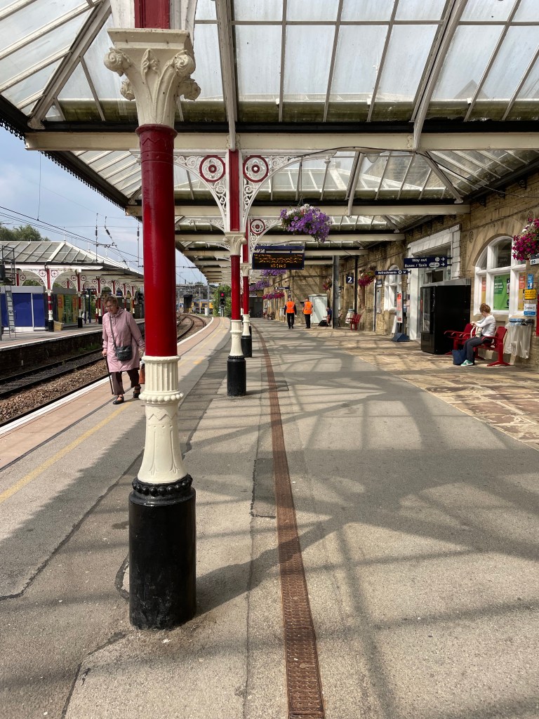
After a two night sojourn in Manchester spent catching up with family friends (by the way, we really liked Manchester and its bustling vibe…), J and I successfully navigated our way to Grassington. This started with two trains, which delivered us to the charming town of Skipton, which had one of the prettiest rail stations we’d seen.
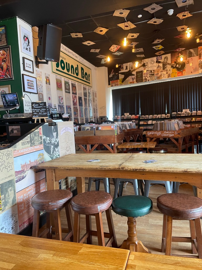
From there we planned a bus ride to Grassington. Of course, the rail station and bus station were not contiguous, so this involved a ten minute jaunt, luggage in tow, but we were able to use our two hours of waiting time to visit the “Sound Bar.” An independently owned combination vinyl record store, coffee shop, and pub that also featured live music on the weekends. The walls were plastered with tickets, posters and other promotional materials for concerts and bands dating back 50 years – really fun spot and not what we expected to find!
Despite the fact that the driver operated the bus to Grassington as though he were auditioning for Mr. Toad’s Wild Ride, he safely delivered us to just outside the Black Horse Hotel where we met up with pals and long time travel partners M and S. They’d arrived a day earlier, fortunately managing to take one of the only trains running on a day of “industrial action” (aka strike day) from London to the north. Unfortunately, the room reserved for J and me had electrical problems. After a couple of hours of waiting around in their very cozy bar, management gave up and sent us across the street to an equally nice inn, the Devonshire, which was graced with a mention somewhere in one of James Herriot’s books.
For those of you not aware, practically all of the Dales is Herriot country – there’s a Herriot Way walk, hotels name their rooms after the characters (both human and animal), and more memorabilia than you can imagine.
After a filling breakfast, the first day of the walk went smoothly. It was only about 11 miles – slightly shorter than the original itinerary because we were to stay in Buckden instead of Cray, which was a couple of miles further down the road. Of course, that did have implications for day 2, as I’m sure any discerning reader will have figured out.
There was a light, misty rain much of the time but it was really nothing more than what you experience with a mister at a Disney theme park. A few steep uphills at the beginning until we reached a ridge line. We then descended through what must have been a planted forest of tall conifers, stripped of their lower branches, and down to a river that was contained in its banks (foreshadowing again – unlike day 2).
We reached the village of Kettlewell where we stopped at the first spot we saw for lunch and an ale (after all, this was billed as an “Ales and Dales” trek). It turned out it was the owner’s first day open, and his manager had quit that very morning. We were happy to support the new endeavor and enjoyed hearing his take on English politics and who should or should not be King….
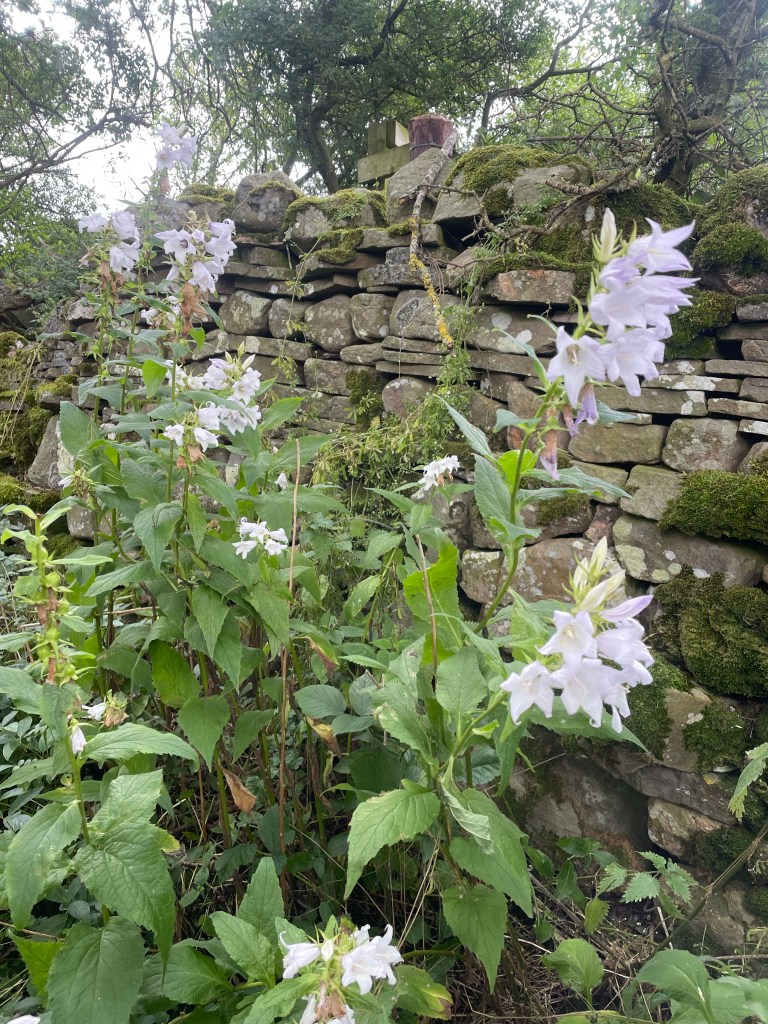
Much of the rest of the walk was on or near the river. It was edged with fantastic wild flowers, thistles, foxgloves, and bluebells. We crossed open fields, or sometimes were sandwiched on narrow paths running between stone walls, flowers and ripening berry brambles on each side.
We reached the tiny village of Buckden (chief feature, a village store that took cash only) in good time. Home for the night was the lovely Buck Inn.
We knew in advance that the repercussion of our shorter day was a longer one….so were prepared for at least 16.5 miles on day 2, and had ordered packed lunches the night before.
We knew things were not off to a propitious start when, as we were departing, a man in the lobby volunteered that he had just come from Askrigg, and everything on the way was flooded. He also cast some dubious looks at the four Floridians blithely heading off into the Yorkshire Dales….
It was indeed raining, and continued to do so for nearly the whole day, veering from light to stinging. We started with a long uphill slog, and learned the first rule of Mac’s Adventure trekking – NEVER veer from the blue GPS line on the app, NO MATTER WHAT. The sign posting (other than for the well-known, main trails) is awful, and that blue line becomes your Bible (or yellow brick road, whichever metaphor you prefer).
Our first issue really started as we descended into Cray, which was where the original itinerary had called for us to spend the night. We reached a roaring river, which we were apparently to cross with the assistance of stepping stones. But the stones were under the white water rapids of a flooded river, and we were not about to start day 2 with an encounter with the river gods. There was a bridge just a few feet away – but to access it we would have to go through private property that lined the river bank.
There was little choice. To the bemusement of the elderly men on the other side of the river who were eating sandwiches and drinking tea from flasks, and having a good time observing our adventure, we all managed to climb a stone wall, scale the wire at the top (avoiding barbed wire on the sides), and make our way to the bridge. (S had ventured along the river edge, clinging to the wall, to see if there was a way to less obviously trespass, but soon gave up the attempt to avoid lawlessness.)
I wish I had pictures, but we were somewhat preoccupied.
We trudged on some more, and reached a turn off that sent us above the fields into bleak and desolate moors, inhabited only by sheep. We did encounter a group of scouts with an older guide who made dire predictions about the water yet to come. More uphill, reached a stretch of paved road, only to find that portions of it were under up to a foot of water. That required another venture into the fields at the side, although by then we were so wet it hardly made a difference.
From the road we were back onto a bridle way running through the moors. As M pointed out – we were experiencing both swamp and summit simultaneously. Many impromptu waterfalls had formed, and it would have been spectacular without the rain, or the wind that had by then kicked up. The conditions defined the word bleak, and the moors were, to use M’s phrase, both desolate and disorienting.
The moor was interspersed by sheep fields every now and then – but my favorite was the pasture guarded by a very large bull with a ring at the end of his nose. I was first in our little parade, and memories of bull running and Pamplona caused me some anxiety as I considered the effect of my orange back pack. But I moved slowly, J edged in close so the back pack wasn’t as visible, and Senor Bull deigned to let us pass without exacting tribute. Nonetheless, once we’d exited his domain, he stood his ground by the gate, staring at us to make sure we really had left.
The rain lightened and we found ourselves on some country lanes, with a couple of houses that seemed to have been built at the edge of the world, so we pulled out our sandwiches and ate on the go. About mid-afternoon, we finally reached the charming village of Askrigg – home to pretty gardens and a 15th (or earlier) century church, St. Oswald’s.
Exiting Askrigg, we hiked through a lovely enchanted forest high above a rushing river. The path ran along the top bank, a stone wall on one side and trees and river below on the other. It was emerald and mossy green, and surely home to a pantheon of forest fairies.
Path finding through the muddy, sodden fields became more difficult and the wind picked up. Things were not helped by the hundreds (thousands?) of sheep we encountered and we spent a lot of time trying to avoid their leavings. Very occasionally we would go through a “clean field,” i.e., one without sheep!
I thought I could see our destination of Hawes in the distance, but couldn’t know for sure. We hiked and hiked through field after field, finally making a left and seeing a sign marked “Hawes Circular Walk.” It was getting late at that point, and I haven’t been so glad to see a town since J and I descended Stok Kangri in Indian in 2018!
We reached the Herriot Guest House in Hawes completely drenched. Both ourselves and our possessions, despite rain pants and back pack covers (turns out passports dry pretty well). To add insult to injury, somehow the luggage that was being transported from inn to inn had managed to get wet as well.
We changed quickly and went the The White Hart for an excellent (and well-deserved) Sunday Roast.
Sodden, waterlogged, drenched, soaking. I’m sure there are a few adjectives that I’m missing but you get the picture. However, you could equally apply: challenging, invigorating, exhausting, stimulating, and most of all – absorbing.
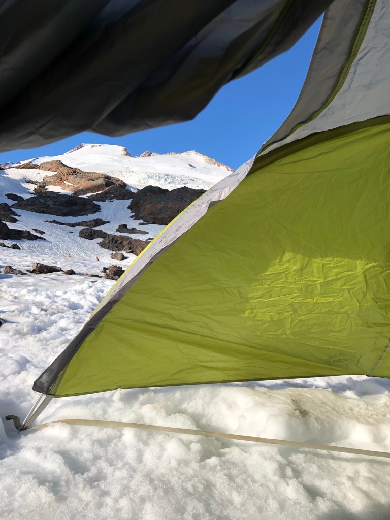
After our excessively long summit day, I slept soundly, which is not as easy as it sounds when you are overtired and sleeping on a slab of ice in a sleeping bag on an ancient thermarest pad. I’m not exaggerating- when we took the tents down we discovered that’s exactly what we were all camping on. See photo!
After more oatmeal – which I was definitely getting tired of – we reverse hiked our way back to the van, starting with the Railroad Grade. This time, instead of wearing my mountaineering boots I chose to wear my brand new Merrill’s, breaking one of the cardinal rules of hiking – don’t go a long trek in brand new boots. The downward slog caused multiple top of toe blisters and no less than five toenails paid the ultimate price.
But I digress. The real marvel of the Railroad grade, which, you will recall, is a slim reed of a trail with precipices on either side, was my mountaineering boot miracle. T had tied them to the sides of my pack, where they inelegantly protruded out in an apparently not very secured way. At the steepest and narrowest part of the trail, I could feel one fall off. I wisely thought, well that’s it, there’s no way I’m going after it – only to have said boot drop right at my feet with nary a roll to the side. With luck like that I really thought I should buy a lottery ticket.
The other odd part of our hike out was that at one point J, who was still not feeling well, managed to pull ahead of me. It had to do with a river crossing that I took my time at….while another group was well behind. For what I’m sure was a brief few minutes, although it felt longer, the trail started to look terribly unfamiliar. I called out to John to no avail, and started to convince myself I must have taken a wrong turn – not that I even recalled seeing any paths veering off. Finally, some other hikers walked by and assured me I was indeed on the way to the parking lot. I was relatively sure that there could only be one such parking lot on Mt. Baker, so that calmed my frazzled nerves.
We finally all made it back to the parking lot, in a state of bedragglement. After all, we’d been wearing the same clothes for four days, some of us had been ill, and we were all footsore. We were too late for our planned celebratory lunch, so we stopped at a Food Coop in Mount Vernon, where we had a very elegant little picnic sitting on a wall in the store parking lot under the overpass.
After surviving Seattle’s quite notable traffic we made it back to the Mountain Madness office where our little band of adventurers broke up and went our respective ways. We’d all bonded on the trip – one of the great things about mountaineering is the relationships you can form with a good group of people. And another is the relationship you form with the mountain. You don’t climb it – it lets you do so.
I had been apprehensive about putting my crampons back on. But this trip confirmed that thrill is still there. Now we just have to pick our next adventure.
My goal of cranking out our entire Mount Baker trip in a few weeks has been waylaid by work, as so many things tend to be. But fear not; we haven’t been stuck on the summit forever – we did in fact make a not very elegant but nonetheless effective descent.
One thing I inadvertently omitted from the account of our trip up to the summit was the eerie, almost tropical breeze that accompanied us at the beginning of our summit night. It was a harbinger because heat was the theme of the way down.
Of course, the first challenge of the descent was to reverse our way down the Roman Wall. As the smallest of our team of four, I was assigned the front of the rope, which meant I had the responsibility for picking out the footsteps we would follow on the way down. I had last led a rope line on Mt Elbrus and I was terrified as guide S short roped us (so he could control the rope better) and I cast a look down at the truly steep slope before me. He’d done the same short rope up the Roman Wall as well, which gives you some inkling of its incline.
It was much harder to get into a steady pace on the switchbacks on the way down, as we had very varying speeds on descent. To my surprise, the really vertical part was actually easier than the switchbacks – it required a boot plunge into already carved steps that you slid into – some almost 18 to 24 inches – but they felt fairly secure. The only problem was that so many other ice axes had already traveled that way when you dug your axe in you were just as likely to hit an existing hole and get absolutely no purchase.
I’d forgotten how much I liked leading a rope. The Roman Wall demanded absolute concentration and my legs felt shaky at times – nerves – but that complete absorption in the moment is one of the things I love best about mountain climbing (and glaciers, in particular). As our guide said – every step had to be purposeful. I’m afraid there are no photos of this. My hands were otherwise occupied.
Not quite sure about this angle but this is what it felt like
We made it down the Roman Wall in decent time and then reversed positions and I was now at the end of a long rope. Our guide, SH, was concerned about speed because temperatures were climbing and water was getting low also. Apparently my Florida heat training helped because I got down with water to spare.
But this is where the different trekking speeds really slowed us down. If I went too fast the rope would pool around J’s legs and he’d trip so I had to keep stopping and we never got a good downward rhythm going. It took almost five hours to get down (recall it had taken about eight to ascend), and it was an enormous relief once we could unrope and slip and slide down the last little bit.
Crevasses presented a few adventures on the way down also. The glacier is always moving and the cracks in the snow were no longer where they were or the same width. In fact, although I didn’t see it, T reports to me that M had a “crevasse crash.” The snow at the edge of one deep crevasse had gotten slushier, and you needed to dig in your crampons before hopping across it to get traction. As M approached, she couldn’t get a good foothold, and, worried about breaking her leg if one foot slipped in, chose to dive headfirst across the crevasse with full momentum. According to T, she quickly uprighted herself, sat up, and started laughing.
Back in camp everyone was exhausted. Poor J was still enduring whatever stomach issue was plaguing him, and M was also having to cope with feeling unwell. We had a latish dinner of spaghetti and needless to say, all were asleep at an extremely early hour.
Next up – the hike out, the miracle of my mountaineering boot drop, and had I actually gotten myself lost somewhere on the trail system of Mount Baker.
The first night of our expedition was the coldest of our three camping nights, and my feet never got warm. For some unknown reason I had failed to wear socks.
But the day dawned bright and sunny. This was to be our rest and training day. We were treated to a non oatmeal breakfast of surprisingly good scrambled eggs from a powder, topped with cheese and turkey bacon jerky. Who knew. SH had dispensed packets of instant oatmeal to everyone for the remaining days, which led to great confusion as to who had the right number of packets and what that number was. He’d also doled out lunches for the next days – wraps that we were already calling salami bombs and I’m sure they added to the weight of my pack.
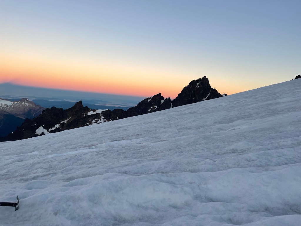
A view from our tent – that steep bank in the distance is the Roman Wall
After a leisurely breakfast we donned crampons and climbed up the nearby snow bank. There we proceeded to practice movement on the snow (duck feet, French technique), self arrest (flip your ice axe around, pick side down, plant it, dig in with your knees and feet, hips raised, and kick), and movement on a rope with a team. It had been four years so I was glad of the practice. M, one of the folks from Canada,was definitely the most adventurous on the self arrest practice – she picked up a lot of speed as she simulated her fall down the slope. J and I were a bit more cautious.
We spent the afternoon reading, napping, and prepping our packs for a 1 a.m. wake up call. I also spent quite a bit of time observing our comrades from other groups – campgrounds are second only to airports for people watching.
We had an early dinner of rice, orzo, the ubiquitous salami chunks, followed by a sunset walk, and were in “bed” by 8. Needless to say, sleep was hard to come by, but I know I must have drowsed off, waking about five minutes before the alarm, just in time to force down my two packets of instant oatmeal. At least we also had dried fruit, nuts, and chocolate chips to add to them.
We finally started off at 2:15 a.m., only 15 minutes after our appointed time. Slow was definitely a theme of this trip – after all, it was referred to as the “slow Baker” expedition in the marketing materials. But let me also add a little flavor. Of our five merry climbers, only M, J and I had worn crampons before, and M had not done so for years. T (friend of absent S) and TF (the other person from Canada) had never worn them. So all in all, I think we made a pretty good showing.
It’s always spooky to take off in the dark, accompanied only by the glow of the headlamps, but the air was perfectly still and I was hiking in only a soft shell jacket. We started off with our crampons on – which was great as we avoided the agony of having to struggle getting them on somewhere on the glacier in the dark.
After about 45 minutes we crossed a rocky area with a bit of scrambling and it was time to rope up – we were well onto the glacier. SH led a rope with J, T and me; H led the other rope with M and TF. Z and C were on their own rope. Z did decide to wear something other than his kilt for the summit day.
I could feel myself slipping into that zen like state of a steady pace where focusing on putting one foot in front of the other is the only thing in your head. I’ve so frequently channeled our guide Ossy’s instruction to me on Cotopaxi in Ecuador that you have to find your own way up a mountain. This time I also repeated SH’s mantra – step purposefully. Surprising how these mountain directions do a lot for everyday life.
The trail was moderately sloped with a couple of flat platforms at 7000 and then at 8000 feet. There weren’t a lot of other groups but we were passed by some who were huffing and puffing – my goal was not to do that! The sun eventually rose and we could see the shadow of the mountain cast along the valley.
There were any number of crevasses that we had to wind our way around or step over, sometimes with the help of a snow bridge and sometimes without. The widest was perhaps 18 inches. They are eerie. You can see blue ice lining the sides and no bottom, and it looks like a fall would usher you into some completely other world.
The crater
We ultimately reached the crater. The mountain is still an active volcano but I wasn’t really aware of any sulfur; it certainly wasn’t anything like Cotopaxi. I was conserving my energy so didn’t walk over to look into it, but I did enjoy my salami bomb. I was making a big point of eating a lot as I know in the past I have failed to do so and that does not work well in the mountains. In the meantime, I learned later that both J and M were feeling unwell, but what troopers! They soldiered on without a word of complaint and still with appreciation of what we were experiencing.
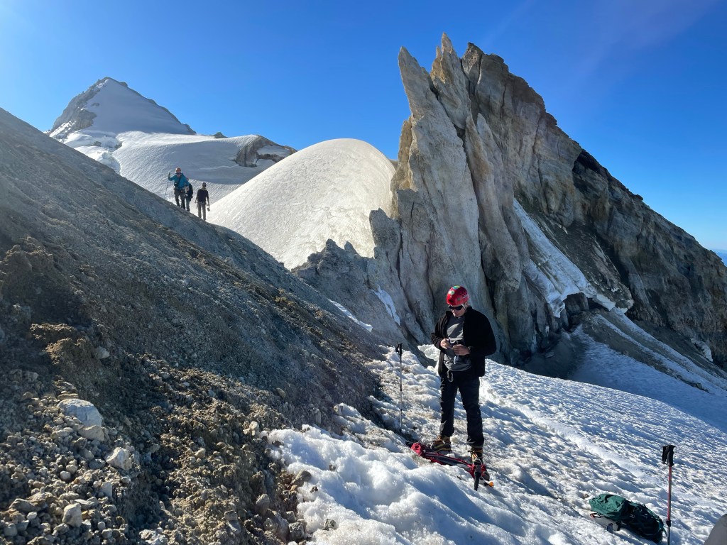
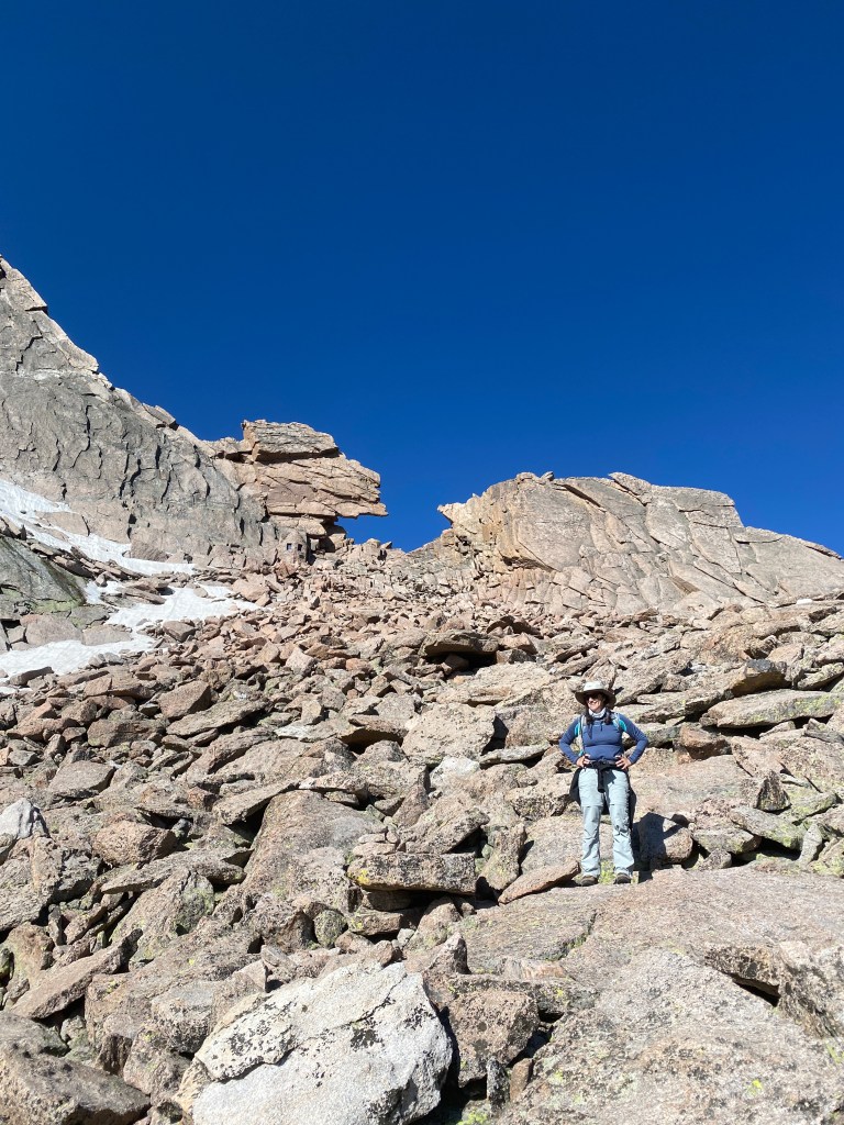
Finally we reached the so-called Roman Wall, unclear why it was so named, but it provided the source for a running series of jokes about the ancient Romans and their visit to Mount Baker. The Roman Wall is indeed steep; it is really the head wall of the mountain and considered the crux – that is, the hardest part. It’s the part I’d been dreading. It averages about 40 degrees according to what I’ve read, and starts at about 9750 feet.
The first part is a series of switchbacks that nicely ameliorated the steep slope. I’ve always said you can climb most anything with enough switchbacks. But near the top, they cease and there’s a straight vertical climb. Kick into the step of the person before you, step up, and repeat. Twenty five or so straight up feet of this. A few more switchbacks and suddenly you’re back on a relatively flat area with the summit not far away.
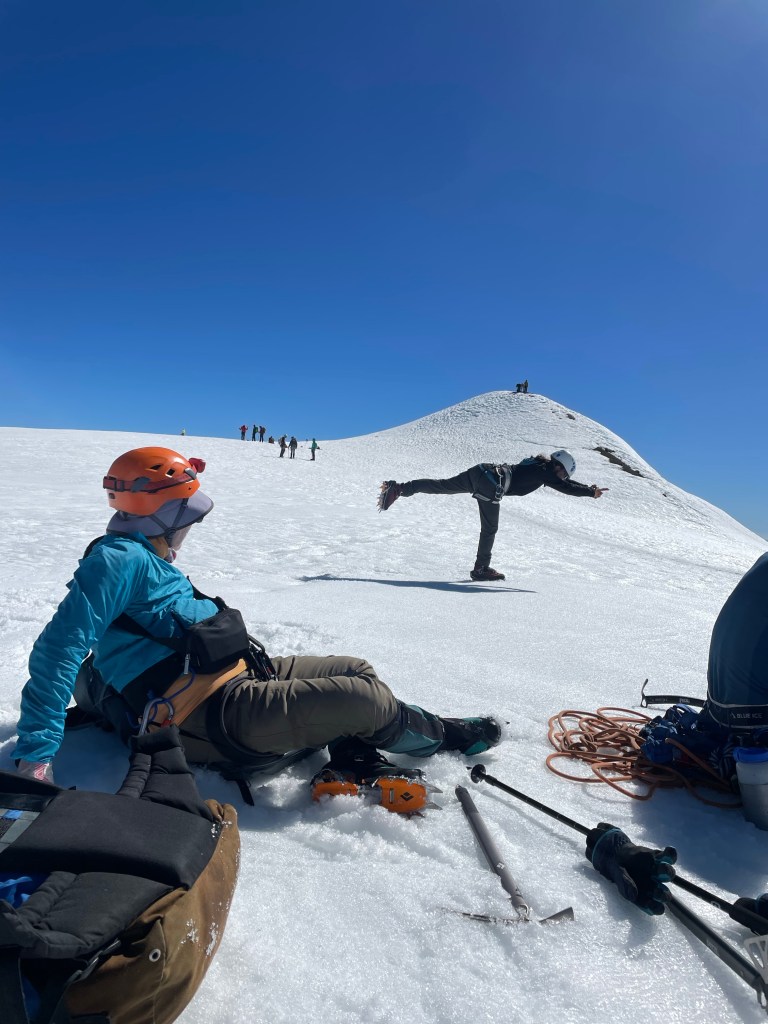
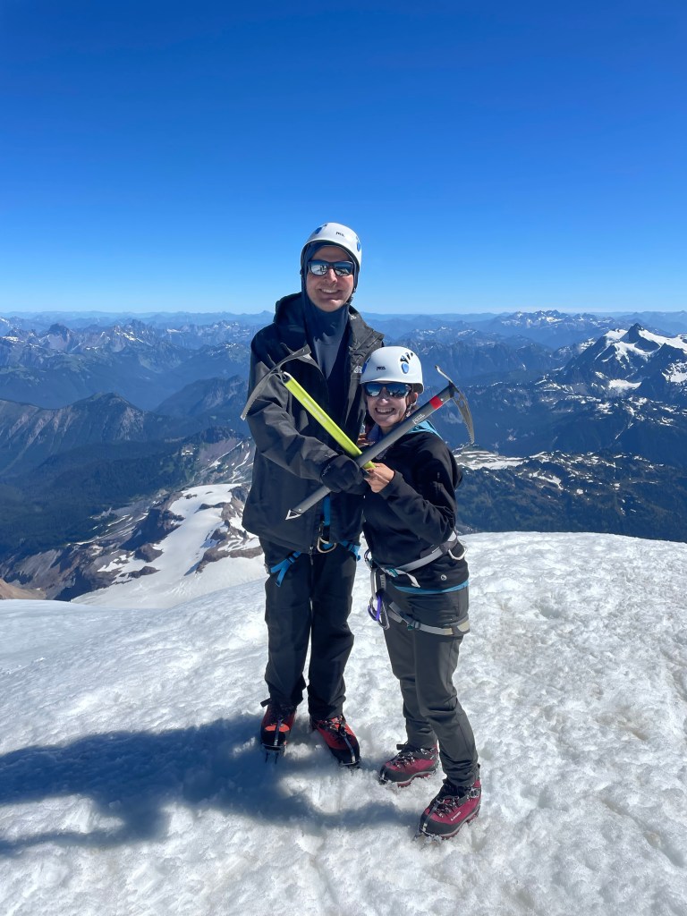
The summit is a small 50 foot high or so mound that protrudes off the flat area. Unfortunately I kept having the image of a pimple, which does not appropriately capture the grandeur of the view or experience. We all collapsed for a few minutes and I took my obligatory yoga pictures – but couldn’t wait to start up the final steps to the summit. It was about 8 hours since we’d started our jaunt.
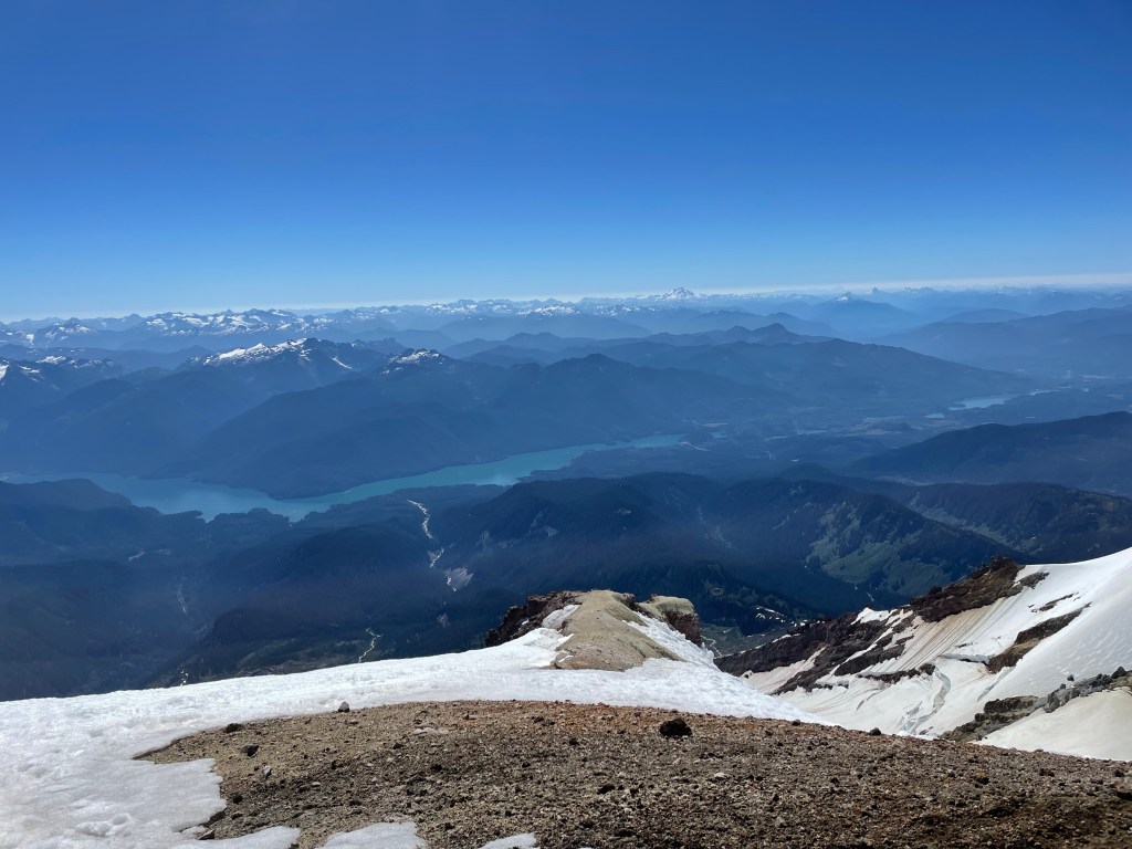
The views were spectacular, as the photos show. And I once again had that top of the world feeling, that exhilaration that I’ve never really been able to capture anywhere but a summit.
I later found out that TF’s parents were from South Africa and in the early 1950s, when they were in their 20s and had been married for four years, had travelled to England, bought a 1933 London taxi for 50 pounds, and proceeded to travel 6,000 miles throughout Europe, camping along the way in their taxi. So many people asked them what they were doing they painted the facts about their journey on the outside of the vehicle – the media picked it up and the taxi became known as their traveling suitcase and they the “traveling suitcase couple.”
What a spirit of adventure! I’d say that TF – and all of us on this trip – were carrying on a bit of that legacy, even at much more advanced ages. I’m sure TF’s parents would approve.
But as I’ve frequently said before here, what goes up must come down – and so it was with this trip also. That’s for next time.
It was the afternoon before the trek/climb. After visits with family and friends – and an absolutely gigantic lunch in Gig Harbor (perhaps I am taking the idea of carbo loading too far) – we got an Uber and headed off to the Georgetown Inn in the Georgetown area of South Seattle. Known for being “gritty,” there are a lot of breweries and some interesting restaurants, but it is a long way from gentrification. The hotel had been recommended by our guiding company, but the desk clerk still seemed surprised to see our two very large backpacks walk into the lobby.
We located an Italian restaurant called Mezzanotte in what looked like a deconstructed building. Three levels of crumbling brick walls, ceiling tin covering some of them, and lots of people sitting outside. We were just as happy to sit inside and enjoy our fancy pasta – mine with king oyster mushroom Raghu and J’s with a very peppery sauce. We walked briefly around the neighborhood and back to our perfectly acceptable hotel – if a little noisy due to some bizarre mechanical noises that clicked and clacked throughout the night.
We woke up at 5:30 and met S, our friend from Alaska who was part of our Elbrus and Stok Kangri expeditions, in the lobby. We all ubered off to the Mountain Madness office, accompanied by three very large packs. The MM office is in a small house and there seemed to be at least three trips all packing up in various areas outdoors. Fortunately we found our correct group (I suppose otherwise we might have inadvertently gone ice climbing or something).
We met our fellow climbers – T, who is S’s friend and a pilot, two women from Canada (about my age or a bit older), and our guides, SH and H. Having nicely packed our packs, we now had to completely unpack, and lay everything out on the ground so our guides could confirm we had what we needed and left behind what we didn’t need. Apparently all of us had panicked when we got the packing video only two days before, which had led to multiple unexpected last minute purchases such as glacier glasses and sun hoodies! Two items, by the way, that I was very glad to have.
Everyone ended up leaving behind at least some items. I ditched my rain pants and second pair of pants. We reloaded our packs (my guess is mine was about 32-33 pounds), and met our porters, C, a Montana State student who was really serious about the mountains , and Z, a mid 20s exmilitary guy who was really serious about his sugar addiction. Z became best known on the trip for his hiking kilt – all he needed was a sporran!
After our packing and repacking extravaganza, we all loaded into the van, packs atop and in the back. We were enjoying trading travel stories with S, when just outside of Seattle he received a call to let him know there was a family medical emergency. S understandably felt he had to return to Alaska and pick up his wife so they could go where they were needed, so he ended up taking an Uber back to the airport. What a disappointment – this had been one of his bucket list trips. His friend T was a super good sport about it, and things were greatly eased by the fact that we really did have a congenial group.
We started off yet again, making a few bathroom and snack breaks. Z proceeded to sample every variety of junk food known to man (or at least available in Washington State), and I even found myself buying a large chocolate bar. Maybe it’s contagious.
Finally we turned off onto a series of dirt roads, gaining altitude over some teeth shattering potholes that sent the whole van rattling. We entered the Mt. Baker National Recreation Area, and traveled along more dirt roads, ultimately meeting up with all the vans and cars of other Mt. Baker adventurers. Vehicles were parked way down the road, but we were totally lucky and someone vacated a spot right by the trailhead. One final bathroom break in our last real bathroom and we were off!
Our merry band
The trail starts off as an easy walk, even with a crushed gravel trail in some spots, but rapidly starts a somewhat unrelenting slope up. There are a fair number of dried out rocky river beds to navigate, tree roots to clamber over, and stone steps to climb. You first hike alongside the towering dark evergreens that stalk the trail; after some elevation gain the trees give way to shorter growth and meadows spotted with pink, purple, and white bell shaped flowers. I would have loved to use my plant identification app but there was no cell service and we weren’t stopping much anyway.
After a while, we reached the portion of the trail known as “Railroad Grade.” It’s a very skinny, straight ridge line that leads to Sandy Camp, which was to be our home for the next three nights. It is on an incline, although not particularly steep, but there is a lot of exposure. One side is a sheer drop down of rock and gravel caused by the receding Easton Glacier; the other side is a slightly less sheer drop into a wild flower covered meadow. I would definitely have preferred to fall meadow side, but neither option was very appealing. At times the path was barely a foot wide and you had to navigate over rock. At some point it must have been wider, making the trail look like a railroad track – hence the name, I presume.
Once we finished the Railroad Grade it was a short jaunt to camp (although maybe jaunt isn’t the right word when you’re lugging heavy packs). Sandy Camp is a small bowl quite close to the edge of the glacier and partly on and off snow banks. It’s somewhat sheltered from the wind – although wind was almost nonexistent while we were there anyway.
SH and H set up tents and we helped shovel snow to flatten out the foundation. As the temperature warmed and snow melted we ultimately found ourselves camping on quasi-islands. SH had to move his entire tent the next day because it turned out he was on a pond! C and Z, in the meantime, had to hike back to the lot to pick up their personal gear for the mountain and return again that same night. What a long day! Altitude gain was about 2300 feet.
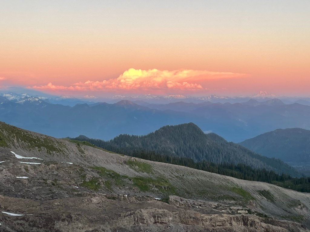
After we settled in, we had a dinner of Mac’n cheese and smoked salmon and hiked up to a nearby bluff to see a spectacular sunset. On one side are the majestic mountains of the Cascades, on the other, the glassy ocean with Vancouver Island in the background. The setting sun backlit the clouds and snow capped mountains turning everything a soft apricot. It was a good omen for the next day and our upcoming summit attempt.
Since you can’t stay at the top of a mountain forever (or near the top, in our case), it was time to start the clamber down through the rock boulders. Being significantly shorter than the others in our group, I have developed a wedge yourself into a crack, slide down, squat and start it all over again technique. It’s not fast but it’s undoubtedly safe. The sun was scorching down on the reddish rocks and we were all glad when we finally reached the Boulderfield. J managed to get totally dehydrated but was better after some electrolyte tablets.
Once we packed up the tents and ourselves, we finally got on the “road”. We had another 4 plus miles to our next campsite, but at least the trajectory was downward, which certainly helped ease the weight of the packs. We climbed over and through lots of rock, and then emerged onto a broad expanse of rocky grasslands. We stopped for lunch where we were joined by another hiker we had met at the Boulderfield- he had gotten to about 100 feet below the summit but had to stop at that point because of ice. A number of large and well fed looking marmots also participated in our dining activities – or attempted to!
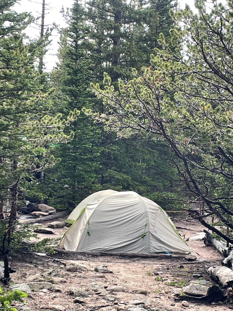
We reached the Boulder Brooks campsite in decent time. It’s situated by a rushing stream and consists of three very spread apart sites. Of course, as soon as we got the tents up it started to pour with a hard rain, which seemed to be the pattern of this trip. J and I hunkered down in the tent and I finished my book. My kindle is truly worth the extra few ounces on trips like these.
The location was beautiful and I sat outside for a bit in the early evening. Unfortunately a multitude of mosquitoes found it equally enjoyable and ultimately chased me back into the relative safety of my tent, where an early bedtime – combined with more rain – made for a very good nights sleep.
The next morning our tents and any possessions stored outside were all quite soggy. We had stayed dry inside but the exteriors were soaked. After a pancake breakfast we dried everything out as best we could and then started a three mile trek out to the pick up point.
The trail followed the same creek we had camped by and we criss-crossed it several times on narrow log bridges just above the water. A far cry from the high swinging bridges of the Himalayas. The Douglas firs soon gave way to silvery white barked aspens. Although they are beautiful I appear to be allergic to them and snuffled and snorted my way the last few miles to the pick up point.
Made it!
The guide company van met us, and delivered a gourmet picnic lunch which we devoured at a nearby state park. The drive back to Estes Park went quickly, and we were deposited at the back of The Stanley Hotel, of The Shining fame, where we were to spend the night. S, J and I were each given a large black garbage bag to serve as a receptacle for the by now extremely dirty contents of our backpacks. The rooms weren’t ready yet so we and our very muddy and smelly possessions found a discrete corner on the porch of the hotel to while away a few hours. We met back up with M and her sister D, who politely refrained from too much commentary on our bedraggled state.
I couldn’t help but think that a haunted hotel was just the right spot to conclude the first part of a magical trip.