From Swamp to Summit is back! There’s been a long hiatus, not because I haven’t been thinking about you, dear readers, but the flotsam and jetsam of ordinary life has simply gotten in the way. But now I’m close to pulling back the curtain on our plans for 2023 – which begin Independence Day – and no, that’s not a coincidence.
But for immediate purposes – this past Saturday, April 29, was the scene of the Mammoth March. I signed us up, over J’s protestations, in January, telling him that was all I really wanted for my 62nd birthday.
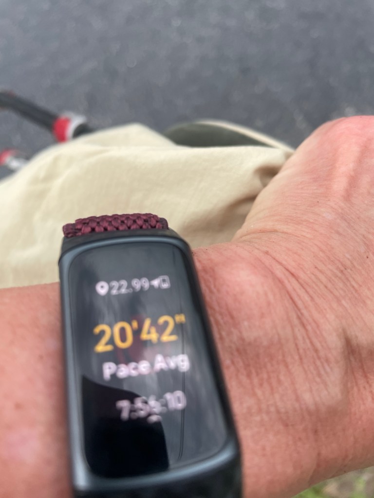
Mammoth March is a sponsored 20 mile hike that you are supposed to finish in 8 hours. Doesn’t sound so bad, right? A 20 minute mile pace? But you have to consider the terrain. It’s Florida jungle, out there in the Charles Bronson forest (see Lost in Florida – Staring Down Charles Bronson); it had rained last week and about two miles were nothing but mud.
Not only that, the night before the event, the sponsors announced it was really 21 miles, and by the way, everyone with a fitness tracker was convinced it was more like 22. The last couple of miles were on an asphalt road, and it was brutal. Shin split city. Not to mention the fact the wind had whipped up, was blowing in our faces, and it was clear the heavens were about to open – which they did, about 10 minutes after I crossed the finish line.
I was going to do the entire damn thing in 8 hours if it killed me. We had met some great folks out there – PAC man and Ken (turns out PAC man and I had a friend in common) and multiple other people who were equally pleasant and fun. There was every age group, gender, body type – pretty hard to be more diverse unless you were a cellular phone ad. And everyone was pulling for everyone else.
Until next time. We could all do a lot worse than model ourselves after folks who just decide they want to walk 21 miles cooperatively with fellow hikers. Ready for the 2024 event.
They were definitely trying to hide it. We had already been driving 45 minutes or so into the development wilds that is east Orange County these days and apparently had zoomed past Clapp-Simms-Duda Road, the very small byway that allegedly was to take us to our hiking destination, the Split Oak Forest Wildlife and Environmental Area. S finally located the turn off on Google maps. Yes, we were a couple of miles beyond.
This state of affairs necessitated a u-turn in front of one of the ubiquitous chain restaurants (Olive Garden, Long Horn, Lime Mexican, you name it, it’s out there on Narcoosee Road). The Ford Explorer begrudgingly obliged, and finally, driving extremely slowly, we found a sharp, unmarked right turn that took us onto Clapp-Simms-Duda, just past a McDonalds.
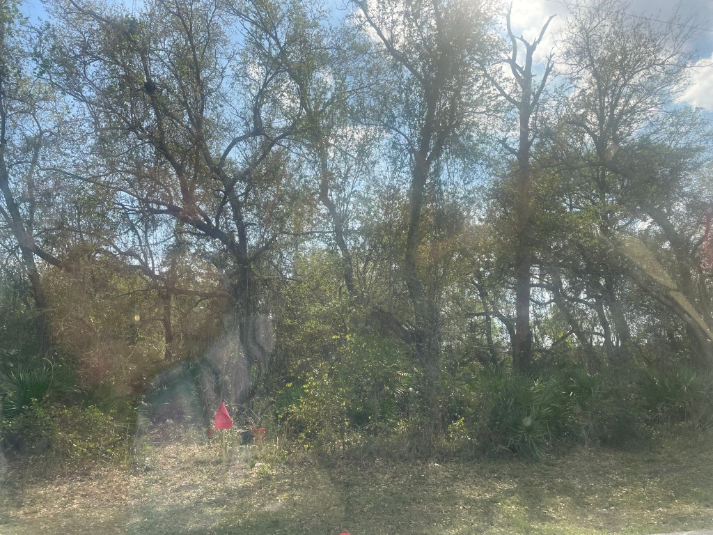
The entrance to the conservation area speaks the story of Florida. One side of the road featured huge armies of earth moving equipment, preparing to clear land for another one of the big housing developments, some of which bear an unfortunate resemblance to the Soviet era apartment complexes we saw in Russian in 2014. But turn your head to the other side of the road, and it was lined with live oak hammocks, palm trees, and Florida prairie. The armies, though, seemingly advancing inexorably into the last of the wild space.
Is that a bat house?
The trail itself starts across an open field, crosses into some palmetto prairies, and then continues for a few miles of very pleasant shaded walking. J, S, and I are now in serious (well, quasi-serious) training for the Marathon March on April 29, so we were undertaking this adventure with great determination. But despite our attempts to keep our pace up, the long leaf pines and peculiarly shaped oaks were a distraction. Most interesting was a trail spur leading to Lake Hart. True to the guidebook’s description, the trail simply turned into a bed of water that drained into the lake. Most trails stop at lakes, but this one appeared to go right into it.
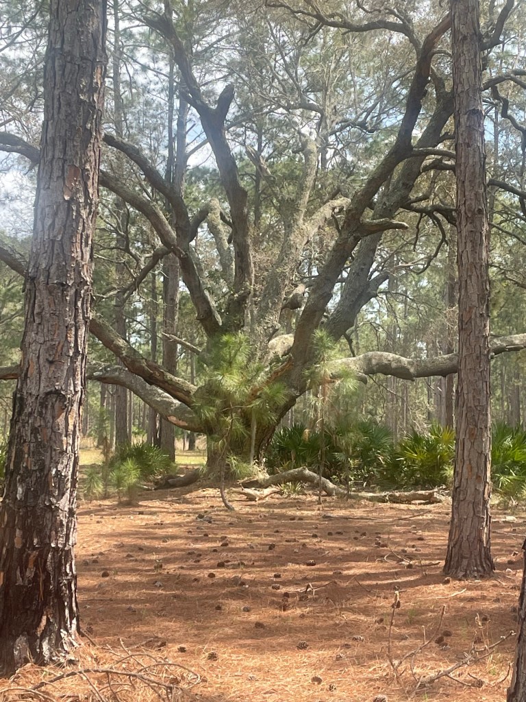
Ultimately you end up in another open meadow, where there’s a different entrance into the park. An interesting, ancient oak tree dominated the area – we decided it should serve as the namesake split oak since apparently we had missed the real thing.
But after the meadow the real training began. The trail was rutted and wide – we saw two different official Orange County vehicles that were apparently the source of the deep crevices – but the main difficulty was that the trails themselves consisted of inches deep white glistening sand. It was unseasonably warm, and the sun’s reflection added a whole different dimension to the effort of sinking down three inches only to have to pull up again.
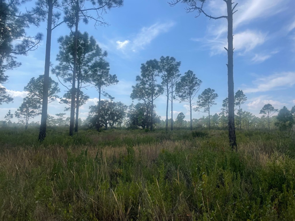
As we got toward mile 6, the trail mercifully provided a little bit more shade, encouraging us to recall its very pleasant beginning. We reached the meadow where we’d started. Insect life was everywhere – humming, chirping, buzzing – a veritable cacophony.
Getting back on the road, it was a mere half mile to the encroaching development. The insect symphony was quickly subsumed by the drone of cars and roar of the bulldozers.
And welcome 2023! As we leave 2022 in our rear view mirror, the new year is already underway with a vengeance. And what a year this promises to be for FromSwamptoSummit and friends.
It needs to start with seriously getting back into shape – at least the sort of shape that will allow for some regular 15 mile hiking days. To that end, I’m trying to convince J, and our faithful training partners S and M to sign up for something called the Mammoth March.
It’s a serious of hikes held throughout the country – this one is 20 miles to be accomplished in 8 hours and takes place in the Charles H. Bronson State Forest here in Central Florida. We are already familiar with that location – you’ll recall we hiked there in 2020, as recounted in Lost in Florida – Staring Down Charles Bronson (a decent title if I do say so myself). While I think that speed and distance quite doable, it’s definitely going to take some practice. You can see from the below it’s not a straightforward path, and there are a fair amount of saw palmettos and other natural dangers to avoid.
J staring down Charles Bronson
Now, careful readers will have noted the teaser above and will be asking but why the need to train for 15 mile hikes. Well, because the latter half of this year will hold many opportunities for travel – J will be on sabbatical! To take this one step at a time, our plans for July have ranged from Egypt and Morocco to the Shetland Islands….and now we seem to have settled on Edinburgh, a hike through the Yorkshire Dales that includes portions of the Coast to Coast and the Pennine Way, followed by time in London, and then another hike that circumnavigates Guernsey, which is one of the Channel Islands.
The dales hike in particular has some long days, including two 15 milers. It’s time to resurrect the hiking poles and get out there. As I was running errands today I happened by what was once one of the premier malls in Orlando. It can’t even be described as being on death’s doorstep – it’s clearly crossed the threshold. Anchored now by a low end Macys, a Dillard close out store, and some sort of flooring or tile place. I don’t want to end up like that mall – it’s time for some adventure.
While not a mountaintop, I think that the dales can count as a summit and the island of Guernsey as a swamp! Of course, the below isn’t Guernsey; it’s a view of Lake George in New York, taken this past summer.
Unless you are an Episcopalian or otherwise have a fascination with the liturgical calendar, you may never have heard of “ordinary time.” It’s that seemingly neverending period that starts right after Trinity Sunday (which is the Sunday after Pentecost) and lasts until Advent, with a few saints days thrown in for good measure. The color is green. As a child I remember thinking those endless Sundays (the “xxth Sunday after Pentecost”) would never end – the same way the long days of summer stretched out like an endless road back then.
Lest you wonder what in the world ordinary time has to do with the adventures of FromSwampToSummit – suffice it to say that I think we all need a little more of it. For example, I wrote this post while climbing on the stepmill at the Y. Is that really the best way to do it? Don’t we all need to slow down a few minutes and experience the boredom that allows our minds to roam free without the constant interruptions of stimulus?
I’m particularly sensitive to those needs right now because I’m about to enter a phase of extraordinary time. A and N get married in just over two weeks in New Bedford, MA. We will be seeing family and friends we haven’t seen for years, some due to Covid and others the vagaries of time. And all in one fell swoop.
Of course, all of this will be capped off by our trip to Mt. Baker in Washington, with S of Stok Kangri and Elbrus fame. Hence the step mill.
S, J, and me in Ladakh, India
But despite all the excitement, I think we could still all use a little ordinary time. I’m going to try to keep my eye on that clock over the next few weeks.
I was halfway through writing a very pleasant blog post about my latest trip to New Bedford, Massachusetts, home of daughter A and her soon to be husband N, when I was (purposefully) interrupted by a trip to my hometown of Durham, NC to visit my parents. It was a beautiful weekend, the temperature was cool, and I was actually able to do one of the best training runs for Mt. Baker that I’ve done in a while. Turns out running in 70 degrees and no humidity is a lot easier than running in mid 80s when the clouds are about to burst open.
I was so inspired by the spring weather that I felt compelled to start weeding in my parents’ front yard. That was Saturday. My father announced toward the end of my session he thought there was a lot of poison ivy there. I hadn’t seen any and shrugged it off (the fact I was using an old bag that had been filled with lime to store my weeds explained the burning sensation in my hands – or so I thought). (I have subsequently determined that poison sumac looks a heckuva lot like the vines I was pulling.)
The next day my flight left in early afternoon, but what better way to spend an hour than pulling a few more weeds, this time from the back yard. Oh, I haven’t mentioned I rarely wear gloves; they diminish the sensation of the good solid pull you get from bare handed gardening.
I was fine on the flight back to Orlando on Sunday, although I started to notice some itchy sensations. Fast forward to Thursday. I’ve lost several days of training. I’m covered with bumps, red blotches, watery blisters, and pretty much any time I think about any part of my body it starts to itch.
The good news is I discovered Teladoc. For five dollars and setting up an account they found my benefits information and I was on a video call with a “Florida board certified ER physician,” within 30 minutes. She took one look at my red face and almost swollen shut left eye and called in a prescription for what is apparently known as a “prednisone blister pack.” I’ve now taken 4 tablets with 2 left to go for the day. Wondering if this is supposed to make me Uber aggressive and I should be arguing with opposing counsel.
But seriously, a totally fabulous and efficient health care experience. But I suggest you avoid it by wearing gloves while gardening.
S looked at me bemusedly. “Really? You swore you were never again going multi day backpacking where you carry your own stuff after the slog up Long’s Peak.” His words resonated as I found myself buying my fifth or so back pack – this time a 70 liter one. It towers over me.
All it took was a late afternoon chat with SB, of Elbrus and Stok Kangri fame. Steps on the SummitThe Trek to Base Camp, Stok Kangri, Ladakh, India As we commiserated about our lack of adventure and travel over the pandemic, SB noted that Mt Baker in the northern cascades had always been on his bucket list. A few internet searches later we were all signed up for a Mountain Madness four day trip up Mt Baker’s Easton Glacier route in August.
In deference to our advancing age we are taking the slow route (relaxed, they call it, I guess like a fit of pants) and there are others who haul up the tents, cooking equipment etc. You “only” have to carry 30 or 35 pounds, but it’s too much bulk for my 53 liter pack.
So, it’s back to training for us. I did stairs twice last week and am forcing myself to run when I can stand it. J’s various Achilles issues seem to have resolved and he’s back to basketball.
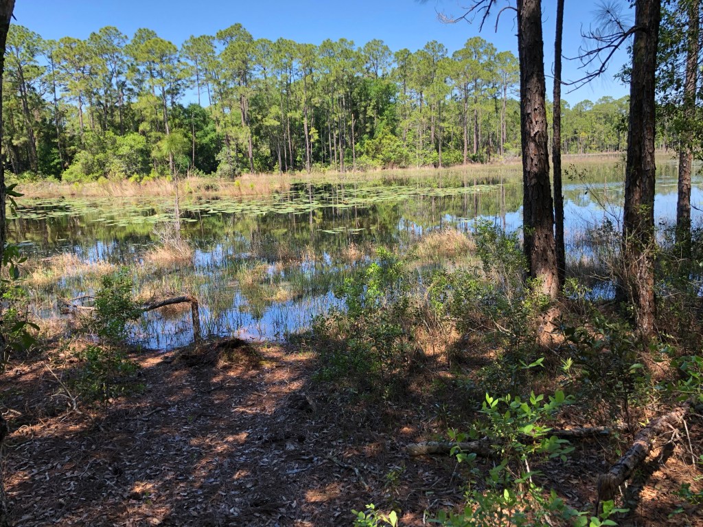
But we are really hoping to get more outdoor hiking in….and yesterday was a good start with a beautiful walk in the Lake Proctor wilderness near Geneva, Florida with S and M. It’s a generally shady trail with Florida scrub on one side and views of a small lake on the other. The weather was spectacular- blue skies and in the 70s and we took our time and relished just being outdoors. There was even enough standing water to wade through and around to make S happy. Should all training hikes be so pleasant!
Our Mt Elbrus guide described Baker as a mini Elbrus so I guess it’s appropriate we are doing it with SB. Hopefully I’ve learned some things over the last 9 years and this time will make sure I have sun screen lip balm, not chapstick in my pocket.
Recent training hikes have exhibited peculiarities just odd enough to suggest the world is out of kilter. Perhaps it’s the general euphoria of creeping out of the slough in which we’ve all been dwelling during the year of Covid.
But a week ago or so, J and I decided it was time to return to the Cady Way Trail for a full 12 miles. After all, June 30 and Colorado is getting ever closer. Encumbered by 30 pound packs, we set off, if not bright and early, at least at the respectable hour of 10 (or so). I had a workshop lined up at 4 that I didn’t want to miss. We knew the weather was going to be relatively cool, so that seemed eminently doable, and we were even ambitiously talking about how we’d fit in a quick lunch at one of our favorite breweries.
But alas, things did not turn out as planned. Turned out my Charge 4 Fitbit lost its GPS Bluetooth connection (who else has this chronic and annoying problem) and was underestimating how far we’d walked. Combine that with the fact that neither of us actually recalled whether the six mile mark was on the other side of the concrete mixing plants or by the little bridge where the two teenagers were murdered. Yes, Cady Way has its own sordid stories, mixed with industrial charm.
Anyway, we plowed along, blisters getting ever worse, when suddenly we realized we were at the Seminole County line, by a new public restroom and trailhead, and about to embark on the Cross Seminole Trail! The mileage marker read 7.2.
At that point we also realized I’d forgotten to pack the plastic bag with the energy bars . We were in good shape for water, but not a bite to eat. Plus there are no shops for miles and J had left his wallet behind anyway.
At that point it was also equally clear that we were going to have to achieve a very rapid pace if I was to have a prayer of attending my workshop on time. We exchanged barely a word on the return trip except for my pointing out that any cyclists (of which there were many) could just go around me as my energies were completely concentrated on putting one foot in front of the other. Most mysterious was the biking couple who seemed to pass us, only to show up again behind us and pass us yet again. It was as though they knew of some Cady Way Trail wormhole which we certainly could have used by that point.
Fortunately it turned out we hadn’t started at the absolute beginning of the trail and had only walked an extra mile and a half or so, making the total trek somewhere just over 13.
We got back home with no time to spare. I grabbed a yoghurt and attended the workshop while sitting on my yoga mat nursing my blistered feet.
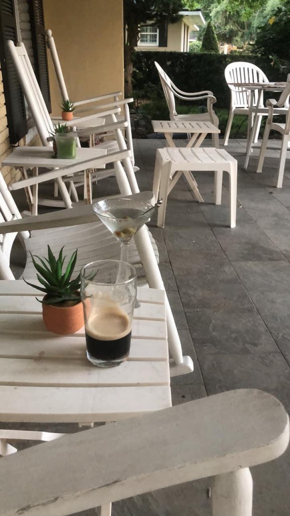
After, I felt I more than deserved a martini while we sat on the porch. Only suddenly to feel a sharp sting on my forehead and realize I’d been bitten by a wasp. Not our most successful training hike. But let’s hope all that bad karma manifests itself now and not at 14000 feet while class III scrambling on the Keyhole Route at Longs Peak. Maybe we will be too high up for wasps.
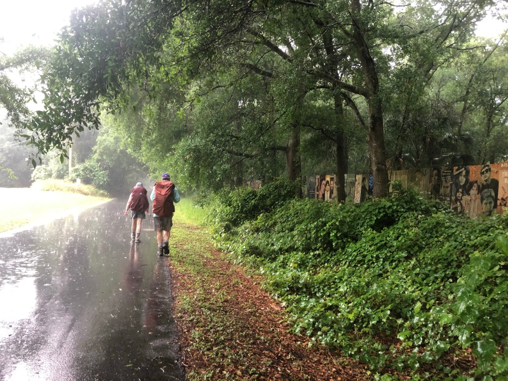
“So what are the chances of rain?” I politely inquired of S. “Oh, the National Weather Service says only 20%,” was his nonchalant response. He and M apparently took this forecast as gospel truth since neither of them brought any rain gear. Although I didn’t voice them, I had my doubts, so J and I padded our weighted backpacks with raincoats.
My foreboding stemmed from our prior attempt with M and S at this very same trail – a couple of months ago we started it only to encounter a cloudburst within the first ten minutes. Alas, history proved predictive.
We managed the first couple of miles, trying to ignore the increasingly dark clouds. The goal was to reach the art walk portion of the trail – a mile or so of painted fences lining the sides. We’d done this hike back in 2018 (see A New Year, A New Trail – Seminole Wekiva Trail ) and had always wanted to return.
Unfortunately the dark clouds were engaged in a slow motion wind up and just as we reached the fences the sporadic drops had turned into a full fledged fire hose. This is a completely urban, asphalt trail, and we had just crossed a busy suburban boulevard that provided shelter in the form of an overhang of a small office building looking across a parking lot to a dry cleaners and what I would call a kennel but now goes by the much more exotic moniker of “pet spa.”
I have been slightly sidelined for a couple of weeks with a knee injury incurred in a rather embarrassing fall off the bouldering wall at Blue Swan Boulders. This first training hike since then had a similarly ignominious ending. Needless to say, since S is known for initiating the soggiest of hikes the proverbial finger was pointed at him. He, however, noted that he and M had done this same hike recently with no rain and that J and I were the only common denominator in the wet ones.
Nonetheless, we slopped along, and managed six miles. After wringing ourselves out, we felt we more than deserved a nice lunch at Antonio’s.
It was the best of times; it was the worst…well, you know how that goes. While my hiking has been curtailed somewhat over the last couple of weeks due to an over energetic reach at the bouldering gym that resulted in an unfortunate and ungraceful fall, the prior two weeks offered hikes into two of Florida’s most opposite landscapes – some of the few remaining miles of undeveloped beach and a stretch of rural clay roads forming a loop amid Florida’s few hills.
Some of you may remember that shortly before the pandemic started a year ago J and I trekked into the back country of Cape Canaveral National Seashore, improbably named the Klondike. Castaway on Cape Cavaveral National Seashore – Florida Hiking. Then we started from Playalinda Beach, at the south end and hiked north six of the twelve miles of completely undeveloped beach. This time, along with fellow hikers M and S, we started from Apollo Beach on the north side and headed south for six miles, hoping that this means we’ve actually done the whole thing. There may be a gap here or there but it’s close enough, IMO.
To no one’s surprise the north end of this narrow strip of sand wedged between the brackish calm of the Intercoastal and the crashing waves of the mighty Atlantic is remarkably like the south end. Mile upon mile of sand that varies between soft and rock hard, flocks of pelicans, and masses of jellyfish.
There were apparently only two other people with backcountry permits that day but we never encountered them. At some point midway in the hike, however, we could see the silhouette, far in the distance, of a figure holding something scythe shaped and standing atop a dune. It was so isolated that all I could think of was that he was either a yogi communing with nature or else a serial killer who lived in the rough underbrush waiting for victims. It’s easy to let your mind wander on beaches like that and S’s fondness for horror movies doesn’t help. I started to wonder whether the scythe shaped thing could be some sort of garrote.
As we got closer, however, we realized he was a park ranger who had clearly been assigned the task of keeping an eye out to make sure that no overly adventurous hiker was going to be cut off by high tide. And the garrote was the strap to his binoculars.
It was truly a long and arduous 12 miles, especially lugging 30 pounds in my pack. But what really made it worse was that I apparently had forgotten all the lessons I learned on Mt. Elbrus in 2014 (Steps on the Summit) and failed to put sunscreen on my lips. For about two weeks afterwards I looked like I had some horrible communicable disease and was very glad I got to wear a mask.
I think you can see the lip sunburn starting
Anyway, not to be put off by mild injury, and feeling the Long’s Peak adventure ever approaching, the next Saturday I convinced J to go with me to hike the 10 Mile Clay Loop in Clermont. (See The Florida Foothills- 10 Mile Clay Loop). Begrudging is the best way I can describe his agreement.
When I’m out in the Florida rolling plains, I personally find it easy to imagine I’m in Tuscany, surrounded by large vistas of fields, gentle hills, and a dramatic grey sky. The fact I’ve never been to Tuscany may assist in this creative exercise. J, however, saw lots of traffic, trucks that seemed to take pleasure in speeding and kicking up large clay dust clouds in our faces, and something that looks like a large sand pit that is being constructed on one part of the loop. The for sale signs for some promised future development are a little ominous also.
It turned it was pick your own strawberries day at the very large berry farm that occupies much of the interior of the loop; hence the traffic. They’d run out of fruit though and instead people were picking sunflowers from acres of brilliant yellow flowers. The last hilly stretch with the lake on one side was as beautiful as always.
You can focus on the worst – the sunburn, the drudgery of trudging through sand and dust, and the blisters. But the best is out there too – the crashing waves, so loud you can hardly hear, the sunflowers and wildflowers and pelicans. It’s sort of like jellyfish – their stings don’t out shadow their luminous, stained glass like glow.
It started off as an innocent seven mile hike. S assured us that we wouldn’t have to wade through miles of swamp water, and on that point, at least he was correct.
The Sabal Point trail is a surprising natural gem buried amidst a large conglomeration of apartment buildings, houses, and condos of the same name. It’s hardly the place you’d expect to find an untouched spread of palm hammocks, marshes, and oaks. But there it is: the trail head innocuously placed at the end of a dead end street. You do rather feel as if you’ve been invited over to someone’s house.
Our goal for that Saturday was to work on carrying weight and to that end we’d all loaded our packs. M and S have had the brilliant idea of using bags of charcoal so they can burn it once done with training. Since I believe training should never end I’m carrying around a gallon of water, my old weight vest, and various bits and bobs to add up to 25 pounds. Need to get up to 35.
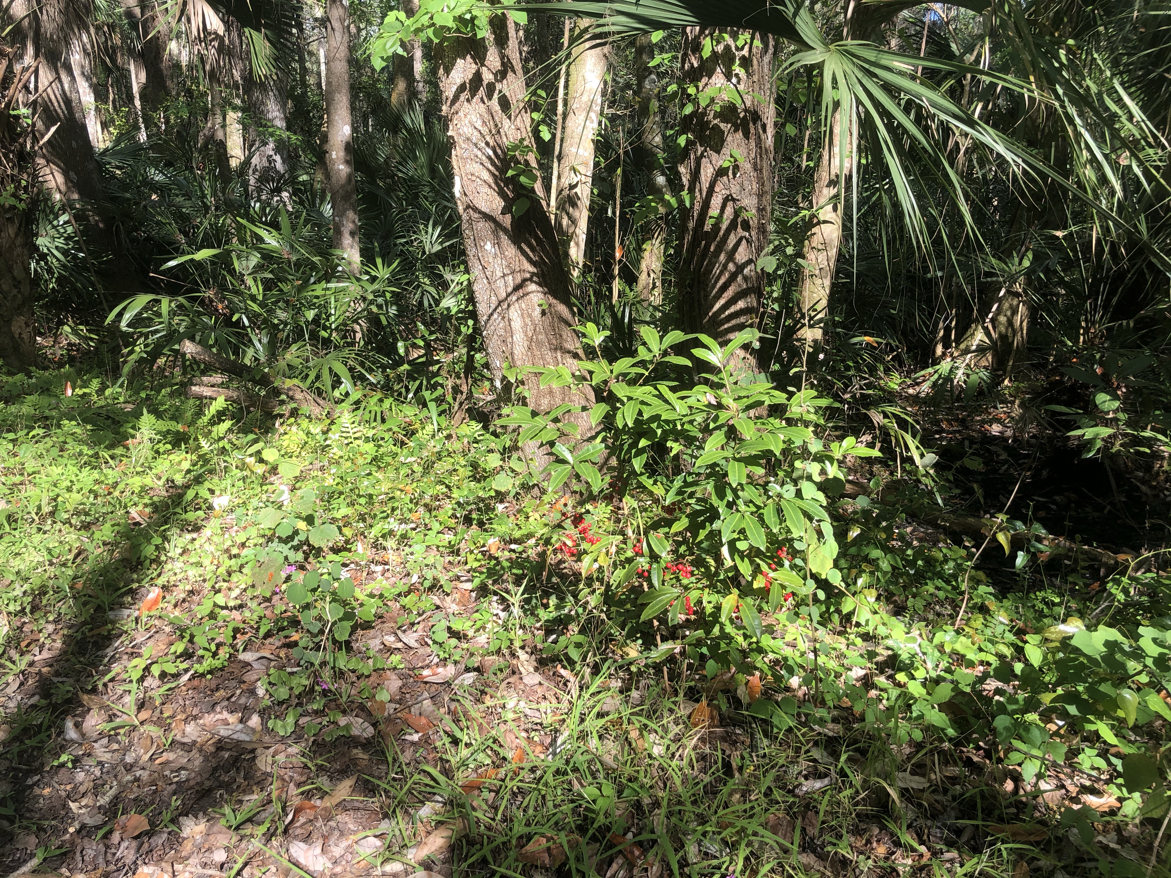
The trail itself is an old railway bed, elevated a few feet above very swampy forest. We are in Florida spring and the trail was dotted with what looked like bluebells, pink star shaped flowers, and red berry bushes whose Christmasy aspect seemed out of place.
Christmas berries?
One of the things about training is to check out your gear and M quickly realized the Osprey pack she’d bought was not for her – too rigid in the waistband and an odd shape that causes your arms to stick out at the side. Fortunately REI has a good return policy so she’s now trying my fav – a tried and true Gregory (I have 3, in all different sizes).
Enough of the gear talk. How did our hike deteriorate into something more sinister? As I was blithely walking along, chattering away, S suddenly yelled out, “You stepped on a snake.” My immediate reaction was, “Oh no, is it Ok?”, to which S (somewhat insensitively I thought), said, “No, it’s dead; you stepped on its head.” Not sure he realized that sounded like the middle verse of a rap song.
I could barely bring myself to look, but as J and S inspected said creature, S looked more closely – and said, “It’s not just a snake; it’s a water moccasin!”
Water moccasin
At that point my guilt over the execution quickly by evaporated and instead I decided I was the hero of the hike. I mean, perhaps I saved countless lives! I don’t know much about snakes, but even I know water moccasins are BAD.
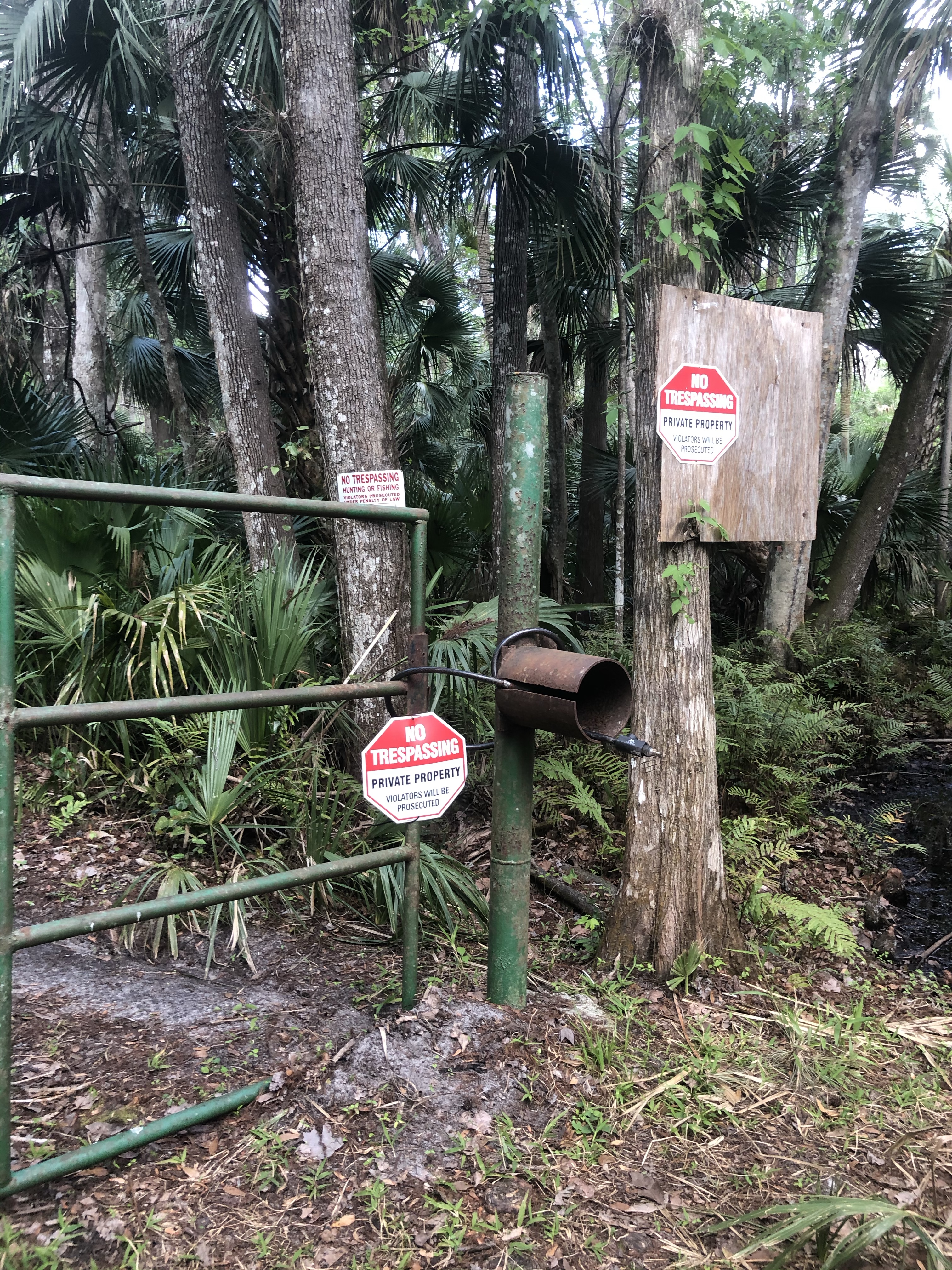
After the excitement of the snake we were looking forward to reaching the river, promised at 3.5 miles. But after a mere 1.75 (according to my trusty Fitbit) we encountered a forbidding metal gate plastered with no trespassing signs warning of prosecution if violated. Whoever posted them looked like they meant business.
So since training called for more miles we simply turned back, hiked back to the cars, and then hiked the same trail all over again to reach our 7 mile goal. The snake was still there the second time around – not unsurprisingly in the same position as before.
Not quite what we’d expected. But it was a beautiful Florida day, we carried our weight, and I now have a new trail name – Snake Stomper.