Road Trip U.S.A. – Down and Dirty in Badlands

The approach to Badlands took us along State Road 44, a two lane road that eventually cuts across the park. There’s very little traffic. But that apparently didn’t deter the same road construction that we saw across the entire country. We experienced a 15 plus minute delay when one lane closed down, and a lead vehicle ceremoniously ushered us along about a three mile strip of highway – where we met the sole car that was waiting to go the other direction.

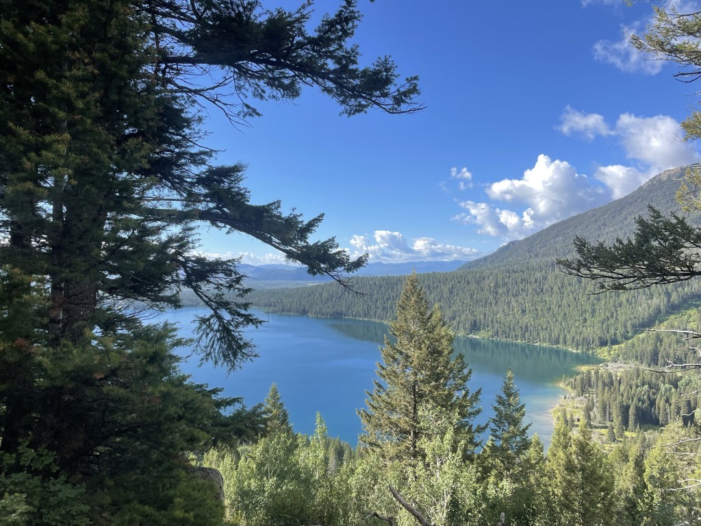
We finally reached the Interior Motel and Campsite in Interior, South Dakota, just outside of the park, about 6:30. It was nice. Several other rooftop tents, toilets and showers, an above ground pool, and a view of the Badlands. There were a few cars speeding along the adjacent highway, but somehow that was comforting in this otherwise extremely desolate place. Plus, the road was a elevated above the campground, giving it sort of a Jetson like feel. A full moon tonight and plans to focus on hiking, not driving, the next day.

I woke up about 5:30 a.m., probably due to the sunrise. great swathes of apricot overlying the wine dark purple of night, and the morning star piercing through all of it.

Apparently they don’t worry too much about park admissions on Tuesdays, and we didn’t even have to show our park passes. We stopped first at the visitors’ center and got some advice about trails, and also looked at the extremely interesting working fossil laboratory and heard a lot about a recently discovered Saber tooth tiger.

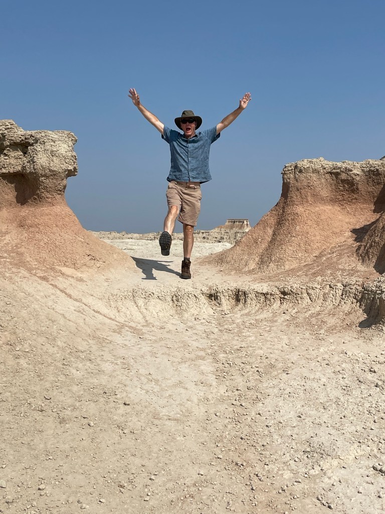
From there, we started the first of our hikes. The Window – a very easy boardwalk – and the Door, a bit more of a hike, culminating in a natural door that frames a view of the wall of jagged white peaks of stone. Traversing through it was almost like walking through a hard iced cake.

The Notch hike was next. The beginning has one steep section with a ladder going up. We rejected the ladder and instead scrambled up along side it. Fairly wide ledges led out to a spectacular overlook of the valley. It was very not, near noon and 90 degrees in the shade. On the return, we chose the ladder route. Mistake. Looking through the ladder with nothing below triggered all my fear responses – I was so tense I basically slid down without ever letting go and messed up my left quad – which plagued me for the rest of the trip. My legs were shaking when we got to the bottom.

After a quick lunch in the air conditioned Explorer, we journeyed on to the Saddle Pass. It was a true scramble – steep and slippery up the rock formations themselves, culminating on the flat upper green prairie and a number of trailheads. At the ranger’s suggestion, we then went off track and climbed the highest peak to a little throne at the very top. Amazing how touching the rock – as opposed to being on a ladder = makes it so much easier!

By then we were more than hot and sweaty. Did I mention temps were well over 90 degrees? We drove a little more of the Loop Road to the Fossil Exhibit boardwalk, an area of mammals fossilized more than 30 plus million years ago.

We finally hightailed it out of the park to see the small hamlet of Interior, South Dakota. There are two churches and a bar. We stopped at the bar. At the Wagon Wheel the bartender explained to us the story behind the poster of the naked woman riding a Radar the Bull (with a ring in its nose). She looked like a bovine Lady Godiva. Apparently Radar was a frequent visitor to the bar at one point. Between fossils (Lyme Regis) and the bull (my encounter with one in the Yorkshire Dales) I had flashbacks to our UK trip.

Spent the rest of the day at the campsite, plotting our next moves while being entertained by the couple in a nearby campsite who appear to be living out of their van while practicing for the their next singing gig.

Road Trip U.S.A. – Living It Up in Deadwood, on the Way to Badlands

After leaving Yellowstone, we had to drive practically the full length of Wyoming, along the northern side. The landscape varied between high prairies and rolling hills, and ultimately morphed into higher hills and mounds of orange, white, and green.

We stopped for lunch at the City Park in Cody, Wyoming, across the street from the high school. The whole town seemed right out of the 1950s, and I kept wondering what it would be like to grow up there. The city park was very nice; people having picnics, a Sunday, quiet.

After Cody, things got wilder. Some very desolate two lane roads (the routes Google Maps picks out are interesting, to say the least). After the colorful mounds (if they had been green they reminded me of Moundville, in Alabama), we started to climb up and up into the incredible Big Horn National Forest. Massive gorges, edged by towering rust grey walls, outlines of rock structures that looked like imaginary cities against the sky. We reached well over 9000 feet elevation, and the good old Explorer just kept chugging along.

Finally we left the Big Horn area, and returned to long straightaways – only to encounter yet more mountains. We finally crossed the border into South Dakota…where gambling is legal.

Deadwood, very close to Sturgis, site of motorcycle rallies, can only be described as insane. No other word for it. We stayed at the historic Franklin Hotel, which was a world class celebrity spot from 1903 to 1929. It was then converted into apartments until it was rehabbed in the 2000s.

The bottom floor is an opulent 1900s recreation with casino, but the rooms are likely as they were in the apartment days. The same wainscoting, fixtures, and tiles. A very comfortable king size bed and it was pretty great to take a shower after three full days of camping. Free parking and a coupon for a free drink in the casino. Dinner was in the basement restaurant, which was very crowded, but it was reasonably priced and actually very good. We also had a great server, who told us all about the wildlife loop at Custer State Park.

After breakfast, we strolled down the main drag. Deadwood is not only the site of the TV series, but was THE place to party for miners in the 1870s who had struck gold in South Dakota. According to the New York Times in 1877 – it was full of flim flam men, brothels, and gambling. Currently, there are lots of historic hotels, western wear, and casinos. Every shop has a bar, and people start drinking very early. It’s a unique vibe, to say the least.

We left Deadwood to drive through the plains to Rapid City, where we made a Walmart grocery store shop. I’m a lot more of a Walmart fan after this trip.

We finally reached Custer State Park, and had lunch at the nice visitors center. Wooded, evergreen black hills, interspersed with grassy plains. Very bucolic. On our way to the wildlife loop, a huge herd of bison crossed the road right in front of us. We immediately say a pronghorn (antelope), more bison, a mule deer, wild donkeys (left over from an old tourist attraction), and lots of prairie dogs.

After Custer State Park, we decided we couldn’t stand the shame of admitting we hadn’t seen Mt. Rushmore, even though we had not planned to visit. So, with me at the wheel, we took the Iron Mountain Road to Mt. Rushmore. The road is crazily and intentionally curvy. It’s the counterpart of the Needles Highway. You go through three tunnels, and at the third the four heads of presidents carved into Mt. Rushmore are perfectly framed. It is remarkable, regardless of your views of taking a natural (and sacred) landscape and carving presidents’ heads into them. The little town at its base is the epitome of tacky tourism.

After the hairpin turns and corkscrew bridges, it was a positive relief to be back on the interstate. But it wasn’t long before we were back on S.D. 44 – over prairies, and suddenly, in the distance, white jagged walls emerged in the distance. If I wasn’t fairly confident we were on Earth, it really could have been a scene from another planet. We were about to reach Badlands National Park.

Road Trip U.S.A – Yellowstone and the Battle of the Elks

We awakened on day two of our Yellowstone adventure to a view of two elks grazing and head butting only ten yards from our rooftop tent. You could actually hear their antlers clacking against each other. It didn’t look like serious business – they’d go at it, like very large puppies, for a bit, and then tire of that game and eat some more grass. Eventually they meandered out of the campground, as comfortable as you please.

This was our day for the “must see” Old Faithful, which required a trip to the western side of the park. There’s a great visitors’ center, with good explanations of volcanoes – especially how we were sitting right on top of one. We then took a decent hike up to an observation spot to see Old Faithful itself. Fortunately, we saw a pretty good eruption. We saw it erupt a second time later in the day, and it simply sputtered.

Next stop was the “prismatic falls.” A navigational error ensued, and we turned off the road too early, which took us along a rather odd hike on the perimeter of the area toward the Fairy Falls. We could see people in the distance on boardwalks, but had no way to get there. Nonetheless, we could still see the billowing multi-colored smoke – pink and turquoise. We were going to try to get to the actual location, but the traffic was simply too much. A lot of Yellowstone is still digging out from the floods of last year, and although the crowds weren’t bad, a weekend day was all that was needed for the traffic snarls to start.

A big rain storm had started so we headed to the Lake Village lodge again to wait it out. There, sitting on the porch, we met someone who was born in Derbyshire, of all places, then moved to the U.S. with his family, and now was a film editor on one of my favorite TV shows, Naked and Afraid! It was he who told us about Deadwood….

After a “grocery store” trip (to the extent a national park general store can be described as a grocery store) we had our last camping night in Yellowstone, and celebrated with an odd concoction of mac’n cheese, precooked bacon, and green beans. As I was cooking I noticed a fellow camper who’d left his chair too close to his campfire on that very windy evening – fortunately I was able to call out to him before it got incinerated. I felt like a veritable Smoky Bear!

The next morning we managed to pack up all the debris we’d been accumulating. Those bear box pantries are a real luxury. We left camp by 10 a.m. and drove to Fishing Bridge, just north of Lake Village and out of Yellowstone via the East Entrance. There was a lot of elevation gain, and evidence of many forest fires, lots of downed, white trees.

There was a full day of driving ahead of us. Our route was going to take us through Cody, into the Big Horn National Forest area, and finally into Deadwood which was as peculiar a place as its name implies.

Road Trip U.S.A. – A Taste of the Tetons

Jackson Hole may be best known for skiing, but snowless summer months offer plenty of entertainment.

Although we are hardly equestrians, J and I have gone horseback riding during many of our travels. So far we have managed trail rides in South Africa (that one also involved zebras), Hawaii, Russia, Croatia, and Arizona, to name a few. The Tetons seemed an appropriate addition.

We met up with our niece, F (who really does live near Nice, France), as she was the only of our family group willing to brave the large four legged creatures that were to take us up one of the nearby mountains. She rode a very hungry “Chuckles,” J had a chunky “OT” (for Overtime), and I was blessed with Rhinestone. Apparently the trail company has over a thousand horses between Grand Teton National Park and one other location. Beautiful wildflowers, including lots of Indian Paintbrush, which is the Wyoming state flower. My favorite part was when our guide instructed us to get a move on so our horses weren’t spooked by the nearby bear cub who had climbed a tree, with Mama Bear right below.

Next up was a drive around the beautiful Lake Jennie loop. It was rainy but that didn’t keep us from enjoying sandwiches and a beer at Dornans, a long time Jackson establishment. And saw another bear. Bears were sort of a theme in the Tetons.

The afternoon saw a short but fun Lake Phelps hike. This part of the park is on the Lawrence Rockefeller Preserve. The Rockefellers, who had built a large estate on the property, donated it all to the park on the condition that all man made structures were to be torn down and the area returned to nature. Towering mountains peering over at a serene mountain lake. And on the way back we encountered a very large moose.

The following day, which was beautifully sunny, our hiking party consisted of my sister in law, T, J and me. I think the others were turned off by the fact the trail bore the auspicious name, Death Canyon. After driving through some of the many road construction sites (it seems as though most of the USA is currently building roads), we entered the park and ventured just beyond Phelps Lake. The trail starts wooded and a bit of an uphill, and then a very steep downhill, which you unfortunately know you will face up on the way back. You cross a number of boulder fields, but the trail is so well constructed you aren’t even aware of the exposure. Meadows of yellow daisies and purple thistles (which are not native, apparently), periwinkle blue flowers that looked like bluebells, and deep purple wild snapdragons. We walked alongside a river that cascaded into waterfalls before encountering a long uphill slog to the saddle right below Static Peak, at the patrol station. We keep going until the IPhone promised us we were at 8000 feet. I’m not sure what our total elevation gain was but it seemed considerable.

We pulled out our Maasai blanket from Tanzania and had a great picnic, which fortified us for a fast downhill followed by the uphill section we knew was coming. 

We couldn’t leave Jackson without some exploration of the town. Yes, we did see the iconic antler arches, browsed through a mountaineering store, and took advantage of the Snake River Brewery.

A very fun spot, and even the fact I left a hiking sock in T’s dryer didn’t seem that important. I guess it met up with the hat left in the Yorkshire Dales and the visor left in Hot Springs. I’m considering a blog post called “things I left behind on sabbatical.”

Into Saddle and Onto Summit – Mount Baker Part 2

The first night of our expedition was the coldest of our three camping nights, and my feet never got warm. For some unknown reason I had failed to wear socks.

But the day dawned bright and sunny. This was to be our rest and training day. We were treated to a non oatmeal breakfast of surprisingly good scrambled eggs from a powder, topped with cheese and turkey bacon jerky. Who knew. SH had dispensed packets of instant oatmeal to everyone for the remaining days, which led to great confusion as to who had the right number of packets and what that number was. He’d also doled out lunches for the next days – wraps that we were already calling salami bombs and I’m sure they added to the weight of my pack.

A view from our tent – that steep bank in the distance is the Roman Wall

After a leisurely breakfast we donned crampons and climbed up the nearby snow bank. There we proceeded to practice movement on the snow (duck feet, French technique), self arrest (flip your ice axe around, pick side down, plant it, dig in with your knees and feet, hips raised, and kick), and movement on a rope with a team. It had been four years so I was glad of the practice. M, one of the folks from Canada,was definitely the most adventurous on the self arrest practice – she picked up a lot of speed as she simulated her fall down the slope. J and I were a bit more cautious.

We spent the afternoon reading, napping, and prepping our packs for a 1 a.m. wake up call. I also spent quite a bit of time observing our comrades from other groups – campgrounds are second only to airports for people watching.

We had an early dinner of rice, orzo, the ubiquitous salami chunks, followed by a sunset walk, and were in “bed” by 8. Needless to say, sleep was hard to come by, but I know I must have drowsed off, waking about five minutes before the alarm, just in time to force down my two packets of instant oatmeal. At least we also had dried fruit, nuts, and chocolate chips to add to them.

We finally started off at 2:15 a.m., only 15 minutes after our appointed time. Slow was definitely a theme of this trip – after all, it was referred to as the “slow Baker” expedition in the marketing materials. But let me also add a little flavor. Of our five merry climbers, only M, J and I had worn crampons before, and M had not done so for years. T (friend of absent S) and TF (the other person from Canada) had never worn them. So all in all, I think we made a pretty good showing.

It’s always spooky to take off in the dark, accompanied only by the glow of the headlamps, but the air was perfectly still and I was hiking in only a soft shell jacket. We started off with our crampons on – which was great as we avoided the agony of having to struggle getting them on somewhere on the glacier in the dark.

After about 45 minutes we crossed a rocky area with a bit of scrambling and it was time to rope up – we were well onto the glacier. SH led a rope with J, T and me; H led the other rope with M and TF. Z and C were on their own rope. Z did decide to wear something other than his kilt for the summit day.

I could feel myself slipping into that zen like state of a steady pace where focusing on putting one foot in front of the other is the only thing in your head. I’ve so frequently channeled our guide Ossy’s instruction to me on Cotopaxi in Ecuador that you have to find your own way up a mountain. This time I also repeated SH’s mantra – step purposefully. Surprising how these mountain directions do a lot for everyday life.

The trail was moderately sloped with a couple of flat platforms at 7000 and then at 8000 feet. There weren’t a lot of other groups but we were passed by some who were huffing and puffing – my goal was not to do that! The sun eventually rose and we could see the shadow of the mountain cast along the valley.

There were any number of crevasses that we had to wind our way around or step over, sometimes with the help of a snow bridge and sometimes without. The widest was perhaps 18 inches. They are eerie. You can see blue ice lining the sides and no bottom, and it looks like a fall would usher you into some completely other world.

The crater

We ultimately reached the crater. The mountain is still an active volcano but I wasn’t really aware of any sulfur; it certainly wasn’t anything like Cotopaxi. I was conserving my energy so didn’t walk over to look into it, but I did enjoy my salami bomb. I was making a big point of eating a lot as I know in the past I have failed to do so and that does not work well in the mountains. In the meantime, I learned later that both J and M were feeling unwell, but what troopers! They soldiered on without a word of complaint and still with appreciation of what we were experiencing.

Finally we reached the so-called Roman Wall, unclear why it was so named, but it provided the source for a running series of jokes about the ancient Romans and their visit to Mount Baker. The Roman Wall is indeed steep; it is really the head wall of the mountain and considered the crux – that is, the hardest part. It’s the part I’d been dreading. It averages about 40 degrees according to what I’ve read, and starts at about 9750 feet.

The first part is a series of switchbacks that nicely ameliorated the steep slope. I’ve always said you can climb most anything with enough switchbacks. But near the top, they cease and there’s a straight vertical climb. Kick into the step of the person before you, step up, and repeat. Twenty five or so straight up feet of this. A few more switchbacks and suddenly you’re back on a relatively flat area with the summit not far away.

The summit is a small 50 foot high or so mound that protrudes off the flat area. Unfortunately I kept having the image of a pimple, which does not appropriately capture the grandeur of the view or experience. We all collapsed for a few minutes and I took my obligatory yoga pictures – but couldn’t wait to start up the final steps to the summit. It was about 8 hours since we’d started our jaunt.

The views were spectacular, as the photos show. And I once again had that top of the world feeling, that exhilaration that I’ve never really been able to capture anywhere but a summit.

I later found out that TF’s parents were from South Africa and in the early 1950s, when they were in their 20s and had been married for four years, had travelled to England, bought a 1933 London taxi for 50 pounds, and proceeded to travel 6,000 miles throughout Europe, camping along the way in their taxi. So many people asked them what they were doing they painted the facts about their journey on the outside of the vehicle – the media picked it up and the taxi became known as their traveling suitcase and they the “traveling suitcase couple.”

What a spirit of adventure! I’d say that TF – and all of us on this trip – were carrying on a bit of that legacy, even at much more advanced ages. I’m sure TF’s parents would approve.

But as I’ve frequently said before here, what goes up must come down – and so it was with this trip also. That’s for next time.

Back in the Saddle – Mount Baker Part One

It was the afternoon before the trek/climb. After visits with family and friends – and an absolutely gigantic lunch in Gig Harbor (perhaps I am taking the idea of carbo loading too far) – we got an Uber and headed off to the Georgetown Inn in the Georgetown area of South Seattle. Known for being “gritty,” there are a lot of breweries and some interesting restaurants, but it is a long way from gentrification. The hotel had been recommended by our guiding company, but the desk clerk still seemed surprised to see our two very large backpacks walk into the lobby.

We located an Italian restaurant called Mezzanotte in what looked like a deconstructed building. Three levels of crumbling brick walls, ceiling tin covering some of them, and lots of people sitting outside. We were just as happy to sit inside and enjoy our fancy pasta – mine with king oyster mushroom Raghu and J’s with a very peppery sauce. We walked briefly around the neighborhood and back to our perfectly acceptable hotel – if a little noisy due to some bizarre mechanical noises that clicked and clacked throughout the night.

We woke up at 5:30 and met S, our friend from Alaska who was part of our Elbrus and Stok Kangri expeditions, in the lobby. We all ubered off to the Mountain Madness office, accompanied by three very large packs. The MM office is in a small house and there seemed to be at least three trips all packing up in various areas outdoors. Fortunately we found our correct group (I suppose otherwise we might have inadvertently gone ice climbing or something).

We met our fellow climbers – T, who is S’s friend and a pilot, two women from Canada (about my age or a bit older), and our guides, SH and H. Having nicely packed our packs, we now had to completely unpack, and lay everything out on the ground so our guides could confirm we had what we needed and left behind what we didn’t need. Apparently all of us had panicked when we got the packing video only two days before, which had led to multiple unexpected last minute purchases such as glacier glasses and sun hoodies! Two items, by the way, that I was very glad to have.

Everyone ended up leaving behind at least some items. I ditched my rain pants and second pair of pants. We reloaded our packs (my guess is mine was about 32-33 pounds), and met our porters, C, a Montana State student who was really serious about the mountains , and Z, a mid 20s exmilitary guy who was really serious about his sugar addiction. Z became best known on the trip for his hiking kilt – all he needed was a sporran!

After our packing and repacking extravaganza, we all loaded into the van, packs atop and in the back. We were enjoying trading travel stories with S, when just outside of Seattle he received a call to let him know there was a family medical emergency. S understandably felt he had to return to Alaska and pick up his wife so they could go where they were needed, so he ended up taking an Uber back to the airport. What a disappointment – this had been one of his bucket list trips. His friend T was a super good sport about it, and things were greatly eased by the fact that we really did have a congenial group.

We started off yet again, making a few bathroom and snack breaks. Z proceeded to sample every variety of junk food known to man (or at least available in Washington State), and I even found myself buying a large chocolate bar. Maybe it’s contagious.

Finally we turned off onto a series of dirt roads, gaining altitude over some teeth shattering potholes that sent the whole van rattling. We entered the Mt. Baker National Recreation Area, and traveled along more dirt roads, ultimately meeting up with all the vans and cars of other Mt. Baker adventurers. Vehicles were parked way down the road, but we were totally lucky and someone vacated a spot right by the trailhead. One final bathroom break in our last real bathroom and we were off!

Our merry band

The trail starts off as an easy walk, even with a crushed gravel trail in some spots, but rapidly starts a somewhat unrelenting slope up. There are a fair number of dried out rocky river beds to navigate, tree roots to clamber over, and stone steps to climb. You first hike alongside the towering dark evergreens that stalk the trail; after some elevation gain the trees give way to shorter growth and meadows spotted with pink, purple, and white bell shaped flowers. I would have loved to use my plant identification app but there was no cell service and we weren’t stopping much anyway.

After a while, we reached the portion of the trail known as “Railroad Grade.” It’s a very skinny, straight ridge line that leads to Sandy Camp, which was to be our home for the next three nights. It is on an incline, although not particularly steep, but there is a lot of exposure. One side is a sheer drop down of rock and gravel caused by the receding Easton Glacier; the other side is a slightly less sheer drop into a wild flower covered meadow. I would definitely have preferred to fall meadow side, but neither option was very appealing. At times the path was barely a foot wide and you had to navigate over rock. At some point it must have been wider, making the trail look like a railroad track – hence the name, I presume.

Once we finished the Railroad Grade it was a short jaunt to camp (although maybe jaunt isn’t the right word when you’re lugging heavy packs). Sandy Camp is a small bowl quite close to the edge of the glacier and partly on and off snow banks. It’s somewhat sheltered from the wind – although wind was almost nonexistent while we were there anyway.

SH and H set up tents and we helped shovel snow to flatten out the foundation. As the temperature warmed and snow melted we ultimately found ourselves camping on quasi-islands. SH had to move his entire tent the next day because it turned out he was on a pond! C and Z, in the meantime, had to hike back to the lot to pick up their personal gear for the mountain and return again that same night. What a long day! Altitude gain was about 2300 feet.

After we settled in, we had a dinner of Mac’n cheese and smoked salmon and hiked up to a nearby bluff to see a spectacular sunset. On one side are the majestic mountains of the Cascades, on the other, the glassy ocean with Vancouver Island in the background. The setting sun backlit the clouds and snow capped mountains turning everything a soft apricot. It was a good omen for the next day and our upcoming summit attempt.

A Retrospective – The Summitless Year of 2020

2020 – learned how to hang my bike in the office parking garage

Not sure summitless is a word, but why not. Everything else was turned topsy turvey by the pandemic, so why not add a non word to the mix.

A year ago – 2019 – we were looking forward to adventures in Maine and a trip to climb Mt. Katahdin, which is the northern end of the Appalachian Trail, with daughter A and now fiancé N. (Yes, for those of you who read this blog, as of December 30 boyfriend N is now officially future son-in-law N)!

Had to include a pic – A and N in the Balkans, 2019

But the summer Covid surge and Maine’s quarantine rules put the kabosh on that plan. In fact, the unused camping permits for Baxter State Park are still sitting on my desk.

So we have trundled through the year with a mixture of Florida swamp hikes and multiple urban hikes. Turns out when there’s a lockdown (I hate that word) looking in closed store windows becomes its own treat. We also experimented with a lot of outdoor lunch places to give city walks a little more flavor.

One of many swamp hikes with friend M and S

And I did manage to walk the three miles to work at least once a week – to the point that the crossing guard by a local daycare asked where I’d been when I took a different route on one of my walking days. Another unexpected lockdown benefit was that the reduced traffic meant I actually rode my bike to work several times without fear of losing life and limb.

Of course, like everyone else my in-office days were severely curtailed – reduced to 2 or 3 during the summer surge and I had only just worked up to 4 in December when I had to quarantine again in order to socially distant visit family. I’m back now, but I may never work in the office on Mondays again. I never knew Sunday nights could be so relaxed.

Another 2020 development has been learning to substitute on line yoga, barre and fitness classes for my thrice weekly Y classes. That experience was a little soured when my favorite on line yoga teacher suddenly died (remember, it’s 2020), but I’m still discovering YouTube videos she’s posted that I’d never done.

We were lucky to have an amazing week with daughters S and A and fiancé N in the Blue Ridge mountains and a beach week in Oak Island in July that even included my parents. That allowed us to escape Florida, then the Covid capital, for the relatively unscathed grounds of North Carolina. Of course, that state is now giving Florida a run for its money, but not to be beaten, in typical fashion Florida is pulling ahead again.

Oak Island, NC

In any event, I’d love nothing more than to be dreaming about the next big adventure. But given that I appear to be toward the bottom of the barrel in the vaccination race it’s hard to count on anything overseas. Not to mention the fact that court calendars are so messed up it is impossible to know when any of your cases might go to trial, just to add another complication to the mix.

I really didn’t intend this post to end up as an extended whine but that’s certainly what it seems to have turned into. I am really hoping for some domestic travel at least – I’ve never climbed a 14er in Colorado and Big Bend in Texas looks highly inviting. But I have the feeling it’s all going to have to be a bit last minute and I’m missing the joy of anticipation.

2021 is here, though. And my resolution – despite my Type A tendencies – will have to be to take it one step at a time and let things evolve as they may. After all, the tag line for this blog is steps, stairs and summits. Happy new year, y’all.

Closing out 2020 with this fine fellow on Lake Ivanhoe

A Cabin in the Woods – Sandy Mush Bald, N.C.

Once it became clear that our permits to camp in Baxter State Park and climb Katahdin in Maine were going to linger, unused, in my desk drawer – thanks to the fact that Floridians are generally unwelcome in many spots – a Plan B was in order. Where could we go for a few days before venturing to the North Carolina beach that would allow at least a semblance of adventure?

J stumbled across a website with the improbable name of Hipcamp – an Airbnb type application for those who are interested in staying in yurts, tents, RVs, tiny houses – basically anything that might cause most people to ask, but “why?” It seemed to list the perfect spot for J, me, daughter S, daughter A and boyfriend N – a cabin with no electricity reached via a steep uphill hike of a couple of miles. Just the thing, we said! Well, J and I said. The girls were not enthralled with the lack of electricity and N wisely made no comment.

After a logistical puzzle that involved an automobile adventure from Florida to Asheville, plane flights from Austin, Texas and Providence, Rhode Island, and a rendezvous in an Aldi’s parking lot where A and N met us with a rental car, we organized ourselves and all our mountain gear into the appropriate back packs to head off for adventure. There’s something inherently difficult in packing for both beach and mountains.

The parking area for the starting point of our hike was about 45 minutes from Asheville, past lots of large estates that ultimately morphed into much more modest dwellings. Eventually we ended up at our turnoff where a large homemade sign announced that we were about to start a 24 mile drive on “The Rattler.” The road lived up to its name but after miles of literally hair raising turns we found the mailbox that marked a small parking area. I had worried about leaving things in the cars for two nights – but we were so far in the proverbial boondocks there was no need to fear.

The trek to the cabin lived up to its reputation, at least as memorialized in the online reviews. It was seriously uphill; probably 1500 to 2000 feet of altitude gain. J and I were carrying about 30 pounds apiece (started to wonder about bringing beer at a certain point!), but we persevered nonetheless, and it felt so good to be away from Covid and the generally sad state of the world for a while.

Rhododendrons were in full bloom and wildflowers edged the trail, interspersed with meadows of tall wavy grass. It reminded me a little of the rhododendrons on the lower part of the Everest Base Camp trek, but instead of splashes of fuscia, these were white, fading into a pale pink.

Once we reached the cabin, our hosts, a young couple who lived in two small rooms on the bottom level of the cabin greeted us. Their goal was ultimately to farm, and they had several ambitious looking gardens planted at the 4500 foot or so elevation. They also had an absolutely adorable part Siamese cat, Kasmar, who provided an endless source of entertainment.

The cabin was originally a 19th century barn. Its owner was a 99 year old, former pilot and physician to coal miners who had bought up old barns and similar structures in the Appalachians and turned them into rental cabins. The downstairs had a kitchen and living area and one of the cleanest bathrooms I’ve ever seen. An old claw foot tub with a shower, and plank floors that absorbed water with no need for any mat. Despite the lack of electricity there was a propane stove for cooking with a full range, and a large hot water tank, so we felt we were living quite the life of luxury.

The five of us slept in the upstairs loft, up a ladder to a semi divided attic with dormitory style beds. Very reminiscent of some of our Balkans accommodations.

The porch overlooked a meadow – little Sandy Mush Bald (more about balds in my next installment). The ridges of the Blue Ridge were iridescent against the sunset. And the NY Times recipe for ramen noodles, eggs, and precooked bacon, all of which we’d lugged up the mountain, actually made something approximating mac’n cheese. Who knew that dried Parmesan would actually turn into cheese. That, with some boxed wine, boded well for the start of a pandemic vacation.

Slow and Steady – Turtlehead Peak, Red Rock

Three bruises, a blister, and a pair of ripped hiking pants.  But they were all worth it for the views at the top of Turtlehead Peak.  After an amazing dinner at what must be the only calm casino environment in Las Vegas (if not the world) — Sage at Aria — we were up at literally the crack of dawn to start our adventure in Red Rock Canyon.

I had my share of trepidation about this one.  I knew it was 2000 feet of altitude gain in 2 miles, 800 of which were in .4 miles.  Sounded steep, and it has been a full year since I’ve  managed to climb anything other than stairs.  And this was compounded by the fact that I managed to do quite a number on my feet on my last ten-miler and am paying the price of some badly treated blisters.  I was triply concerned when I exited our one-day rental car to start the hike  and realized I was limping!

But the adrenaline of being in the mountains kicked in and soon we were trotting along at a pretty decent pace.  The trail starts at an old stone quarry with monster chunks of limestone on either side.  From there, it gradually rises up.  Well, gradual for a while.

I was expecting a brown, dry, barren landscape.  But that’s not what we found.  A surprising number of low growing green shrubs flanked the trail, but even more remarkably, a ton of flowers – pinks, lavender, some bright yellows, and every now and then a brilliant red, sprouted up all around.  And interesting shapes, too.  Some dripping like crystals in chandeliers, others swollen seed pods, some wispy and feathery.

Turtlehead Peak is famous for its vanishing trail on the way up.  In fact, calling it a trail may be an exaggeration.  Once we got beyond the initial wash, the few trail markers seemed to disappear and we were confronted with a rocky, scree scramble heading toward the ridge. We’d encountered two other intrepid hikers (needless to say, a lot younger than J and me) and they were having an equally difficult time figuring out how to journey from the to the ridge.

I knew we were in trouble when J convinced me to go up and over a bluff – while I was certain the easier route lay below. After all, the lower route is exactly where the other hikers were. Nonetheless, up and over we went, only to be faced with another even steeper section. J, apparently believing left and up was always the right way, pushed on; I, certain a better way lay below, kept going along my own personal trail.  But after a bit – and seeing J well above me and the ridge towering above that – I realized I needed to get onto some semblance of a trail that would carry me on up.

So, with Ossy’s words (Shifting Winds Lead to Cotopaxi Summit) echoing in my ears, I started thinking to myself – right, left, right – just find your next step – and wend your way up the side.  I found myself on a couple of ledges and unstable spots – but shaky legs and all, eventually wound up next to J, with trail markers in sight. I’m pretty sure that little scramble is the source of the arm bruises.

From there, it was simply a steep slog to the summit.  The foliage changed to small scarred trees (sort of like what I remember from the North Carolina coast).  Once we got to the top, and with the elation that even a 6300 foot peak can bring, I totally lost my concentration and managed to stumble on a relatively flat surface. Bruise #3, the leg bruise.

We spent about thirty minutes at the summit, ate our power bars, and took photos of the sculpted peaks surrounding us. A little yoga, of course.

What goes up must come down. Miraculously, we were able to see trail blazes the entire descent – which simply confirmed how far off the trial we (I) was on the way up.  The descent went much faster, but there was the one moment where I realized sitting down and then stepping onto the next rock was the best way down one section – resulting in that unique, not to be replicated – R -I-P – of your hiking pants. I knew it was a risk when I decided on that strategy. Those pants have been with me since Kilimanjaro in 2011, though, so what better way for them to meet their maker.

We hiked back to the parking lot by the sandstone quarry, watching the people who’d decided to try to climb the sandstone cliffs as opposed to hiking on up to Turtlehead Peak. It looked hot and miserable.  In fact, the way down was cooler than the way up, even though it was then close to noon, as the sun had retreated behind the clouds.

After finishing the 13 mile scenic drive through Red Rock Canyon (you have to, because the loop is one way only), we were back in Las Vegas in 40 minutes.  Back to the land of casinos and cards.  A red eye flight to Florida awaited us.  As well as a wedding of the son of dear friends M and S back in the swamp.


The Night Before the Night Before; India, Here We Come

img_0522

So we are count down 72 hours or so. I had a great work out last night – but that’s the last one. At this point, on the countdown, I’m not going to get any better; I’m just going to get hurt.

We celebrated J’s upcoming 58th birthday tonight with dear friends; I’ll work a half day tomorrow; we’ll get our house ready for our housesitters; go to a cocktail party; and get up at 3am or sooner to Uber to the airport.

Our travel companion, S from Alaska, who is featured in the beginning of this blog in 2014 when we met him on our Mt. Elbrus (Russia) climb, has already left for Delhi. We will all arrive on Sunday – Delhi time.

On the level of things to worry about I realized today that I’ve been so focused on the summit I forgot about the river crossings – several of them. As some may know, I was almost swept out to sea crossing over to Z Trail on the Muliwai Trail on the Big Island in Hawaii. I am not a water person.

So I think I’ll use that for distraction. I can focus on whether my Costco water sandals will be ripped off my feet as before. The list of things that can seemingly go wrong is insurmountable. I could worry about all of them or none.

The only choice to make it to 20,147 feet is to put one foot in front of the other. I’m as ready as I’m going to be. And I’ll report back on the river crossings.