Sliding Down the Saddle – Descent of Mount Baker – Part 3

Just a little the worse for wear

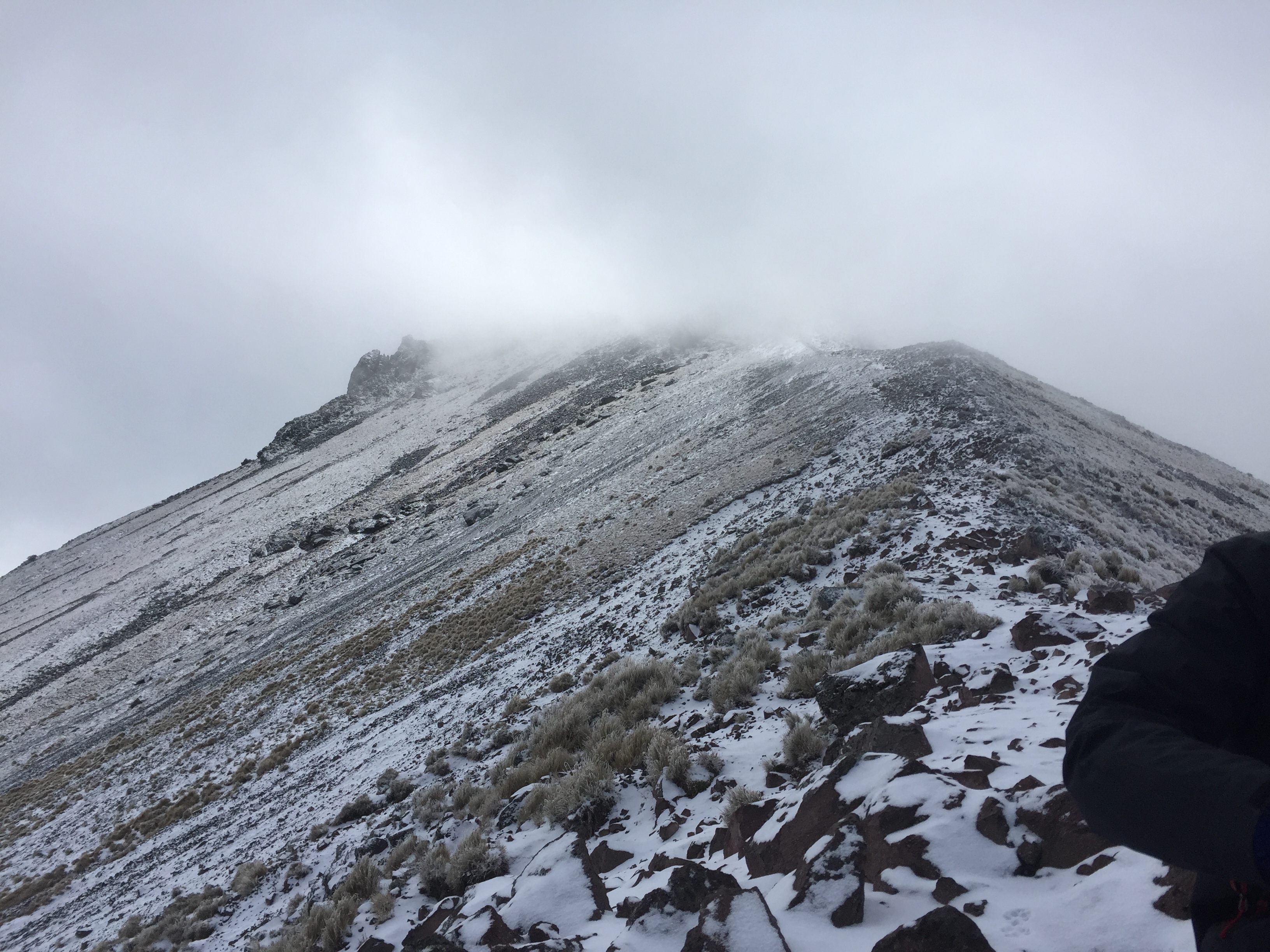
My goal of cranking out our entire Mount Baker trip in a few weeks has been waylaid by work, as so many things tend to be. But fear not; we haven’t been stuck on the summit forever – we did in fact make a not very elegant but nonetheless effective descent.

One thing I inadvertently omitted from the account of our trip up to the summit was the eerie, almost tropical breeze that accompanied us at the beginning of our summit night. It was a harbinger because heat was the theme of the way down.

Of course, the first challenge of the descent was to reverse our way down the Roman Wall. As the smallest of our team of four, I was assigned the front of the rope, which meant I had the responsibility for picking out the footsteps we would follow on the way down. I had last led a rope line on Mt Elbrus and I was terrified as guide S short roped us (so he could control the rope better) and I cast a look down at the truly steep slope before me. He’d done the same short rope up the Roman Wall as well, which gives you some inkling of its incline.

It was much harder to get into a steady pace on the switchbacks on the way down, as we had very varying speeds on descent. To my surprise, the really vertical part was actually easier than the switchbacks – it required a boot plunge into already carved steps that you slid into – some almost 18 to 24 inches – but they felt fairly secure. The only problem was that so many other ice axes had already traveled that way when you dug your axe in you were just as likely to hit an existing hole and get absolutely no purchase.

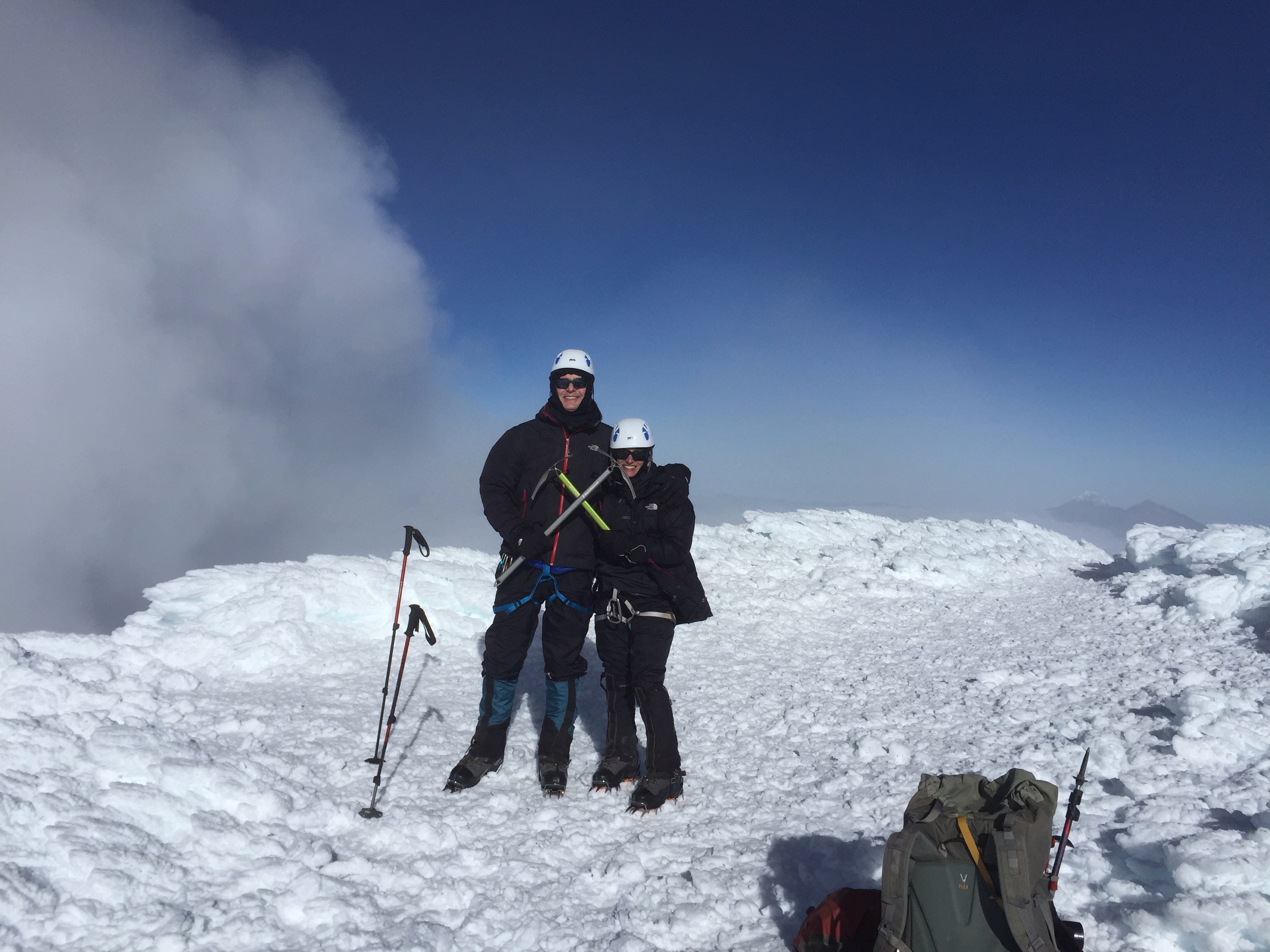
I’d forgotten how much I liked leading a rope. The Roman Wall demanded absolute concentration and my legs felt shaky at times – nerves – but that complete absorption in the moment is one of the things I love best about mountain climbing (and glaciers, in particular). As our guide said – every step had to be purposeful. I’m afraid there are no photos of this. My hands were otherwise occupied.

Not quite sure about this angle but this is what it felt like

We made it down the Roman Wall in decent time and then reversed positions and I was now at the end of a long rope. Our guide, SH, was concerned about speed because temperatures were climbing and water was getting low also. Apparently my Florida heat training helped because I got down with water to spare.

But this is where the different trekking speeds really slowed us down. If I went too fast the rope would pool around J’s legs and he’d trip so I had to keep stopping and we never got a good downward rhythm going. It took almost five hours to get down (recall it had taken about eight to ascend), and it was an enormous relief once we could unrope and slip and slide down the last little bit.

Crevasses presented a few adventures on the way down also. The glacier is always moving and the cracks in the snow were no longer where they were or the same width. In fact, although I didn’t see it, T reports to me that M had a “crevasse crash.” The snow at the edge of one deep crevasse had gotten slushier, and you needed to dig in your crampons before hopping across it to get traction. As M approached, she couldn’t get a good foothold, and, worried about breaking her leg if one foot slipped in, chose to dive headfirst across the crevasse with full momentum. According to T, she quickly uprighted herself, sat up, and started laughing.

Back in camp everyone was exhausted. Poor J was still enduring whatever stomach issue was plaguing him, and M was also having to cope with feeling unwell. We had a latish dinner of spaghetti and needless to say, all were asleep at an extremely early hour.

Next up – the hike out, the miracle of my mountaineering boot drop, and had I actually gotten myself lost somewhere on the trail system of Mount Baker.

Malinche, Mexico – High Up and Low Down

Ridge on Malinche
Ridge on Malinche

According to one of our guides, the mountain of Malinche, officially 14,636 feet but higher when measured by GPS, is home to one of the world’s highest forests. It’s a mix of tree and rocky trail, shielded forest glades and exposed ridges. Almost a metaphor for our entire trip to Mexico. The name given he mountains by the Tlaxcaltecs was Matlalcueyetl, which means “lady of the green skirts,” a goddess of rain and wind.

After our visit to the Teotihuacan pyramids, we drove several hours further, southeast toward Malinche, located in the state of Tlaxcala. On the way, stopped for lunch at restaurant where lamb tacos and rabbit were high on the list of menu choices. Venturing further and further into rural Mexico was a time machine experience. We soon left behind the truck stops – rows and rows of non chain cafes (except for the ubiquitous Oxxo – the Mexican version of 7-11) – and were driving through fields of nopales – the cactus that is the base for incredible salads.

There wasn’t a tractor to be seen. Men were plowing the land with horses and donkeys. Each small village had several shrines on the side of the road occupied by ornately dressed saints. And there were similar smaller shrines adorning the gates of many houses.

image

Eventually we reached the IMSS cabins in the park surrounding Malinche, at an altitude of about 10,000 feet. As I understand it, they are operated by the ministry of health or some other equally unlikely branch of government. They are two room cabins with a bathroom, nice tile but some unusual features. A refrigerator, but no stove? The bathroom leading off of the bedroom, railroad car style? One electrical outlet? No heat of course, and we were all wearing our lightweight down jackets (which had become like a second skin by the end of the trip).

We had quesadillas made with Oaxaca cheese for dinner, and went to bed early in preparation for a before dawn start up Malinche.

We started walking about 6, accompanied by three dogs who were our travel companions all the way to the summit. They clearly did this everyday, and seemed to be in excellent shape, so their presence didn’t cause my animal loving heart any angst. The first part of the Malinche hike is through beautiful forest that we could just make out by the glow of our headlamps.  As the sun rose, the trail got progressively steeper.  There had been frost, and drops of water sparkled on the grasses and bluebells still blooming here and there.

Eventually we reached the tree line, crossed a brief grassy section and moved onto steep rock and scree. Close to the top, you traverse a ridge, narrow in some points, and finally up a steep rocky section to the summit.

image

The wind died down just a bit so we, together with our dog companions and a couple of other climbers, could enjoy the partial views we got when the sun briefly appeared.  It was surprisingly comfortable in the grey cloud at the summit – as if we were in a nest of cotton, safe at the top of our mountaintop tree. The dogs scratched the snow away and made beds for themselves on the warmer dirt. They were getting ready for the long trek down.

image

It took us about 5 hours to reach the summit – appoximately 4500 feet of elevation gain. We came down fast, running at times, in just under three hours.

Once down, we drove a short distance to the Hacienda Santa Barbara. Built in the 1600s, the hacienda is huge, yet only a few rooms are available for guests. J and I were in a large room, high ceilings and a small bathroom inserted into one corner.  Heated by only a very small stove, we definitely needed all the blankets from the two beds.  The floor was stone, and the window – which locked by way of a giant beam that slid across it – looked out in more ruins of outbuildings.  Meals were in a dining room occupied by one large long table.  And in the morning we had atole, as well as coffee, a hot drink made from corn and tasting like chocolate.  Dinner was chiles rellenos, hot enough to warm us up even in that frigid dining room.

It was now Tuesday night.  We knew Pico de Orizaba awaited.

.

Where We Are Going Next – Pico de Orizaba, Veracruz, Mexico

image
Photo – http://www.sil.org/~tuggyd/Pix – Pico de Orizaba

Over the last few months I’ve been publishing posts that refer to Pico de Orizaba, our next climbing destination, as though it’s a location at the forefront of everyone’s personal geography. That certainly can’t be the case – this particular mountain wasn’t close to the forefront of my mind until we started to try to find a big mountain that could be climbed in winter and in under seven days. When you live in Florida, the choices are limited.

So after looking at our options, we settled on the Orizaba Express trip, again through Mountain  Madness, the company that has successfully and safely led us up Mt. Elbrus in Russia and Cotopaxi, Illiniza Norte and Cayambe in Ecuador.

Pico de Orizaba is a strato volcano 120 miles outside of Mexico City, on the border of Veracruz and Puebla, by the town of Orizaba.  According to Wikipedia, fount of all knowledge, it has gone by a number of names. Non-Nahuatl speakers in the area call it Istaktepetl or “White Mountain.” During  the Pre-Columbian Era it was referred to as Poyautécatl, which means “the ground that reaches the clouds.”

My favorite of its names is  Citlaltépetlas, which is what it was called in the Náhuatl language when the Spanish arrived in this part of the world, and means “Star Mountain.”

During the colonial era, the mountain was known by the rather boring appellation, Cerro de San Andrés, due to the nearby settlement of San Andrés Chalchicomula at its base.

It is the third highest mountain in North America (behind Denali and Mt.  Logan), one of the volcanic Seven Summits, and the second most prominent volcano in the world, after Kilimanjaro. Pico de Orizaba measures 18,491 feet high, a statistic I find particularly notable because one of our teammates on Mt. Elbrus was part of the group that measured the mountain using GPS some years ago.

After arriving on AeroMexico, according to our trip itinerary, we will start acclimatizing in Mexico City, around 7,341 feet. From there we journey to the pyramids of Teotihuacan, and the next day climb Malinche, 14,640 feet. After that we travel to Tlachichuca, and – somewhat ominously – “transfer to four wheel drive” for the trip to the hut at Piedra Grande (13,972′). Our final acclimatization hike is to the toe of the Jamapa glacier at about 16,000′ and back down to the hut.  Summit day involves elevation gain of about 4,500′ – which is a lot, and may be one of the biggest elevation gains we will have done in one day. To reach the summit, you traverse a rocky section named after one of my favorite words, the Labyrinth. The section right below the caldera looks really quite steep – definitely an area for ice axes. If it’s anything like Cotopaxi, I anticipate collapsing at the top – assuming the gods bless us with good weather and the mountain lets us summit.

We’ll have a night in Tlachichuca and one final night in Mexico City – and then it will be back to Orlando on an airline I had never even heard of until yesterday, Volaris. I realized one of the reasons it’s so cheap is that you have to pay to select seats – but they let you have a free checked bag!

I’ve been looking for free images of the Labyrinth, but couldn’t locate any. Perhaps a testament to the comparative obscurity of this mountain.  But I love that it’s a mountain of many names. As I said above, and as many a mountain guide has told me – you don’t climb a mountain; it lets you climb it. And I hope that Pico de Orizaba will look favorably on us in just a few weeks.


Cayambe Calling

Checking out this route from outside the hut at Cayambe
Checking out the route from outside the hut at Cayambe

Four mountains, including one at 19,347 feet and another at 18,996 feet, in eight days, is a lot. I knew I was in trouble when I started to cough the night before we attempted Cayambe.  And how did we end up at Cayambe in the first place, you ask? You’ll recall the original plan was to follow our Cotopaxi climb  (second highest peak in Ecuador) with Chimborazo, the highest peak and the point on earth closest to the sun.

Well, the worldwide rise in temperatures is affecting Chimborazo as much as the next glacier. Have you seen photos of Kilimanjaro recently? Very different than 2011 when we were there. Warm glaciers create greater risk of avalanches and rock fall (not to mention the difficulties of slushy snow). Chimborazo is also a long drive from Quito and it’s one heckuva big mountain. So, prudence being the better part of valor we decided, with guidance from Ossy, not to let the wax on our wings melt by attempting to fly too close to the sun and instead to try Cayambe, Ecuador’s third highest peak at just under 19,000 feet, as the final mountain of our Ecuador trip.

After our peak (literally) experience on Cotopaxi — even two weeks later I keep re-living it in my head  — Cayambe was a logical choice. It’s just a little lower than Cotopaxi, perhaps steeper in spots (but for shorter sections), and has some rock to climb at the beginning. We had summited Cotopaxi at 9:05 am on July 3. After a rest day in Quito on July 4, we left the next morning to drive to the hut at Cayambe. Unlike the other huts at which we stayed, at Cayambe you can “drive” – if that’s the right word – right to the door of the hut.

Road to Cayambe hut - and this was the good part!
Road to Cayambe hut – and this was the good part!

The road to Cayambe beats about any road I have ever travelled on for ruts, rocks, and steep precipices.  It doesn’t resemble anything on which any self-respecting automobile should drive. We’d all learned our lesson by then about my issues with winding roads and cars, so I sat in the front. Ossy spent a lot of the time sticking his head out the side window to see exactly which snow, mud or ice covered rut would best create traction for the four wheel drive.

Eventually we made our way to the hut and checked in. For the first time during our trip we were sharing the hut with another team, a large group of nine or so climbers with four guides.  All males and considerably physically larger than I. As we settled in at a table in the main room we traded stories  about what we’d been climbing – and I must say it was 100% satisfying to say “yes” when they asked if we’d summited Cotopaxi, which they hadn’t yet attempted, and to be met with some very bemused looks. For a five foot, one and one-half inch woman (that half inch is very important), I felt a certain instant credibility. As Ossy said though, the pressure on all those guys to summit Cotopaxi had just increased immeasurably!

But Cayambe was the summit that was not to be. I still had not  completely recovered from whatever stomach issues had so gravely affected me the night after we climbed Illiniza Norte and had also developed a nagging cough. Plus I think I was still generally burned out from Cotopaxi. I had put my heart and soul into that climb, and I couldn’t help but regard Cayambe as a latecomer to the party.

We followed a similar routine – packed for the next day, went out and looked at the route we’d be taking, ate soup and something  sweet, and were in our bunkbeds by 6:30. I slept a couple of hours and we were up at 11:30 – this time with other climbers also packing up and getting ready to go. It did change the serenity of the moment. But, as the only woman, I got to have the entire women’s bathroom all to myself!

The night was spectacular; the moon had waned only a bit and there was scarcely any wind. But the downside of all that was that it was quite warm – in fact, we all wore a layer less than we’d originally planned. And the snow was soft, meaning  that once we were on the glacier we were sinking in and exerting a lot more energy than desired. Once we had scaled the rock area – which I had spent way too much time worrying about because it wasn’t that hard – we had to traverse through a scree and rock field and finally reached the glacier, where we could put our crampons on.

But as we roped up and took off I just couldn’t attain the same sort of steady rhythm that I’d been able to manage on Cotopaxi. Although at one point we were among the highest teams I made the mistake of looking up and seeing how incredibly steep and seemingly never ending the slopes above me were, and let myself get distracted by what the other climbers on the mountain were doing. All of which added up to a point where I was feeling dizzy and our pace simply was not what it needed to be if we were to summit early enough to avoid the risk of avalanche as the mountain heated up during the day.

Dawn breaking over Cayambe - photo by Oswaldo Freire
Dawn breaking over Cayambe – photo by Oswaldo Freire

Just then, one of the other teams that had passed us turned around after reaching a ridge line about 400 meters from the summit. We decided to go to the same point and then head back down. It turned out two other teams did make the summit but it took them 8 or so hours – an hour and a half longer than usual, due to the hard climbing conditions.

Our descent went well, even though the scree field we were hoping to slide down instead of rock climb was covered with snow. That meant we had to turn around and walk back up an area we had just hiked down – possibly the most dispiriting moment of the whole climb. But I did well on the rock climbing on the way down, no ropes needed.

Descent down Cayambe - photo by Oswaldo Freire
Descent down Cayambe – photo by Oswaldo Freire

And on the way down we were treated to a rainbow. Clearly a promise of future summits. Cayambe is still calling to me. I think we’ll be back.

Shifting Winds Lead to Cotopaxi Summit

Cotopaxi Summit
Cotopaxi Summit

The wind shifted. I’ve always known the wind is important. After all, Mary Poppins arrived with the east wind, and there’s an old saying that if you make a face when the wind changes your face will get stuck that way. But I’d never really experienced just how important a shift in the wind could be until we were right at the lip of the Cotopaxi crater, just below the summit.

After climbing Illiniza Norte, we spent the night at the Hacienda Chilcabamba. I went to bed at 6:30 and slept for about 12 hours – unable to face anything for dinner. I felt about a hundred times better the next day, and we had an easy morning at the hacienda, followed by a large lunch. J and I had a little thatched cottage all to ourselves, with two bedrooms and a sitting area, heated by a wood stove.

Hacienda Chilcabamba

We left in early afternoon to drive to the parking lot for the Cotopaxi hut. This time I sat in the front seat to avoid the  gastrointestinal dangers associated with the curving cobbled stone roads. From the parking lot we strapped on our backpacks, which contained only what we needed at the hut and for our summit attempt. We were already wearing our base layers, to minimize having to change. The walk up to the hut is about 45 minutes on a steep dirt road – we reached the top, only for Ossy to realize he’d left his phone in the car and had to go down to get it!

The Cotopaxi hut was redone only a few months ago, and although nicely varnished and with new mattresses, it’s really cold and the roof makes an incredible array of noises in the whistling wind. While the Illiniza Norte roof clanged and sounded as though it might blow off, this roof variably screamed, whistled, hooted and howled. Despite all that, after we’d had bowls of quinoa soup, followed by figs, cheese and sweet biscuits, we still managed to sleep a few hours.

Bedroom at the hut at Cotopaxi

We were supposed to awaken at 11:30 pm but  slept through the alarm and ended up getting up at midnight. Just as on Illiniza Norte, we were the only people in the hut.  And we soon found out there were only two other climbers on the entire mountain, besides us.

We stuffed some food into ourselves and started climbing about 1 am. The first part is a 45 minute walk up a relatively steep scree field. Once at the top, you’re on the glacier, which meant it was time to rope up and put on crampons.
The old “normal” route has been closed for 2 or 3 years after a climber was killed on it – too many crevasses. Instead you now use the Rompe Corazones – the heartbreaker. There’s an extremely long 2 plus hour stretch that simply goes up without any sort of break. And it’s a killer. I was trying hard to stay hydrated, so each hour when we stopped, the routine was water, a handful of trail mix, and more water. As we gained altitude, the trail mix became GU, and Ossy was literally tearing the top of the packages and holding them as I sucked the sticky sweet electrolytes out.

We climbed up one sheer icy patch where we had to use the front points of our crampons – as if we were scaling a vertical wall.  Much of the trek up was simple side by side steps, but even there I kept finding my crampons pointing too far uphill, and I quickly realized how much I had to learn in the way of technique.

Sea of Penitentes
Sea of Penitentes

At one point you traverse a sea of Penitentes – formed by the wind, they are peculiar to the Andes in the summer months. Sometimes they are upright, but these were bent by the wind. They look like a field of praying hands, fingers outstretched in supplication. You can walk between or on them, and if on, each step sounds as though you are stepping on a brittle twig – or finger.

The very last bit of Cotopaxi is steep, steep, steep. As we had to do in a couple of prior areas, we used the picks of our ice axes overhand to dig in and help pull ourselves up (normally you’re using your ice axe in your uphill hand like a very sharp ski pole or walking stick).

But just before we reached that point, we saw the only other two climbers on the mountain turn around, apparently overwhelmed by the sulphur fumes spewing out of the crater.  You may recall I mentioned that starting in May or so Cotopaxi had reactivated. It is “degassing” (lovely word) and literally tons of fumes are forming into thick heavy clouds over the crater – which is just below the summit.

Despite the retreat of the other climbers, we kept on going. Although the mountain administered a pretty strong dose of sulphur to us – Ossy and J in their throats and me in my eyes – just at that point….the wind shifted. I heard Ossy say that we might have a window and I kept slogging up the close to vertical slope.

Suddenly I was on a flat area – but surely I couldn’t be there. I was positive there must be another 15 or more minutes of sheer physical and mental pushing left and this was just a fake….but no, I was actually at the summit. There wasn’t anywhere else up to go. I’d seen people on YouTube videos throw themselves down on the ground when they finally arrived, and without even thinking, that’s just what I did too.

Cotopaxi Summit - sulphur cloud in background
Cotopaxi Summit – sulphur cloud in background

We couldn’t stay on the summit for long – just in case the wind shifted again and the crater drenched us with another load of sulphur.

Our descent was noneventful, which is about the best that can be said about descents. We kept up a pretty good pace, with J on the front of the rope, me in the middle, and Ossy bringing up the rear in order to arrest whoever might fall.

It turned out we made it up in 6 hours and 50 minutes, well within the range of normal, and down in 3 hours – also what Ossy wanted us to do.

Once back at the hut the reality of what we had just accomplished finally sank in. All those stairs; all those hot and sweaty runs.  The culmination of all of it was that confluence of ice and snow and blue sky. A perfect summit.

Illiniza Norte Or How I Ended Up Rock Climbing After All

Cotopaxi from the hut at Illiniza Norte

Some of you may remember that one reason we ended up in Ecuador instead of the Grand Teton was our conclusion that we preferred mountaineering to rock climbing. (See “Cotopaxi, Ecuador – 180 Degree Turns.”)  So it was somewhat inexplicable that I nonetheless found myself on July 1 hanging on for dear life to an ice encrusted basalt wall with my left hand, ski pole in my right and nothing but an almost vertical drop of rocks below. Oh, and this was at about 16,000 feet. And did I mention no ropes?

Illiniza Norte is one of the two Illiniza peaks (the other, obviously, is Sud), and is a common acclimatization hike in preparation for Cotopaxi. It reaches about 16,500 feet, and is the taller of the two forked peaks in the right in the photo. Its sister peak, on the left, is much more technical and is covered in snow.

The Illiniza Peaks
The Illiniza Peaks

It was about a three hour hike to the mountain hut where we were to stay for our ascent of Illiniza Norte so we left in early morning. After fighting through Quito traffic, we followed modern highways for a while until we abruptly turned off to cobble stone roads, still in the same condition as in the 1940s when Ossy thought they were originally built. Jaw breaking and winding is an understatement. More on that later.  We passed through several small villages, stopping at one to drop off things we wouldn’t need on the hike. Once we parked the car near the trailhead, we met up with the two men who took our supplies up to the hut on horses. Each day the horses plod up to the hut with full loads and bring trash back.  Despite the routine, they seem quite content with their rather proletariat role in life.
image
The mountain hut is primitive – but there are flushing toilets, even if you do have to go outside to get to them. There’s a series of about four bunk beds, going up to a triple level, a small eating area and a tiny kitchen. No electricity. We were the only people there, and, in fact, the only climbers on the mountain the next day. That night we were treated to a spectacular sunset with a full moon. The entire Avenue of Volcanoes was visible, including the white capped isosceles triangle of Cotopaxi.

We got up at 5 for an early morning departure. The weather cleared as we hiked. There was more snow than normal, and many of the rocks were encrusted with icicles. I was glad of my climbing helmet since I hit my head several times on wide swathes of ice sticking out from the rocks I was trying to hold on to.

There are several sections of rock, the most difficult probably the one right below the summit. We climbed up through a chimney, along exposed ledges – and all without ropes. Ossy very carefully instructed where to place hands and feet and how to balance – and ultimately we did make it to the summit which is marked by a metal cross. But that wasn’t before a bowling ball sized rock hurtled down from the top in J’s general direction, followed by a smaller one in his more specific direction. Fortunately, no injuries. We now know the best way to react to rockfall (besides not experiencing it in the first place!) is to make yourself as small as possible. Sort of an airline crash position.

Summit of Illiniza Norte - that's the summit cross that appears to be sticking out of my head
Summit of Illiniza Norte – that’s the summit cross that appears to be sticking out of my head

Coming down was exhausting and Ossy roped me in after I slipped twice. I think I’d burned up a lot of nervous energy on the ascent – not to mention physical. And we not only had to descend and get back to the hut – there was still the three hour hike back to the parking lot ahead of us, and then a couple of hours to drive to our next stop, the Hacienda Chilcabamba, outside Cotopaxi National Park.

For someone who actually froze on the stairs of the Eiffel Tower and who still has recurring dreams about being stuck on the old swinging bridge on Grandfather Mountain in North Carolina, reaching this summit was huge. But it also reminded me that figuring out how to get down from summits is just as important as going up them.

Cotopaxi and Chimborazo – Where We Are Going

Volcanoes of Ecuador

So I did it. Last week, on Tuesday to be precise.  I emailed Mountain Madness, our trekking company, and just said yes to the Chimborazo extension. Now I recognize that some of you were pushing for the Galopagos Islands, but I simply couldn’t escape the fact that there will be no other point at which husband J and I stand a better chance of actually climbing a 20,000 foot mountain. I think I can manage the Galopagos in future years.

As I continue the grueling process of forcing  myself to run at ever faster paces and climb stairs with increasing amounts of weight – and of finding the time to do so – it occurs to me that I have not really described the two mountains that are engendering such passion (or foolhardiness). I’ve referred to them by name, but without much explanation.

Here’s what is inspiring me.

Both mountains are part of Ecuador’s Avenue of Volcanoes, named by 19th century German scientist Alexander Van Humboldt.  Due to a location just above and below the equator, the scenery is supposed to be reminiscent of the Scottish highlands or the Arctic tundra, at least according to our trekking company.  Both were first summited (at least by westerners) in 1882 by Edward Whymper, for whom some of the passes are named.

Cotopaxi last erupted in 1940 and some consider it the world’s highest active volcano.  It stands at 19,347 feet (5897 meters) and is located near Quito, which at 9400 feet is itself one of the world’s highest cities.  Cotopaxi has been worshipped as a sacred mountain, a bringer of rain and fertility.

We will acclimatize for the altitude first with a climb up Guagua Pichincha (just outside Quito, standing at 15,696 feet, last eruption 2004) and then what is described as an “enjoyable rock scramble” up Illiniza Norte (16,818 feet), with trekking, camping and stays at haciendas in between. Mules are supposed to help at certain points as we travel between and up the various mountains.  Once we are at Cotopaxi, summit day (summit night is a more accurate description) begins at 15,749 feet, where we will have been staying at the Jose Ribas Hut.  The glacier starts at about 17,000 feet, and according to Mountain Madness, we will be crossing snow bridges, avoiding large crevasses, and climbing “short, steep sections.”  Once at the summit of Cotopaxi, we should be able to peer into a perfectly round caldera, the origin of the steam you apparently can sometimes see boiling up.

I have found a lot less written about Chimborazo. It is famous for being the point closest to the sun, due to the bulge of the earth at the equator. As I mentioned before, I hope our attempt to climb it is not too Icarus like. It is currently inactive, with a last eruption in 550 A.D. or so.  It reaches a whopping 20,564 feet (6268 meters) and is the highest mountain in Ecuador. Chimborazo can sometimes be in very bad condition – with unstable snow, big crevasses and high risk of rock fall. The itinerary states that if Chimborazo is not climable, we are to attempt Antisana. It’s only 18,714 feet high, but from what I’ve read is even more technically challenging, as it is completely covered by glaciers, and is not climbed very frequently.

Despite all this, you may still be left wondering – but “why?” Well, a summit goal, for me at least, gives me something to focus on, look forward to, and lifts me out of the drab tension of the day to day working world.  And the other reason is simply a variation of the “because it’s there” phrase – because there is something about standing on a summit that gives a high that doesn’t come from anything else.