It was still mid-October.
The 24/7 church bells clanging next to our hotel in Strobl didn’t keep us up quite as much on our last night there, so we were a bit better rested for our trek to our next stop, Bad Ischl. The weather was cool, and great for hiking. Our walk started off along the banks of the River Ischl – lots of flood control and hydropower. Some pretty woodland sections but not nearly as dramatic as the fairy dells we discovered the day before.

The hike passed through a number of small villages. The houses here, even if old, look so much newer than those in England. White stucco with dark wood work and balconies.
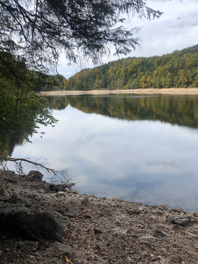
We finally reached Nunsensee (Lake), which looked almost like a dugout reservoir. We were worried about rain so we didn’t even stop for lunch and reached Bad Ischl close to 2 p.m. A church greeted us at the outskirts. I wanted to go in, but two people were in there, clearly praying. The flowers in the terraced gardens were all labeled.


Bad Ischl is an old spa town of the Habsburg regime, located by the river. The Goldeness-Schiff hotel, where we were staying, faces the River Traun, which is part of the River Ischl. (The water geography seemed very complicated.) The hotel was very modern; we had a small room without a view, but perfectly adequate. They gave us a coupon for a free drink for agreeing not to have daily cleaning. No decision there!
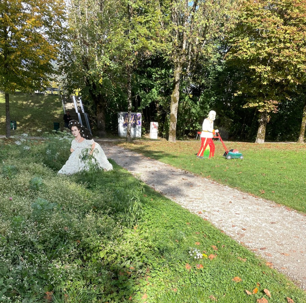
We decided against a visit to Kaiservilla, the summer residence of Emperor Franz Joseph I, and Empress Elisabeth of Austria (known as Sisi). It was very expensive and we only had an hour before closing, so instead we chose to have a drink at an open air cafe (under the awning, while it rained around us), and enjoy window shopping (especially the modern takes on traditional Austrian dress). We also spent time in Sisi Park. Bad Ischl pays homage to her (and her husband) in many ways (for example, cartoonish metal sculptures of them gardening in the park…).
Dinner was at the Spoarhead Gastropoda. Very nice and a nice server, who managed well with few other servers, and appreciated our patience. I always feel like an ambassador for the U.S. on these trips. Chicken Paprika for J and couscous chicken bowl for me. Austria closes down early. We were back in our room by 8:30.
Sunday dawned to a very elegant breakfast, with Prosecco on tap! I wish I had felt like trying it, just to say I’d done so. And a fresh squeezed orange juice maker – I’ve never seen one of those before. We again were anxious about the weather so we skipped the local hill walk that was on our itinerary and instead walked along the banks of the Traun, by lots of sports fields, to the almost empty gondola station. The gondola took us up almost 4000 feet in just 10-15 minutes. Wow! At least the gondola came to a nice slow speed at the top so we could step off.
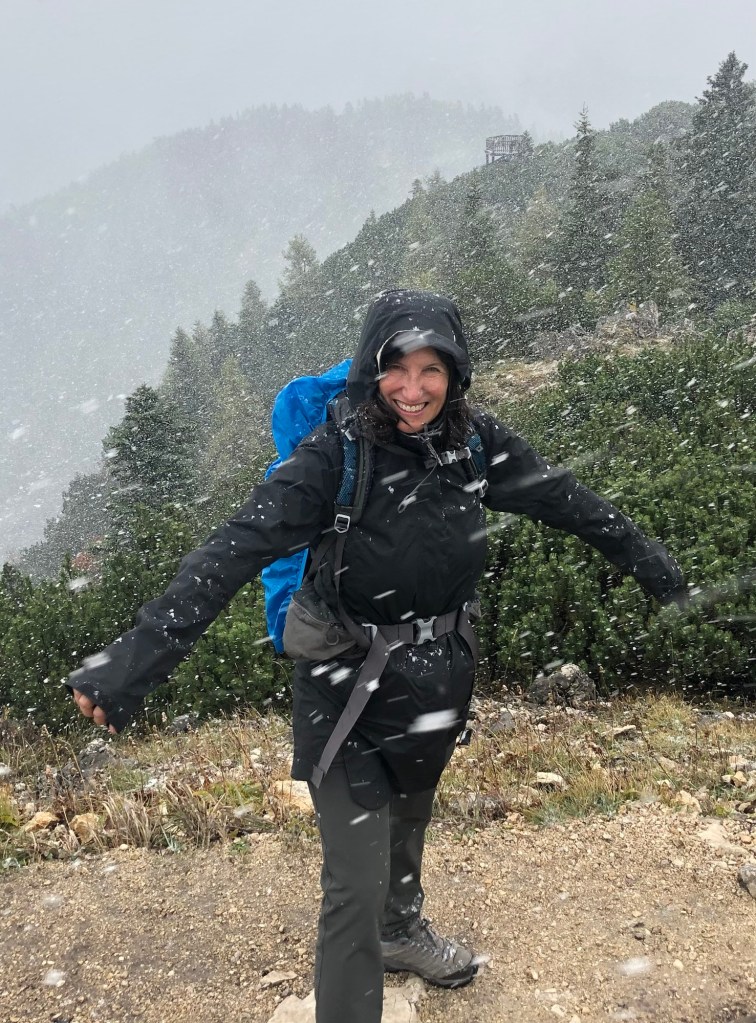
It was very cloudy, misty, and the “hut” where we’d hoped to have lunch was closed (as was most everything on Sunday). We took off up the mountain to the Katrinkogel, with only a few others hikers around. Tall evergreens gave way to short ones – and then it started to hail (small round pellets), shortly turning into genuine snow. It was very arid, dry and felt much better than rain. While this wasn’t a hard trail, there were certainly lots of steps.

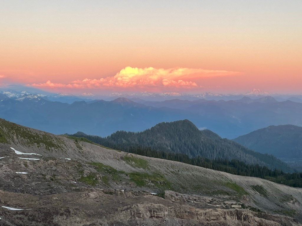
After snowy views on Katrina, we backtracked and took another spur trail to the higher Elferkogel – we were the only people up there. Evergreens beautifully snow tipped and energy emanating from the crisp air. On the way down the clouds started to clear, and once on the gondola the views were great.
We walked back the same way to the hotel. It was clouding up so we still didn’t want to risk the other hill. We found zero places to eat. Everything was closed. Eventually we made it back to the hotel and ventured out to the nearby cafe for a beer – they didn’t even serve food. We were under an umbrella, but then the skies simply opened. We spent the last part of the afternoon in the our room planning the Italy portion of the trip. A nice dinner at the hotel restaurant – it seemed quite popular, but of course, it was one of the only places open.
On Monday, after another nice breakfast (Prosecco was on tap even on a Monday!), we packed and took the train to the train station for Hallstatt, which is a UNESCO world heritage sight. From the station you catch a ferry to the other side of Hallstadtsee, where the actual village is located. There’s a replica of this place in China, and there were tons of Asian tourists, even out of season.

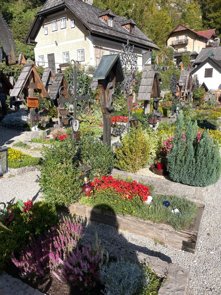
The town, built on the side of a cliff, is spectacular and filled with flowers. Salt mining was its claim to fame. The 19th century Lutheran church (first non-Catholic church I’ve seen ) by the dock has a large poster explaining that’s where the unfortunate Protestants were sent during the Counter Reformation. The Catholic Church is high up on the hill, surrounded by a cemetery, each grave with its own flower plot.
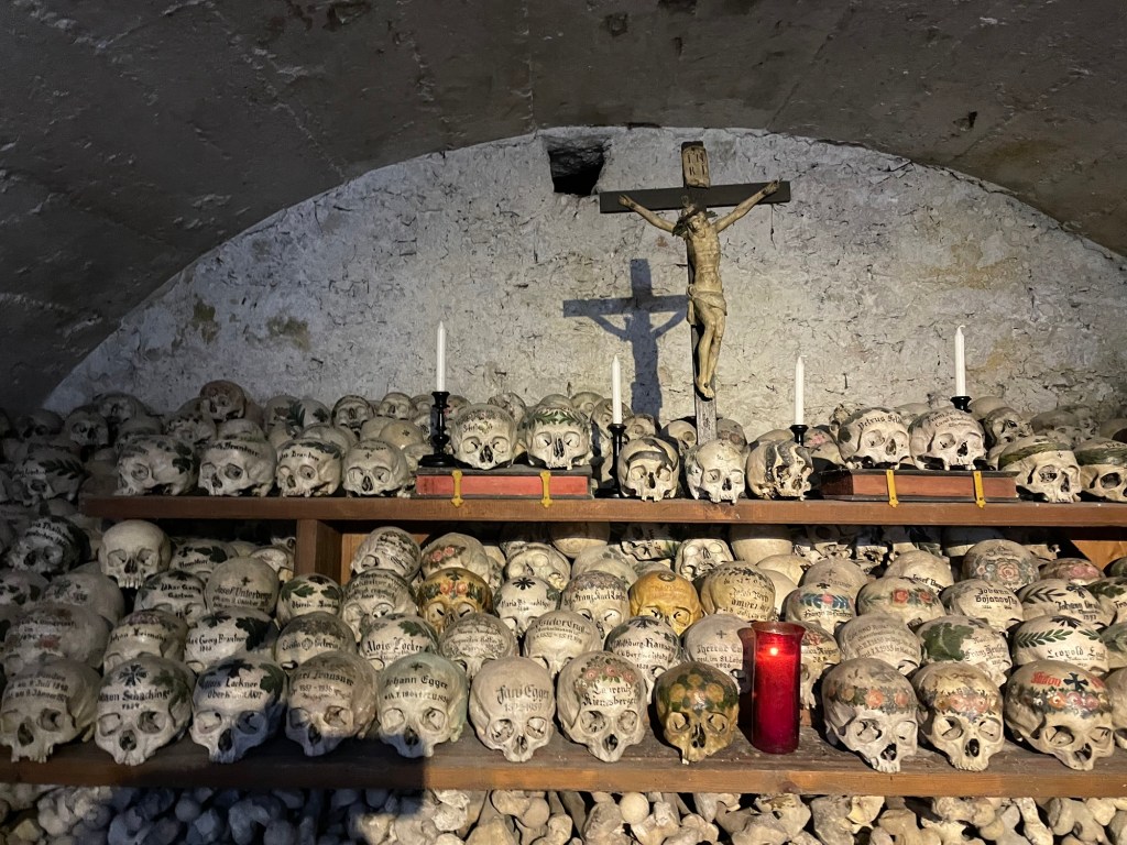
But Hallstatt is best known for the Charnel House. We saw the entrance by the cemetery and decided to pay the 2 euros to go in, little knowing that we were about to walk into an ossuary for skulls. When the graveyard became too congested, the families brought the skulls into the ossuary. (Not sure what happened to the rest of the remains.) But rather than just plop the skulls down, they were painted with family crests, dates, and remembrances. I actually found it surprisingly peaceful. J, on the other hand, found it quite creepy.
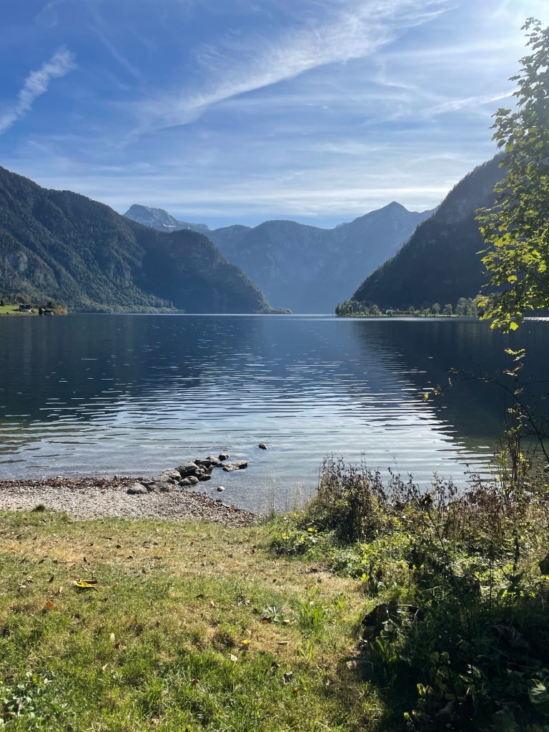
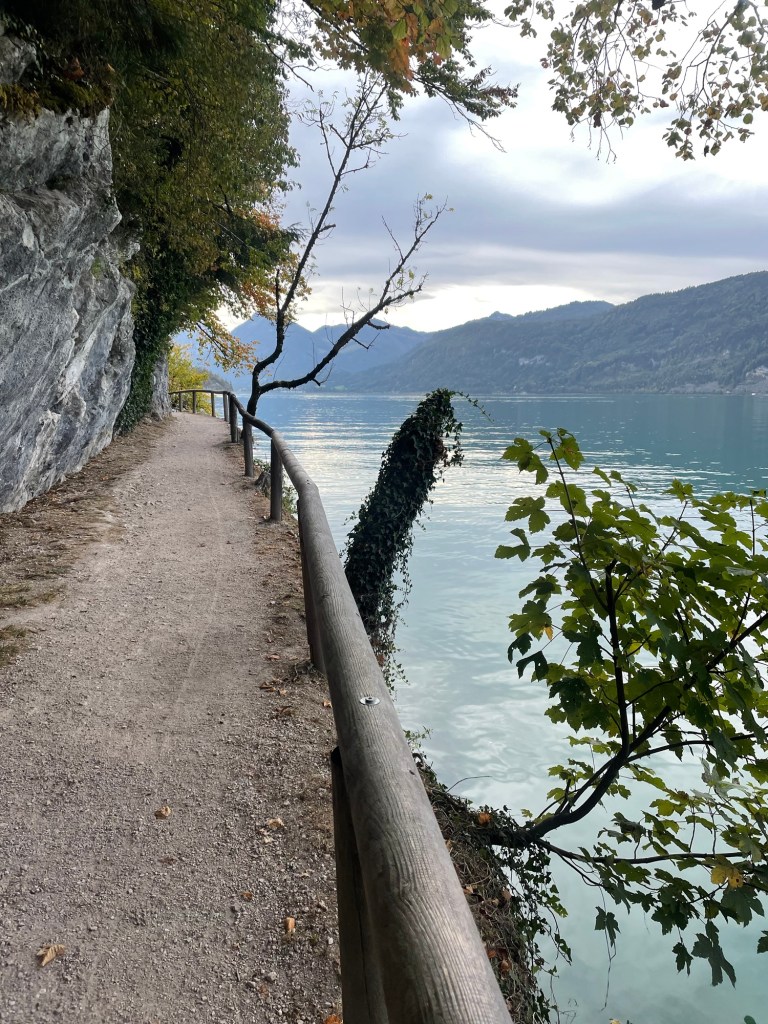
We then ferried back across the lake to start our seven mile walk to Bad Goisern, our next stop. The first part was around the lake – beautiful views, and much of the trail hangs off the cliffs over the lake. Mountains towering over the lake, and you could actually see a nearby glacier. The trail paralleled the railroad track near the lake. Lots of very small yellow finches accompanied us. There were some beautiful private homes. I can’t judge wealth in this country, but at least in the rural parts, it’s hard to see anything I would characterize as poverty.
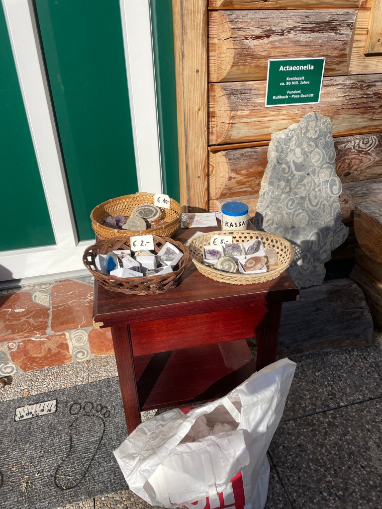
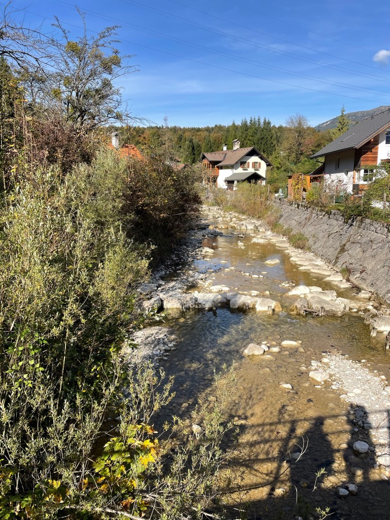
Eventually, we left the lakeshore to walk along the banks of the River Traun, which feeds into the lake. My favorite bit was the tiny village of Undersee. There, along the street in front of someone’s house, was a table of gems and fossils for sale on the honor system. I bought a beautiful ammonite for five euros.
A very nice, easy walk.

Bad Goisern is a real, little town, not just a tourist place. We stayed at the 17th century Hotel Moserwirt, in a large corner room that even had a balcony. After a grocery store trip, we had a lovely drink on the balcony with the late afternoon sun illuminating the mountains. The day was topped off with a dinner of venison and pork at the hotel restaurant.

We’d finished our Austrian hike. Now back to Vienna, and then to Nice.