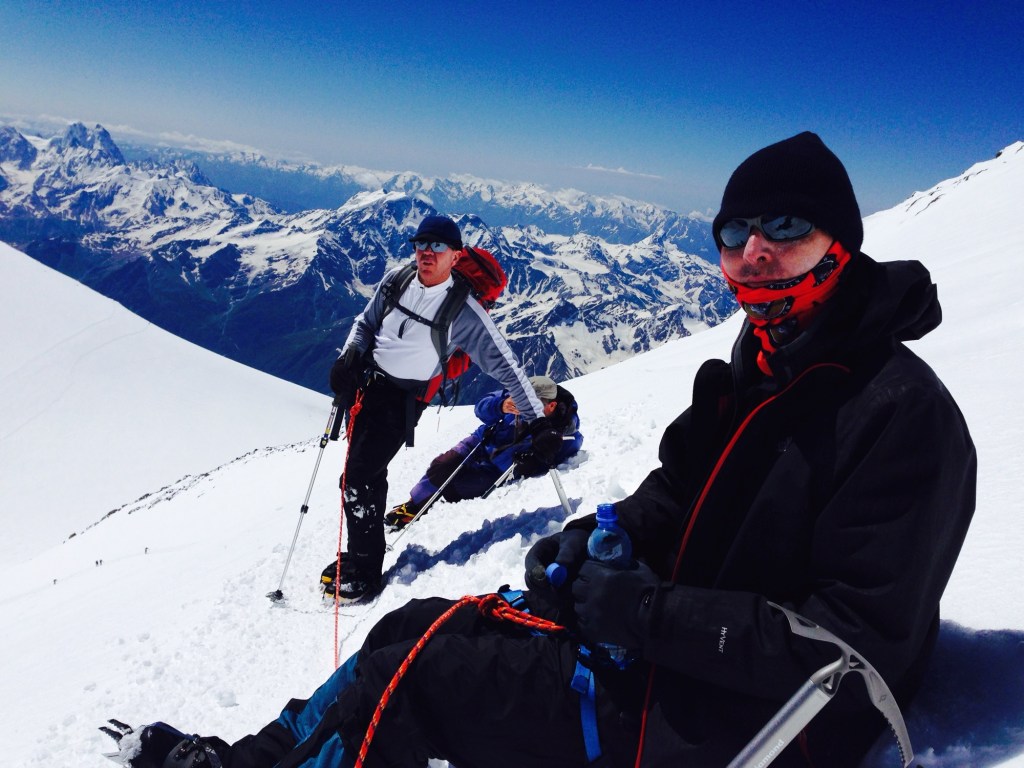
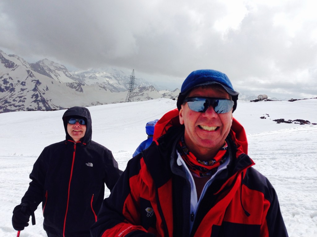
Those of you who have followed this blog since its inception – in 2014 – have heard for a long time about the original “S” (there is a later one, associated with M) but the true original is the 2014 S. S reached out to us prior to our trip to climb Mt Elbrus, one of the Seven Summits, before we were even officially introduced to anyone else going on the trip. He’d seen that J’s email address had an .edu extension, and since he himself was a professor of agriculture at University of Alaska, he wanted to see who the heck he was going to be adventuring with in Russia’s Caucasus Mountains.
We discovered on that 2014 trip that we’d found a soul mate. J and I had already climbed Kilimanjaro (2011) and hiked Machu Piccu and the Grand Canyon (2013), but Elbrus was our first experience with ropes, crampons, and ice axes. We made tons of rookie mistakes, not the least of which was my failure to use any type of sunscreen on my lips on a bluebird summit day, and instead thinking regular chapstick that I happened to find in my coat pocket would do the trick. The third degree blisters on my mouth were a thing of wonder.
Our home at Mt. Elbrus
Through it all, S maintained his unfailing sense of humor and a collection of stories to while away the long slogs up various snow fields and saddles, as well as the ability to maneuver the intricacies of Russian air travel when flights are canceled and it appears a semi riot might break out at a regional airport following your third time of having to retrieve duffel bags off the same baggage conveyer belt.
So when we got the idea in 2017 that we really did want to climb an over 20,000 foot mountain the next year, who else would we reach out to but S. Last night I inadvertently discovered a trove of emails back and forth discussing our trip. He explained he’d talked about it with his wife and since his alternative was Everest she was all for the Stok Kangri trip.
And what a trip it was! A group of 11, only 6 of whom ended up attempting and achieving the summit, some with a lot more grace and speed than others. J and I were definitely ones without the grace or speed, but S was with us all the way to the top.
After the trip, the three of us had an extra day to tour the Red Fort, take a rickshaw to a restaurant that had been billed as a place that served the Moghul emperors but seemed to actually be a small place behind a laundromat with a sink to wash hands as you entered, and even managed to find an uber in the cacophony of live chickens, people, ancient architecture and livestock in the middle of Delhi.
I learned S had passed, at age 61, via a Facebook post last Saturday. The last we’d seen him was on our way to climb Mt. Baker in the Cascades in 2022. That mountain had been on his bucket list. Unfortunately, he had to leave the trip early because a family member had suddenly died and, in typical S fashion, he felt he needed to be with his wife and family. Nonetheless, we carried on and enjoyed spending time with another of his climbing buddies, T, whom he had cajoled into going on the trip.
I was literally just about to reach out to S to see if he had any interest in a potential Mt. Adams climb.
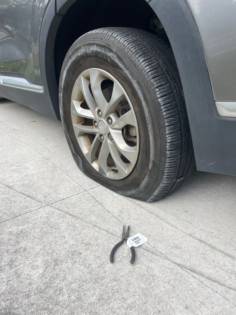
We had planned to go hiking last Saturday at Wekiva Springs with M and the other S. Just as we reached the entrance of the state park, there was a huge rumbling noise and it was clear we had a flat tire. Later we discovered we’d run over a brand new pair of needle nose pliers that still had a label on them. Two hours later, AAA finally showed up, changed the tire in 30 seconds flat, and we had just enough time to get home to make a dinner reservation.
That hiking trip certainly didn’t turn out as expected. And similarly I hadn’t expected to wake up that morning to find out I’d never climb with S again, at least in this life.
I’m not going to say RIP to S. Instead, Godspeed on your next adventure.
For a collection of some of our adventures with S, take a look at the following links. These are only a sampling, and it makes me happy just to read them.
When last FromSwampToSummit wrote she was wandering through downtown Orlando, contemplating the eerie emptiness of the heretofore bustling streets and plazas. But after her husband questioned the sanity of continuing to go into the office each day, even by foot, the interests of marital harmony (especially under lockdown) took precedence over the walk to work every day goal. So those excursions have been circumscribed to once a week.
But what, you ask, does this have to do with Acotango, a potentially active volcano of over 19,000 feet located in Bolivia? (Photo of Acotango By Gerard Prins – Own work, CC BY-SA 3.0, https://commons.wikimedia.org/w/index.) Well, it turns out that it is very difficult to try to stay in shape without some goal ahead. The sheer pleasure of being in shape somehow isn’t enough to put up with the pain. And yes, Katahdin in Maine lies ahead in July, and presuming we can travel by then, I am sure will present a challenge – but somehow, not enough to keep these now 59 year old legs pumping.
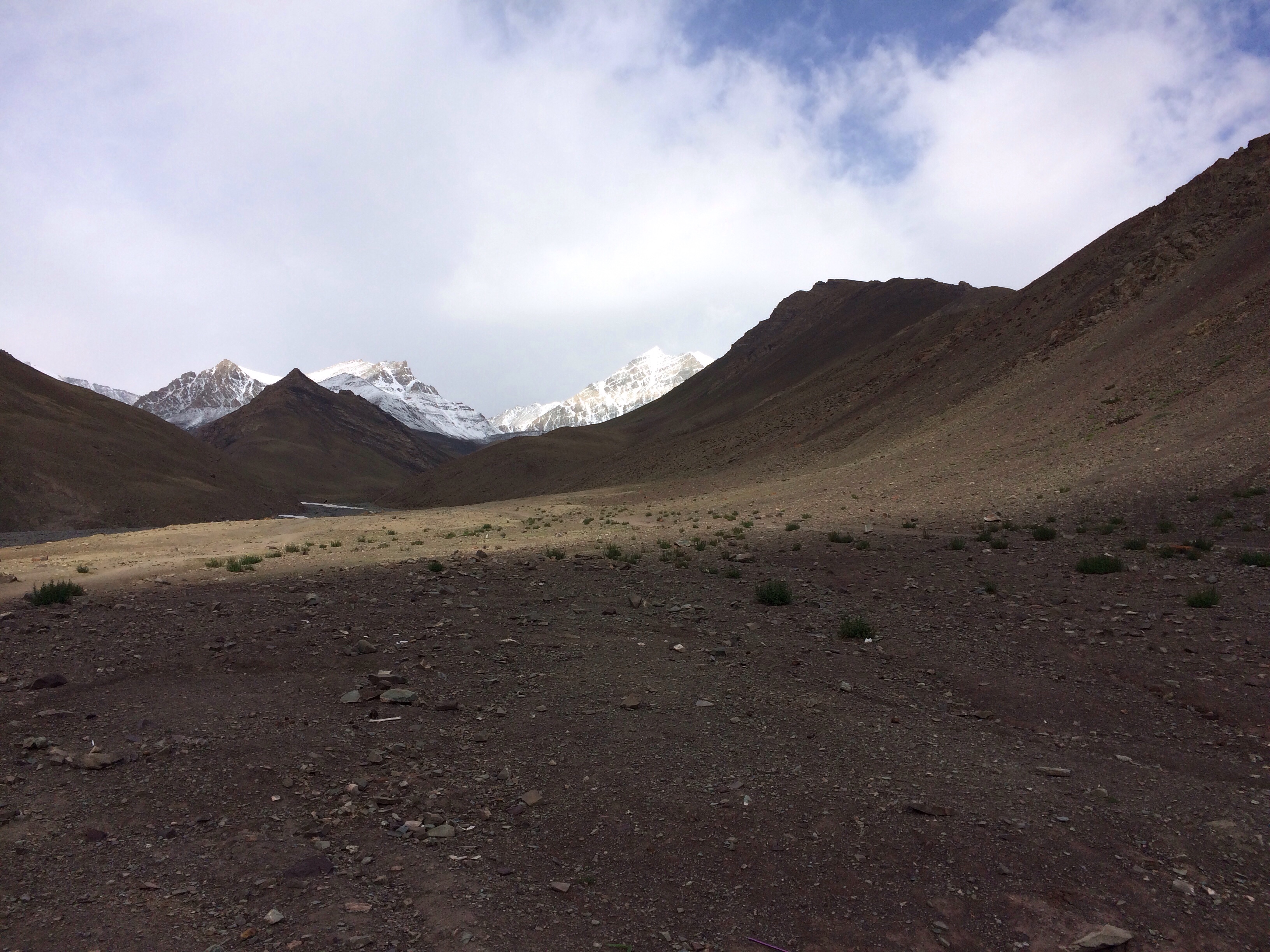
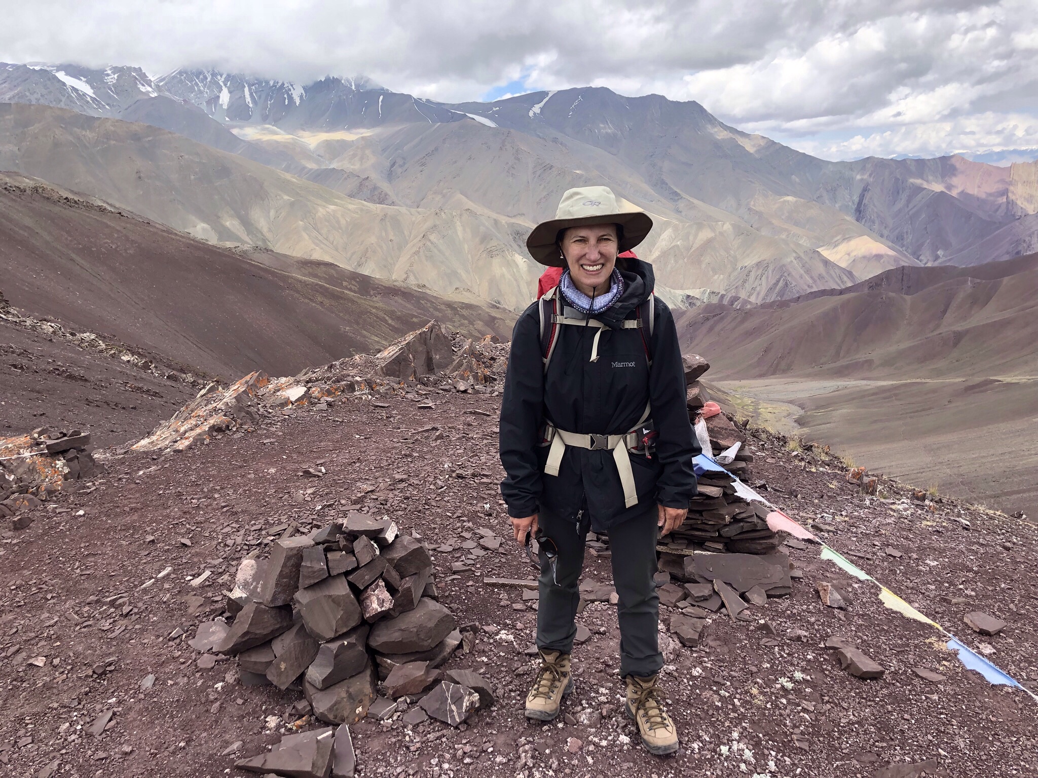
Acclimatizing outside Leh, Ladakh, India 2018
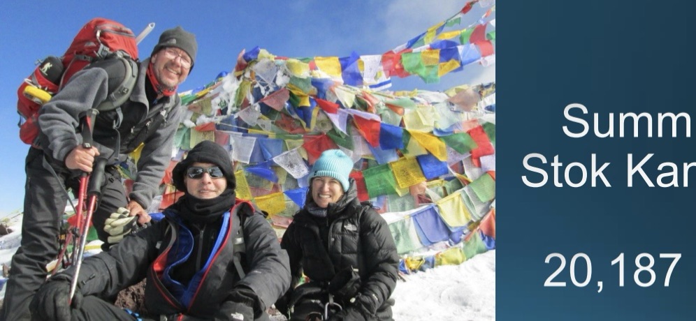
Spur of the moment last weekend we picked up the phone and called our adventure companion S in Alaska, of Stok Kangri and Mt. Elbrus fame. See, among others, The Peak – Summit of Stok Kangri, India. He too is looking for that next expedition and between the three of us we have cobbled together the start of a plan.
Based on J’s research, it looks as though a trip through the salt flats of Bolivia and the world’s highest desert, capped by a non technical climb of Acotango could be in order. The landscape is dry and otherworldly – odd rock formations. And Acotango itself may still have life – apparently it erupted 10,000 years ago, which is recent in volcanic terms. So there’s still life in those old bones.
What better way to celebrate my 60th birthday next year and the 10th anniversary of our climbing career! Let the training begin.
When people ask about our next adventure, I know the real question they have is…how much does all this cost? I’ve been thinking about answering it for a long time, but perhaps it’s less awkward to do so in a blog post.
The internet is filled with blogs from twenty-somethings who grab their backpacks, buy rail passes, stay at youth hostels, and make their way around the world before embarking on a more sedate life to come, all apparently on the proverbial shoestring.
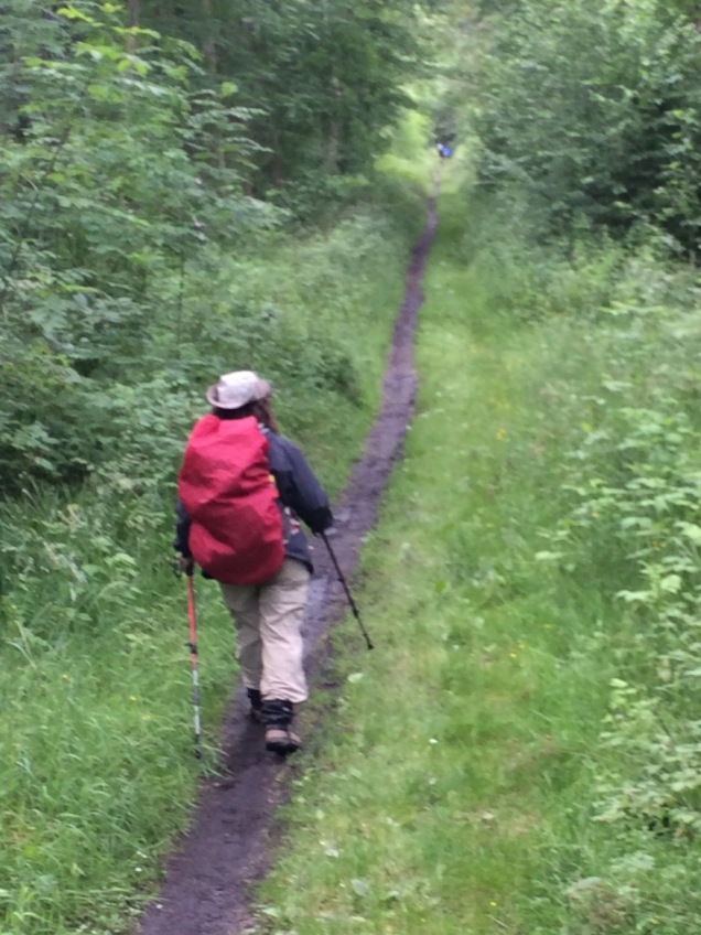
Backpacks are required – on the Speyside Way
But suppose that you’re well beyond your twenty-somethings, are well established on that more sedate life to come, and are now ready to do all the things that you didn’t do way back then. And while you may have more resources than you did years ago, you don’t want to spend every last bit of your savings on the possibility of making it up a 20,000 foot mountain somewhere — that is, unless you’re planning to retire on top of one.
So here are a few hints as to how we’ve managed over the last eight years to climb Kilimanjaro and go on a safari in Tanzania, climb Mt. Elbrus and visit Moscow, hike the Speyside Way in the Scottish Highlands, trek the Inca Trail in Peru and the Everest Base Camp Trail in Nepal, climb the Ecuadorian and Mexican Volcanoes (ok, we didn’t summit the Mexican one!), and make it to the top of Stok Kangri in India. And how we’re planning to trek through Montenegro, Croatia, Kosovo, and Albania with family and friends this summer.
Consider using a U.K. based company. While we have had fantastic experiences with some well-known U.S. companies, the reality is they are more expensive. You’re typically paying for a U.S. guide to be with you at all times, and I’m sure they would argue that there are higher standards of accommodation, safety, etc etc. And while on our beginning climbs we certainly wanted that, as we became marginally more experienced, we felt a lot more confident.
Our last few trips have been with three different U.K. companies that utilize English-speaking guides local to the area. They have been great. In Nepal our guide was the son of a gurkha. And in India our guide was a native of Ladakh, the site of Stok Kangri. Nothing could beat making a special trip to Upper Pangboche to celebrate Buddha’s birthday at an ancient monastery with our Nepalese guide.
Monasteries on Buddha Day in Nepal
Be flexible about accommodations. You really don’t need a five star hotel everywhere you stay. With the less expensive companies, we’ve typically had a very nice hotel in whatever major city we’ve been in, followed by a mixture of small guesthouses, tea houses (well, that’s all there is on the Everest Base Camp Trail), and this summer’s trip to the Balkans promises whatever are called “home stays.” I think one’s on a farm.
Yak ‘n Yeti Hotel in Kathmandu Our accommodations in Ladakh
Don’t worry about the food. It’s fine. Quite frankly, I haven’t noticed any difference between the food on the more expensive trips than the less expensive. It’s really more a function of what the food is like in that location to begin with. On Mt. Elbrus, you’re stuck with whatever the cook decides to serve to the barrel dwellers that day regardless of who you’re traveling with. Some of the best food we ever had was in India, provided by a head cook and his two sons.
Barrel dining
Be willing to fly economy! I’ve travelled for 24 plus straight hours in economy class. On international flights there are free drinks. There are plenty of movies. It’s going to be miserable anyway, so you might as well wallow in misery in economy rather than spend thousands of extra dollars. (Ok, for those of you who are adept at frequent flyer points I do acknowledge there’s probably a better way, but I’ve never been able to make it work.
Gear is a one time cost. Admittedly, there’s a certain outlay to begin with, but the more you use it, the cheaper it is! HOWEVER, do not skimp on the cost of 1. hiking boots, 2. backpacks, and 3. hiking poles. You will be sorry if you do.
So how much money are we really talking about? Let’s get down to dollars and cents. Exclusive of international airfare, we paid less than $2500 each for a 12 day trip to India, inclusive of three nights at a hotel in Delhi, four plus nights at a hotel in Leh, domestic flights to and from Delhi, and trekking/camping with a team of 20 horses to lug our stuff around, not to mention a host of guides and cooks. As for Nepal, we paid less than $2500 per person for two weeks, inclusive of all lodging, food, and domestic flights (the famous flight into Lukla on the world’s shortest runway at 11,000 or so feet) for a private trip with J, M, and S, one main guide and two porters, arranged at dates of our convenience. And this summer? Eight days in the Balkans for $1,240 each.
It’s doable, both financially and practically. Don’t let the idea you can’t take two straight weeks off daunt you. I’m a lawyer and I connect via email for all but a few days on these trips, as I find that determining the world hasn’t ended without me actually reduces my stress. In the immortal words of Nike, just do it.
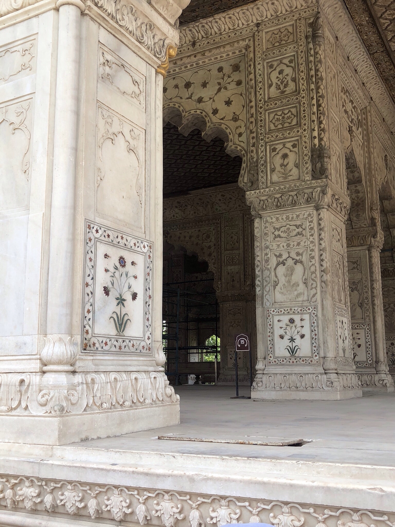
Our departure from Delhi was not until late evening, meaning that we had a full day of adventure ahead of us. S’s flight was even later than J’s and mine. So on the advice of the concierge at the Ashok Country House we decided the Red Fort was the appropriate destination. By now we had realized how little we really knew about the history of India so we were prepared for anything. But the Red Fort truly was like something out of the The Arabian Nights.
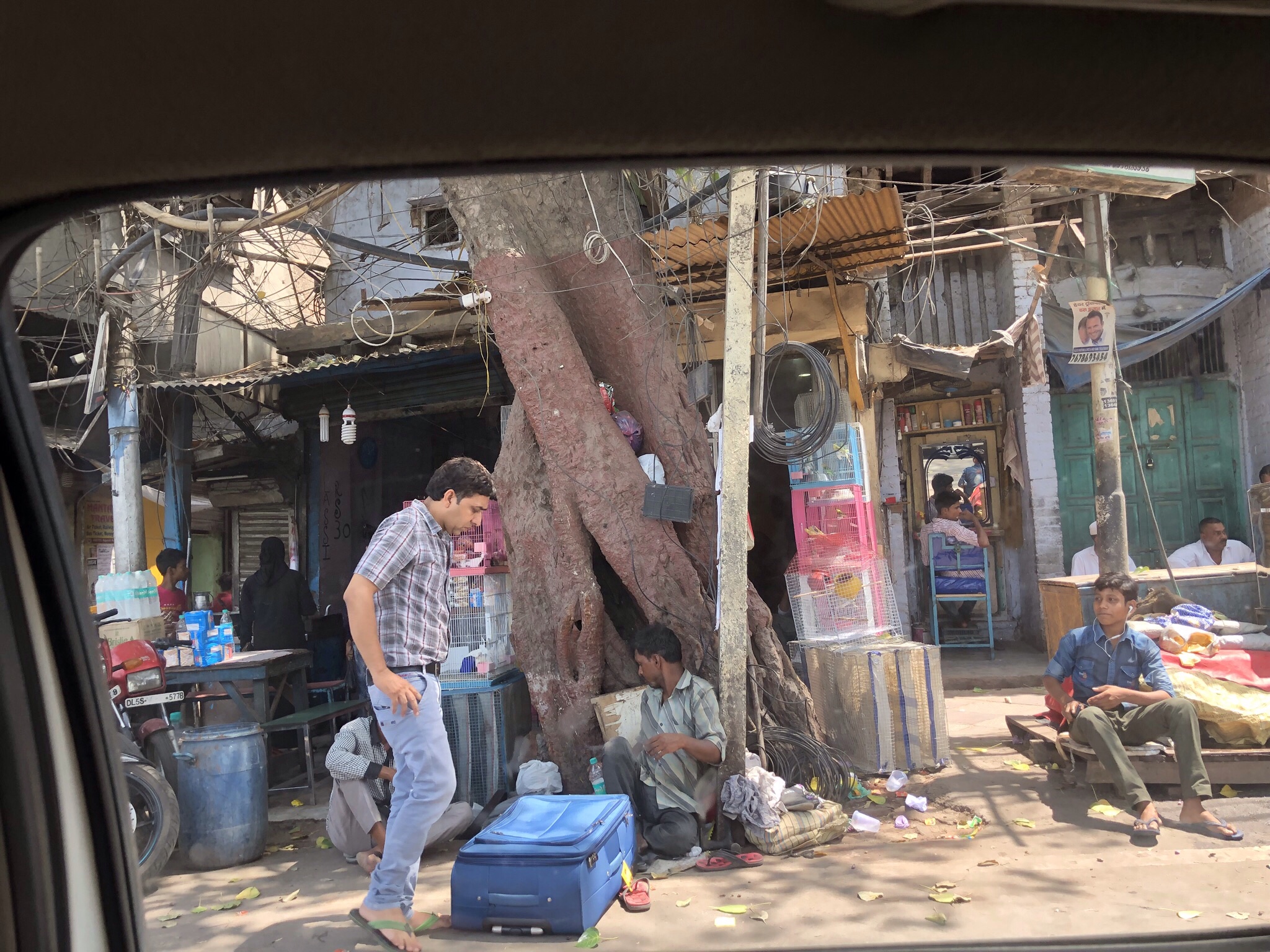
We took an Uber (talk about creating a continuity of experience in any culture…) along beautiful boulevards, interspersed with crumbling shopfronts and people camped in every little open space. After 40 minutes, we arrived in Old Delhi, facing a long and high red brick wall that seemed to go on forever – especially in the 102 degree F heat. Now we had to find the entrance, which we presumed was somewhere behind the numerous military checkpoints. There were very few Westerners, and seemed to be no Americans at all. I located one European looking man in a pastel shirt who vaguely looked as if he knew what he was doing. We followed him up to the ticket counter and through even more checkpoints into the Red Fort itself. Once again, men and women were separated into two queues, so I proceeded along in solitary splendor as J and S veered off in a different direction until we’d gone through metal detectors, pat downs, and bag checks.
The Red Fort was built in the 1600s by one of the Mogol sultans, and destroyed by the British. It’s now undergoing a major reconstruction. You enter through a large gate into an arcade filled with small shops selling everything from scarves to curios to jewelry. So overwhelming we didn’t even attempt to buy anything. You then arrive at the main campus, which I can only describe as Aladdin-like. A throne room for public audiences; a spectacular mosque with delicately inlaid red jeweled flowers on white marble. The whole area is about 2 kilometers in size.
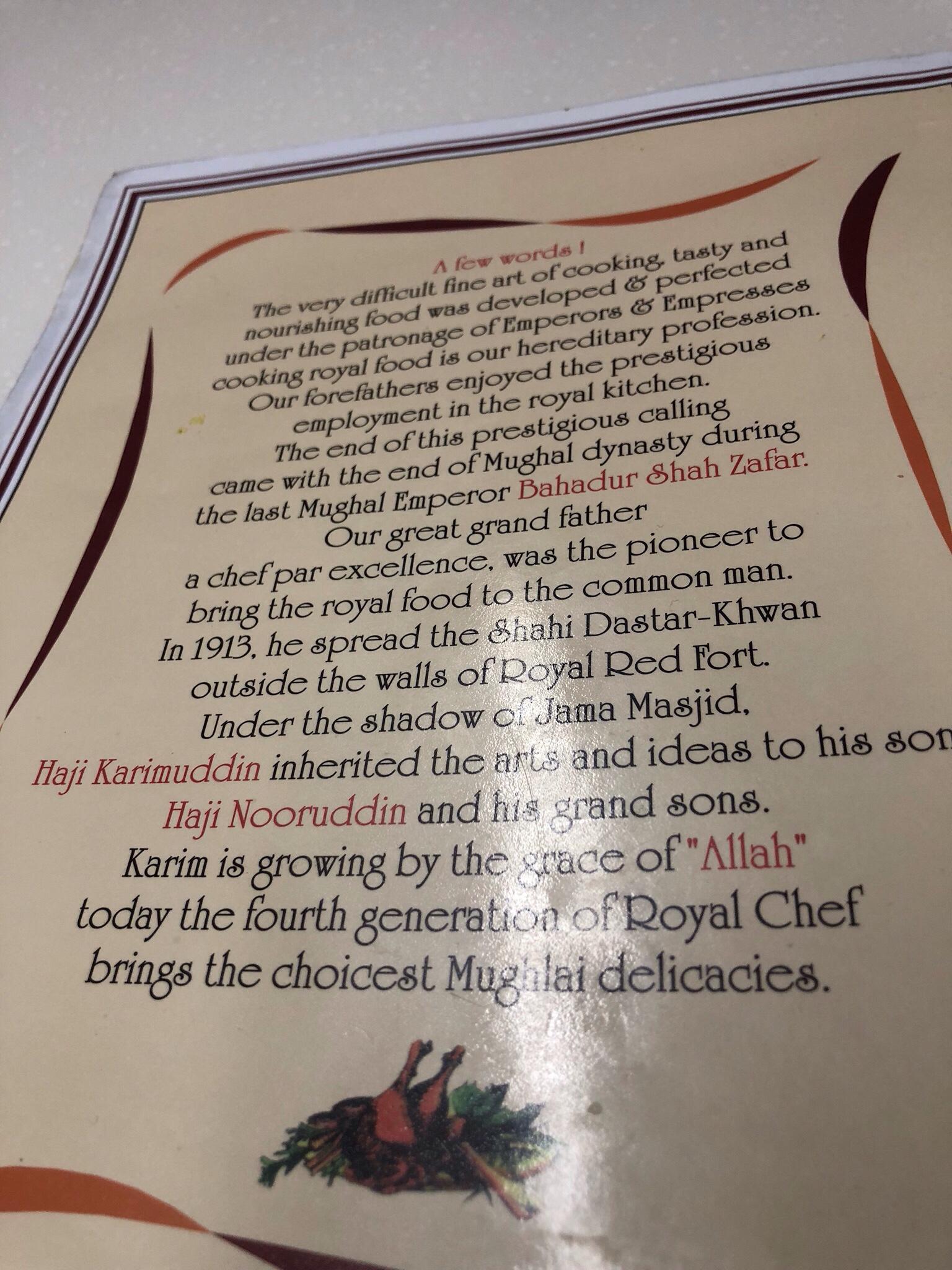
After several hours recreating the world of the sultans in our mind’s eye, we were ready to fortify ourselves with a 21st century lunch. I’d read about a Mogol restaurant that dated back to 1913 that was supposedly run by the descendants of a chef to the sultans. We tried to walk there from the Red Fort, through reams of people, beggars, salesmen, and just occupants of the city. We eventually figured out Google Maps was taking us in circles, and I was still dealing with a swollen and numb foot – so we swallowed our adventurers’ pride and hailed a motorized rickshaw type thing. I showed the driver the address on my phone, and along we went though narrow streets only to be dropped off at what appeared to be a literal hole in the wall, but turned out to be a warren of interconnected restaurants. Yes, it was a little Alice in Wonderland-like.
To call it informal was an understatement. There was a sink at the entryway for washing up; we were then ushered up a short flight of stairs to a small and blessedly air conditioned room with five tables. Once again – we were the only westerners. I had mutton Muglai – a stew that was remarkably hard to eat with only a spoon and nothing to cut with. Plus, I felt so filthy by then that eating with my hands didn’t seem like a good idea – nor was I convinced that washing up with Delhi water was going to assist with any standard of cleanliness. Nonetheless, we managed. J had a superb chicken tandoori and S roasted mutton. Really good rice and nan and I don’t think a Coke has ever tasted so good as it did on that hot day.
We were worried about getting back to the hotel in sufficient time to get our transfer to the airport especially given some of the challenges of getting around Delhi. We walked past a man carrying what was (at that point) a live rooster, spice shops, a live bird market – and miraculously were able to connect with our Uber driver.
S still had his hotel room for another night (it turned out his flight left at 2 am that night, not 2 pm the next day as he had thought!) so we were able to shower off some of the grime from the 100 degree day before heading off for our flight to Dubai and then onto Orlando.
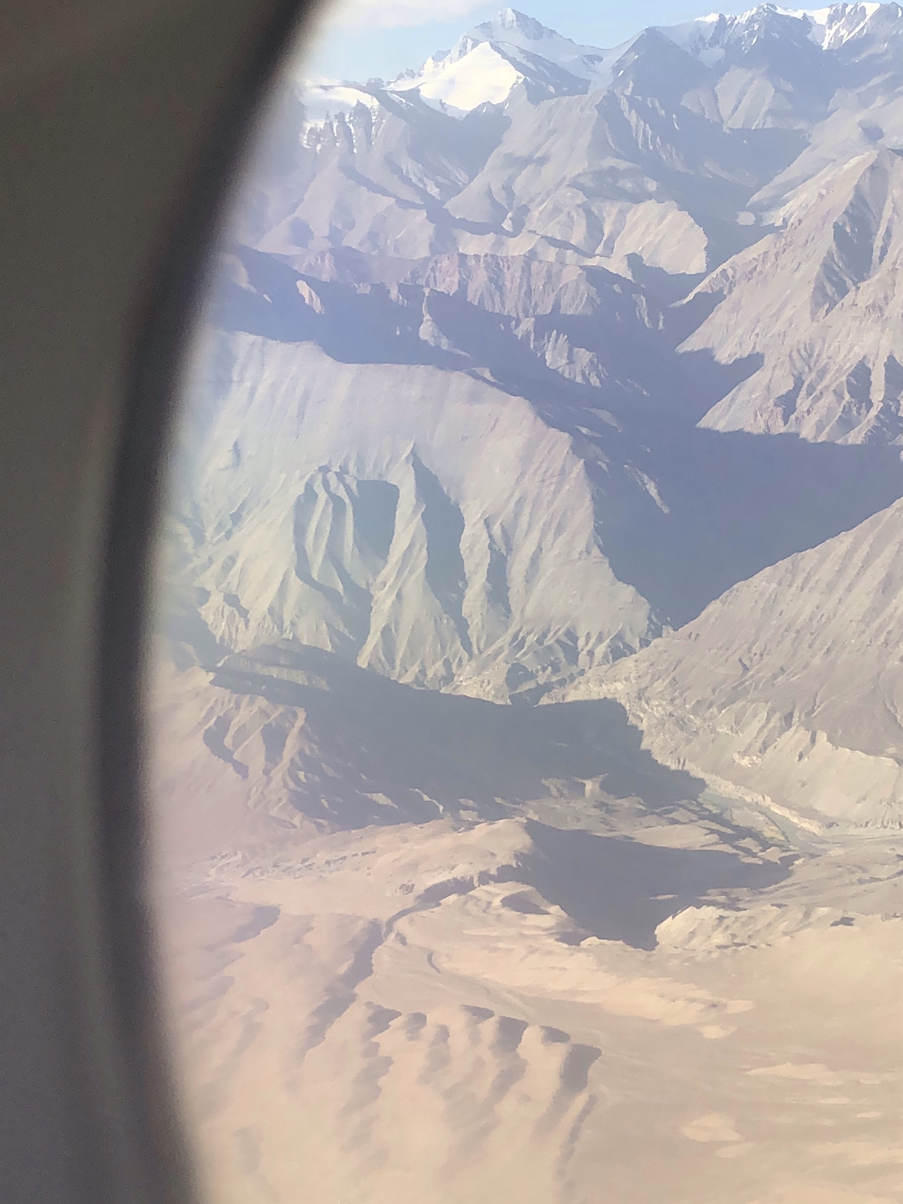
We’d traveled up 20,000 feet by foot to get to the top of Stok Kangri. As our flight took off I looked out the window at the puffy clouds as we topped that height. Had I really climbed there, into that level of the stratosphere? I had–into that cotton, light, hard fought, rocky, grey and white, jagged, damp and dry, foot upon foot, part of the world. Usually you only see 20,000 feet from the window of a plane. But to reach that altitude on foot meant every inch had a special meaning. From the horses that carried our bags, their bells clanging as they looked toward their home villages, to the shrines with the yak skulls ashen in the hearths, to the rainbow colored prayer flags sending wishes into the winds….20,000 feet now evokes an infinite number of memories.
It’s now the end of September and about two months since the wrap up of our Stok Kangri expedition. I’ve described much of the trip in a circular fashion – I started with the trek, the summit, and descent, returned to the acclimatization days in Leh when we first arrived – and now I’m the point to conclude with the trip’s real ending, our stay in Delhi.
After the death march down Stok Kangri, one fell swoop from the summit to Base Camp to Stok Village, we ended up back at the Hotel Mogul in Leh at 10:30 pm, with a 4 am wake up call for a 5 am flight to Delhi on Go Air. We said good bye to our patient guide R, and were off to the airport, rejoined now by our three fellow trekkers who hadn’t made the summit attempt. So our ranks were back up to 10, if not the original 11.
The flight over the snow covered mountain ranges was spectacular. Once in Delhi, we were met promptly and were back at the Ashok Country Resort by mid morning. After catching up on emails, we had lunch and then seven of us went off on the Delhi City Tour. Three of us had had enough and spent the afternoon touring various bars!
Feeling scholarly, J, S and I took the tour route. Unfortunately I decided to wear shoes that seemed like a good idea at the time but turned out to be exactly what you shouldn’t wear following 21 hours of trekking. By the end of the day, my left foot was the size of a melon, and I’d managed to compress a nerve on the top of my left foot (an injury that is still plaguing me even today).
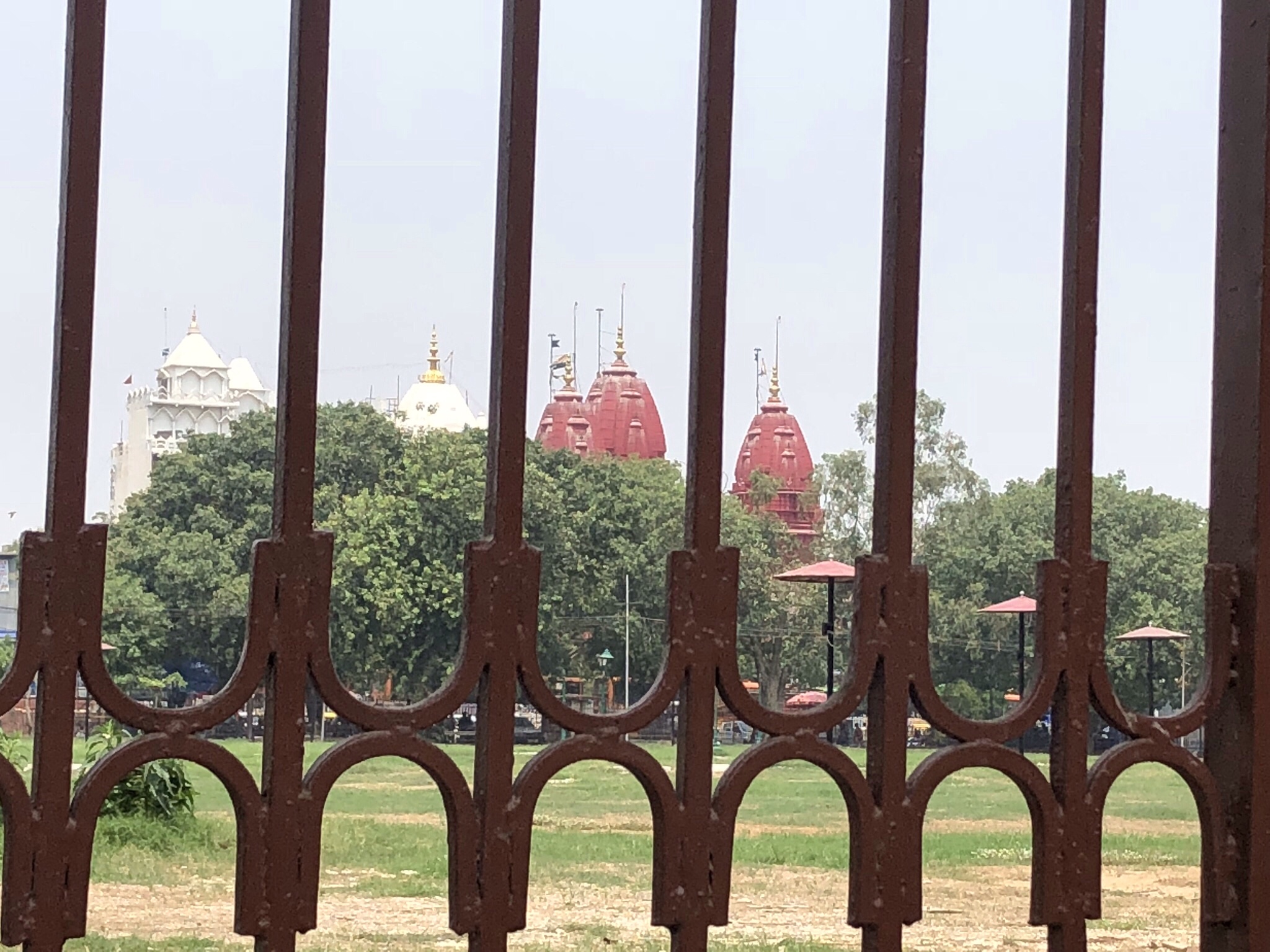
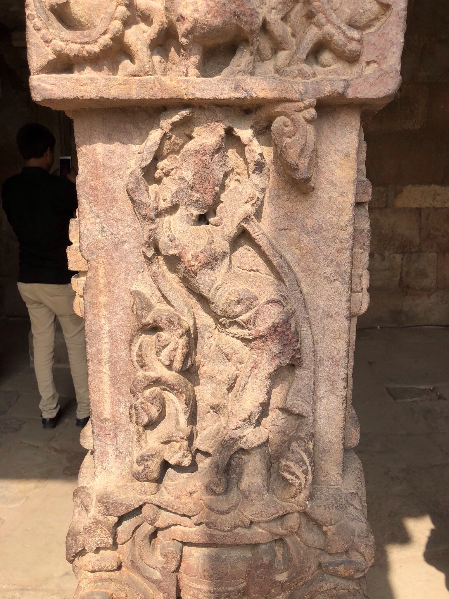
That afternoon’s tour, led by a very enthusiastic tour guide, started with a trip to a monument, whose name I failed to memorialize, built by the Moguls atop a destroyed Hindu temple. The Moguls had defaced the eyes from the intricate Hindu carvings of men and women, but ironically, left intact their bodies, all carved into positions of the Kama Sutra. Next up was India Gate, a 20th century war monument. It operates as a free park for Indians and was packed with people picnicking in the red hot dirt, with very little grass. It was supposed to be the monsoon season, but the rains are getting later and later, and not a drop of water did we see.
We finished up with a drive through the “White House” area of Delhi. This is where the British and Indian governmental officials lived. The dusty streets of Delhi suddenly shifted into something that all but resembled a gated community here in Florida. Wide, tree-lined boulevards with low slung white houses behind fortified walls. You could imagine the governmental elite, all drinking gin and tonics, oblivious to the world a quarter mile from their doorsteps.
We made our way back to the hotel, where our own gin and tonics awaited by the pool. There was one last day ahead of us. The adventure to the Red Fort awaits.
The first night in Leh – our night’s sleep was punctuated by the sounds of very loud people in the hotel courtyard, followed by a heavy rain storm and a cacophony of barking dogs. I quit trying to sleep at 5:30 a.m. Breakfast finally started at 7:30 – eggs to order, poori, chick peas and corn.
That day, Tuesday, our second in Leh, Ladakh, involved a two hour drive along winding roads cutting through the mountains and following the river to the Alchi Monastery. A few villages along the way but the main outposts of civilization seemed to be multiple military bases.
The oldest parts of the monastery were 1000 years old, and show Mogol influences – before conversion to Islam. Our guide R gave an interesting description of his brand of Mahayana Buddhism. We had a typical lunch at a restaurant at the monastery – cheese in red sauce, potato curry, dahl, local vegetables.
Along the way was the remarkable view of the Indus River merging into another – the Crest toothpaste like blue into the murky brown. Especially notable were the carved signs of the road construction companies advertising their work.
After we returned from the monastery we had some down time until 5:30, when we met up with R for a short acclimatization walk to the big stupa at the edge of town. After a climb up 500 stairs, we were rewarded with a great view. And to reward ourselves further we ventured to “Food Planet,” a roof top bar where people who weren’t worried about their VO2 levels could order hookahs.
Wednesday started off on a sad note as one of our trekkers, V, encountered some medical issues that resulted in his having to return to the UK. And two others, M and M, were off at the doctors for colds! A bit daunted by the early reduction in our ranks, we took off on yet another acclimatization hike. Wove through crowded streets and alleyways by very large houses, many of which were under construction. Because of the weather, construction can occur only during the summer months. Spent quite a while watching the outdoor assembly at an elementary school.
Finally we broke from the road and went up a very steep trail, with switchbacks up to the top of an over 13,000 foot mountain. There are so many such peaks here they don’t even bother to name them.
I was steady but definitely the slowest – felt the altitude a bit. We were going rapidly and I felt I did ok. There were actually two summits with some fun scrambling in between. And coming downhill was great.
These early hikes are so odd – you can tell the guide is continuously evaluating you- not just to make sure you’re ok at the moment but to get a sense of how you’ll do when you are really at altitude and facing the summit and whether you’re ready.
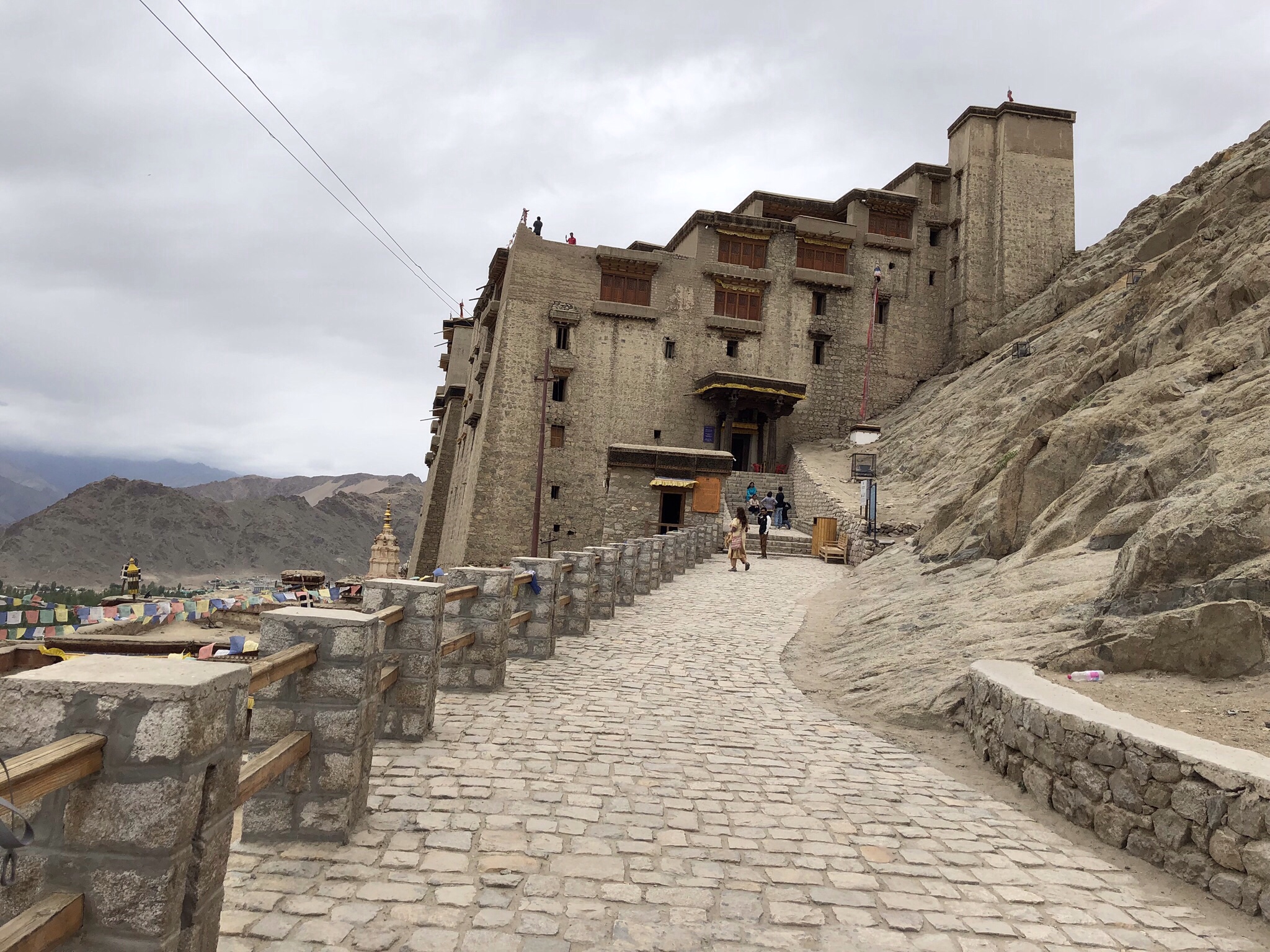
We re-entered Leh by the 16th century Ladakh palace. A very plain, large fortified structure now empty. The current “king” of Ladakh – who no longer has any official status – is still alive and lives in a nearby village. Stripped of power but apparently not money.
That afternoon J and had our one splurge and purchased an old, intricate kilim (woven rug). It tells a story – you can see where the weaver started to run out of wool and and misjudged the layout of certain motifs.
One more day in Leh before our trek was to begin….and a day we’d all been looking forward to – a drive to the second highest drivable pass in the world. I was sitting in the front (motion sickness doesn’t improve with altitude). Many Indian tourists who had no acclimatization at all on motorcycles heading up to the pass. And many T-shirts promoting it as the highest drivable pass in the world – with lots of motorcycle graphics. The higher we got the more hairpin turns there were and the less the visibility. I simply didn’t look out the window for large parts of it.
The pass was highly militarized and we had to show our passports to move forward, even though we were still in the same country. We also learned that satellite phones and detailed maps were completely banned in this part of India. So much for my rescue plan at the summit.
We were now at 17,500 feet and it was freezing with light snow. I was grateful I’d dressed warmly and had my hiking poles – those who hadn’t were pretty miserable. After we stopped we struggled up a nearby hill – quite icy and couldn’t go as high as planned because it was simply too slippery.
But what was near the top was a small hut, lots of burning incense – and an oracle – a woman in a purple and yellow shirt dancing around the hut screaming and chanting. It turned out the day was a holy day – the one time a year that the oracle – from a local village – comes to this spot. Other villagers were there to light the butter lamps and pay appropriate homage. I think C from our trip has video. If he reads this he should add it to the comments.
After a very quick tea at the crowded small tea house – where most were huddling to stay out of the cold – we drive back down through a steady rain that only occasionally cleared.
Once back, we had a delicious lunch of momos (dumplings) and listened to R give our trek briefing for the next day. J and I went back to town to pick up some last minute things – amidst the pouring rain in what was supposed to be the dry season.
In the meantime, S had somehow managed to run into a rabbi doing evangelical work in Leh. He got into a conversation about the synagogue his wife attended in Alaska and ended up with a dinner invitation for 10 pm at night. He may be the only American/Alaskan to experience a Lubavitch Jewish dinner in Northwestern India. Just another example of the unexpected things that can happen in Ladakh.
The next day – the true Odyssey started. The one to Stok Kangri- where I started this series – Days 1/2 – The Stok Kangri, Ladakh, India Expedition. But there’s still more left- after the trek, Base Camp, the summit and the Death March down – there was still our stay in Delhi. That awaits.
This title sounds a bit like “Trinity Park, Durham, North Carolina, United States, Earth, Milky Way, Universe,” which I found very amusing to list as my address in middle school. My travel diary for our Stok Kangri adventure – which was indeed to such a remarkably named location – starts this way: “My Fitbit claims it is 10 am but by now we having been traveling long enough I only have the vaguest idea. I believe it’s about 2 am Sunday in Orlando after I woke up on Saturday morning at 2:15 am.”
Kira the cat is uncertain about the backpacks
2:15 am was our planned wake up time. Yes, we were very paranoid about all that could go wrong between our house and the airport for a 6 am flight, not to mention the packing that remained to be done before we boarded our Uber. What? You don’t think it’s a good idea to go to a cocktail party the night before a big trip?
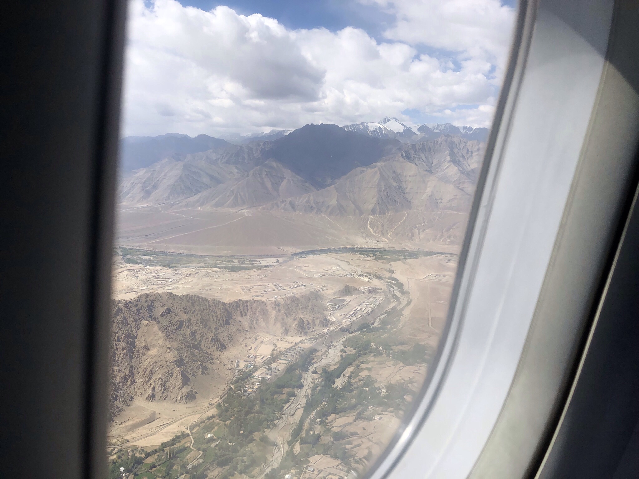
After quite a long wait at the airport – because nothing did go wrong – we made it to JFK, and boarded the same Emirates flight to Dubai that we took last year on our way to Nepal. It was probably the same plane. The flight was full, lots of Indian families traveling back to visit relatives over the summer holidays. I read; watched two movies, including The Shape of Water; and crossed Northern Europe and Russia on the way to the UAE. Fortunately we didn’t have to change terminals this time, although it was still quite a substantial walk to the gate. We boarded our next flight in good time and were on our way to Delhi. Turns out New Delhi is really just a portion of the ancient city of Delhi. Hence the use of both names. For those of you who have asked.
The views upon the takeoff from Dubai are so strange. Canals carved in the desert resembling tattoos.
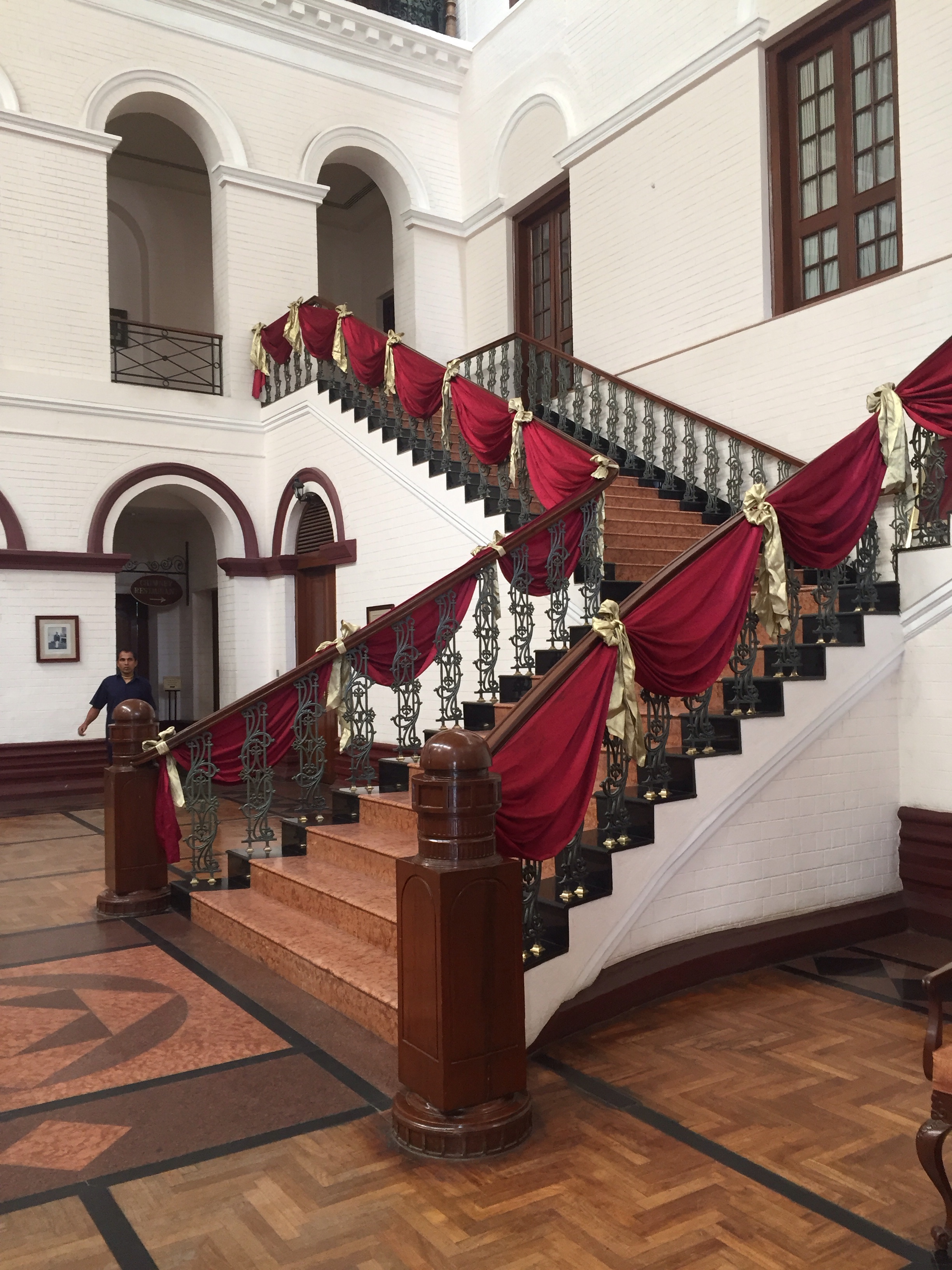
Once we arrived in Delhi we knew to look for the e-visa line thanks to our travel companion S who’d arrived a day before and encountered no queues there. We were duly met by our Delhi group leader and transported to the Ashok Country House hotel. We passed numerous chain stores (like Benetton), all closed as it was Sunday. “Normal” looking stores were interspersed with carts and people selling anything you could imagine. The hotel was dated and a little quirky but perfectly nice, and we went off to the pool to meet our fellow trekkers. It was 112 degrees Fahrenheit. Our group ranged from two 61 year olds down to two 27 and 28 year olds. Four from the US and seven from the U.K. All of us seemed quite compatible and we shared a few Indian beers. We all found it remarkable that the alcohol content was given as a range – a “light,” which was “up to 5%” or a “strong,” which was between 5.2 and 8%.” Did that mean a light could have 0?
Our wake up call the next day was 4:30 am and we were off to the domestic airport in Delhi for the hour and a half flight to Leh. In contrast to Katmandu, there weren’t any monkeys at the airport, though. See Leaving for Lukla or Monkeys in the Airport. I think we were the only westerners in the entire plane. At the Leh airport we met our guide, R, who was from Ladakh. There is a big military presence – soldiers with scary looking guns everywhere and signs warning if you violated the rules you would not just be shot, but shot dead. You could tell we were near disputed borders. Ladakh was its own kingdom until 1834 and its residents are very conscious of having a separate identity from India. It’s largely Buddhist, and shares a lot culturally with Tibet. The Dalai Lama was to visit while we were in India, over his birthday, no less, and his was cause for great celebration.
Ladakh is very barren, a high plateau landscape. A few planted fields separated by poplar trees. Our hotel, the Hotel Mogol, had a rooftop cafe, a restaurant, and our room was large. It worked.
Our first day in Leh – which is at around 11,000 feet – was supposed to be spent acclimatizing. One reason we picked this particular guide company was a really good acclimatization plan. We were to have several days hiking around Leh before starting the trek and climb. Day 1 involved lunch, beers, a nap, and a yoga class at the Mahabodhi Yoga Center for several of us. It was remarkably similar to a US yoga class and felt very familiar.
Mahabodhi Yoga Center
Afterwards, we met R for a very rapid stroll to the “market” and the “local market.” Streets were covered with rocks, mud, motorcycles, people, mangy dogs, all vying for a spot. Lots of cafes and guest houses. Leh is bigger than you would think from its population figures, and we were there during the tourist season for visitors from the rest of India. According to R, after Ladakh was featured in a 2009 movie called “3 Idiots,” it became a popular tourist destination – which has brought benefits but also increased trash, not to mention the noise pollution of hundreds of rental motorcycles cycles revving their way along the main streets.
The hotel served dinner at 8 pm. There was hot water in our rooms between 6 and 8 am and 6 and 8 pm. We had another couple of days ahead of us to explore monasteries and visit the second highest drivable pass in the world at 17,500 feet.
Life was good. And, as you’ll see soon, there was to be an oracle in our future.
As I walked home from the YMCA in a torrential downpour, I kept thinking, well, at least this didn’t happen during the death march. But rain is about the only thing we didn’t endure.
You will remember that our summit attempt was postponed a full 24 hours due to bad weather. The repercussion of that delay was that, after summiting, we were going to have to immediately hike from Base Camp down to Stok Village – where we would pick up taxis to take us the 45 minute drive back to Leh. From the summit to Stok Village is over 9000 feet of altitude descent. (It was about 4000 feet of altitude gain from Base Camp to the summit so that gives you some idea.)
The original plan had been to collapse at Base Camp after summiting and have a nice leisurely hike out the next day. Now, only 7 of us remained of our original 11 team members. We were all dedicated to reaching the summit, and we would probably have accepted any Faustian bargain to make it happen. But we really didn’t know what we’d agreed to until many hours later.
Approaching the ridge
After our few triumphant minutes on the 20,387 foot summit – after all, J, S, and I had made it with a whopping 26 minutes to spare before the 9 a.m. cutoff, came the dread realization – we had to get back down.
To be perfectly honest, I think I’ve lost the memory of the first hundred feet or so down. I presume we went back down the ridge; I do recall being very anxious about locating our backpacks, which we had discarded somewhere below. We obviously found them but I truly have no memory of descending what I had found such a difficult climb on the way up. All I know is it took a really long time.
After we got our packs, we faced the descent of the very steep snow field. Somewhere about then, my contact lenses, which had done oh so well up until that point, decided that 20,000 feet of altitude was not compatible with staying planted on my eyes in any way that enabled 20 20 vision. Hence, my call out to J that my distance eye (I have mono vision) was out of focus and I couldn’t see. I loathed having to stop, but eye drops were a necessity. After successfully managing to squirt some in each eye, we started off again – we were still roped and trying to get a rhythm for the way down.
S told our guides he thought I should go first, based on our Elbrus experience; after all, the three of us had been on a rope together before. I’d also been the first going down Cotopaxi and Orizaba. For some reason I’m good at setting a downward pace on a rope. But our Sherpa guides were having none of it and classically put me in the middle with J in the front and S behind. Needless to say – it wasn’t ideal. J was moving too fast; he’d have to slow down; I’d be too fast and he’d take off again to be too fast all over. Several falls later and I had a few large bruises on my backside that were to be with me for a while.
Finally we reached the snow slope above the glacier and our guides seemed to think we were best off unroping, taking off our crampons, and cross crossing the glacial moraine. I swear they were looking for the trail themselves and I’m certain we made a few needless forays across the rocks on the way down. At that point it was clear we were going way slower than we should be. By then I’d given up on my left contact and was hiking with my eyes completely caddywampus. Should I try to go fast and risk the twisted ankle or just keep on at my own tortoise like pace? I chose the latter.
Just about then, after some consultation in Nepalese, one of our guides took off with S to go much quicker down the moraine. Think dry river bed with huge cobblestones. Moraine sounds kinder than it was. J and I stopped with our other guide for water, some Gus (me) and some of our packed lunch (J).
Back up we got and off again. One of our guides took my pack – the ultimate ignominy but I kept remembering that J gave his pack to a porter on the Kilimanjaro descent and I didn’t. So I felt I could justify it (not to mention that simply Increasing my odds of surviving the descent seemed like adequate justification by then). We finally reached the glacier and toward the other side, near the old and now unused high camp, saw some of the kitchen crew who were waiting for us with drinks.
We were now about 6 hours or so in the descent, and our main guide, R, had hiked out to see what was going on as we had been so slow. He knew we’d summited in an adequate time – and hadn’t anticipated how long it would take us to descend and was concerned something really bad had happened. He was soon to learn it was just intrinsic age 57 year old slowness! J plowed on with one guide, quite a bit ahead of me, and I walked with R. By now the bizarreness of my out of focus eyesight was getting the worst of me and I put my glasses on. While the contact issues were gone, my glasses are progressive lenses. Thus, I couldn’t look down – I was relegated to the top third of the lens as there was little need of the mid lens computer view where we were, much less the reading portion.
Walking with R, I suddenly realized how incredibly steep what we had climbed up was. It was probably much better that we’d done it in the dark, as it was almost inconceivable to me what we’d climbed. Finally we were back at the prayer flags at the bit of the summit trek that we’d climbed so successfully a couple of days before and could see Base Camp below us.
All would have been well and good, had our adventure stopped there. It was about 2:30 pm or so; we’d been going for about 15 hours. I’d survived on about 5 Gus (I still love those things) at 100 calories each. J had only had some energy blocks and a hard boiled egg out of the packed lunch.
Remember that plan about trekking out the same day? Well, when we reached camp most of the tents were already disassembled. Needless to say, we were the last of our team members. We had about an hour to pack up our tent and participate in the tipping ceremony – which we had single handedly delayed due to our slow descent. Anyway, by about 3:45- 4 we all traipsed off to start the final descent to Stok Village. There we were to meet cars that would take us the 45 minute drive back to Leh. We had an 8 am flight back to Delhi so not getting there was not a choice.
We all took off at once and immediately broke up into about 3 or 4 groups. Super Amazon women J and A were in the front, C and S tag teamed down, I’m not sure where P was, and J and I were convincingly in the rear.
We all knew it was 13 plus kilometers but somehow we had all translated that in our head to a 3 hour hike out. Oh, so not so.
First, we were back on glacial moraine. Somehow the workers from our crew (not to mention the horses) who’d now finished their work could simply fly down the rock on heir way back to their villages. Not so for us mere mortals. Plus, at least at the beginning, I thought Stok Village was going to be around just the next corner and saw no reason for any hurry.
But as the shadows grew long, and one of our crew passed us and offered to carry what at that point was a pretty heavy pack because, as he told us, we had several more hours to go – I realized my time estimates were way off base.
We had descended to the region of the brown serrated mountains – which cut against the sky like knife blades. Evening was falling and the only people we saw now were workers from the camps happy to be going home. They were moving at the twice our pace.
R had stayed behind at camp to see to close out issues, but fortunately caught up with us. So, our little band was J, a non English speaking kitchen helper who’d been sent off with us originally, me and R. I asked if we needed our headlamps and R said no but about 30 minutes later that changed. Luckily I knew where mine was – J’s was mashed in the bottom of his pack and he ended up having to use R’s. R ended up using the flashlight on his iPhone.
We were supposed to only be walking downhill, which is why the hike out and summit the same day didn’t seem so bad. But it was so late that the river was high and we had to scramble up a significant bluff – and descend it – to be safe.
By now we’d been going for 18 or more hours. I truly felt I was sleeping while standing. It was all I could do to put one foot in front of the other. The sole of my hiking boot had blown out and I had absolutely no faith in its tread. It was slow, slow, slow on slippery sandy dirt on the way down the bluffs by the river.
We’d waited for the twinkling lights of Stok Village for so long that when we finally saw them I thought it must be a mirage. For the first time ever, I felt what it must have been like in the Middle Ages for travelers to see some signs of human habitation glowing in the midst of a pitch black night. We’d been wandering in the middle of nowhere, with no choice but to keep walking. I kept wondering if there were actually wild animals out there. But even during the most miserable bits, I was conscious of what an amazing experience this was and felt profound gratitude that I was experiencing this time and this place.
Finally, the wilderness morphed into what appeared to be a more formal trail. We passed small houses under various stages of construction and walked through what seemed to be a construction site. We crossed a meadow where our horses – or somebody’s horses – were eating. We passed a home stay guest house.
And then, miraculously enough – the van appeared. It was loaded with our teammates’ duffel bags and had just room enough for R, J, and me. Our other guide had long before peeled off to go home.
It took 45 minutes to get to Leh. We arrived about 10:30 pm. Wake up time for our flight to Delhi was 4 am.
Summit of Stok Kangri in the distance with Base Camp below
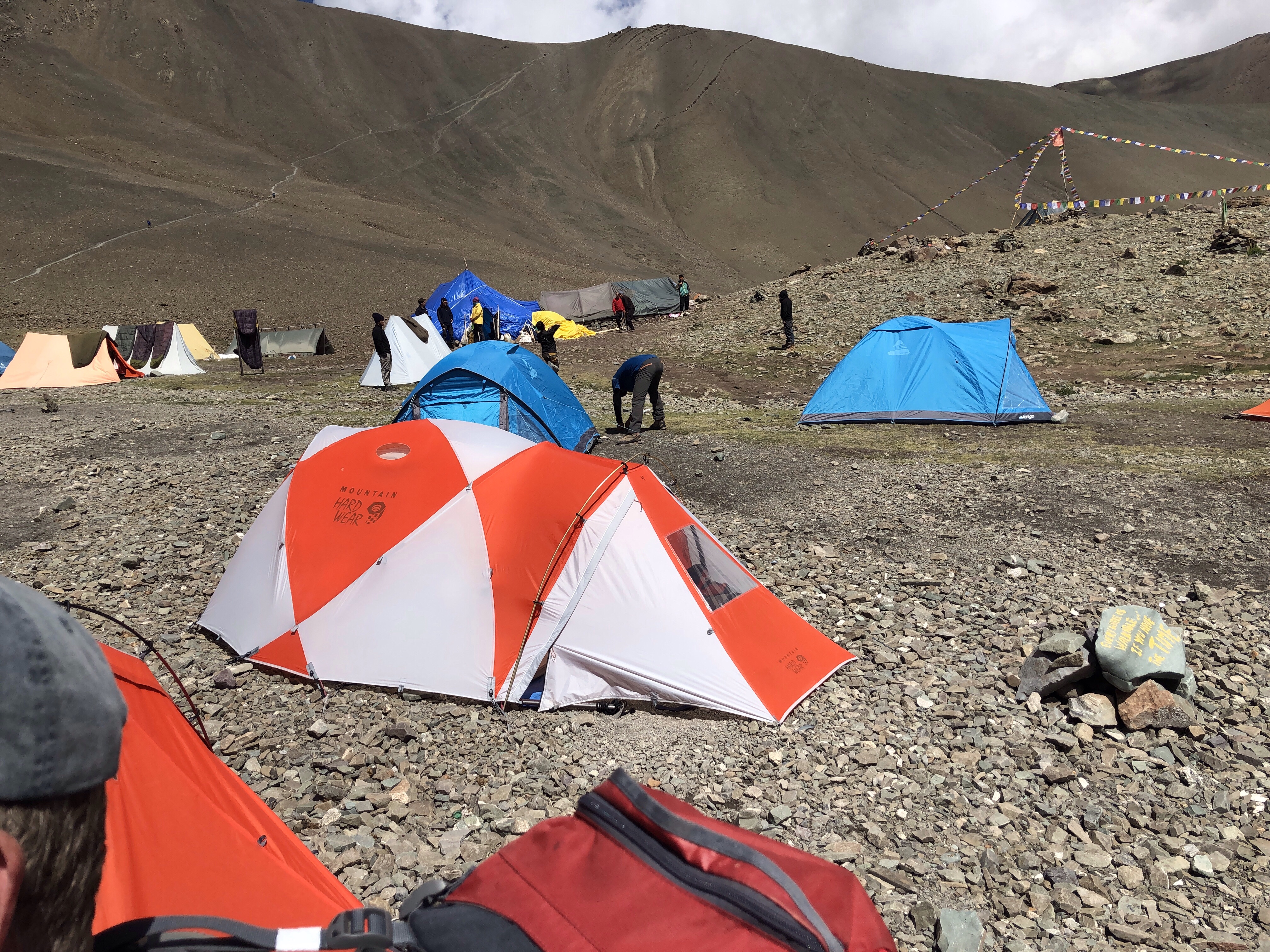
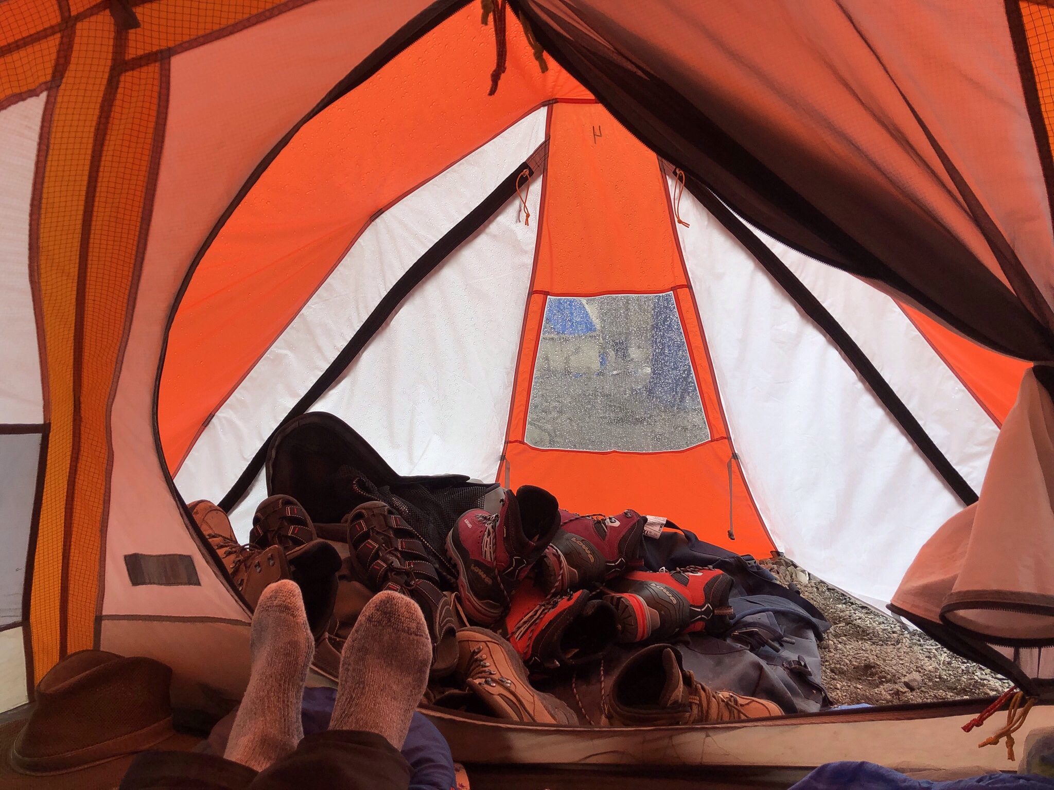
Now that we had made it to base camp at approximately 16,400 feet, the waiting began. The afternoon we arrived we were sent off on a very steep hike up the beginning of the summit trail. Our guide assured us this would actually be the most difficult part of the trek as we’d be doing it in the dark and the cold, so it was a good idea to know exactly what we were in for. It turned out to be a steep dirt trail with decent exposure, but quite doable – at least in the daylight. Plus, it appeared a flat stretch immediately followed, which would hopefully give some incentive to keep on going.
In the meantime, our ranks were dwindling. IB developed an upper respiratory infection and left to hike down to Stok Village the day after we arrived at base camp. M and M started to feel the altitude and after the delay in our summit schedule (more on that below) also decided to make the trek back rather than attempt the summit. This left J and me as the two most senior members of our band of would-be summiteers.
Base camp was bizarre. Lots of tents and any number of other groups, all with varying degrees of acclimatization. A lot of people attempt this mountain woefully unprepared.
There was a tea house selling beer and sundries – I never actually saw the inside; somehow I got it into my head that visiting it would undo everything I’d achieved in the past week and impede my chances of a summit. Such fears didn’t deter a few members of our group who came back with lots of stories about the characters they had met there – some of whom seemed to be suffering from the early stages of altitude sicknesses or else were just genuinely odd people.
Base camp was also home to a collection of toilet tents which kept getting moved to higher locations such that it was a hike even to reach them. Speaking of which, the ecosystem at the base camp is simply unsustainable. There is an entire area pockmarked with latrines now filled in with dirt and rocks – you have the sense that at any moment your boots could go crashing through into who knew what nastiness below. Think toilet crevasses.
With that charming image in mind – what else happened at base camp? Well, the plan was to rest on day 2 (July 4) and take off about midnight that night. But the weather gods were having none of it. After our walk up the initial portion of the trek that first day there, the weather turned very on and off, with sporadic showers of what can only be described as snow pellets – small round almost gravel shaped things. I felt a long way from Florida.
The next day, July 4, did not greet us with any better weather. It was foggy all day, with intermittent snow and hail. We were supposed to be resting and there really wasn’t anything else to do anyway. We began to gauge visibility by how many horses you could see on the mountainside. In the morning we did some rope travel and crampon training but we basically didn’t move all day, and I was finally starting to feel I’d had a lot of sleep.
By mid afternoon the snow had started to accumulate on our tent and we heard that many groups had decided not to attempt the summit that night – by then you could hardly see your hand before your face. Apparently one group made a different decision and a 29 year old trekker died that night up on the mountain because they couldn’t get him down after he started to experience serious altitude sickness.
We carbo loaded that night with delicious Nepalese dumplings (momos) but with the knowledge that if weren’t awakened between 11 and 12:30 am we would not be going that night and would have to use our buffer day for the summit attempt. Camp was crowded and you could hear horse bells clanging and conversation all night but we slept anyway. At 12:20 am R came by to confirm. We weren’t going and breakfast would be at 8. It was a relief simply to know, one way or the other.
This put our departure on the night of July 5 and summit attempt on July 6, the Dalai Lama’s birthday, so we all hoped for an auspicious day. In fact, the day dawned beautifully and conditions looked great. However, we knew we were in for a long haul because we were going to have to hike out to Stok Village the same day as our summit attempt. More on this later.
That morning we hiked up to about 17,400 (1000 feet elevation gain) just to get ourselves moving. Quite steep but confidence building. Tents were nice and warm and after another huge dinner we settled in to sleep for a couple of hours before our 10:30 pm wake up, trying to ignore the sounds of the pick up cricket game nearby.
Eveyone was tense as we gathered for “breakfast.” J, S and I were in one group and the faster (and younger) climbers were in another. We’d packed and repacked our packs and slept in our base layers (for the second night) so we were ready to go. I ate one of the thick pancakes, little realizing that would be the last solid food I’d have for over 24 hours.
We trekked more or less as one group up to what used to be the high camp. If they still allowed camping there it would have made our day much easier! We then split into our two groups. We were trekking in the dark, so you couldn’t see the exposure and only felt the steepness.
After a couple of hours, we eventually reached the glacier – it truly was a relief to suddenly get to a nice flat area. But on the other side was a very steep snow and rock slope – we stopped at the rocky area, to put on crampons and harnesses and rope up. At first our guide wasn’t traversing but just forging straight up the side of the mountain – but I think he then realized we (or at least I) needed an easier S curve. Next came a series of upwardly sloping river beds (more of that pesky glacial moraine) and steep rock climbs up. There was really very little snow by that point. The air was thin, and getting into a steady rhythm of breath and step and climb and breath was critical.
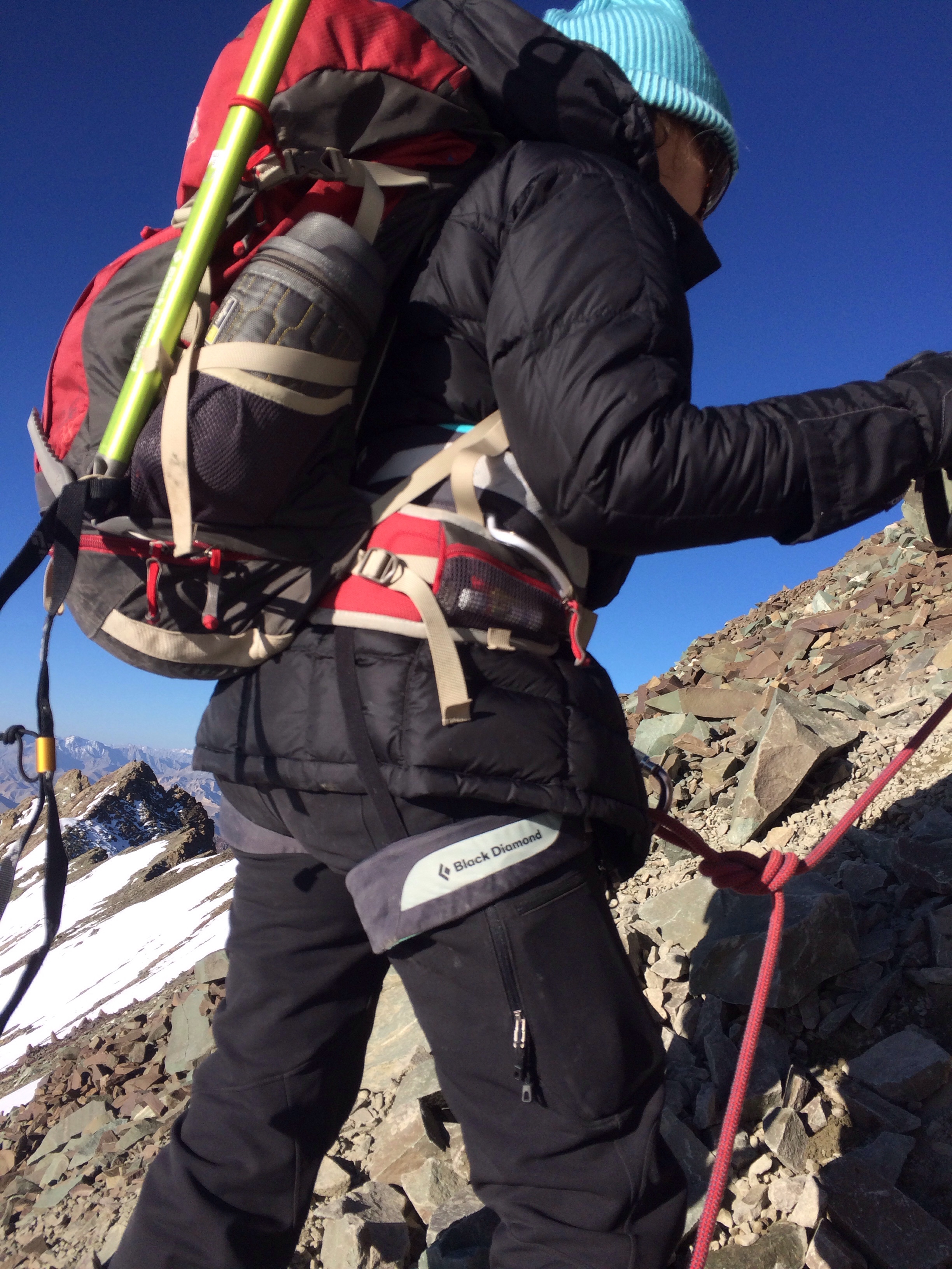
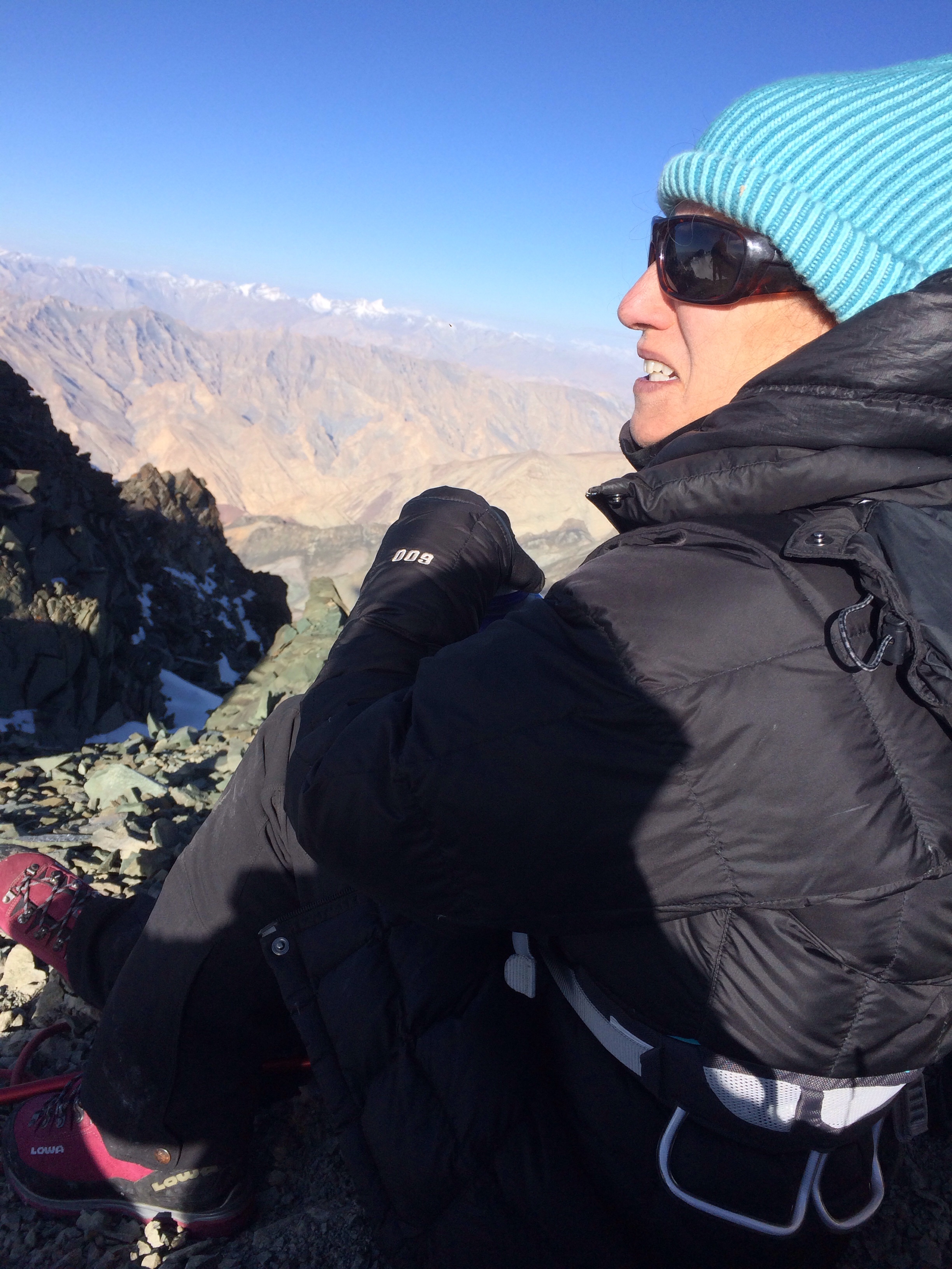
The sun was rising as we approached the ridge, and there was a spot to drop our packs. There’s a high level of trust at over 19,000 feet. For some reason I had thought the ridge would simply be an exposed path nicely meandering along the mountaintop to the summit. To the contrary, it was a series of jagged rock formations, each of which had to be climbed up or around. I could never figure out which the super steep wall was supposed to be because they all felt equally damn steep!
At a certain point S looked at his watch and we were already at 19,600 – 300 feet above our prior best on Cotopaxi in Ecuador. Somewhere along the ridge we passed the other group returning – all had summited, although they, like us, were all looking a little the worse for wear. It was now about 8 am and we’d been climbing for 8 hours. R said if we weren’t at the summit by 9 we’d have to turn around.
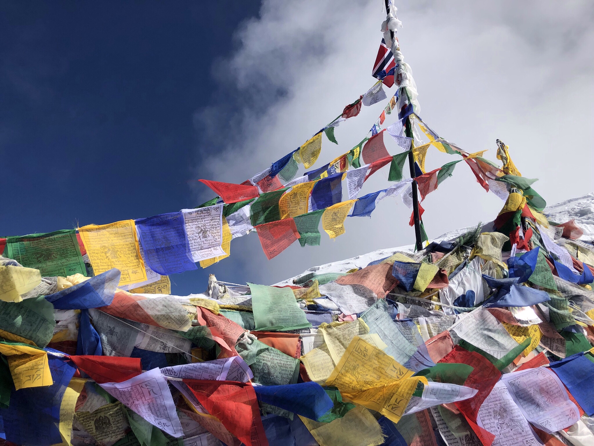
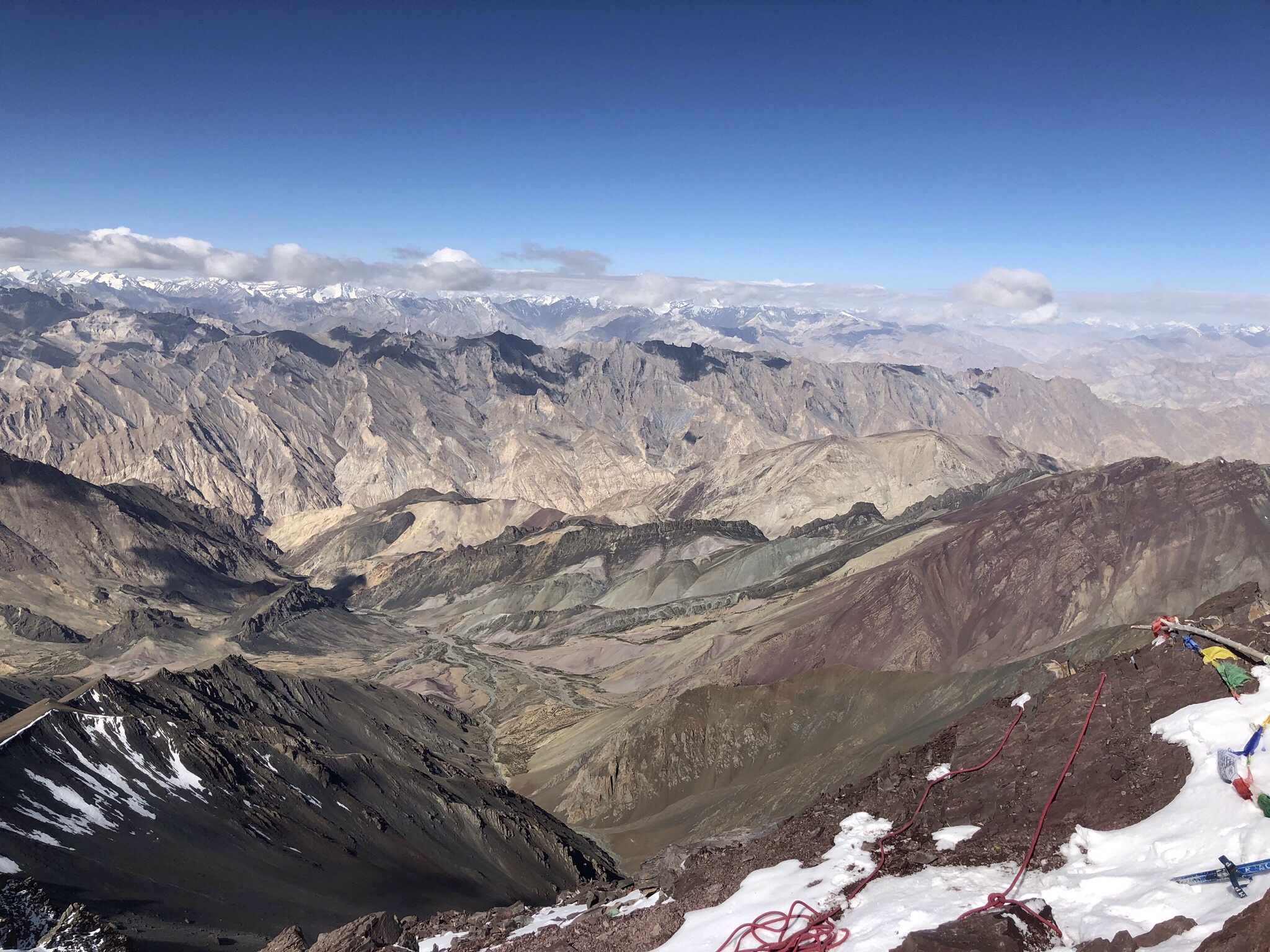
That gave all of us, including our two Sherpa guides, the impetus we needed. They set up safety ropes into a series of what S called running (or free) belays, and with their good guiding skills we made our way up, by hook and by crook. We reached the summit with 30 minutes to spare. J, S, and me. About 8:30 am and all 20,187 feet of it.
Sitting on the summit
It was clear and blue and turning to cloudy. The prayer flags flapped their brilliant primary colors, sending mantras out on the winds for all to to receive. We had done it.
But, as we all know, what goes up must come down again. And what a descent it was. The adventure continued.
When I last left my readers, we had camped at both Shang Sumdo and Shang Phu. Day 3 of our trek, which went over two passes to Matho Phu, was reputed to be the longest and most difficult, barring summit day itself. (Spoiler – summit day was immeasurably harder!)
We were forewarned, but that doesn’t mean forearmed! Three of our ten trekkers had been suffering mightily from an array of ailments, but that day one of them made an absolutely miraculous recovery that lasted him the rest of the trip. Some might credit the antibiotics he had, but I like to believe it was really the chewable Pepto Bismol tablets I was dispensing.
The food created on this trip was remarkable. Carbo loading occurred practically every meal. The night before our long day we were fortified with noodles, potato pancakes, spinach with cheese. The prior night was curry chicken and a tomato cilantro soup. Each dinner started with a thin soup – part of the anti-dehydration technique. Breakfasts all included porridge, followed by pancakes or eggs.
At Shang Phu, I actually slept fairly well for a night in a tent. Our guide R’s promise of the beauty of the hike over the passes was borne out. We gained a lot of altitude on gentle undulating paths, now leaving behind the brown serrated mountains and hiking between green meadow mountains. This is apparently where the horses go to graze when they aren’t escaping back to their villages (as they are apparently wont to do on occasion). At a certain point the trail changed to steep switchbacks going up to the Shang La pass at 16,300 feet. Many small wildflowers between the rocks – periwinkle blue, lavender, and a tiny pink and white one. The color yellow was everywhere. S, whose professional research involves the plant rodiola, even found its cousin here. Speaking of which, double doses of rodiola are apparently not a good idea at high altitude.
After lunch, in a grazing meadow following the big pass, we trekked to the second, lower pass. Frankly, I thought it was harder than the high one. After a climb up, we traversed along numerous, narrow dirt ledges with serious exposture. All I could look at was where my foot would go next – no up or down glances for me! Plant uphill pole, step, repeat.
To top it off, we then reached a fast flowing river crossing where R had to place stepping stones to help everyone across. From there, we were blessedly off the ledges, across a meadow (where a flock of sheep were in a pen), and finally up a last hill to our camp site (Matho Phu at 14,435 feet) and a welcome dinner of eggplant, egg curry, and rice.
We had one more night on the trail before we arrived at Stock Kangri Base Camp, at a campsite called Smankarmo, a little lower at 14,370 feet. The day was slightly easier – we started with a long traversing uphill to a pass (Matho La) as high as yesterday’s. The trek was gradual, so you didn’t realize how much altitude you’d gained. There’s nothing like the high – literal and figurative – you can get at 16,000 feet. It’s gotta be the dopamine.
Following a 2000 foot descent, we veered off the trail to a meadow worthy of the Hobbit. As we’d made our way back to the green stone mountains again, the grass was particularly refreshing. After a long lunch break, we finished the descent- this one was steeper and yet another stepping stone bridge had to be constructed. The campsite had a beautiful view, but for the very first time we had to share it with another group.
Dinner at Smankarmo was a version of a Scotch egg – but instead of sausage, the egg was wrapped with fried potatoes. It apparently reacted well with my sleep schedule – I managed to sleep from 9:45 to 5:15, a record so far.
The trek to Base Camp had quite a few steep sections but was much shorter than we’d expected. J and I reached a collection of prayer flags and just assumed we were at a pass with hours left to go – but no, we were there. About 16,400 feet high – we were at our home for the next three nights.


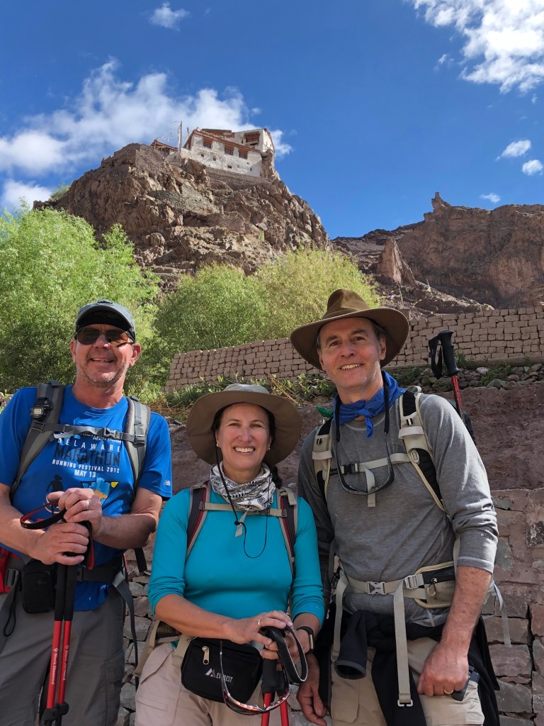


 Acclimatizing outside Leh, Ladakh, India 2018


 Once we arrived in Delhi we knew to look for the e-visa line thanks to our travel companion S who’d arrived a day before and encountered no queues there. We were duly met by our Delhi group leader and transported to the Ashok Country House hotel. We passed numerous chain stores (like Benetton), all closed as it was Sunday. “Normal” looking stores were interspersed with carts and people selling anything you could imagine. The hotel was dated and a little quirky but perfectly nice, and we went off to the pool to meet our fellow trekkers. It was 112 degrees Fahrenheit. Our group ranged from two 61 year olds down to two 27 and 28 year olds. Four from the US and seven from the U.K. All of us seemed quite compatible and we shared a few Indian beers. We all found it remarkable that the alcohol content was given as a range – a “light,” which was “up to 5%” or a “strong,” which was between 5.2 and 8%.” Did that mean a light could have 0?