FromSwamptoSummit has been silent over the last few weeks….but that’s the effect of a brand new grandchild, who shall be known by the initial L, son of A and N. Plus, daughter S and her boyfriend known as T (he plays a starring role in our Basque Country trip back in 2023) just announced their engagement, with a wedding early next year, so that’s served as another distraction.
But my real excuse is that never in my wildest dreams did I still think I would be trying to finish our sabbatical trip write ups over a year after the fact!I still have to write about Orvieto and Rome. And of course, my dedication to fully memorializing our six months of travel means that I haven’t even broached our trip in May 2024 to climb the highest mountain in North Africa (Mt. Toubkal in Morocco). That trip is still residing untouched in my travel journal.
But in an attempt to introduce some temporal reality, I’m going to take a detour to 2025 and current events.
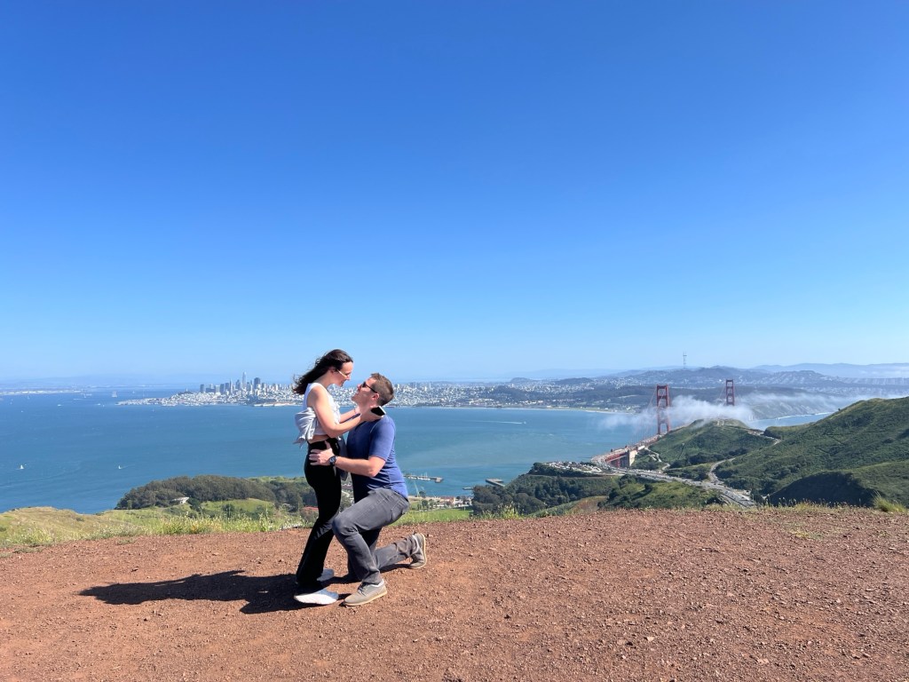
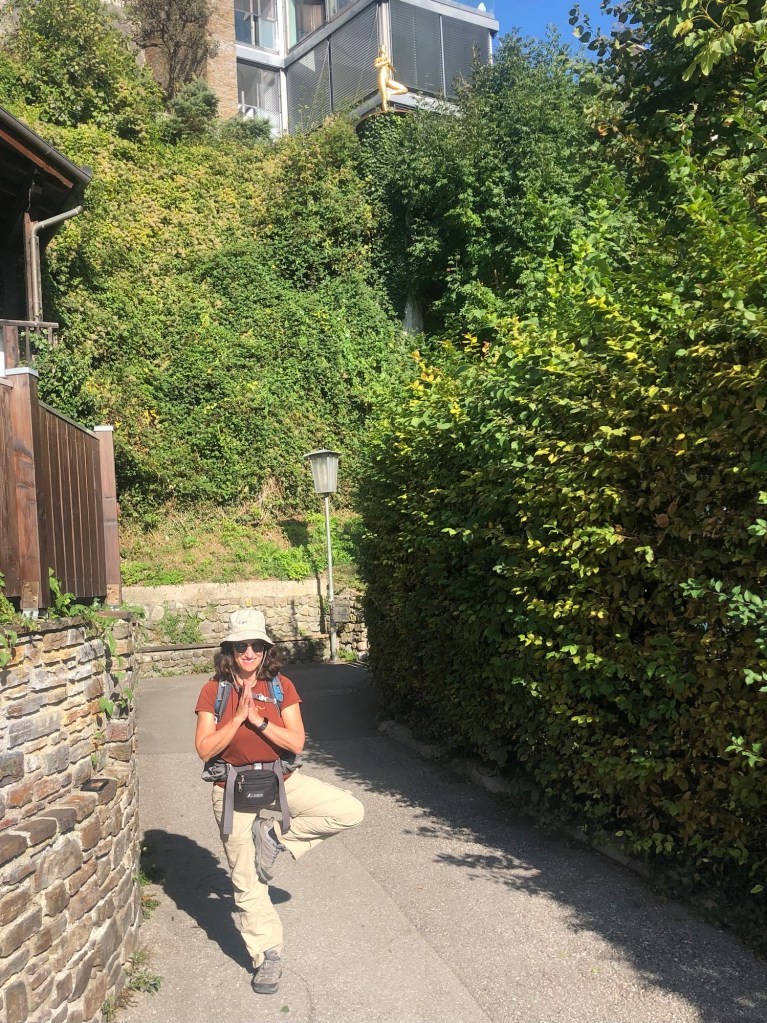
Right now J and I are training with 30 plus pound packs for an upcoming backpacking trip to the Lost Coast in Humboldt County, California. We start off with a few days in San Francisco and Monterey to see family (including the newly engaged couple!). Following that, we have to figure out how to get to the REI in Corte Madera, which is the meeting spot for the backpacking group. REIs seem to be a common meeting place for backpacking groups – we did the same thing when we hiked Long’s Peak in Colorado with a different outfitter.
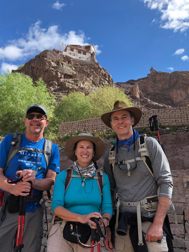
Long’s Peak hike – July 2021
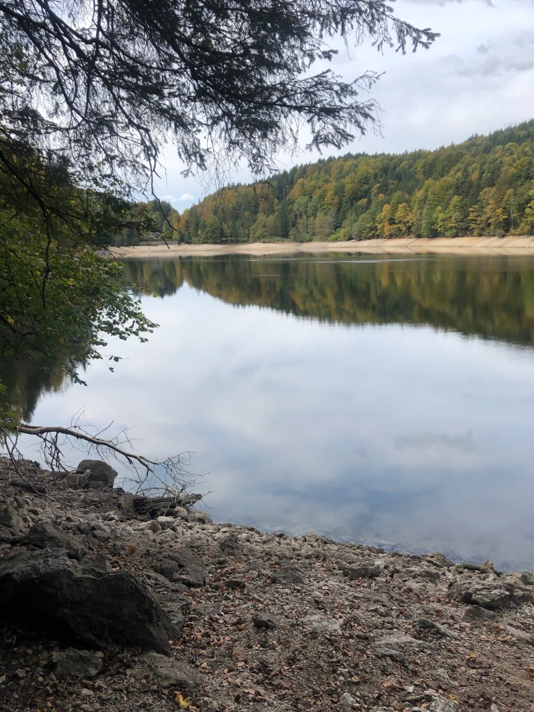
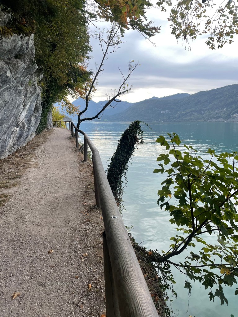
The Lost Coast is about a 4-5 hour drive north of San Francisco. It’s the section of Pacific coastline that was too rugged for Highway 1 – hence, the coastal highway dips inland, leaving a completely remote area known as the King Range National Conservation area.
The hike itself is 4 days and 3 nights, and involves sand walking, rocky beaches, and going up and down dunes and cliffs. One night we camp in a cove that is “locked in” by the high tide.
I’ve always made the point that FromSwamptoSummit is not a water person, despite the swamp in the name. Swamps do contain a lot of earth, I note, which makes them more palatable. But I must admit, the idea of a beach hike has a lot of appeal. For one thing, coming from the swamp of Florida we won’t have to deal with the acclimatization issues that can affect a bid for a real summit. (Wait til I write about Morocco.)
And for another thing, we can actually train for sand walking. A couple of weeks ago we went out to the Canaveral National Seashore to hike in the back country. To get there you have to walk through the farthest end of the public beaches – where, as usual, we were the most covered up folks around. (I will just point out that there is no federal law against nudity.)
But once we got beyond that back country sign – permits dutifully in hand – there were no footprints, and little but sand, surf, and most remarkably, a flock of flamingoes on the sound side of the narrow strip of barrier island. (The photo below doesn’t do them justice. They really were pink and definitely were standing on one leg.)
We’re hoping for some of the same next week. Although I don’t think flamingoes will be in the mix.
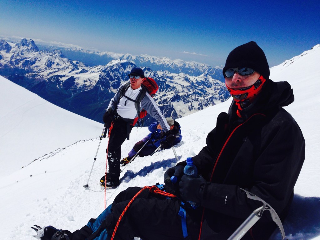
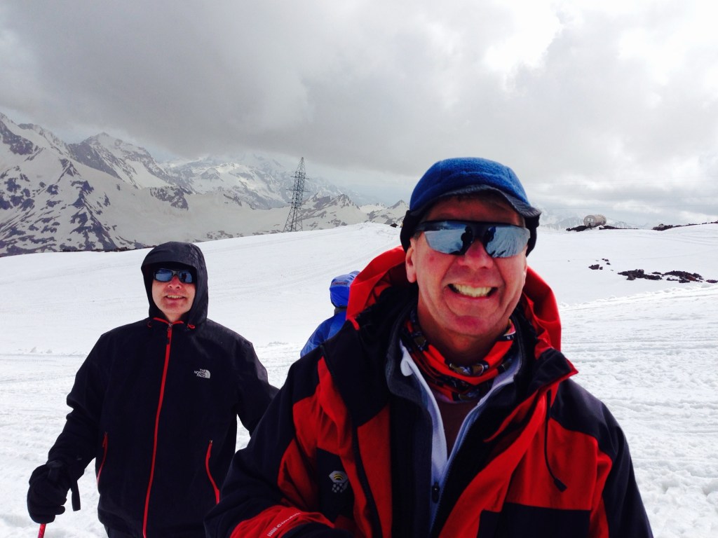
Those of you who have followed this blog since its inception – in 2014 – have heard for a long time about the original “S” (there is a later one, associated with M) but the true original is the 2014 S. S reached out to us prior to our trip to climb Mt Elbrus, one of the Seven Summits, before we were even officially introduced to anyone else going on the trip. He’d seen that J’s email address had an .edu extension, and since he himself was a professor of agriculture at University of Alaska, he wanted to see who the heck he was going to be adventuring with in Russia’s Caucasus Mountains.
We discovered on that 2014 trip that we’d found a soul mate. J and I had already climbed Kilimanjaro (2011) and hiked Machu Piccu and the Grand Canyon (2013), but Elbrus was our first experience with ropes, crampons, and ice axes. We made tons of rookie mistakes, not the least of which was my failure to use any type of sunscreen on my lips on a bluebird summit day, and instead thinking regular chapstick that I happened to find in my coat pocket would do the trick. The third degree blisters on my mouth were a thing of wonder.
Our home at Mt. Elbrus
Through it all, S maintained his unfailing sense of humor and a collection of stories to while away the long slogs up various snow fields and saddles, as well as the ability to maneuver the intricacies of Russian air travel when flights are canceled and it appears a semi riot might break out at a regional airport following your third time of having to retrieve duffel bags off the same baggage conveyer belt.
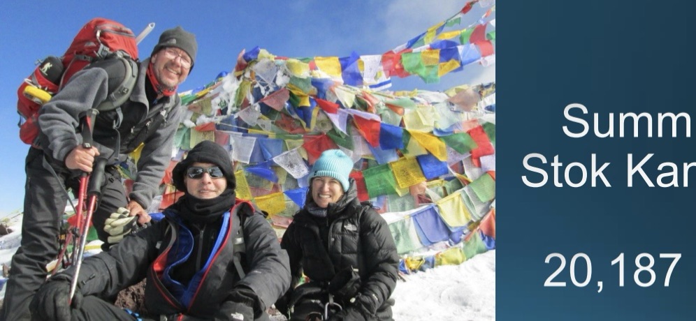
So when we got the idea in 2017 that we really did want to climb an over 20,000 foot mountain the next year, who else would we reach out to but S. Last night I inadvertently discovered a trove of emails back and forth discussing our trip. He explained he’d talked about it with his wife and since his alternative was Everest she was all for the Stok Kangri trip.
And what a trip it was! A group of 11, only 6 of whom ended up attempting and achieving the summit, some with a lot more grace and speed than others. J and I were definitely ones without the grace or speed, but S was with us all the way to the top.
After the trip, the three of us had an extra day to tour the Red Fort, take a rickshaw to a restaurant that had been billed as a place that served the Moghul emperors but seemed to actually be a small place behind a laundromat with a sink to wash hands as you entered, and even managed to find an uber in the cacophony of live chickens, people, ancient architecture and livestock in the middle of Delhi.
I learned S had passed, at age 61, via a Facebook post last Saturday. The last we’d seen him was on our way to climb Mt. Baker in the Cascades in 2022. That mountain had been on his bucket list. Unfortunately, he had to leave the trip early because a family member had suddenly died and, in typical S fashion, he felt he needed to be with his wife and family. Nonetheless, we carried on and enjoyed spending time with another of his climbing buddies, T, whom he had cajoled into going on the trip.
I was literally just about to reach out to S to see if he had any interest in a potential Mt. Adams climb.
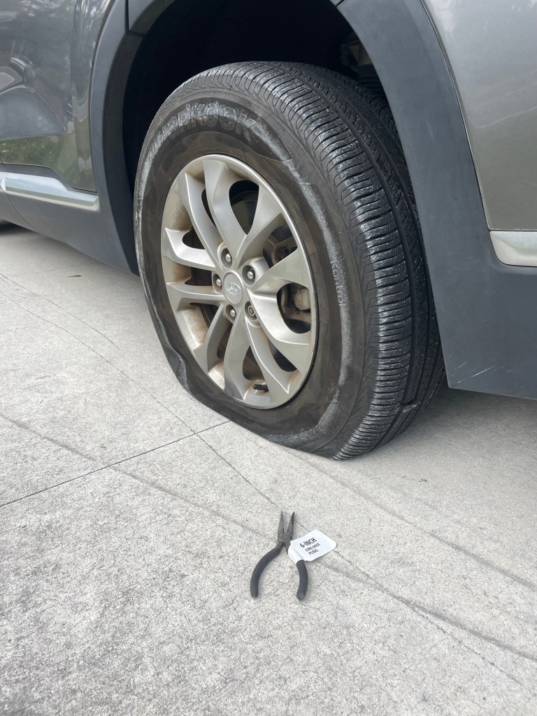
We had planned to go hiking last Saturday at Wekiva Springs with M and the other S. Just as we reached the entrance of the state park, there was a huge rumbling noise and it was clear we had a flat tire. Later we discovered we’d run over a brand new pair of needle nose pliers that still had a label on them. Two hours later, AAA finally showed up, changed the tire in 30 seconds flat, and we had just enough time to get home to make a dinner reservation.
That hiking trip certainly didn’t turn out as expected. And similarly I hadn’t expected to wake up that morning to find out I’d never climb with S again, at least in this life.
I’m not going to say RIP to S. Instead, Godspeed on your next adventure.
For a collection of some of our adventures with S, take a look at the following links. These are only a sampling, and it makes me happy just to read them.
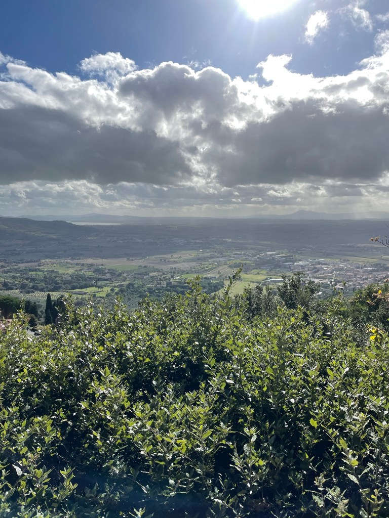
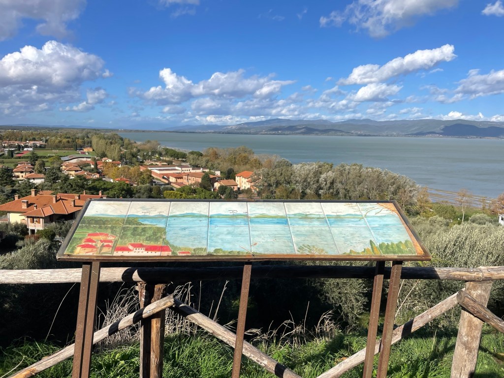
Our first of several days in Tuscany (that is, November 5, 2023, just to give a temporal context) was supposed to be a rest day, given that we had been traveling almost non-stop for a month. But there’s no rest for the weary, and we soon found ourselves heading toward Lake Trisimeno, which we could see in the distance from our Airbnb.
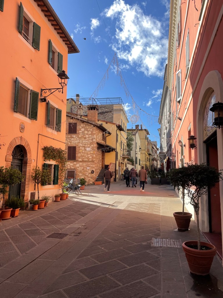
After unsuccessfully looking on the internet for any trails to hike, we simply drove in the direction of Castiglione del Lago, a charming hilltop town. There were hardly any tourists or traffic, despite a very interesting castle where we were able to have a picnic lunch. We walked through the town, enjoying the medieval vibe and the lack of crowds, and then down to the lake where we walked the perimeter for an hour or so. There were lots of cafes, but everything was closed for the season. I’m sure it’s crazy in the summer.
Enjoyed getting to cook again that night – fresh papperdelle with a vegetable sauce and artichokes.
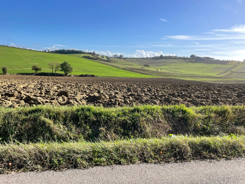
The next day we decided to tour some of the famous hill towns of Tuscany. From Cortona we drove across the valley on some seriously narrow roads with so many vistas of Tuscany hills we kept having to stop to take photos.
Ultimately we reached Pienza. The town is atop a hill, but on a flat plateau so you avoid some of the ups and downs. It too was empty at this time of year; we managed to locate ourselves on the Rick Steves audio tour and found the main square – where the grid lines of the squares line up with the palazzos to form a “Renaissance cube.” We finally found a spot outdoors where you are allowed to eat (very strict rules about this!).
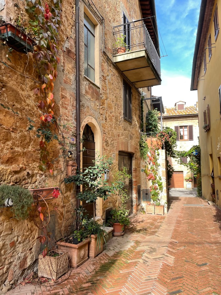
We looked into some interesting – almost stark – Romanesque churches, adorned with peeling frescos on the walls. The town itself was beautifully preserved – narrow lanes, stone buildings, and what I can only call red creeper vines.
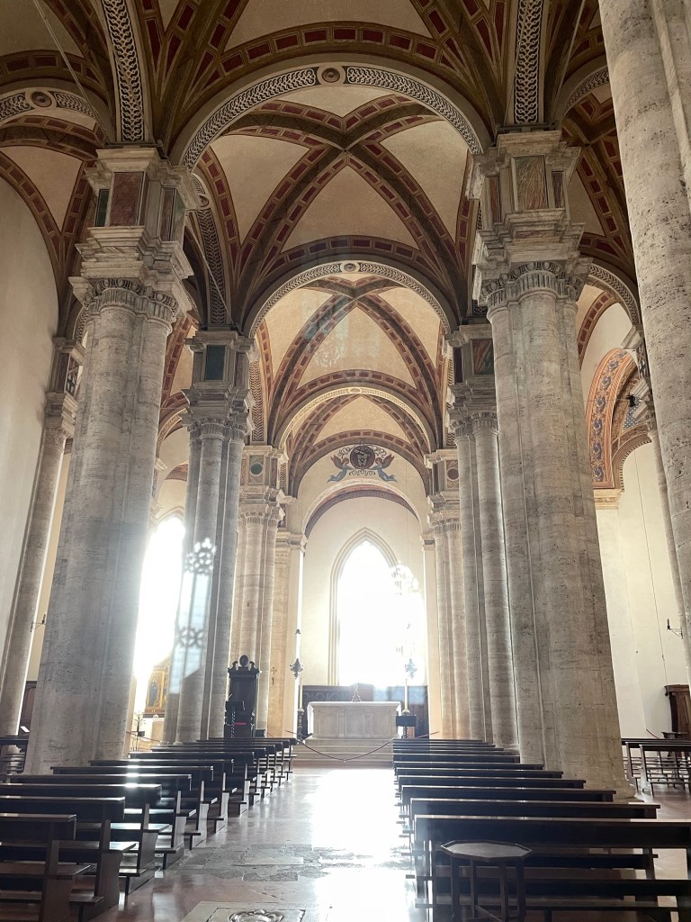
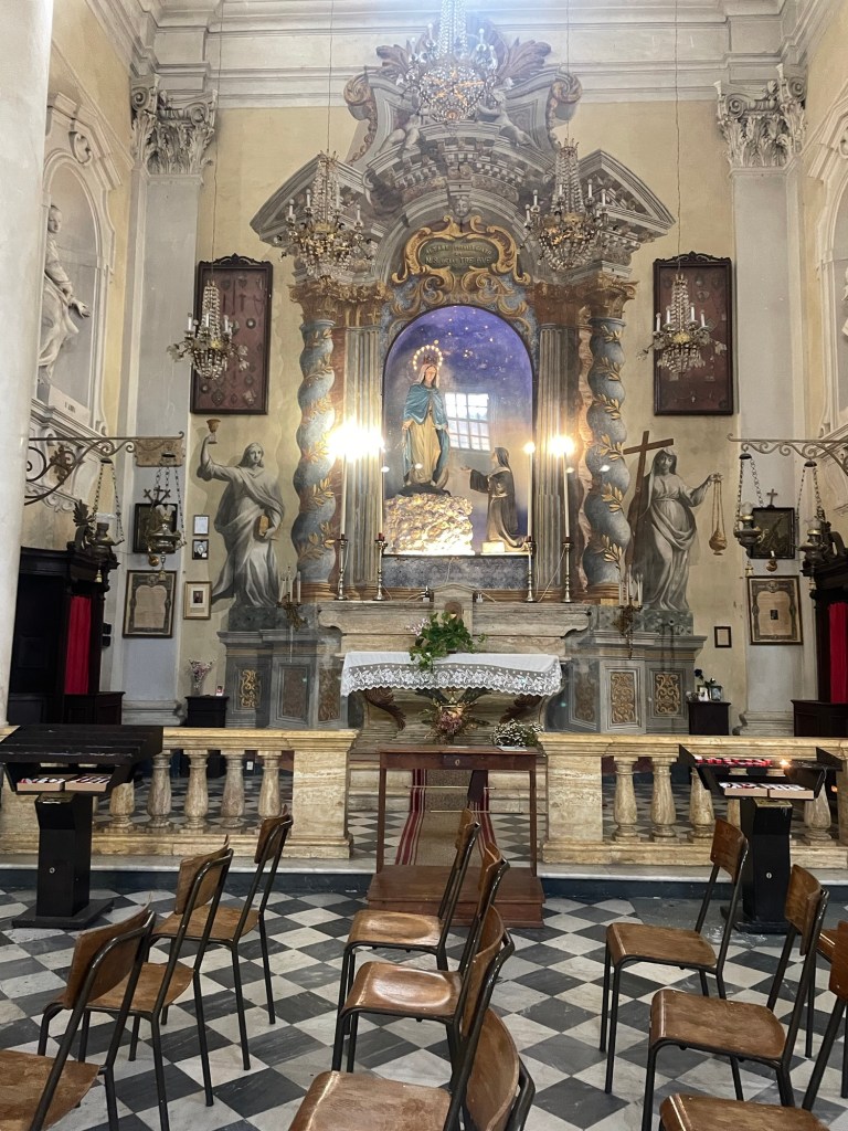
With only a few wrong turns, we drove to Montepulciano. It’s an equally charming, but much larger, hill top town. And not crowded. We were definitely experiencing the joys of the so-called “shoulder season.” We managed to situate ourselves on the map; and visited the Parroccia Santissimo Nom di Gesu – a very ornate church whose painted 3D illusions (trompe l’oeil, to use a little French), were captivating.
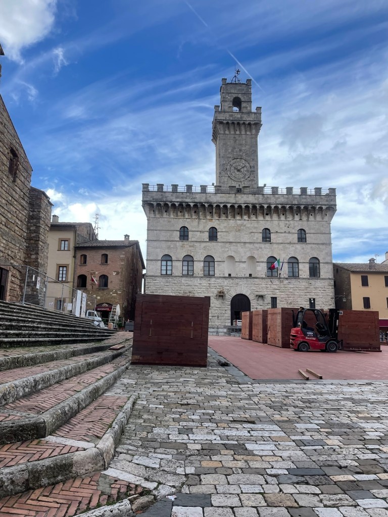
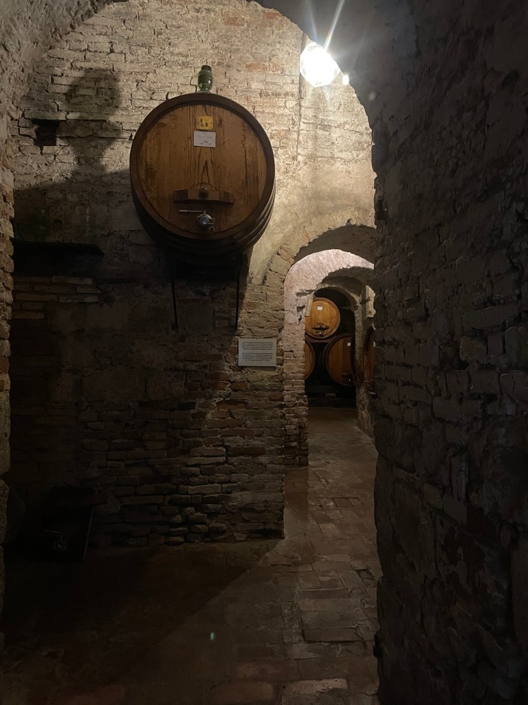
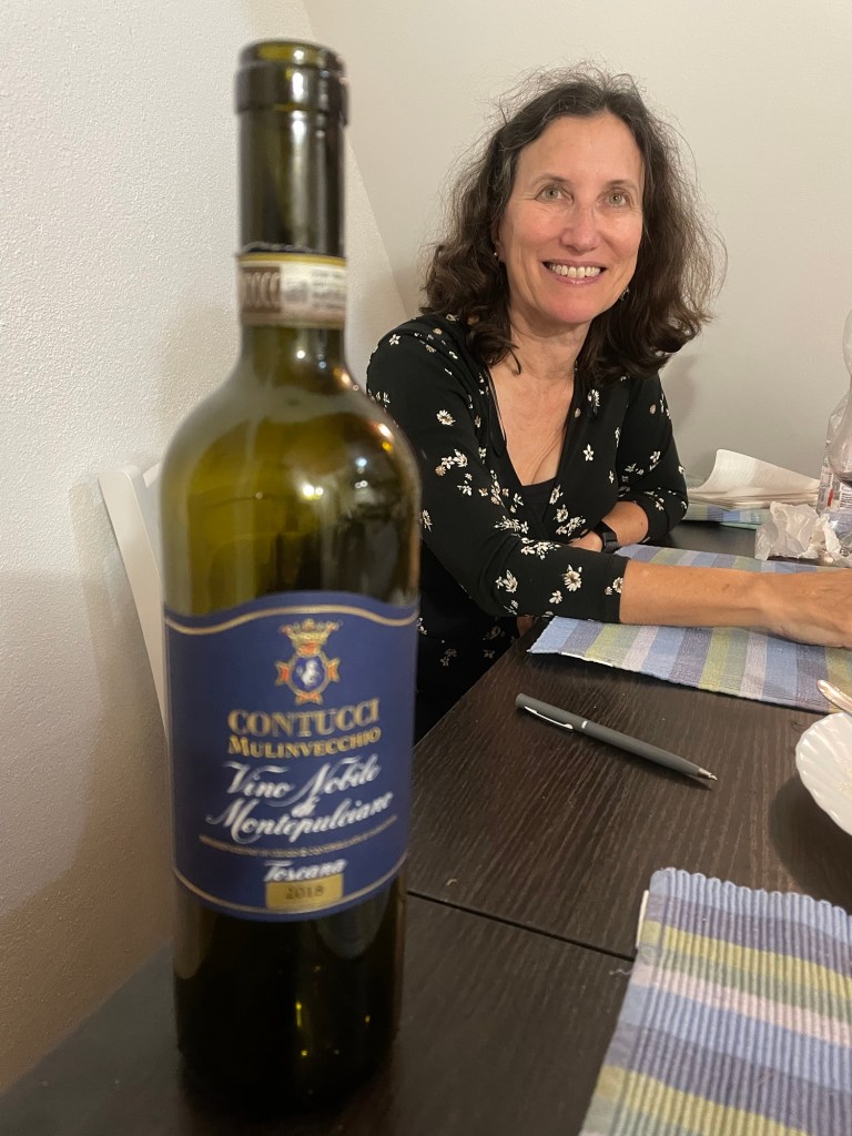
The main duomo, whose facade was never actually finished, was closed and booths outside were being erected for the Christmas market, to the great interest of on lookers. . We also visited the Contucci wine caves, where J bought some very expensive wine. The family still lives in their palazzo on the main square.
I especially liked the contrades building which still posted lists of births and deaths in the neighborhood. Instead of the horse races of Siena, in Montepulciano the contrades push wine casks uphill. Incidentally, this is also the place that J saw $1000 bottles of brunello.
By now it was mid afternoon, and time to make our way back to Cortona. All the wrong turns we made were compensated for by the very expensive bottle of Contucci wine.
The 24/7 church bells clanging next to our hotel in Strobl didn’t keep us up quite as much on our last night there, so we were a bit better rested for our trek to our next stop, Bad Ischl. The weather was cool, and great for hiking. Our walk started off along the banks of the River Ischl – lots of flood control and hydropower. Some pretty woodland sections but not nearly as dramatic as the fairy dells we discovered the day before.
The hike passed through a number of small villages. The houses here, even if old, look so much newer than those in England. White stucco with dark wood work and balconies.
We finally reached Nunsensee (Lake), which looked almost like a dugout reservoir. We were worried about rain so we didn’t even stop for lunch and reached Bad Ischl close to 2 p.m. A church greeted us at the outskirts. I wanted to go in, but two people were in there, clearly praying. The flowers in the terraced gardens were all labeled.
Bad Ischl is an old spa town of the Habsburg regime, located by the river. The Goldeness-Schiff hotel, where we were staying, faces the River Traun, which is part of the River Ischl. (The water geography seemed very complicated.) The hotel was very modern; we had a small room without a view, but perfectly adequate. They gave us a coupon for a free drink for agreeing not to have daily cleaning. No decision there!
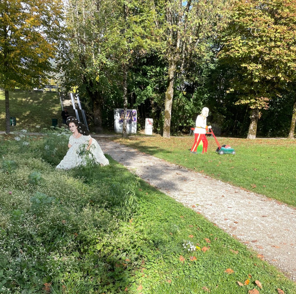
We decided against a visit to Kaiservilla, the summer residence of Emperor Franz Joseph I, and Empress Elisabeth of Austria (known as Sisi). It was very expensive and we only had an hour before closing, so instead we chose to have a drink at an open air cafe (under the awning, while it rained around us), and enjoy window shopping (especially the modern takes on traditional Austrian dress). We also spent time in Sisi Park. Bad Ischl pays homage to her (and her husband) in many ways (for example, cartoonish metal sculptures of them gardening in the park…).
Dinner was at the Spoarhead Gastropoda. Very nice and a nice server, who managed well with few other servers, and appreciated our patience. I always feel like an ambassador for the U.S. on these trips. Chicken Paprika for J and couscous chicken bowl for me. Austria closes down early. We were back in our room by 8:30.
Sunday dawned to a very elegant breakfast, with Prosecco on tap! I wish I had felt like trying it, just to say I’d done so. And a fresh squeezed orange juice maker – I’ve never seen one of those before. We again were anxious about the weather so we skipped the local hill walk that was on our itinerary and instead walked along the banks of the Traun, by lots of sports fields, to the almost empty gondola station. The gondola took us up almost 4000 feet in just 10-15 minutes. Wow! At least the gondola came to a nice slow speed at the top so we could step off.
It was very cloudy, misty, and the “hut” where we’d hoped to have lunch was closed (as was most everything on Sunday). We took off up the mountain to the Katrinkogel, with only a few others hikers around. Tall evergreens gave way to short ones – and then it started to hail (small round pellets), shortly turning into genuine snow. It was very arid, dry and felt much better than rain. While this wasn’t a hard trail, there were certainly lots of steps.
After snowy views on Katrina, we backtracked and took another spur trail to the higher Elferkogel – we were the only people up there. Evergreens beautifully snow tipped and energy emanating from the crisp air. On the way down the clouds started to clear, and once on the gondola the views were great.
We walked back the same way to the hotel. It was clouding up so we still didn’t want to risk the other hill. We found zero places to eat. Everything was closed. Eventually we made it back to the hotel and ventured out to the nearby cafe for a beer – they didn’t even serve food. We were under an umbrella, but then the skies simply opened. We spent the last part of the afternoon in the our room planning the Italy portion of the trip. A nice dinner at the hotel restaurant – it seemed quite popular, but of course, it was one of the only places open.
On Monday, after another nice breakfast (Prosecco was on tap even on a Monday!), we packed and took the train to the train station for Hallstatt, which is a UNESCO world heritage sight. From the station you catch a ferry to the other side of Hallstadtsee, where the actual village is located. There’s a replica of this place in China, and there were tons of Asian tourists, even out of season.
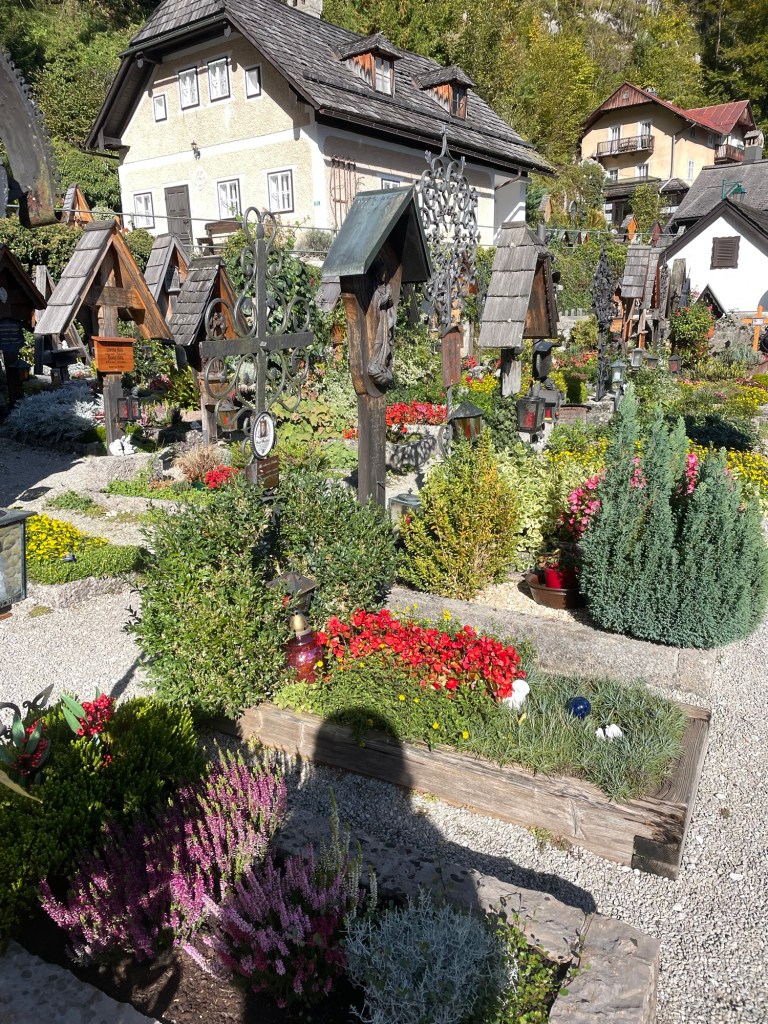
The town, built on the side of a cliff, is spectacular and filled with flowers. Salt mining was its claim to fame. The 19th century Lutheran church (first non-Catholic church I’ve seen ) by the dock has a large poster explaining that’s where the unfortunate Protestants were sent during the Counter Reformation. The Catholic Church is high up on the hill, surrounded by a cemetery, each grave with its own flower plot.
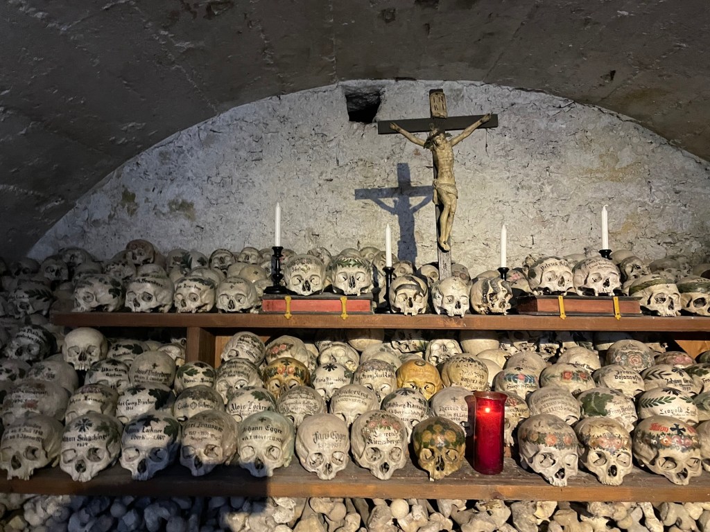
But Hallstatt is best known for the Charnel House. We saw the entrance by the cemetery and decided to pay the 2 euros to go in, little knowing that we were about to walk into an ossuary for skulls. When the graveyard became too congested, the families brought the skulls into the ossuary. (Not sure what happened to the rest of the remains.) But rather than just plop the skulls down, they were painted with family crests, dates, and remembrances. I actually found it surprisingly peaceful. J, on the other hand, found it quite creepy.
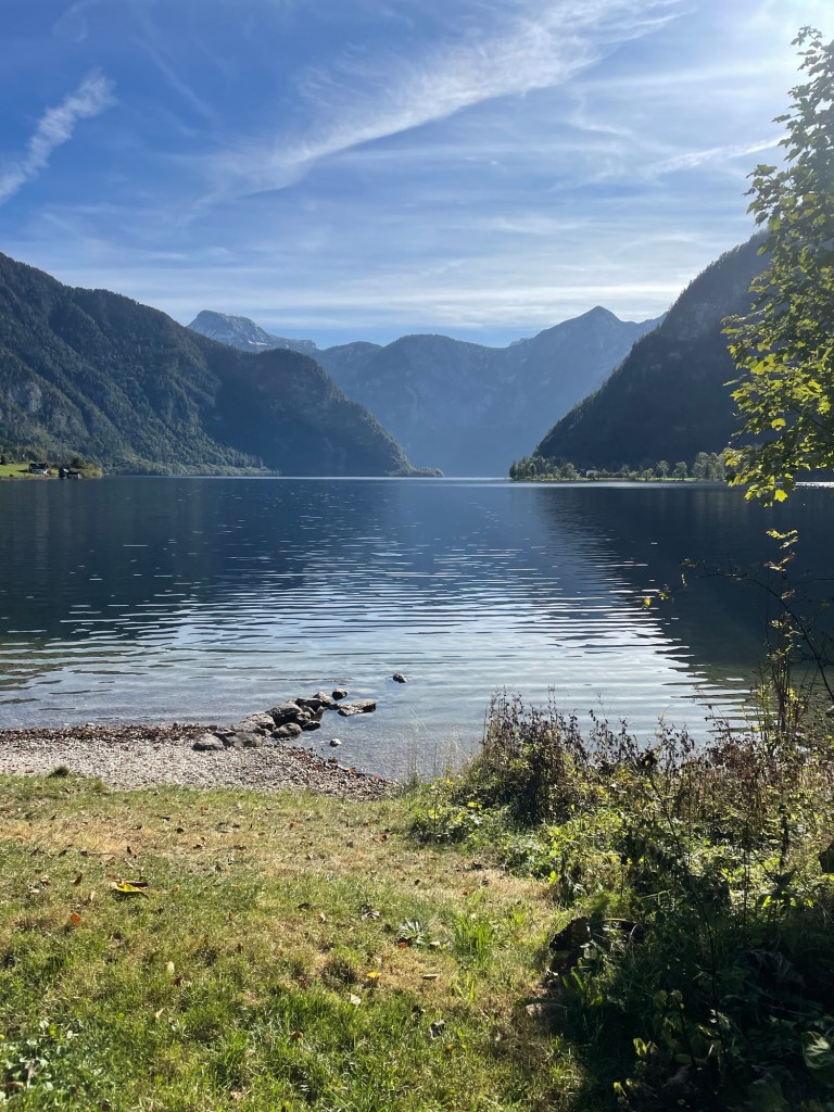
We then ferried back across the lake to start our seven mile walk to Bad Goisern, our next stop. The first part was around the lake – beautiful views, and much of the trail hangs off the cliffs over the lake. Mountains towering over the lake, and you could actually see a nearby glacier. The trail paralleled the railroad track near the lake. Lots of very small yellow finches accompanied us. There were some beautiful private homes. I can’t judge wealth in this country, but at least in the rural parts, it’s hard to see anything I would characterize as poverty.
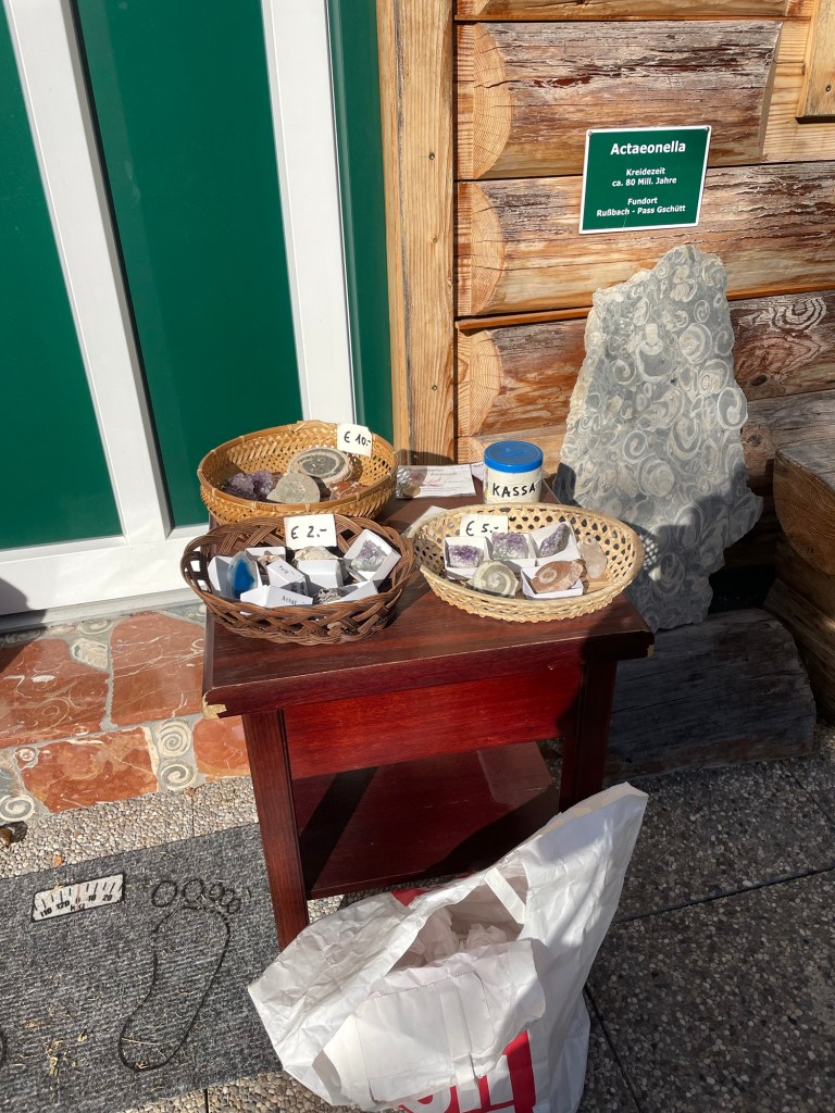
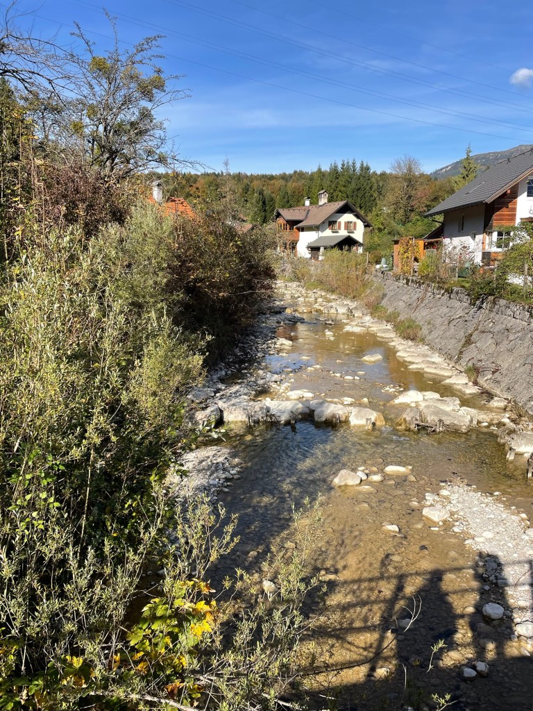
Eventually, we left the lakeshore to walk along the banks of the River Traun, which feeds into the lake. My favorite bit was the tiny village of Undersee. There, along the street in front of someone’s house, was a table of gems and fossils for sale on the honor system. I bought a beautiful ammonite for five euros.
A very nice, easy walk.
Bad Goisern is a real, little town, not just a tourist place. We stayed at the 17th century Hotel Moserwirt, in a large corner room that even had a balcony. After a grocery store trip, we had a lovely drink on the balcony with the late afternoon sun illuminating the mountains. The day was topped off with a dinner of venison and pork at the hotel restaurant.
We’d finished our Austrian hike. Now back to Vienna, and then to Nice.
It was October 12. The next stage of our Austrian adventures involved a hike from St. Gilgen to St. Wolfgang and a ferry to Strobl. Incidentally, one of the many things I learned on this trip is that you can download any language from Google translator onto your phone and use it even when you don’t have Wi-Fi or cell. That turns out to be invaluable when you’re in a German speaking country and your only German consists of Gesundheit.
Once again, a very nice breakfast buffet at our St. Gilgen hotel (Kendler Hotel). J and I are getting used to the pushed together twin beds, each of which has its own duvet. It turns out that minimizes a lot of arguments about who has pulled the covers off of whom. This coffee machine was exceptionally good, with at least six plus types of coffees, and once again, many types of breads (you are given a basket, just so you can completely carbo load), meats, cheese, eggs, fruit, yoghurt.
The hike from St. Gilgen to St. Wolfgang is an actually a pilgrimage route for St. Wolfgang himself. He lived as a hermit, later founding a monastery in St. Wolfgang. Lots of information boards along the way told his story, including in English at first…but then someone clearly became tired of translating and they were in German only.
Some very steep uphills made the trail markers that depicted pilgrims carrying heavy crosses quite appropriate. A small white church stood at the peak, right by a spring (shrine) that was supposed to have healing properties. Although I felt I could use some healing properties by that point, I resisted the urge to take off my boots and dabble my feet. The trail had a nice mix of up and down, and reminded me a bit of the Balkans.
One of many Virgin Mary shrinesTwo Yogis – Look Closely
We reached St. Wolfgang in time for lunch at a cafe by the church. The very young servers seemed overwhelmed, so it left a bit to be desired. St. Wolfgang is quite the tourist spot, but still retains a lot of charm. Nice little boathouses line the lakeside; it looked like you could rent them. And I was amused by all the statues of yogis! It was quite the contrast to the Virgin Mary icons we were seeing everywhere, at stops on trails, above front doors.
The 15th century church, right beside the lake, was amazing – painted ceilings, multiple carved alters.
We bought our ferry tickets online and took the 15:45 to Strobl, where we were to stay for two nights. Like the buses, the ferries leave right on the dot. It was about a 20-25 minute ride across the lake to the far end. Strobl feels smaller than St. Wolfgang, although it looks bigger on the map. I think it’s just less touristy.
A fair number of places were closed for the season. We stayed at the Hotel Strobler, very nice and convenient, but right by the church which rings its bells every 15 minutes, 24 hours a day. Our window looked out on a well-maintained and colorful graveyard, decorated with flower gardens atop each grave.
After a walk down to Lake Wolfgang (Wolfgangsee), we had dinner at a brewery with very interesting food. I had a vegetarian meal of baked potato with sour cream, root vegetables and chestnuts. J had Wiener schnitzel (not so unusual). Sleep was a bit hard to come by, with the church bells clanging every 15 minutes.
The next day was Friday the 13th. After our somewhat disrupted night, we made it to a grocery store to pick up lunch food for our day hike. We started off by passing the elementary school track races; lanes had been marked off by the lake, and there was lots of excitement.
The start of the Burgl Panaramaweg (Trail) is neat. In contrast to the ancient Wolfgang pilgrimage we had taken the day before, it opened in 1982. The trail starts off on a boardwalk tethered to the side of a mountain as you round the Burgl Rock. It then meanders through a valley (replete with very nice cows, all wearing bells), and though a pass and up, up, up to the Schwarzensee (see means lake).
On the way, we walked through beautiful mossy areas that looked like fairy spots, biodiverse forests, followed by spread out tall pines with light dappling through. The lake seems small compared to the others, but it’s large enough when you walk around it.
We had a nice picnic lunch in a secluded spot on the banks, and made it back to St. Wolfgang (where we’d been the day before) in time to catch the same 15:45 ferry.
As I wrote this diary entry, we were enjoying a drink in the garden at the Hotel Strobler while vaguely watching the only other Americans we’ve seen (two men, investments bankers?), who were also on the ferry, trying to figure out how to order drinks.
Our final night we had dinner at Kirchenwirt – we even made reservations. J had a goulash, and I had spinach dumplings. Fortunately we were either so tired or so used to the every 15 minute church bells we didn’t even hear them that night. A good thing, because the next day was 9 miles to Bad Ischl.
It does sound a bit like “I Had Trouble in Getting to Solla Sollew,” for those of you who remember the 1965 Dr. Seuss book…but Fuschl am See was our next destination after our couple of nights in Vienna. (“See” means lake; “am” means “at the”.) This entailed trains and buses and trails, oh my, and a few wrong turns along the way.
Actually, we were about to embark on the hiking phase of our trip — about a week exploring the hills surrounding the Salzburg Lake District. Our adventure started with the subway to the main train station in Vienna, a long wait, and then a train to Salzburg. Fortunately, it was easy to find the bus from Salzburg to Fuschl am See, although getting off the bus proved more difficult.
We bought tickets for the 2:15 bus and boarded almost immediately, except for the delay occasioned by some woman who insisted we put our suitcases in the cargo area below. I knew we must be in the right place, since one of the few passengers on board was wearing a native green Austrian hat, festooned with feathers and insignia. See photo above. We clearly weren’t in Kansas anymore.
We had looked at all the stops listed on the electronic display on the bus and there seemed to be only one Fuschl stop. Although this was not consistent with my previous research, we thought we better go with the real time indication on the bus and get off at that one. I should have relied on my research, as we ended up disembarking a full four stops too soon. It turns out that having Fuschl in the name of a place was not much of an indicator…there were multiple stops labeled Fuschl and the electronic display simply hadn’t shown them yet!
Anyway, we exited the bus at what was a suspiciously remote stop on the side of a highway, after making quite a production since the bus driver had to help us get the suitcases out from the cargo hold. The fact no one else got off should have been another hint. It didn’t take more that a couple of minutes before it was clear something was terribly wrong. I checked GPS (which, by the way, works without cell data or Wi-Fi) and realized we were a good three miles from our destination. Since pulling our luggage along the side of a two-lane highway without sidewalks didn’t seem like a very good idea we were happy to learn the next bus was only 20 minutes away. The bus driver rolled his eyes when we got back on but let us use the same tickets…clearly chalking it up to incompetent Americans. This time we did not put our suitcases in the cargo hold!
After three more stops, we arrived at the correct Fuschl stop and located the Hotel Jakob (which also seemed to have a moniker of the Triathlon hotel). And indeed it was aimed at triathletes and cyclists, with bikes on display and biking gear for sale. The town was quite small – on a beautiful lake surrounded by mountains. J and I strolled through town and had a gin and tonic at a nice lakefront cafe, and made a dinner reservation for the attached restaurant, which was recommended for local fish.
The temperature dropped; we returned to the hotel to change. This is when we figured out that Austrians, at least in the country, eat early – between 6 and 7 p.m.! I can only describe the restaurant as staid, lots of older people (it was a weeknight in the off season), all seated at tables lined up around the sides of the room so we could all inspect everyone else as they ate their meals….I had three types of fish all from the lake – a filet whose name I didn’t catch, arctic char, and perch, served with carrots and leeks.
The next day we finally started the hike, but only after an amazing breakfast buffet featuring salmon, cold meats, cheeses, breads. I managed to mess up the coffee machine by using too small a cup for my latte (you can imagine what happened), but discovered that the coffee machines in Austria rivaled those in Spain. America needs these!
After we checked out of the hotel, we started to follow the “blue line” on our downloaded GPS map, just as we had done in the Yorkshire Dales. The first part, through a valley, was a trail themed around gnomes, with little signs up everywhere telling a story of some ill fated gnome. The landscape really does explain where the Brothers Grimm got their tales.
It was only about a five miles to our next stop, although there was a decent uphill and down, and I did miss my hiking poles – but there was no way to fit them into the luggage. One thing to get used to were all the Catholic shrines and chapels along the trails. Every couple of miles there would be a shrine with candles lit, typically for the Virgin Mary. I’m assuming the candles were battery operated.
After some good scrambling and beautiful views from Mozartblik, we descended into St. Gilgen, which is on Lake Wolfgang. It’s a very wealthy summer town, but many places were closed for the season, which had ended a couple of weeks before. It was almost too quaint, painted buildings and Austrian architecture.
We had lunch by the lake, followed by a power nap, since we still weren’t exactly on the right time zone. After a long walk through town, we capped off the day with a drink at a bar across the street, which featured someone wearing lederhosen along with many tattooed bikers. That theme continued at dinner – again, the restaurant was practically empty by 7 – where we enjoyed watching four very elderly men, clearly on their weekly outing, each wearing lederhosen with the appropriate jackets.
J and I retired early. The next day was going to introduce yet a new mode of transportation – a lake ferry.
The approach to Badlands took us along State Road 44, a two lane road that eventually cuts across the park. There’s very little traffic. But that apparently didn’t deter the same road construction that we saw across the entire country. We experienced a 15 plus minute delay when one lane closed down, and a lead vehicle ceremoniously ushered us along about a three mile strip of highway – where we met the sole car that was waiting to go the other direction.
We finally reached the Interior Motel and Campsite in Interior, South Dakota, just outside of the park, about 6:30. It was nice. Several other rooftop tents, toilets and showers, an above ground pool, and a view of the Badlands. There were a few cars speeding along the adjacent highway, but somehow that was comforting in this otherwise extremely desolate place. Plus, the road was a elevated above the campground, giving it sort of a Jetson like feel. A full moon tonight and plans to focus on hiking, not driving, the next day.
I woke up about 5:30 a.m., probably due to the sunrise. great swathes of apricot overlying the wine dark purple of night, and the morning star piercing through all of it.
Apparently they don’t worry too much about park admissions on Tuesdays, and we didn’t even have to show our park passes. We stopped first at the visitors’ center and got some advice about trails, and also looked at the extremely interesting working fossil laboratory and heard a lot about a recently discovered Saber tooth tiger.
From there, we started the first of our hikes. The Window – a very easy boardwalk – and the Door, a bit more of a hike, culminating in a natural door that frames a view of the wall of jagged white peaks of stone. Traversing through it was almost like walking through a hard iced cake.
The Notch hike was next. The beginning has one steep section with a ladder going up. We rejected the ladder and instead scrambled up along side it. Fairly wide ledges led out to a spectacular overlook of the valley. It was very not, near noon and 90 degrees in the shade. On the return, we chose the ladder route. Mistake. Looking through the ladder with nothing below triggered all my fear responses – I was so tense I basically slid down without ever letting go and messed up my left quad – which plagued me for the rest of the trip. My legs were shaking when we got to the bottom.
After a quick lunch in the air conditioned Explorer, we journeyed on to the Saddle Pass. It was a true scramble – steep and slippery up the rock formations themselves, culminating on the flat upper green prairie and a number of trailheads. At the ranger’s suggestion, we then went off track and climbed the highest peak to a little throne at the very top. Amazing how touching the rock – as opposed to being on a ladder = makes it so much easier!
By then we were more than hot and sweaty. Did I mention temps were well over 90 degrees? We drove a little more of the Loop Road to the Fossil Exhibit boardwalk, an area of mammals fossilized more than 30 plus million years ago.
We finally hightailed it out of the park to see the small hamlet of Interior, South Dakota. There are two churches and a bar. We stopped at the bar. At the Wagon Wheel the bartender explained to us the story behind the poster of the naked woman riding a Radar the Bull (with a ring in its nose). She looked like a bovine Lady Godiva. Apparently Radar was a frequent visitor to the bar at one point. Between fossils (Lyme Regis) and the bull (my encounter with one in the Yorkshire Dales) I had flashbacks to our UK trip.
Spent the rest of the day at the campsite, plotting our next moves while being entertained by the couple in a nearby campsite who appear to be living out of their van while practicing for the their next singing gig.
We awakened on day two of our Yellowstone adventure to a view of two elks grazing and head butting only ten yards from our rooftop tent. You could actually hear their antlers clacking against each other. It didn’t look like serious business – they’d go at it, like very large puppies, for a bit, and then tire of that game and eat some more grass. Eventually they meandered out of the campground, as comfortable as you please.
This was our day for the “must see” Old Faithful, which required a trip to the western side of the park. There’s a great visitors’ center, with good explanations of volcanoes – especially how we were sitting right on top of one. We then took a decent hike up to an observation spot to see Old Faithful itself. Fortunately, we saw a pretty good eruption. We saw it erupt a second time later in the day, and it simply sputtered.
Next stop was the “prismatic falls.” A navigational error ensued, and we turned off the road too early, which took us along a rather odd hike on the perimeter of the area toward the Fairy Falls. We could see people in the distance on boardwalks, but had no way to get there. Nonetheless, we could still see the billowing multi-colored smoke – pink and turquoise. We were going to try to get to the actual location, but the traffic was simply too much. A lot of Yellowstone is still digging out from the floods of last year, and although the crowds weren’t bad, a weekend day was all that was needed for the traffic snarls to start.
A big rain storm had started so we headed to the Lake Village lodge again to wait it out. There, sitting on the porch, we met someone who was born in Derbyshire, of all places, then moved to the U.S. with his family, and now was a film editor on one of my favorite TV shows, Naked and Afraid! It was he who told us about Deadwood….
After a “grocery store” trip (to the extent a national park general store can be described as a grocery store) we had our last camping night in Yellowstone, and celebrated with an odd concoction of mac’n cheese, precooked bacon, and green beans. As I was cooking I noticed a fellow camper who’d left his chair too close to his campfire on that very windy evening – fortunately I was able to call out to him before it got incinerated. I felt like a veritable Smoky Bear!
The next morning we managed to pack up all the debris we’d been accumulating. Those bear box pantries are a real luxury. We left camp by 10 a.m. and drove to Fishing Bridge, just north of Lake Village and out of Yellowstone via the East Entrance. There was a lot of elevation gain, and evidence of many forest fires, lots of downed, white trees.
There was a full day of driving ahead of us. Our route was going to take us through Cody, into the Big Horn National Forest area, and finally into Deadwood which was as peculiar a place as its name implies.
Jackson Hole may be best known for skiing, but snowless summer months offer plenty of entertainment.
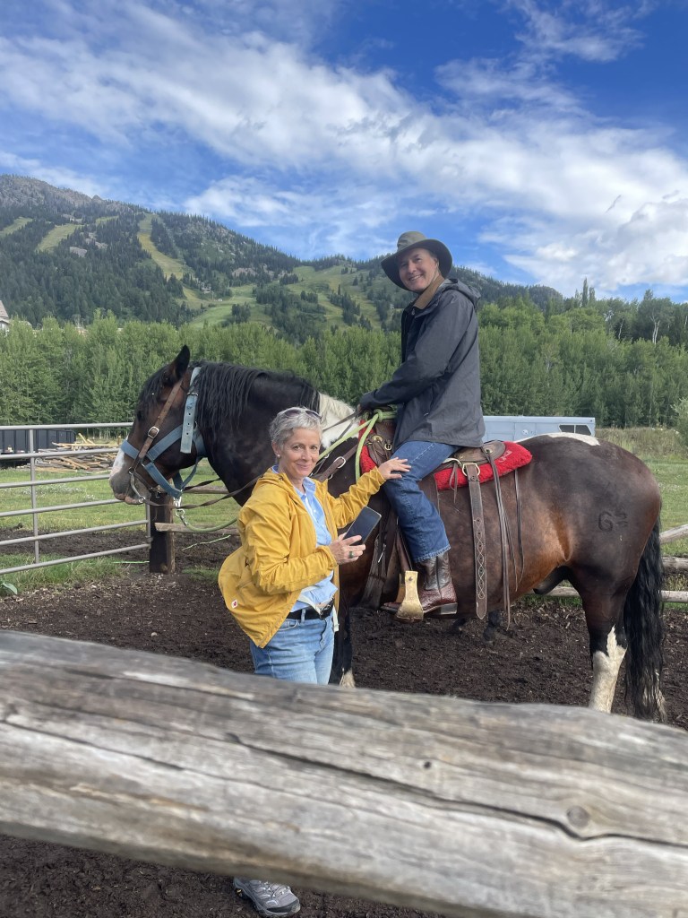
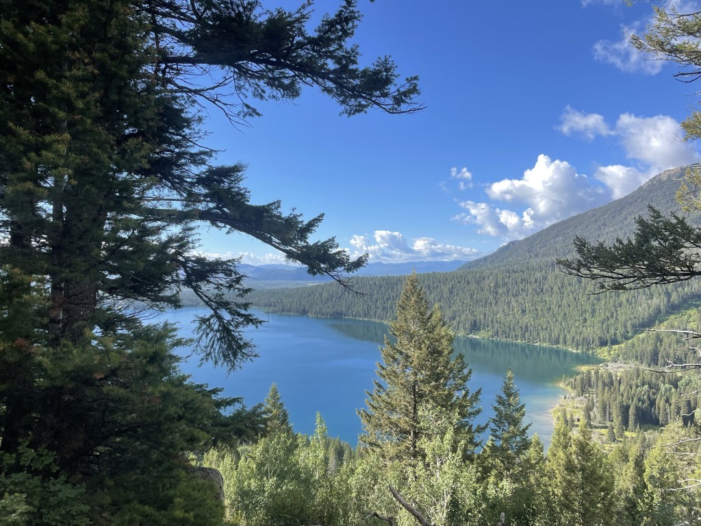
Although we are hardly equestrians, J and I have gone horseback riding during many of our travels. So far we have managed trail rides in South Africa (that one also involved zebras), Hawaii, Russia, Croatia, and Arizona, to name a few. The Tetons seemed an appropriate addition.
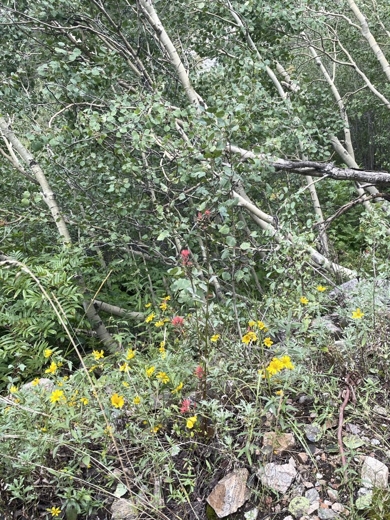
We met up with our niece, F (who really does live near Nice, France), as she was the only of our family group willing to brave the large four legged creatures that were to take us up one of the nearby mountains. She rode a very hungry “Chuckles,” J had a chunky “OT” (for Overtime), and I was blessed with Rhinestone. Apparently the trail company has over a thousand horses between Grand Teton National Park and one other location. Beautiful wildflowers, including lots of Indian Paintbrush, which is the Wyoming state flower. My favorite part was when our guide instructed us to get a move on so our horses weren’t spooked by the nearby bear cub who had climbed a tree, with Mama Bear right below.
Next up was a drive around the beautiful Lake Jennie loop. It was rainy but that didn’t keep us from enjoying sandwiches and a beer at Dornans, a long time Jackson establishment. And saw another bear. Bears were sort of a theme in the Tetons.
The afternoon saw a short but fun Lake Phelps hike. This part of the park is on the Lawrence Rockefeller Preserve. The Rockefellers, who had built a large estate on the property, donated it all to the park on the condition that all man made structures were to be torn down and the area returned to nature. Towering mountains peering over at a serene mountain lake. And on the way back we encountered a very large moose.
The following day, which was beautifully sunny, our hiking party consisted of my sister in law, T, J and me. I think the others were turned off by the fact the trail bore the auspicious name, Death Canyon. After driving through some of the many road construction sites (it seems as though most of the USA is currently building roads), we entered the park and ventured just beyond Phelps Lake. The trail starts wooded and a bit of an uphill, and then a very steep downhill, which you unfortunately know you will face up on the way back. You cross a number of boulder fields, but the trail is so well constructed you aren’t even aware of the exposure. Meadows of yellow daisies and purple thistles (which are not native, apparently), periwinkle blue flowers that looked like bluebells, and deep purple wild snapdragons. We walked alongside a river that cascaded into waterfalls before encountering a long uphill slog to the saddle right below Static Peak, at the patrol station. We keep going until the IPhone promised us we were at 8000 feet. I’m not sure what our total elevation gain was but it seemed considerable.
We pulled out our Maasai blanket from Tanzania and had a great picnic, which fortified us for a fast downhill followed by the uphill section we knew was coming.
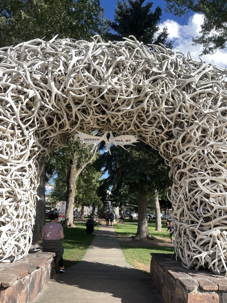
We couldn’t leave Jackson without some exploration of the town. Yes, we did see the iconic antler arches, browsed through a mountaineering store, and took advantage of the Snake River Brewery.
A very fun spot, and even the fact I left a hiking sock in T’s dryer didn’t seem that important. I guess it met up with the hat left in the Yorkshire Dales and the visor left in Hot Springs. I’m considering a blog post called “things I left behind on sabbatical.”
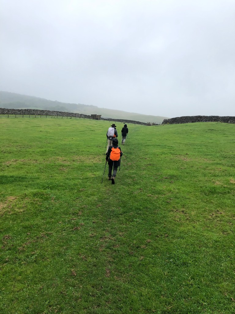
As we’d had several long and steep hiking days, we decided to knock off a couple of miles by avoiding a loop around something called Apedale Moor (which we couldn’t locate on any map anyway) on our way from Reeth to Bolton Castle and on into Aysgarth Falls.
This meant having the nerve to stray from the ever present blue GPS line that was our North Star to take a paved road called Hargill Lane practically the whole way. Just because it was paved, however, did not mean that it didn’t go up and down, and unfortunately, it was a quintessential long slog shin splint generator. Hargill Lane crossed windy, windy moors with absolutely nothing around but sheep and occasional cars that operated at the same speed as all the bus drivers – that is to say, fast.
Eventually the road descended into the conservation area for the Bolton Estate, lands that are still owned by the same family that held them hundreds and hundreds of years ago. There were many beautiful wildflowers, but they were interrupted by lots of warning signs for the quarry works on the other side of the road.
We reached the very well preserved Bolton Castle right at lunch time and had a nice meal in the tea room. The castle, built between 1378 and 1399, is quite intact, and M and I enjoyed the diagram that showed what each level of the structure was used for. There was also a lot of information about the castle’s architect, John Lewyn. Who knew castles had architects!
The walk from the castle to Aysgarth Falls was lovely. We did cross a field with another bull, which was actually starting to lunge at a couple on the other side of a wall who had a dog with them. (Incidentally, everyone in the Dales has dogs, and they are welcome guests in restaurants, pubs, shops, etc.) They had some long story about someone they knew who had recently been charged at by a bull and had to throw his dog over a wall….in any event, it turned out my bull fears were not unwarranted! While the bull was occupied with them, J, M, S and I managed to sneak over another section of the wall, unnoticed.
On the way, we also suddenly heard a huge roar overhead that practically shook the stone walls surrounding the fields. Two Typhoon RAF jets zoomed by, and made several passes. We soon learned that war had not actually broken out while we were in the solitude of the Dales, but that this was a popular location for the RAF to do low altitude training.
The Aysgarth Falls themselves were pretty, but by then we’d seen so many waterfalls, we were somewhat jaded, and just as glad to keep on moving up a steep hill to our next guest house — the newly renovated Aysgarth Falls Hotel. Despite three flights of stairs (thank God for those backpack straps on my suitcase!), it was really nice and we thoroughly enjoyed their pub and dinner and breakfast food.
That was good, because the next and final day turned out to be the most challenging yet.
The plan was to walk from Aysgarth Falls to Kettlewell, where we would meet a taxi at 5:30 that would transport us back to Grassington, for our travel to London the next day. We wisely chose the 12.6 mile route rather than the 15.3…..
We started with some easy walking through fields and what was described as some “unavoidable” road walking. But there was little traffic, and the flowers were pretty as we basically hiked the length of the valley. Despite its remoteness, a number of little cottages bore signs of construction.
Eventually the valley ended, and so did the road. A very nice farmer gave us directions (the blue line becoming somewhat cryptic at that point), and we were able to cross the river and start what was described as a “big up.”
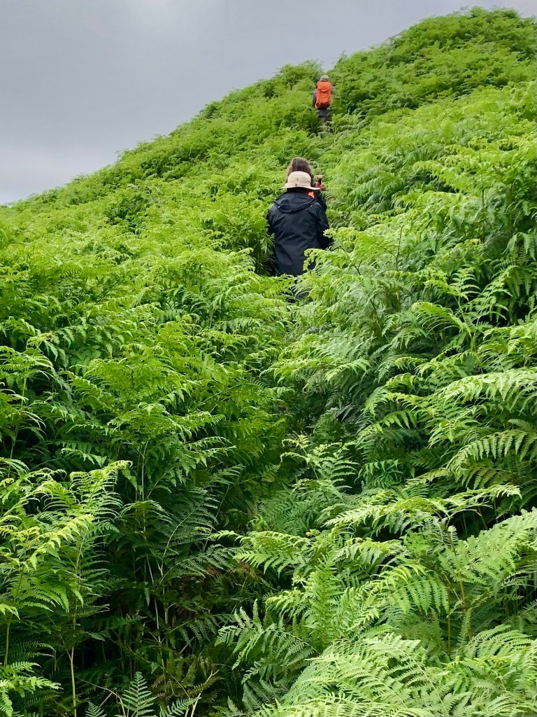
We were completely distracted from the steepness of our ascent because the almost imperceptible trail started to lead us through fields of five plus foot high ferns. They literally towered over us and I found I was using my body as a battering ram to push through. It felt way more like an Amazon jungle than the Yorkshire Dales.
Part of the way up, we realized there may have been a slightly more trodden path, but we were too busy bushwhacking and trying not to be swallowed by the ferns to have seen it.
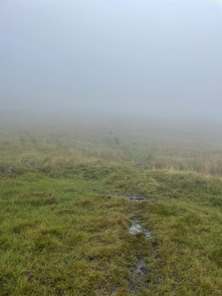
We finally cleared the fern field and continued to ascend. It was a very rapid elevation gain. Suddenly we found that we were no longer below the low hanging cloud we’d been observing all day, but were actually in it!
Yet still we continued to climb up. Visibility was starting to close and navigating the blue line was like flying a plane on instrumentation only. We encountered one group of young scouts using maps who were clearly doing some sort of orienteering exercise….they seemed infinitely better equipped for the challenge than we were.
We had no choice but just to stick to the GPS line as much as we could and aim toward the cairns and waymarkers that we could see. Finally, the scout leader passed us asking if we’d seen his charges anywhere – we were relieved to see him as proof that civilization existed somewhere in the direction we were aimed.
Visibility continued to get worse and the wind was whipping. We stopped for a brief break by a the first stone wall we’d even seen. But by then I was simply dedicated to getting down as fast as we could because it really was starting to feel unsafe. I was beginning to feel like a character in one of those Sierra Club magazine articles about what can go wrong while hiking….they usually end with hypothermia or broken bones.
Anyway, we finally reached what the itinerary termed a “snappy descent.” To the dismay of my fellow hikers, I actually found that part sort of fun – skipping around and over rocks, but with lots of grass cushioning on either side. Plus we were going down.
But we were still in the cloud, and M and S were just dots in the mist. All I could think about was that we had to maintain visual contact. You really could have gotten lost up there.
Finally we were below the cloud, and the world started to come back into focus. We could see the village of Starbotton at the bottom of the peak we were descending, and the wind that had whipped us as we crossed the ridges of the moors died down.
A steep descent down a stone road, and we were back in the valley, only 2 1/2 miles from Kettlewell. We had a quick bite of our sandwiches, and then walked through the fields that lined the valley for a straight shot to Kettlewell.
We had made it – all 77 plus miles! We walked through the village to the Blue Bell Inn where we were to meet the taxi in an hour or so. We had a celebratory drink to toast our most recent adventure. And even the fact that the taxi was an hour and a half late picking us up didn’t really matter.