I’m interrupting the tranquil narrative of last October and November’s European excursion. And what could make me do that, you ask?
A spur of the moment bucket list trip….to Morocco! J has always wanted to climb Mount Toubkal, the highest mountain in North Africa, in the Atlas Mountains. It’s way shorter than its gigantic sibling, Kilimanjaro, in Tanzania – which is what, of course, started us off on this crazy mountain climbing binge we’ve been engaged in for the last 13 years. And it seems a particularly good choice given that I grew up in North Carolina and the Atlas Mountains were originally part of the Appalachian Range. Who knew?
So when we saw KE Adventures had somewhat reduced its price for an 8 day trekking adventure, and our calendars looked relatively clear….what was to stop us from signing up? Of course, there is that little detail about the trip starting in four weeks and the fact that we had hardly been training to climb an almost 14,000 foot mountain, four days of trekking at altitude (13 mile days or so), and some with a LOT of elevation gain….
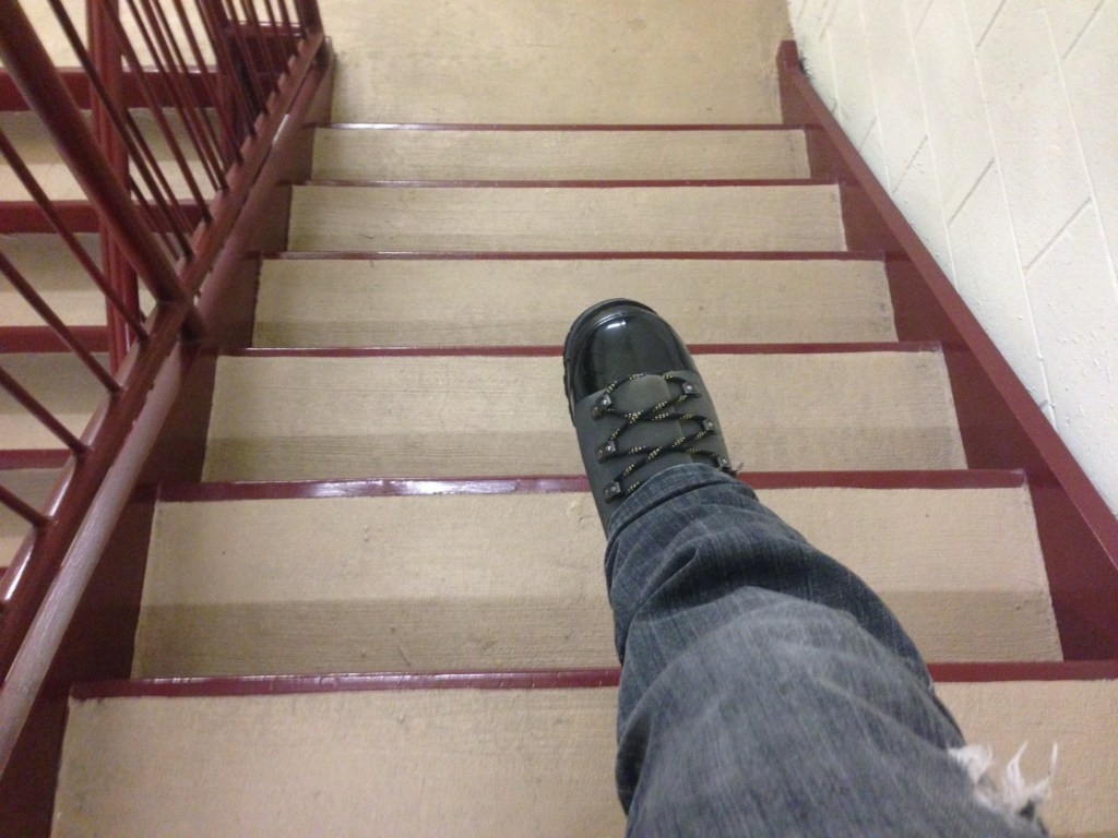
It’s back to the stairs for me. And the ten mile clay loop in Clermont tomorrow.
As we’d had several long and steep hiking days, we decided to knock off a couple of miles by avoiding a loop around something called Apedale Moor (which we couldn’t locate on any map anyway) on our way from Reeth to Bolton Castle and on into Aysgarth Falls.
This meant having the nerve to stray from the ever present blue GPS line that was our North Star to take a paved road called Hargill Lane practically the whole way. Just because it was paved, however, did not mean that it didn’t go up and down, and unfortunately, it was a quintessential long slog shin splint generator. Hargill Lane crossed windy, windy moors with absolutely nothing around but sheep and occasional cars that operated at the same speed as all the bus drivers – that is to say, fast.
Eventually the road descended into the conservation area for the Bolton Estate, lands that are still owned by the same family that held them hundreds and hundreds of years ago. There were many beautiful wildflowers, but they were interrupted by lots of warning signs for the quarry works on the other side of the road.
We reached the very well preserved Bolton Castle right at lunch time and had a nice meal in the tea room. The castle, built between 1378 and 1399, is quite intact, and M and I enjoyed the diagram that showed what each level of the structure was used for. There was also a lot of information about the castle’s architect, John Lewyn. Who knew castles had architects!
The walk from the castle to Aysgarth Falls was lovely. We did cross a field with another bull, which was actually starting to lunge at a couple on the other side of a wall who had a dog with them. (Incidentally, everyone in the Dales has dogs, and they are welcome guests in restaurants, pubs, shops, etc.) They had some long story about someone they knew who had recently been charged at by a bull and had to throw his dog over a wall….in any event, it turned out my bull fears were not unwarranted! While the bull was occupied with them, J, M, S and I managed to sneak over another section of the wall, unnoticed.
On the way, we also suddenly heard a huge roar overhead that practically shook the stone walls surrounding the fields. Two Typhoon RAF jets zoomed by, and made several passes. We soon learned that war had not actually broken out while we were in the solitude of the Dales, but that this was a popular location for the RAF to do low altitude training.
The Aysgarth Falls themselves were pretty, but by then we’d seen so many waterfalls, we were somewhat jaded, and just as glad to keep on moving up a steep hill to our next guest house — the newly renovated Aysgarth Falls Hotel. Despite three flights of stairs (thank God for those backpack straps on my suitcase!), it was really nice and we thoroughly enjoyed their pub and dinner and breakfast food.
That was good, because the next and final day turned out to be the most challenging yet.
The plan was to walk from Aysgarth Falls to Kettlewell, where we would meet a taxi at 5:30 that would transport us back to Grassington, for our travel to London the next day. We wisely chose the 12.6 mile route rather than the 15.3…..
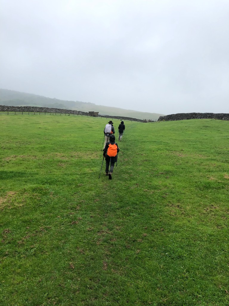
We started with some easy walking through fields and what was described as some “unavoidable” road walking. But there was little traffic, and the flowers were pretty as we basically hiked the length of the valley. Despite its remoteness, a number of little cottages bore signs of construction.
Eventually the valley ended, and so did the road. A very nice farmer gave us directions (the blue line becoming somewhat cryptic at that point), and we were able to cross the river and start what was described as a “big up.”
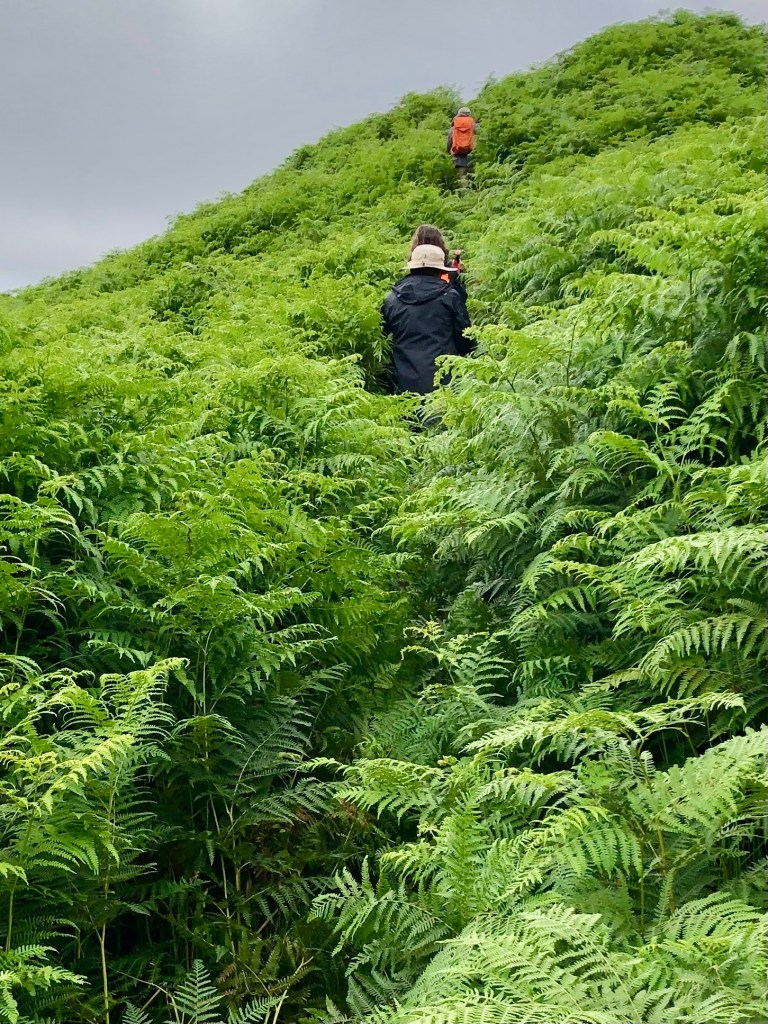
We were completely distracted from the steepness of our ascent because the almost imperceptible trail started to lead us through fields of five plus foot high ferns. They literally towered over us and I found I was using my body as a battering ram to push through. It felt way more like an Amazon jungle than the Yorkshire Dales.
Part of the way up, we realized there may have been a slightly more trodden path, but we were too busy bushwhacking and trying not to be swallowed by the ferns to have seen it.
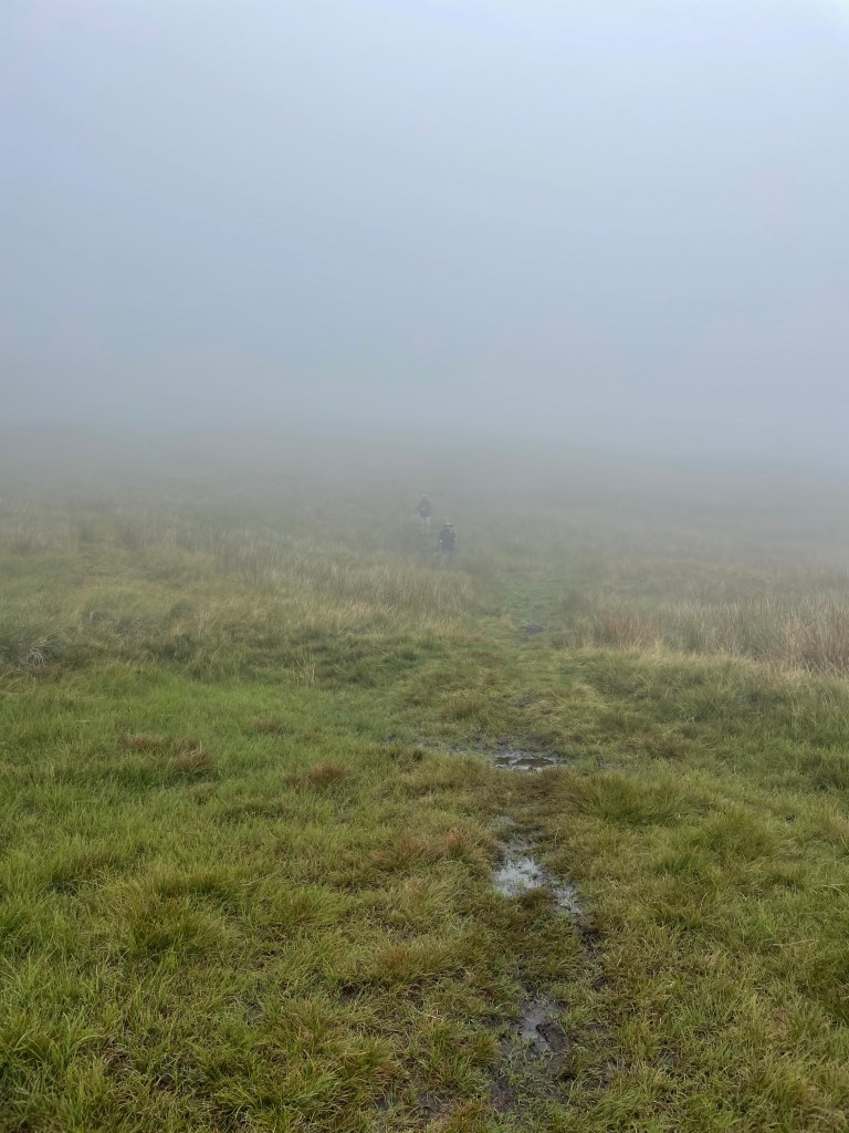
We finally cleared the fern field and continued to ascend. It was a very rapid elevation gain. Suddenly we found that we were no longer below the low hanging cloud we’d been observing all day, but were actually in it!
Yet still we continued to climb up. Visibility was starting to close and navigating the blue line was like flying a plane on instrumentation only. We encountered one group of young scouts using maps who were clearly doing some sort of orienteering exercise….they seemed infinitely better equipped for the challenge than we were.
We had no choice but just to stick to the GPS line as much as we could and aim toward the cairns and waymarkers that we could see. Finally, the scout leader passed us asking if we’d seen his charges anywhere – we were relieved to see him as proof that civilization existed somewhere in the direction we were aimed.
Visibility continued to get worse and the wind was whipping. We stopped for a brief break by a the first stone wall we’d even seen. But by then I was simply dedicated to getting down as fast as we could because it really was starting to feel unsafe. I was beginning to feel like a character in one of those Sierra Club magazine articles about what can go wrong while hiking….they usually end with hypothermia or broken bones.
Anyway, we finally reached what the itinerary termed a “snappy descent.” To the dismay of my fellow hikers, I actually found that part sort of fun – skipping around and over rocks, but with lots of grass cushioning on either side. Plus we were going down.
But we were still in the cloud, and M and S were just dots in the mist. All I could think about was that we had to maintain visual contact. You really could have gotten lost up there.
Finally we were below the cloud, and the world started to come back into focus. We could see the village of Starbotton at the bottom of the peak we were descending, and the wind that had whipped us as we crossed the ridges of the moors died down.
A steep descent down a stone road, and we were back in the valley, only 2 1/2 miles from Kettlewell. We had a quick bite of our sandwiches, and then walked through the fields that lined the valley for a straight shot to Kettlewell.
We had made it – all 77 plus miles! We walked through the village to the Blue Bell Inn where we were to meet the taxi in an hour or so. We had a celebratory drink to toast our most recent adventure. And even the fact that the taxi was an hour and a half late picking us up didn’t really matter.
My goal of cranking out our entire Mount Baker trip in a few weeks has been waylaid by work, as so many things tend to be. But fear not; we haven’t been stuck on the summit forever – we did in fact make a not very elegant but nonetheless effective descent.
One thing I inadvertently omitted from the account of our trip up to the summit was the eerie, almost tropical breeze that accompanied us at the beginning of our summit night. It was a harbinger because heat was the theme of the way down.
Of course, the first challenge of the descent was to reverse our way down the Roman Wall. As the smallest of our team of four, I was assigned the front of the rope, which meant I had the responsibility for picking out the footsteps we would follow on the way down. I had last led a rope line on Mt Elbrus and I was terrified as guide S short roped us (so he could control the rope better) and I cast a look down at the truly steep slope before me. He’d done the same short rope up the Roman Wall as well, which gives you some inkling of its incline.
It was much harder to get into a steady pace on the switchbacks on the way down, as we had very varying speeds on descent. To my surprise, the really vertical part was actually easier than the switchbacks – it required a boot plunge into already carved steps that you slid into – some almost 18 to 24 inches – but they felt fairly secure. The only problem was that so many other ice axes had already traveled that way when you dug your axe in you were just as likely to hit an existing hole and get absolutely no purchase.
I’d forgotten how much I liked leading a rope. The Roman Wall demanded absolute concentration and my legs felt shaky at times – nerves – but that complete absorption in the moment is one of the things I love best about mountain climbing (and glaciers, in particular). As our guide said – every step had to be purposeful. I’m afraid there are no photos of this. My hands were otherwise occupied.
Not quite sure about this angle but this is what it felt like
We made it down the Roman Wall in decent time and then reversed positions and I was now at the end of a long rope. Our guide, SH, was concerned about speed because temperatures were climbing and water was getting low also. Apparently my Florida heat training helped because I got down with water to spare.
But this is where the different trekking speeds really slowed us down. If I went too fast the rope would pool around J’s legs and he’d trip so I had to keep stopping and we never got a good downward rhythm going. It took almost five hours to get down (recall it had taken about eight to ascend), and it was an enormous relief once we could unrope and slip and slide down the last little bit.
Crevasses presented a few adventures on the way down also. The glacier is always moving and the cracks in the snow were no longer where they were or the same width. In fact, although I didn’t see it, T reports to me that M had a “crevasse crash.” The snow at the edge of one deep crevasse had gotten slushier, and you needed to dig in your crampons before hopping across it to get traction. As M approached, she couldn’t get a good foothold, and, worried about breaking her leg if one foot slipped in, chose to dive headfirst across the crevasse with full momentum. According to T, she quickly uprighted herself, sat up, and started laughing.
Back in camp everyone was exhausted. Poor J was still enduring whatever stomach issue was plaguing him, and M was also having to cope with feeling unwell. We had a latish dinner of spaghetti and needless to say, all were asleep at an extremely early hour.
Next up – the hike out, the miracle of my mountaineering boot drop, and had I actually gotten myself lost somewhere on the trail system of Mount Baker.
The first night of our expedition was the coldest of our three camping nights, and my feet never got warm. For some unknown reason I had failed to wear socks.
But the day dawned bright and sunny. This was to be our rest and training day. We were treated to a non oatmeal breakfast of surprisingly good scrambled eggs from a powder, topped with cheese and turkey bacon jerky. Who knew. SH had dispensed packets of instant oatmeal to everyone for the remaining days, which led to great confusion as to who had the right number of packets and what that number was. He’d also doled out lunches for the next days – wraps that we were already calling salami bombs and I’m sure they added to the weight of my pack.
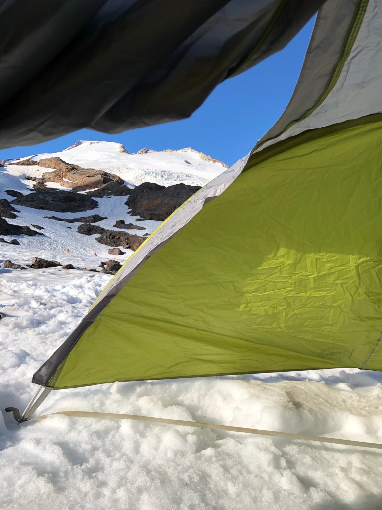
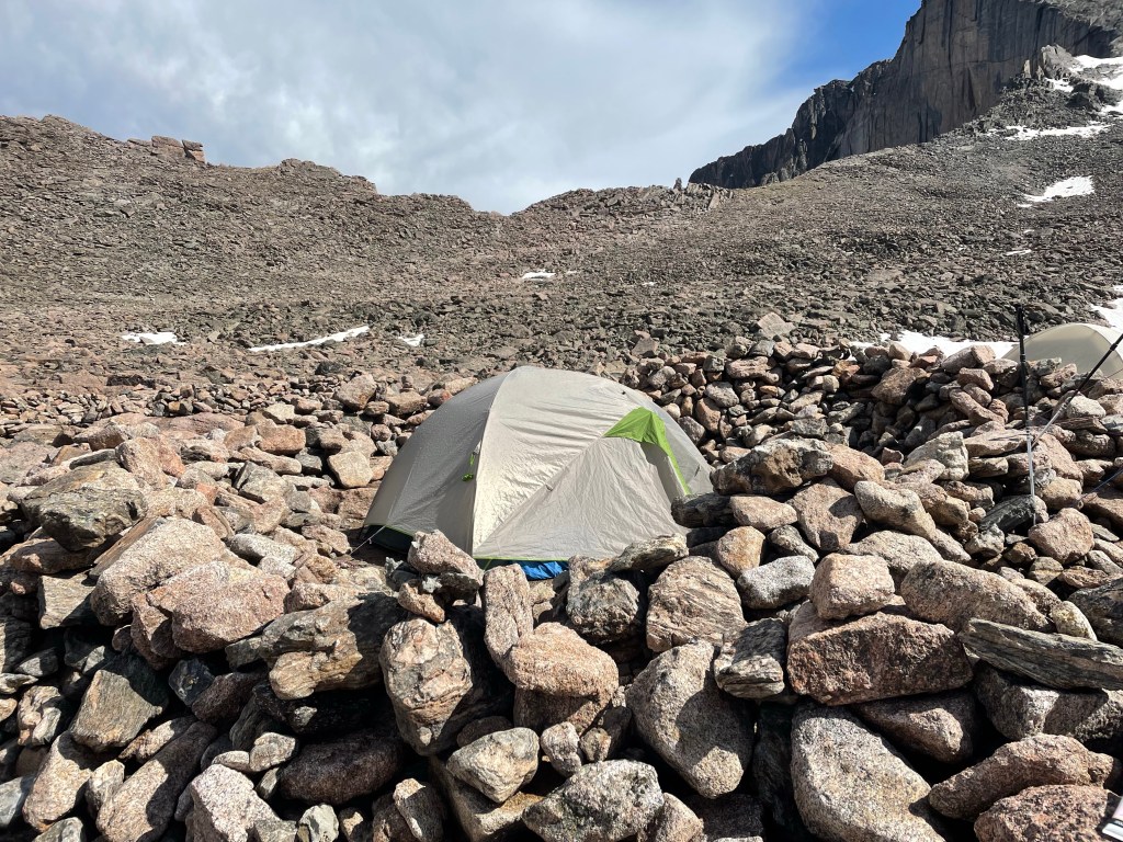
A view from our tent – that steep bank in the distance is the Roman Wall
After a leisurely breakfast we donned crampons and climbed up the nearby snow bank. There we proceeded to practice movement on the snow (duck feet, French technique), self arrest (flip your ice axe around, pick side down, plant it, dig in with your knees and feet, hips raised, and kick), and movement on a rope with a team. It had been four years so I was glad of the practice. M, one of the folks from Canada,was definitely the most adventurous on the self arrest practice – she picked up a lot of speed as she simulated her fall down the slope. J and I were a bit more cautious.
We spent the afternoon reading, napping, and prepping our packs for a 1 a.m. wake up call. I also spent quite a bit of time observing our comrades from other groups – campgrounds are second only to airports for people watching.
We had an early dinner of rice, orzo, the ubiquitous salami chunks, followed by a sunset walk, and were in “bed” by 8. Needless to say, sleep was hard to come by, but I know I must have drowsed off, waking about five minutes before the alarm, just in time to force down my two packets of instant oatmeal. At least we also had dried fruit, nuts, and chocolate chips to add to them.
We finally started off at 2:15 a.m., only 15 minutes after our appointed time. Slow was definitely a theme of this trip – after all, it was referred to as the “slow Baker” expedition in the marketing materials. But let me also add a little flavor. Of our five merry climbers, only M, J and I had worn crampons before, and M had not done so for years. T (friend of absent S) and TF (the other person from Canada) had never worn them. So all in all, I think we made a pretty good showing.
It’s always spooky to take off in the dark, accompanied only by the glow of the headlamps, but the air was perfectly still and I was hiking in only a soft shell jacket. We started off with our crampons on – which was great as we avoided the agony of having to struggle getting them on somewhere on the glacier in the dark.
After about 45 minutes we crossed a rocky area with a bit of scrambling and it was time to rope up – we were well onto the glacier. SH led a rope with J, T and me; H led the other rope with M and TF. Z and C were on their own rope. Z did decide to wear something other than his kilt for the summit day.
I could feel myself slipping into that zen like state of a steady pace where focusing on putting one foot in front of the other is the only thing in your head. I’ve so frequently channeled our guide Ossy’s instruction to me on Cotopaxi in Ecuador that you have to find your own way up a mountain. This time I also repeated SH’s mantra – step purposefully. Surprising how these mountain directions do a lot for everyday life.
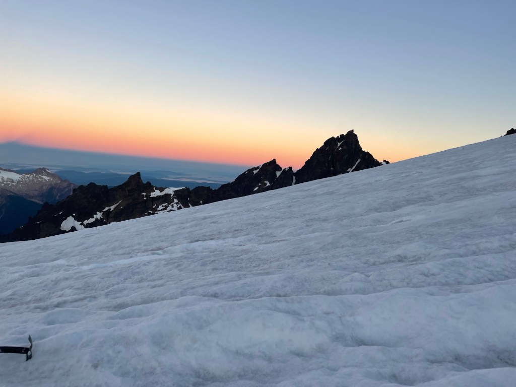
The trail was moderately sloped with a couple of flat platforms at 7000 and then at 8000 feet. There weren’t a lot of other groups but we were passed by some who were huffing and puffing – my goal was not to do that! The sun eventually rose and we could see the shadow of the mountain cast along the valley.
There were any number of crevasses that we had to wind our way around or step over, sometimes with the help of a snow bridge and sometimes without. The widest was perhaps 18 inches. They are eerie. You can see blue ice lining the sides and no bottom, and it looks like a fall would usher you into some completely other world.
The crater
We ultimately reached the crater. The mountain is still an active volcano but I wasn’t really aware of any sulfur; it certainly wasn’t anything like Cotopaxi. I was conserving my energy so didn’t walk over to look into it, but I did enjoy my salami bomb. I was making a big point of eating a lot as I know in the past I have failed to do so and that does not work well in the mountains. In the meantime, I learned later that both J and M were feeling unwell, but what troopers! They soldiered on without a word of complaint and still with appreciation of what we were experiencing.
Finally we reached the so-called Roman Wall, unclear why it was so named, but it provided the source for a running series of jokes about the ancient Romans and their visit to Mount Baker. The Roman Wall is indeed steep; it is really the head wall of the mountain and considered the crux – that is, the hardest part. It’s the part I’d been dreading. It averages about 40 degrees according to what I’ve read, and starts at about 9750 feet.
The first part is a series of switchbacks that nicely ameliorated the steep slope. I’ve always said you can climb most anything with enough switchbacks. But near the top, they cease and there’s a straight vertical climb. Kick into the step of the person before you, step up, and repeat. Twenty five or so straight up feet of this. A few more switchbacks and suddenly you’re back on a relatively flat area with the summit not far away.
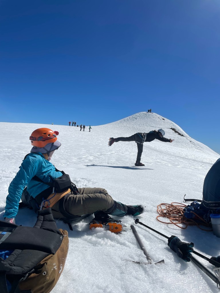
The summit is a small 50 foot high or so mound that protrudes off the flat area. Unfortunately I kept having the image of a pimple, which does not appropriately capture the grandeur of the view or experience. We all collapsed for a few minutes and I took my obligatory yoga pictures – but couldn’t wait to start up the final steps to the summit. It was about 8 hours since we’d started our jaunt.
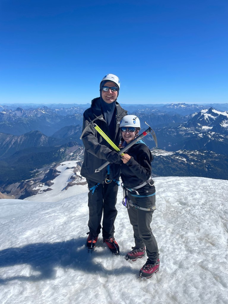
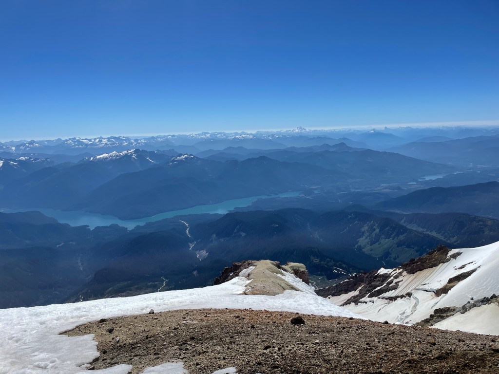
The views were spectacular, as the photos show. And I once again had that top of the world feeling, that exhilaration that I’ve never really been able to capture anywhere but a summit.
I later found out that TF’s parents were from South Africa and in the early 1950s, when they were in their 20s and had been married for four years, had travelled to England, bought a 1933 London taxi for 50 pounds, and proceeded to travel 6,000 miles throughout Europe, camping along the way in their taxi. So many people asked them what they were doing they painted the facts about their journey on the outside of the vehicle – the media picked it up and the taxi became known as their traveling suitcase and they the “traveling suitcase couple.”
What a spirit of adventure! I’d say that TF – and all of us on this trip – were carrying on a bit of that legacy, even at much more advanced ages. I’m sure TF’s parents would approve.
But as I’ve frequently said before here, what goes up must come down – and so it was with this trip also. That’s for next time.
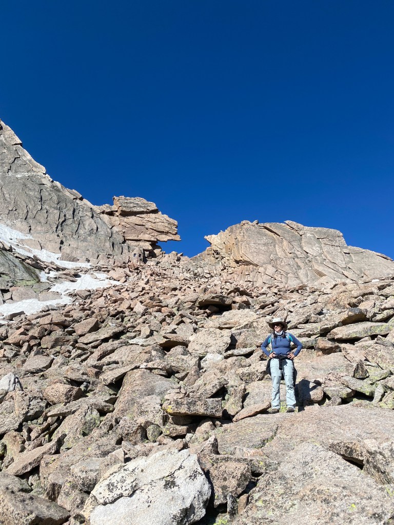
Since you can’t stay at the top of a mountain forever (or near the top, in our case), it was time to start the clamber down through the rock boulders. Being significantly shorter than the others in our group, I have developed a wedge yourself into a crack, slide down, squat and start it all over again technique. It’s not fast but it’s undoubtedly safe. The sun was scorching down on the reddish rocks and we were all glad when we finally reached the Boulderfield. J managed to get totally dehydrated but was better after some electrolyte tablets.
Once we packed up the tents and ourselves, we finally got on the “road”. We had another 4 plus miles to our next campsite, but at least the trajectory was downward, which certainly helped ease the weight of the packs. We climbed over and through lots of rock, and then emerged onto a broad expanse of rocky grasslands. We stopped for lunch where we were joined by another hiker we had met at the Boulderfield- he had gotten to about 100 feet below the summit but had to stop at that point because of ice. A number of large and well fed looking marmots also participated in our dining activities – or attempted to!
We reached the Boulder Brooks campsite in decent time. It’s situated by a rushing stream and consists of three very spread apart sites. Of course, as soon as we got the tents up it started to pour with a hard rain, which seemed to be the pattern of this trip. J and I hunkered down in the tent and I finished my book. My kindle is truly worth the extra few ounces on trips like these.
The location was beautiful and I sat outside for a bit in the early evening. Unfortunately a multitude of mosquitoes found it equally enjoyable and ultimately chased me back into the relative safety of my tent, where an early bedtime – combined with more rain – made for a very good nights sleep.
The next morning our tents and any possessions stored outside were all quite soggy. We had stayed dry inside but the exteriors were soaked. After a pancake breakfast we dried everything out as best we could and then started a three mile trek out to the pick up point.
The trail followed the same creek we had camped by and we criss-crossed it several times on narrow log bridges just above the water. A far cry from the high swinging bridges of the Himalayas. The Douglas firs soon gave way to silvery white barked aspens. Although they are beautiful I appear to be allergic to them and snuffled and snorted my way the last few miles to the pick up point.
Made it!
The guide company van met us, and delivered a gourmet picnic lunch which we devoured at a nearby state park. The drive back to Estes Park went quickly, and we were deposited at the back of The Stanley Hotel, of The Shining fame, where we were to spend the night. S, J and I were each given a large black garbage bag to serve as a receptacle for the by now extremely dirty contents of our backpacks. The rooms weren’t ready yet so we and our very muddy and smelly possessions found a discrete corner on the porch of the hotel to while away a few hours. We met back up with M and her sister D, who politely refrained from too much commentary on our bedraggled state.
I couldn’t help but think that a haunted hotel was just the right spot to conclude the first part of a magical trip.
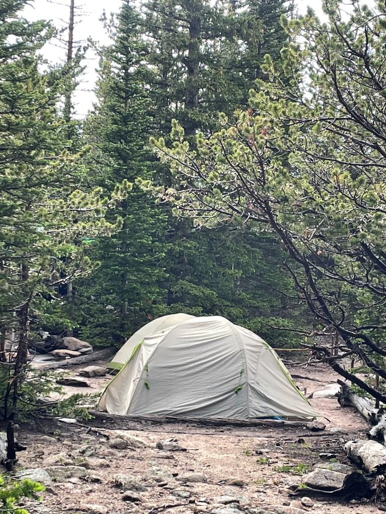
I felt like Alice. Going through the Keyhole was as though we’d walked through the looking glass, only to find ourselves in the netherworld. But we aren’t there yet on this journey – let me resume where I left off, at the Goblins Forest.
We woke up on time, about 6 am after an adequate nights sleep – except for the part where I thought J’s shadow as he reached for a drink of water was a bear…
After a filling breakfast of eggs, bacon, and potatoes we started hiking about 8:10. The first section was what we had done the day before – but this time with over 35 pound packs. As I had feared, an 18 inch step up is a lot harder with 35 pounds on your back – especially as you are working your way up a couple of thousand feet of elevation gain.
It took about five hours to get to the next campsite – the infamous Boulderfield, the real start of the Keyhole Route. We started by disassembling our tents etc, and once fully laden with our packs and the ever constant bear cans, started to hike, up, up, and more up. We made decent time to the junction we’d reached the day before, but definitely slowed down after that and as we went above the tree line.
Weather was moving in, and we all got out our rain gear. The sky turned progressively grayer as the thunderclouds rolled in. The rain came first. Then, just as we reached an even more exposed traverse, the hail started. This was larger than the Twin Sisters hail – almost buckshot sized pellets aiming at us as if fired from shotguns.
The stone steps kept going up and up. I only kept going by focusing on my office building stair training – each time there was a brief leveling out I pretended I was on a landing.
Eventually the stairs turned into an uphill field of boulders, and after a few wrong turns we finally made our way to the “campsite.” It consisted of a square gravel and sand base outlined by small rock walls. Stark, to say the least. No vegetation to speak of except for a few clumps of grass peeking up between the rocks – leading one to wonder what in the world all the marmots are surviving on.
Once there, we got the tents up just before the next rain storm arrived. J was very dehydrated and we just hunkered down in the tent. I amused myself by trying to video the tent interior as he slept. Eventually our guide T delivered carrots, hummus, and cheese to each tent for a mid afternoon lunch – which revived J considerably.
Finally the rain stopped and we emerged from our tents to take in our surroundings. Our guides had suggested in lieu of the Keyhole we could climb Mt Lady Washington if we wanted. After we asked what it looked like and they pointed to a high pile of what can only be described as a rubble heap, there was not even any discussion among the three of us. The Keyhole it was!
We were up at 4:30 am on what appeared to be a true bluebird day. The Keyhole is visible from the Boulderfield and each clamber up another boulder brought it closer and closer. Just below the Keyhole is a stone monument to the first woman to summit Longs Peak in winter – she died on the way down.
I wasn’t even aware of the precise moment I went through the Keyhole – it’s a steep bit and you’re looking down. But once through, suddenly a previously unseen mountain range spreads out before you, towering over a dark, stony valley. It was as if we had entered another world, some magical kingdom populated by giants and goblins and ghosts.
We ventured out onto the Ledges, the next section of the route. There’s a fair degree of exposure, but I felt comfortable- able to lean into the wall and move fluidly. We followed the bulls eye markers almost to the end of the Ledges section, which is marked by a piece of rebar. At that point you have to step around a fairly intense rock – it was slippery and you have to move around it without being able to see to the other side. It was clear our guides weren’t going to let the 60 year olds under their charge go any further.
But the elation of reaching that other world – paired with a lot of adrenaline and endorphins, I’m sure – brought back all my summit experiences. It always makes it worth it.
But – we couldn’t stay there forever. The descent had to begin.
I’ve been promising an announcement – and here it is – Long’s Peak in Rocky Mountain National Park is to be this summer’s adventure!
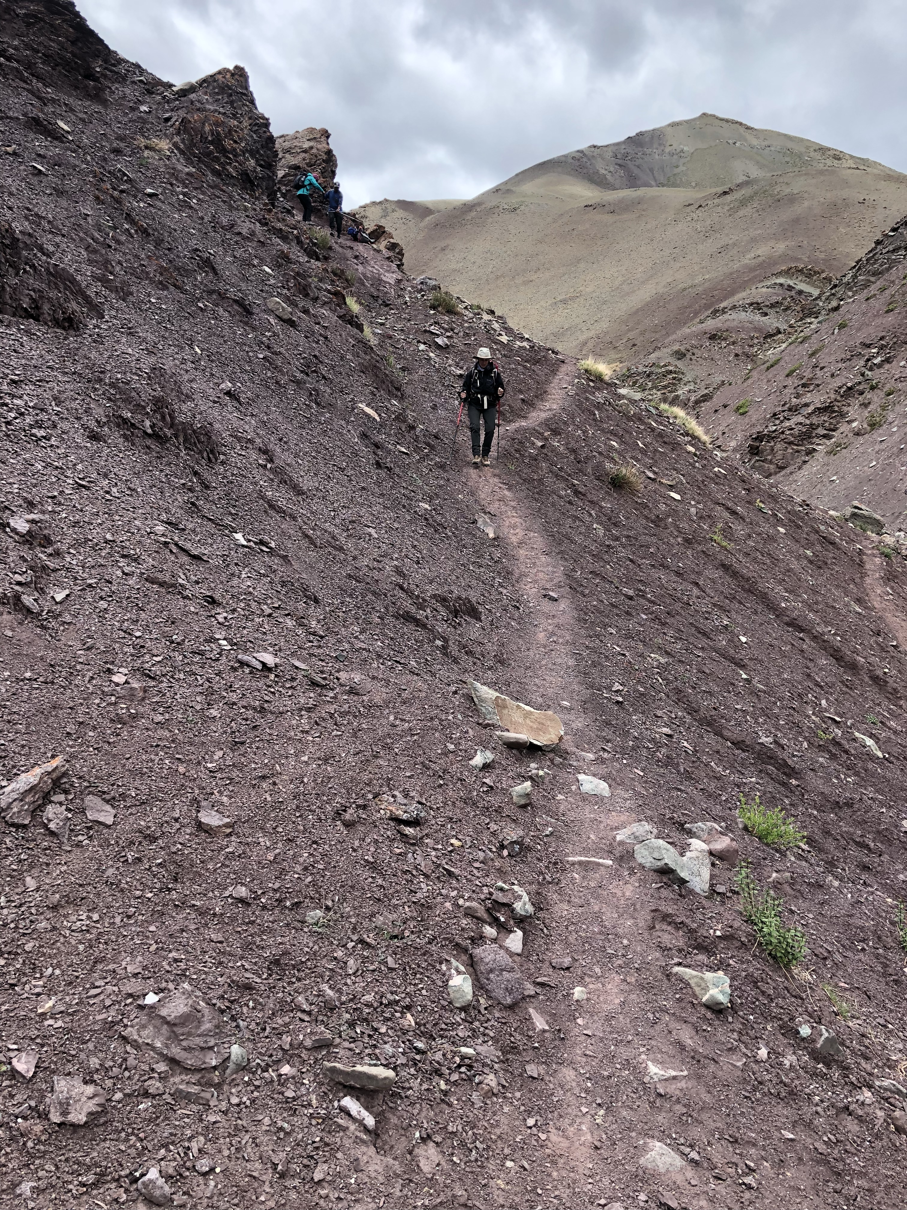
This is Ladakh, India but I couldn’t find a free Longs Peak photo to use!
When J and I began mountain climbing and trekking in 2011, we saw no point in starting with something small. So Kilimanjaro, at over 19,000 feet and the highest mountain in Africa, was our poison of choice. We’ve never been to Colorado or climbed a 14-er either – so why not start with one of the most difficult – Long’s Peak via the Keyhole route!
While not the tallest of the so-called 14-ers, at 14,254 feet this summit presents a number of segments of class 3 scrambling. The trail is broken up into sections, each labeled with forbidding names such as the Boulder Field, Ledges, Narrows, the Trough, and the Home Stretch.
J and I have watched any number of YouTube videos, many of which are taken with GoPros and whose goal appears to be to strike terror in the eye of the beholder. My favorite is an 8 minute long one, where the climber repeats at least three times, “it’s not really as bad as the GoPro video makes it out to be.”
And intrepid hikers M and S will be accompanying us on this latest adventure. Last Saturday after an urban hike we all sat in the porch trying to get our heads around the amount of exposure on this hike – no easy feat when you are looking out at an ever so gentle slope down to a lake and only Florida flatlands beyond.
But where there is will there are ways, and yesterday’s foray to Blue Swan Boulders was the start of a new aspect of training designed to get us to the top. Aside from climbing a rock wall on a cruise ship (remember those?) many moons ago, neither J nor I has ever done any indoor climbing. An indoor bouldering gym consists of multiple walls at various inclines reaching up 15 or 20 feet or so, ornamented with hand and foot holds color coded by level of difficulty. There are no ropes – and you spend a lot of time practicing how to fall.
Only drew blood a couple of times.
Although we were clearly the oldest people there we loved it! Talk about a mindfulness practice – as you swing your center of gravity toward that next handhold while reaching with your foot – not much else you can think about. On day 1 we limited ourselves to yellow and beginning green routes – and may not advance much further – but mastering those should translate well for Long’s Peak scrambling.
We ended up with a few scrapes and are pretty sore today but plan to return on Monday. And the craft beer we rewarded ourselves with at the Ivanhoe Park Brewery afterwards was pretty good too!
People keep asking me, “What’s the next one?” The reality is that we are in a between year. Trying not to make it sound like the doldrums (what a great word), but when I looked at my schedule for next year, I simply can’t find a spot for a two week trip plus weekends on either side. I am usually able to preserve that period of respite but this year’s judicial system apparently had other ideas in mind. Hmm.
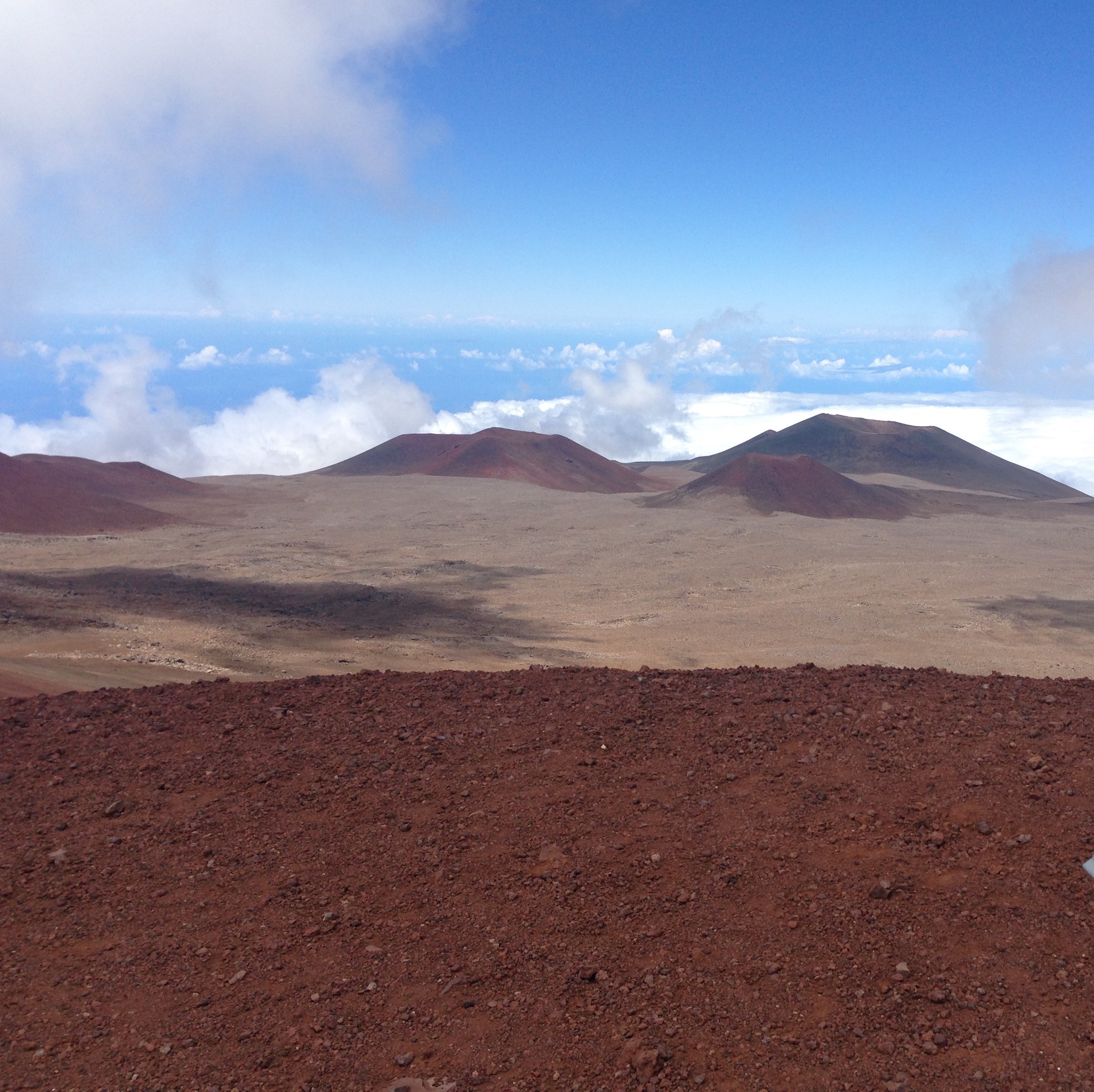
Mauna Kea, Hawaii, 2013
We haven’t had a between year for a while. In fact, I think since 2013 which somewhat inadvertently turned into one due to a virulent flu attack on J as we were about to embark on our Hawaii backpacking trip. Since then, we’ve climbed Elbrus, Ecuador’s volcanoes, hiked the Scottish Highlands and the Peaks of the Balkans, and summited Stok Kangri at all of its over 20,000 foot splendor.
Our home at Mt. Elbrus, Russia, 2014
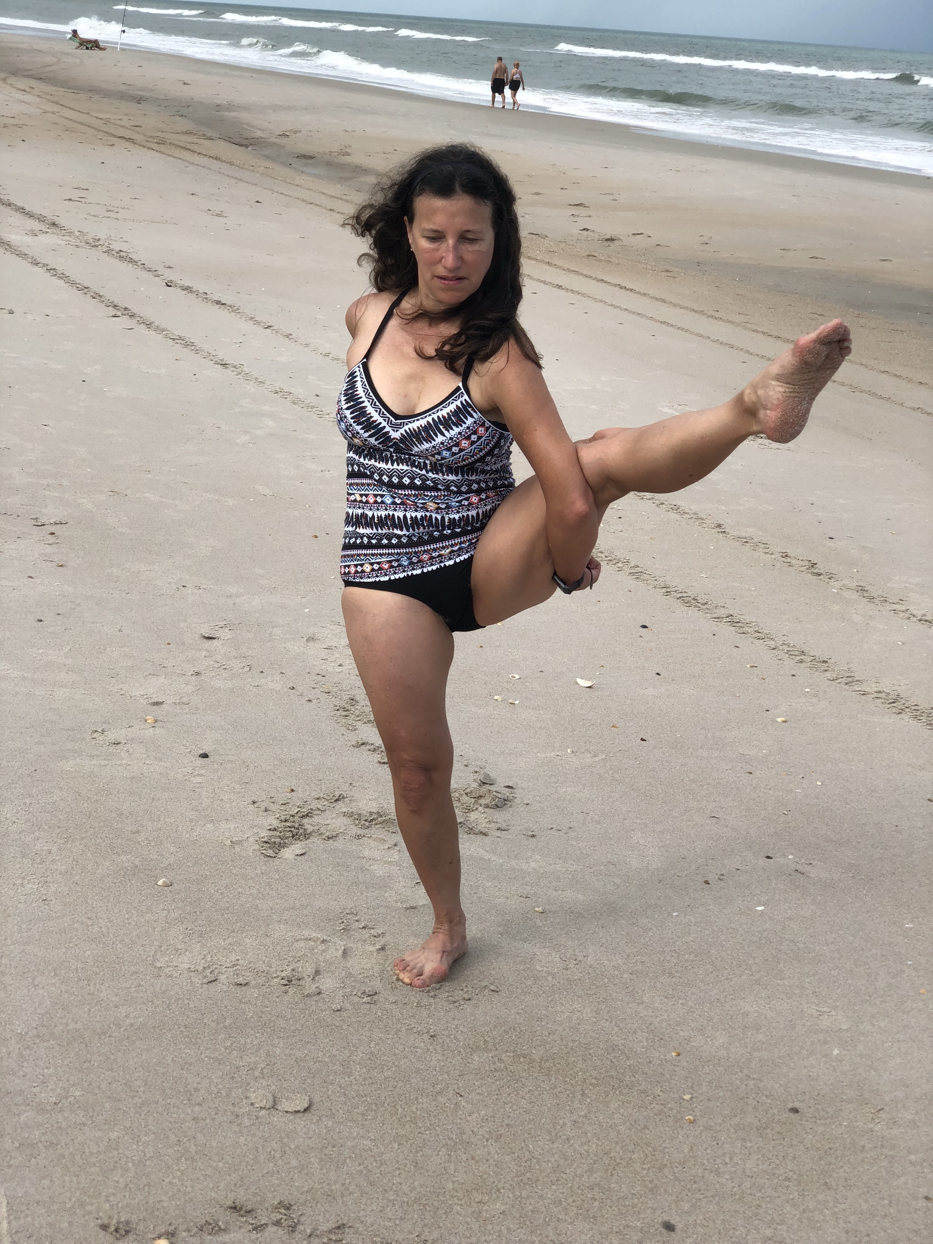
So what will 2020 hold? The year itself – with its parallel numbers – must mean something. Thus far, the idea is a throwback – a week at the North Carolina beach with family and friends. Haven’t done that for years. And hopefully the daughters are now old enough to avoid sea kayaking accidents like the one many years ago that caused me to call 911 to everyone’s great embarrassment since they’d hauled themselves out of the ocean by the time the rescue team arrived. I suspect we are still black listed at the sea kayak rental place.
But as fun as that will be, there have to be some actual summits somewhere. It looks like work will take me to Seattle over spring break – and there appear to be some nearby hikes with a good 3500-4000 feet of elevation gain. And N, A’s boyfriend, has suggested we hike the northern part of the Appalachian Trail and summit Mt. Katahdin. It’s the highest mountain in Maine and he promises he knows the way to reach its 5,267 foot peak.
That sounds appealing. Given that the odds of our hiking the entire AT are probably close to nil we might as well cross the finish line first.
So, I may wrap the decade of my 50s with local summits. They are just as important as the others. But 2021 marks the 10th anniversary of the start of all my mountaineering and related adventures. Entertaining suggestions for another non (or at least mostly non) technical, over 20,000 foot mountain for my 60th birthday next year! Got to keep looking toward the future!
A and N looking toward the future from Mt. Washington, New Hampshire
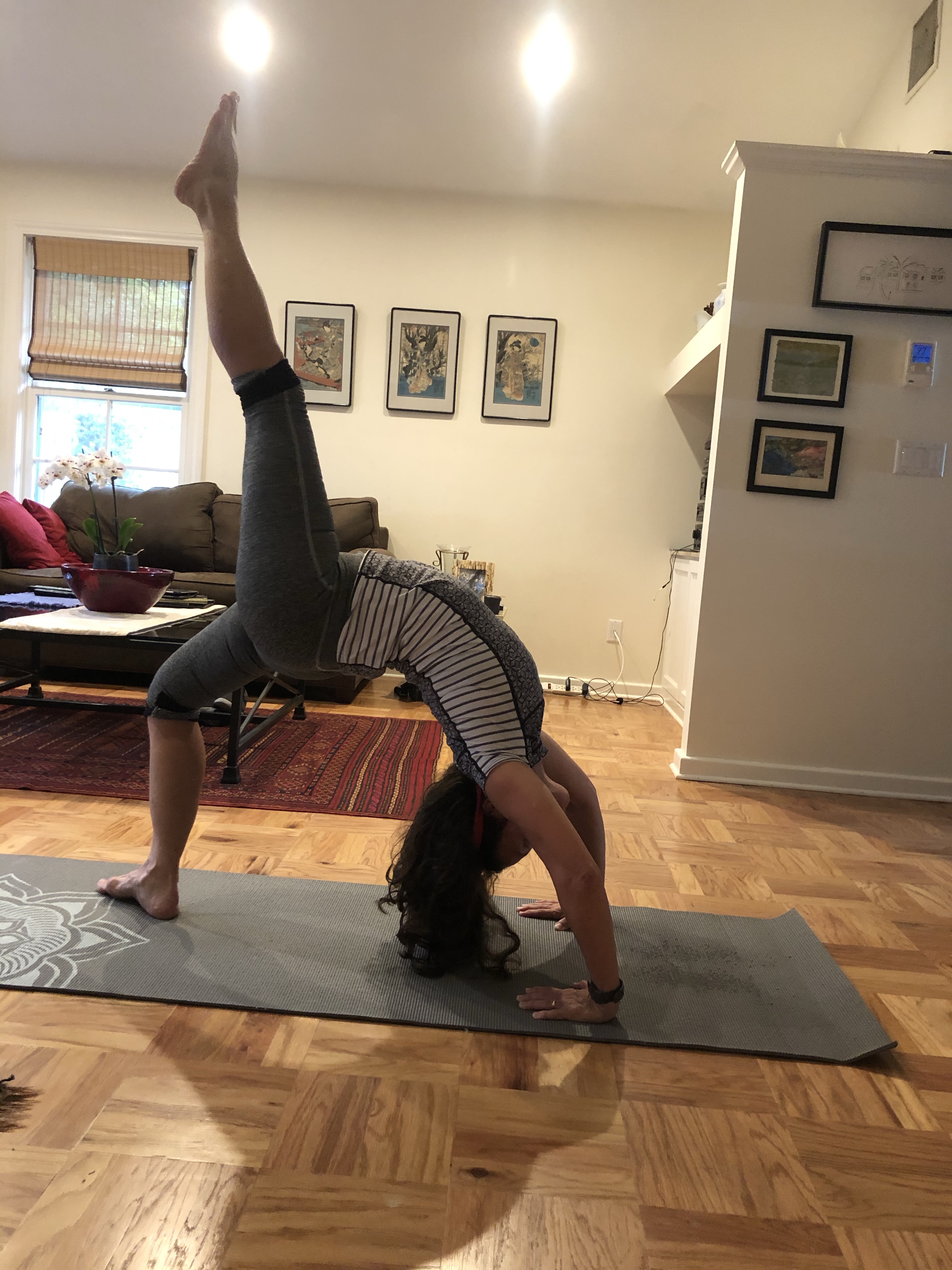
Yoga. It’s been an underlying theme to this blog since the early days. In fact, I’ve tried to honor my practice by doing at least a few asanas on mountains and trails through all of our adventures – from the steep treks in Nepal to India to rocky riverbed hikes in Austin, Texas.
Over the last couple of weeks of silence on the blog – I promise I really haven’t been binge watching TV (well, I did finish Succession) – I have been spending at least a little time honing my thoughts on the topic.
I started practicing regularly at the Y back in the early 2000s, when my daughters were old enough that I felt I could take two hours respite from motherly, lawyerly, chief cook and bottlewasher duties on Sunday afternoons. I still remember my first yoga class. I positioned myself in the back row of the 30 or so yogis – that was pre the construction of the Y’s yoga studio and we practiced in the “Fitnasium,” a fancy word for a small gym. You could line yourself up with the various floor markings. My yoga teacher at that class remained my Sunday afternoon yoga teacher for almost 20 years until she recently stepped down. And I’ve been practicing with the guy next to me now for an equivalent length of time. He’s ten or so years older than I and I’m now older than he was when we first met.
There’s a community that forms in a regular yoga practice. Wednesdays and Sundays are my days of choice. While people come and go there been a regular core of us over the years. I refer to them as my yoga buddies. There’s something to be said for the sharing that goes on as you contort yourself into the next pretzel like position. And before or after class we can complain about our latest ache or pain or the state of the world in general. It’s those little interactions that build connection (karma?) that can carry you through your week and up your next summit.
Teachers – and I’ve been blessed with great ones – can add to the practice, but they really are guides, not yoga maestros. It’s the combination of energy and eventual calm of those in class that creates the yogic environment.
How, you may ask, does this relate to summits? Well, aside from the obvious physical benefits – clambering up rock frequently require flexibility – there’s a mindset that goes with you. It’s a degree of determination that you can in fact hold that posture for a few seconds beyond what you thought. It’s a focus on that next step in front of you instead of obsessing about whether there’s a fake summit a few hundred (but oh so long and steep) meters away. It’s keeping an intention in your mind, body, spirit that propels you upward. It works for work, too.
My Wednesday night yoga class is the one that lets me know I really can get through the rest of the week. My Sunday one brings the calm that lets me start a new one. Both summits, of a sort. Namaste.
It’s perhaps a little misleading to characterize the final part of the Balkans saga as a trek. Perhaps a journey in a time machine is more like it – we were about to move from a world where our dinner was being butchered before us into the land of tourists and suntan lotion.
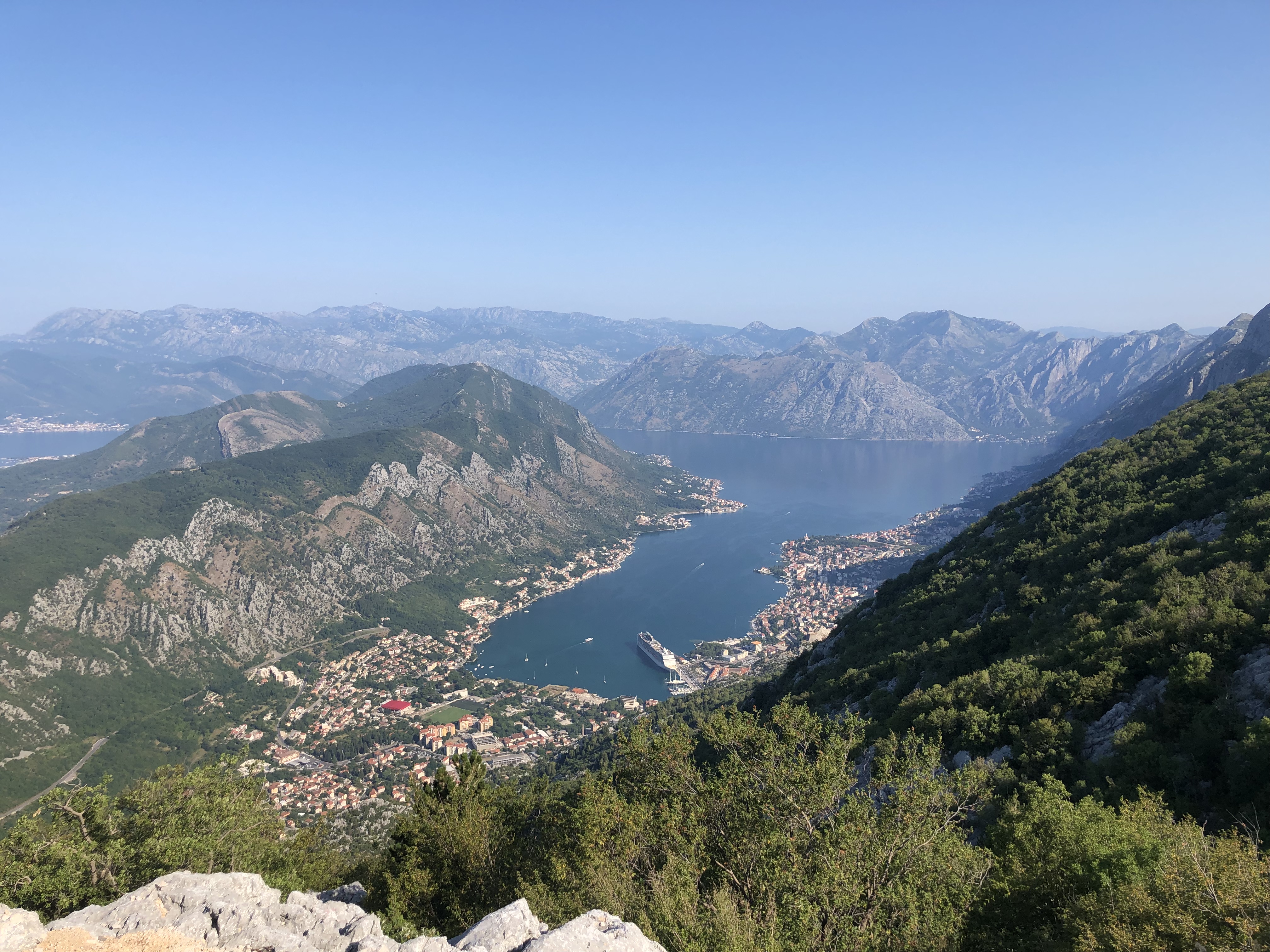
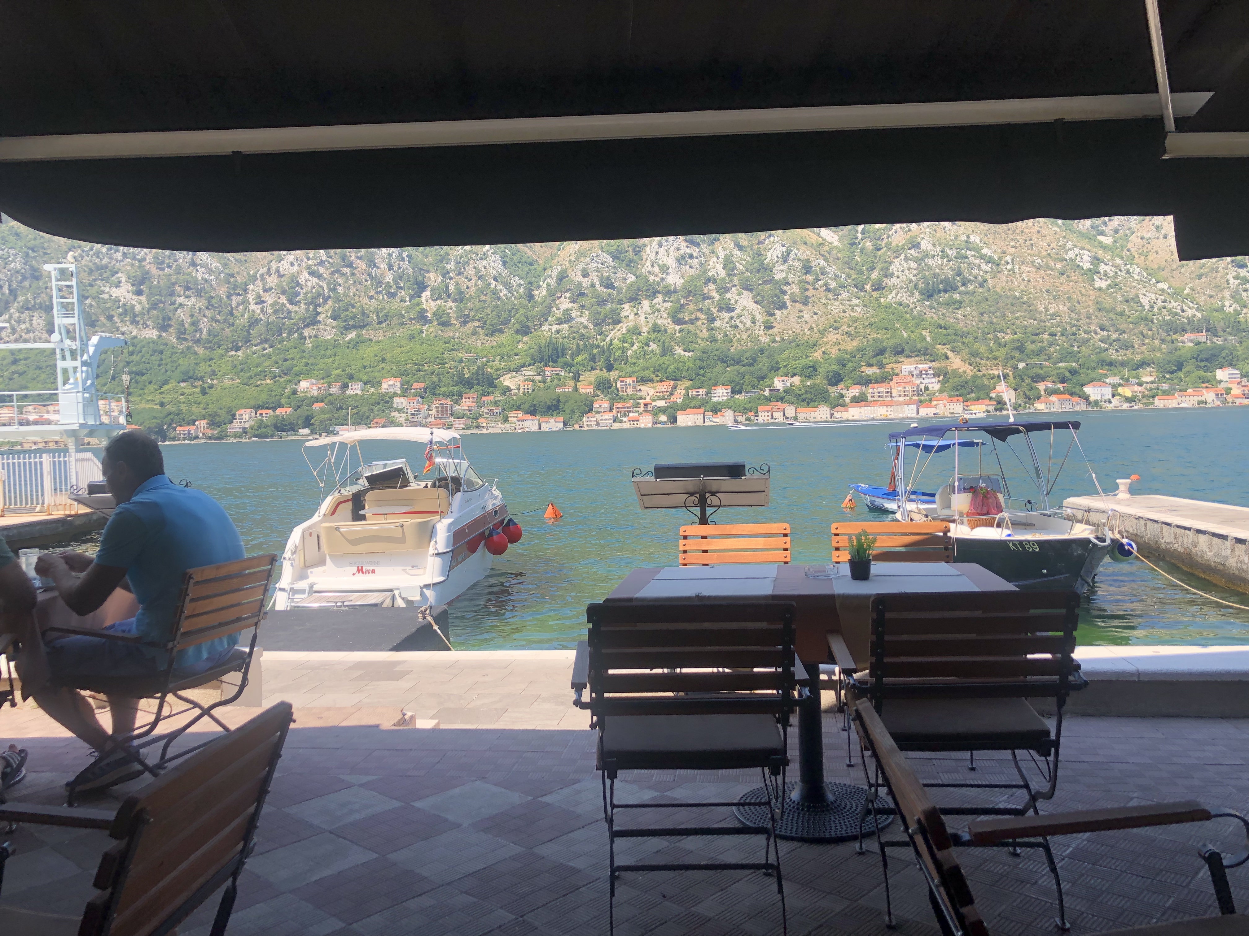
We started our next to the last day with a very beautiful and less terrifying drive to Kotor Bay. Kotor Bay, located in Montenegro, is filled with domestic tourists, all of whom were enjoying spectacular weather. We were also celebrating the end of the trek with much nicer accommodations – J and I even had a room with a balcony and a view of the bay. Prices went up accordingly. No more Pristina like lunches for 8 for $20 with drinks.
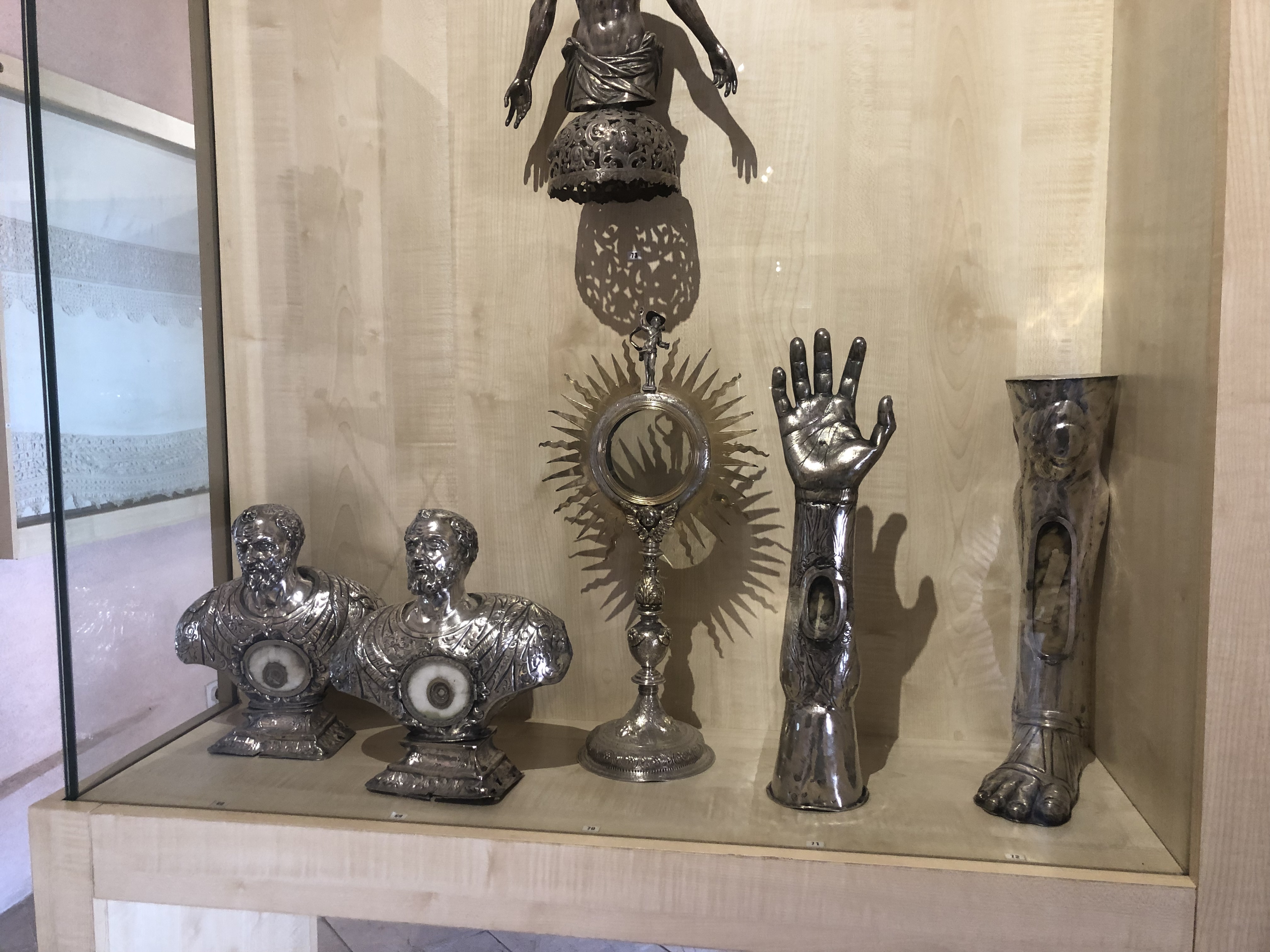
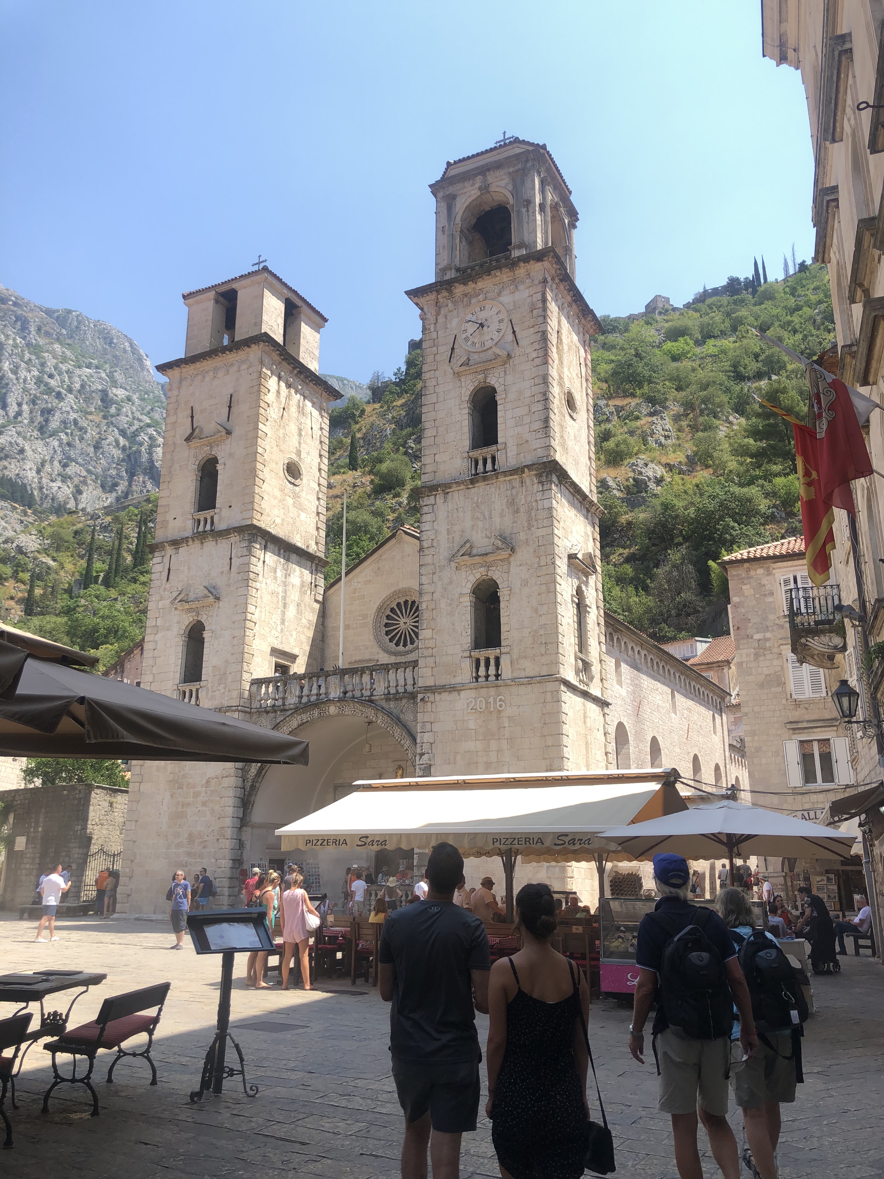
Once settled into the hotel we all walked down to the beach and found a restaurant with the unlikely name of Jet Ski for lunch. After yet another Greek salad, we walked into Old Town and visited several churches, both Catholic and Orthodox. Lots of relics (think silver gloves with a small aperture through which there is theoretically a nail clipping of a saint). Turned out to be a good place for souvenirs as well – particularly intricately embroidered linens.
It was then time for a boat ride to Perast. For once, our legs truly weren’t our main mode of transportation. Kotor Bay is basically a fjord. We sailed down one side, past two islands, one of which was manmade, very crowded, and housed a church that looked Orthodox but was Catholic, and another that was natural, privately owned, and was the home of a church that was Orthodox but looked Catholic. So much for architectural sterotypes.
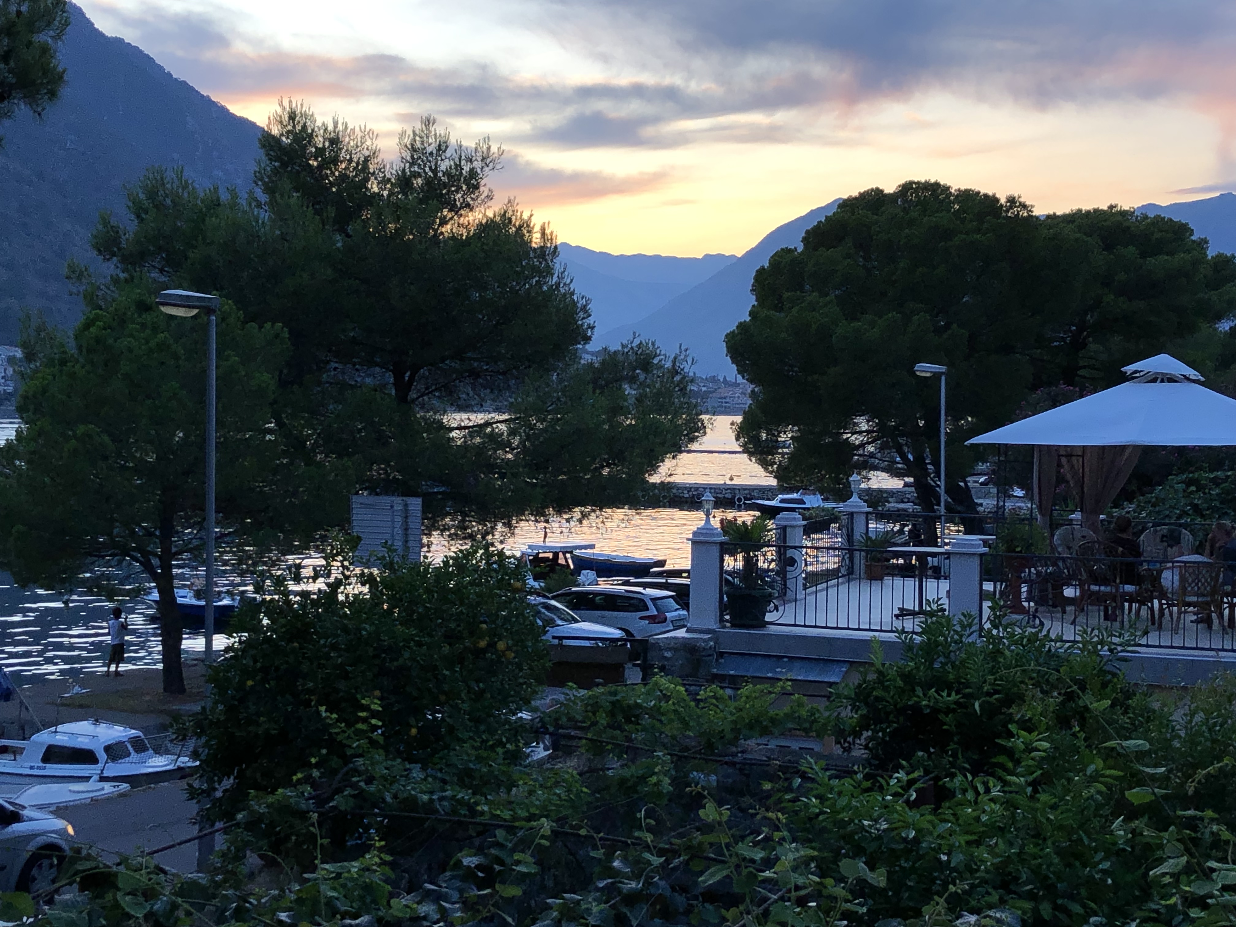
We ended up in the pretty village of Perast. the houses were uniformly built of light colored stone with red rooves (as everywhere in Montenegro), and dotted with colorful window boxes. At the end of the village was a narrow strip of concrete and gravel beach, dominated by a huge bar. It was quite the scene – a mashup of 20 year olds in bikinis and speedos, and families out for the afternoon.
That night, our guide B had picked a very nice restaurant where we ate on the outdoor terrace – mussels with a tomato sauce was the specialty and the salad had real lettuce as opposed to cabbage! Or just tomatoes and cucumbers.
After dinner we walked down y the water. Lots of people, bars, and music, and J from Newcastle bought everyone a round of flavored raki. So strange that the last time it was offered was at 10 a.m. in a remote Albanian meadow.
On the final day of the “trek” – I use quotes on purpose – we journeyed via a large van to the border of Croatia, where we had quite a wait. We watched as one poor soul, a middle aged man in a fedora, had to get off a bus while everything in the vehicle was searched. Not clear whether they let him back on or not.
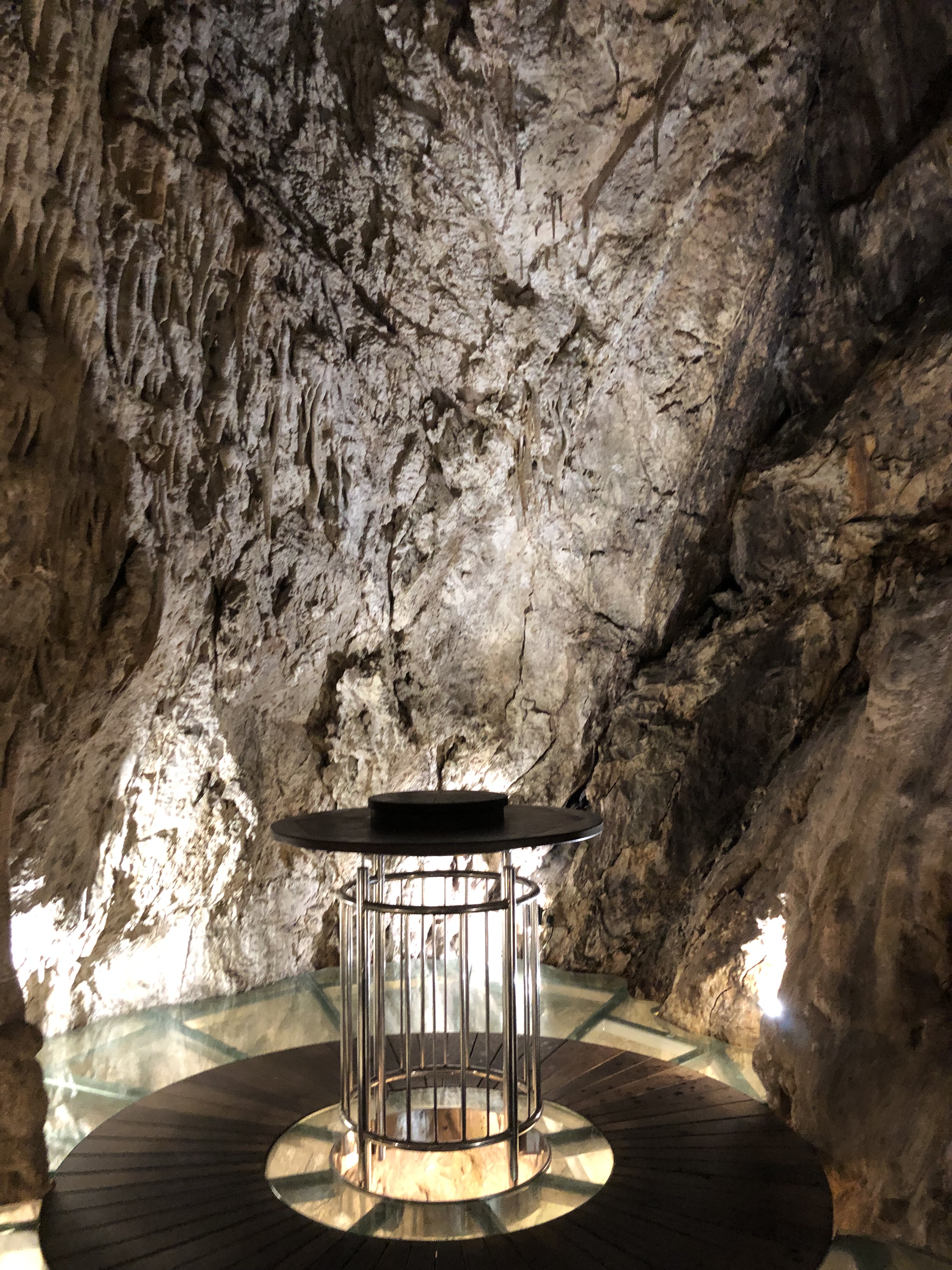
We bid farewell to our guide and travel companions at the Dubrovnik airport. We were now having to use kuna instead of euros. Made our way to a very unique Airbnb in Lapad Beach, and quickly found our way to a bar located in an actual cave at the Hotel More. The trek was over, but we still had four days in Dubrovnik to go.