Road Trip U.S.A. – Fast Forward from S.D. To N.C. To FL – and On To Vienna!

OK, so that title was a hook. J and I don’t actually reach Vienna in this post (unless we unknowingly went through a Vienna on the way back to Florida, always a possibility), but this episode does finally return us to Florida after five weeks on the road. But we will make it to Vienna, Austria in the next post, I promise!

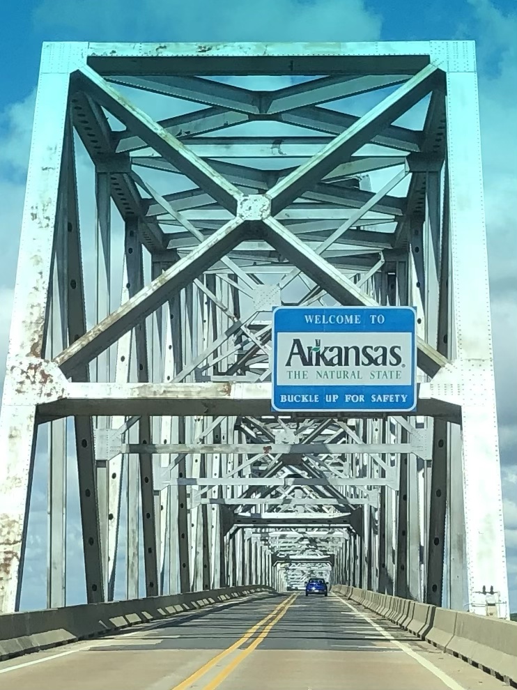
The final stage of our road trip meant we had to cross that vast expanse of the United States that lies between South Dakota and North Carolina, where we planned to spend time with friends and family. All I can say is that there’s a lot of United States.

To sum up:

— The Corn Palace in Mitchell, South Dakota. The largest high school basketball arena in South Dakota, completely decorated with dried corn. Apparently George McGovern played there. Who knew? J insisted having his photo taken in the center of the court.

— High prairies in South Dakota turned into rolling hills and a lot more trees during a brief foray into Iowa.

— Omaha, Nebraska has a lot more hills than I expected and it was not at all easy to find (or enter) our AirBnb. Maybe we should have spent another night in the rooftop tent. On the other hand, J loved his 14 ounce ribeye. It turns out I didn’t take a single photo in Omaha.

— Left quad still showing the wear from the Badlands ladder incident and stairs are not going so well…found a large ace bandage that might help…

— From Nebraska into Missouri. Lots of trees and lakes and very beautiful, especially once we got into the Ozark area. Detoured into Kansas City for the precise purpose of going to the Jack Stack steak restaurant.

— Missouri doesn’t believe in leveling roads. The two lane “highways” we were on simply followed the steep rolling hills regardless of pitch up or down. I’ve never been over as many “blind hills.” And there are some great town names – “Tightwad” being one of my favorites. With a street called “Stingy.”

— At the Doolittle campground, outside of Rolla, Missouri, we saw a red fox scamper across the golden, illuminated field behind our campsite.

— Further along in Missouri (it’s a big state), and outside the “Boomland” fireworks center (a truly scary place), we visited a somewhat desolate park that holds itself out as the location of the first steps of the Lewis and Clark expedition.

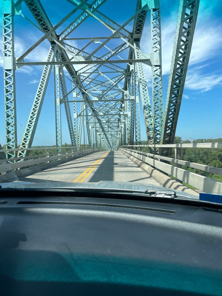
— There are a lot of terrifying bridges in the U.S., especially between Missouri and Kentucky. No shoulders, rusting, and they look like they could collapse at any minute.

— Nashville is a very large city. The “hockeytonks,” as they are called, are crowded day in and day out. After enjoying a lot of music simply from the street side we found a relatively tame venue where we could listen to a very good singer playing acoustic guitar. No luck in finding an unannounced Lucinda Williams or Steve Earle or Jack White show. Oh well.

It was a relief to get to the home of our friends K and B in Banner Elk, N.C. The next week and a half was taken up with family and friends (and the recovery of my leg). Unfortunately the leg issue meant that discretion was the better part of valor, and we didn’t attempt the Grandfather Mountain climb that we’d planned.

On the way back from N.C to Florida we had one last rooftop tent night at Skidaway Island State Park, Georgia, outside of Savannah. It was hot and humid and rained a lot.

But beautiful. Just like our 6,500 miles driving through 16 states and four national parks of the United States.

Road Trip U.S.A. – Down and Dirty in Badlands

The approach to Badlands took us along State Road 44, a two lane road that eventually cuts across the park. There’s very little traffic. But that apparently didn’t deter the same road construction that we saw across the entire country. We experienced a 15 plus minute delay when one lane closed down, and a lead vehicle ceremoniously ushered us along about a three mile strip of highway – where we met the sole car that was waiting to go the other direction.

We finally reached the Interior Motel and Campsite in Interior, South Dakota, just outside of the park, about 6:30. It was nice. Several other rooftop tents, toilets and showers, an above ground pool, and a view of the Badlands. There were a few cars speeding along the adjacent highway, but somehow that was comforting in this otherwise extremely desolate place. Plus, the road was a elevated above the campground, giving it sort of a Jetson like feel. A full moon tonight and plans to focus on hiking, not driving, the next day.

I woke up about 5:30 a.m., probably due to the sunrise. great swathes of apricot overlying the wine dark purple of night, and the morning star piercing through all of it.

Apparently they don’t worry too much about park admissions on Tuesdays, and we didn’t even have to show our park passes. We stopped first at the visitors’ center and got some advice about trails, and also looked at the extremely interesting working fossil laboratory and heard a lot about a recently discovered Saber tooth tiger.

From there, we started the first of our hikes. The Window – a very easy boardwalk – and the Door, a bit more of a hike, culminating in a natural door that frames a view of the wall of jagged white peaks of stone. Traversing through it was almost like walking through a hard iced cake.

The Notch hike was next. The beginning has one steep section with a ladder going up. We rejected the ladder and instead scrambled up along side it. Fairly wide ledges led out to a spectacular overlook of the valley. It was very not, near noon and 90 degrees in the shade. On the return, we chose the ladder route. Mistake. Looking through the ladder with nothing below triggered all my fear responses – I was so tense I basically slid down without ever letting go and messed up my left quad – which plagued me for the rest of the trip. My legs were shaking when we got to the bottom.

After a quick lunch in the air conditioned Explorer, we journeyed on to the Saddle Pass. It was a true scramble – steep and slippery up the rock formations themselves, culminating on the flat upper green prairie and a number of trailheads. At the ranger’s suggestion, we then went off track and climbed the highest peak to a little throne at the very top. Amazing how touching the rock – as opposed to being on a ladder = makes it so much easier!

By then we were more than hot and sweaty. Did I mention temps were well over 90 degrees? We drove a little more of the Loop Road to the Fossil Exhibit boardwalk, an area of mammals fossilized more than 30 plus million years ago.

We finally hightailed it out of the park to see the small hamlet of Interior, South Dakota. There are two churches and a bar. We stopped at the bar. At the Wagon Wheel the bartender explained to us the story behind the poster of the naked woman riding a Radar the Bull (with a ring in its nose). She looked like a bovine Lady Godiva. Apparently Radar was a frequent visitor to the bar at one point. Between fossils (Lyme Regis) and the bull (my encounter with one in the Yorkshire Dales) I had flashbacks to our UK trip.

Spent the rest of the day at the campsite, plotting our next moves while being entertained by the couple in a nearby campsite who appear to be living out of their van while practicing for the their next singing gig.

Road Trip U.S.A. – A Taste of the Tetons

Jackson Hole may be best known for skiing, but snowless summer months offer plenty of entertainment.

Although we are hardly equestrians, J and I have gone horseback riding during many of our travels. So far we have managed trail rides in South Africa (that one also involved zebras), Hawaii, Russia, Croatia, and Arizona, to name a few. The Tetons seemed an appropriate addition.

We met up with our niece, F (who really does live near Nice, France), as she was the only of our family group willing to brave the large four legged creatures that were to take us up one of the nearby mountains. She rode a very hungry “Chuckles,” J had a chunky “OT” (for Overtime), and I was blessed with Rhinestone. Apparently the trail company has over a thousand horses between Grand Teton National Park and one other location. Beautiful wildflowers, including lots of Indian Paintbrush, which is the Wyoming state flower. My favorite part was when our guide instructed us to get a move on so our horses weren’t spooked by the nearby bear cub who had climbed a tree, with Mama Bear right below.

Next up was a drive around the beautiful Lake Jennie loop. It was rainy but that didn’t keep us from enjoying sandwiches and a beer at Dornans, a long time Jackson establishment. And saw another bear. Bears were sort of a theme in the Tetons.

The afternoon saw a short but fun Lake Phelps hike. This part of the park is on the Lawrence Rockefeller Preserve. The Rockefellers, who had built a large estate on the property, donated it all to the park on the condition that all man made structures were to be torn down and the area returned to nature. Towering mountains peering over at a serene mountain lake. And on the way back we encountered a very large moose.

The following day, which was beautifully sunny, our hiking party consisted of my sister in law, T, J and me. I think the others were turned off by the fact the trail bore the auspicious name, Death Canyon. After driving through some of the many road construction sites (it seems as though most of the USA is currently building roads), we entered the park and ventured just beyond Phelps Lake. The trail starts wooded and a bit of an uphill, and then a very steep downhill, which you unfortunately know you will face up on the way back. You cross a number of boulder fields, but the trail is so well constructed you aren’t even aware of the exposure. Meadows of yellow daisies and purple thistles (which are not native, apparently), periwinkle blue flowers that looked like bluebells, and deep purple wild snapdragons. We walked alongside a river that cascaded into waterfalls before encountering a long uphill slog to the saddle right below Static Peak, at the patrol station. We keep going until the IPhone promised us we were at 8000 feet. I’m not sure what our total elevation gain was but it seemed considerable.

We pulled out our Maasai blanket from Tanzania and had a great picnic, which fortified us for a fast downhill followed by the uphill section we knew was coming. 

We couldn’t leave Jackson without some exploration of the town. Yes, we did see the iconic antler arches, browsed through a mountaineering store, and took advantage of the Snake River Brewery.

A very fun spot, and even the fact I left a hiking sock in T’s dryer didn’t seem that important. I guess it met up with the hat left in the Yorkshire Dales and the visor left in Hot Springs. I’m considering a blog post called “things I left behind on sabbatical.”

Road Trip U.S.A. – Zipping Our Way Over the Plains, Via A World Class Art Museum

One of the nice things about road trips is the freedom to stop where you want. OK, we did have certain set spots where our arrival time was sacrosanct (e.g., our campsite in Yellowstone), but between here and there there was a bit of flexibility.

One of those unplanned adventures resulted from our last minute decision to visit the Crystal Bridges Museum of American Art located in, of all places, Bentonville, Arkansas. Created by Alice Walton of Wal-Mart fame, it is the repository of an immense collection of American art of all genres and periods, and since there is free admission, it is an enormous gift to the public. One of her goals was to give access to art to those who had not had it before, and the visitors to the museum are a truly eclectic group.

Getting there entailed a trip through the mountain ranges bordering Hot Springs, the first being the Ouachita Mountains (and national forest). A sign aptly described the roads as “steep and crooked.” The mountains were heavily wooded, but occasionally opened up for vistas of multiple levels of ridges. Reminiscent of the Blue Ridge Mountains, except the color scheme was dark green textured against a blue sky. I don’t have any photos of the drive – I was too preoccupied with hanging on for dear life! The Ouachita were followed by another set of mountains – the Boston Mountains (who knows the reason for the name?) – which were still steep but with more gradual curves. The Boston Mountains took us into Bentonville, where we made a beeline for the museum.

Bentonville was surprisingly interesting. The museum area is a city unto itself, replete with apartment buildings, retail, sports fields, something called the Scott Family Museum (or Amazeum?), and, of course, the Wal-Mart Museum. But Crystal Bridges was our goal. It’s being doubled, if not more, in size, so there’s a lot of construction going on. The structure – low buildings bordered by lagoons and flowing water, blends into the landscape like a Frank Lloyd Wright building – sort of the opposite of the Guggenheim in Bilbao. The interior feels warm in tone and the art is thematically organized by great motifs in American art. There are also hiking trails and sculpture gardens, none of which we had time to sample – we had to reach Wichita!

If you wonder why the eagerness to reach Wichita, one of our non-negotiable times was to make it to Golden, Colorado for a party our friends D & D were hosting. And Wichita looked like the mid-point. Miles and miles of corn fields, peppered with occasional oil drills. I never thought of oil drilling as a family business before….but I guess that’s the whole Beverly Hillbillies idea . . . Blue sky backed the fields and prairies. It was an exciting moment when we encountered a curve in the road.

It turns out Kansas has great rest stops – probably because there are so few towns. My favorite was the one apparently erected in honor of the Benders, a 19th century family who lured unsuspecting travelers, and served them a meal in front of a curtain. In the meantime, one of the family would hide behind the curtain, cosh the unfortunate guests, and steal all their possessions. After the mysterious disappearance of a number of travelers the Benders went on the lam and no one knows what happened to them.

We stayed at a motel in Wichita just off the interstate. It was still too hot to pop up the rooftop tent and try our luck. We were so sick of driving by this point that we walked to the “Irish” pub next door. the only thing Irish was Guinness on tap. All the food was Mexican.

We got an early start the next day – there were still a lot of hours to go before Golden. More and more Kansas fields – we stopped in the charming town of Selina, which had some of the best Art Deco architecture I’ve seen anywhere. Lots of restaurants and a 1931 movie theater still operating as a theater. And we were able to purchase a “Tomahawk” steak as a house gift for D & D. Somehow that seemed an appropriate choice coming from Kansas.

Miles and miles more of driving, with little traffic until we hit Denver, where rain and a navigational error didn’t make it any easier.

But we made it to Golden just in time for the party which featured one of D & D’s friends, singer/songwriter Lynn Drury of New Orleans, who performed with the beautiful mountains in the background.

What better spot for a brief hiatus with friends before hitting the Wild West of Wyoming.

Road Trip U.S.A. – Tasting the Waters From the Mississippi Delta to Hot Springs

Unfortunately, this blog has only taken us thus far to Clarksdale, Mississippi, and there is much more of the country to cover before J and I leave again in a couple of weeks for Europe.

After we woke up in the Mississippi Delta in our gentrified sharecropper’s cabin, we met a ZZ Top looking guy who must have been a home health person because he’d come to check on our neighbors, who seemed to be permanent residents (that is, unless they were traveling with a cat). He immediately asked what we’d heard the night before but recognized that Tuesday wasn’t the best night for music in Clarksdale. His wife was from Wyoming so he provided some travel hints for the upcoming weeks. He clearly resided in Clarksdale just for the music, and we vowed to come back over a weekend or during a festival.

After repacking the Explorer in a more logical fashion, we drove miles upon miles of Mississippi Delta fields of cotton and soy…and finally crossed the Mississippi River itself, which divides Arkansas and Mississippi. The bridge was two lanes, no shoulder, and very high – just like the ones that terrified me as a child when we crossed the Tombigbee or Black Warrior Rivers when going to visit my grandparents. Once across, the roads improved and it seemed – almost imperceptibly – a little less flat.

More and more agriculture but no sight of the opulent plantation towns we’d been traveling through in Mississippi. Our “grey” road finally merged onto I-40 outside of Little Rock. It was awful, and our rapidly learned lesson was to avoid interstates whenever possible on a cross country trip. There was nothing but huge truck traffic, an unfortunate contrast to the rural roads we’d been traveling.

Ultimately we exited I-40 and I-30 (even worse than 40), onto U.S. 70 and into Hot Springs, also the site of Hot Springs National Park (which must be one of a kind). What a place. Verdant green and rolling hills. Apparently my grandfather came here in the 1940s to “take the waters.”

In the 1830s, well before the national park system, the federal government took control of four sections of land as a “national reservation” due to the alleged healing properties of the hot water bubbling up from the ground below (and I can personally vouch for the fact that it is hot). The park itself is shaped like a doughnut, with the town in the center. One side of the Main Street (Central Avenue) is part of the national park, and is lined with seven or more of the original “bath houses” that are still in operation of various kinds. One is still used for spa treatments and bathing, another is a visitor center/museum, another is a brewery, and some are still waiting to see what the future brings.

At one point, the poorer folks were so upset they couldn’t afford the “spas” that they started their own “ral” (short for “neuralgia”) camps to bathe in the 135 degree waters up on the hills above the spas. Ultimately federal troops arrived to stop them from “corrupting” the waters, but in some type of concession, erected some free bath houses.

What struck me was how before their time some of these “treatments” were – mechanized machines (tension and resistance) that are only a step removed from the machines we use at the Y today.

After a thorough inspection of the museum, which truly was fascinating, we walked along the Grand Promenade on the hill behind the bath houses, which is of a much more recent vintage, up the Peak Trail to the Mountain Tower. I steeled myself and J and I climbed the 21 flights up the metal staircase to the observation deck. I didn’t look down once. We did take the elevator down.

The entire area is checkered with green metal boxes that serve as collection sites for the water. Which, by the way, we tried at the visitor’s center and it tasted like plain H2O.

After a quick descent down the trail, we decided to take advantage of the Superior Bath House Brewing Company, which uses the thermal water to make the beer. I’m pretty sure it is now also are the home of my visor, which was never to be seen again after our visit.

After a beer, we located our AirBnb, not an opulent section of town, but quite nice. Back on the main Street, we stumbled upon the Brick Grill, a very reasonably priced and pleasant restaurant – many here were quite expensive.

Coming up – out of the flatlands and into the “steep and crooked” Ozarks.