It’s a thinly veiled secret on From Swamp to Summit that I’m from Orlando. That Central Florida city where one looks in vain for a hill to train on and ends up resorting to staircases. Staircases have been good to me. I’ve made it up Kilimanjaro, Mt. Elbrus, Illiniza Norte and Cotopaxi. And more to come. I hope.
I may not have grown up here, but Orlando and Florida reach out to you with their sticky sweaty humid hands and hold you close to their hearts. I moved here in the middle of 1989. Sight unseen. True story. It was a snowy night in New York and husband J, who was finishing his Ph.D. at NYU received a tenure track offer at a small liberal arts college here. I’d never even been to Florida on spring break but after J interviewed in Orlando and described the smell of orange blossom, I was sold.
So after a brief diversion through Greece and Turkey (another blog post in and of itself) we found ourselves, our one room of furniture, and our cat Chelsea in this city we’ve called home for over 25 years.
A swamp does describe life in Orlando this week. But not the life giving jungle green of the Everglades wetlands. More the brown slough of despond. Exactly one week ago I awakened early, despite having been out in downtown Orlando the night before at a concert. And across my phone came word that at least 20 had been killed at the Pulse nightclub, not far from where we had been and a few blocks from my office. By mid morning the number had increased to 50. 49 victims and the gunman.
This massacre was framed by the Friday night shooting of a singer from the Voice, followed by the suicide of the killer, and the tragedy a day after the Pulse shootings of the drowning of a two year old by an alligator at a theme park lagoon.
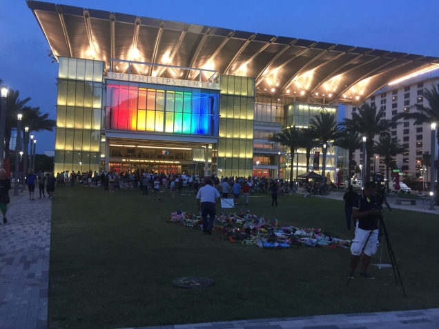
The City Beautiful, as Orlando likes to call itself, didn’t look so beautiful anymore. On Monday evening I found myself at one of many vigils around the city at a makeshift memorial that has sprung up in front of the Performing Arts Center. There’s not enough public space in Orlando and what has happened there shows why people need to have a place to come together. There are candles, ribbons, photos, posters, notes written on paper chains. People standing are reverent. Nearly everyone I know has made a trip there.
On Thursday, President Obama and Vice President Biden arrived. I watched the motorcade from my office window, together with some of my partners. I’ve seen many grown men cry in the last few days.
That night, J and I went back to the memorial. A motorcycle club had its bikes lined up, illuminated in rainbow colors. They revved their engines, and a speaker for the club stepped forward and asked the several hundred assembled there to hold hands and observe a moment of silence. Everyone did.
Rainbow flags are flying all over the city and practically every public building has been illuminated in the now familiar red, yellow, orange and blue colors. Tonight is a city wide commemoration that is supposed to be non religious, non political, and non branded. Just a time for people to be together. We’re going to walk down there.
Perhaps after today, and the symbolism of one week later, healing will start.
It’s a long way up any mountain. And it’s going to take Orlando a while to slog up this one. But I know that Orlando and its people have what it takes.
Ok, so Speyside Way isn’t much of a summit. In fact, much of it seems suspiciously close to a river bed, and it’s still unclear to me how much above the ocean rivers can be anyway. I mean, they run downhill, right? Where do they start?
Regardless, the Speyside Way is so darn far north on the globe that it should still count as a summit of some sort. I can’t rid myself of this vague idea that things to the north must be higher than things to the south. And, of course, if you live in Australia you must get very tired clinging onto the earth for dear life so you don’t fall off.
Yes, there are true mountains for us in the future including Katahdin in Maine. And we hope Mont Blanc next summer. But for now – it’s four weeks to our multi generational trip to Scotland and England. More on all that to come in future posts.
As six of the eight of our traveling party will be engaged in a 67 mile hike in the Scottish Highlands during week one …. there’s still got to be a gear check. Admittedly, this is luxury back packing (glampacking?). Our luggage will be carted along by a taxi between b’n’bs and small hotels and we only have to carry daypacks. A far cry from the barrels on Mt. Elbrus. (Yes, for those of you new to this blog – you really do stay in converted (but large) oil barrels on Mt. Elbrus.)
Nonetheless, we’ve learned from experience – there’s still gear that must go with you even while glampacking So what does this trip entail?
Hiking poles. Everybody but me on the trip rejects them, but after day 3 they will be thanking me.
Headlamps. Who would have thought you needed them in Mt. Washington in October but after a late start and letting all the French Canadians celebrating Canada Day pass us, it was a pretty dark descent.
Hard candies. I’ve sworn by these since Kilimanjaro. Cinnamon is the best but husband J swears by cherry.
Everything waterproof. I have a strong feeling that there is is a lot of rain to be experienced north of Aberdeen. As we celebrate Tropical Storm Colin here in Florida this week the wet theme is definite front and center.
Gloves. Need I say more. Cold hands. (Not small hands.)
Ibuprofen. It will make everything feel better. Especially after a couple of 15 mile days.
A kindle. Weighs nothing. Battery lasts for months. And you can cart an entire library with you. There’s a lot of down time on hikes. You need a good book to read.
The last couple of weeks have involved being sick, attending graduation, Mother’s Day, out of town business trips and a serious lack of any sort of exercise. And no blog post last week.
It all started almost two weeks ago Monday when “she who never gets sick” felt and was sick as a dog that night. (I wonder where that phrase comes from. My cat does just as good a job as getting as sick as the dog.) Work was out of the question the next day as I knew I would be about as welcome as an ant at a picnic. And of course being sick then led to the inevitable “I shouldn’t exercise until I am really and truly better” – which, while doubtless good advice, is sort of a nice excuse for a little break.
But all breaks must end — not to mention the profound fear of every 55 year old that if you stop exercising you’ll never be able to start up again – that spinning tire will just slow down and there won’t be any gas in the engine to start it up again. So Saturday I was back at it – only for a four mile run since it has been an entire two weeks, after all.
And not very fast. Last time I ran it was a beautiful dry day. And today it was a beautiful humid day with temps, I’m sure, in the mid 80s. The contrast is huge. Those of you who run in dry air don’t know what it feels like to run through a sponge. I have to believe it’s good for you. Somehow? Maybe?
The other remarkable thing about running in this weather is the difference between shade and sun. On days like this I find myself criss crossing streets and paths to find that 12 inches of shade. It may only be a few degrees but it makes a difference.
I’ve been following #EverestNoFilter on Snapchat. (Ask someone under 20. They can tell you how to do it.) It’s a real time account of Adrian Ballinger and Cory Richards’ attempt to climb Everest without oxygen and is probably as close as I’m going to ever get to that summit. One of the things they talk about is the sun/shade contrast on the mountain. A T-shirt on one side; a down suit on the other.
Those contrasts can be a pain to deal with. But without one we certainly wouldn’t appreciate the other. Some might characterize it as meaning the grass is always greener on the other side of the fence. But, for those of you old enough to remember Erma Bombeck – the grass is always greener over the septic tank. Now, that’s a contrast we can all appreciate.
Where am I going and where have I been? The Big Island, 2013
The last thing I expected in May of 2014 when I hesitantly pressed the “publish” button (see https://fromswamptosummit.com/2014/05/12/how-it-began/ ) was that two years later I’d still be writing this blog. What started simply as a means to keep family and friends informed about our upcoming trip to Russia to climb Mt. Elbrus ended up being a weekly place to muse about past adventures, think about new ones, and contemplate the here and now in between them.
And as my 55th birthday comes and goes – serendipitously I was born on what 9 years later became Earth Day – it gives me a moment of pause to reflect about the last five years and consider the next. As a friend of mine put it, somehow the “five” birthdays that split the decades seem even more significant than the “zero” ones.
You see, this entire mountain climbing, summit seeking, trekking business all started when husband J asked me what I wanted for my 50th birthday. And surprising myself, “climb Kilimanjaro” was what popped out of my mouth. Hey, it could have been a lot worse. At least I didn’t say “Redrum.” And over these last five years, we’ve climbed a heckuva lot of mountains and trekked a boatload of trails. And this was for someone who had last slept in a tent at age 18 and hadn’t run over a mile since her first early 20s. Yes, I did yoga and dance and all versions of 1980s aerobic classes (remember those?!) but it was hardly the same.
Dead Woman’s Pass, Inca Trail with the Family, 2012
So we’ve got this summer worked out – not really a summit, but the Speyside Way in the Scottish Highlands with the Daughters and the Boyfriends. But that alone isn’t quite enough to provide the inspiration that I increasingly need to drag myself through the dreary grind of daily work. What I really need is to figure out the next mountain. After five years of doing this, J and I have realized that some of our ascents have been due to the combined luck of excellent guides and decent weather and not and because of any great skill on our part. So perhaps a mountaineering school is in order – to add some real training to what we’ve learned on the run.
There’s one in Mont Blanc that I’ve got my eye on. After all, in another five years I’m hoping I’ll be getting ready for the summits of the next five. I was born on Earth Day. How can I not be an optimist?
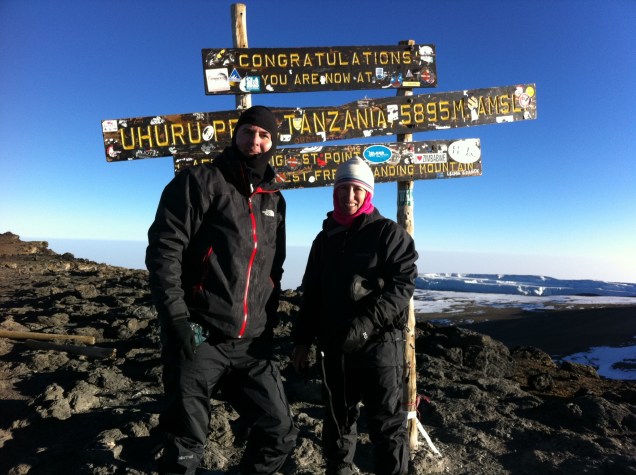
Where it all began – Summit of Kilimanjaro, July 2011
I couldn’t miss at least one allusion in the title to that rarest of days last week – leap day! One does wonder if anything that happens on that day really counts – or perhaps all the events of leap day fall into some alternate universe that contains only four days each year, or that takes four years to create a year….but enough of such ruminations.
It’s time for a brief retrospective and for a glimpse into future trips. It will be five years ago July that J and I summited Mt. Kilimanjaro – an experience that, as cliched as it sounds, changed our lives forever. Call it mountain fever – or as a friend puts it – mountain head, we couldn’t wait to reach another summit. That trip led to Mt. Hood, the Grand Canyon, the Inca Trail, Mauna Kea, Mt. Elbrus, Mount Washington, the Ecuador volcanoes including Cotopaxi, Pico de Orizaba, and even the little known Puzzle Mountain in Maine.
And a lot of these trips remain to be written about, especially Kilimanjaro. This blog was born when we decided to go to Russia to climb Mt. Elbrus in 2014 and I thought it would be a convenient way to update friends and family. Little did I know that two years later I’d still be blogging.
So what’s on the horizon, both near and far? Well, in the short term, we have a visit to the swamp coming up in about three weeks – that is, a weekend in New Orleans. It’s only one of my favorite places of all time, and of course is home to daughter S (who has wholly rebelled against being referred to as daughter #2, Dr. Seuss allusions notwithstanding). And we follow that with a trip to Boston, more specifically Cambridge and Somerville, where daughter A and a 30th year law school reunion await. Ironically, we were preparing to climb Kilimanjaro when we attended the last reunion and I still remember our visit to Eastern Mountain Sports.
The mid horizon reveals the Whisky Trail in the Scottish Highlands, and there will be much more to come on that. We’ll see if I develop a taste for scotch as part of the training for that hike. It may not be a “summit” per se, but the last day is an ambitious 17 miles. And that will be followed by a week in Scarborough.
As for the distant future – I think there are still more mountains in me. Perhaps another attempt in the Cascades – Rainier may have my name on it.
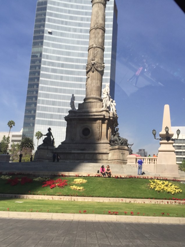
I want to go back! While we may not have made it all the way to the very top of Pico de Orizaba, Mexico City was its own sort of summit.
The day before we left for Mexico City – when we were attempting to scale the mountain – all the corn that had been drying on the rooves of the village houses had been fed into some monstrous and loud machine that stripped off the kernels. Now, burlap bags of corn were stacked in front of each house, apparently waiting to be picked up for market.
We had a several hour drive back toward Mexico City. More and more fields being plowed, with nary a tractor in site. Corn was being stored in strange concrete pyramids – agricultural homage to the great pyramids of Teotihuacan, perhaps?
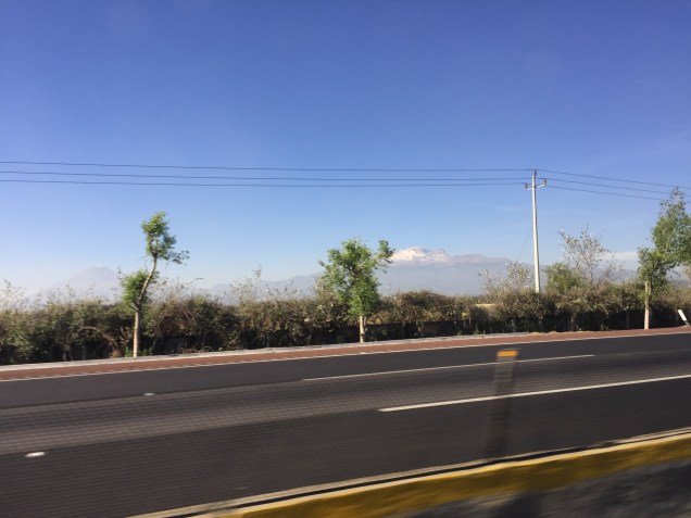
Eventually our time travel back into the ancient means of corn production ceased, and we fast forwarded into the heavy traffic approaching Mexico City. So unusual to look across the modern interstate and see the volcanoes towering over, one quite actively puffing smoke. They reminded me of a gathering of old men observing the neighborhood from a high up vantage point, having a contemplative cigar as they looked down.
We said farewell to our guides and our fellow climber, and were dropped off at the eminently reasonably priced Hotel Marie Cristina. J still remembered the Anthropological Museum from his trip to Mexico City with his brothers in the 1970s (his parents actually entrusted their two youngest sons to the care of a slightly older brother for a bus trip from Mexico City to Guatamala; we still have the machetes they brought back with them on the airplanes in that more innocent world). Anyway, that’s a story for a different day.
Suffice it to say that we hopped into a taxi to go to what is effectively a museum row. A tree lined boulevard with parks on either side which houses all the major museums. The Anthropological Museum is spectacular. Oriented around various geographical areas of Mexico, each part of the museum flows into the next. There’s a courtyard in the center of the square structure with a large water feature.
It was a beautiful sunny day, and we had lunch outdoors at the museum cafe. The wood platforms of Orizaba’s hut felt a thousand miles away.
We made our any back to the hotel and somehow managed to fit all our climbing gear back into our duffels. It remains a mystery of physics how the same items take up more space after they have been used on a trip.
In any event, we finally masterd our packing and made our way to Porfirio’s in the Polanca area, a restaurant highly recommended by G. He had told us that 8 pm was the earliest we should arrive – and sure enough, people were only just starting to venture into restaurants. We walked around for about 30 minute before, looking into windows of elegant shops and it was clear that we were in a lull before the evening got underway. By the time we left – stuffed with chicken mole and steak – it was a crowded lively street scene.
I would have loved to have seen the Freida Kahlo house, and so much more, but 24 hours wasn’t enough. But the dollar is strong; it’s not a long plane flight – and we will go back.
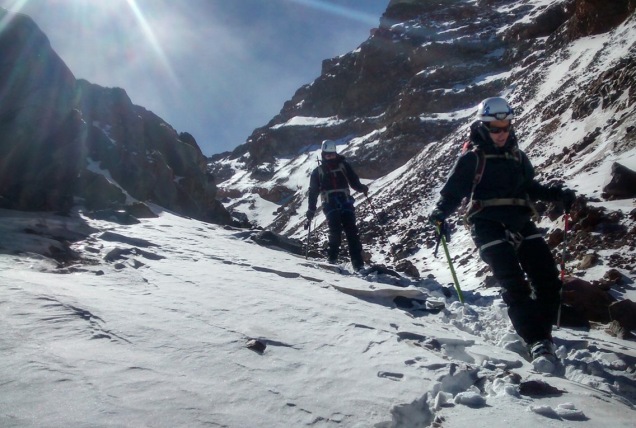
What goes up must come down. And after our guide R put the kabosh on my secret plan to snail my way ever so slowly up the glacier to the top, timing be damned, the down is what faced us. We started off at a good clip. Ever since my way too long climb down Mt. Elbrus in 2014, I’ve focused on descents, with some modicum of success. R put me at the front of the rope on the way down the canalone – it’s certainly the safest place to be, but it’s also the spot where you get to pick out the route and match all the mixed up steps in front of you to create some semblance of a path down. I could tell I hadn’t acclimatized well because as I descended I felt more and more energetic – and we moved much better as a team than we had at any point on the way up.
We finally made our way back to the scree field, and R went on ahead of us. J and I managed to pick our on way down, albeit with some wrong turns that increased the difficulty of the route. At one point we found ourselves on an 18 inch ledge with a sheer drop on one side. I’m sure that is not exactly the trail we were supposed to be taking. But at least the 18 inch ledge didn’t coincide with the increasingly high wind gusts. Two separate times I was literally knocked off my feet. There was a steady 30 plus mile an hour wind with gusts blowing harder. I didn’t slip – I was simply slapped down.
Finally we made it back to the strange stone aqueduct that led to the hut. Apparently at one point there had been a grandiose plan to work with water and drainage on Orizaba, leading to the construction of a now defunct aqueduct feature that forms the first part of the trail up the mountain.
And, how, you may wonder, were the other teams doing? Well, as mentioned, the Italian hadn’t even made it to the glacier before altitude overcame him. When we left the edge of the glacier, we could see three teams of two each inching their way up its stark white. They were no more than little black doodles on a white sheet of paper. It was hard to tell who was who, and it wasn’t until we were back at the hut and the two Russian teams showed back up without reaching the summit that we realized the top most team battling the high high winds was our own teammate G and our guide D!
I wanted to wait to greet them when they returned, hopefully after a successful summit, but after we’d packed up and they still weren’t down, it was clear it was going to be a lot longer. We’d already been climbing for about 8 or 9 hours, and the green of the forest below was starting to seem inviting.
And this is where the people part of the trip became bizarre enough to rival the uniqueness of our natural surroundings. We’d heard rumors that the Russian team included a high ranking politician and others – but how high ranking we didn’t realize until R arranged for us to hitch a ride down the mountain to the village in their two jeeps while he waited for G and D. There was one free spot in each van. J went with the politician and his fiancée; she hadn’t climbed but still looked pretty wind blown. When we say high ranking, we are talking cabinet level. I know; I figured out names and Googled everyone. Google images helped confirm I’d locate the right bios. Who expects to spend a night sleeping in the freezing cold on wooden platforms in a hut in remotest Mexico with government officials from Russia.
My jeep mates were equally illustrious in Russian political and academic ranks. Perhaps even more so for a would be mountaineer, as one of them had been a professional climber who had summited Everest in 1992 (where he and Scott Fisher of Mountain Madness fame had argued about placement of fixed ropes) and climbed K2 in 1996. He was also a snow leopard – meaning he had summited all of the highest peaks in Russia, no mean feat. (I found that last bit out through Google.) Anyway, we had a fascinating conversation on the way down, and it certainly added an international flair to the trip.
Luxury accommodations compared to the hut
Back at the hostel, we read and had a very late lunch. Eventually G and D showed up, with the glow of the summit still surrounding them and only a few bruises and battle scars to show. They had battled unbelievably high winds, and even though they couldn’t even stand upright on the summit, had the glory of being the only two climbers to make it to the the top that day. I just kept hoping a little of that karma would wear off on me.
We had one more night in the hostel. A whirlwind of Mexico City comes next.
Pico de Orizaba. From the steep scree slope that starts the climb to the glacier to our multi-national companions in the Piedra Grande refuge – this trip had enough twists and turns for any best selling novel.
After our day of rest at the Hacienda Santa Barbara, we packed up and drove a couple of hours through farmland and small villages into the heart of rural Mexico. We were aiming for the Orizaba Mountain Guides hostel, located in, I believe, Tlachichuca. It’s a very small village. One gigantic house, protected by an elaborate gate and wall, dominates the streetscape. We understood it to be a vacation house owned by people from Mexico City. Corn was drying on the rooves of many of the village houses, which a couple of days later was being fed into a machine that stripped off the kernels. A lot of houses had large gates leading into courtyards not visible from the road. Again, I was struck by the interior nature of life here – little looks out on the street. Everything is directed toward the private family life behind the walls.
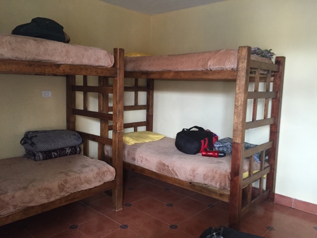
G, our team mate, husband J and I had a room with two sets of bunk beds, perfectly adequate, but cold. My light weight down jacket was practically glued to my body by then. We all went out and took a look at the mountain when it appeared between clouds – and it looked steep! No two ways around it.
Lunch was late – and filling. Pasta with a cheese sauce, followed by chicken breasts stuffed with ham and cheese. I decided we were just carbo loading. The afternoon was for rest and a few hours later it was time to eat again – this time steak. My mountain reading this trip was the Elena Ferrante Neapolitan novels quartet, and My Brilliant Friend was a good companion in the freezing room.
The trusty 4×4
Next morning we changed vehicles from the van to a beat up 4 wheel drive jeep that is de rigueur for the drive up to the mountain hut. Through an old growth forest to the tree line, continuing on a rutted road to the hut at about 14,000 feet. We were well aware that the wind forecast was very high.
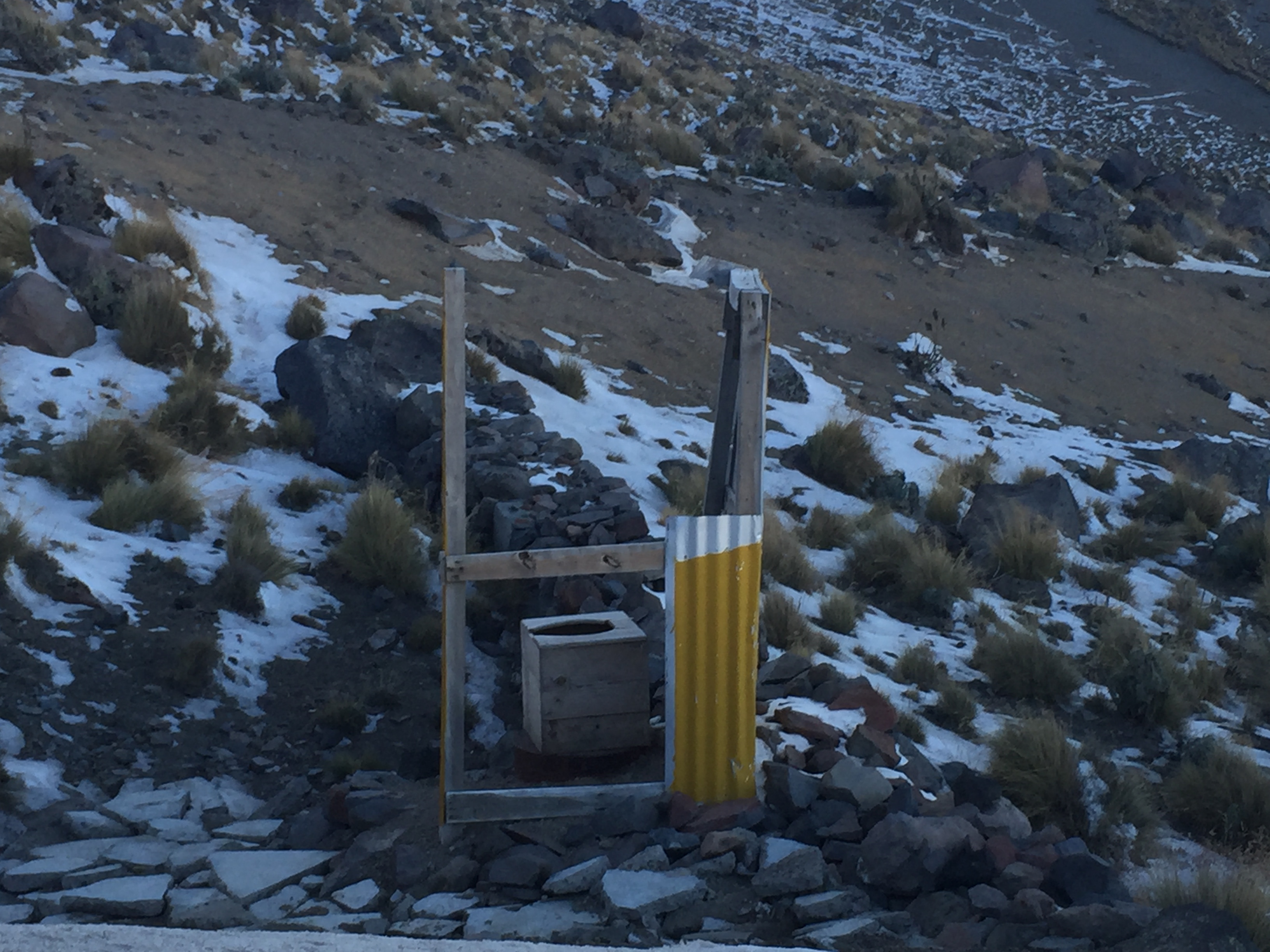
Outhouses around the world
The hut contained three levels of simple wood platforms and two counters for cooking and meal preparation for whatever teams had shown up. The outhouses were rivalled those at Mt. Elbrus in the Cacausus Mountains in Russia. These had even fewer walls, but an equally commanding view. We commandeered a lower level platform as soon as we arrived, and immediately afterwards were sent up on an acclimatization hike to high camp. We’d had a lot of conversation beforehand about whether to spend the night at high camp – which would have meant starting off with heavy packs and trying to sleep in tents – or whether to have a day with more altitude gain – but sleep in the hut and be better rested for summit day. In light of the wind forecast, we opted for the acclimatization hike to high camp and sleeping in the hut.
Made it to high camp
Our guide, R, decided to take everyone’s pulse ox (measures oxygen saturation) in the hut. Except for one time on Kilimanjaro at 16,000 feet, I’ve never had that done before. It’s not really clear what the measurements mean, and it can freak you out a bit. As it did me. G, our ironman companion, was well in the 90s; J was about 89; and I registered a whopping 84. Nope; not acclimatized.
But after our acclimatization hike scrambling up the scree field to high camp for a couple of hours, I could tell I was breathing better and better the more elevation I gained. Sure enough, by the the time we descended and were eating dinner and ready for our paltry hours of sleep before summit attempt, I was back up to 90. I think even our guides were surprised. But the fact is, I think the extra days of altitude I’d had in in Ecuador really helped me Eachieve that Cotopaxi summit.
Here are the players in the hut: our team: G, whom you’ve already met through this blog – Ironman triathlete and corporate executive, J, me, and our guides D and R. Next was an Italian climber, athletic, into snow boarding, with a Mexican guide. He read a paperback novel much of the afternoon before our summit attempt. A German woman with her American friend who walked from the hostel to the hut, arriving in late afternoon. We’d helped out by taking their wheeled suitcases from the hostel in our jeep and they were going for the summit the day after us. Possibly the first wheeled suitcases the hut had ever seen. I kept envisioning them pulling the suitcases up that rutted road. Then there was the group of Russians and their guides. More on them later. For you mountaineers out there – suffice it to say – Snow Leopard.
We had whatever hours of sleep could be snatched between the howls of the wind and arose at 2 am. You sleep pretty much in what you’re going to climb in so base layers were already on. For some reason, R thought we should hold off on putting on our climbing harnesses until we needed them higher up – never again will I do that. I’ve always put my harness on before starting a climb and that’s a lot easier than fighting with it in the side of a mountain.
It was unbelievably windy as we started, and the night stars glowed like sparklers. We headed up the same steep scree slope we’d just climbed that afternoon. But it felt even steeper and more exposed at night, and I also quickly realized that my resistance to putting new batteries in my headlamp (they were fine in Malinche? they are lithium?) was just dumb. It was definitely dimmer than everyone else’s and that makes a difference on a mountain, at night.
It was clear from the start that we were at a different pace than G, and not long after we began he and D, one of our two guides, took off up the mountain.
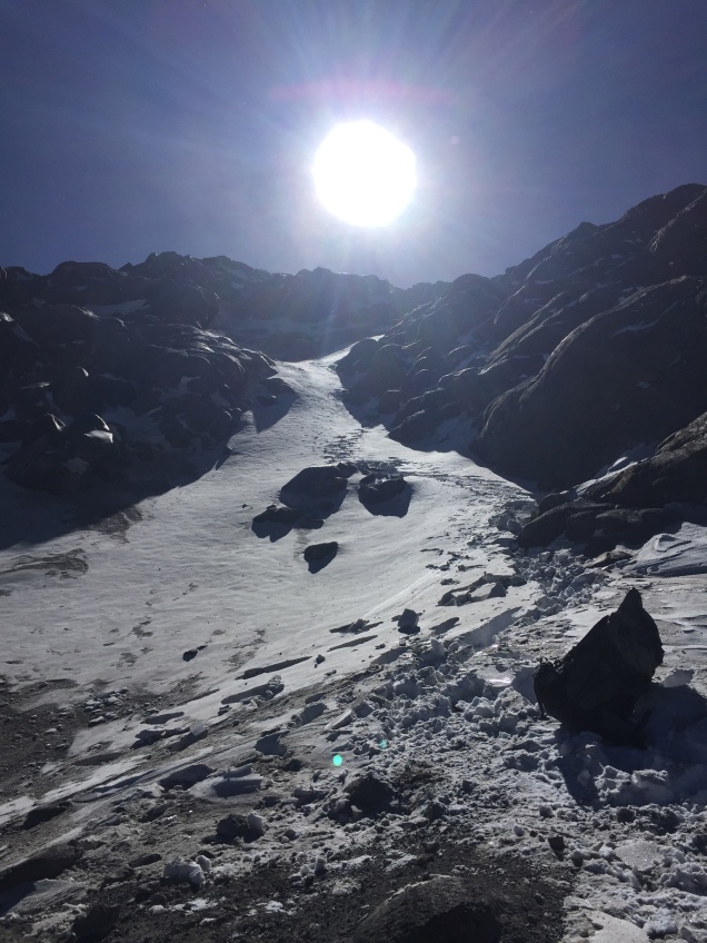
Finally, trudging away, we passed high camp, where we’d been just a few hours before, and kept going along a slightly less steep area to the canalone (spelling unknown), fighting wind every inch of the way. We knew in advance we weren’t going to attempt the Labyrinth, a steep outcropping of rock. It was too icy, and the canalone, a smooth flow of snow, was accessible. Only at that point did I start to feel that smooth movement where you are just putting one foot in front of the other and your breathing falls into rhythm.
By then we’d roped up and were in crampons – and I had been way too over confident in my ability to don crampons without practice, relying only on my success in July with them. Some things you just need to do over and over. At some point the Italian climber and his guide headed down. Apparently he’d had altitude issues and didn’t make it to the top of the canalone. The smooth slope up of the canalone quickly changed and we were back to rock and ice and deep steep snow up toward the glacier.
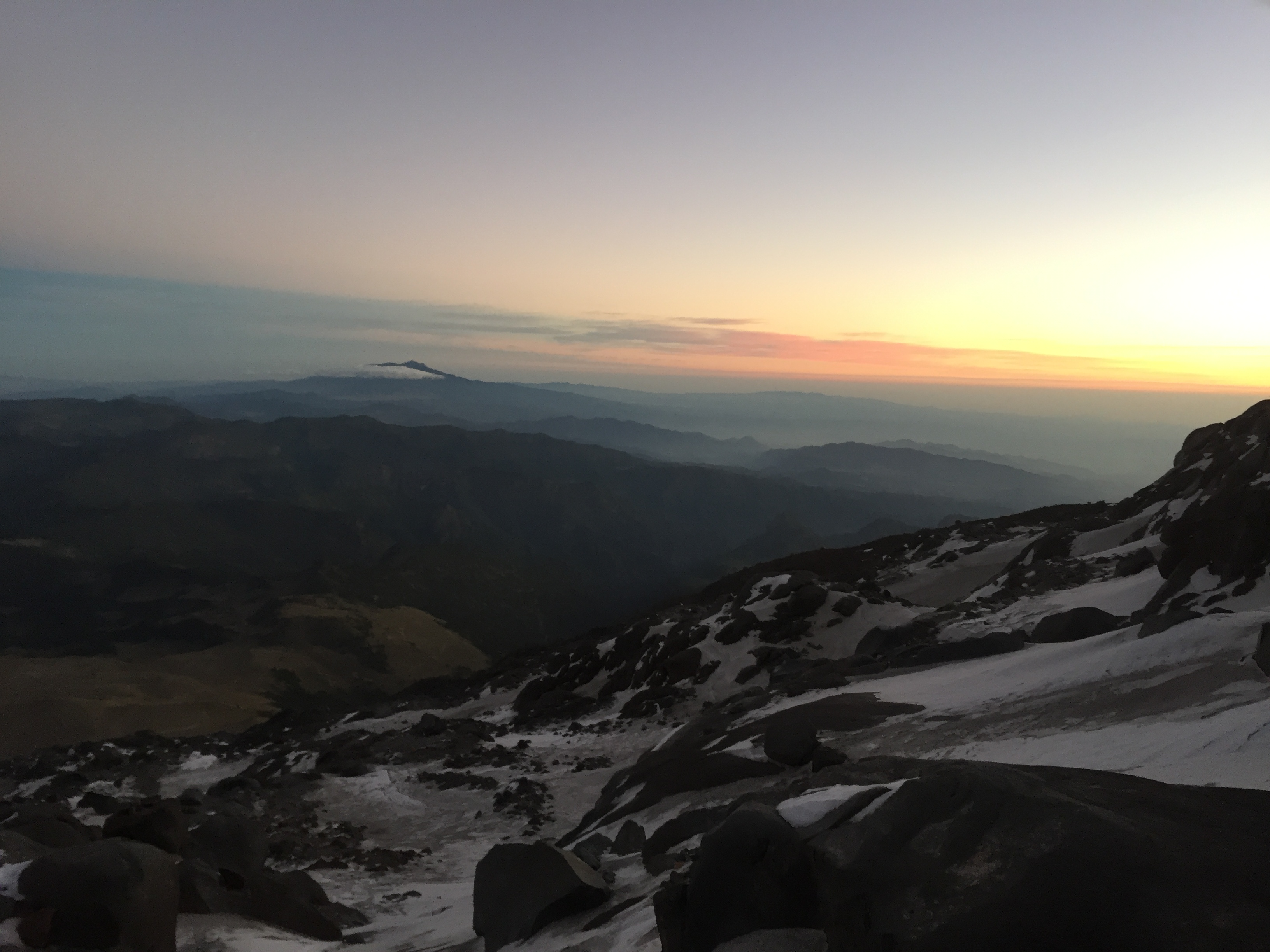
Sunrise over Orizaba
By then the winds were increasing even beyond what they had been, and it was pretty clear a summit attempt was not a realistic possibility. We were just too slow. I wasn’t properly acclimatized, and while small steps were manageable and I could get a rhythm, each time big step up required a real effort that then wiped me out for the next few steps. The wind was blowing; the sun glinting.
But you know, I probably would have kept plowing away forever, at whatever snail’s pace I was going. And I think R, our guide, realized that, because when we finally reached the glacier at about 16,000 feet he simply announced that was all for the day. I think he thought otherwise I would just keep putting one foot in front of the other, however many hours it was going to take. The glacier was beautiful. A steep field of snow, the summit peering down. Way up on that steep white meadow we could see the others on the mountain who’d passed us. There was G and D, from our team, and two groups of the Russians. All in all, we had reached the glacier, the Italian team had returned, and there were six climbers left on the mountain.
Next up – how we battled winds on the way down, hitching a ride to the village, and who got to the top of the mountain.
According to one of our guides, the mountain of Malinche, officially 14,636 feet but higher when measured by GPS, is home to one of the world’s highest forests. It’s a mix of tree and rocky trail, shielded forest glades and exposed ridges. Almost a metaphor for our entire trip to Mexico. The name given he mountains by the Tlaxcaltecs was Matlalcueyetl, which means “lady of the green skirts,” a goddess of rain and wind.
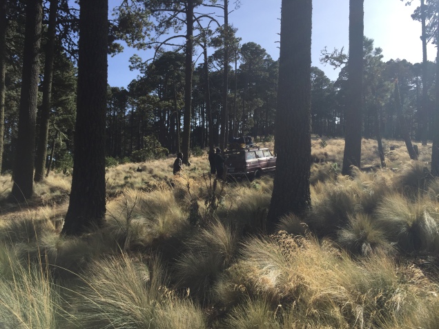
After our visit to the Teotihuacan pyramids, we drove several hours further, southeast toward Malinche, located in the state of Tlaxcala. On the way, stopped for lunch at restaurant where lamb tacos and rabbit were high on the list of menu choices. Venturing further and further into rural Mexico was a time machine experience. We soon left behind the truck stops – rows and rows of non chain cafes (except for the ubiquitous Oxxo – the Mexican version of 7-11) – and were driving through fields of nopales – the cactus that is the base for incredible salads.
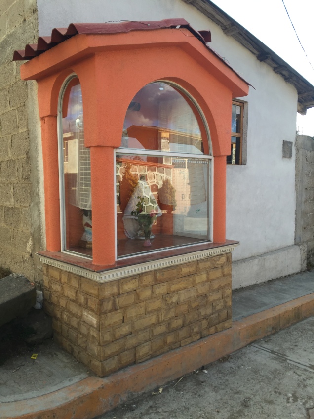
There wasn’t a tractor to be seen. Men were plowing the land with horses and donkeys. Each small village had several shrines on the side of the road occupied by ornately dressed saints. And there were similar smaller shrines adorning the gates of many houses.
Eventually we reached the IMSS cabins in the park surrounding Malinche, at an altitude of about 10,000 feet. As I understand it, they are operated by the ministry of health or some other equally unlikely branch of government. They are two room cabins with a bathroom, nice tile but some unusual features. A refrigerator, but no stove? The bathroom leading off of the bedroom, railroad car style? One electrical outlet? No heat of course, and we were all wearing our lightweight down jackets (which had become like a second skin by the end of the trip).
We had quesadillas made with Oaxaca cheese for dinner, and went to bed early in preparation for a before dawn start up Malinche.
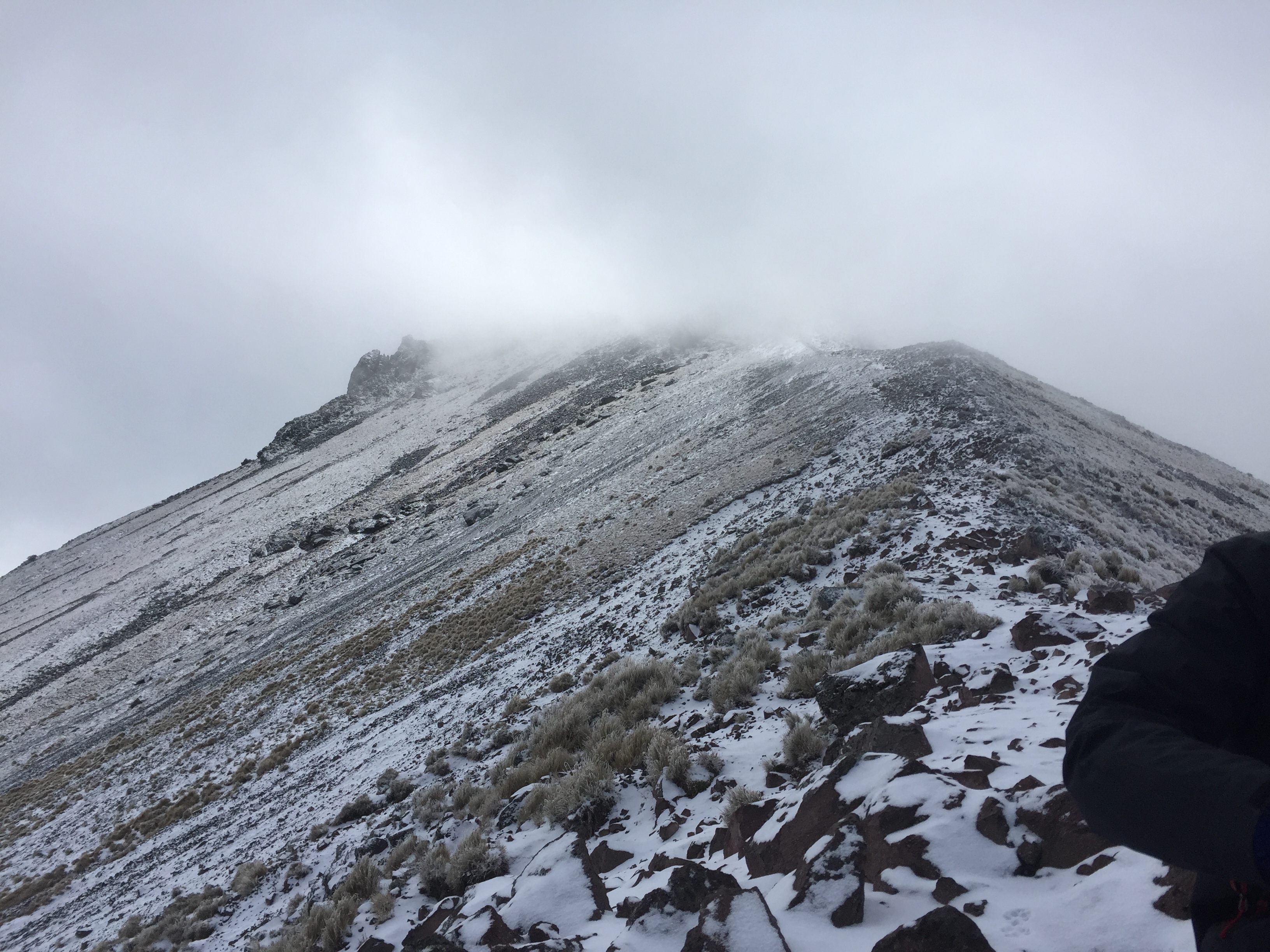
We started walking about 6, accompanied by three dogs who were our travel companions all the way to the summit. They clearly did this everyday, and seemed to be in excellent shape, so their presence didn’t cause my animal loving heart any angst. The first part of the Malinche hike is through beautiful forest that we could just make out by the glow of our headlamps. As the sun rose, the trail got progressively steeper. There had been frost, and drops of water sparkled on the grasses and bluebells still blooming here and there.
Eventually we reached the tree line, crossed a brief grassy section and moved onto steep rock and scree. Close to the top, you traverse a ridge, narrow in some points, and finally up a steep rocky section to the summit.
The wind died down just a bit so we, together with our dog companions and a couple of other climbers, could enjoy the partial views we got when the sun briefly appeared. It was surprisingly comfortable in the grey cloud at the summit – as if we were in a nest of cotton, safe at the top of our mountaintop tree. The dogs scratched the snow away and made beds for themselves on the warmer dirt. They were getting ready for the long trek down.
It took us about 5 hours to reach the summit – appoximately 4500 feet of elevation gain. We came down fast, running at times, in just under three hours.
Once down, we drove a short distance to the Hacienda Santa Barbara. Built in the 1600s, the hacienda is huge, yet only a few rooms are available for guests. J and I were in a large room, high ceilings and a small bathroom inserted into one corner. Heated by only a very small stove, we definitely needed all the blankets from the two beds. The floor was stone, and the window – which locked by way of a giant beam that slid across it – looked out in more ruins of outbuildings. Meals were in a dining room occupied by one large long table. And in the morning we had atole, as well as coffee, a hot drink made from corn and tasting like chocolate. Dinner was chiles rellenos, hot enough to warm us up even in that frigid dining room.
It was now Tuesday night. We knew Pico de Orizaba awaited.
On this grey sad day – where we all awakened to the news of the death of Ziggy Stardust, the Thin White Duke, or whatever persona the talented Mr. Bowie was currently assuming – the world I returned from yesterday in Mexico seems as far away as Mars. 1930s techniques of corn production – that sums up the village life we experienced. Steep harsh terrain and 35 mph winds – that sums up the slopes of Pico de Orizaba we attempted to scale.
But to begin at the beginning. After a four hour flight from Orlando to Mexico City on AeroMexico – again enjoying the amenities that U.S. airlines seem to have completely dispensed with – we found ourselves in an extremely long customs line. But we did get to meet an interesting young woman who was on her way to spend six months in Veracruz counting raptors and doing bird research. Interesting folks were a theme of this trip. Wait til I get to the part about our Russian hut mates on Orizaba.
We finally emerged from customs to find we were the last to pick up our luggage – our duffels were off to the side of the conveyor belt but all contents safe and sound. And the gorilla tape used for tear repair was still holding.
We must have looked like lost American tourists because it took no time for R and D, our guides, to recognize us. They drove us to the Hotel Marie Christina in downtown Mexico City, and within a few minutes we were already undergoing a gear check. We passed! The hotel is an old Colonial building with a feel of faded glory.
That evening we met up with G, our fellow climber and excellent travel companion, and had dinner with R and D at a nearby shopping area. Somehow grilled octopus seems just right for the occasion. It was close to the Feast of the Three Kings; the Christmas lights were blazing; and children were having their photos taken with the three kings who had somehow found themselves in a high end Mexican shopping center, apparently sidetracked from their journey to the manger.
The next day we had a breakfast of frijoles and fried eggs at the hotel, and then took off for the pyramids at Teotihuacan, en route to Malinche, our first acclimatization hike.
Pyramid of the Sun
Two thousand years old, the pyramids loom over the landscape like alien beings keeping tabs on the mortals below. As you walk along the long Avenue of the Dead the massive Pyramid of the Sun peers down on your right. Experts guess it’s the pyramid of the sun simply because it faces west (which did not seem a particularly scholarly rationale to me, but I guess it’s difficult to reach conclusions when there’s no written language). At the end of the avenue is the smaller, but somehow more graceful Pyramid of the Moon. G, J and I clambered to the top of each of them, figuring they were our first summits of the trip. To the left of the Pyramid of the Moon stands the Palace of Quetzalpapalotl, with multiple pillars emblazoned with owl iconography. Apparently owl imagery is found throughout Teotihuacan.
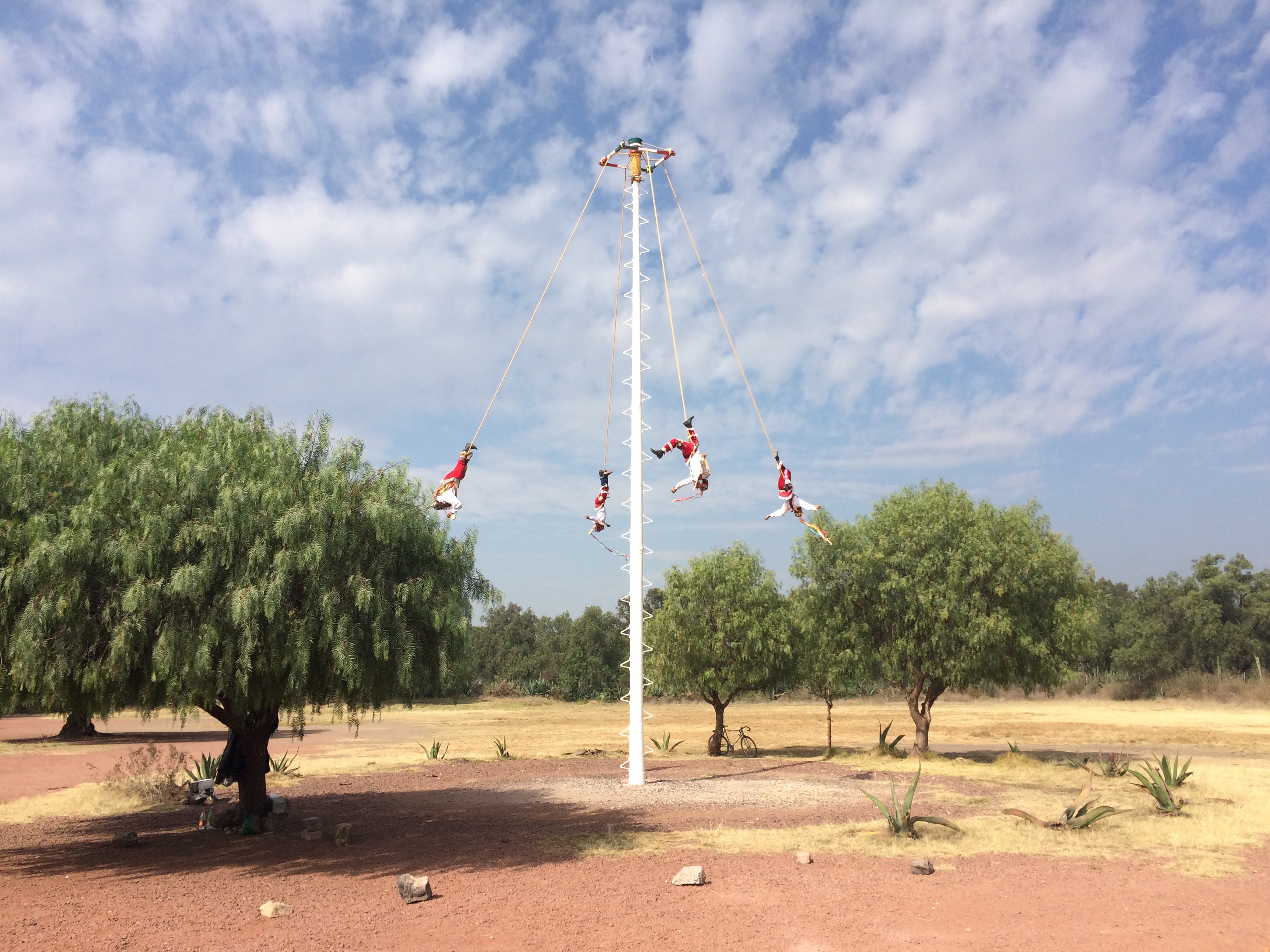
On the way into the pyramids we saw several men high up on a pole, tethered by ropes, wearing masks and costumes. All of a sudden, playing instruments, they fanned out from the pole, whirling in circles round and down in a gradual descent. An apt analogy for our next days of mountain climbing?
Next up – the IMSS cabins and an ascent of Malinche, accompanied by three dogs.