Reflections on the Swamp – An Orlando Loop

image
City Reflections

The swamp was especially wet this week as a very beautiful morning morphed into a grey day of drizzle, thanks to El Niño. Yes, this post is a detour from adventures in Mexico, the conclusion of which will be forthcoming. A few twists are always needed here and there.

Orlando’s Dinky Line Urban Trail is part of my running routine. But I’d always wondered about the part of the trail that on the map consisted mostly of orange dots, which is apparently code for sidewalk as opposed to trail. In any event, the cool weather proved tempting and instead of a run followed by Bikram, husband J and I found ourselves on what turned out to be an 11 mile loop to and around Orlando’s in-the-process-of-being-renovated and turned into something else entirely Fashion Square Mall.

image

We started off accompanied by one of Lake Ivanhoe’s many resident and, to me, unidentifiable water birds. He looked a lot more enthusiastic about the drizzle than we were.  Shortly after, still on the part of the trail I knew, we passed what I am convinced is a haunted radio station. It’s been empty since we’ve lived here, yet it’s right next to a popular hotel. Just one of those urban ruins. A few other urban ruins in our journey – an abandoned sushi restaurant and a bank that looked as though it had never recovered from a heist.

image

Finally we reach d the orange dot part of the trail and we were off! First up was a tour of in-fill development in an area called Colonialtown.  Small townhouses and fourplexes, built in the style of the original small houses.  Surprisingly attractive, even in the rain that started to fall more heavily.

To my surprise, we then discovered that what I had always thought was the beginning of the Cady Way Trail wasn’t. The trail head is actually located at Lake Druid Park – a lake and a park I’d never heard of despite 25 plus years in Orlando. Shortly after, we finally reached the mall and it was time for a lunch break at Noodle Co. – a first for us. At least it rained hardest while we were inside.

The Executive Airport is across the street from the mall, and after some difficulty with urban route finding, we got ourselves back on the orange dots. Next to the airport is a party supply store selling themed party goods for any type of celebration you could imagine. Who knew there were so many types of princess tiaras. Not to mention sizes and shapes of plastic trays or colors of napkins. And there was even a room filled with nothing but janitorial supplies.

A little bit of FaceTime with daughter S entertained us for the next mile or so. Nothing like getting to watch a New Orleans Mardi Gras parade in real time. That was followed up by the Orlando Chili Cook Off – if we’d known we wouldn’t have had lunch!

image

After passing the landmark Colonial Lanes Bowling alley – what could be better than cocktails and bowling – we finally made our way back toward downtown and along what I can only describe as Memory Lane. There was the girls’ daycare center. And the orthodontist’s office, where I spent many an hour in the waiting room.

image

Mile 11 of our loop brought us back to Lake Ivanhoe. We bookended our hike with another bird – a serious grey heron who looked as though he might charge us admission for passage around the lake.

image

There was no snow, no ice, and no altitude. But there were a lot of things and places I’d never noticed before in the few miles right around my house – and that’s an exploration in itself.


My First Hike, Yorkshire, England, circa late 1960s/early 1970s

With my grandparents and brother, on the way to Greasborough, South Yorkshire, circa late 1960s

This is a difficult post to write because it needs be just right. How do you capture your first hike – at least, the one that you remember? Something there planted a seed. And somehow that has ultimately led me to Cotopaxi, Ecuador, to Kilimanjaro, to Puzzle Mountain, Maine.

It started with the bridle path from Rawmarsh to Greasborough, both in South Yorkshire. My mother is English and my father is from Alabama (don’t even ask), and as they were both English professors, we had the luxury of spending weeks at a time in England during the summers. More specifically, in South Yorkshire, where my mother’s family is from.  Another time I’ll write about the coast and the moors. This is about an old fashioned trail, in the “industrial” north, replete with stiles.

In the late 1960s, my grandparents moved to very nice council housing, outside of their original home on Clay Pit Lane, yes, that’s a real address, in a small town called Rawmarsh, outside of Rotherham, in South Yorkshire. D. H. Lawrence, coal mining, and all that. My parents were married at the Rawmarsh parish church, St. Mary’s, and that’s where I was christened.  There were any number of small villages on the outskirts of Rawmarsh – from Parkgate (home of antique shops and the tripe shop) to Upper Haugh (a collection of rundown houses, at least rundown at that time, ten or so of which made up a village for mailing purposes). Perhaps now they are all rehabbed and are expensive weekend homes for IT people working in Sheffield.

The bridle path to Greasborough, a small village by a lake, was a special walk that entailed a picnic basket, a thermos filled with tea, and sandwiches. As you can see from the photo at the top, my grandmother did it all with stockings and a skirt. And it appears I was wearing a dress! One summer my parents left my brother and me in Yorkshire with our grandparents while they attended the very first Bloomsday conference in Dublin at which my father was presenting a paper on Joyce. (This is the sort of childhood memory you have when you’re the daughter of two English professors.) I’m pretty sure the hike to Greasborough is one of the activities that my poor grandparents used to try to entertain their excruciatingly Amerrican grandchildren.

Just at the head of the trail was an old shop that in America we’d call a general store. I remember my brother and me buying candies (sweets) for the walk from our allowances (pocket money).

The bridle path itself was old cobbled bricks, running through forests and between fields. Where one field bordered another you’d clamber over a wooden stile. See photo below. As I understood it, the stiles were meant to keep livestock from crossing unwanted into their neighbors’ fields. I’d never seen a stile in North Carolina, where I lived when I wasn’t in England.

My Grandmother and me
On the left side of the bridle path was a gully filled with beds and beds of bluebells. I so wish I had photos of them because I’ve never seen them since – at least not like that. Six inch stems with rich indigo bells of flowers cascading down. On the right of the bridle path, if you ventured off, was the old head of a mine. This had been a working world, where many spent the sunlit days hundreds of feet down mining the coal that was fueling the mid twentieth century economy. The hole into the ground looked like an entrance into some magical world to my brother and me. We just knew it was a spot we were told never to go – we could fall down and never come out. Every time we passed the hollow that housed the mine head, we always veered off to have a look.

As you continued on, you eventually reached a lake, and I believe a dam of some sort, and on into the village of Greasborough. If memory serves, we’d stop at that point and get an ice cream or something for the walk back.

In 1985 or so, when I returned with my boyfriend – ultimately to be husband – I think after we hiked the few miles to Greasborough, we caught a bus back to Rawmarsh. He was struck by the public bathroom by the bus stop in Greasborough – a stone enclosure on the side of the road, the facilities of which involved nothing more than a gutter with water flowing through it.

I haven’t been to this spot for at least 30 years. And I’m pretty sure that the last time I went, you could already see housing developments over the bluebell beds, and I’m sure the old mine head had been cordoned off and made safe from incursions of eleven year olds.

But the magic of that old bridle path – and the people who walked it all those years ago – still resonates like some chord left reverberating. And when I climb mountains, or hike in the woods, that’s the fairy magic I’m returning to.

West Orange Trail Redux

image

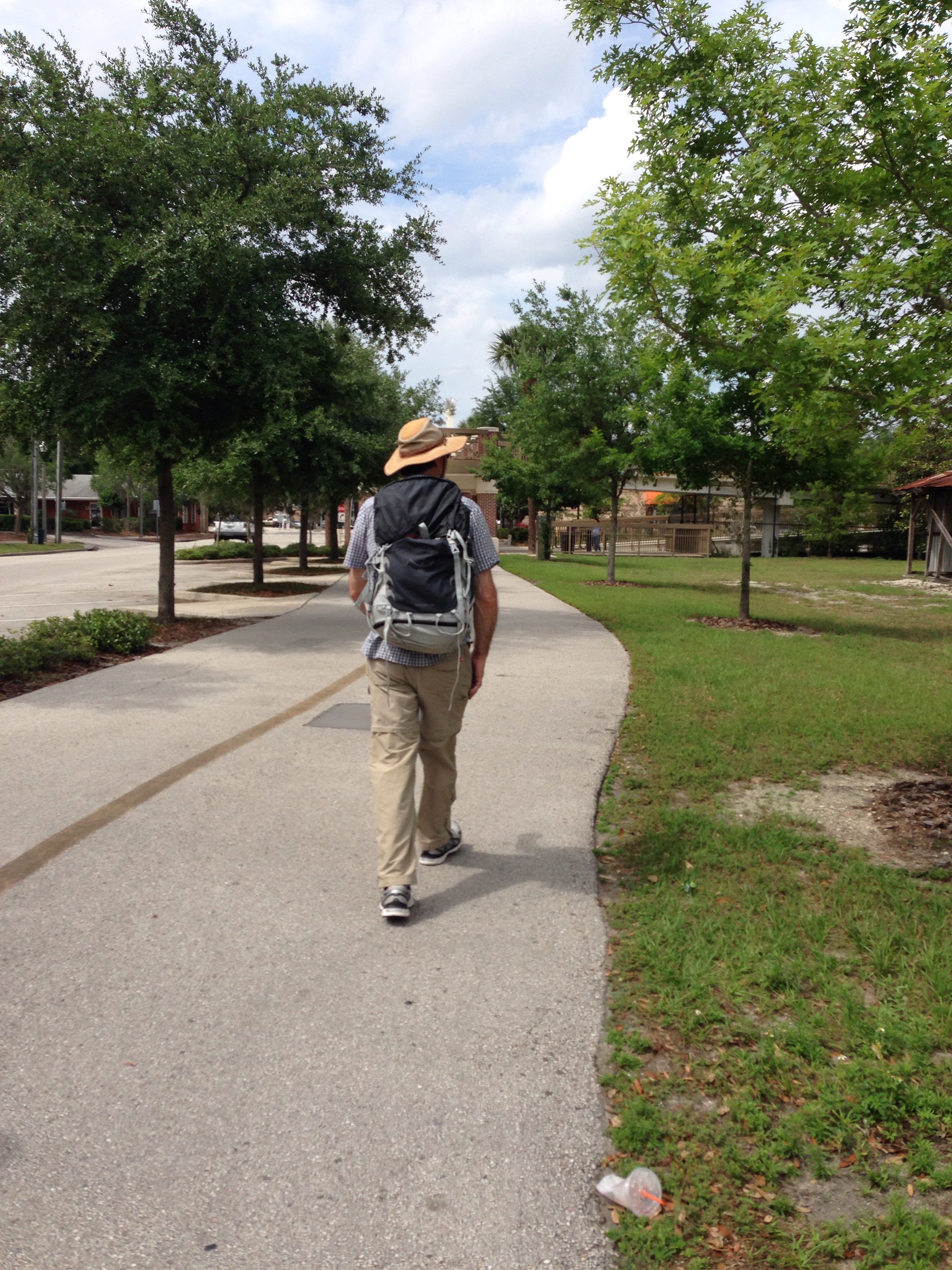
We are two months out from Pico de Orizaba, so it’s time for…the 20 mile hike on the West Orange Trail!

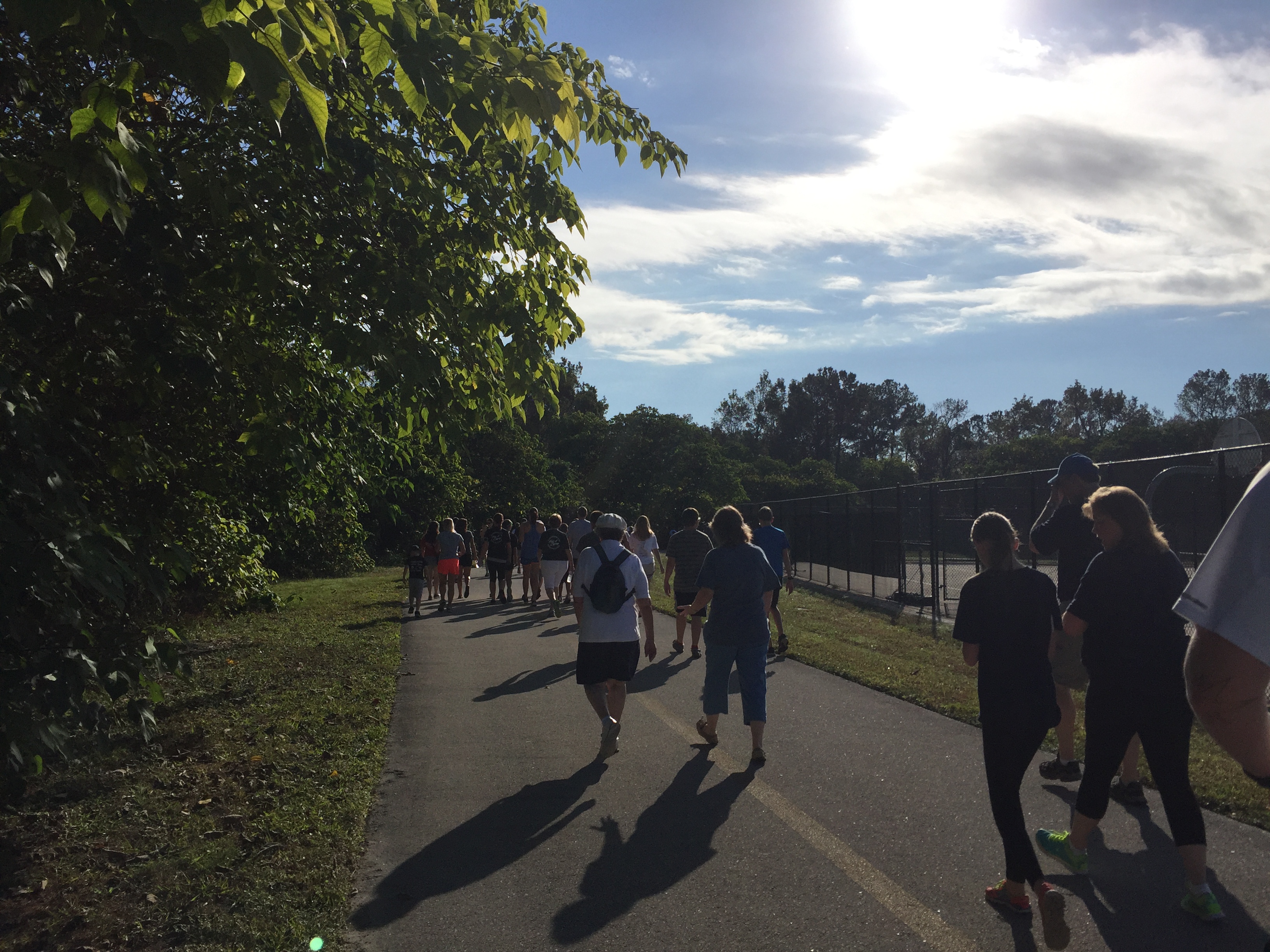
For those of you who’ve read this blog before, you know this isn’t the first time we’ve embarked on this somewhat odd urban hike through the wilds of Orlando’s suburbs. But this time we decided to start from the Apopka end and finish at the Killarney Station, just five miles beyond Winter Garden. (Sorry, Apopka – you just don’t compete with Winter Garden’s breweries and brasseries.)

Themes of the day were butterflies, bugs, and bruises. The butterflies you’ll see in the photos below. The bugs are not pictured, but it turns out that every beautifully shaded bench is equally viewed as such by Florida’s massive mosquitos. And the bruises are from the last two miles where I decided my boots were laced too loosely, tied them up tightly – and hugely over compensated.

So here’s the blow by blow –

It’s 6:55 a.m. We violated all of our vows to prepare sensibly by not going to sleep early enough.  Instead we followed dinner with our friends M and S (see “travel with friends – the Iceland series” https://fromswamptosummit.com/2015/03/15/iceland-part-1-a-day-in-reykjavik/) with a visit to an Irish pub, Fiddlers Green, to hear The Windbreakers. We’ve been listening to this Irish music duo since all of our kids were knee high to a grasshopper. But it wasn’t conducive to an early morning rising.

Nonetheless, by 8:15 or so we contacted Uber to take us up to the trailhead. It was way too early to get any of our nearest and dearest to drive 30 minutes on a Saturday morning. I’m sure I typed in the right address on the Uber app – to Park Avenue in Apopka – but somehow our driver thought he’d picked up a trip to Park Avenue in Hollywood, Florida. Now that would have been a worthy affair.

Mile 2 – after exiting our Uber ride (surely no more stylish way to arrive), by the Apopka Middle School, we suddenly found ourselves in a throng of a couple hundred middle school students, some with parents, walking a walk to raise money for either breast cancer or cystic fibrosis. Whatever the worthy cause, I’m embarrassed to say we walked as fast as possible to get ourselves out of the throng.

image

Here are  the snippets from my contemporaneously recorded notes.

Scraps of middle school conversation. “She blew up in the middle of class” (I really wanted to know how that happened). Very few boyfriend/girlfriends hand holding. I’m sure there was more of that in my day in the ’70s.

Downtown Apopka. The Catfish Place restaurant amidst a sea of fast food establishments.  Dunkin Donuts taken to an art form.  Right next to the BBQ place. Turns out BBQ was a theme for the day.

image

Mile 3.  Shaded woods, winding trail, lots of churches. As before, I’m baffled by St. Elizabeth, Church of God by Faith next to the Freedom Missionary church.  More BBQ smokers smoking away by modest and well kept homes. Moving on – we pass what must be a borrow pit for the interstate construction project.

Mile 4. Two people pass us, riding what look like elliptical bikes. Never seen them before. All of a sudden I realize my iPhone email isn’t working and it wipes out and then re-downloads my messages since August. Not a big deal – except I’m already fielding work calls on this Saturday morning.

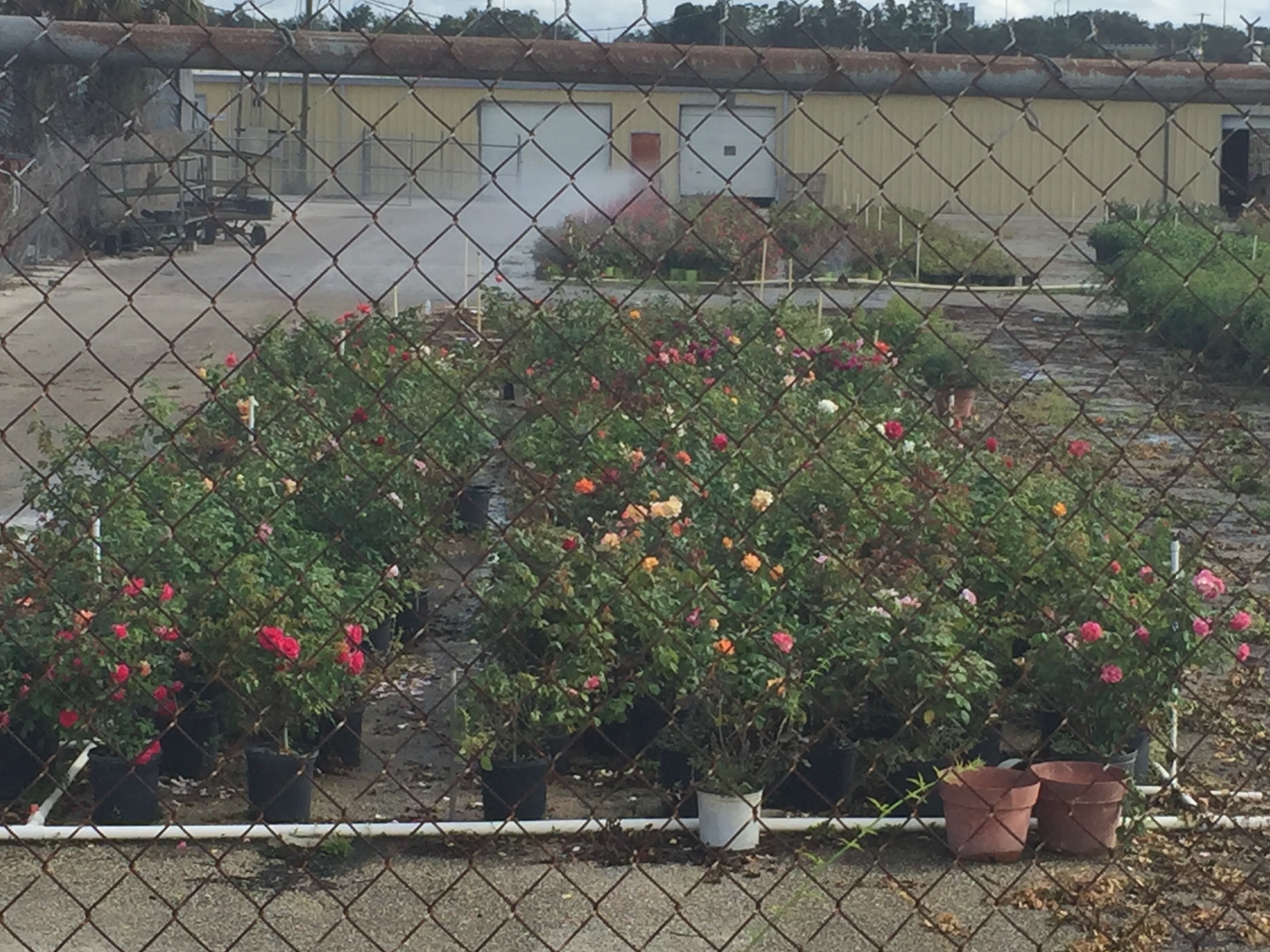
The remnants of Florida’s fern industry – right next to Nelson’s Florida roses and Hippy’s Junk Auto Parts. That’s really the name.

image

At Mile 5 we take a break – where we encounter the first of the mosquito swarms.  I also inadvertently hit my Fitbit watch face and it starts counting miles all over again on the GPS. For the remainder of the hike, I’m adding 5.23 miles to what the current  mileage shows. That’s a challenge to your math after about six hours or so.

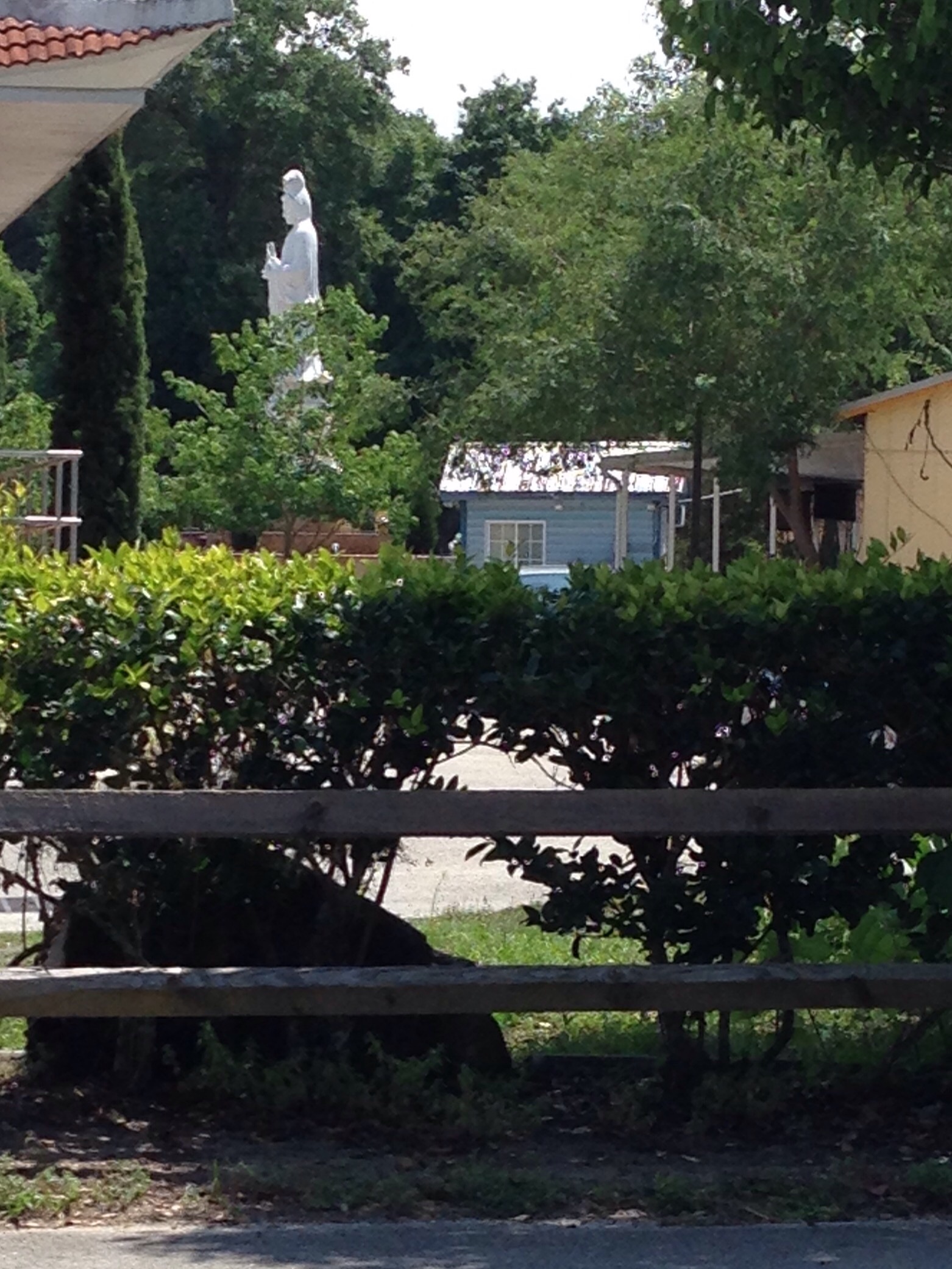
Mile 6. We’ve made our way to the Buddhist temple,which was such a surprise the first time around.
A service is going on. I could hear voices but  couldn’t make out any words. Through the open door at the back I could see the monks in their yellow robes.

Immediately after we pass a home decorated with great concrete statues – next to one of several town homes abutting the trail where birthday celebrations seemed to have started hard and early. “Go Jerry” – whoever you are.

image

Mile  7.  We’re back on a sidewalk by a main road. Housing complex to our  left, clear cutting and a seemingly abandoned housing development on our right. It’s really hot. We’ll see a long stretch of unshaded asphalt ahead of us and just think – go for it.

Mile 8.  Off the streets again onto a trail.  But it’s a stereotypical Florida image. A golf course on the left, a memorial garden on the right, and a filled in swimming pool by some outbuildings. Golf, then die?

Mile 9. We stop for lunch under an overpass.  There are golf courses on either side, but there are no bugs because there are no trees. And we forgot the bug spray anyway. All of a sudden, we realize what we had thought were some sort of exotic trash cans are really water coolers. Who knew.

image

image

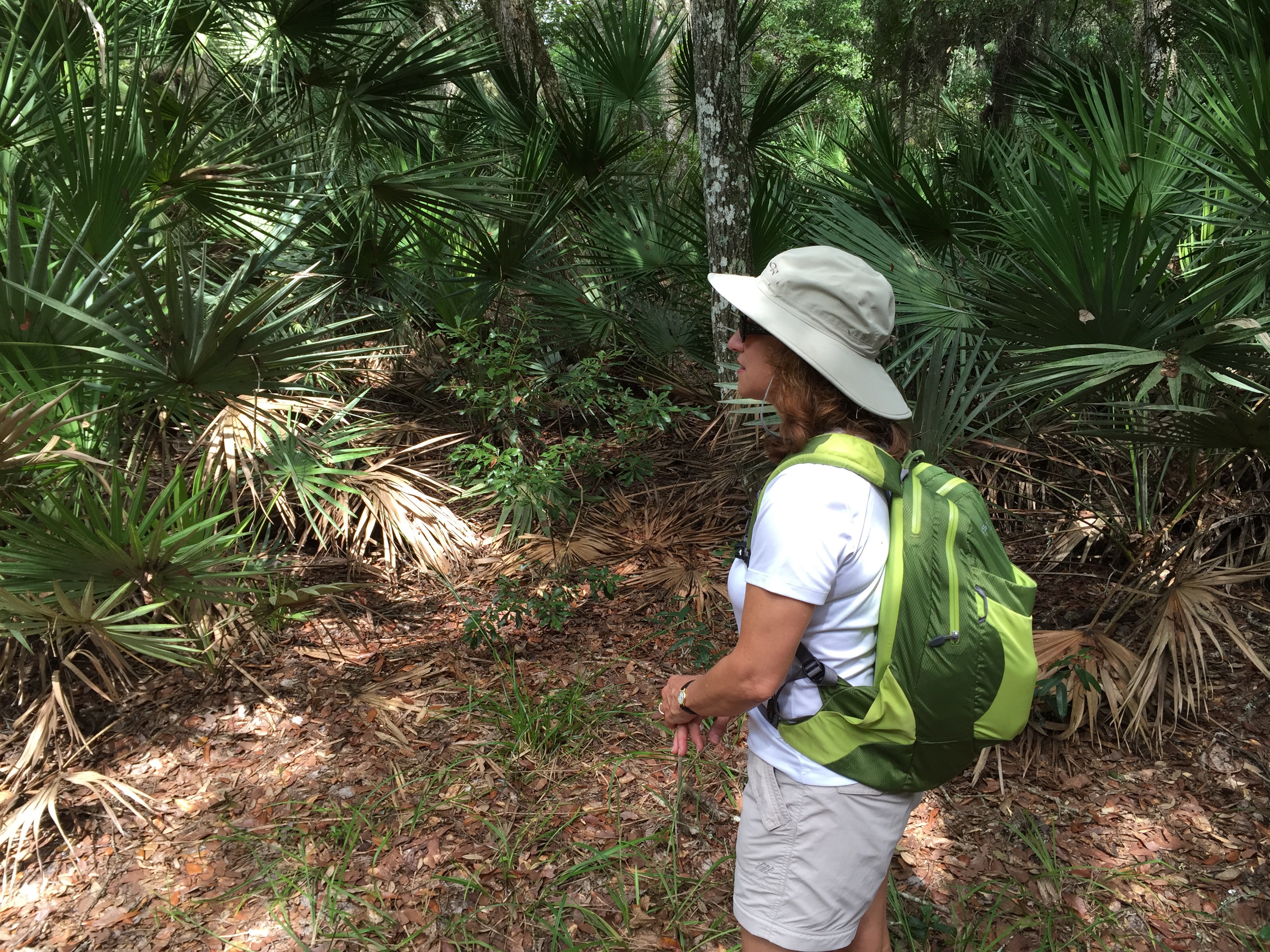
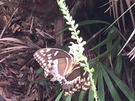
Mile 10.  Tiger swallowtail butterflies; beautiful light brown and lavender moths, Florida’s version of monarchs.. Caterpillars. I spend a lot of time thinking about shape shifters.

Mile 11. Time for blister and foot repair. Get a call from daughter #2. She sounds good. Way away from golf courses now and back into that odd cacophony of semi rural and suburbs. There’s an old warehouse on the right, and a band practicing.

Mile 12. We see a huge tortoise.  We pass Ocoee High School. There’s an ag program, and the three cows and donkey make  lot of noises as we pass. Reach another rest stop – the “Chapin station.” Lots more housing developments. A bathroom break. I see a flame bush over the top of the white vinyl fence lining the trail.

image

Mile 13. I’m getting tired.  After some beautiful wooded and agricultural sections, we pass a truck storage spot. Guys are hanging out by their big flatbeds. A smoker is going. Looks like a good time on a Saturday afternoon if you have to hang out by your work truck.

There are old abandoned orange groves and a few packing buildings. There’s a concrete plant.   Seven  more miles to go and my discipline of a sentence or two each mile breaks down. Here’s what we saw – in retrospect – moving into Winter Garden. An absolutely perfect small town restoration, with a lively downtown and lots of people, enjoying a November Saturday. The last five miles are a park-like trail from Winter Garden to the Killarney Station with oh so eco friendly housing developments – but they are still housing developments. The odd farm opposite on the other side of the trail houses zebras and ostriches. There’s a parking lot for mega party buses. And a covered bridge going over the interstate that we were sure was swaying beneath our feet. Or that could just have been the fact it was mile 19. Nothing beats Florida for iconoclasm. Suburbs. Spanish moss. Greenness that just doesn’t quit. Even the golf courses can’t eradicate it. And peering down at it all this great blue flat sky.

After we reached Killarney Station and met up with friends A and T – and enjoyed beer and pizza at Winter Garden’s Crooked Can craft brewery (the thought of an ice cold beer definitely helped motivate those last five miles) – we wended our way back to College Park. But on the way we passed by the Citrus Bowl where the Electronic Daisy electronic dance music festival,  replete with ferris wheels, carnival rides and neon sound, was going on. Even in my house late at night, some miles away, I could hear the bass.

It wasn’t iconoclastic, somehow. It was just another way of finding the same sort of engagement I felt out there on the trail. It’s Florida.

The Real Mysteries of Puzzle Mountain, Maine

Looking up toward Puzzle Mountain

Mysteries surround Puzzle Mountain, which was the site of last weekend’s Maine adventure.

After a successful rampage through the L.L. Bean clearance facility, we started the journey northeast to the weekend home of N’s parents. It’s a lovely old farmhouse near the Appalachian Trail. And on the way – the mysteries begin.

9. How does Google maps pick its prescribed route from point A to point B?  Somehow we found ourselves taking a one lane road dotted with potholes through multiple small towns. Extremely scenic, but I’m sure there was a more direct route.

8. What’s a bean supper? Every small town in Maine seems to have one on Saturday night.

7. What are confederate flags doing in Maine? That was a really weird one to me. Here in the south, we spend a lot of time working to take them down, but they seem to be going strong up north.

6. How many ways can you cook apples? Daughter A is an expert pie maker (a skill she did not inherit from her beloved mother) and brought a delicious apple pie up to Maine, which she somehow carried on an Uber ride to a train station, on a train to Portland, and on our trip in N’s Previa up to Northwest Maine. She returned to Boston with another two bags of apples, picked fresh off the tree. Unclear what can be done with a hundred or more apples.

image

5. What mountain ranges can you see from Puzzle Mountain? We set off fairly early on Sunday for our trek up the mountain. It was a short drive to the trailhead, and the leaves were at their peak color. The trail climbs fairly steeply in sections, but is interspersed with enough flat sections to keep it interesting. The first part was all birch forest, pale yellow leaves set off against the peeling white bark of the somewhat spindly trunks. Finally, we came to an opening in the woods and could see across the patchwork valley to the White Mountains of New Hampshire and other unnamed ridges.

Birch forest
Birch forest

4. Where were all the people? It was Columbus Day weekend (or more correctly, Indigenous People’s weekend), and I would have expected at least some other hikers, if not the raging crowds we’d faced on Mt. Washington last year. But except for one other group who only made it to the first peak of the mountain, we saw absolutely no one.

Mount Washington in the distance

3. Where did the blue blazes go? Most of the trail is nicely maintained. But after we reached the second and highest peak (a whopping 3100 feet), we took a loop trail down that was considerably overgrown. At one point, coming out onto a rock outcropping, it simply petered out into a tree. Although there were some remnants of blue paint on the rock, and a very misleading cairn, it turned out the real trail was in a completely different direction. And it turns out that daughter A’s belief that always going left was the right answer did not work.

2. Which way is down? Now, this seems like a question with an obvious answer. But not so. The descending trail seemed to have as many uphill parts as down, and at one point I was convinced we were corkscrewing ourselves around the mountain.

image

1. Where is Puzzle Mountain? Some mysteries are best left unsolved. And I promised our hosts that I’d help keep it hidden!

Urban Hiking in Orlando – Art in Odd Places

Art in Odd Places
Art in Odd Places

My neighbor, known as A, and I share a fence at home and a wall at work. It’s a long story as to how we became both work and residence neighbors. Suffice it to say that this past Thursday we agreed we would walk the 2 1/2 miles to work, all so that the two husbands could drive one car downtown to meet us for the Art in Odd Places event – and, since it was Friday, happy hour.

It was a grey day, as they nearly all have been this summer, but at least the humidity didn’t coalesce and rain all over us. By now urban hiking in downtown involves a lot of looking at cranes and bulldozers that form the backdrop for the Ultimate I4 construction project – which the developers already admit will never solve Central Florida’s traffic problems.

But those cranes are second only to the cranes from the multitude of apartments springing up throughout the city like mushrooms. Nearly every vacant lot in the downtown area has now been filled with 3 to 5 story buildings, usually with retail on the bottom and residences in top. Where the heck are the people going to come from to live in them? It’s a mystery. We’ve in-filled practically the whole city – it has swelled up so much that one good prick and the entire bubble will burst. We’ll see.

Mushrooms by the Performing Arts Center

An urban hike, of course, can’t be complete without an adventure on the stairs with a backpack in an office building. Although A was eager to accompany me on a walk to work, strangely enough I’ve never succeeded in getting anyone to join me in the stair climbing/backpack toting portion of urban hiking. But I dutifully did my 108 flights up and 108 down (according to my FitBit, of course).

By now I’d managed to wear three different outfits at work – the morning walk to work clothes, the Friday casual ensemble, and the stair climbing gear. People in my office were presumably wondering if I’d done anything all day besides get ready for the next work out event.

As the end of the day rolled around it was time for outfit number 4 – the going out Friday night look. The two husbands successfully navigated their way through downtown to our building with one car and we embarked on the next stage of our urban hike – Art in Odd Places.

This was a curated collection of interactive visual, performance and sound pieces by artists from around the world, along several blocks of Magnolia Avenue.  Although we’d expected a cluster of events and installations, the works were scattered throughout the area – and some of them were indeed lurking behind walls or on fences. You did have to look, and just occasionally, would catch a glimpse of art in some everyday object that was not part of the show but that suddenly had taken on new meaning.  Orlando’s large homeless population, many of whom spend time at the History Center park where there were a number of installations, seemed to be enjoying the event as much as the expected hipster crowd.

Cemetery Flowers
Cemetery Flowers

A series of hands emerged from drain pipes at various odd points on the city streets. A field of paper bag mushrooms dotted the grounds of the performing arts center. A collage of silk flowers from cemeteries was designed to raise awareness of policing in America (yes, I also wondered how the artist came to have other people’s memorial flowers). A bed of nails, also covered in pages from the Bible with all the text covered in gold paint except the parts about women. Live status updates from silent human mannequins. And those are only snippets.

Status Updates
Status Updates

Where else could you go from such an erudite event but to the TexMex restaurant on Wall Street. Half price appetizers and $3 margaritas. After that, The Celt, an Irish pub, was the only natural next stop. Steak and mushroom pie for the husband (the whole night did seem to have a mushroom theme) and mussels for me.

Bed of Nails
Bed of Nails

As we departed The Celt, we were greeted by a human cat in a cage – with a small black and white kitten on a leash standing guard nearby.

Who's in the cage? Photo - A. Luby
Who’s in the cage? Photo – A. Luby

To top the evening off, I had given daughter #1 carte blanche to book a place in Portland, Maine for our upcoming trip. Next thing I knew we had rented an AirBnB that seems to include chickens. It was one of those nights.

Swamp Stories – Spiders and Skeeters and Flies, Oh My

image For a variety of complicated reasons, husband J and I found ourselves this weekend at the luxurious Ponte Vedra Inn, just south of Jacksonville. Founded in 1928, the inn has the same feel as the Santa Maria Inn in Santa Maria, California – big reception room replete with model sail boats, backgammon tables, and overstuffed furniture designed to look like it’s been in some blue blooded family’s estate forever. Over the fireplace, there’s even a spooky painting of two young boys holding recently caught fish — the colors fade toward the bottom so they seem almost to be floating in some netherworld.

Spooky kids....
Spooky kids….

So with a fancy spa, a golf course, three pools and a beach with servers eager to bring iced drinks with umbrellas, where more logical to end up than on a seven mile hike by an estuary, our only travel companions a variety of biting flies, gigantic spiders, and most unwelcome of all, ticks.

I’d actually looked up the Guana Tolomato Matanzas National Estuarine Research Reserve (what a name) before we left and we’d already committed to ourselves we were going to do this hike on Saturday morning. We almost lured a couple of friends who were attending the same weekend event but at 7:15 am they thought better of it.

The first challenge was finding the darn place. One of the reviews I had read cryptically mentioned the directions in the hiking app were not correct – which we too discovered as we made our way past the opulent Ponte Vedra oceanfront homes into the reserve. Although there are three parking lots, none of them is the location of the trailheads. But persevere we did, and eventually figured out where the loop hike started. We saw a total of three other people on the trail – and then only at the very beginning.  An amazingly uninhabited place — at least by humans.

The trail starts off through classic Florida palm hammocks, framed by live oaks and swaying Spanish moss. It was beautifully shady and the temperature wasn’t bad. The shades of green ranged from neon to hunter, and the canopy over the trail made it almost as though we were walking under a pergola in a landscaped park.

We’d covered ourselves in heavy duty bug spray but at a certain point my sweaty body apparently became too much for the flies and ticks to resist and I found myself pursued by an onslaught of flying and jumping creatures. After I literally ran several yards, hiking boots and all, to escape I decided covering up was the only answer. So I dutifully zipped the bottom parts of my hiking pants onto the shorts and donned my long sleeved shirt. I may have looked a bit like one of those eccentric old ladies who wear winter clothes regardless of the season, but the heat was infinitely preferable to the attack of the flies.

Shortly into the hike we passed a tree with two gigantic growths – if we were in Africa I would have thought they were some sort of termite mound, but here – perhaps overgrown mud dobber nests? Ideas? Photo is below.

image
The trail then winds its way by the edge of the river – part of the complicated intracoastal waterway system that hugs the east coast from Florida to Maine.  The green of the water grasses is pale and you start to see yellow flowers, a welcome sight as summer is not the best time for flowers in the Florida woods.

image

Most amazing were the huge yellow and black spiders we kept seeing everywhere. Fortunately their elegantly spun webs tended to be set high between the trees, meaning even J only had a few encounters. But the spiders were about two inches in length, and seemed to be quite well fed.

image

After almost 7 miles there was still a further loop we could have done, but by then the insect wildlife was starting to pursue J, who had made the mistake of hiking without full body armor in his backpack. So we called it a morning and headed back to civilization.

image

But as I type this on my phone (my iPad having encountered yet another problem that will require a trip to, horror of horrors, the Genius Bar), and look out on the red tile roof of the resort and the sliver of ocean I can see through our window, I do keep thinking how much more I’d really prefer to be looking at the pale green of the river grasses and the deep comforting trunks of the live oaks.

Ecuador – A Walk in the Cloud Forest

image

We returned from Cayambe on a Monday, with one day left to eke out every last remaining bit of our Ecuador experience before we returned to hot, humid and flat Florida. Of all the various options Ossy offered, a hike up into the cloud forest in the Pichincha range, into the Yanacocha Reserve, had the most appeal. Plus, he promised hummingbirds.

Now, I’ve had a hummingbird feeder for years. I’ve heard that Florida too has hummingbirds – but each time I spy such a potential winged creature, it turns out to be one of Florida’s special species of gigantic, winged bugs. Of course, the fact I have never bothered to put hummingbird food in the feeder probably doesn’t help.

So off we took, me, husband J, Ossy, and his wife. One fact I hadn’t realized before we left the U.S. was that our trip coincided with Pope Francis’s trip to Ecuador – and specifically Quito. Multiple roads were closed and police were everywhere.

On the way out of Quito we turned on the car radio and heard the Pope saying mass as we looked down on the crowd, half a million strong, in Quito’s Bicentennial Park. A little surreal.

A sea of people at Pope Francis' visit to Quito
A sea of people at Pope Francis’ visit to Quito

The sunny weather we’d brought from Florida had definitely turned and there was a steady downpour as we drove the winding roads up to the trailhead. Once we arrived at Yanacocha we all donned raingear, and I was profoundly greatful for my absolutely waterproof wind jacket (a Marmot that dates back to 2011) and pants (also Marmlot).

After a mile or so straight uphill through the paramo – the Ecuadorian highlands, we encountered our first swarm of hummingbirds. And I use the word swarm intentionally. There were so many of them darting back and forth to feeders that you could hear their wings. They shot past our heads as if catapulted from some sort of slingshot.

Not only were there small hummingbirds, but we saw several (I think) Great Sapphirewings, one of the largest hummingbirds, about the size of a cardinal, native to Ecuador. We also saw one hummingbird with a needle like beak almost as long as his body.

After we hiked through hummingbird central, we turned a corner – and there, growing on the side, was a fully blooming orchid, exactly (well, bigger and healthier) like one I have at home.

image

Even though it was still pouring, we ventured up the steeper section of trail as it didn’t seem too slippery. Of course, nothing seems slippery after a glacier. Nonetheless, by this point it had started to hail, and chunks of ice were accumulating and forming small banks of snow.  Ossy could have used a machete as there was a fair amount of trail breaking involved as moved further into the dense jungle of cloud forest. Flowers were everywhere, purple lupines, flame colored trumpets, white daisies growing close to the ground, all framed against a canopy of outsized leaves.

We finally reached a turnoff that would have taken us down a steep section to circle back to where we’d started – but that path did seem very muddy and by then we were all pretty well soaked. So we opted for what looked like a wider trail, despite the fact no one present had ever gone on it before.  The trail exited the cloud forest and took us back into the highlands – where we continued to climb up and up and up – even though it really seemed we should be going down and down and down. There were ultimately some long switchbacks, and we passed a few people working on the roof of a tumbled down structure of some sort, so we knew that at some point we should rejoin civilization.

Just after that, we suddenly realized we were walking across a field that was surrounded by a barbed wire fence – we were apparently on the wrong side of it. After we scrambled under the barbed wire, we looked back to see a large keep out sign barricading the area we’d been blithely strolling across.

image

But, our faith in Ossy’s mountain guide instincts was justified. Within another mile of so we hooked up with the “main” road and ended up exiting just a little below the spot we’d parked the car.

image

It was still raining, and we could all squeeze puddles of water out of everything we had on. J had on his customary too many layers of shirts and was able to lend Ossy one for the drive back. Apparently it’s illegal to drive without a shirt on in Ecuador. And besides, the Pope was there so I suppose it would have been unseemly in any event.

We made a quick pit stop back at the Hacienda Rumiloma to change – and dry off. The next order of business was a trip down into Quito for Chinese food – hot and sour soup never sounded so good. The Pope’s presence and road closings seemed to have resulted in an eerily quiet city, and we were able to park directly in front of the restaurant.

Hummingbirds, orchids, Chinese food, the Pope, and crawling under barbed wire. What better ribbon for wrapping our four Ecuadorean mountains in eight days?

Crossing Florida

Historical Florida
Historical Florida

The beauty of taking a road trip under the guidance of Google maps is that, Dr. Seuss-like, you’ll never guess the places you’ll go – or the things that you’ll see. And such was the case this weekend when Google maps itook us off I 4
and routed us onto Florida Road 570 and 540 – and then continued to take us down 17 South cutting across the great state of Florida – until we finally met up with I 75 near the Gulf and made our way to Naples, location of my law firm retreat.

One of my favorite parts of Google maps on this particular adventure was its insistence that we were traveling north – despite all indications to the contrary, including road signs, Google’s own moving map, and the location of the Gulf of Mexico itself ahead of us.

Living in metropolitan Central Florida it’s easy to forget that Florida still has vast swathes of rural land.  Cows graze in brownish green meadows and rest in the shade of the curtains of Spanish moss that cascade down from clusters of live oaks. The land has just a little roll to it, just enough to envision it once as the sandy floor of a lapping ocean.

image

Every few miles you happen upon yet another small town. Most of them seem to have escaped the scourge of McDonalds, Chick-Fil-A and Burger King. In fact, the one time we really only had time for fast food all we could find was slow food. The Double JJ Restaurant, the Pioneer Cafe, Smokin’ Joe’s BBQ.  It wasn’t until we returned to the interstate that the familiar chains showed up again.

image

Small town USA no longer looks like Archie Bunker’s US of A.  Smokin’Joe’s is right next to the Taqueria and the place that specializes in wiring money to Mexico.  In towns like Zolfo Springs and Bowling Green and Cleveland, the Pioneer Restaurant is across the street  from the Acapulco Cafe and the Mercadio. In the fields growing who knows what, converted school buses were busy delivering migrant farm workers to do the back breaking picking of whatever it is that we only encounter in the pleasant coolness of the produce sections in our local grocery stores.

image

After passing through Polk, Hardee and DeSoto counties, as we neared the Gulf, stucco walls surrounding golf communities started to partition the wide open spaces. The old Florida cracker tin rooves gave way to the repetitive Florida idea of Mediterranean tile. Funny how those Mediterraneans had garages as a central feature of the facade of their houses.

Despite all that nothing beats the glassy lake of the gulf or its sugar sand that was waiting for us in Naples.

We returned home the same way. We stopped to eat a quick picnic lunch in a small park across from the DeSoto County Courthouse. Somehow that seemed an appropriate way to end a law firm retreat. And what better way to prepare for the mountains of Ecuador in three weeks than to really experience the Flatlands of Florida.

DeSoto County Courthouse

West Orange Trail – Beginning to End

image

Husband J and I have been walking different chunks of the West Orange Trail for about the last year, as memorialized in “A Walk on the West Orange Trail” and “The West Orange Trail – Starting from the Other End.” But we also had an overarching desire to see if we could walk the whole thing in one fell swoop – well, at least 20 of its 22 miles. (The very last couple of miles – mostly along the side of a busy street in Apopka and culminating in the middle of a sidewalk in front of a strip mall – are simply not worth including.) After all, we reasoned, if the Romans could march miles like that in one day while laden with armor and the spoils of war, surely we could manage it with hiking boots and backpacks.

So, early on Saturday we set out with a couple of friends who had agreed to participate in the initial stages – M, of Iceland fame (see the prior weeks’ Iceland saga), one of my law partners who is affectionately known as King A, his daughter A, and her large, brown brindled part Weimaraner who shall be known by her full name, Daphne.

It was a beautiful, if humid, day and the first five miles to Winter Garden were like a walk in a shaded park along oak lined paths. The park theme was particularly evident as we passed a meadow inhabited by ostriches and long horned cattle (or maybe buffalo?) – not what we were expecting amid the Spanish moss.

image

The amount of rapid development along the trail is incredible. In the months since we were last there houses have sprung up like proverbial mushrooms. While many developments are promoting their ecofriendly characteristics, the fact remains that each of them is occupying what used to be open Florida land.

Just before mile 5, M abandoned us to return to a more normal day of activities. King A and his daughter left us in the charming town of Winter Garden – after Daphne lay down in the middle of the sidewalk and clearly announced she had had enough.

Downtown Winter Garden

Miles 5 to 10 wind through multiple housing developments and old citrus groves; they pass warehouses and fields, and the site of the Ocoee high school sustainable agriculture program, where three students were tending a cow. Some of the housing developments share great swaths of green semicircular common areas surrounding retention ponds – the manicured grass for all intents and purposes looking like a giant green unibrow. But where were all the people? It was as sterile as a glossy page from a magazine. When we walked through some much poorer areas later on the outskirts of Apopka there were men outside sitting on lawn chairs, kids playing with hoses, people walking down the trail to actually get somewhere.

Only in Florida - hill warning with no discernible hill in sight!
Only in Florida – hill warning with no discernible hill in sight!

At just after mile 10, we decided it was time for lunch and eventually located a bench in the shade of a freeway overpass, with a golf course running along one side. I had started off in running shoes, believing their light weight would help with the distance but had packed my boots just in case. By mile 10 it was clear it was time to shift footwear. So after a sandwich break and foot ministrations, we set off for the final 10.

Things, as they are wont to do, got even stranger during the last half of the hike. As we neared the end of the seemingly interminable golf course, lining the other side of the trail was a field dotted with bright flowers – which after a few moments we realized was a memorial garden. We had been thrown off by the office building – a small frame house with a filled in swimming pool. Huh? And I’m not sure what the proximity of the memorial garden to the golf course says about the nature of human existence but it doubtless means something.  We also concluded that Apopka must be slightly higher than Oakland, at the beginning of the trail – although there were no real hills, we kept going up a steady slight incline – and never seemed to get to go down.

When we reached mile 15 we had travelled more miles than on any previous hikes, and we were also on a part of the trail we hadn’t seen before. All of a sudden, peering over the edge of the trail was a giant white statue of Buddha gazing down serenely on the cyclists whizzing by him – it turned out we were next to an extremely large and ornate Buddhist temple. The religious juxtapositions were interesting. We had started by the “Mosaic Church” near Oakland, now the Buddhist temple, and shortly after encountered churches ranging from the Seventh Day Adventists (where a very dressed up congregation was just departing church services) to something called St. Elizabeth, a Church of God By Faith, with no other apparent denominational affiliation.

image

After a wooded section we emerged onto another road which offered a tour of Apopka’s dying foliage industry. Nelson’s Florida Roses (I had never realized it was even in Apopka) still seemed to be flourishing – although we couldn’t help but note that when we saw them switch on the sprinklers the electrical transformer over our heads actually crackled and sparked. But next to Nelson’s are acres of semi-abandoned greenhouses, giving a sort of post apocalyptic feel to the whole place.

image

Finally we made our way through a wooded area, dotted with small houses, and up to the Apopka bridge. Just beyond that is the Apopka Station, our ending point, but we were just under miIe 20. So we forced ourselves to go on just a little further so that when we turned around back to the Apopka Station we stopped at mile 20 on the nose.

This particular training adventure, unlike most, was a one way trip. Except for the half mile at the end, when our friends A and T retrieved us, we hadn’t covered any of the same ground twice. Sometimes I wish summits were like that – you could get to the top, just stay there, and not have to come down again.

J near the beginning of the hike

Let It Go, Flow

image

Apologies to Paul Simon for the title (“never look back, Jack”). I’ve been writing an account of our trip to Iceland in early March – a travelogue of driving adventures, Nordic history, and stunning scenery. But all good sagas need intermissions – a time to break out the mead (or whatever it is the Vikings drank), roast some lamb (or whatever they ate) – and just generally sit around the fire and stare at the sky.

And so it is with my Nordic epic. I started this blog almost a year ago because I thought it would be the simplest way to share our then upcoming trip to Mt. Elbrus in the Caucasus Mountains with everyone who had expressed interest. But I rapidly discovered that I was getting something else out of it entirely – a chance to write outside of the tightly constrained boundaries of legal writing (my profession) and an opportunity to speak in what I like to think of as a more authentic voice.

Yet I can’t escape my Type A tendencies. As I faced writing this weekend about our final days in Iceland, I realized, “I really don’t feel like writing about that now.” And you know what? I don’t have to. I have to fight the impulse to turn everything into a homework assignment for myself, making this blog just one more weekly deadline to add to the numerous and all pervasive deadlines I deal with on a daily basis.

I’m a really disciplined person, in most ways. It’s what has enabled me to climb these mountains even though I started at age 50, and I’m soon to be 54. It takes a lot of will to climb up and down the world’s most boring staircase between two and four times a week almost every week since April 2010. No, I’m not kidding.

But it’s one thing to be disciplined and another thing to let it enslave you. The discipline of making myself write at least once a week here is one thing. But it’s another thing to feel I have got to write Part 4 of Iceland when I don’t feel like it, even when there’s no court or client demanding I do so. And it’s also another thing to feel compelled to publish this on a Sunday simply because I’ve arbitrarily imposed that internal deadline on myself.

So today I’m going to go with the flow. I did do my stairs today (in fact I wore my mountaineering boots and I’m sure I looked even more peculiar than usual), but I’m going to press publish tonight. Even though it’s Friday.

And how about you? How do you keep from turning things that are optional into obligations?

image