I’m interrupting the tranquil narrative of last October and November’s European excursion. And what could make me do that, you ask?
A spur of the moment bucket list trip….to Morocco! J has always wanted to climb Mount Toubkal, the highest mountain in North Africa, in the Atlas Mountains. It’s way shorter than its gigantic sibling, Kilimanjaro, in Tanzania – which is what, of course, started us off on this crazy mountain climbing binge we’ve been engaged in for the last 13 years. And it seems a particularly good choice given that I grew up in North Carolina and the Atlas Mountains were originally part of the Appalachian Range. Who knew?
So when we saw KE Adventures had somewhat reduced its price for an 8 day trekking adventure, and our calendars looked relatively clear….what was to stop us from signing up? Of course, there is that little detail about the trip starting in four weeks and the fact that we had hardly been training to climb an almost 14,000 foot mountain, four days of trekking at altitude (13 mile days or so), and some with a LOT of elevation gain….
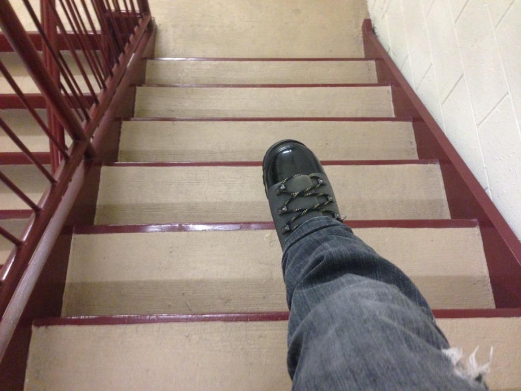
It’s back to the stairs for me. And the ten mile clay loop in Clermont tomorrow.
The hike was over and it was time to walk to the train station in Bad Goisern for our journey to Vienna. A quick change of trains and after two and a half hours we were back in the city center.
This time we stayed at the Hotel Josefshof, a very different experience than the Superbude, both in location and ambience. It’s an old building, and everything inside is modeled after Klimt designs, even down to a gold sink and a Klimt drawing on the glass door to the bathroom. It is in the Josephstadt area, just off the outer ring road.
After checking in, we did a gigantic walk along the ring roads. The buildings are massive, and I’ve never seen so many statues on top of buildings – a veritable army of gods, goddesses, emperors, and war heroes staring down at you. We explored multiple, high end shopping areas – very high design, plus Hermes, Luis Vuitton, etc etc. The Fersatt (sp?) passageway was particularly amazing. There were lots of museums I wish we’d had time to see, such as the Sisi Museum and the Imperial Apartments. By then it was so late it made no sense to return to the hotel; instead we found an Italian restaurant.
From there, we walked to the KarlsKirche, named for the emperor Charles. It’s a masterpiece of Counter Reformation architecture – all marble rust and cream interior, with Asian, Byzantine, Roman, and Greek references. Definitely an attempt to wow the masses. A pool outside reflected the glowing dome, giving the whole place a movie set like quality. The kids playing funky electric music provided a stark contrast to the concert we were going to in the church – Orchestra 1756, performing Vivaldi’s Four Seasons on original instruments. By the way, the Viennese somehow lost Vivaldi’s grave….which turned out to be a theme of much of the rest of the trip. He wasn’t the only one whose remains went missing.
The next day was for travel. After coffee and pastries, we took the underground to the main station, HBF, a train to the airport, and boarded our plane for the Charles de Gaulle airport in Paris. One more train into Paris itself – and our French adventure was about to begin.
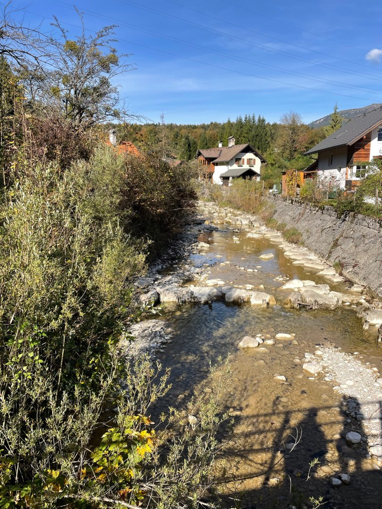
The 24/7 church bells clanging next to our hotel in Strobl didn’t keep us up quite as much on our last night there, so we were a bit better rested for our trek to our next stop, Bad Ischl. The weather was cool, and great for hiking. Our walk started off along the banks of the River Ischl – lots of flood control and hydropower. Some pretty woodland sections but not nearly as dramatic as the fairy dells we discovered the day before.
The hike passed through a number of small villages. The houses here, even if old, look so much newer than those in England. White stucco with dark wood work and balconies.
We finally reached Nunsensee (Lake), which looked almost like a dugout reservoir. We were worried about rain so we didn’t even stop for lunch and reached Bad Ischl close to 2 p.m. A church greeted us at the outskirts. I wanted to go in, but two people were in there, clearly praying. The flowers in the terraced gardens were all labeled.
Bad Ischl is an old spa town of the Habsburg regime, located by the river. The Goldeness-Schiff hotel, where we were staying, faces the River Traun, which is part of the River Ischl. (The water geography seemed very complicated.) The hotel was very modern; we had a small room without a view, but perfectly adequate. They gave us a coupon for a free drink for agreeing not to have daily cleaning. No decision there!
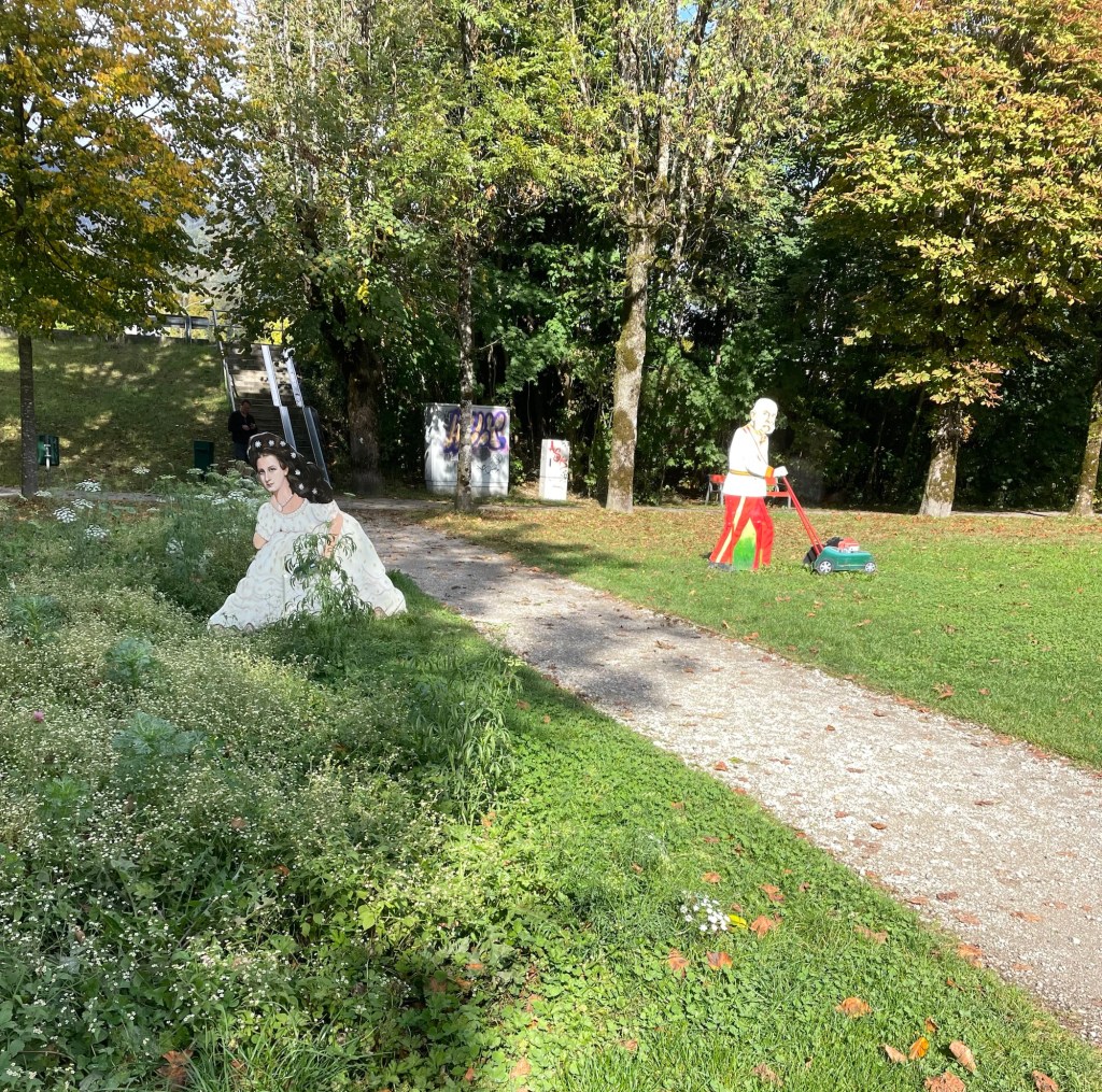
We decided against a visit to Kaiservilla, the summer residence of Emperor Franz Joseph I, and Empress Elisabeth of Austria (known as Sisi). It was very expensive and we only had an hour before closing, so instead we chose to have a drink at an open air cafe (under the awning, while it rained around us), and enjoy window shopping (especially the modern takes on traditional Austrian dress). We also spent time in Sisi Park. Bad Ischl pays homage to her (and her husband) in many ways (for example, cartoonish metal sculptures of them gardening in the park…).
Dinner was at the Spoarhead Gastropoda. Very nice and a nice server, who managed well with few other servers, and appreciated our patience. I always feel like an ambassador for the U.S. on these trips. Chicken Paprika for J and couscous chicken bowl for me. Austria closes down early. We were back in our room by 8:30.
Sunday dawned to a very elegant breakfast, with Prosecco on tap! I wish I had felt like trying it, just to say I’d done so. And a fresh squeezed orange juice maker – I’ve never seen one of those before. We again were anxious about the weather so we skipped the local hill walk that was on our itinerary and instead walked along the banks of the Traun, by lots of sports fields, to the almost empty gondola station. The gondola took us up almost 4000 feet in just 10-15 minutes. Wow! At least the gondola came to a nice slow speed at the top so we could step off.
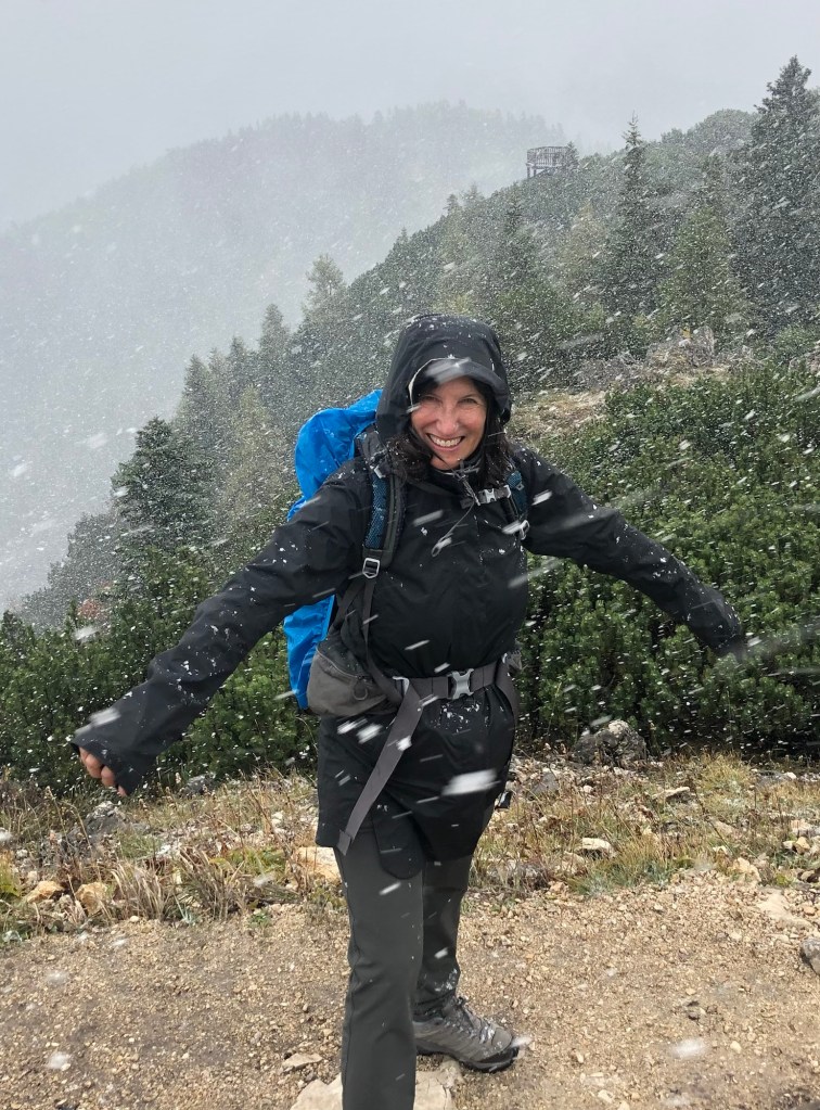
It was very cloudy, misty, and the “hut” where we’d hoped to have lunch was closed (as was most everything on Sunday). We took off up the mountain to the Katrinkogel, with only a few others hikers around. Tall evergreens gave way to short ones – and then it started to hail (small round pellets), shortly turning into genuine snow. It was very arid, dry and felt much better than rain. While this wasn’t a hard trail, there were certainly lots of steps.
After snowy views on Katrina, we backtracked and took another spur trail to the higher Elferkogel – we were the only people up there. Evergreens beautifully snow tipped and energy emanating from the crisp air. On the way down the clouds started to clear, and once on the gondola the views were great.
We walked back the same way to the hotel. It was clouding up so we still didn’t want to risk the other hill. We found zero places to eat. Everything was closed. Eventually we made it back to the hotel and ventured out to the nearby cafe for a beer – they didn’t even serve food. We were under an umbrella, but then the skies simply opened. We spent the last part of the afternoon in the our room planning the Italy portion of the trip. A nice dinner at the hotel restaurant – it seemed quite popular, but of course, it was one of the only places open.
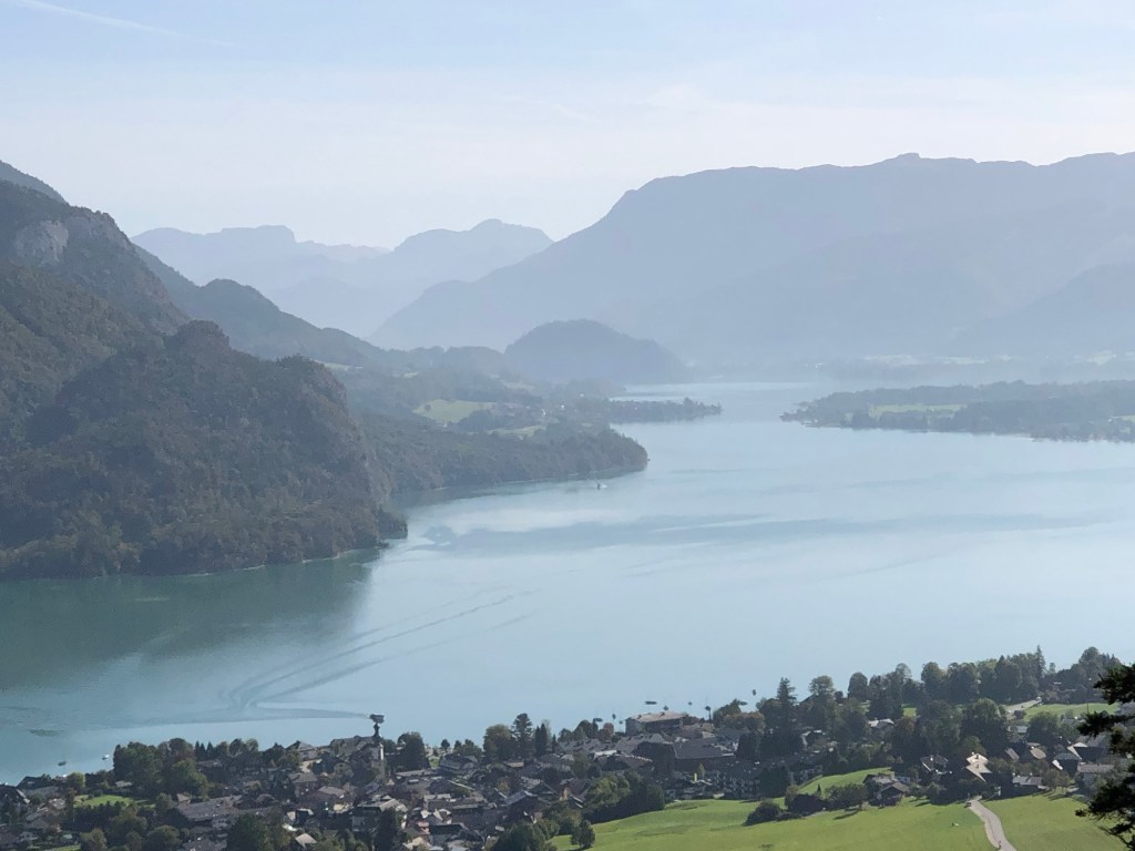
On Monday, after another nice breakfast (Prosecco was on tap even on a Monday!), we packed and took the train to the train station for Hallstatt, which is a UNESCO world heritage sight. From the station you catch a ferry to the other side of Hallstadtsee, where the actual village is located. There’s a replica of this place in China, and there were tons of Asian tourists, even out of season.
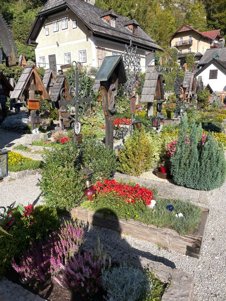
The town, built on the side of a cliff, is spectacular and filled with flowers. Salt mining was its claim to fame. The 19th century Lutheran church (first non-Catholic church I’ve seen ) by the dock has a large poster explaining that’s where the unfortunate Protestants were sent during the Counter Reformation. The Catholic Church is high up on the hill, surrounded by a cemetery, each grave with its own flower plot.
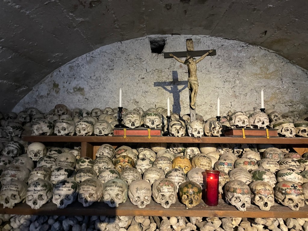
But Hallstatt is best known for the Charnel House. We saw the entrance by the cemetery and decided to pay the 2 euros to go in, little knowing that we were about to walk into an ossuary for skulls. When the graveyard became too congested, the families brought the skulls into the ossuary. (Not sure what happened to the rest of the remains.) But rather than just plop the skulls down, they were painted with family crests, dates, and remembrances. I actually found it surprisingly peaceful. J, on the other hand, found it quite creepy.
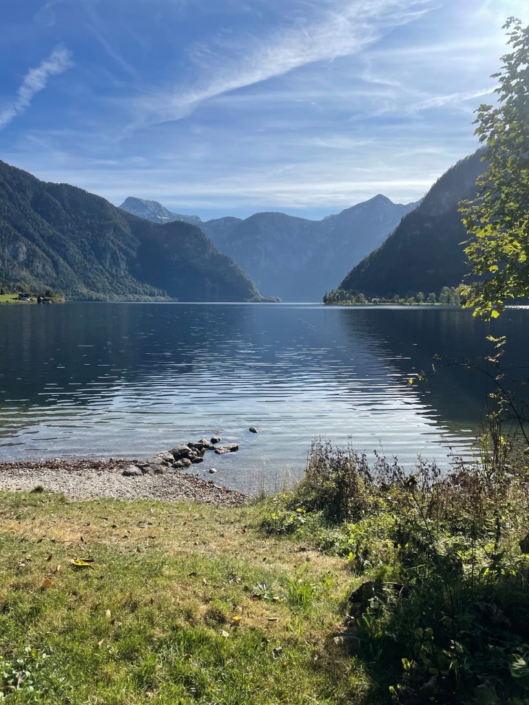
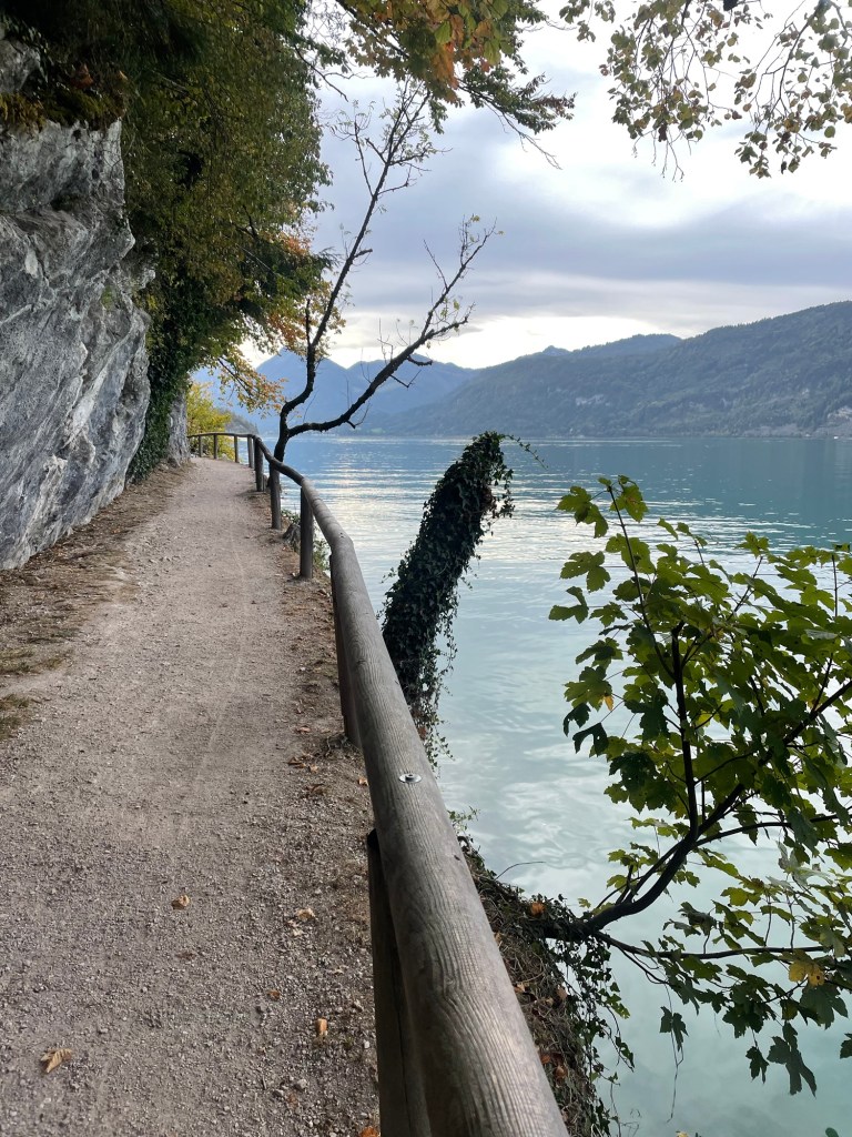
We then ferried back across the lake to start our seven mile walk to Bad Goisern, our next stop. The first part was around the lake – beautiful views, and much of the trail hangs off the cliffs over the lake. Mountains towering over the lake, and you could actually see a nearby glacier. The trail paralleled the railroad track near the lake. Lots of very small yellow finches accompanied us. There were some beautiful private homes. I can’t judge wealth in this country, but at least in the rural parts, it’s hard to see anything I would characterize as poverty.
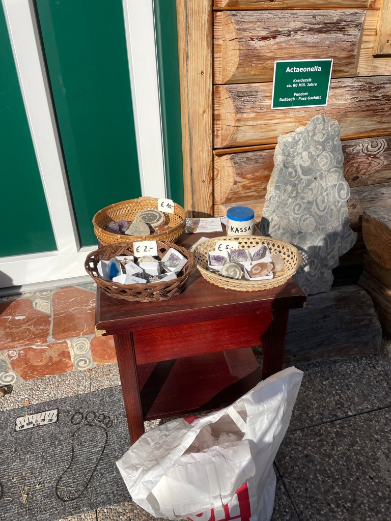
Eventually, we left the lakeshore to walk along the banks of the River Traun, which feeds into the lake. My favorite bit was the tiny village of Undersee. There, along the street in front of someone’s house, was a table of gems and fossils for sale on the honor system. I bought a beautiful ammonite for five euros.
A very nice, easy walk.
Bad Goisern is a real, little town, not just a tourist place. We stayed at the 17th century Hotel Moserwirt, in a large corner room that even had a balcony. After a grocery store trip, we had a lovely drink on the balcony with the late afternoon sun illuminating the mountains. The day was topped off with a dinner of venison and pork at the hotel restaurant.
We’d finished our Austrian hike. Now back to Vienna, and then to Nice.
It was October 12. The next stage of our Austrian adventures involved a hike from St. Gilgen to St. Wolfgang and a ferry to Strobl. Incidentally, one of the many things I learned on this trip is that you can download any language from Google translator onto your phone and use it even when you don’t have Wi-Fi or cell. That turns out to be invaluable when you’re in a German speaking country and your only German consists of Gesundheit.
Once again, a very nice breakfast buffet at our St. Gilgen hotel (Kendler Hotel). J and I are getting used to the pushed together twin beds, each of which has its own duvet. It turns out that minimizes a lot of arguments about who has pulled the covers off of whom. This coffee machine was exceptionally good, with at least six plus types of coffees, and once again, many types of breads (you are given a basket, just so you can completely carbo load), meats, cheese, eggs, fruit, yoghurt.
The hike from St. Gilgen to St. Wolfgang is an actually a pilgrimage route for St. Wolfgang himself. He lived as a hermit, later founding a monastery in St. Wolfgang. Lots of information boards along the way told his story, including in English at first…but then someone clearly became tired of translating and they were in German only.
Some very steep uphills made the trail markers that depicted pilgrims carrying heavy crosses quite appropriate. A small white church stood at the peak, right by a spring (shrine) that was supposed to have healing properties. Although I felt I could use some healing properties by that point, I resisted the urge to take off my boots and dabble my feet. The trail had a nice mix of up and down, and reminded me a bit of the Balkans.
One of many Virgin Mary shrinesTwo Yogis – Look Closely
We reached St. Wolfgang in time for lunch at a cafe by the church. The very young servers seemed overwhelmed, so it left a bit to be desired. St. Wolfgang is quite the tourist spot, but still retains a lot of charm. Nice little boathouses line the lakeside; it looked like you could rent them. And I was amused by all the statues of yogis! It was quite the contrast to the Virgin Mary icons we were seeing everywhere, at stops on trails, above front doors.
The 15th century church, right beside the lake, was amazing – painted ceilings, multiple carved alters.
We bought our ferry tickets online and took the 15:45 to Strobl, where we were to stay for two nights. Like the buses, the ferries leave right on the dot. It was about a 20-25 minute ride across the lake to the far end. Strobl feels smaller than St. Wolfgang, although it looks bigger on the map. I think it’s just less touristy.
A fair number of places were closed for the season. We stayed at the Hotel Strobler, very nice and convenient, but right by the church which rings its bells every 15 minutes, 24 hours a day. Our window looked out on a well-maintained and colorful graveyard, decorated with flower gardens atop each grave.
After a walk down to Lake Wolfgang (Wolfgangsee), we had dinner at a brewery with very interesting food. I had a vegetarian meal of baked potato with sour cream, root vegetables and chestnuts. J had Wiener schnitzel (not so unusual). Sleep was a bit hard to come by, with the church bells clanging every 15 minutes.
The next day was Friday the 13th. After our somewhat disrupted night, we made it to a grocery store to pick up lunch food for our day hike. We started off by passing the elementary school track races; lanes had been marked off by the lake, and there was lots of excitement.
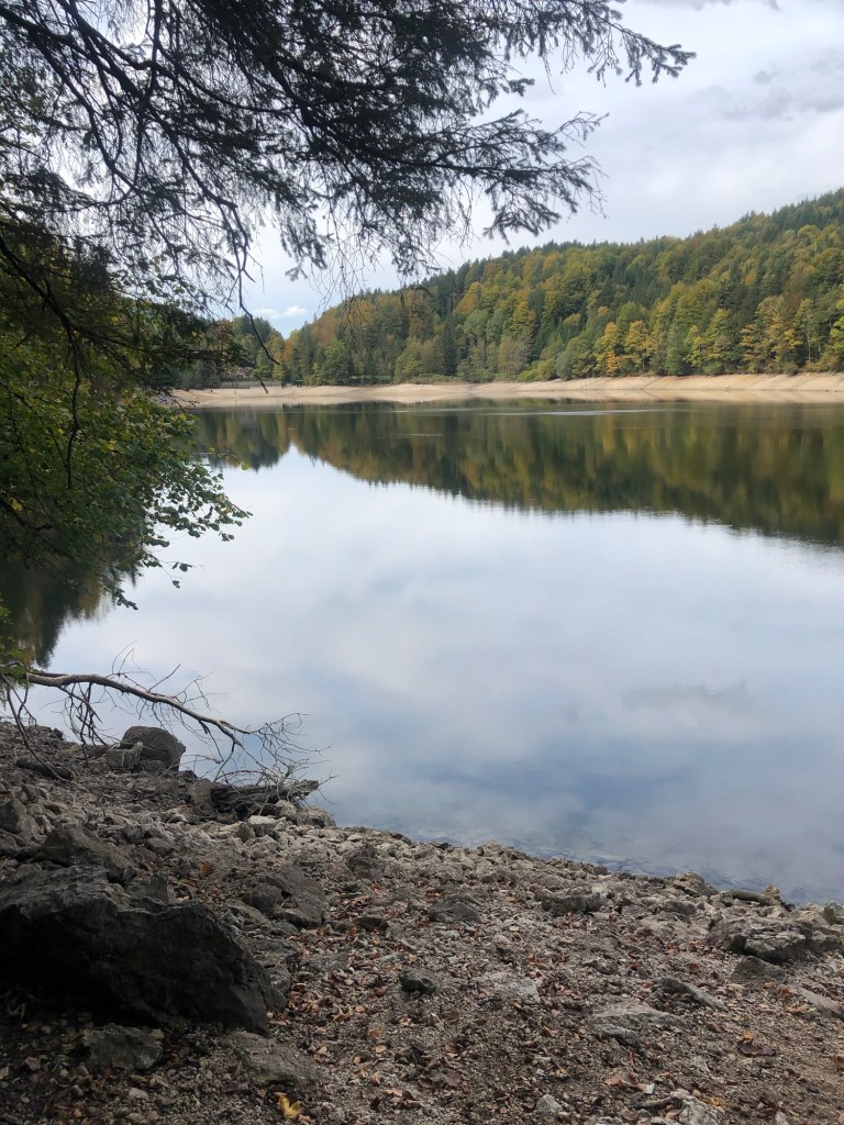
The start of the Burgl Panaramaweg (Trail) is neat. In contrast to the ancient Wolfgang pilgrimage we had taken the day before, it opened in 1982. The trail starts off on a boardwalk tethered to the side of a mountain as you round the Burgl Rock. It then meanders through a valley (replete with very nice cows, all wearing bells), and though a pass and up, up, up to the Schwarzensee (see means lake).
On the way, we walked through beautiful mossy areas that looked like fairy spots, biodiverse forests, followed by spread out tall pines with light dappling through. The lake seems small compared to the others, but it’s large enough when you walk around it.
We had a nice picnic lunch in a secluded spot on the banks, and made it back to St. Wolfgang (where we’d been the day before) in time to catch the same 15:45 ferry.
As I wrote this diary entry, we were enjoying a drink in the garden at the Hotel Strobler while vaguely watching the only other Americans we’ve seen (two men, investments bankers?), who were also on the ferry, trying to figure out how to order drinks.
Our final night we had dinner at Kirchenwirt – we even made reservations. J had a goulash, and I had spinach dumplings. Fortunately we were either so tired or so used to the every 15 minute church bells we didn’t even hear them that night. A good thing, because the next day was 9 miles to Bad Ischl.
It does sound a bit like “I Had Trouble in Getting to Solla Sollew,” for those of you who remember the 1965 Dr. Seuss book…but Fuschl am See was our next destination after our couple of nights in Vienna. (“See” means lake; “am” means “at the”.) This entailed trains and buses and trails, oh my, and a few wrong turns along the way.
Actually, we were about to embark on the hiking phase of our trip — about a week exploring the hills surrounding the Salzburg Lake District. Our adventure started with the subway to the main train station in Vienna, a long wait, and then a train to Salzburg. Fortunately, it was easy to find the bus from Salzburg to Fuschl am See, although getting off the bus proved more difficult.
We bought tickets for the 2:15 bus and boarded almost immediately, except for the delay occasioned by some woman who insisted we put our suitcases in the cargo area below. I knew we must be in the right place, since one of the few passengers on board was wearing a native green Austrian hat, festooned with feathers and insignia. See photo above. We clearly weren’t in Kansas anymore.
We had looked at all the stops listed on the electronic display on the bus and there seemed to be only one Fuschl stop. Although this was not consistent with my previous research, we thought we better go with the real time indication on the bus and get off at that one. I should have relied on my research, as we ended up disembarking a full four stops too soon. It turns out that having Fuschl in the name of a place was not much of an indicator…there were multiple stops labeled Fuschl and the electronic display simply hadn’t shown them yet!
Anyway, we exited the bus at what was a suspiciously remote stop on the side of a highway, after making quite a production since the bus driver had to help us get the suitcases out from the cargo hold. The fact no one else got off should have been another hint. It didn’t take more that a couple of minutes before it was clear something was terribly wrong. I checked GPS (which, by the way, works without cell data or Wi-Fi) and realized we were a good three miles from our destination. Since pulling our luggage along the side of a two-lane highway without sidewalks didn’t seem like a very good idea we were happy to learn the next bus was only 20 minutes away. The bus driver rolled his eyes when we got back on but let us use the same tickets…clearly chalking it up to incompetent Americans. This time we did not put our suitcases in the cargo hold!
After three more stops, we arrived at the correct Fuschl stop and located the Hotel Jakob (which also seemed to have a moniker of the Triathlon hotel). And indeed it was aimed at triathletes and cyclists, with bikes on display and biking gear for sale. The town was quite small – on a beautiful lake surrounded by mountains. J and I strolled through town and had a gin and tonic at a nice lakefront cafe, and made a dinner reservation for the attached restaurant, which was recommended for local fish.
The temperature dropped; we returned to the hotel to change. This is when we figured out that Austrians, at least in the country, eat early – between 6 and 7 p.m.! I can only describe the restaurant as staid, lots of older people (it was a weeknight in the off season), all seated at tables lined up around the sides of the room so we could all inspect everyone else as they ate their meals….I had three types of fish all from the lake – a filet whose name I didn’t catch, arctic char, and perch, served with carrots and leeks.
The next day we finally started the hike, but only after an amazing breakfast buffet featuring salmon, cold meats, cheeses, breads. I managed to mess up the coffee machine by using too small a cup for my latte (you can imagine what happened), but discovered that the coffee machines in Austria rivaled those in Spain. America needs these!
After we checked out of the hotel, we started to follow the “blue line” on our downloaded GPS map, just as we had done in the Yorkshire Dales. The first part, through a valley, was a trail themed around gnomes, with little signs up everywhere telling a story of some ill fated gnome. The landscape really does explain where the Brothers Grimm got their tales.
It was only about a five miles to our next stop, although there was a decent uphill and down, and I did miss my hiking poles – but there was no way to fit them into the luggage. One thing to get used to were all the Catholic shrines and chapels along the trails. Every couple of miles there would be a shrine with candles lit, typically for the Virgin Mary. I’m assuming the candles were battery operated.
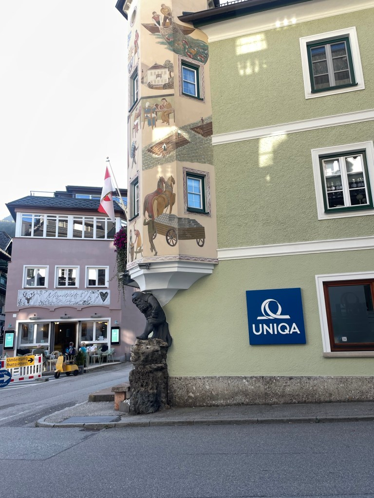
After some good scrambling and beautiful views from Mozartblik, we descended into St. Gilgen, which is on Lake Wolfgang. It’s a very wealthy summer town, but many places were closed for the season, which had ended a couple of weeks before. It was almost too quaint, painted buildings and Austrian architecture.
We had lunch by the lake, followed by a power nap, since we still weren’t exactly on the right time zone. After a long walk through town, we capped off the day with a drink at a bar across the street, which featured someone wearing lederhosen along with many tattooed bikers. That theme continued at dinner – again, the restaurant was practically empty by 7 – where we enjoyed watching four very elderly men, clearly on their weekly outing, each wearing lederhosen with the appropriate jackets.
J and I retired early. The next day was going to introduce yet a new mode of transportation – a lake ferry.
As I sit here on a cold, dreary Central Florida winter day, battling the same annoying case of Covid that half the population seems to have, nothing seems as pleasurable as revisiting our six weeks in Europe that made up the third phase of our sabbatical. You’ll recall J and I started our six months off in the UK and Northern Spain, followed by a multi thousand mile road trip that took us from Florida to Yellowstone National Park and back again, with multiple sights along the way.
On October 7, having barely slept, we finished last minute packing into two backpacks and carry on suitcases, and started our journey. Uber to MCO (for those of you not versed in Central Florida lingo, Orlando International Airport is actually the former McCoy Airforce Base, whose initials it still uses). After a flight to Newark, we boarded our Air Austria flight to Venice. All the flight attendants wore red, down to their stockings, and despite some bumpiness there were free drinks and good food, albeit little sleep.
We arrived in Vienna very early on Sunday morning and managed to find the train to take us to the Prater station, which, to our surprise, was at the edge of a very large and old fashioned amusement park. Ferris wheel, roller coasters, fun houses, and games of chance…it reminded me of Tivoli Gardens in Copenhagen, which informed Walt’s ideas for Disney….I guess I just can’t escape! Pulling our suitcases through a deserted carnival the day after the last day of Oktoberfest was a little eerie.
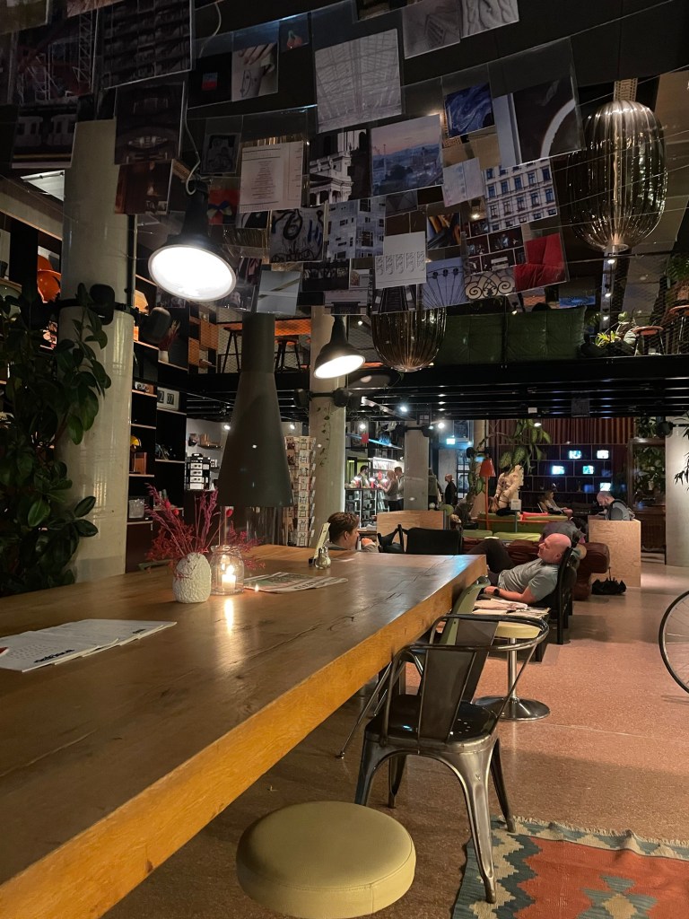
Lobby of the Superbude
The Superbude Hotel, recommended by one of J’s colleagues, was just on the far side of the park. A very hipster style place, with lots of retro, mid century modern stuff in the lobby, including an astronaut space suit. Our room, which fortunately was ready by 10 am, was perhaps modeled after a tent? How appropriate. A pattern of mushrooms on the wallpaper, net hanging from the ceiling to mimic tent walls (?), folding chairs attached to the wall.
After a brief rest we decided to wander toward the city center via the canal. We’d been told there were lots of bars and establishments on the canal – we could see signs of that but they certainly weren’t open on a cold and rainy fall Sunday.
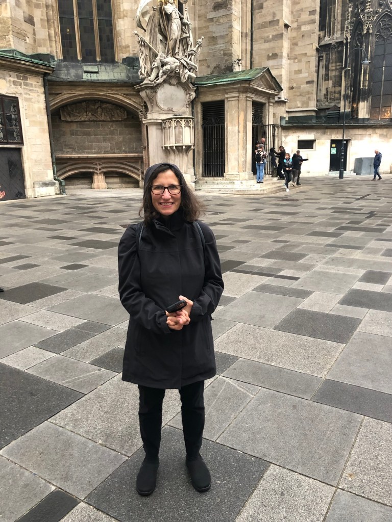
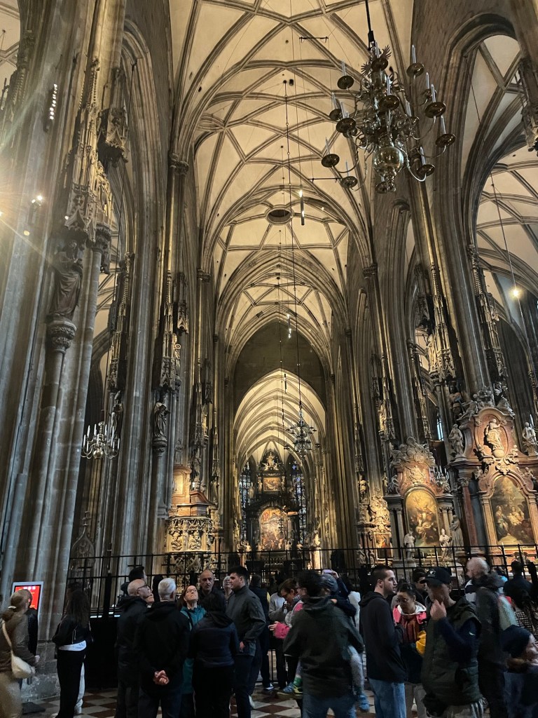
Eventually we made our way to the old city center. Lots of grand, ornate buildings situated next to utilitarian structures clearly built after the war. We ventured into St. Stephen’s, the main cathedral in Vienna. Highly decorated, multiple altars, and a Virgin Mary icon that is supposed to have wept…and to whom many were lighting candles.
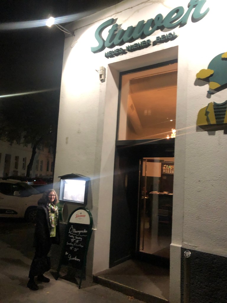
It was now raining even more so we headed back to the hotel in a slightly more direct fashion. We hadn’t yet mastered the subway system. After a little more napping, we went to a nearby restaurant in the non carnival side of the Prater, which is dominated by the Sigmund Freud University and the Messe Vien (a conference center) and home to lots of small shops and cafes. The restaurant, Stuwer, was great and local. J had wild boar schnitzel (we were later informed that wild boar are farmed domestically and not actually being hunted in the wild!), and I had fried carp served over carrots and leeks. Two things I learned – (a) carp is an edible fish and (b) Weiner means Viennese style. Also discovered that spritzes (red or white wine or Aperol mixed with seltzer) are huge in Austria. And they are good – with none of the nasty sweeteners that tend to be added in the states.
The next day was our one full day in Venice before heading toward the Salzburg Lakes for a week of hiking. My diary reflects that I was fighting off an upper respiratory infection but felt ok. How appropriate, given my current circumstances.
Breakfast for me was something called “eggs in a glass.” Medium boiled eggs in a small bowl, liberally sprinkled with chives, and bread and butter. Chives are also very popular.
I had done a lot of work by then to figure out the underground, so we walked to the nearby Messe station, took the U2 one stop to the U1, which took us to the main train station from which we’d be leaving tomorrow.
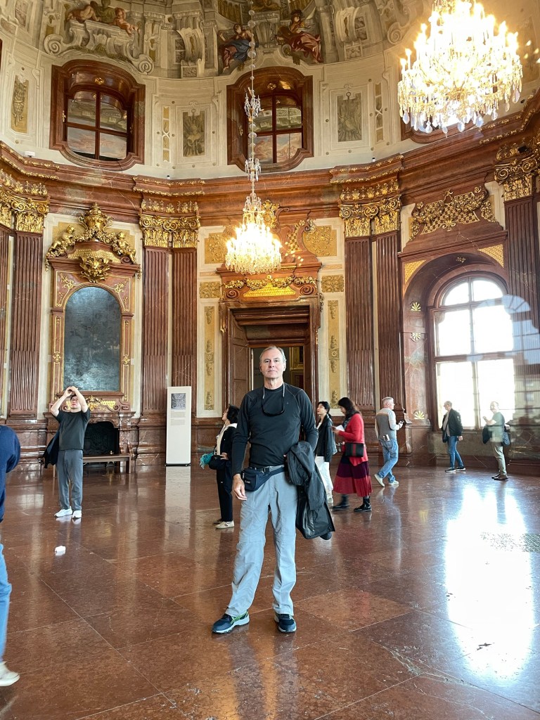
Then, using GPS (thank God for GPS which connects even without Wi-Fi) we walked ten minutes to the Belvedere Palace, one of the huge Hapsburg palaces. It was originally the summer residence of Prince Eugene of Savoy. There are two palaces, upper and lower, surrounded by formal gardens. The museum is in the upper palace, so that’s what we explored. Built in 1723, the ceilings are painted, highly ornate, and the signs did a good job of explaining the function of each room.
There’s an enormous collection of Klimt, including the famous “The Kiss,” which even has its own signs posting its location. The Messerschmidt character heads also reside here.
It was very interesting to view the Expressionist and Modernist works against the backdrop of 18th century baroque rooms. And it’s a manageable size museum.
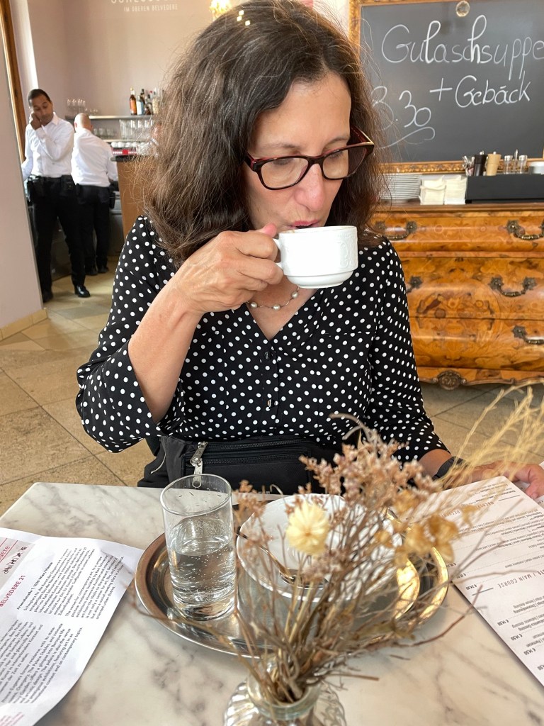
After Viennese coffee and chocolate torte at the cafe (how could we not) we walked another thirty or so minutes to the Museum Quartier. This took us past the Secession Building, the headquarters for an iconoclastic group of artists led by Klimt (and whose members seemed to come and go based on personal and other conflicts). The building is ornately painted and has a golden globe on top; designs harkening back to the English Arts and Crafts movement, at least to my eye.
The Museum Quartier is a collection of art museums and event spaces, and also home to the Vienna University of Technology (architecture and design), and is full of pedestrian walkways and lots of trees.
After a quick lunch we went to the Leopold Museum, which has an amazing collection of Vienna 1900. See the film, Portrait of Wally, for more background on the museum’s less than salubrious history. The museum is constructed of white travertine marble, and is light and airy. There are numerous references throughout to settlements reached with the original owners of a number of the paintings.
We saw lots more Klimts, and rooms of Egon Schiel’s paintings. He died at age 28, in 1918 of the Spanish flu, only three days after his pregnant wife- and the same year that his mentor, the much older Klimt, died. It was also the year he had his first successful show.
It turns out that I was so enamored with the various print and graphic styles and their potential use in future projects most of my photos are of various posters and not of the great Klimts and Schiels!
I had never really before focused on the immensity of Vienna as a cultural and intellectual capital in the early 20th century- Klimt, Schiller, Freud, Mahler, Wittgenstein- you name it. And then along came the world wars and isolation for some decades.
By this time we were pretty museumed out, and took the train back to the hotel. Dinner that night was at L’Osteria, a nearby Italian restaurant that’s part of a chain but clearly a local student hang out and quite inexpensive.
It was time to try to get some sleep. Some real Austrian adventuring was about to begin the next day.
OK, so that title was a hook. J and I don’t actually reach Vienna in this post (unless we unknowingly went through a Vienna on the way back to Florida, always a possibility), but this episode does finally return us to Florida after five weeks on the road. But we will make it to Vienna, Austria in the next post, I promise!
The final stage of our road trip meant we had to cross that vast expanse of the United States that lies between South Dakota and North Carolina, where we planned to spend time with friends and family. All I can say is that there’s a lot of United States.
To sum up:
— The Corn Palace in Mitchell, South Dakota. The largest high school basketball arena in South Dakota, completely decorated with dried corn. Apparently George McGovern played there. Who knew? J insisted having his photo taken in the center of the court.
— High prairies in South Dakota turned into rolling hills and a lot more trees during a brief foray into Iowa.
— Omaha, Nebraska has a lot more hills than I expected and it was not at all easy to find (or enter) our AirBnb. Maybe we should have spent another night in the rooftop tent. On the other hand, J loved his 14 ounce ribeye. It turns out I didn’t take a single photo in Omaha.
— Left quad still showing the wear from the Badlands ladder incident and stairs are not going so well…found a large ace bandage that might help…
— From Nebraska into Missouri. Lots of trees and lakes and very beautiful, especially once we got into the Ozark area. Detoured into Kansas City for the precise purpose of going to the Jack Stack steak restaurant.
— Missouri doesn’t believe in leveling roads. The two lane “highways” we were on simply followed the steep rolling hills regardless of pitch up or down. I’ve never been over as many “blind hills.” And there are some great town names – “Tightwad” being one of my favorites. With a street called “Stingy.”
— At the Doolittle campground, outside of Rolla, Missouri, we saw a red fox scamper across the golden, illuminated field behind our campsite.
— Further along in Missouri (it’s a big state), and outside the “Boomland” fireworks center (a truly scary place), we visited a somewhat desolate park that holds itself out as the location of the first steps of the Lewis and Clark expedition.
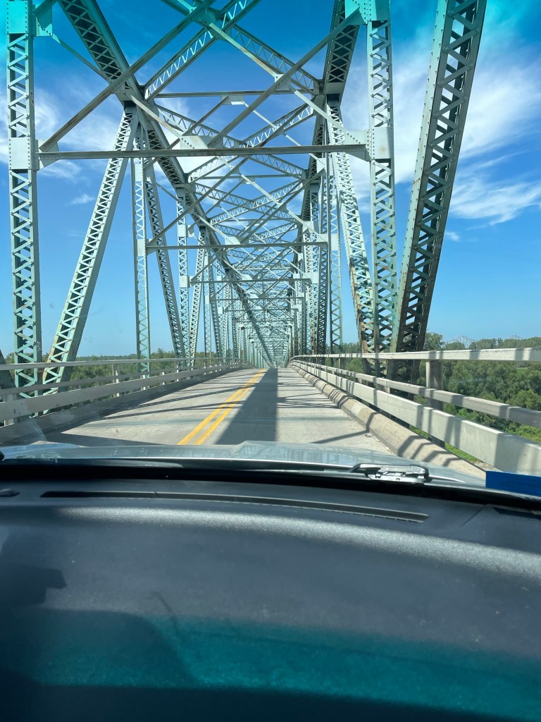
— There are a lot of terrifying bridges in the U.S., especially between Missouri and Kentucky. No shoulders, rusting, and they look like they could collapse at any minute.
— Nashville is a very large city. The “hockeytonks,” as they are called, are crowded day in and day out. After enjoying a lot of music simply from the street side we found a relatively tame venue where we could listen to a very good singer playing acoustic guitar. No luck in finding an unannounced Lucinda Williams or Steve Earle or Jack White show. Oh well.
It was a relief to get to the home of our friends K and B in Banner Elk, N.C. The next week and a half was taken up with family and friends (and the recovery of my leg). Unfortunately the leg issue meant that discretion was the better part of valor, and we didn’t attempt the Grandfather Mountain climb that we’d planned.
On the way back from N.C to Florida we had one last rooftop tent night at Skidaway Island State Park, Georgia, outside of Savannah. It was hot and humid and rained a lot.
But beautiful. Just like our 6,500 miles driving through 16 states and four national parks of the United States.
The approach to Badlands took us along State Road 44, a two lane road that eventually cuts across the park. There’s very little traffic. But that apparently didn’t deter the same road construction that we saw across the entire country. We experienced a 15 plus minute delay when one lane closed down, and a lead vehicle ceremoniously ushered us along about a three mile strip of highway – where we met the sole car that was waiting to go the other direction.
We finally reached the Interior Motel and Campsite in Interior, South Dakota, just outside of the park, about 6:30. It was nice. Several other rooftop tents, toilets and showers, an above ground pool, and a view of the Badlands. There were a few cars speeding along the adjacent highway, but somehow that was comforting in this otherwise extremely desolate place. Plus, the road was a elevated above the campground, giving it sort of a Jetson like feel. A full moon tonight and plans to focus on hiking, not driving, the next day.
I woke up about 5:30 a.m., probably due to the sunrise. great swathes of apricot overlying the wine dark purple of night, and the morning star piercing through all of it.
Apparently they don’t worry too much about park admissions on Tuesdays, and we didn’t even have to show our park passes. We stopped first at the visitors’ center and got some advice about trails, and also looked at the extremely interesting working fossil laboratory and heard a lot about a recently discovered Saber tooth tiger.
From there, we started the first of our hikes. The Window – a very easy boardwalk – and the Door, a bit more of a hike, culminating in a natural door that frames a view of the wall of jagged white peaks of stone. Traversing through it was almost like walking through a hard iced cake.
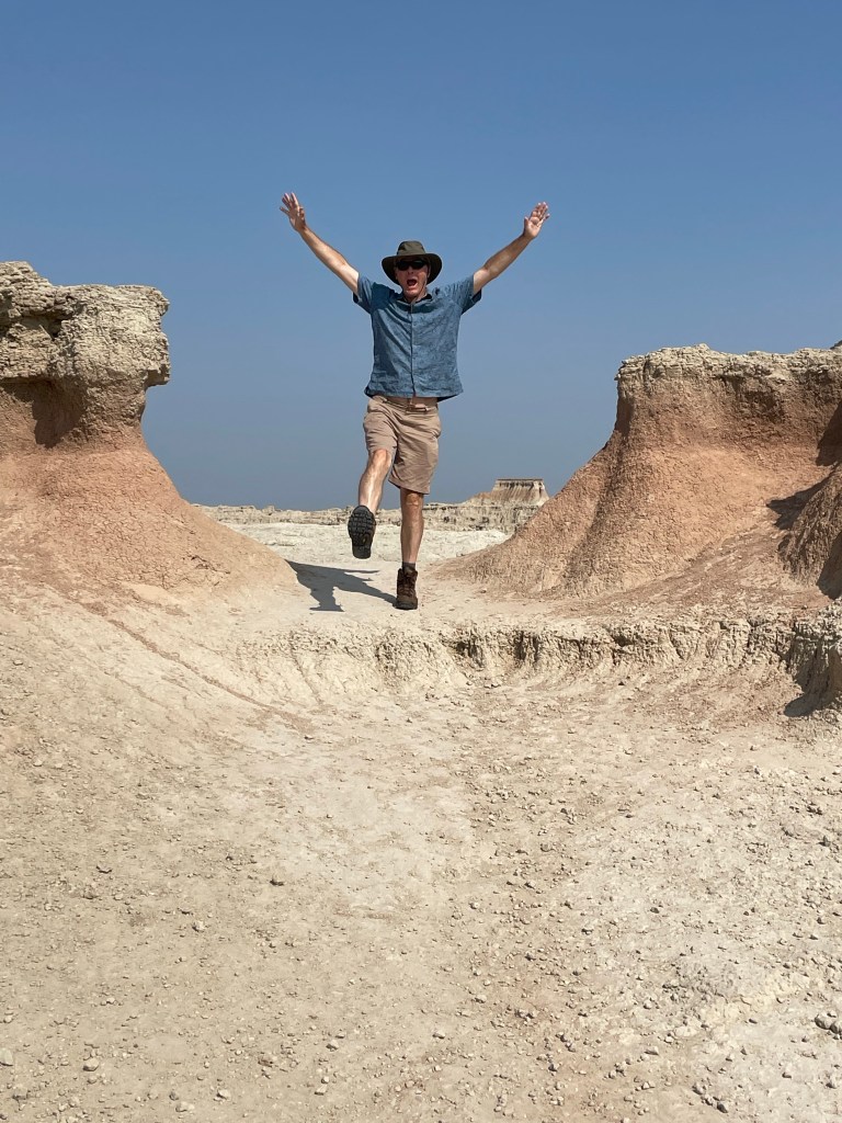
The Notch hike was next. The beginning has one steep section with a ladder going up. We rejected the ladder and instead scrambled up along side it. Fairly wide ledges led out to a spectacular overlook of the valley. It was very not, near noon and 90 degrees in the shade. On the return, we chose the ladder route. Mistake. Looking through the ladder with nothing below triggered all my fear responses – I was so tense I basically slid down without ever letting go and messed up my left quad – which plagued me for the rest of the trip. My legs were shaking when we got to the bottom.
After a quick lunch in the air conditioned Explorer, we journeyed on to the Saddle Pass. It was a true scramble – steep and slippery up the rock formations themselves, culminating on the flat upper green prairie and a number of trailheads. At the ranger’s suggestion, we then went off track and climbed the highest peak to a little throne at the very top. Amazing how touching the rock – as opposed to being on a ladder = makes it so much easier!
By then we were more than hot and sweaty. Did I mention temps were well over 90 degrees? We drove a little more of the Loop Road to the Fossil Exhibit boardwalk, an area of mammals fossilized more than 30 plus million years ago.
We finally hightailed it out of the park to see the small hamlet of Interior, South Dakota. There are two churches and a bar. We stopped at the bar. At the Wagon Wheel the bartender explained to us the story behind the poster of the naked woman riding a Radar the Bull (with a ring in its nose). She looked like a bovine Lady Godiva. Apparently Radar was a frequent visitor to the bar at one point. Between fossils (Lyme Regis) and the bull (my encounter with one in the Yorkshire Dales) I had flashbacks to our UK trip.
Spent the rest of the day at the campsite, plotting our next moves while being entertained by the couple in a nearby campsite who appear to be living out of their van while practicing for the their next singing gig.
After leaving Yellowstone, we had to drive practically the full length of Wyoming, along the northern side. The landscape varied between high prairies and rolling hills, and ultimately morphed into higher hills and mounds of orange, white, and green.
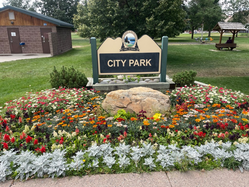
We stopped for lunch at the City Park in Cody, Wyoming, across the street from the high school. The whole town seemed right out of the 1950s, and I kept wondering what it would be like to grow up there. The city park was very nice; people having picnics, a Sunday, quiet.
After Cody, things got wilder. Some very desolate two lane roads (the routes Google Maps picks out are interesting, to say the least). After the colorful mounds (if they had been green they reminded me of Moundville, in Alabama), we started to climb up and up into the incredible Big Horn National Forest. Massive gorges, edged by towering rust grey walls, outlines of rock structures that looked like imaginary cities against the sky. We reached well over 9000 feet elevation, and the good old Explorer just kept chugging along.
Finally we left the Big Horn area, and returned to long straightaways – only to encounter yet more mountains. We finally crossed the border into South Dakota…where gambling is legal.
Deadwood, very close to Sturgis, site of motorcycle rallies, can only be described as insane. No other word for it. We stayed at the historic Franklin Hotel, which was a world class celebrity spot from 1903 to 1929. It was then converted into apartments until it was rehabbed in the 2000s.
The bottom floor is an opulent 1900s recreation with casino, but the rooms are likely as they were in the apartment days. The same wainscoting, fixtures, and tiles. A very comfortable king size bed and it was pretty great to take a shower after three full days of camping. Free parking and a coupon for a free drink in the casino. Dinner was in the basement restaurant, which was very crowded, but it was reasonably priced and actually very good. We also had a great server, who told us all about the wildlife loop at Custer State Park.
After breakfast, we strolled down the main drag. Deadwood is not only the site of the TV series, but was THE place to party for miners in the 1870s who had struck gold in South Dakota. According to the New York Times in 1877 – it was full of flim flam men, brothels, and gambling. Currently, there are lots of historic hotels, western wear, and casinos. Every shop has a bar, and people start drinking very early. It’s a unique vibe, to say the least.
We left Deadwood to drive through the plains to Rapid City, where we made a Walmart grocery store shop. I’m a lot more of a Walmart fan after this trip.
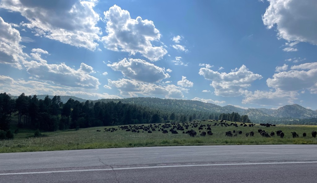
We finally reached Custer State Park, and had lunch at the nice visitors center. Wooded, evergreen black hills, interspersed with grassy plains. Very bucolic. On our way to the wildlife loop, a huge herd of bison crossed the road right in front of us. We immediately say a pronghorn (antelope), more bison, a mule deer, wild donkeys (left over from an old tourist attraction), and lots of prairie dogs.
After Custer State Park, we decided we couldn’t stand the shame of admitting we hadn’t seen Mt. Rushmore, even though we had not planned to visit. So, with me at the wheel, we took the Iron Mountain Road to Mt. Rushmore. The road is crazily and intentionally curvy. It’s the counterpart of the Needles Highway. You go through three tunnels, and at the third the four heads of presidents carved into Mt. Rushmore are perfectly framed. It is remarkable, regardless of your views of taking a natural (and sacred) landscape and carving presidents’ heads into them. The little town at its base is the epitome of tacky tourism.
After the hairpin turns and corkscrew bridges, it was a positive relief to be back on the interstate. But it wasn’t long before we were back on S.D. 44 – over prairies, and suddenly, in the distance, white jagged walls emerged in the distance. If I wasn’t fairly confident we were on Earth, it really could have been a scene from another planet. We were about to reach Badlands National Park.
We awakened on day two of our Yellowstone adventure to a view of two elks grazing and head butting only ten yards from our rooftop tent. You could actually hear their antlers clacking against each other. It didn’t look like serious business – they’d go at it, like very large puppies, for a bit, and then tire of that game and eat some more grass. Eventually they meandered out of the campground, as comfortable as you please.
This was our day for the “must see” Old Faithful, which required a trip to the western side of the park. There’s a great visitors’ center, with good explanations of volcanoes – especially how we were sitting right on top of one. We then took a decent hike up to an observation spot to see Old Faithful itself. Fortunately, we saw a pretty good eruption. We saw it erupt a second time later in the day, and it simply sputtered.
Next stop was the “prismatic falls.” A navigational error ensued, and we turned off the road too early, which took us along a rather odd hike on the perimeter of the area toward the Fairy Falls. We could see people in the distance on boardwalks, but had no way to get there. Nonetheless, we could still see the billowing multi-colored smoke – pink and turquoise. We were going to try to get to the actual location, but the traffic was simply too much. A lot of Yellowstone is still digging out from the floods of last year, and although the crowds weren’t bad, a weekend day was all that was needed for the traffic snarls to start.
A big rain storm had started so we headed to the Lake Village lodge again to wait it out. There, sitting on the porch, we met someone who was born in Derbyshire, of all places, then moved to the U.S. with his family, and now was a film editor on one of my favorite TV shows, Naked and Afraid! It was he who told us about Deadwood….
After a “grocery store” trip (to the extent a national park general store can be described as a grocery store) we had our last camping night in Yellowstone, and celebrated with an odd concoction of mac’n cheese, precooked bacon, and green beans. As I was cooking I noticed a fellow camper who’d left his chair too close to his campfire on that very windy evening – fortunately I was able to call out to him before it got incinerated. I felt like a veritable Smoky Bear!
The next morning we managed to pack up all the debris we’d been accumulating. Those bear box pantries are a real luxury. We left camp by 10 a.m. and drove to Fishing Bridge, just north of Lake Village and out of Yellowstone via the East Entrance. There was a lot of elevation gain, and evidence of many forest fires, lots of downed, white trees.
There was a full day of driving ahead of us. Our route was going to take us through Cody, into the Big Horn National Forest area, and finally into Deadwood which was as peculiar a place as its name implies.