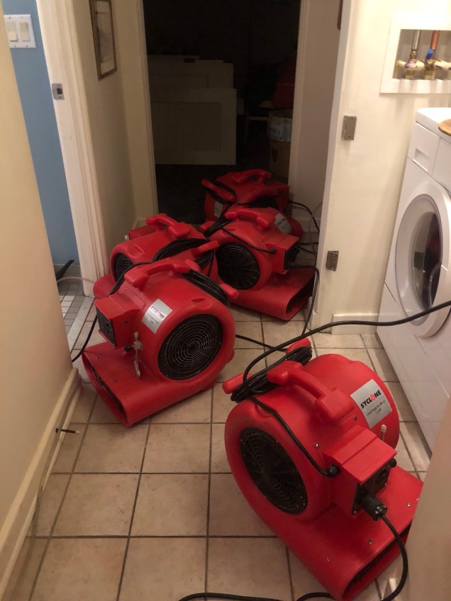
We’ve all been there. That one thing that keeps you powering on, even when your legs and your mind say this is a really dumb idea.
For both J and me (and maybe daughter A and her boyfriend N – although i haven’t asked them) the man in the mist on Mt. Jefferson in New Hampshire’s White Mountains did just that.
It had taken us forever to find the trailhead, which seemed to veer off of Google maps onto some narrow dirt road. And once there, the hike up the rocky, fog-laden trail was more uncomfortable than awe inspiring. The one overlook was a bleak landscape of grey fog, with none of the autumnal offerings we were hoping for.
We’d just encountered a miserable family of four – two parents, two kids – one of whom was scampering up the rocky cliffs like an energizer bunny while his older sister wept below and threatened mutiny if forced to go further.
We knew we were near the top, but we were still in the fog, The goal was starting to seem less and less significant. A was making serious queries about the rationale for further climbing.
But just at that point – looking for all the world like an older Jamie from Outlanders – a figure emerged through the mist. In a vaguely European accent he said it was no more than 20 minutes to the summit and he had already come through the pass from the next mountain, which he summited already that morning. At that point, it was only the fact we’d all collectively seen him that reassured us we weren’t having individual delusions.
So we kept on climbing. It took us another 45, not 20, minutes but we got there. Sometimes it just takes a man in the mist. J claimed he was the spirit of adventure. Something most of us don’t get enough of in our lives.
Stok Kangri is a snow covered mountain 6153 meters, or 20,187 feet, high. Yes, that is a reference to Hemingway’s “Snows of Kilimanjaro” and I don’t expect to see a snow leopard, dead or alive, anywhere up there. It’s supposed to be pretty arid. And, it’s only partially snow covered. But Kilimanjaro is what started J and me on this summit journey, seven long years ago. God willing and the creek don’t rise, we’re off to Stok Kangri in the Kashmir region of India starting on June 24 of 2018.
To top it off – it’s not just the two of us, but our friend SB, from Alaska, is going too! I sent a casual Facebook post to him about our tentative plans, and within 72 hours he’d committed. SB is the person who gave me that last push – and I mean a literal push – to get up that last steep incline to the top of Mount Elbrus in the Caucuses region of Russia when I started this blog in 2014. Ever since, J and I have said how much we’d like to climb with him again – and now we are! He’s climbed Denali and Aconcagua and actually knows what he’s doing. Provides a lot of confidence for J and me.
This is going to be a first. We’ve made it to 19,347 feet on Cotopaxi in Ecuador in 2015. But we’ve never made it to that elusive 6,000 m/20,000 ft. peak. This is our one chance, before we go totally grey and spend our time sitting by the fire – although in Florida that would mean before a cool air conditioner. There will be a lot of more details to come.
It felt as though we’d already had a full day of activity – after all, we’d just peered at Everest from 18,200 feet at the summit of Kala Pattar – but we had hours of trekking ahead of us. After breakfast in Gorak Shep, we headed off to Pheriche, via Lobuche, where we had stayed two nights ago. We had lunch at the same tea house – the Oxygen Altitude. Such an appropriate name – M and S suffering a little bit – sometimes the way down is actually harder than the trek up.
After lunch in Lobuche, we traversed again past the memorials to the dead Everest trekkers (this time getting a photo of the one in honor of Scott Fischer – after all, his old company, Mountain Madness, has been responsible for a lot of our adventures), and then down what had been a very long uphill on the way to EBC. After a bit, we made a right turn and headed into previously unhiked areas toward Pheriche.
We descended into a wide flat valley with spring grasses and flowers sprouting up. The monsoon was starting early this year, and we experienced a bit of hail, followed by rain. The wind picked up, and we marched along stoically, picking our way amid puddles and piles of yak dung.
We finally reached the village of Pheriche and our abode for the night, the Himalayan Hotel. It was the nicest place we had stayed for a while. Each room had its own bathroom and there was a huge dining room. I had dahl bat for dinner. J and I were both exhausted after climbing Kala Pattar and then hiking five plus hours mostly in rain. But we were at a lower altitude and it’s amazing how well you can sleep lower than 16,000 feet – especially with an en suite bathroom.
I awoke without a headache for the first time in a while. For me, at least, altitude just does that. You learn to live with a low grade headache each morning – but two ibuprofen and two cups of coffee typically take care of it. We took our time and finally departed about 10. There was a lot of downhill and then up along the side of the valley with the milky river below.
Stopped for some bathroom breaks at various small villages; we were moving back into village culture. Mani stones and stupas were the order of the day again. At the Wind Horse Lodge – the elderly owners sat outside in the sun. The man had a mala in one hand and an individual prayer wheel in the other – as he spun it the mala beads slipped through his fingers, effortlessly counting his prayers. His wife wore the traditional apron over her brown skirt – topped by the ubiquitous down jacket that everyone wore.
This time, instead of Upper Pangboche (home of the flying monk – recounted in Everest Base Camp Trek – Tengboche and Dingboche (or Lost Horizons)) we went through Lower Pangboche. It was an active little village, with juniper incense burning outside many of the tiny shops. By now blisters were running rampant and I was the cause of the next stop for foot care issues.
We had descended to the tree line now, and wild purple iris were starting to reappear. We crossed the river a couple of times, and then made our way up a long uphill through the rhododendron forest back to the placid setting of Tengboche. It truly was a Shangri La moment, and even more pink and purple spring flowers had bloomed since we were last here. We had lunch and hung out in the dining room, watching the grey mist settle in over the grazing cows and horses. Despite this, a group of monks in their crimson robes made their way across the meadow into the neighboring field for an energetic game of soccer. We did nothing so energetic. Instead, our little hiking group engaged in a lively game of snakes and ladders on one of the many board games in the dining room.
The next day we had to make our way to Namche. We’d walked this path before. But it looked totally different from the opposite direction. I think this is possibly the most beautiful part of the whole trek – and possibly any trek. It was nearly all rhododendron forest – crimsons of all shades, steep snow-capped mountains, clouds, and blue skies. The rhododendrons were so bright you could see splashes of colors in the distant mountains like fall leaves.
At one point we saw a musk deer, unusual for this area. They are hunted for their musk glands, and grow long canine teeth.
It was a relatively short hike to Namche and we were back at the now familiar Himalayan Culture Home by lunch. It seemed warmer this time. In the afternoon we climbed a series of hills to the rather dilapidated National Park Museum (most notable for the Tenzing Sherpa statue) and the Sherpa Culture Museum. It is an odd place. Owned by a man who had lost his hearing to meningitis, didn’t go forward with his education and instead opened the museum. He’d hosted Sir Edmund Hillary in his later years. We were ushered into a dank and moldy basement where we sat on folding plastic chairs and watched a 20 minute slide show about Sherpa culture projected on the wall. And the inspected the very impressive – but not updated – photos of every Sherpa Climber who had scaled Everest.
We had an early night that night (not that any weren’t early). The next day we had to make it all the way to Lukla. On the way, this had taken us two days and now we had to do it in one.
It had now been eight days since we left Orlando, and we were finally ready for our trek to Lobuche at 16,180 feet. This took us well above the tree line into a very barren area, through valleys occupied only by grazing yaks (who seem able to eat anything), and what can only be described as a stone hobbit house for the yak herders. Everest peeked through clouds and mountains in the distance.
We had lunch at a tea house on the other side of a slightly less scary swinging bridge, which was followed by a very long uphill, culminating in the many memorials placed in honor of those who have died on Everest. They reminded me in some grim way of the above ground tombs you see tthroughout New Orleans.
From there, it was more up and down and finally into Lobuche. We were by now completely out of village culture and into trekking culture. We kept running into the same people everywhere – the guys from India, the nurses from Florida who were working in Nepal, the Australian couple. And I think I forgot to mention that he who hogged my seat on the flight to Katmandu ended up staying across the hall from me in Dingboche!
The Oxygen Altitude Hotel was our next residence and one of the worst bathroom experiences yet – even though by then we had adapted to the fact that the existence of an ostensibly normal looking toilet meant nothing about flushing. Instead, flushing was correlated to the barrel of water with the plastic jug floating on top that was placed next to the toilet – and usually in just a spot to make it hard to close the door. But when you realize how difficult it was just to get that water there it becomes much more understandable. At that height – despite the surrounding glaciers – there’s no easy water source. There’s also no source for fuel. Yak dung fed the one stove in the dining room – and it was the only source of heat.
After we arrived, J and I went with our guide for a short acclimatization hike up the nearby ridge to look at the Kumbo Icefall. I forgot my poles and it was dicy on the way up and started to snow on the way down. The Icefall itself looks like someone took a big bag of snow covered ice cubes and dumped them down a slide.
None of us slept well that first night at over 16,000 — and the next day was to be the trek to Gorak Shep and EBC. We started at a reasonable hour but the team wasn’t moving very fast – it’s a lot harder to get oxygen at that altitude – and we ended up going first to Gorak Shep, checked into our tea house and had lunch. This was a much smaller lodging – our rooms were up three flights of completely uneven stairs – some almost 20 inches high – and I found getting to the room as hard as the trek itself. To add insult to injury, due to the water issues the inside bathrooms were barricaded off during the day!
The trek to EBC – theoretically the talisman of the trip – is challenging. You hike alongside the glacier – mostly stone-covered but with deep divots through which you can see tens of feet of blue ice and frozen lakes. Lots of rocks to pick your way between and finally you reach what feels like a natural levee between two valleys that you hike along.
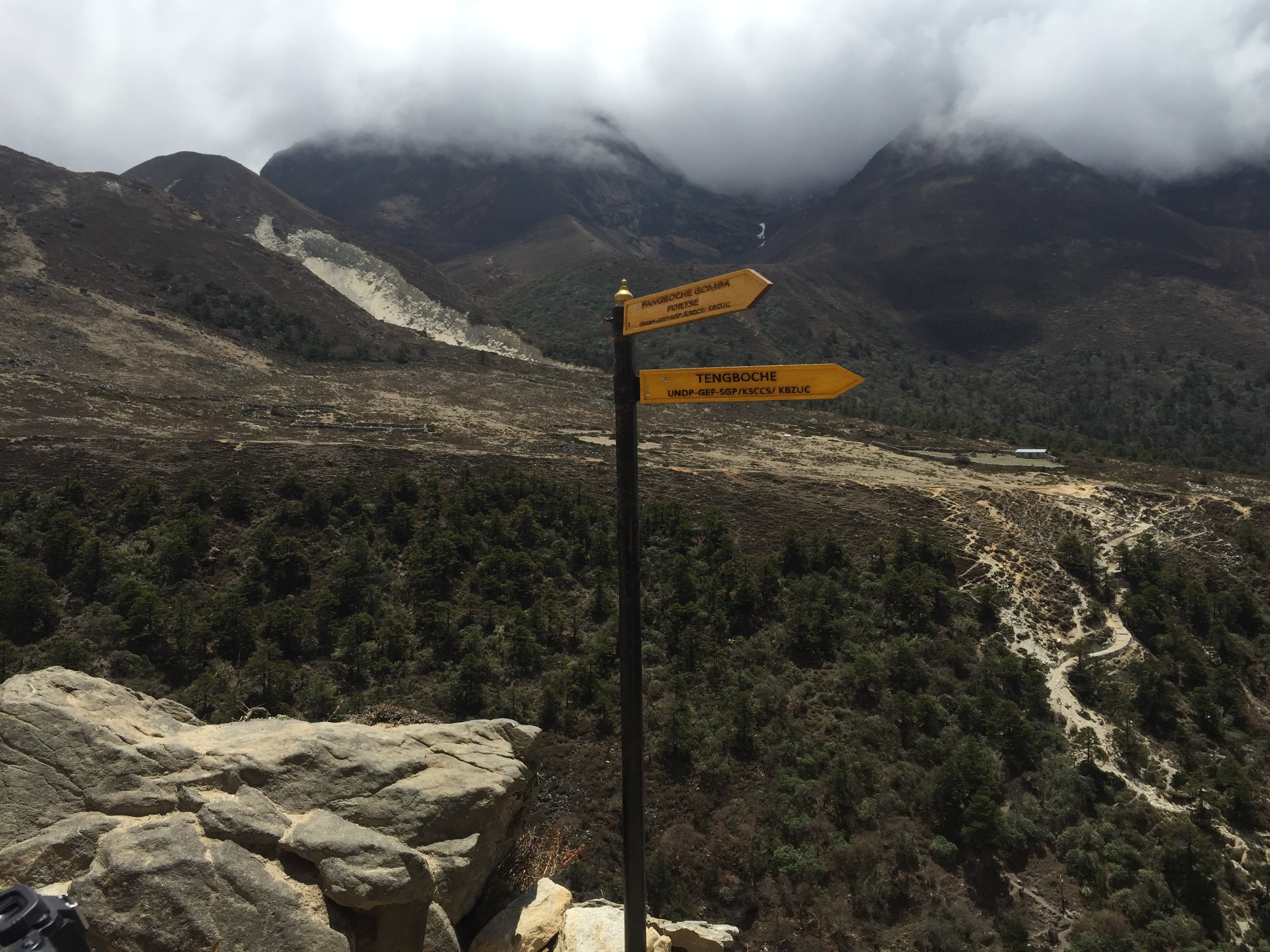
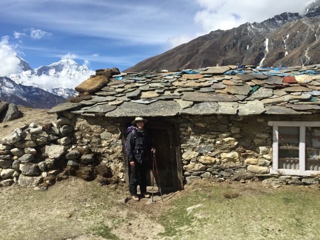
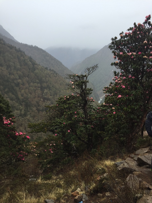
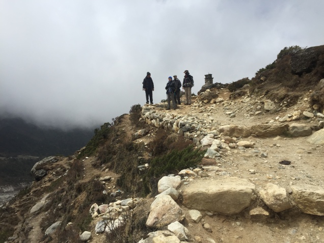
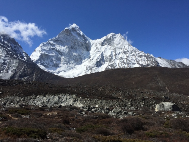
The creepiest part of the experience was to hear avalanches and rock fall by Everest and the surrounding g mountains. J and I were hiking by ourselves ahead of the team. At first I heard a sound like thunder – a slow roar, a rush, and then I heard someone yell from across the valley. I think it was on Lhotse. We heard several more similar soundtracks – and on the way back I saw a huge rock become dislodged and start a slide.
We waited for M and S at the levee just before base camp so we enter together surrounded by prayer flags. It’s very spread out and I wish we’d had the time to poke about. Weather had been terrible at the summit so most of the climbers were still at base camp.
After photos, we headed straight back. Exhausted and early to bed – especially since J and I were rising early to climb Kala Pattar – 18’200 feet – which was our main mission.
We got up at 5, had a coffee and a Cliff bar, and met up with our guide. Our tea house was very close to the beginning of the trail. Very steep dirt for the first part and my fingers were absolutely numb. The ground was frozen solid. Then, there was sort of a tundra area and another steep uphill, this time through black stone (which is what kala pattar means). A tiny bit of scrambling, especially at the top – and we were there. Surrounded by the panaramic view of the highest of the Himalayas – I finally I had that over 18,000 feet of altitude nothing will get to you feeling that happens only at serious height and after days of trekking. I was happy.
Descended, and had breakfast with M and S. We headed back to Lobuche, for lunch at the Oxygen Altitude. We were about to start the trek for the long way home. (More to come in that front.)
M and S had never done anything like this before. They did great. But it’s nothing to do with the training or physical discomfort you endure. The outcome of trekking at high altitude takes a while to sink in. The reality is – no one and nothing can ever take away it away from you. We had stood in the attic just under the roof of the world.
After two nights acclimatizing in Namche Bazaar, it was time for the march to continue. Sleep patterns were by now most peculiar – I found myself asleep by 9 pm, awakening at 1 am or so and reading, and then returning to sleep. I seemed to have reverted to the Middle Ages concept of first and second sleep.
The day we left Namche was the day before Buddha’s Day. We walked clockwise (of course) around the monastery where prayers had already started and along the trail that we had looked down upon the day before. At first it was relatively flat, with some gradual ups and downs. After some time, we entered the Sagamurtha National Park and the altitude where the rhododendrons were still in bloom. Pink, white, red – forming an arcade over the trail. Another swinging bridge – I can feel myself start to sweat – and then time for lunch in a small cafe. The walls were covered in tapestry and all the food was prepared by two women over a wood burning stove. It felt as though we were in an old fashioned gypsy caravan. After, we were backed against a wall by one of the many yak trains coming through. This was S’s first of many encounters of the not good sort with a yak.
A couple of hours of up through layered jagged mountains, overhanging fog, framed by rhododendrons. These mountains are new, geologically speaking, and a young world appeared around each bend in the trail. Light green trees interspersed with dark pines, creating a textures that clothed the mountains. We made it to the top in a respectable time, turned a corner, and suddenly we were at the Tengboche Monastery.
Checked in to the Tashi Delek Lodge and then visited the monastery. Tengboche is centered around the very old monastery – there were a few tea houses for trekkers and a bakery, but we were now far away from the village culture we had previously experienced. It is bucolic. There’s an open meadow area where cows roam, the gate to the monastery and some low buildings where the monks live in numbered rooms, and a few grey stone tea houses.
Six of the 12 resident monks sat in the center, chanting in a low drone. They spend their lives here, in very small rooms. When we stayed at Tengboche on the return, we saw the younger ones going off to play soccer, crimson robes flapping in the wind.
The fog rolled in, slowly covering the small dwellings.
The next day we trekked to Dingboche, where we were to spend two more days acclimatizing to to over 14,000 feet. We could hear prayers chanted in each of the villages as we walked through. The wooded part of the trail soon opened up into a stony valley – the milky river below and some serious rock slides where I did not want to linger. Ultimately we ended up in Upper Pangboche. Most trekkers go through Lower Pangboche only, but it was clear that our guide wanted to make a special stop at the monastery for Buddha’s Day. This is a 400 year old structure, founded by a monk who allegedly flew there. Various people were coming in and out to pray for Buddha’s Day. Z lit a butter lamp, incense was burned, and he prostrated himself three times. A lay monk poured water in all of our cupped hands to drink and smoothe on our foreheads as an act of purification. He also showed us a niche in the wall of the monastery that housed a relic of the flying monk – a bone of some sort.
Hiked on and on, including a stop for lunch, and then another couple of hours to Dingboche. Trail normally about 2 feet wide, sometimes with very steep drops on each side. Across the river the stones were white with splashes of red. We were above the tree line now. Small junipers, yaks, and a lot of helicopters making their way to base camp.
in Dingboche we stayed at the Good Luck lodge. It was packed. We had a nice little room where the sun shone through the window and it was almost warm. The last few have been cold and damp. We are now at the point where yak dung provided the only fuel for the fire in the comunal dining area (which is never ignited before 5 pm). The middle of Dingboche is all privately owned potato fields – to get anywhere you have to walk three sides of a square.
The next day we did an acclimatization hike to the Chukung Valley. We followed the milky river. A wide, stony expanse, with Ama Dablam peering at us from the right, Lhotse to our left, and Island Peak in solitary splendor straight ahead. We stopped at a cafe – and who was there but the guy from the plane. This time he explained that his seat hogging actions had been fueled by a few too many pints after he unexpectedly ran into a cousin at the Dubai airport. He and his friends were doing the three pass EBC route.
There was a piercing wind on the way back and we went much faster. Once safely ensconced in Dingboche, J and I explored the village while M Andy S made friends with some fellow trekkers who were happy to share the very exotic salami they had brought from France. A nice change from gu’s! The dining room was packed because the rooms were so cold.
We were now acclimatized to over 14,000 feet. Next up – two nights at over 16,000 feet – EBC itself and Kala Pattar!
No photo in tbis blog. I’ve been too busy. I started this post with five days to go. And now I’m staying in the hotel at the airport in preparation for a 6 am flight, followed by 24 hours plus of traveling.
I’ve faced my usual paranoia that the ridiculous hours I’ve been working in order to garner 2 1/2 weeks off will have so impeded my training I’ll find myself coughing as soon as I hit 10,000 feet, only to have a so far unexperienced asthma attack, get pulmonary edema, and expire somewhere at an unimpressive 12,000 feet. Matters have not been helped by the death of Ueli Steck a few days ago on Everest.
One can’t help but wonder about the possibilities. But more important than the possibilities – however tantalizing they may be – at least for those of us who have some great need for adrenaline – is figuring out why you’re going up the damn mountain in the first place.
The busyness – business of our lives has taken over. I don’t know about you, but if one more person asks me to do one more thing, I might just combust. I’m called upon every hour multiple times per hour to make decisions. Some small; some large. Whether my recommendation affects one or thousands – you know what? It’s just as important if it affects one person’s working life as it is if it affects many. Jobs are important to people.
Back to topic. I’ve been training for this trek since we came down from the last. And I really, really need to get away from that busyness – business. I’m hoping that somewhere in Nepal, on the way to Everest, there’s some fabulous lost horizon that’s going to give that sense of peace.
It’s a thinly veiled secret on From Swamp to Summit that I’m from Orlando. That Central Florida city where one looks in vain for a hill to train on and ends up resorting to staircases. Staircases have been good to me. I’ve made it up Kilimanjaro, Mt. Elbrus, Illiniza Norte and Cotopaxi. And more to come. I hope.
I may not have grown up here, but Orlando and Florida reach out to you with their sticky sweaty humid hands and hold you close to their hearts. I moved here in the middle of 1989. Sight unseen. True story. It was a snowy night in New York and husband J, who was finishing his Ph.D. at NYU received a tenure track offer at a small liberal arts college here. I’d never even been to Florida on spring break but after J interviewed in Orlando and described the smell of orange blossom, I was sold.
So after a brief diversion through Greece and Turkey (another blog post in and of itself) we found ourselves, our one room of furniture, and our cat Chelsea in this city we’ve called home for over 25 years.
A swamp does describe life in Orlando this week. But not the life giving jungle green of the Everglades wetlands. More the brown slough of despond. Exactly one week ago I awakened early, despite having been out in downtown Orlando the night before at a concert. And across my phone came word that at least 20 had been killed at the Pulse nightclub, not far from where we had been and a few blocks from my office. By mid morning the number had increased to 50. 49 victims and the gunman.
This massacre was framed by the Friday night shooting of a singer from the Voice, followed by the suicide of the killer, and the tragedy a day after the Pulse shootings of the drowning of a two year old by an alligator at a theme park lagoon.
The City Beautiful, as Orlando likes to call itself, didn’t look so beautiful anymore. On Monday evening I found myself at one of many vigils around the city at a makeshift memorial that has sprung up in front of the Performing Arts Center. There’s not enough public space in Orlando and what has happened there shows why people need to have a place to come together. There are candles, ribbons, photos, posters, notes written on paper chains. People standing are reverent. Nearly everyone I know has made a trip there.
On Thursday, President Obama and Vice President Biden arrived. I watched the motorcade from my office window, together with some of my partners. I’ve seen many grown men cry in the last few days.
That night, J and I went back to the memorial. A motorcycle club had its bikes lined up, illuminated in rainbow colors. They revved their engines, and a speaker for the club stepped forward and asked the several hundred assembled there to hold hands and observe a moment of silence. Everyone did.
Rainbow flags are flying all over the city and practically every public building has been illuminated in the now familiar red, yellow, orange and blue colors. Tonight is a city wide commemoration that is supposed to be non religious, non political, and non branded. Just a time for people to be together. We’re going to walk down there.
Perhaps after today, and the symbolism of one week later, healing will start.
It’s a long way up any mountain. And it’s going to take Orlando a while to slog up this one. But I know that Orlando and its people have what it takes.
What goes up must come down. And after our guide R put the kabosh on my secret plan to snail my way ever so slowly up the glacier to the top, timing be damned, the down is what faced us. We started off at a good clip. Ever since my way too long climb down Mt. Elbrus in 2014, I’ve focused on descents, with some modicum of success. R put me at the front of the rope on the way down the canalone – it’s certainly the safest place to be, but it’s also the spot where you get to pick out the route and match all the mixed up steps in front of you to create some semblance of a path down. I could tell I hadn’t acclimatized well because as I descended I felt more and more energetic – and we moved much better as a team than we had at any point on the way up.
We finally made our way back to the scree field, and R went on ahead of us. J and I managed to pick our on way down, albeit with some wrong turns that increased the difficulty of the route. At one point we found ourselves on an 18 inch ledge with a sheer drop on one side. I’m sure that is not exactly the trail we were supposed to be taking. But at least the 18 inch ledge didn’t coincide with the increasingly high wind gusts. Two separate times I was literally knocked off my feet. There was a steady 30 plus mile an hour wind with gusts blowing harder. I didn’t slip – I was simply slapped down.
Finally we made it back to the strange stone aqueduct that led to the hut. Apparently at one point there had been a grandiose plan to work with water and drainage on Orizaba, leading to the construction of a now defunct aqueduct feature that forms the first part of the trail up the mountain.
And, how, you may wonder, were the other teams doing? Well, as mentioned, the Italian hadn’t even made it to the glacier before altitude overcame him. When we left the edge of the glacier, we could see three teams of two each inching their way up its stark white. They were no more than little black doodles on a white sheet of paper. It was hard to tell who was who, and it wasn’t until we were back at the hut and the two Russian teams showed back up without reaching the summit that we realized the top most team battling the high high winds was our own teammate G and our guide D!
I wanted to wait to greet them when they returned, hopefully after a successful summit, but after we’d packed up and they still weren’t down, it was clear it was going to be a lot longer. We’d already been climbing for about 8 or 9 hours, and the green of the forest below was starting to seem inviting.
And this is where the people part of the trip became bizarre enough to rival the uniqueness of our natural surroundings. We’d heard rumors that the Russian team included a high ranking politician and others – but how high ranking we didn’t realize until R arranged for us to hitch a ride down the mountain to the village in their two jeeps while he waited for G and D. There was one free spot in each van. J went with the politician and his fiancée; she hadn’t climbed but still looked pretty wind blown. When we say high ranking, we are talking cabinet level. I know; I figured out names and Googled everyone. Google images helped confirm I’d locate the right bios. Who expects to spend a night sleeping in the freezing cold on wooden platforms in a hut in remotest Mexico with government officials from Russia.
My jeep mates were equally illustrious in Russian political and academic ranks. Perhaps even more so for a would be mountaineer, as one of them had been a professional climber who had summited Everest in 1992 (where he and Scott Fisher of Mountain Madness fame had argued about placement of fixed ropes) and climbed K2 in 1996. He was also a snow leopard – meaning he had summited all of the highest peaks in Russia, no mean feat. (I found that last bit out through Google.) Anyway, we had a fascinating conversation on the way down, and it certainly added an international flair to the trip.
Luxury accommodations compared to the hut
Back at the hostel, we read and had a very late lunch. Eventually G and D showed up, with the glow of the summit still surrounding them and only a few bruises and battle scars to show. They had battled unbelievably high winds, and even though they couldn’t even stand upright on the summit, had the glory of being the only two climbers to make it to the the top that day. I just kept hoping a little of that karma would wear off on me.
We had one more night in the hostel. A whirlwind of Mexico City comes next.
Pico de Orizaba. From the steep scree slope that starts the climb to the glacier to our multi-national companions in the Piedra Grande refuge – this trip had enough twists and turns for any best selling novel.
After our day of rest at the Hacienda Santa Barbara, we packed up and drove a couple of hours through farmland and small villages into the heart of rural Mexico. We were aiming for the Orizaba Mountain Guides hostel, located in, I believe, Tlachichuca. It’s a very small village. One gigantic house, protected by an elaborate gate and wall, dominates the streetscape. We understood it to be a vacation house owned by people from Mexico City. Corn was drying on the rooves of many of the village houses, which a couple of days later was being fed into a machine that stripped off the kernels. A lot of houses had large gates leading into courtyards not visible from the road. Again, I was struck by the interior nature of life here – little looks out on the street. Everything is directed toward the private family life behind the walls.
G, our team mate, husband J and I had a room with two sets of bunk beds, perfectly adequate, but cold. My light weight down jacket was practically glued to my body by then. We all went out and took a look at the mountain when it appeared between clouds – and it looked steep! No two ways around it.
Lunch was late – and filling. Pasta with a cheese sauce, followed by chicken breasts stuffed with ham and cheese. I decided we were just carbo loading. The afternoon was for rest and a few hours later it was time to eat again – this time steak. My mountain reading this trip was the Elena Ferrante Neapolitan novels quartet, and My Brilliant Friend was a good companion in the freezing room.
The trusty 4×4
Next morning we changed vehicles from the van to a beat up 4 wheel drive jeep that is de rigueur for the drive up to the mountain hut. Through an old growth forest to the tree line, continuing on a rutted road to the hut at about 14,000 feet. We were well aware that the wind forecast was very high.
Outhouses around the world
The hut contained three levels of simple wood platforms and two counters for cooking and meal preparation for whatever teams had shown up. The outhouses were rivalled those at Mt. Elbrus in the Cacausus Mountains in Russia. These had even fewer walls, but an equally commanding view. We commandeered a lower level platform as soon as we arrived, and immediately afterwards were sent up on an acclimatization hike to high camp. We’d had a lot of conversation beforehand about whether to spend the night at high camp – which would have meant starting off with heavy packs and trying to sleep in tents – or whether to have a day with more altitude gain – but sleep in the hut and be better rested for summit day. In light of the wind forecast, we opted for the acclimatization hike to high camp and sleeping in the hut.
Made it to high camp
Our guide, R, decided to take everyone’s pulse ox (measures oxygen saturation) in the hut. Except for one time on Kilimanjaro at 16,000 feet, I’ve never had that done before. It’s not really clear what the measurements mean, and it can freak you out a bit. As it did me. G, our ironman companion, was well in the 90s; J was about 89; and I registered a whopping 84. Nope; not acclimatized.
But after our acclimatization hike scrambling up the scree field to high camp for a couple of hours, I could tell I was breathing better and better the more elevation I gained. Sure enough, by the the time we descended and were eating dinner and ready for our paltry hours of sleep before summit attempt, I was back up to 90. I think even our guides were surprised. But the fact is, I think the extra days of altitude I’d had in in Ecuador really helped me Eachieve that Cotopaxi summit.
Here are the players in the hut: our team: G, whom you’ve already met through this blog – Ironman triathlete and corporate executive, J, me, and our guides D and R. Next was an Italian climber, athletic, into snow boarding, with a Mexican guide. He read a paperback novel much of the afternoon before our summit attempt. A German woman with her American friend who walked from the hostel to the hut, arriving in late afternoon. We’d helped out by taking their wheeled suitcases from the hostel in our jeep and they were going for the summit the day after us. Possibly the first wheeled suitcases the hut had ever seen. I kept envisioning them pulling the suitcases up that rutted road. Then there was the group of Russians and their guides. More on them later. For you mountaineers out there – suffice it to say – Snow Leopard.
We had whatever hours of sleep could be snatched between the howls of the wind and arose at 2 am. You sleep pretty much in what you’re going to climb in so base layers were already on. For some reason, R thought we should hold off on putting on our climbing harnesses until we needed them higher up – never again will I do that. I’ve always put my harness on before starting a climb and that’s a lot easier than fighting with it in the side of a mountain.
It was unbelievably windy as we started, and the night stars glowed like sparklers. We headed up the same steep scree slope we’d just climbed that afternoon. But it felt even steeper and more exposed at night, and I also quickly realized that my resistance to putting new batteries in my headlamp (they were fine in Malinche? they are lithium?) was just dumb. It was definitely dimmer than everyone else’s and that makes a difference on a mountain, at night.
It was clear from the start that we were at a different pace than G, and not long after we began he and D, one of our two guides, took off up the mountain.
Finally, trudging away, we passed high camp, where we’d been just a few hours before, and kept going along a slightly less steep area to the canalone (spelling unknown), fighting wind every inch of the way. We knew in advance we weren’t going to attempt the Labyrinth, a steep outcropping of rock. It was too icy, and the canalone, a smooth flow of snow, was accessible. Only at that point did I start to feel that smooth movement where you are just putting one foot in front of the other and your breathing falls into rhythm.
By then we’d roped up and were in crampons – and I had been way too over confident in my ability to don crampons without practice, relying only on my success in July with them. Some things you just need to do over and over. At some point the Italian climber and his guide headed down. Apparently he’d had altitude issues and didn’t make it to the top of the canalone. The smooth slope up of the canalone quickly changed and we were back to rock and ice and deep steep snow up toward the glacier.
Sunrise over Orizaba
By then the winds were increasing even beyond what they had been, and it was pretty clear a summit attempt was not a realistic possibility. We were just too slow. I wasn’t properly acclimatized, and while small steps were manageable and I could get a rhythm, each time big step up required a real effort that then wiped me out for the next few steps. The wind was blowing; the sun glinting.
But you know, I probably would have kept plowing away forever, at whatever snail’s pace I was going. And I think R, our guide, realized that, because when we finally reached the glacier at about 16,000 feet he simply announced that was all for the day. I think he thought otherwise I would just keep putting one foot in front of the other, however many hours it was going to take. The glacier was beautiful. A steep field of snow, the summit peering down. Way up on that steep white meadow we could see the others on the mountain who’d passed us. There was G and D, from our team, and two groups of the Russians. All in all, we had reached the glacier, the Italian team had returned, and there were six climbers left on the mountain.
Next up – how we battled winds on the way down, hitching a ride to the village, and who got to the top of the mountain.
Over the last few months I’ve been publishing posts that refer to Pico de Orizaba, our next climbing destination, as though it’s a location at the forefront of everyone’s personal geography. That certainly can’t be the case – this particular mountain wasn’t close to the forefront of my mind until we started to try to find a big mountain that could be climbed in winter and in under seven days. When you live in Florida, the choices are limited.
So after looking at our options, we settled on the Orizaba Express trip, again through Mountain Madness, the company that has successfully and safely led us up Mt. Elbrus in Russia and Cotopaxi, Illiniza Norte and Cayambe in Ecuador.
Pico de Orizaba is a strato volcano 120 miles outside of Mexico City, on the border of Veracruz and Puebla, by the town of Orizaba. According to Wikipedia, fount of all knowledge, it has gone by a number of names. Non-Nahuatl speakers in the area call it Istaktepetl or “White Mountain.” During the Pre-Columbian Era it was referred to as Poyautécatl, which means “the ground that reaches the clouds.”
My favorite of its names is Citlaltépetlas, which is what it was called in the Náhuatl language when the Spanish arrived in this part of the world, and means “Star Mountain.”
During the colonial era, the mountain was known by the rather boring appellation, Cerro de San Andrés, due to the nearby settlement of San Andrés Chalchicomula at its base.
It is the third highest mountain in North America (behind Denali and Mt. Logan), one of the volcanic Seven Summits, and the second most prominent volcano in the world, after Kilimanjaro. Pico de Orizaba measures 18,491 feet high, a statistic I find particularly notable because one of our teammates on Mt. Elbrus was part of the group that measured the mountain using GPS some years ago.
After arriving on AeroMexico, according to our trip itinerary, we will start acclimatizing in Mexico City, around 7,341 feet. From there we journey to the pyramids of Teotihuacan, and the next day climb Malinche, 14,640 feet. After that we travel to Tlachichuca, and – somewhat ominously – “transfer to four wheel drive” for the trip to the hut at Piedra Grande (13,972′). Our final acclimatization hike is to the toe of the Jamapa glacier at about 16,000′ and back down to the hut. Summit day involves elevation gain of about 4,500′ – which is a lot, and may be one of the biggest elevation gains we will have done in one day. To reach the summit, you traverse a rocky section named after one of my favorite words, the Labyrinth. The section right below the caldera looks really quite steep – definitely an area for ice axes. If it’s anything like Cotopaxi, I anticipate collapsing at the top – assuming the gods bless us with good weather and the mountain lets us summit.
We’ll have a night in Tlachichuca and one final night in Mexico City – and then it will be back to Orlando on an airline I had never even heard of until yesterday, Volaris. I realized one of the reasons it’s so cheap is that you have to pay to select seats – but they let you have a free checked bag!
I’ve been looking for free images of the Labyrinth, but couldn’t locate any. Perhaps a testament to the comparative obscurity of this mountain. But I love that it’s a mountain of many names. As I said above, and as many a mountain guide has told me – you don’t climb a mountain; it lets you climb it. And I hope that Pico de Orizaba will look favorably on us in just a few weeks.