Swamp Stories – Spiders and Skeeters and Flies, Oh My

image For a variety of complicated reasons, husband J and I found ourselves this weekend at the luxurious Ponte Vedra Inn, just south of Jacksonville. Founded in 1928, the inn has the same feel as the Santa Maria Inn in Santa Maria, California – big reception room replete with model sail boats, backgammon tables, and overstuffed furniture designed to look like it’s been in some blue blooded family’s estate forever. Over the fireplace, there’s even a spooky painting of two young boys holding recently caught fish — the colors fade toward the bottom so they seem almost to be floating in some netherworld.

Spooky kids....
Spooky kids….

So with a fancy spa, a golf course, three pools and a beach with servers eager to bring iced drinks with umbrellas, where more logical to end up than on a seven mile hike by an estuary, our only travel companions a variety of biting flies, gigantic spiders, and most unwelcome of all, ticks.

I’d actually looked up the Guana Tolomato Matanzas National Estuarine Research Reserve (what a name) before we left and we’d already committed to ourselves we were going to do this hike on Saturday morning. We almost lured a couple of friends who were attending the same weekend event but at 7:15 am they thought better of it.

The first challenge was finding the darn place. One of the reviews I had read cryptically mentioned the directions in the hiking app were not correct – which we too discovered as we made our way past the opulent Ponte Vedra oceanfront homes into the reserve. Although there are three parking lots, none of them is the location of the trailheads. But persevere we did, and eventually figured out where the loop hike started. We saw a total of three other people on the trail – and then only at the very beginning.  An amazingly uninhabited place — at least by humans.

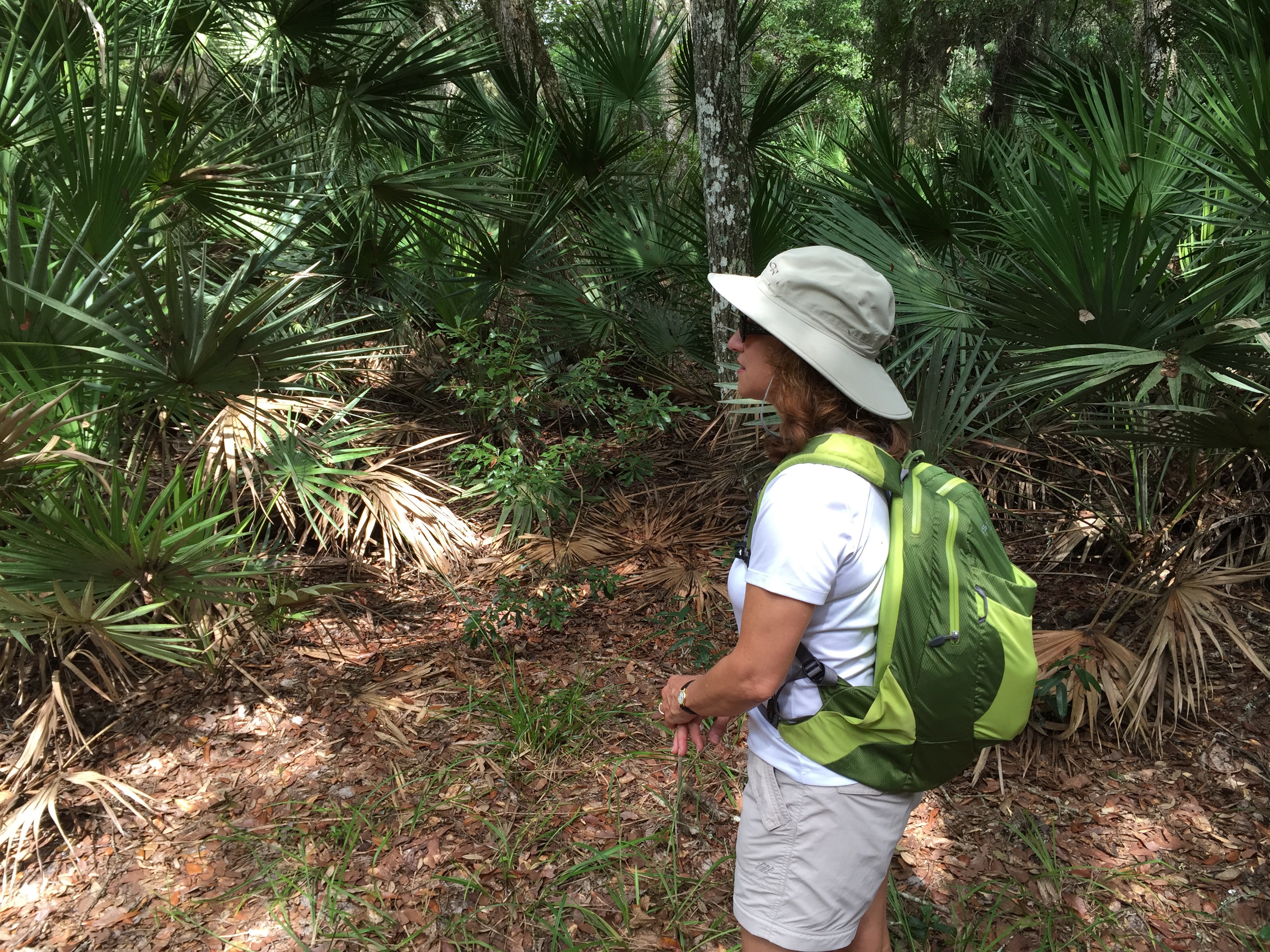
The trail starts off through classic Florida palm hammocks, framed by live oaks and swaying Spanish moss. It was beautifully shady and the temperature wasn’t bad. The shades of green ranged from neon to hunter, and the canopy over the trail made it almost as though we were walking under a pergola in a landscaped park.

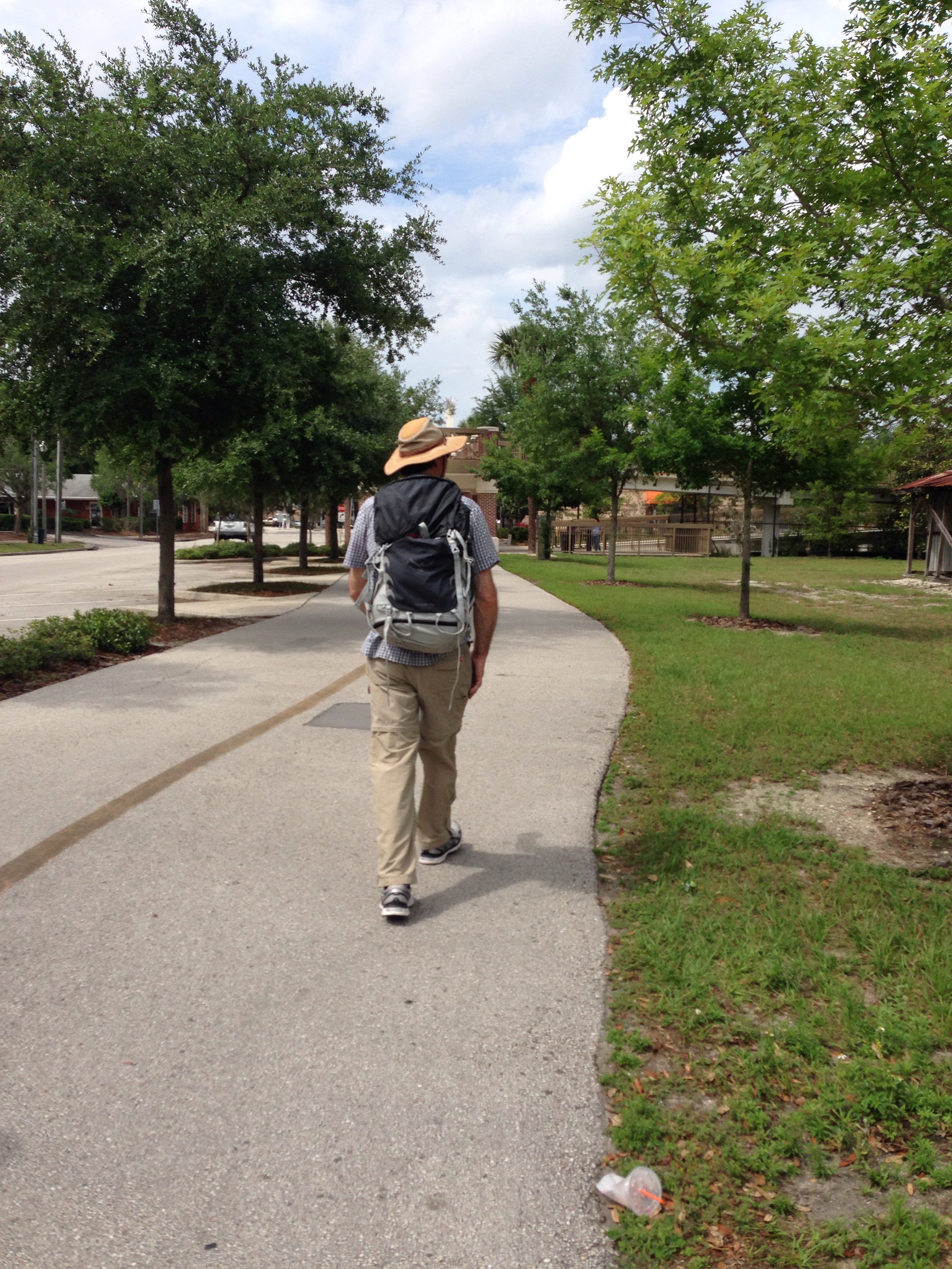
We’d covered ourselves in heavy duty bug spray but at a certain point my sweaty body apparently became too much for the flies and ticks to resist and I found myself pursued by an onslaught of flying and jumping creatures. After I literally ran several yards, hiking boots and all, to escape I decided covering up was the only answer. So I dutifully zipped the bottom parts of my hiking pants onto the shorts and donned my long sleeved shirt. I may have looked a bit like one of those eccentric old ladies who wear winter clothes regardless of the season, but the heat was infinitely preferable to the attack of the flies.

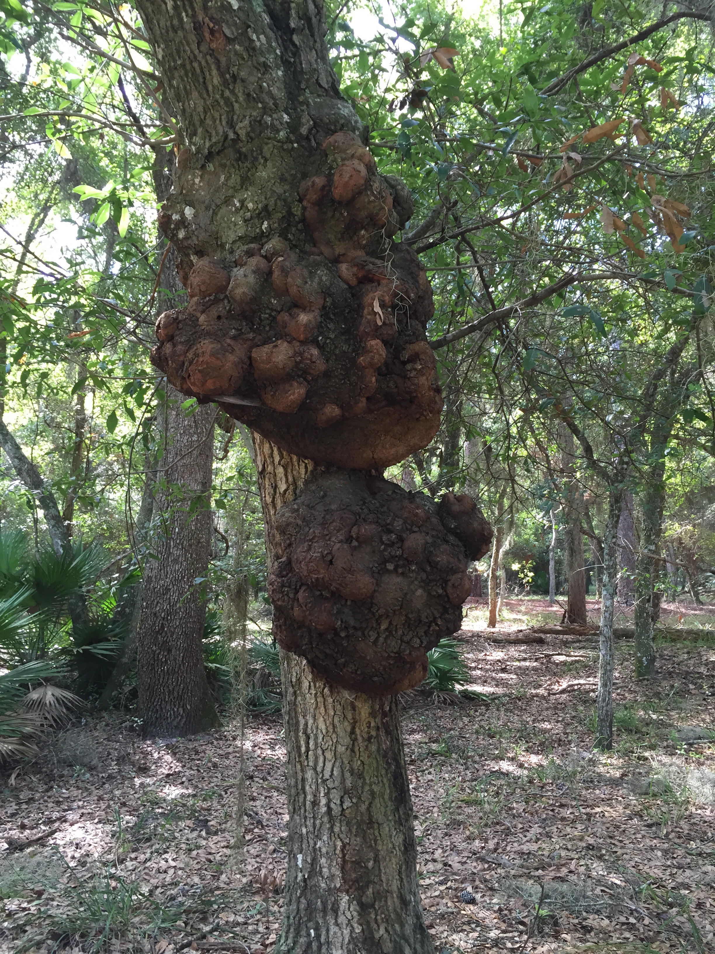
Shortly into the hike we passed a tree with two gigantic growths – if we were in Africa I would have thought they were some sort of termite mound, but here – perhaps overgrown mud dobber nests? Ideas? Photo is below.

image
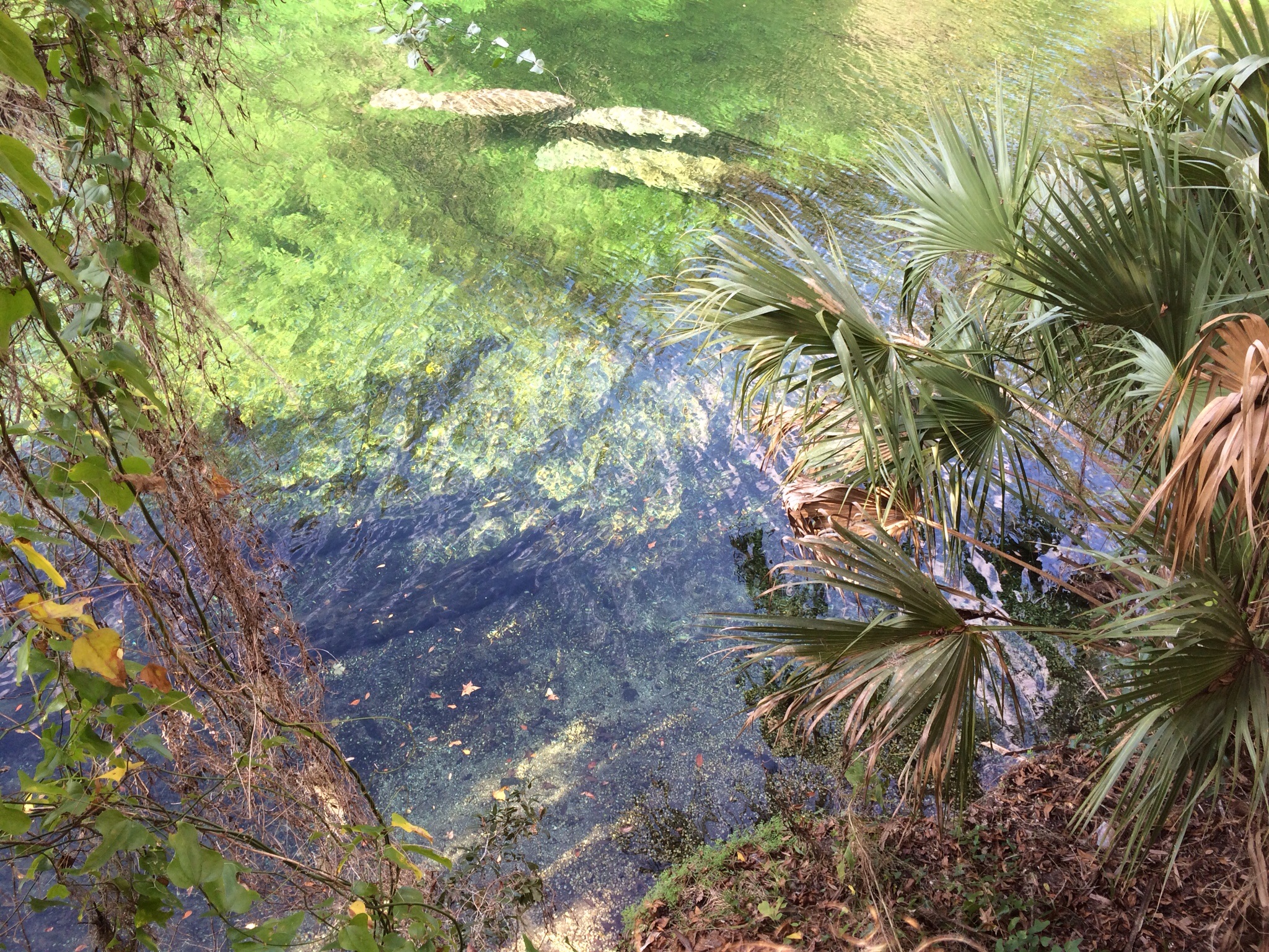
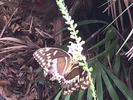
The trail then winds its way by the edge of the river – part of the complicated intracoastal waterway system that hugs the east coast from Florida to Maine.  The green of the water grasses is pale and you start to see yellow flowers, a welcome sight as summer is not the best time for flowers in the Florida woods.

image

Most amazing were the huge yellow and black spiders we kept seeing everywhere. Fortunately their elegantly spun webs tended to be set high between the trees, meaning even J only had a few encounters. But the spiders were about two inches in length, and seemed to be quite well fed.

image

After almost 7 miles there was still a further loop we could have done, but by then the insect wildlife was starting to pursue J, who had made the mistake of hiking without full body armor in his backpack. So we called it a morning and headed back to civilization.

image

But as I type this on my phone (my iPad having encountered yet another problem that will require a trip to, horror of horrors, the Genius Bar), and look out on the red tile roof of the resort and the sliver of ocean I can see through our window, I do keep thinking how much more I’d really prefer to be looking at the pale green of the river grasses and the deep comforting trunks of the live oaks.

Ecuador – A Walk in the Cloud Forest

image

We returned from Cayambe on a Monday, with one day left to eke out every last remaining bit of our Ecuador experience before we returned to hot, humid and flat Florida. Of all the various options Ossy offered, a hike up into the cloud forest in the Pichincha range, into the Yanacocha Reserve, had the most appeal. Plus, he promised hummingbirds.

Now, I’ve had a hummingbird feeder for years. I’ve heard that Florida too has hummingbirds – but each time I spy such a potential winged creature, it turns out to be one of Florida’s special species of gigantic, winged bugs. Of course, the fact I have never bothered to put hummingbird food in the feeder probably doesn’t help.

So off we took, me, husband J, Ossy, and his wife. One fact I hadn’t realized before we left the U.S. was that our trip coincided with Pope Francis’s trip to Ecuador – and specifically Quito. Multiple roads were closed and police were everywhere.

On the way out of Quito we turned on the car radio and heard the Pope saying mass as we looked down on the crowd, half a million strong, in Quito’s Bicentennial Park. A little surreal.

A sea of people at Pope Francis' visit to Quito
A sea of people at Pope Francis’ visit to Quito

The sunny weather we’d brought from Florida had definitely turned and there was a steady downpour as we drove the winding roads up to the trailhead. Once we arrived at Yanacocha we all donned raingear, and I was profoundly greatful for my absolutely waterproof wind jacket (a Marmot that dates back to 2011) and pants (also Marmlot).

After a mile or so straight uphill through the paramo – the Ecuadorian highlands, we encountered our first swarm of hummingbirds. And I use the word swarm intentionally. There were so many of them darting back and forth to feeders that you could hear their wings. They shot past our heads as if catapulted from some sort of slingshot.

Not only were there small hummingbirds, but we saw several (I think) Great Sapphirewings, one of the largest hummingbirds, about the size of a cardinal, native to Ecuador. We also saw one hummingbird with a needle like beak almost as long as his body.

After we hiked through hummingbird central, we turned a corner – and there, growing on the side, was a fully blooming orchid, exactly (well, bigger and healthier) like one I have at home.

image

Even though it was still pouring, we ventured up the steeper section of trail as it didn’t seem too slippery. Of course, nothing seems slippery after a glacier. Nonetheless, by this point it had started to hail, and chunks of ice were accumulating and forming small banks of snow.  Ossy could have used a machete as there was a fair amount of trail breaking involved as moved further into the dense jungle of cloud forest. Flowers were everywhere, purple lupines, flame colored trumpets, white daisies growing close to the ground, all framed against a canopy of outsized leaves.

We finally reached a turnoff that would have taken us down a steep section to circle back to where we’d started – but that path did seem very muddy and by then we were all pretty well soaked. So we opted for what looked like a wider trail, despite the fact no one present had ever gone on it before.  The trail exited the cloud forest and took us back into the highlands – where we continued to climb up and up and up – even though it really seemed we should be going down and down and down. There were ultimately some long switchbacks, and we passed a few people working on the roof of a tumbled down structure of some sort, so we knew that at some point we should rejoin civilization.

Just after that, we suddenly realized we were walking across a field that was surrounded by a barbed wire fence – we were apparently on the wrong side of it. After we scrambled under the barbed wire, we looked back to see a large keep out sign barricading the area we’d been blithely strolling across.

image

But, our faith in Ossy’s mountain guide instincts was justified. Within another mile of so we hooked up with the “main” road and ended up exiting just a little below the spot we’d parked the car.

image

It was still raining, and we could all squeeze puddles of water out of everything we had on. J had on his customary too many layers of shirts and was able to lend Ossy one for the drive back. Apparently it’s illegal to drive without a shirt on in Ecuador. And besides, the Pope was there so I suppose it would have been unseemly in any event.

We made a quick pit stop back at the Hacienda Rumiloma to change – and dry off. The next order of business was a trip down into Quito for Chinese food – hot and sour soup never sounded so good. The Pope’s presence and road closings seemed to have resulted in an eerily quiet city, and we were able to park directly in front of the restaurant.

Hummingbirds, orchids, Chinese food, the Pope, and crawling under barbed wire. What better ribbon for wrapping our four Ecuadorean mountains in eight days?

Illiniza Norte Or How I Ended Up Rock Climbing After All

Cotopaxi from the hut at Illiniza Norte

Some of you may remember that one reason we ended up in Ecuador instead of the Grand Teton was our conclusion that we preferred mountaineering to rock climbing. (See “Cotopaxi, Ecuador – 180 Degree Turns.”)  So it was somewhat inexplicable that I nonetheless found myself on July 1 hanging on for dear life to an ice encrusted basalt wall with my left hand, ski pole in my right and nothing but an almost vertical drop of rocks below. Oh, and this was at about 16,000 feet. And did I mention no ropes?

Illiniza Norte is one of the two Illiniza peaks (the other, obviously, is Sud), and is a common acclimatization hike in preparation for Cotopaxi. It reaches about 16,500 feet, and is the taller of the two forked peaks in the right in the photo. Its sister peak, on the left, is much more technical and is covered in snow.

The Illiniza Peaks
The Illiniza Peaks

It was about a three hour hike to the mountain hut where we were to stay for our ascent of Illiniza Norte so we left in early morning. After fighting through Quito traffic, we followed modern highways for a while until we abruptly turned off to cobble stone roads, still in the same condition as in the 1940s when Ossy thought they were originally built. Jaw breaking and winding is an understatement. More on that later.  We passed through several small villages, stopping at one to drop off things we wouldn’t need on the hike. Once we parked the car near the trailhead, we met up with the two men who took our supplies up to the hut on horses. Each day the horses plod up to the hut with full loads and bring trash back.  Despite the routine, they seem quite content with their rather proletariat role in life.
image
The mountain hut is primitive – but there are flushing toilets, even if you do have to go outside to get to them. There’s a series of about four bunk beds, going up to a triple level, a small eating area and a tiny kitchen. No electricity. We were the only people there, and, in fact, the only climbers on the mountain the next day. That night we were treated to a spectacular sunset with a full moon. The entire Avenue of Volcanoes was visible, including the white capped isosceles triangle of Cotopaxi.

We got up at 5 for an early morning departure. The weather cleared as we hiked. There was more snow than normal, and many of the rocks were encrusted with icicles. I was glad of my climbing helmet since I hit my head several times on wide swathes of ice sticking out from the rocks I was trying to hold on to.

There are several sections of rock, the most difficult probably the one right below the summit. We climbed up through a chimney, along exposed ledges – and all without ropes. Ossy very carefully instructed where to place hands and feet and how to balance – and ultimately we did make it to the summit which is marked by a metal cross. But that wasn’t before a bowling ball sized rock hurtled down from the top in J’s general direction, followed by a smaller one in his more specific direction. Fortunately, no injuries. We now know the best way to react to rockfall (besides not experiencing it in the first place!) is to make yourself as small as possible. Sort of an airline crash position.

Summit of Illiniza Norte - that's the summit cross that appears to be sticking out of my head
Summit of Illiniza Norte – that’s the summit cross that appears to be sticking out of my head

Coming down was exhausting and Ossy roped me in after I slipped twice. I think I’d burned up a lot of nervous energy on the ascent – not to mention physical. And we not only had to descend and get back to the hut – there was still the three hour hike back to the parking lot ahead of us, and then a couple of hours to drive to our next stop, the Hacienda Chilcabamba, outside Cotopaxi National Park.

For someone who actually froze on the stairs of the Eiffel Tower and who still has recurring dreams about being stuck on the old swinging bridge on Grandfather Mountain in North Carolina, reaching this summit was huge. But it also reminded me that figuring out how to get down from summits is just as important as going up them.

West Orange Trail – Beginning to End

image

Husband J and I have been walking different chunks of the West Orange Trail for about the last year, as memorialized in “A Walk on the West Orange Trail” and “The West Orange Trail – Starting from the Other End.” But we also had an overarching desire to see if we could walk the whole thing in one fell swoop – well, at least 20 of its 22 miles. (The very last couple of miles – mostly along the side of a busy street in Apopka and culminating in the middle of a sidewalk in front of a strip mall – are simply not worth including.) After all, we reasoned, if the Romans could march miles like that in one day while laden with armor and the spoils of war, surely we could manage it with hiking boots and backpacks.

So, early on Saturday we set out with a couple of friends who had agreed to participate in the initial stages – M, of Iceland fame (see the prior weeks’ Iceland saga), one of my law partners who is affectionately known as King A, his daughter A, and her large, brown brindled part Weimaraner who shall be known by her full name, Daphne.

It was a beautiful, if humid, day and the first five miles to Winter Garden were like a walk in a shaded park along oak lined paths. The park theme was particularly evident as we passed a meadow inhabited by ostriches and long horned cattle (or maybe buffalo?) – not what we were expecting amid the Spanish moss.

image

The amount of rapid development along the trail is incredible. In the months since we were last there houses have sprung up like proverbial mushrooms. While many developments are promoting their ecofriendly characteristics, the fact remains that each of them is occupying what used to be open Florida land.

Just before mile 5, M abandoned us to return to a more normal day of activities. King A and his daughter left us in the charming town of Winter Garden – after Daphne lay down in the middle of the sidewalk and clearly announced she had had enough.

Downtown Winter Garden

Miles 5 to 10 wind through multiple housing developments and old citrus groves; they pass warehouses and fields, and the site of the Ocoee high school sustainable agriculture program, where three students were tending a cow. Some of the housing developments share great swaths of green semicircular common areas surrounding retention ponds – the manicured grass for all intents and purposes looking like a giant green unibrow. But where were all the people? It was as sterile as a glossy page from a magazine. When we walked through some much poorer areas later on the outskirts of Apopka there were men outside sitting on lawn chairs, kids playing with hoses, people walking down the trail to actually get somewhere.

Only in Florida - hill warning with no discernible hill in sight!
Only in Florida – hill warning with no discernible hill in sight!

At just after mile 10, we decided it was time for lunch and eventually located a bench in the shade of a freeway overpass, with a golf course running along one side. I had started off in running shoes, believing their light weight would help with the distance but had packed my boots just in case. By mile 10 it was clear it was time to shift footwear. So after a sandwich break and foot ministrations, we set off for the final 10.

Things, as they are wont to do, got even stranger during the last half of the hike. As we neared the end of the seemingly interminable golf course, lining the other side of the trail was a field dotted with bright flowers – which after a few moments we realized was a memorial garden. We had been thrown off by the office building – a small frame house with a filled in swimming pool. Huh? And I’m not sure what the proximity of the memorial garden to the golf course says about the nature of human existence but it doubtless means something.  We also concluded that Apopka must be slightly higher than Oakland, at the beginning of the trail – although there were no real hills, we kept going up a steady slight incline – and never seemed to get to go down.

When we reached mile 15 we had travelled more miles than on any previous hikes, and we were also on a part of the trail we hadn’t seen before. All of a sudden, peering over the edge of the trail was a giant white statue of Buddha gazing down serenely on the cyclists whizzing by him – it turned out we were next to an extremely large and ornate Buddhist temple. The religious juxtapositions were interesting. We had started by the “Mosaic Church” near Oakland, now the Buddhist temple, and shortly after encountered churches ranging from the Seventh Day Adventists (where a very dressed up congregation was just departing church services) to something called St. Elizabeth, a Church of God By Faith, with no other apparent denominational affiliation.

image

After a wooded section we emerged onto another road which offered a tour of Apopka’s dying foliage industry. Nelson’s Florida Roses (I had never realized it was even in Apopka) still seemed to be flourishing – although we couldn’t help but note that when we saw them switch on the sprinklers the electrical transformer over our heads actually crackled and sparked. But next to Nelson’s are acres of semi-abandoned greenhouses, giving a sort of post apocalyptic feel to the whole place.

image

Finally we made our way through a wooded area, dotted with small houses, and up to the Apopka bridge. Just beyond that is the Apopka Station, our ending point, but we were just under miIe 20. So we forced ourselves to go on just a little further so that when we turned around back to the Apopka Station we stopped at mile 20 on the nose.

This particular training adventure, unlike most, was a one way trip. Except for the half mile at the end, when our friends A and T retrieved us, we hadn’t covered any of the same ground twice. Sometimes I wish summits were like that – you could get to the top, just stay there, and not have to come down again.

J near the beginning of the hike

Iceland Summits: A Glacier Melts – Part 3

image

Day 3 of our Travel With Friends Trip was to be the Iceland version of a summit. We had peeled off from the more typical tourist sightseeing regime and made our way to Sólheimajökull, an outlet glacier of Mýrdalsjökull, which is Iceland’s fourth-largest glacier. It offered the opportunity to don crampons and climb on ice for a couple of hours. And at least J and I could regard it as some sort of training for our upcoming trip to Cotopaxi and Chimborazo (only three months from now!).  Because of our out of the way location at the Efstidalur Farmhotel, we were a considerable distance away, and had to hit the road bright and early for our 10 am rendezvous with the guide.

The theme of “the weather gets worse” continued. After surviving the narrow snowed over road on which the hotel was located, we ended up on a mountain pass. All we could see was a line of yellow tipped stakes outlining the contours of the road, and it was only on the way back we realized how close we were to the ocean. We finally turned off onto what was described on our map as a 3 km road that could take 20 minutes to travel. It was dirt and lava rocks, pocked with huge ruts. Eventually we reached the end, in howling wind and hail – only to find the long promised cafe where we were to meet the guide was closed and there was no other sign of human existence. In our excitement of getting there and maybe finding a bathroom, we had all jumped out of the car without properly fastening ourselves up against the elements, and accordingly were drenched. There was no bathroom either.

Finally, another car pulled up and out with it our erstwhile guide from Icelandic Mountain Guides. From New Zealand, he bounced between Aconcagua, the Alps, the Cascades – all the best climbing. I’m not quite sure how Iceland fit in, but there he was. He assured us that although conditions were not good now (read “you will be blown off the face of the mountain”), he’d been watching the forecast and the weather should clear by 2 pm.

One of the many churches dotting the Icelandic landscape

So with several hours to kill, we drove back along the rutted road to the village of Vik. Supposedly a quaint fishing village, on that cold icy day all we located was a collection of warehouses and small homes with barely any commercial establishments.  We did find one hotel with a cafe and a sign stating it opened at 11. We rang the bell and eventually the owner shuffled down. After I inquired if  they were open, he went back upstairs to check with the wife, and following an onslaught of Icelandic argument apparently between the two of them, grudgingly returned and opened the cafe. We ate greasy pizza while another few drenched lost souls staggered in, all of whose plans had also been laid waste by the weather.

image

Eventually we departed Vik to head back to our long gravel road, but on the way we took a detour to Reynisfjara beach. A black sand beach with tremendous cliffs and rock formations – brutally windy and cold but stark and beautiful. It didn’t require much imagination to visualize Vikings landing there in their long boats. There was a cafe there with a huge glass window overlooking the crashing surf – next time we will know where to go.

image

The glacier hike, although not particularly challenging, lived up to our expectations. As you ascend, the ice has become so compacted that in the winter it is a startling shade of clear blue, varying from periwinkle to deep turquoise. It’s set against black lava, some of which is even banded into the ice itself. There’s an ice tunnel just sturdy enough to crawl through – not dark as the light from the tunnel opening is refracted against the clear glass of the surrounding ice. A delicate tall ice arch had formed in one spot – by the time we were descending, it had fallen. Sadly, the glacier, like all glaciers worldwide it seems, is retreating. Where we were standing on rock near the cafe had been glacier just the year before.

It was finally time to bring our day to an end, and we had several hours of snowy driving to get back to our hotel. We had one more day left, and it was time to make plans.

West Orange Trail – Starting from the Other End

Pedestrian Bridge Over Apopka's Main Street
Pedestrian Bridge Over Apopka’s Main Street

Saturday presented with a solid drizzle of rain from dawn to dusk and thereafter. What better occasion than to try out some new gear to check how waterproof it really was.

Husband J and I decided a few more  miles on the West Orange Trail would be an appropriate testing ground. But this time, instead of starting in charming Winter Garden, we decided to begin our hike 22 miles away at the other end of the trail, just outside of Apopka. We have a goal of ultimately walking the whole thing in one fell swoop, but before we do so we thought we should have walked all its pieces.

The trailhead on the eastern end is nothing short of unimpressive. Literally nothing but a small sign marks the trail, which runs along a busy commuter road, and it’s hard to tell where the regular sidewalk ends and the trail begins. It’s equally mysterious why that particular point was selected – there’s certainly no distinguishing characteristic. There are a couple of strip malls, populated by places like “Beef O’Brady’s,” Pizza Hut, a grocery store and the inevitable 7-11. And no parking – except for the strip malls.

IMG_1703

After a couple of miles of cars whizzing past, we were glad to turn down a side street where the trail finally diverged from the roads. It wound back behind several schools in a wide concrete band, at one point on a well-built boardwalk that meanders past a deep gully, unusual for Florida. There were some houses tucked behind it and I couldn’t help but wonder what the bear population was. For those of you not from Florida, black bears have developed their own suburbs in all of Orlando’s outlying areas. As the boardwalk ended, we passed a huge Seventh Day Adventist church and several expanses of open land. It was not clear if they are parks, grounds of commercial establishments, or simply placeholders waiting for development. And there is some topography- there is at least one real hill and by the end of he trail, my Map Your Walk said we’d gained a whopping 65 feet.

The trail finally reaches the town of Apopka itself. A pedestrian bridge, shown in the top photo, crosses Main Street. There’s a restaurant called the Catfish House right by the bridge – which looks as though it would be an appropriate place for celebration when we finally do the entire trail. And it looks a lot more interesting than the Duncan Donuts, which appears to be the other food choice.

Next West Orange Trail hike – well, we still have about 12 or so miles before we’ve walked all of its bits and pieces. I’m hoping for a little less 4 wheeled traffic on the next part. As for the gear – it worked admirably. Patagonia Alpine climbing guide pants repelled water just as advertised and my new hiking boots – yes, after five years I have a new pair of Renegades by Lowa – continue to get broken in. And just as well – because the weather reports for Iceland – where I will report from next week – indicate snow every day!

Summits – The To Do List

Part of the broken trekking pole

We have reached that point of every major travel adventure where the to do list seems as daunting and insurmountable as we fear the summits of Cotopaxi and Chimborazo themselves might be. So on Saturday I suggested to husband J, as he struggled with a new computer which seemingly has no spam filter, that perhaps he would feel more organized if he made a list. He didn’t follow this sage advice, and for that matter, neither did I. But I did think about what I would jot down in one of the many notebooks I have left over from the daughters’ school days that I use for such purposes (I can’t bear to throw away unused paper), if I were so inclined.

1. Go to Iceland. Now that may not be first on most people’s list of mountain climbing preparation, but it is a fact that we will be spending five days in Iceland in the beginning of March. And that upcoming adventure has created other subset of to do lists that I won’t even begin to address here.

2. The gear check. This is an inevitable part of any expedition and one that I both anticipate and dread at the same time. Certainly we are in much better shape than we were back on 2011 when we climbed Kilimanjaro but now we have broken gear to deal with and new and unusual gear to get. We are in good shape for crampons, but have never before had to buy any rope. Since the guide company supplies rope I’m still not sure why we have to have our own as well – an emergency supply in case we fall into a crevasse on the way to an outhouse? The possibilities are not reassuring. We have to call Travel Country to see if the balaclava/face mask I ordered has arrived and if climbing helmets in a smaller size are in stock yet. And we have to replace the trekking poles that somehow daughter #1 managed to break on Mt. Washington. I still don’t know how she hiked the last 5 miles not realizing that one pole was 12 inches shorter than the other. And this is just a fraction of the gear issues.

3. Order zinc for lips. As those of you who followed our climb up Mt. Elbrus know, it never occurred to me that my allergies to regular sunscreen meant that I couldn’t use Chapstick with any sort of sun protection. In fact, this didn’t occur to me until I was on the side of the glacier on summit day, realizing that I looked and felt like I had kissed a hot burner on a stove. Never again.

4. Write to do lists for work, training, family and trip. Yes, this is a circular blog post. But I can’t think of any other way to try to have some certainty about what remains to do for the next few months. Should it be one giant list, or multiple lists for each area? I’m trying to make some order out of chaos – but I’m afraid that if I overthink it I’ll be doing the reverse. Wish me luck.

Cotopaxi and Chimborazo – Where We Are Going

Volcanoes of Ecuador

So I did it. Last week, on Tuesday to be precise.  I emailed Mountain Madness, our trekking company, and just said yes to the Chimborazo extension. Now I recognize that some of you were pushing for the Galopagos Islands, but I simply couldn’t escape the fact that there will be no other point at which husband J and I stand a better chance of actually climbing a 20,000 foot mountain. I think I can manage the Galopagos in future years.

As I continue the grueling process of forcing  myself to run at ever faster paces and climb stairs with increasing amounts of weight – and of finding the time to do so – it occurs to me that I have not really described the two mountains that are engendering such passion (or foolhardiness). I’ve referred to them by name, but without much explanation.

Here’s what is inspiring me.

Both mountains are part of Ecuador’s Avenue of Volcanoes, named by 19th century German scientist Alexander Van Humboldt.  Due to a location just above and below the equator, the scenery is supposed to be reminiscent of the Scottish highlands or the Arctic tundra, at least according to our trekking company.  Both were first summited (at least by westerners) in 1882 by Edward Whymper, for whom some of the passes are named.

Cotopaxi last erupted in 1940 and some consider it the world’s highest active volcano.  It stands at 19,347 feet (5897 meters) and is located near Quito, which at 9400 feet is itself one of the world’s highest cities.  Cotopaxi has been worshipped as a sacred mountain, a bringer of rain and fertility.

We will acclimatize for the altitude first with a climb up Guagua Pichincha (just outside Quito, standing at 15,696 feet, last eruption 2004) and then what is described as an “enjoyable rock scramble” up Illiniza Norte (16,818 feet), with trekking, camping and stays at haciendas in between. Mules are supposed to help at certain points as we travel between and up the various mountains.  Once we are at Cotopaxi, summit day (summit night is a more accurate description) begins at 15,749 feet, where we will have been staying at the Jose Ribas Hut.  The glacier starts at about 17,000 feet, and according to Mountain Madness, we will be crossing snow bridges, avoiding large crevasses, and climbing “short, steep sections.”  Once at the summit of Cotopaxi, we should be able to peer into a perfectly round caldera, the origin of the steam you apparently can sometimes see boiling up.

I have found a lot less written about Chimborazo. It is famous for being the point closest to the sun, due to the bulge of the earth at the equator. As I mentioned before, I hope our attempt to climb it is not too Icarus like. It is currently inactive, with a last eruption in 550 A.D. or so.  It reaches a whopping 20,564 feet (6268 meters) and is the highest mountain in Ecuador. Chimborazo can sometimes be in very bad condition – with unstable snow, big crevasses and high risk of rock fall. The itinerary states that if Chimborazo is not climable, we are to attempt Antisana. It’s only 18,714 feet high, but from what I’ve read is even more technically challenging, as it is completely covered by glaciers, and is not climbed very frequently.

Despite all this, you may still be left wondering – but “why?” Well, a summit goal, for me at least, gives me something to focus on, look forward to, and lifts me out of the drab tension of the day to day working world.  And the other reason is simply a variation of the “because it’s there” phrase – because there is something about standing on a summit that gives a high that doesn’t come from anything else.

Training Up on the Roof


Up on the roof - with hibiscus below
Up on the roof – with hibiscus below

In passing, I’ve previously mentioned a fear of heights – in fact, it played a role in the decision not to climb the Grand Teton. I’ve downplayed it to avoid the inevitable queries about why someone with any such concern would decide mountain climbing was for them. But occasionally that fear rears its head again, like the proverbial dragon waking up in its cave. And I realize that each time I set off for a new summit, vertical drops provide their own very special form of challenge (or torture).  It goes back to kindergarten when on my way to the second floor of the building I somehow slipped between the steps of the fire escape style metal staircase, just catching myself before I fell. I was a skinny child. I didn’t say much to anyone about it, but I remember it to this day.

Year later, when I was about 13, my family made a trip to Grandfather Mountain in North Carolina, where my father walked my brother and me over the swinging bridge that crosses a gorge several hundred feet below. I still have never told anyone how completely paralyzed I felt on that bridge, but one of my repeated anxiety dreams (aside from the one where you have to take an exam in a class that you forgot to attend) is of being on a high, narrow bridge with no rails, unable to move forward or back.

So, yesterday when my husband (now known as J) and I decided the time had come to clean the skylights on our house, I clambered up the ladder after him. (The roof really is a bit steeper than the photo shows.)  As soon as I put my foot down on the sloping roof every fear I’d had was triggered – what in the world would prevent me from simply sliding right back down and onto the patio below. I started to think about the angles of Cotopaxi – and, if we do it, Chimborazo – and thought, well, if you’re having a hard time on your own roof top you aren’t going to do very well there. So I took a deep breath, trusted in the grip of my tennis shoes, and bribed myself with the promise of the great view I would have of the neighborhood and everyone else’s backyards.

And it worked. By the time we were done I was skipping around on the roof – if not like a mountain goat at least like one of those mules that go up and down the Grand Canyon.

But, you know what? Last night I still dreamed about walking on a narrow ledge at the very top of a multi-level mall. I had to hold on to some sort of rope and half way along the ledge drop one rope and pick up another. I did really well on one side of the mall, but when I had to cross the ledge on the other side, I found myself saying to the anonymous, but stern, guides, I’d just prefer to do this tomorrow.

Still some work to be done before Cotopaxi!


Blue Springs – Mysteries of a New Year

Manatees in the emerald waters of Blue Springs State Park

We celebrated the day before New Year’s Eve with a very tame hike along the boardwalk at Blue Springs State Park to see the manatees. Just daughter #1, her boyfriend, the husband and me. Oh, and in celebration of 2015 and six months of writing this blog, I’ve decided the husband can now have – if not a name – at least an initial. Perhaps a little Kafkaesque, but “J” does have a certain ring to it. Perhaps the daughters will obtain their own initials at some point.

I’d like to say that Blue Springs is a hidden treasure – but it has clearly been discovered, as demonstrated by the hordes of eager manatee watchers who were out in force on an overly hot winter’s day.  Blue Springs has always been “discovered”: it has been a tourist spot – or at least, a layover – since the pre-train days of 19th century Central Florida. The house of the original settlers still stands – a couple from Brooklyn, New York, who migrated to Florida to establish what became a steamboat stop on the St. John’s River in the 1870s or so. As steamboats gave way to trains, the place evolved into a weekend resort for hunters and fishers. The tourism that seems so out of place in the apparent wilderness is actually an authentic part of Blue Springs.

Blue Springs is also tremendously accessible to anyone with any physical challenges. A smooth boardwalk runs the length of the river, which not only helps walkers who need some assistance but also protects the plant life. The place itself is one of the most beautiful in Central Florida. The spring – one of the largest in North America – pumps out water from the Florida aquifer at a staggering 100,000,000 gallons per day. The water is a brilliant clear emerald color, and through it you can see long nosed gar wending their way down the river, as well as the large cow-like blobs that are the manatees themselves. Legend has it that manatees were the original mermaids, but it would take many days at sea for one of them to resemble Ariel!

One of my favorite parts of Blue Springs is the fact that somewhere hundreds of feet down the spring connects to the limestone caves that permeate Florida’s substructure.  As I understand it, many of these underwater caves are unexplored (and probably can’t be explored). Frankly, as much as I can imagine scaling summits of mountains, the idea of going underwater into a subterranean cave is unfathomable. But just knowing of the existence of those deep dark places – who knows, perhaps inhabited by goblins mining for the fairy queen’s jewels – adds an appropriate level of mystery for this New Year’s Eve.

Because who knows what 2015 will bring? It should bring our climb up Cotopaxi, but that’s just one of the many summits I’m sure I’ll encounter. 2015 is stretching out before me like those underground passageways below Blue Springs – and it will just take a little imagination  to realize its possibilities. Here’s to exploration in the New Year!