FromSwamptoSummit has been silent over the last few weeks….but that’s the effect of a brand new grandchild, who shall be known by the initial L, son of A and N. Plus, daughter S and her boyfriend known as T (he plays a starring role in our Basque Country trip back in 2023) just announced their engagement, with a wedding early next year, so that’s served as another distraction.
But my real excuse is that never in my wildest dreams did I still think I would be trying to finish our sabbatical trip write ups over a year after the fact!I still have to write about Orvieto and Rome. And of course, my dedication to fully memorializing our six months of travel means that I haven’t even broached our trip in May 2024 to climb the highest mountain in North Africa (Mt. Toubkal in Morocco). That trip is still residing untouched in my travel journal.
But in an attempt to introduce some temporal reality, I’m going to take a detour to 2025 and current events.
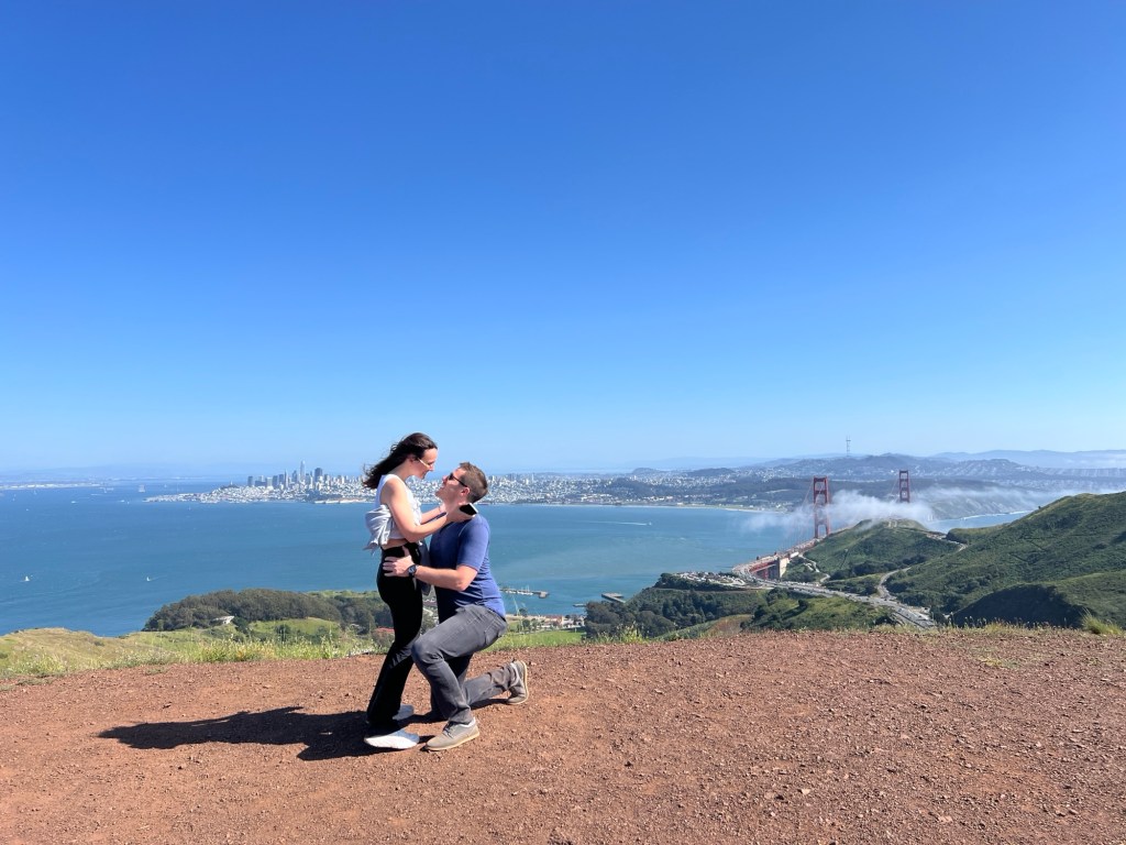
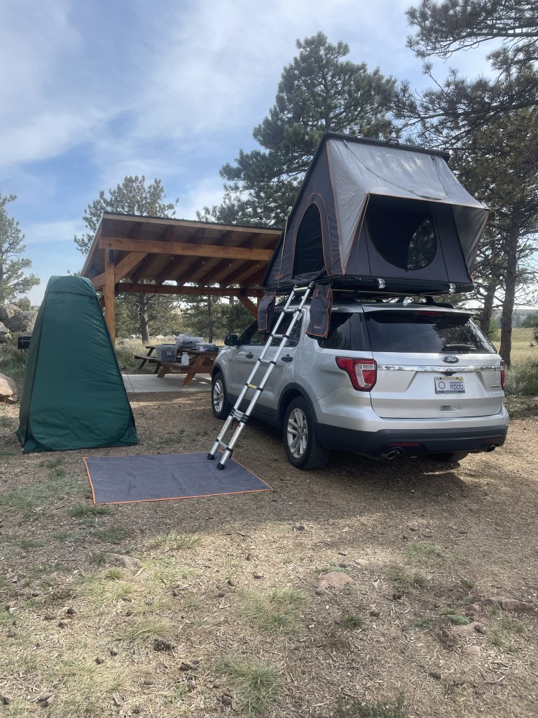
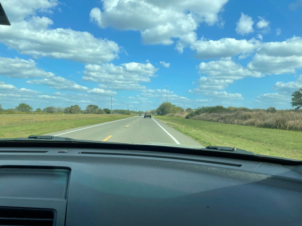
Right now J and I are training with 30 plus pound packs for an upcoming backpacking trip to the Lost Coast in Humboldt County, California. We start off with a few days in San Francisco and Monterey to see family (including the newly engaged couple!). Following that, we have to figure out how to get to the REI in Corte Madera, which is the meeting spot for the backpacking group. REIs seem to be a common meeting place for backpacking groups – we did the same thing when we hiked Long’s Peak in Colorado with a different outfitter.
Long’s Peak hike – July 2021
The Lost Coast is about a 4-5 hour drive north of San Francisco. It’s the section of Pacific coastline that was too rugged for Highway 1 – hence, the coastal highway dips inland, leaving a completely remote area known as the King Range National Conservation area.
The hike itself is 4 days and 3 nights, and involves sand walking, rocky beaches, and going up and down dunes and cliffs. One night we camp in a cove that is “locked in” by the high tide.
I’ve always made the point that FromSwamptoSummit is not a water person, despite the swamp in the name. Swamps do contain a lot of earth, I note, which makes them more palatable. But I must admit, the idea of a beach hike has a lot of appeal. For one thing, coming from the swamp of Florida we won’t have to deal with the acclimatization issues that can affect a bid for a real summit. (Wait til I write about Morocco.)
And for another thing, we can actually train for sand walking. A couple of weeks ago we went out to the Canaveral National Seashore to hike in the back country. To get there you have to walk through the farthest end of the public beaches – where, as usual, we were the most covered up folks around. (I will just point out that there is no federal law against nudity.)
But once we got beyond that back country sign – permits dutifully in hand – there were no footprints, and little but sand, surf, and most remarkably, a flock of flamingoes on the sound side of the narrow strip of barrier island. (The photo below doesn’t do them justice. They really were pink and definitely were standing on one leg.)
We’re hoping for some of the same next week. Although I don’t think flamingoes will be in the mix.
OK, so that title was a hook. J and I don’t actually reach Vienna in this post (unless we unknowingly went through a Vienna on the way back to Florida, always a possibility), but this episode does finally return us to Florida after five weeks on the road. But we will make it to Vienna, Austria in the next post, I promise!
The final stage of our road trip meant we had to cross that vast expanse of the United States that lies between South Dakota and North Carolina, where we planned to spend time with friends and family. All I can say is that there’s a lot of United States.
To sum up:
— The Corn Palace in Mitchell, South Dakota. The largest high school basketball arena in South Dakota, completely decorated with dried corn. Apparently George McGovern played there. Who knew? J insisted having his photo taken in the center of the court.
— High prairies in South Dakota turned into rolling hills and a lot more trees during a brief foray into Iowa.
— Omaha, Nebraska has a lot more hills than I expected and it was not at all easy to find (or enter) our AirBnb. Maybe we should have spent another night in the rooftop tent. On the other hand, J loved his 14 ounce ribeye. It turns out I didn’t take a single photo in Omaha.
— Left quad still showing the wear from the Badlands ladder incident and stairs are not going so well…found a large ace bandage that might help…
— From Nebraska into Missouri. Lots of trees and lakes and very beautiful, especially once we got into the Ozark area. Detoured into Kansas City for the precise purpose of going to the Jack Stack steak restaurant.
— Missouri doesn’t believe in leveling roads. The two lane “highways” we were on simply followed the steep rolling hills regardless of pitch up or down. I’ve never been over as many “blind hills.” And there are some great town names – “Tightwad” being one of my favorites. With a street called “Stingy.”
— At the Doolittle campground, outside of Rolla, Missouri, we saw a red fox scamper across the golden, illuminated field behind our campsite.
— Further along in Missouri (it’s a big state), and outside the “Boomland” fireworks center (a truly scary place), we visited a somewhat desolate park that holds itself out as the location of the first steps of the Lewis and Clark expedition.
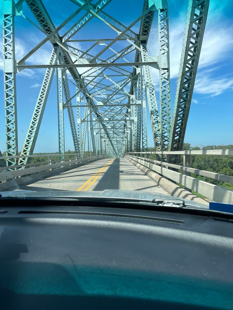
— There are a lot of terrifying bridges in the U.S., especially between Missouri and Kentucky. No shoulders, rusting, and they look like they could collapse at any minute.
— Nashville is a very large city. The “hockeytonks,” as they are called, are crowded day in and day out. After enjoying a lot of music simply from the street side we found a relatively tame venue where we could listen to a very good singer playing acoustic guitar. No luck in finding an unannounced Lucinda Williams or Steve Earle or Jack White show. Oh well.
It was a relief to get to the home of our friends K and B in Banner Elk, N.C. The next week and a half was taken up with family and friends (and the recovery of my leg). Unfortunately the leg issue meant that discretion was the better part of valor, and we didn’t attempt the Grandfather Mountain climb that we’d planned.
On the way back from N.C to Florida we had one last rooftop tent night at Skidaway Island State Park, Georgia, outside of Savannah. It was hot and humid and rained a lot.
But beautiful. Just like our 6,500 miles driving through 16 states and four national parks of the United States.
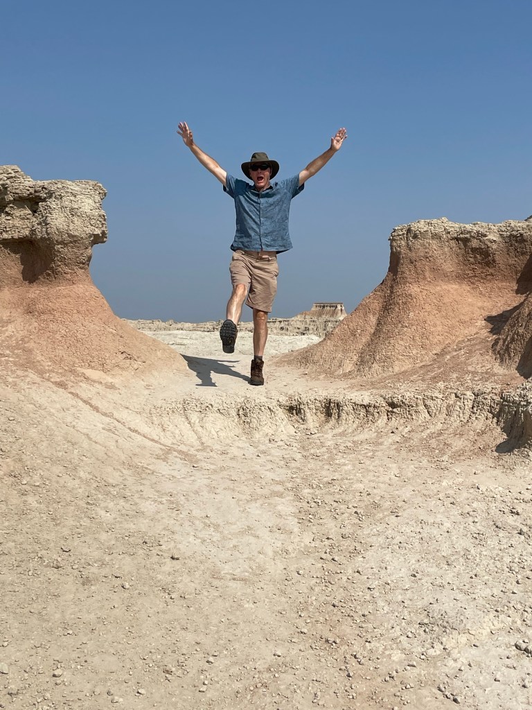
The approach to Badlands took us along State Road 44, a two lane road that eventually cuts across the park. There’s very little traffic. But that apparently didn’t deter the same road construction that we saw across the entire country. We experienced a 15 plus minute delay when one lane closed down, and a lead vehicle ceremoniously ushered us along about a three mile strip of highway – where we met the sole car that was waiting to go the other direction.
We finally reached the Interior Motel and Campsite in Interior, South Dakota, just outside of the park, about 6:30. It was nice. Several other rooftop tents, toilets and showers, an above ground pool, and a view of the Badlands. There were a few cars speeding along the adjacent highway, but somehow that was comforting in this otherwise extremely desolate place. Plus, the road was a elevated above the campground, giving it sort of a Jetson like feel. A full moon tonight and plans to focus on hiking, not driving, the next day.
I woke up about 5:30 a.m., probably due to the sunrise. great swathes of apricot overlying the wine dark purple of night, and the morning star piercing through all of it.
Apparently they don’t worry too much about park admissions on Tuesdays, and we didn’t even have to show our park passes. We stopped first at the visitors’ center and got some advice about trails, and also looked at the extremely interesting working fossil laboratory and heard a lot about a recently discovered Saber tooth tiger.
From there, we started the first of our hikes. The Window – a very easy boardwalk – and the Door, a bit more of a hike, culminating in a natural door that frames a view of the wall of jagged white peaks of stone. Traversing through it was almost like walking through a hard iced cake.
The Notch hike was next. The beginning has one steep section with a ladder going up. We rejected the ladder and instead scrambled up along side it. Fairly wide ledges led out to a spectacular overlook of the valley. It was very not, near noon and 90 degrees in the shade. On the return, we chose the ladder route. Mistake. Looking through the ladder with nothing below triggered all my fear responses – I was so tense I basically slid down without ever letting go and messed up my left quad – which plagued me for the rest of the trip. My legs were shaking when we got to the bottom.
After a quick lunch in the air conditioned Explorer, we journeyed on to the Saddle Pass. It was a true scramble – steep and slippery up the rock formations themselves, culminating on the flat upper green prairie and a number of trailheads. At the ranger’s suggestion, we then went off track and climbed the highest peak to a little throne at the very top. Amazing how touching the rock – as opposed to being on a ladder = makes it so much easier!
By then we were more than hot and sweaty. Did I mention temps were well over 90 degrees? We drove a little more of the Loop Road to the Fossil Exhibit boardwalk, an area of mammals fossilized more than 30 plus million years ago.
We finally hightailed it out of the park to see the small hamlet of Interior, South Dakota. There are two churches and a bar. We stopped at the bar. At the Wagon Wheel the bartender explained to us the story behind the poster of the naked woman riding a Radar the Bull (with a ring in its nose). She looked like a bovine Lady Godiva. Apparently Radar was a frequent visitor to the bar at one point. Between fossils (Lyme Regis) and the bull (my encounter with one in the Yorkshire Dales) I had flashbacks to our UK trip.
Spent the rest of the day at the campsite, plotting our next moves while being entertained by the couple in a nearby campsite who appear to be living out of their van while practicing for the their next singing gig.
We awakened on day two of our Yellowstone adventure to a view of two elks grazing and head butting only ten yards from our rooftop tent. You could actually hear their antlers clacking against each other. It didn’t look like serious business – they’d go at it, like very large puppies, for a bit, and then tire of that game and eat some more grass. Eventually they meandered out of the campground, as comfortable as you please.
This was our day for the “must see” Old Faithful, which required a trip to the western side of the park. There’s a great visitors’ center, with good explanations of volcanoes – especially how we were sitting right on top of one. We then took a decent hike up to an observation spot to see Old Faithful itself. Fortunately, we saw a pretty good eruption. We saw it erupt a second time later in the day, and it simply sputtered.
Next stop was the “prismatic falls.” A navigational error ensued, and we turned off the road too early, which took us along a rather odd hike on the perimeter of the area toward the Fairy Falls. We could see people in the distance on boardwalks, but had no way to get there. Nonetheless, we could still see the billowing multi-colored smoke – pink and turquoise. We were going to try to get to the actual location, but the traffic was simply too much. A lot of Yellowstone is still digging out from the floods of last year, and although the crowds weren’t bad, a weekend day was all that was needed for the traffic snarls to start.
A big rain storm had started so we headed to the Lake Village lodge again to wait it out. There, sitting on the porch, we met someone who was born in Derbyshire, of all places, then moved to the U.S. with his family, and now was a film editor on one of my favorite TV shows, Naked and Afraid! It was he who told us about Deadwood….
After a “grocery store” trip (to the extent a national park general store can be described as a grocery store) we had our last camping night in Yellowstone, and celebrated with an odd concoction of mac’n cheese, precooked bacon, and green beans. As I was cooking I noticed a fellow camper who’d left his chair too close to his campfire on that very windy evening – fortunately I was able to call out to him before it got incinerated. I felt like a veritable Smoky Bear!
The next morning we managed to pack up all the debris we’d been accumulating. Those bear box pantries are a real luxury. We left camp by 10 a.m. and drove to Fishing Bridge, just north of Lake Village and out of Yellowstone via the East Entrance. There was a lot of elevation gain, and evidence of many forest fires, lots of downed, white trees.
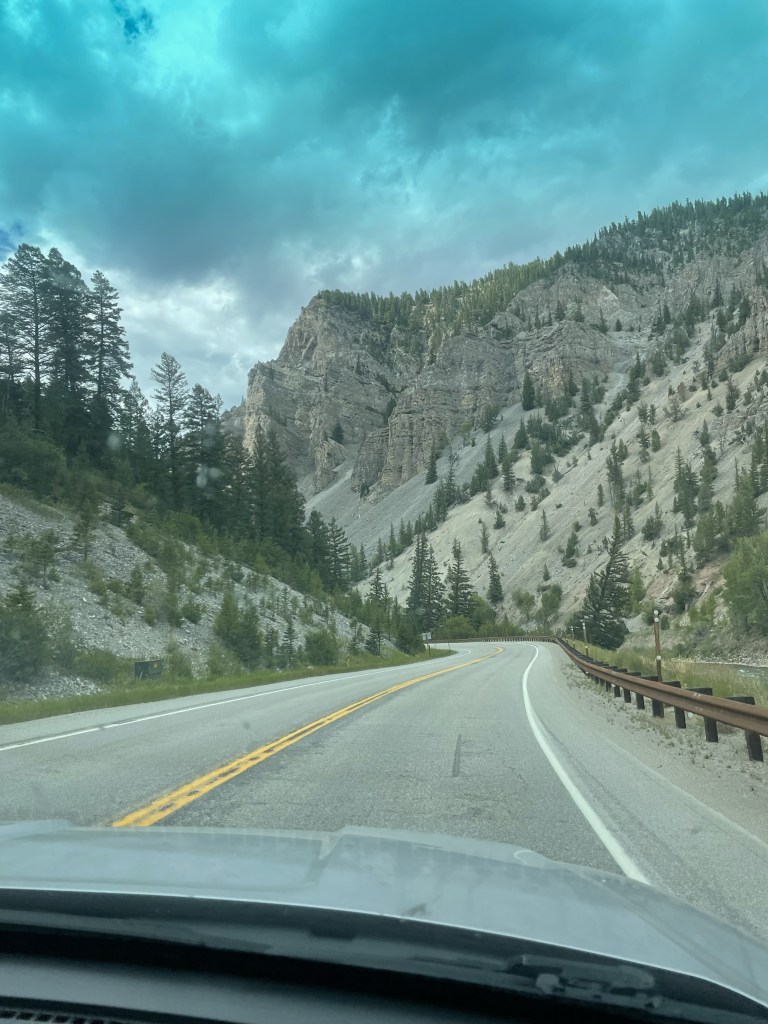
There was a full day of driving ahead of us. Our route was going to take us through Cody, into the Big Horn National Forest area, and finally into Deadwood which was as peculiar a place as its name implies.
Yellowstone National Park is GIGANTIC. There’s no other way to put it, except to use capital letters. And especially when you have just arrived from the much smaller Grand Teton National Park.
It’s an easy trip from Jackson up to Yellowstone. You drive through the eastern side of the Grand Teton National Park (beautiful views of the Grand Teton peak itself, which does tower above the others). We had previously explored the western side so it was interesting to see the other part of the park. The granite mountains looked like rows of jagged shark teeth biting the blue sky.
After a while, the Tetons peter out, and you leave the park for a few miles – only to enter Yellowstone, the oldest of all the national parks (although I think Hot Springs also claims that honor…). It is gorgeous. We drove along a river and through a canyon, on to West Thumb, which is part of the massive Yellowstone Lake. Nothing here is small.
We finally reached the Bay Bridge Campground, where the person checking us in was from Melbourne, Florida! In keeping with everything in Yellowstone, the campground was huge, but each site was a good size and it was a great place for people watching. For example, the European threesome of two men and a woman – one of whom jumped rope for at least 30 minutes before dinner while the woman looked on wearing a fur vest. We even saw a few other rooftop tents.
We set up camp at what was to be our home for the next three nights, taking particular advantage of the built in bear box, which made a great pantry. We then drove to the Lake Lodge, the closest of the lodges where we sat on the porch with a drink (and Wi-Fi) enjoying the views of the lake.
Sleep that night was not easy. It started off with the sound of some creature making high pitched noises and grating sounds. I was terrified that the empty water cooler (BTW, a completely useless purchase, gallon jugs work way better) was being dragged around by some unspecified creature of the night. J asked if we should look out of the tent to see what was going on, and my response was “absolutely not.”
The next morning I noticed one of the logs that delineated the parking area by our site bore fresh (and large) scratch marks, and heard one of our neighbors saying they had seen a mother bear and her cub visiting the campground right by our tents. This was not reassuring.
Our first day we decided to explore the northern loop, parts of which are among the least traveled. This took us by the Mud Volcano – a nice boardwalk passing over the steaming and roiling fumeroles and mud pots. You have the sense of earth moving under your feet.
From there, we drove through the Hayden Valley, lush green and yellow grasses – flat plains with brown mountains in the background. The yellow tones coordinated well with the sulphur from the geothermal activity. There we saw a herd of bison wading in the ponds. We stayed at the prescribed distance, mindful of the five people last year who were gored by bison.
Canyon Village was our next stop. It’s a very large “town” in that part of the park where we indulged in some souvenir shopping, followed by a drive along a very windy road and a high pass to Tower Roosevelt, on the way to Mammoth Springs.
The one thing not to go see in Yellowstone- the petrified redwood tree. After seeing numerous signs advertising it, I had visions of a preserved and immense tree….only to find something that looks like a stump of tree rock at the end of a dirt road.
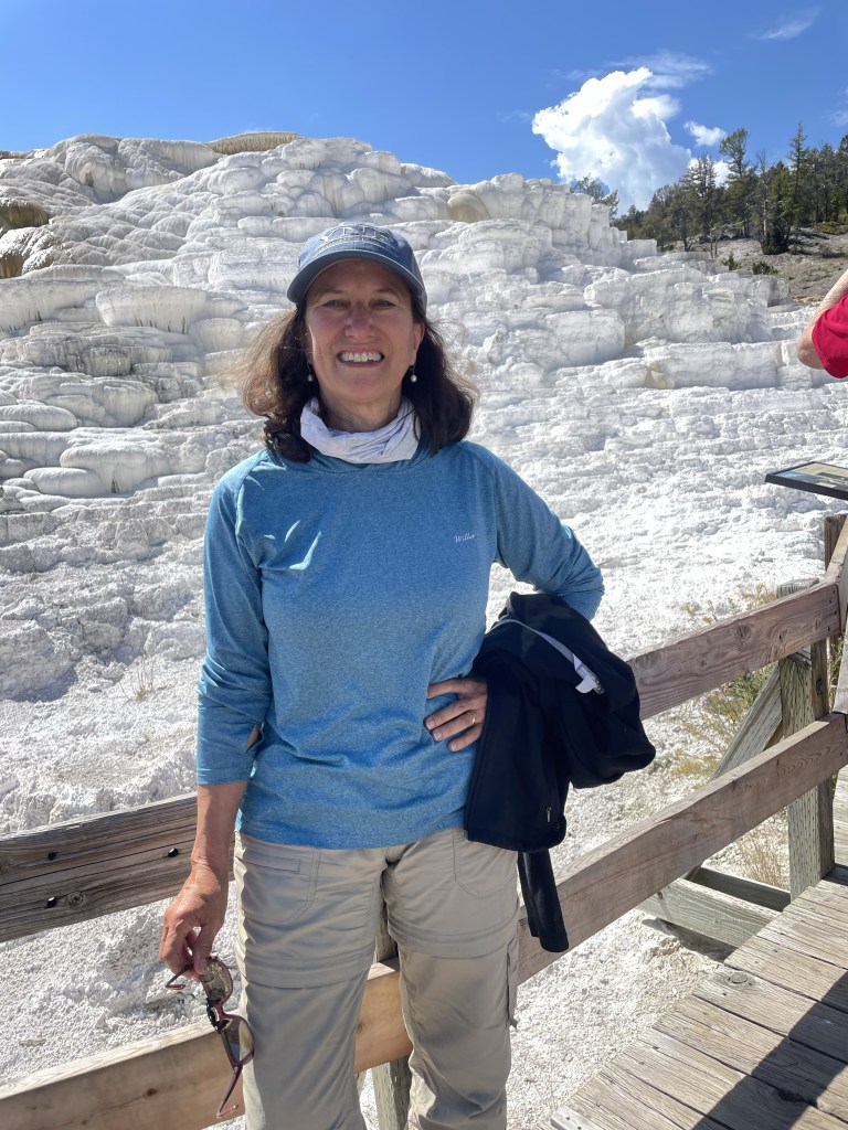
Mammoth Hot Springs consists of hot springs bubbling up into layers of calcium that form terraces of white travertine. It’s a lot like Pamukkale in Turkey, which we saw in 1989. In the 19th century people would dip objects into the hot springs to coat them in travertine and apparently you can still find some of these objects in antique shops. They don’t let you do that anymore.
From the marbled Mammoth Springs we worked our way to the Grand Canyon of Yellowstone. It is an amazing gorge, turquoise water below, a huge waterfall, and gradated orange and grey cliffs. It’s possibly the most beautiful area in the whole park.
And on the way back we encountered a female elk crossing the road right in front of us. That was a precursor to the next day.
Once we left Golden, CO the temperature had crept far enough below three digits that we had no excuses left. Rooftop tent camping had to begin. After all, we had already lumbered a couple of thousand miles from Florida with the thing stuck on top of our car roof. It was time to do something with it.
Another set point on our road trip was the start date of an AirBnb in Jackson Hole, Wyoming, where we were meeting up with family members. Hence, day 1 of camping had to be somewhere between Golden and there.
We managed to reserve a Hipcamp in Buford Canyon, Wyoming, just west of Cheyenne. After a quick stop at a Colorado grocery store (with the unlikely name of “King Soopers” – but that was actually a Kroger’s), we had miles of driving north through Colorado. The burgeoning development outside of Denver reminds me in an unfortunate way of Florida, but then we shifted into high prairie and desert, multiple shades of yellow. Plus the wind picked up…no wonder Kansas had a song called Dust in the Wind. (Incidentally, the Spotify playlist for Kansas contains only two tolerable songs. It was J’s bright idea that’s what we should listen to while driving across the prairies.)
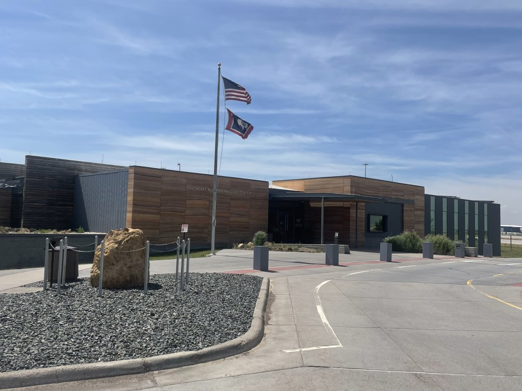
We stopped at the very modern Wyoming State Welcome Center. It’s more like a museum than a welcome center, with lots of interesting displays. The wind blew everything off our picnic table…
We decided to drive through Cheyenne, but there wasn’t much to see other than the capitol building and a very inactive downtown. Even though it was Sunday, I don’t think that was the problem.
Our campsite was about a mile off of the very heavily trafficked I-80. This part of the country is apparently home to the freight train industry with one plus mile long trains. I didn’t even know such things existed.
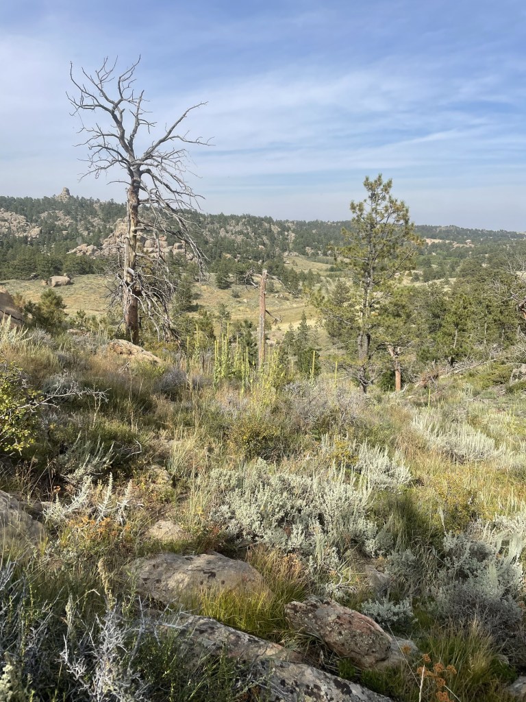
The campsite was absolutely stunning. A beautiful shelter for a picnic table, with a “designed by” plaque commemorating the architect. A spotless composting toilet and two sites with tiny houses. We set up camp, and walked around the interesting rock formations on the property, and over the ladder the owner had placed to allow entry into state land and the canyon itself.
After a brief scare when we couldn’t get the lighter to work we managed a pretty good first night camping dinner of steak and asparagus. The night sky was a spectacular tapestry of silver and black. The only downside was the I-80 traffic and train noise, which was constant. But it was more than made up for by the convenient and beautiful location. Elevation was about 7600-7800, and we could feel it.
The next day was a long day of driving the length of Wyoming. After we broke down camp, we drove through high desert with the Wind River mountain range on one side. Unfortunately much of the drive was on I-80, with 18 wheelers careening in the wind, and my fingers were sore afterwards from my white knuckled driving.
Some of the area looked like what I would call salt flats. Very desolate, with tiny hamlets of only 100-200 people. I especially liked the truck stop called “Stinker.” We even went through a small town called Eden, which had a few green fields.
Eventually we climbed higher and higher, suddenly saw evergreens, and the next thing we knew we were approaching the Tetons and Jackson.
We located our AirBnb in Teton Village, a major ski resort with lots of condos. What a change from what we had been driving through. J and I managed to get cleaned up – after a night of camping and days of driving we were pretty grimy – and rendezvoused with family. Time for a few days of real R&R – hiking and the like, and a nice break from the road.
After our excessively long summit day, I slept soundly, which is not as easy as it sounds when you are overtired and sleeping on a slab of ice in a sleeping bag on an ancient thermarest pad. I’m not exaggerating- when we took the tents down we discovered that’s exactly what we were all camping on. See photo!
After more oatmeal – which I was definitely getting tired of – we reverse hiked our way back to the van, starting with the Railroad Grade. This time, instead of wearing my mountaineering boots I chose to wear my brand new Merrill’s, breaking one of the cardinal rules of hiking – don’t go a long trek in brand new boots. The downward slog caused multiple top of toe blisters and no less than five toenails paid the ultimate price.
But I digress. The real marvel of the Railroad grade, which, you will recall, is a slim reed of a trail with precipices on either side, was my mountaineering boot miracle. T had tied them to the sides of my pack, where they inelegantly protruded out in an apparently not very secured way. At the steepest and narrowest part of the trail, I could feel one fall off. I wisely thought, well that’s it, there’s no way I’m going after it – only to have said boot drop right at my feet with nary a roll to the side. With luck like that I really thought I should buy a lottery ticket.
The other odd part of our hike out was that at one point J, who was still not feeling well, managed to pull ahead of me. It had to do with a river crossing that I took my time at….while another group was well behind. For what I’m sure was a brief few minutes, although it felt longer, the trail started to look terribly unfamiliar. I called out to John to no avail, and started to convince myself I must have taken a wrong turn – not that I even recalled seeing any paths veering off. Finally, some other hikers walked by and assured me I was indeed on the way to the parking lot. I was relatively sure that there could only be one such parking lot on Mt. Baker, so that calmed my frazzled nerves.
We finally all made it back to the parking lot, in a state of bedragglement. After all, we’d been wearing the same clothes for four days, some of us had been ill, and we were all footsore. We were too late for our planned celebratory lunch, so we stopped at a Food Coop in Mount Vernon, where we had a very elegant little picnic sitting on a wall in the store parking lot under the overpass.
After surviving Seattle’s quite notable traffic we made it back to the Mountain Madness office where our little band of adventurers broke up and went our respective ways. We’d all bonded on the trip – one of the great things about mountaineering is the relationships you can form with a good group of people. And another is the relationship you form with the mountain. You don’t climb it – it lets you do so.
I had been apprehensive about putting my crampons back on. But this trip confirmed that thrill is still there. Now we just have to pick our next adventure.
The first night of our expedition was the coldest of our three camping nights, and my feet never got warm. For some unknown reason I had failed to wear socks.
But the day dawned bright and sunny. This was to be our rest and training day. We were treated to a non oatmeal breakfast of surprisingly good scrambled eggs from a powder, topped with cheese and turkey bacon jerky. Who knew. SH had dispensed packets of instant oatmeal to everyone for the remaining days, which led to great confusion as to who had the right number of packets and what that number was. He’d also doled out lunches for the next days – wraps that we were already calling salami bombs and I’m sure they added to the weight of my pack.
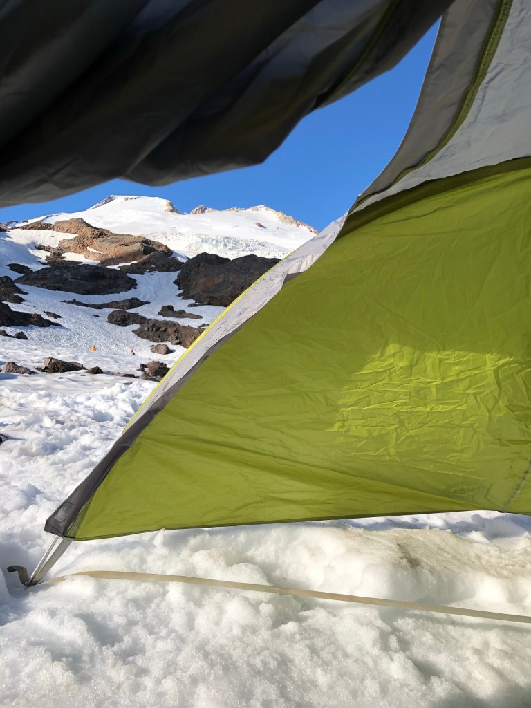
A view from our tent – that steep bank in the distance is the Roman Wall
After a leisurely breakfast we donned crampons and climbed up the nearby snow bank. There we proceeded to practice movement on the snow (duck feet, French technique), self arrest (flip your ice axe around, pick side down, plant it, dig in with your knees and feet, hips raised, and kick), and movement on a rope with a team. It had been four years so I was glad of the practice. M, one of the folks from Canada,was definitely the most adventurous on the self arrest practice – she picked up a lot of speed as she simulated her fall down the slope. J and I were a bit more cautious.
We spent the afternoon reading, napping, and prepping our packs for a 1 a.m. wake up call. I also spent quite a bit of time observing our comrades from other groups – campgrounds are second only to airports for people watching.
We had an early dinner of rice, orzo, the ubiquitous salami chunks, followed by a sunset walk, and were in “bed” by 8. Needless to say, sleep was hard to come by, but I know I must have drowsed off, waking about five minutes before the alarm, just in time to force down my two packets of instant oatmeal. At least we also had dried fruit, nuts, and chocolate chips to add to them.
We finally started off at 2:15 a.m., only 15 minutes after our appointed time. Slow was definitely a theme of this trip – after all, it was referred to as the “slow Baker” expedition in the marketing materials. But let me also add a little flavor. Of our five merry climbers, only M, J and I had worn crampons before, and M had not done so for years. T (friend of absent S) and TF (the other person from Canada) had never worn them. So all in all, I think we made a pretty good showing.
It’s always spooky to take off in the dark, accompanied only by the glow of the headlamps, but the air was perfectly still and I was hiking in only a soft shell jacket. We started off with our crampons on – which was great as we avoided the agony of having to struggle getting them on somewhere on the glacier in the dark.
After about 45 minutes we crossed a rocky area with a bit of scrambling and it was time to rope up – we were well onto the glacier. SH led a rope with J, T and me; H led the other rope with M and TF. Z and C were on their own rope. Z did decide to wear something other than his kilt for the summit day.
I could feel myself slipping into that zen like state of a steady pace where focusing on putting one foot in front of the other is the only thing in your head. I’ve so frequently channeled our guide Ossy’s instruction to me on Cotopaxi in Ecuador that you have to find your own way up a mountain. This time I also repeated SH’s mantra – step purposefully. Surprising how these mountain directions do a lot for everyday life.
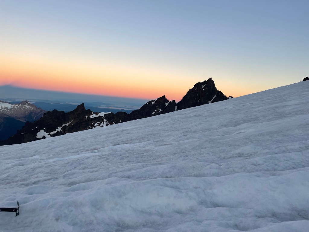
The trail was moderately sloped with a couple of flat platforms at 7000 and then at 8000 feet. There weren’t a lot of other groups but we were passed by some who were huffing and puffing – my goal was not to do that! The sun eventually rose and we could see the shadow of the mountain cast along the valley.
There were any number of crevasses that we had to wind our way around or step over, sometimes with the help of a snow bridge and sometimes without. The widest was perhaps 18 inches. They are eerie. You can see blue ice lining the sides and no bottom, and it looks like a fall would usher you into some completely other world.
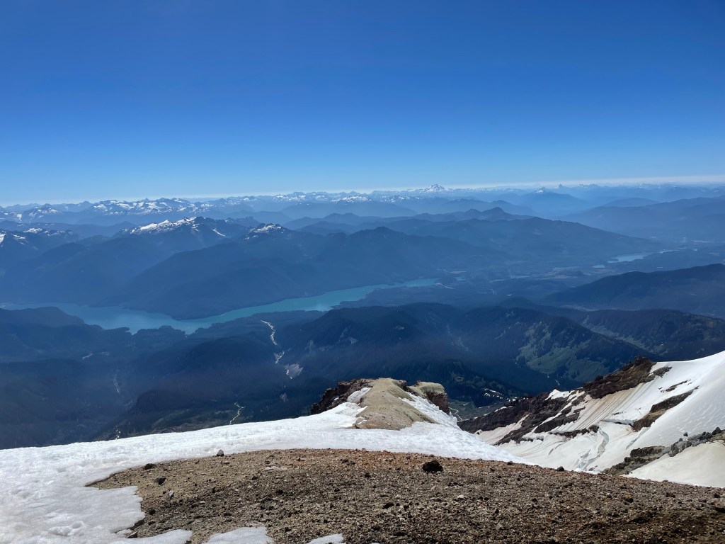
The crater
We ultimately reached the crater. The mountain is still an active volcano but I wasn’t really aware of any sulfur; it certainly wasn’t anything like Cotopaxi. I was conserving my energy so didn’t walk over to look into it, but I did enjoy my salami bomb. I was making a big point of eating a lot as I know in the past I have failed to do so and that does not work well in the mountains. In the meantime, I learned later that both J and M were feeling unwell, but what troopers! They soldiered on without a word of complaint and still with appreciation of what we were experiencing.
Finally we reached the so-called Roman Wall, unclear why it was so named, but it provided the source for a running series of jokes about the ancient Romans and their visit to Mount Baker. The Roman Wall is indeed steep; it is really the head wall of the mountain and considered the crux – that is, the hardest part. It’s the part I’d been dreading. It averages about 40 degrees according to what I’ve read, and starts at about 9750 feet.
The first part is a series of switchbacks that nicely ameliorated the steep slope. I’ve always said you can climb most anything with enough switchbacks. But near the top, they cease and there’s a straight vertical climb. Kick into the step of the person before you, step up, and repeat. Twenty five or so straight up feet of this. A few more switchbacks and suddenly you’re back on a relatively flat area with the summit not far away.
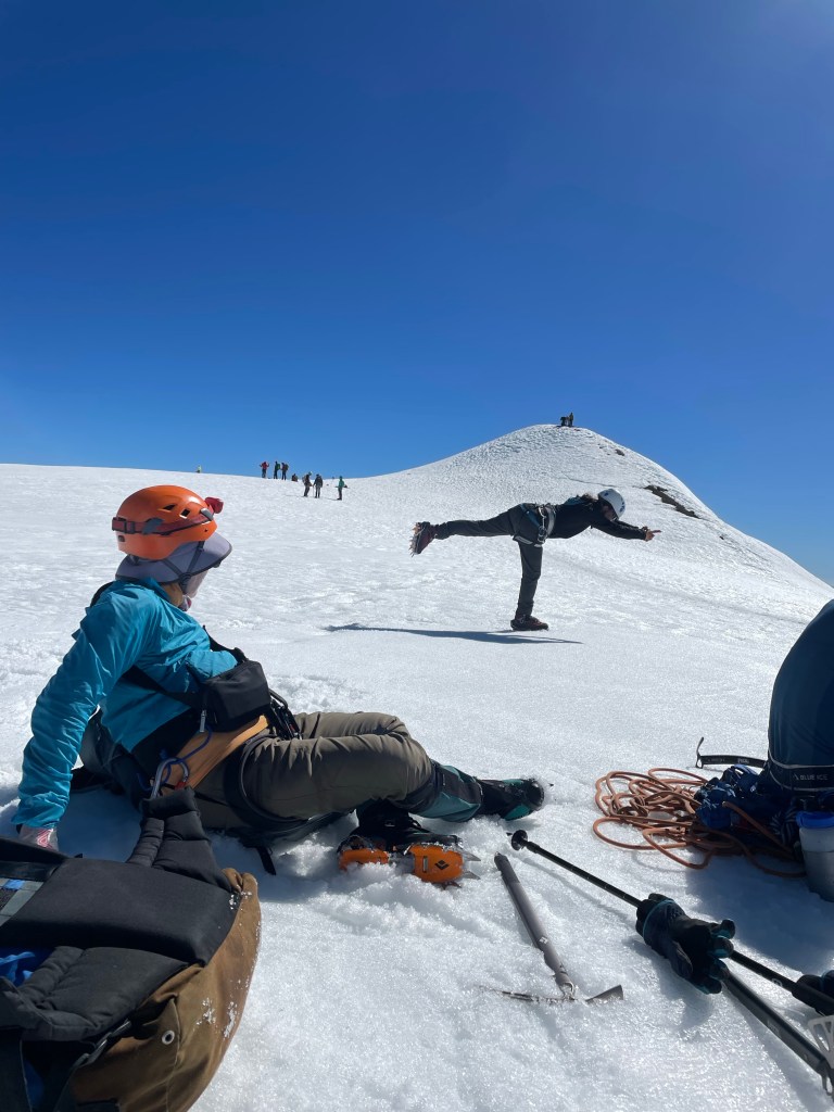
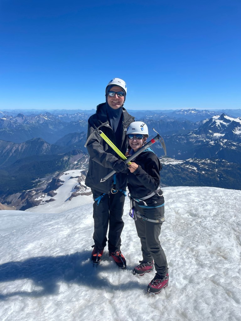
The summit is a small 50 foot high or so mound that protrudes off the flat area. Unfortunately I kept having the image of a pimple, which does not appropriately capture the grandeur of the view or experience. We all collapsed for a few minutes and I took my obligatory yoga pictures – but couldn’t wait to start up the final steps to the summit. It was about 8 hours since we’d started our jaunt.
The views were spectacular, as the photos show. And I once again had that top of the world feeling, that exhilaration that I’ve never really been able to capture anywhere but a summit.
I later found out that TF’s parents were from South Africa and in the early 1950s, when they were in their 20s and had been married for four years, had travelled to England, bought a 1933 London taxi for 50 pounds, and proceeded to travel 6,000 miles throughout Europe, camping along the way in their taxi. So many people asked them what they were doing they painted the facts about their journey on the outside of the vehicle – the media picked it up and the taxi became known as their traveling suitcase and they the “traveling suitcase couple.”
What a spirit of adventure! I’d say that TF – and all of us on this trip – were carrying on a bit of that legacy, even at much more advanced ages. I’m sure TF’s parents would approve.
But as I’ve frequently said before here, what goes up must come down – and so it was with this trip also. That’s for next time.
It was the afternoon before the trek/climb. After visits with family and friends – and an absolutely gigantic lunch in Gig Harbor (perhaps I am taking the idea of carbo loading too far) – we got an Uber and headed off to the Georgetown Inn in the Georgetown area of South Seattle. Known for being “gritty,” there are a lot of breweries and some interesting restaurants, but it is a long way from gentrification. The hotel had been recommended by our guiding company, but the desk clerk still seemed surprised to see our two very large backpacks walk into the lobby.
We located an Italian restaurant called Mezzanotte in what looked like a deconstructed building. Three levels of crumbling brick walls, ceiling tin covering some of them, and lots of people sitting outside. We were just as happy to sit inside and enjoy our fancy pasta – mine with king oyster mushroom Raghu and J’s with a very peppery sauce. We walked briefly around the neighborhood and back to our perfectly acceptable hotel – if a little noisy due to some bizarre mechanical noises that clicked and clacked throughout the night.
We woke up at 5:30 and met S, our friend from Alaska who was part of our Elbrus and Stok Kangri expeditions, in the lobby. We all ubered off to the Mountain Madness office, accompanied by three very large packs. The MM office is in a small house and there seemed to be at least three trips all packing up in various areas outdoors. Fortunately we found our correct group (I suppose otherwise we might have inadvertently gone ice climbing or something).
We met our fellow climbers – T, who is S’s friend and a pilot, two women from Canada (about my age or a bit older), and our guides, SH and H. Having nicely packed our packs, we now had to completely unpack, and lay everything out on the ground so our guides could confirm we had what we needed and left behind what we didn’t need. Apparently all of us had panicked when we got the packing video only two days before, which had led to multiple unexpected last minute purchases such as glacier glasses and sun hoodies! Two items, by the way, that I was very glad to have.
Everyone ended up leaving behind at least some items. I ditched my rain pants and second pair of pants. We reloaded our packs (my guess is mine was about 32-33 pounds), and met our porters, C, a Montana State student who was really serious about the mountains , and Z, a mid 20s exmilitary guy who was really serious about his sugar addiction. Z became best known on the trip for his hiking kilt – all he needed was a sporran!
After our packing and repacking extravaganza, we all loaded into the van, packs atop and in the back. We were enjoying trading travel stories with S, when just outside of Seattle he received a call to let him know there was a family medical emergency. S understandably felt he had to return to Alaska and pick up his wife so they could go where they were needed, so he ended up taking an Uber back to the airport. What a disappointment – this had been one of his bucket list trips. His friend T was a super good sport about it, and things were greatly eased by the fact that we really did have a congenial group.
We started off yet again, making a few bathroom and snack breaks. Z proceeded to sample every variety of junk food known to man (or at least available in Washington State), and I even found myself buying a large chocolate bar. Maybe it’s contagious.
Finally we turned off onto a series of dirt roads, gaining altitude over some teeth shattering potholes that sent the whole van rattling. We entered the Mt. Baker National Recreation Area, and traveled along more dirt roads, ultimately meeting up with all the vans and cars of other Mt. Baker adventurers. Vehicles were parked way down the road, but we were totally lucky and someone vacated a spot right by the trailhead. One final bathroom break in our last real bathroom and we were off!
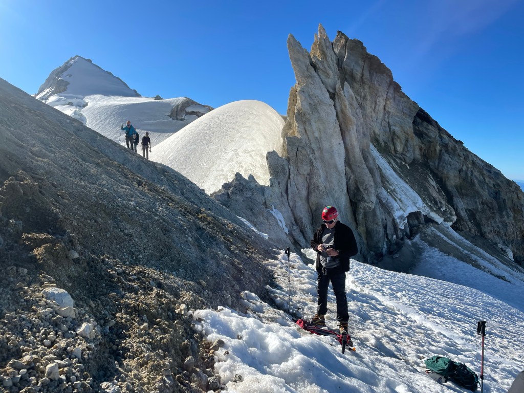
Our merry band
The trail starts off as an easy walk, even with a crushed gravel trail in some spots, but rapidly starts a somewhat unrelenting slope up. There are a fair number of dried out rocky river beds to navigate, tree roots to clamber over, and stone steps to climb. You first hike alongside the towering dark evergreens that stalk the trail; after some elevation gain the trees give way to shorter growth and meadows spotted with pink, purple, and white bell shaped flowers. I would have loved to use my plant identification app but there was no cell service and we weren’t stopping much anyway.
After a while, we reached the portion of the trail known as “Railroad Grade.” It’s a very skinny, straight ridge line that leads to Sandy Camp, which was to be our home for the next three nights. It is on an incline, although not particularly steep, but there is a lot of exposure. One side is a sheer drop down of rock and gravel caused by the receding Easton Glacier; the other side is a slightly less sheer drop into a wild flower covered meadow. I would definitely have preferred to fall meadow side, but neither option was very appealing. At times the path was barely a foot wide and you had to navigate over rock. At some point it must have been wider, making the trail look like a railroad track – hence the name, I presume.
Once we finished the Railroad Grade it was a short jaunt to camp (although maybe jaunt isn’t the right word when you’re lugging heavy packs). Sandy Camp is a small bowl quite close to the edge of the glacier and partly on and off snow banks. It’s somewhat sheltered from the wind – although wind was almost nonexistent while we were there anyway.
SH and H set up tents and we helped shovel snow to flatten out the foundation. As the temperature warmed and snow melted we ultimately found ourselves camping on quasi-islands. SH had to move his entire tent the next day because it turned out he was on a pond! C and Z, in the meantime, had to hike back to the lot to pick up their personal gear for the mountain and return again that same night. What a long day! Altitude gain was about 2300 feet.
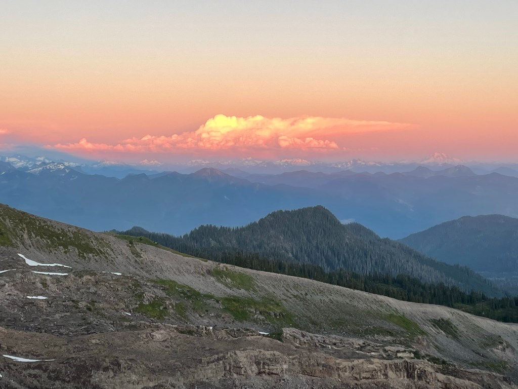
After we settled in, we had a dinner of Mac’n cheese and smoked salmon and hiked up to a nearby bluff to see a spectacular sunset. On one side are the majestic mountains of the Cascades, on the other, the glassy ocean with Vancouver Island in the background. The setting sun backlit the clouds and snow capped mountains turning everything a soft apricot. It was a good omen for the next day and our upcoming summit attempt.
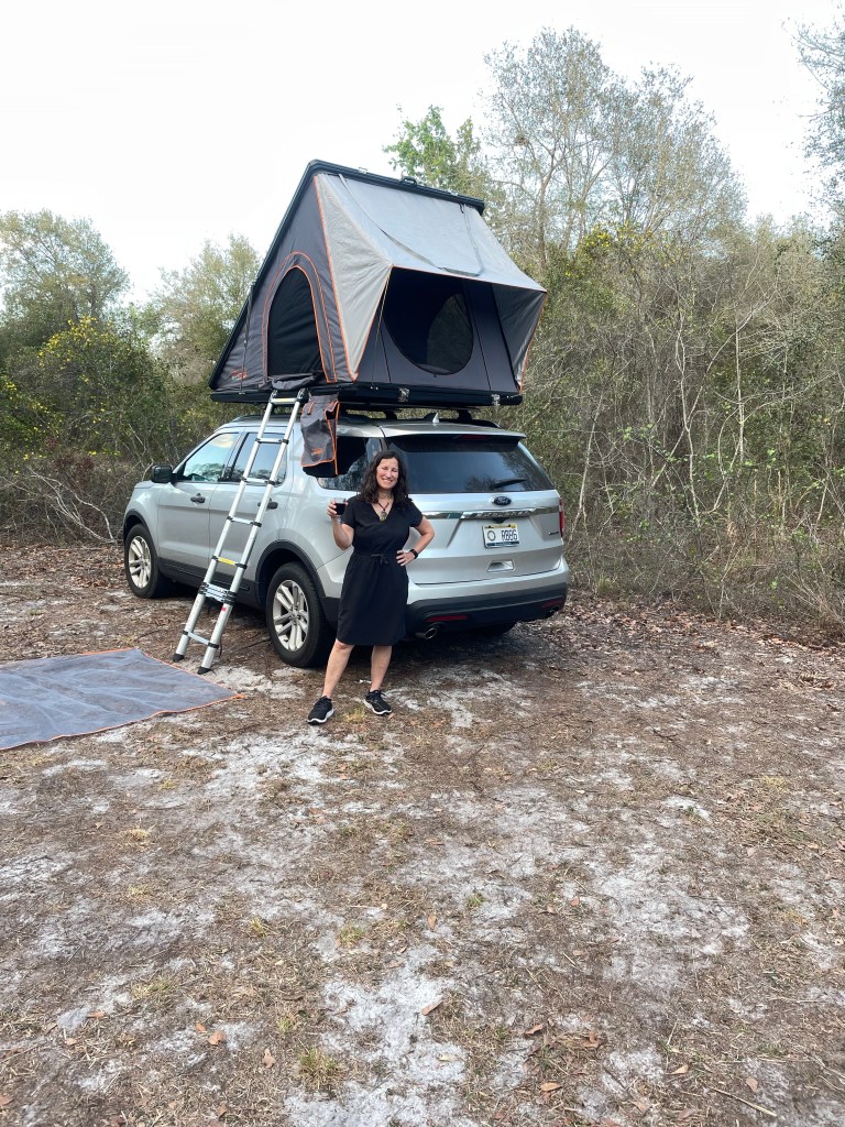
They don’t say a little black dress can be worn anywhere for nothing. A case in point.
The other week I was invited to speak to the Florida Young Lawyers division about mental toughness (which I call resilience) and my mountain climbing adventures. Having rejected the urge to show up in full battle gear – crampons, helmet, boots and the like – I decided my REI black travel dress would convey the necessary formality (these young lawyers were much more dressed up than we older lawyers tend to be) while still demonstrating that mountain “savoir faire.”
The event was in Tampa, and our plan for afterwards was to drive southeast toward the heart of Florida to a Hipcamp named Camp Catfish. It advertises itself as one of the top Hipcamps in Florida for 2021. It was a primitive site – no water, portapotties or any amenities (if you consider a port a potty an amenity). Just four leveled off pull in sites on a piece of property bordering the Peace River.
The drive to Camp Catfish took us along two lane county roads wending their way through fields of crops and citrus groves. I know Florida’s citrus industry is on the wane, but you wouldn’t know it when you’re in the midst of acres of orange trees.
Finally our GPS – yes, we had no address, only GPS coordinates- took us to a dirt road. Nestled along side were a few small farms and dwelling places – one was a “peace bus”. Truly looked like a spot for those living off the so-called grid.
We reached the end of the road and pulled into the campsite, marked by a Camp Catfish sign. Each site was large, with plenty of privacy. J and I immediately set to work – even though we’ve gotten a lot faster there’s still a lot of set up to do, and J insists on setting up an awning even for a one night stay. Hopefully some time we can go for two nights and enjoy the fruit of our labors.
Now what I haven’t mentioned is that I saw absolutely no point in changing clothes – hence I found my self erecting a privacy tent and making up the roofnest in a black dress! Well, I did change into tennis shoes. Like I said, those little black dresses go anywhere.
I did find something else to wear for a lovely short hike to the Peace River on the Hipcamp property the next morning. The river is home to many fossils – sharks teeth, armadillo plates, and the like – and the other campers were taking full advantage. They floated sieves in the river, dug up portions of the muddy riverbed and strained it through. They also had the biggest tent I’ve ever seen and I wondered if they were actually professional fossil hunters. After all, it was only $10 per night!
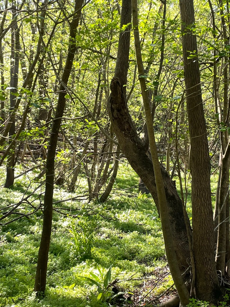
The hike itself took us through hobbit land. Covered in emerald green ferns, gentle rises and falls, and a canopy of old oaks.
I left the best for last. The night was moonless. There were no clouds or light pollution of any sort and the sky was embroidered with a thick weave of brilliant stars. Peace River. A wishful hope in these times.