I’ve been thinking about bridges a lot lately. Perhaps partly because I am living by a ten year construction project called the Ultimate I4. So far it has manifested itself as a series of disconnected bridges to nowhere. There’s nothing quite as majestic as running under an overpass, only to be met on the other side by a 1000 foot strip of raised concrete floating on mid air like some sort of giant teeter totter.
But I’m also thinking of bridges because I’ve been looking at photos of the trek to Everest Base Camp and have suddenly realized there are a heckuva lot of suspension foot bridges that cross extremely high ravines. I think I read somewhere that there are 27. Now, when I was much younger (and to be truthful, up to the present day) I used to have a recurrent anxiety dream that involved being stuck on a swinging bridge over a deep gully, absolutely frozen and unable to move either forward or back.
Grandfather Mountain swinging bridge – even scarier in the 1970s
I’m sure this goes back to the kernel of a true childhood memory (funny how “truth” becomes relative when you’re talking decades ago) when my family went to Grandfather Mountain in North Carolina. While I frequently recalled crossing the swinging bridge – from which you could quite definitely have slid through the side chains that were all that separated you from doom – I never admitted to anyone that I was absolutely terrified, right down to the white cotton ankle socks that I’m sure I had been made to wear.
Mountain climbing – or at least aspects of it – is like that. Regular readers may remember a post from a few years ago about training to climb Mt. Elbrus by scrambling around on my roof. ( Training Up on the Roof ) We did have leaves to remove from the gutters but I also thought it might help conquer a fear of heights.
I guess bridges will be have to be my next such training location. Making myself go forward one step at a time without freezing in place – that’s something to which we can all aspire. And these days, it’s a lot better to cross a bridge than to build a wall.
This wasn’t the summit but it looked just about the same!
For the last several years, we’ve spent that most politically incorrect of all holidays, Columbus Day, either in New Hampshire or Maine, together with Boston and New Bedford residents Daughter A and Boyfriend N.
And despite hurricane force winds in Florida, courtesy of Hurricane Matthew, this year was no different. Of course, we had planned for a Friday departure, but after even my office announced it would close for both Thursday and Friday, I was pretty sure that wasn’t going to happen. But it still took our So Budget It Shall Remain Unnamed airline until 4 am Friday to cancel the flight. For some unknown reason I’d woken up almost at the precise moment of flight cancellation and hence was able to have rebooked us before 5 – after which I immediately went back to sleep, lulled by the 60 mph wind gusts.
Saturday we woke bright and early to inspect the debris in the yard. The wind had howled most of the night, but Matthew’s 20 mile jog to the east had made all the difference. We made it to the airport, our one checked suitcase within one pound of an excess weight charge. All was going as smoothly as it could for a 24 hour delayed flight, until we learned that our Unnamed Budget airline had apparently forgotten to tell the first officer he was supposed to be on that flight. After about an hour, said Unnamed Budget airline snagged two pilots who had just arrived from Texas and who agreed to rearrange their schedules to fly us to Boston.
We finally arrived in Boston about 7 pm. After dinner at a nearby Peruvian restaurant (with Pisco Sours!), N drove us through the night in the old faithful Previa to Jackson, New Hampshire.
We had left our reservations late and knew we weren’t staying at a quaint New England B&B. Instead we were booked at an old style motel, run by a crusty elderly man who had clearly been asleep when we had to ring the service phone after we arrived at midnight. I must admit to a brief moment of panic when I saw all the lights off in the office and the no vacancy signs at every establishment in town.
But we managed to get ourselves checked in and even to wake up by 7 or so. Well, 7:30. Our original plan had been to climb Mt. Jefferson and then go over the ridge to summit Mt. Adams. But given the late start and the overall hassles of the last few days, even we recognized that perhaps that was overly ambitious.
We gave A the choice between a shorter and steeper climb or a longer and more gradual one. Ever the pragmatist, she went without hesitation for the shorter one – Caps Ridge.
It was about an hour drive to the trailhead, which was quite well hidden down a dirt logging road. It was a relief when we finally found the small parking lot and saw other hikers getting ready to start.
The trail starts with a fairly steep climb through thick woods. It was overcast and grey and proceeded to get more overcast and grey the higher we climbed. After a bit, the trees turned into skinny short birches, their white trunks looking vaguely unclothed with ribbons of grey bark hanging off them.
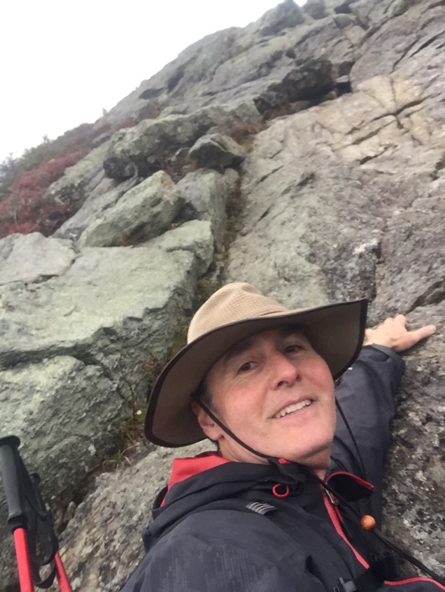
From the birches we climbed through scrubby pines and finally above the tree line. At that point, the bit we hadn’t been expecting – some real scrambling and rock climbing – suddenly appeared. Frankly, I thought it was harder than Mt. Washington up the Tuckerman Ravine Trail – although it certainly was shorter. There were at least three sections where we were looking for cracks to scale and I made good use of the shrubs growing on the sides as handholds. A had neglected to bring any gloves and J ended up doing it all bare handed.
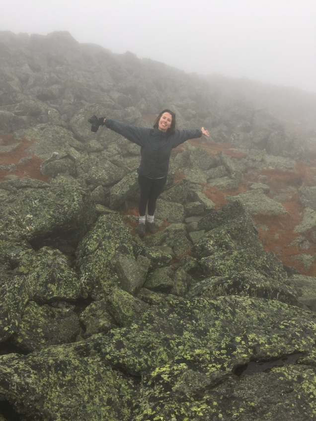
Toward the top there was a section of big boulders, covered in lichen, where you balanced along the edges of one rock holding on to the one above. It was like some crazy jungle gym that you had always wanted to try in kindergarten.
By that point it was all slippery and even greyer and A was showing tremendous resistance to the idea that a summit was really necessary, wisely reminding us all that what goes up must come down. But at that point, striding out of the mist, came a European climber who looked as though he’d just left the Matterhorn. According to him, the summit was only “10 or 15 minutes” away. Despite the fact we were now experiencing sharp dry pellets of hail, that gave us the encouragement we needed for that final push up.
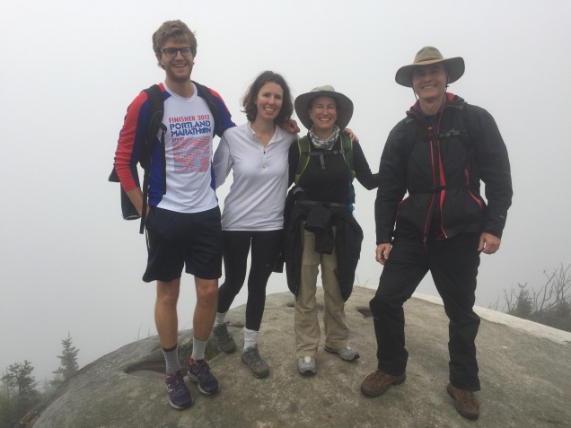
Of course, it took us 30 minutes, and the view from the top was as grey as the view from the bottom — but it was still the summit!
Summit!
We had made a commitment not to waste time at the top because we had all those sections of rock to slide down. And slide we did. My favorite part was when I saw a foothold several feet below my legs, and figured if I just started the slide I could grab on to a nearby branch halfway down to break my fall. Not very elegant, but it worked.
I ended up climbing a good portion of the way down solo. As I’m usually the slowest going up, I feel I must make up for it on the way down. I had a good head start and it seemed a mistake to intentionally reduce my pace. But voices don’t carry well in the mountains; I couldn’t hear my fellow hikers; and I spent a fair amount of time worrying I had drifted on to a rabbit trail or a dry stream bed and would plow further into the wilderness, never to be heard from again. And, I was without a phone since J had forgotten his and was holding mine to take photos. Big note to self. One group should not have all the phones!
Regardless, it was back through the scrub, the birches and the woods, and I was sitting on a log waiting for the other side when they reappeared not too long thereafter.
We were all absolutely filthy and wet. Back to our little motel, showers, and out for a short walk and dinner. The weather cleared and the brilliant fall foliage that we’d been hoping to see all day was finally reflected in the orange pink sunset.
And how better to conclude our climb in The Presidentials than by watching the presidential debate. Jeffersonian it was not.
Actually I’m not sure whether we took the high or the low road journeying from Aviemore to Scarborough – all we were certain of after six plus long hours of driving is that Google Maps had directed us in an incredibly inefficient manner.
Of course, some of it was likely our own fault. As we contemplated the comfort of traveling on four wheels instead of two legs – after 70 miles of walking that was the equivalent of a luxury jet liner – a side trip to a Scottish castle seemed in order. We had two in mind – the first was one that we found listed online and seemed to be on the way; the second, Niddrie Castle, was by reputation in the area S’s boyfriend P’s family hailed from in Scotland. But the best laid plans….
It turned out Castle #1, as I’ll call it, had, unbeknownst to the writers of the castle Internet site, been turned into an event venue. The rather imposing entrance into the grounds, was zealously guarded by a large sign welcoming all comers to Allie and Colin’s wedding. We contemplated having one of the young couples masquerade as Allie and Colin and make off with the wedding presents, but ultimately ruled it out as too risky.
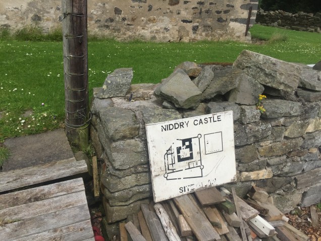
So, on to Castle #2. It turned out to be in a small village just outside of Edinburgh whose main geographic feature was an enormous landfill hill set beside a golf course. Getting there required going completely off GPS and driving along remarkably narrow roads that permitted no turn arounds (and needless to say, we managed to go the wrong direction on several).
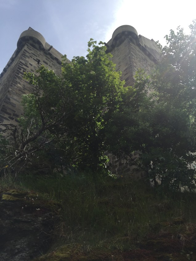
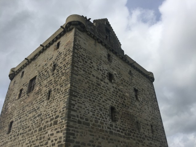
Niddrie Castle is the first very old castle that I have actually seen inhabited. All that’s standing is a rectangular building- but there were most definitely signs of dwellers. Outside the castle was a large, posted map of the castle plans, and we saw signs of some sort of renovation but of what wasn’t clear. You could walk the entire way around the castle and that path linked up to a nature trail running through the golf course. We had lunch out of the trunks of the cars in a muddy driveway just by the castle – it felt a bit as if we were eating in someone’s back yard, but I think P was happy to have seen it.
By then we had many miles left to go before we reached Scarborough, and somehow were routed through Glasgow which made little sense. Perhaps one of those occasions when an old fashioned map might have worked best? At least that would show us what was and wasn’t out of the way!
In any event, our route took us through the idyllic villages of the North Yorkshire moors…all of which required us to slow down to a crawl. And since we had heard of tickets by mail we were quite cognizant of obeying the traffic laws. But the most slowed down spot resulted from our encounter with several wooden gypsy caravans pulled off the side of the road. The horses were taking a break, and the travelers, as they’re known in England, were sitting outside on lawn chairs. It was as though we had travelled miles back in time as well as along the road.
A few days later, we learned that there was a travelers horse show in Scarborough, where horses are bought and sold and traded, and presumably that’s where the caravans were headed.
About 8 pm or so we pulled into Scarborough to our AirBnb. An Edwardian house, replete with a billiards table and multiple bedrooms. What more could one want than for half of us to get fish ‘n chips from a shop heated to about 900 degrees and the rest of us locate Indian food, also about 900 degrees. Life was good.
The last four weeks have been the longest break I’ve taken from blogging in the two years since I started this journey. And to think I stopped right before the exciting conclusion of the 70 mile hike along the Speyside Way.
But as we all know, sometimes life gets in the way, and it’s important to remember a blog isn’t actually a thru hike that requires you to march 20 plus miles every day when the spirit simply isn’t there. Self discipline is one thing, but walking for the sake of just putting one foot in front of the other starts to seem a bit pointless.
In any event – I’m back! And with the Speyside Way still to finish up, I have lots more subject matter for the future. For one, there’s the second week of our Scotland and England trip, which will feature Niddrie Castle (whoever has heard of it?), an aborted trip to another castle that turned out to be an event venue where we almost crashed Colin and Allie’s wedding, and a gypsy caravan on its way to the travelers’ horse show in Scarborough. There are also plans for the future – including, dare I say it? Yes? The Everest Base Camp trek in Nepal in May 2017. Seriously. And then there are my latest training adventures which involve discovering barre, a hip injury, new hiking boots….
But it’s important to finish stories before starting new ones, and when I last wrote we had just finished a lovely evening at the Dunallan House in Grantown-on-Spey socializing with our host from Northern Island. Did I mention that I didn’t feel like scotch so was handed our host’s six week old baby to hold while he poured “wee drams” for the others? I’m not sure it was a fair trade.
Our final day started off with medical care issues, involving trips to the chemist for more blister care products (nearly all of us) and tape for shin splints (P) and a strained Achilles’ tendon (me). After we finally made our way back to the trailhead, S’s ankle started hurting, and she decided she needed to ditch her hiking boots in favor of tennis shoes. Since they were in the bag being transported to our next stop, this necessitated P running a quarter mile back to the guesthouse before the luggage was picked up to retrieve said shoes…not sure that helped the shin splints at all.
Our last day was predicted to be the longest – over 17 miles presuming no wrong turns which was an impossible assumption for our crew. Our plan was that the three fastest hikers would forge ahead to Aviemore, check in at the hotel, take the taxi we’d reserved the 70 miles back to the beginning of the trail in Buckie, pick up the two cars and then drive back to Aviemore. All this because Aviemore was a good two hours closer to Scarborough, which was our destination the next day. It sounds a bit insane, but we couldn’t think of any other way to do it.
In any event, the morning hike was relatively flat. We were near the Spey for a bit but mostly inland. We hiked more or less together in the morning and paused for lunch in a beautiful, solitary wooded spot – except for the ubiquitous Scottish flies with which we were well familiar by now.
After lunch, J, P and S plowed ahead on their car retrieval mission. A, N and I continued on at a slightly more leisurely pace, made more interesting by A’s retelling of a Norwegian epic that recounted the life and legends of Od the Pointy. Really, that was the name – at least in her pronunciation. Anyway, she’d just listened to it on a podcast and proceeded to give a remarkable verbatim account. It lasted a while since Od lived to be about 300 years old. Hiking mile after mile you start to realize how and why epics evolve!
We crossed field and forest, finally encountering rugged moors that were more what I had actually envisioned the whole trail to be rather than the gentle farmland much of it was. We were approaching the Cairngorn Mountains, many of which still had patches of snow, and their dark and brooding presence cast shadows over the moors.
When we reached mile 16, there was, of course, a decision to make. We could blindly follow the sign pointing to “Aviemore,” or we could ignore it and instead take the road to the “town centre” where we’d already seen another couple of hikers go. Being a lawyer, I, of course, opted to follow the sign as precisely as possible – only to find that we’d put ourselves on a loop hike called the Orbital that added at least two extra miles to our trek. We finally found someone to ask for directions -a young woman walking two golden labs. Just as we’d finished our conversation another woman with a pit bull walked by and we were treated to a very messy dog fight.
In any event, our triumphant March into Aviemore ended with a traipse through a vacant lot near a housing development. That brought us out on the main road, and victory of victories, we located the Ravenscraig Guesthouse.
The other three of our party had indeed already made it to Aviemore and gone off to get the cars, so A, N and I cleaned ourselves up and found the Ski-Ing Doo pub. That truly was the name. There was a ski resort nearby and the whole place was themed around skiing – with some odd touches like lamb steak burgers. And I’m pretty sure haggis was on the menu.
J, S and P joined us about 7:45 pm after driving 70 miles back from Buckie. Our five day hike had taken less than two hours by car. But somehow I think we gained a lot more than just miles by walking.
As a reminder, this summer’s adventure was a 70 mile hike along the Speyside Way in the Scottish Highlands, followed by a week in Scarborough on the North Yorkshire Coast. By day 3 of the hike we had sampled lots of scotch, eaten some very interesting food, and were getting in the groove of plus 13 mile days.
Day 3 was supposed to be easy, and it was mainly flat, even though the distances were longer than promised. This is the point at which I became convinced that a Scottish mile is simply longer than an American one. But easier walking didn’t mean there weren’t other issues – this time of the directional variety.
After a nice breakfast at the Craigellachie Lodge – which included a “wee dram” of scotch in daughter A’s porridge – we got a late start and stopped for lunch only two miles later at a small town called Aberlour. By then my sunglasses had broken so we went to a chemist’s – where the only women’s sunglasses resided in a plastic box in the depths of the shop – which took the sales girl about ten minutes if not more to ferret out. Apparently there’s not much call for sunglasses in the Scottish Highlands.
After dilly dallying around, it was time to make some miles. Scents distinguished day 3 from the others. They ranged from honeysuckle to breath of wild rose to anise to the yeast into sharp spirits smell of the distilleries.
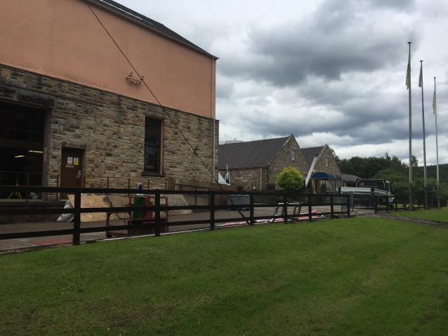
There were quite a few distilleries along the way, but tourist friendly most of them weren’t. These aren’t anything like the welcoming wineries you find throughout California and elsewhere. The distilleries are definitely a product of the Industrial Revolution and they maintain a stern factory like appearance – replete with lots of metal, brick, tubes….quaint, they aren’t.
Distillery close to Ballindalloch – the ones on the river were even more forbidding
By mid afternoon we’d spread out, with daughter S and boyfriend P well in the lead. That meant that when we arrived at Ballindalloch after many miles of hiking, expecting to find our next hotel immediately, they were the first to discover that there were simply a few holiday cottages by the trail, none of which was for us. Ever resourceful, they asked directions and finally realized it was another two miles, off the main trail and on what’s called the Tomintoul Spur. Needless to say, all this had to be conveyed back to us stragglers, which required much use of our free texting on our close to dying phones.
As we were all somewhat dubious about where we were going, it was a relief to find the Delnashaugh Hotel, a very nice small hotel just off the A 95. No, the last couple of mile weren’t particularly scenic – for much of them we clung to the side of a two lane highway hoping the speeding cars wouldn’t sideswipe us.
An added benefit of the hotel was a really excellent restaurant and a very nice bar.
Day 4 involved the two mile trek back to the trail, and another thirteen miles (that is, a Scottish thirteen miles) to Grantown-on-Spey. This was possibly the most beautiful scenery of the entire hike. Along the river and between fields, past a huge bull with a ring in his nose – separated from us by only two strings of barbed wire- baby calves and lambs, and deer. S and P even met a large and friendly horse near a farm, following which they took a wrong turn down what turned out to be a driveway where they were pursued by a very small and yapping guard dog. We then traversed forest and more fields into a magical hidden valley, complete with babbling brook and wild flowers. Lots of uphill today – even one section steep enough that steps had been kicked into the grassy incline.
After a very nice lunch – at the edge of a forest with a view over the valley – more fields and forest. We must have gone through every variety of metal gate in existence.
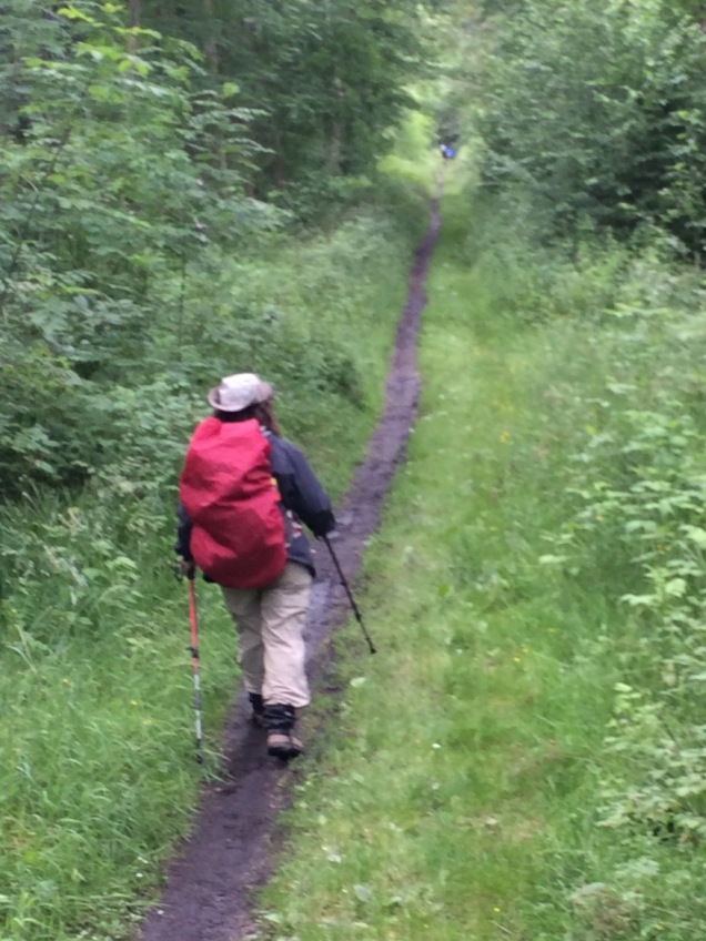
I especially loved crossing muddy fields with little portable bridges and stepping stones over the muddiest bits.
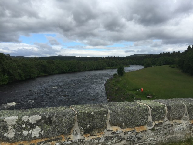
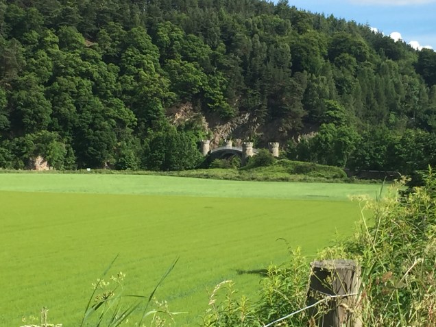
At Cromdale we crossed the river and collapsed in front of an old railway station – only to learn we had another 3-4 miles left. They seemed neverending – especially those through a forested park with very few directional signs right outside the town. But eventually we made it to Dunallan House, where we received a warm welcome from the owner, a native of Northern Ireland, who offered scotch and lots of stories. Incidentally, the interesting bridge below turned out to be another of our wrong turns!
After our kick off dinner in Sale (don’t try googling “Sale United Kingdom” – a place name will not be your first hit) and a night in Buckie at the Rosemount Guest House, we got a relatively early start for our first and easiest day – about ten miles to Fochabers.
Fortified by Indian food the night before, and a breakfast of smoked salmon and scrambled eggs, which seems to be a Highlands favorite (and kippers for some!), we retraced our steps to the trailhead we had supposedly already located. After a few wrong turns that took us down some alleys we made our way to the edge of the Firth of Moray. We walked on a well laid path by glassy silver water, passing small cottages where various inhabitants gave friendly, but rather bemused greetings to our party of six hikers.
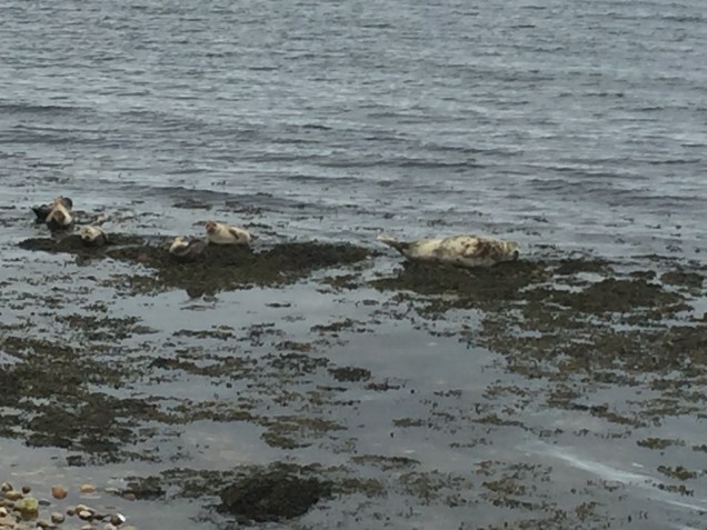
It was five miles to Spey Bay. Wild flowers were everywhere – scarlet poppies, pink and purple foxgloves, brilliant yellow gorse. And lots of animals, too. Many dogs were being walked; sheep grazed contentedly; and a family of grey seals swam beside us for part of the way.
We stopped for lunch at Spey Bay, which is part of a dolphin research center. It features two old ice houses, a small museum, a path to the sea amid the rocks, but most importantly, a bathroom and a picnic table. We were also introduced to the dread Scottish midges we’d been warned about.
The trail then cut inland through varying landscapes – planted pine forests of serious uniformity, native forests filled with an abundance of different trees, riverfront with anglers fly fishing and wearing thigh high waders, and small paths between fields. The weather changed from rain to sun and back again on a steady rotation. At one point we passed someone who must have been a birder – wearing a most peculiar garment that may have been an oil cloth coat – something I’ve read about but never actually seen. Not a lot of hikers though.
We arrived in Fochebers in mid afternoon. Entering the very small town via a park with a river vista and a manicured bowling green, we made our way to the Gordon Arms Hotel, and managed to find the sole pub in town for a post-hike pint. The hotel, a faded, rambling place, had the only actual restaurant in town. We sampled six different Speyside Way scotches, and feasted on game pie (venison, partridge, and pheasant), haggis in cream sauce (surprisingly good), and cullen skink, a thick soup boasting smoked haddock, potatoes, and onions.
And this was just page 1!
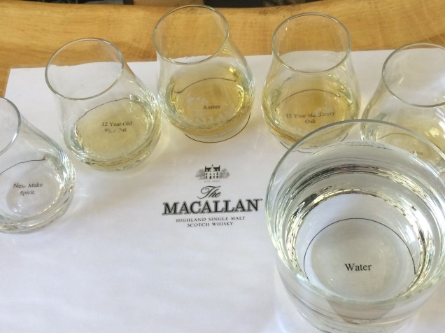
Day 2 of the hike was supposed to be more difficult, and our one reserved distillery tour at The Macallan, as it’s known, was at 3 pm. Hence, we took off early and set a brisk pace, even counting breaks, which were few and far between. Day 2 presented fields, forest, and some very muddy uphill that was the equivalent of 160 floors according to my faithful Fitbit. And wildlife today included two deer and rabbits (which seem exceptionally large and warrant the title of hare, I think).
After 13 or so miles, we arrived in Craigellachie about 1:30. We stayed at a lovely small guesthouse, likely the nicest place we would stay. There was a beautiful garden and slippers in the rooms (which the daughters and boyfriends took and used religiously for the rest of the trip – I’m sure they will end up back at their homes in Boston and New Orleans).
After a picnic lunch in the hotel lounge we decided to forego the walk to the distillery and splurge on a taxi. The Macallan is very aware that it is an impressive operation – they don’t even let you take pictures in the manufacturing areas – lest their secrets be revealed I suppose.
Craigellachie is a very small and seemingly high end tourist town- with an expensive dress shop and nowhere to buy food. It seemed like an appropriate place to have dinner at The Copper Dog, a well known Scottish restaurant that, according to J, is being replicated in Dubai!
Finished the day with wine in the drawing room of the hotel – contemplating the number of miles tomorrow would hold.
The reward for a week of pre-vacation hell at work – those of you in the working world know what I mean – was possibly the world’s smoothest trip from Orlando, Florida to Manchester, England. J and I were able to meet my parents at Gate 75, stop at a restaurant, and travel all the way to Gate 83 for our Virgin Atlantic flight. I’d never flown Virgin before, and it lived up to its reputation as a luxury flight even for those of us in lowly economy.
But the best part? We were able to board early – due, I believe, to my father skillfully asking for his cane at just the right moment and within earshot of the gate agent. After we arranged ourselves and our hand luggage into our seats, it seemed boarding was taking an inordinately long time as hardly anyone else had joined us. Then I realized the flight attendants (all wearing those elegant red VA suits) were closing all the overhead bins. At that point we realized the flight was less than half full – there were only seven other people in our section of the 747! We were all able to have our own row to stretch out on. It had been years since I didn’t feel like a proverbial sardine in a tin can on a trans-Atlantic flight.
Once at Manchester we met up with daughters A and S, and respective boyfriends N and P, whose trip on budget Thomas Cook Airlines had been anything but easy. The entire computer system had gone down at checkin and the agents were handwriting boarding passes. When was the last time you traveled with one of those?!
In any event, after a rather long session at the rental car booth, the daughters/boyfriends took off to the hotel – P, the driver, looking a little white-knuckled during his first experience of left hand side driving – and J and I left in the other rental car to take my parents to their friends where they will stay while we hike the Speyside Way. I’m hopeful that was our most difficult drive. It involved narrow car lined streets, lots of traffic, pedestrians with a strong sense of entitlement, a world festival with parking problems that had resulted in a street with room only for one vehicle, topped off by a hairpin turn that took multiple starts and reverses to accomplish.
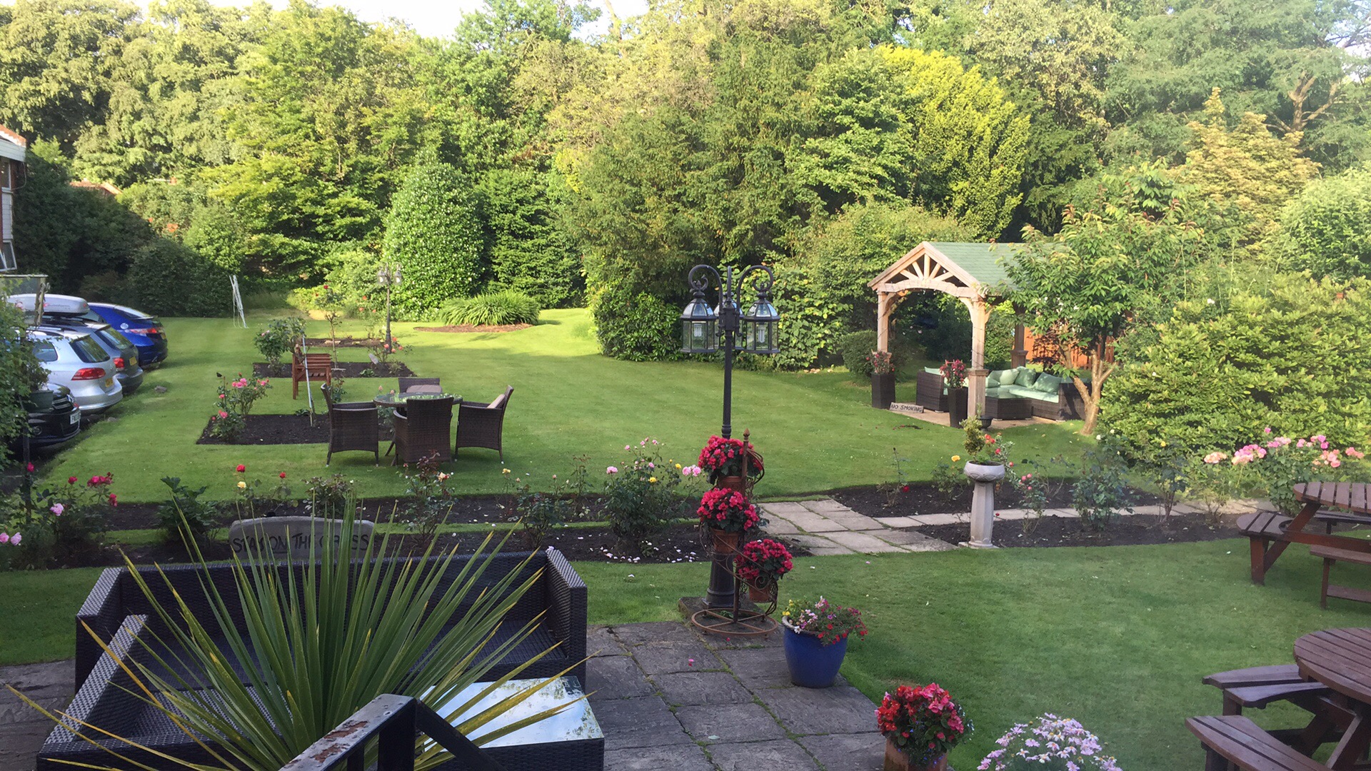
We stayed at the Normanhurst Hotel in Sale, a small town on the outskirts of Manchester (best known for being close to the stadium where Manchester United plays). It had beautiful gardens, very small rooms, a nice sunlit bar, and a dining room that was populated by semi-elderly people who looked like they came there regularly for their weekly night out. It felt just like the type of place I would have gone to with my Yorkshire grandparents in the 1970s.
The next day the six of us fit ourselves, our backpacks, and our suitcases into the two cars, and started north on our eight hour drive to Buckie. Weather varied from sun to rain to glowering clouds, all in the space of thirty minutes, and then started all over again. One of our stops involved a trip to a camping store to buy yet more rain pants.
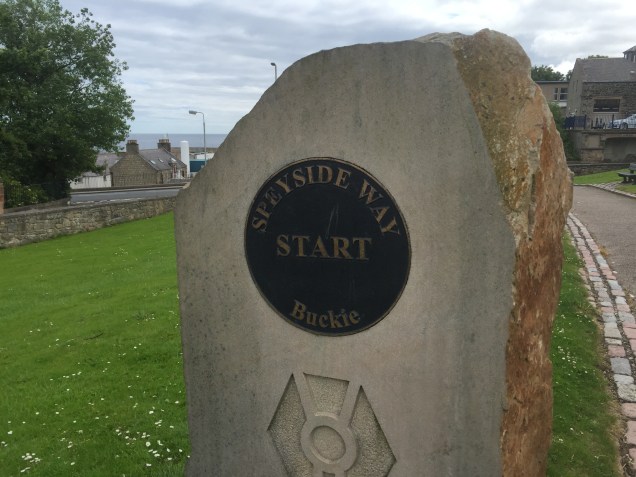
After only a few wrong turns – which resulted in some miles on the “B” roads – we made our way across the Grampion Mountains to the River Spey and on into the town of Buckie, a town of 8,000 on the coast of the North Sea. The buildings are universally grey/brown stone, which matches the grayish Firth of Moray (what a great name!), which I can see through the window of our guesthouse as I write this. We topped off a long day of driving with – of course – an Indian meal – it was the only restaurant open in Buckie at 7:30 pm when we arrived.
The Firth of Moray at sunset in Buckie
The walk begins today. We located the trail head in the middle of the town square last night, and it is now Westward Ho!
Ok, so Speyside Way isn’t much of a summit. In fact, much of it seems suspiciously close to a river bed, and it’s still unclear to me how much above the ocean rivers can be anyway. I mean, they run downhill, right? Where do they start?
Regardless, the Speyside Way is so darn far north on the globe that it should still count as a summit of some sort. I can’t rid myself of this vague idea that things to the north must be higher than things to the south. And, of course, if you live in Australia you must get very tired clinging onto the earth for dear life so you don’t fall off.
Yes, there are true mountains for us in the future including Katahdin in Maine. And we hope Mont Blanc next summer. But for now – it’s four weeks to our multi generational trip to Scotland and England. More on all that to come in future posts.
As six of the eight of our traveling party will be engaged in a 67 mile hike in the Scottish Highlands during week one …. there’s still got to be a gear check. Admittedly, this is luxury back packing (glampacking?). Our luggage will be carted along by a taxi between b’n’bs and small hotels and we only have to carry daypacks. A far cry from the barrels on Mt. Elbrus. (Yes, for those of you new to this blog – you really do stay in converted (but large) oil barrels on Mt. Elbrus.)
Nonetheless, we’ve learned from experience – there’s still gear that must go with you even while glampacking So what does this trip entail?
Hiking poles. Everybody but me on the trip rejects them, but after day 3 they will be thanking me.
Headlamps. Who would have thought you needed them in Mt. Washington in October but after a late start and letting all the French Canadians celebrating Canada Day pass us, it was a pretty dark descent.
Hard candies. I’ve sworn by these since Kilimanjaro. Cinnamon is the best but husband J swears by cherry.
Everything waterproof. I have a strong feeling that there is is a lot of rain to be experienced north of Aberdeen. As we celebrate Tropical Storm Colin here in Florida this week the wet theme is definite front and center.
Gloves. Need I say more. Cold hands. (Not small hands.)
Ibuprofen. It will make everything feel better. Especially after a couple of 15 mile days.
A kindle. Weighs nothing. Battery lasts for months. And you can cart an entire library with you. There’s a lot of down time on hikes. You need a good book to read.
The last couple of weeks have involved being sick, attending graduation, Mother’s Day, out of town business trips and a serious lack of any sort of exercise. And no blog post last week.
It all started almost two weeks ago Monday when “she who never gets sick” felt and was sick as a dog that night. (I wonder where that phrase comes from. My cat does just as good a job as getting as sick as the dog.) Work was out of the question the next day as I knew I would be about as welcome as an ant at a picnic. And of course being sick then led to the inevitable “I shouldn’t exercise until I am really and truly better” – which, while doubtless good advice, is sort of a nice excuse for a little break.
But all breaks must end — not to mention the profound fear of every 55 year old that if you stop exercising you’ll never be able to start up again – that spinning tire will just slow down and there won’t be any gas in the engine to start it up again. So Saturday I was back at it – only for a four mile run since it has been an entire two weeks, after all.
And not very fast. Last time I ran it was a beautiful dry day. And today it was a beautiful humid day with temps, I’m sure, in the mid 80s. The contrast is huge. Those of you who run in dry air don’t know what it feels like to run through a sponge. I have to believe it’s good for you. Somehow? Maybe?
The other remarkable thing about running in this weather is the difference between shade and sun. On days like this I find myself criss crossing streets and paths to find that 12 inches of shade. It may only be a few degrees but it makes a difference.
I’ve been following #EverestNoFilter on Snapchat. (Ask someone under 20. They can tell you how to do it.) It’s a real time account of Adrian Ballinger and Cory Richards’ attempt to climb Everest without oxygen and is probably as close as I’m going to ever get to that summit. One of the things they talk about is the sun/shade contrast on the mountain. A T-shirt on one side; a down suit on the other.
Those contrasts can be a pain to deal with. But without one we certainly wouldn’t appreciate the other. Some might characterize it as meaning the grass is always greener on the other side of the fence. But, for those of you old enough to remember Erma Bombeck – the grass is always greener over the septic tank. Now, that’s a contrast we can all appreciate.
Where am I going and where have I been? The Big Island, 2013
The last thing I expected in May of 2014 when I hesitantly pressed the “publish” button (see https://fromswamptosummit.com/2014/05/12/how-it-began/ ) was that two years later I’d still be writing this blog. What started simply as a means to keep family and friends informed about our upcoming trip to Russia to climb Mt. Elbrus ended up being a weekly place to muse about past adventures, think about new ones, and contemplate the here and now in between them.
And as my 55th birthday comes and goes – serendipitously I was born on what 9 years later became Earth Day – it gives me a moment of pause to reflect about the last five years and consider the next. As a friend of mine put it, somehow the “five” birthdays that split the decades seem even more significant than the “zero” ones.
You see, this entire mountain climbing, summit seeking, trekking business all started when husband J asked me what I wanted for my 50th birthday. And surprising myself, “climb Kilimanjaro” was what popped out of my mouth. Hey, it could have been a lot worse. At least I didn’t say “Redrum.” And over these last five years, we’ve climbed a heckuva lot of mountains and trekked a boatload of trails. And this was for someone who had last slept in a tent at age 18 and hadn’t run over a mile since her first early 20s. Yes, I did yoga and dance and all versions of 1980s aerobic classes (remember those?!) but it was hardly the same.
Dead Woman’s Pass, Inca Trail with the Family, 2012
So we’ve got this summer worked out – not really a summit, but the Speyside Way in the Scottish Highlands with the Daughters and the Boyfriends. But that alone isn’t quite enough to provide the inspiration that I increasingly need to drag myself through the dreary grind of daily work. What I really need is to figure out the next mountain. After five years of doing this, J and I have realized that some of our ascents have been due to the combined luck of excellent guides and decent weather and not and because of any great skill on our part. So perhaps a mountaineering school is in order – to add some real training to what we’ve learned on the run.
There’s one in Mont Blanc that I’ve got my eye on. After all, in another five years I’m hoping I’ll be getting ready for the summits of the next five. I was born on Earth Day. How can I not be an optimist?