The beauty of taking a road trip under the guidance of Google maps is that, Dr. Seuss-like, you’ll never guess the places you’ll go – or the things that you’ll see. And such was the case this weekend when Google maps itook us off I 4
and routed us onto Florida Road 570 and 540 – and then continued to take us down 17 South cutting across the great state of Florida – until we finally met up with I 75 near the Gulf and made our way to Naples, location of my law firm retreat.
One of my favorite parts of Google maps on this particular adventure was its insistence that we were traveling north – despite all indications to the contrary, including road signs, Google’s own moving map, and the location of the Gulf of Mexico itself ahead of us.
Living in metropolitan Central Florida it’s easy to forget that Florida still has vast swathes of rural land. Cows graze in brownish green meadows and rest in the shade of the curtains of Spanish moss that cascade down from clusters of live oaks. The land has just a little roll to it, just enough to envision it once as the sandy floor of a lapping ocean.
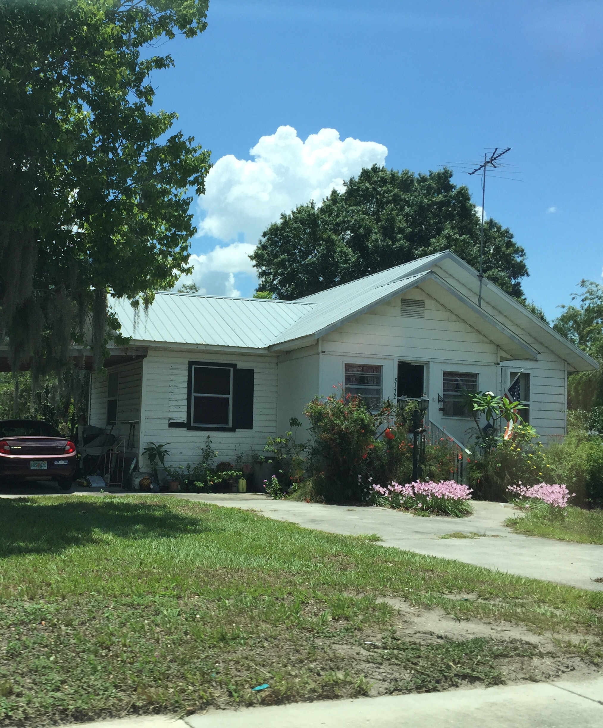
Every few miles you happen upon yet another small town. Most of them seem to have escaped the scourge of McDonalds, Chick-Fil-A and Burger King. In fact, the one time we really only had time for fast food all we could find was slow food. The Double JJ Restaurant, the Pioneer Cafe, Smokin’ Joe’s BBQ. It wasn’t until we returned to the interstate that the familiar chains showed up again.
Small town USA no longer looks like Archie Bunker’s US of A. Smokin’Joe’s is right next to the Taqueria and the place that specializes in wiring money to Mexico. In towns like Zolfo Springs and Bowling Green and Cleveland, the Pioneer Restaurant is across the street from the Acapulco Cafe and the Mercadio. In the fields growing who knows what, converted school buses were busy delivering migrant farm workers to do the back breaking picking of whatever it is that we only encounter in the pleasant coolness of the produce sections in our local grocery stores.
After passing through Polk, Hardee and DeSoto counties, as we neared the Gulf, stucco walls surrounding golf communities started to partition the wide open spaces. The old Florida cracker tin rooves gave way to the repetitive Florida idea of Mediterranean tile. Funny how those Mediterraneans had garages as a central feature of the facade of their houses.
Despite all that nothing beats the glassy lake of the gulf or its sugar sand that was waiting for us in Naples.
We returned home the same way. We stopped to eat a quick picnic lunch in a small park across from the DeSoto County Courthouse. Somehow that seemed an appropriate way to end a law firm retreat. And what better way to prepare for the mountains of Ecuador in three weeks than to really experience the Flatlands of Florida.
As I plowed uphill on the first half of Saturday’s seven miler, I reveled in the knowledge that the backside was going to be all down. I was running a new route – through “downtown” College Park, our area of town, all the way up Edgewater Drive, past the public high school, the Catholic high school, an abandoned juke box store (who has thought of those for a while?), a gun shop, a driftwood designer, and assorted and sundry other small establishments.
But after I turned around at the half way mark, to my utter horror, nothing but uphill faced me. I kept running along, confident that at some point I was bound to find the downward trajectory of the long hill I was sure I had climbed. But none was to be found, at least until I reached the very short half block leading down to our lake.
I’ve been punked like this before. Mt. Elbrus has a fake summit that after several hours of climbing looks like the real thing. And on the long slog down, the random metal structures that dot the slopes of Elbrus all resemble the barrel huts we were staying in. Not to mention our explorations of the buttes around Sedona, Arizona where I was convinced that each arch must have been the one that would lead us out of the vortex and to the parking lot that housed our rental car and escape to civilization.
I can’t risk thwarted expectations on the way up Cotopaxi, much less Chimborazo or whatever other mountains we end up climbing. They stop you in your tracks; they bring you down – figuratively, and in the case of climbing, literally. I just need take each step in the moment, so that when that summit finally appears, or the refuge hut out of the winds can be seen, it’s a wonderful surprise.
And maybe it’s not so bad not to have the downhill stretch. There’s either an optical illusion where long flat stretches ahead of you appear to rise up in a gentle swell – or, it could just be the fact the prescription in my sunglasses is wrong. But the real point is that maybe something that can feel so hard is really easier than you’re letting yourself believe. Maybe the world is flat after all.
Husband J and I have been walking different chunks of the West Orange Trail for about the last year, as memorialized in “A Walk on the West Orange Trail” and “The West Orange Trail – Starting from the Other End.” But we also had an overarching desire to see if we could walk the whole thing in one fell swoop – well, at least 20 of its 22 miles. (The very last couple of miles – mostly along the side of a busy street in Apopka and culminating in the middle of a sidewalk in front of a strip mall – are simply not worth including.) After all, we reasoned, if the Romans could march miles like that in one day while laden with armor and the spoils of war, surely we could manage it with hiking boots and backpacks.
So, early on Saturday we set out with a couple of friends who had agreed to participate in the initial stages – M, of Iceland fame (see the prior weeks’ Iceland saga), one of my law partners who is affectionately known as King A, his daughter A, and her large, brown brindled part Weimaraner who shall be known by her full name, Daphne.
It was a beautiful, if humid, day and the first five miles to Winter Garden were like a walk in a shaded park along oak lined paths. The park theme was particularly evident as we passed a meadow inhabited by ostriches and long horned cattle (or maybe buffalo?) – not what we were expecting amid the Spanish moss.
The amount of rapid development along the trail is incredible. In the months since we were last there houses have sprung up like proverbial mushrooms. While many developments are promoting their ecofriendly characteristics, the fact remains that each of them is occupying what used to be open Florida land.
Just before mile 5, M abandoned us to return to a more normal day of activities. King A and his daughter left us in the charming town of Winter Garden – after Daphne lay down in the middle of the sidewalk and clearly announced she had had enough.
Downtown Winter Garden
Miles 5 to 10 wind through multiple housing developments and old citrus groves; they pass warehouses and fields, and the site of the Ocoee high school sustainable agriculture program, where three students were tending a cow. Some of the housing developments share great swaths of green semicircular common areas surrounding retention ponds – the manicured grass for all intents and purposes looking like a giant green unibrow. But where were all the people? It was as sterile as a glossy page from a magazine. When we walked through some much poorer areas later on the outskirts of Apopka there were men outside sitting on lawn chairs, kids playing with hoses, people walking down the trail to actually get somewhere.
Only in Florida – hill warning with no discernible hill in sight!
At just after mile 10, we decided it was time for lunch and eventually located a bench in the shade of a freeway overpass, with a golf course running along one side. I had started off in running shoes, believing their light weight would help with the distance but had packed my boots just in case. By mile 10 it was clear it was time to shift footwear. So after a sandwich break and foot ministrations, we set off for the final 10.
Things, as they are wont to do, got even stranger during the last half of the hike. As we neared the end of the seemingly interminable golf course, lining the other side of the trail was a field dotted with bright flowers – which after a few moments we realized was a memorial garden. We had been thrown off by the office building – a small frame house with a filled in swimming pool. Huh? And I’m not sure what the proximity of the memorial garden to the golf course says about the nature of human existence but it doubtless means something. We also concluded that Apopka must be slightly higher than Oakland, at the beginning of the trail – although there were no real hills, we kept going up a steady slight incline – and never seemed to get to go down.
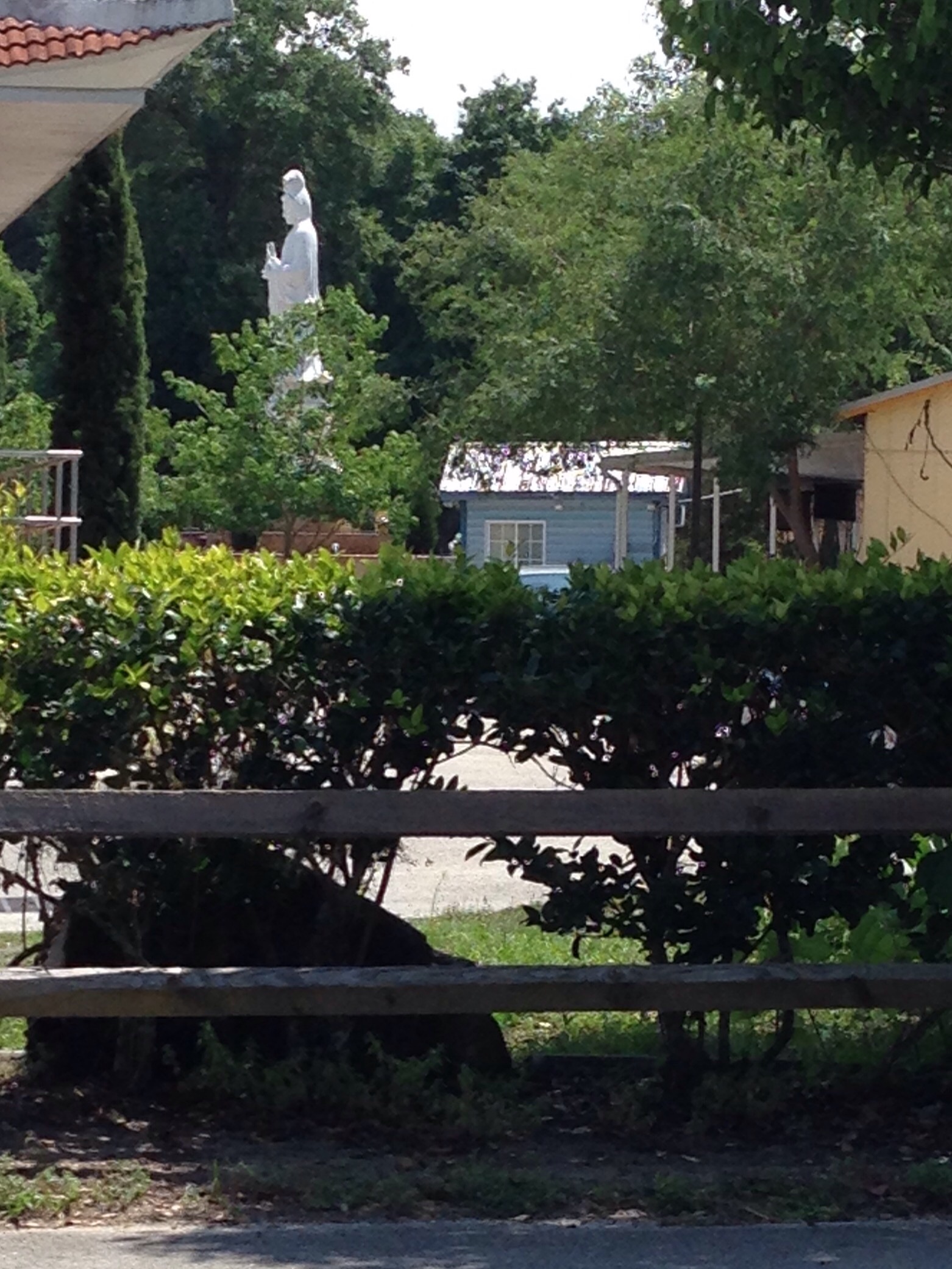
When we reached mile 15 we had travelled more miles than on any previous hikes, and we were also on a part of the trail we hadn’t seen before. All of a sudden, peering over the edge of the trail was a giant white statue of Buddha gazing down serenely on the cyclists whizzing by him – it turned out we were next to an extremely large and ornate Buddhist temple. The religious juxtapositions were interesting. We had started by the “Mosaic Church” near Oakland, now the Buddhist temple, and shortly after encountered churches ranging from the Seventh Day Adventists (where a very dressed up congregation was just departing church services) to something called St. Elizabeth, a Church of God By Faith, with no other apparent denominational affiliation.
After a wooded section we emerged onto another road which offered a tour of Apopka’s dying foliage industry. Nelson’s Florida Roses (I had never realized it was even in Apopka) still seemed to be flourishing – although we couldn’t help but note that when we saw them switch on the sprinklers the electrical transformer over our heads actually crackled and sparked. But next to Nelson’s are acres of semi-abandoned greenhouses, giving a sort of post apocalyptic feel to the whole place.
Finally we made our way through a wooded area, dotted with small houses, and up to the Apopka bridge. Just beyond that is the Apopka Station, our ending point, but we were just under miIe 20. So we forced ourselves to go on just a little further so that when we turned around back to the Apopka Station we stopped at mile 20 on the nose.
This particular training adventure, unlike most, was a one way trip. Except for the half mile at the end, when our friends A and T retrieved us, we hadn’t covered any of the same ground twice. Sometimes I wish summits were like that – you could get to the top, just stay there, and not have to come down again.
Saturday presented with a solid drizzle of rain from dawn to dusk and thereafter. What better occasion than to try out some new gear to check how waterproof it really was.
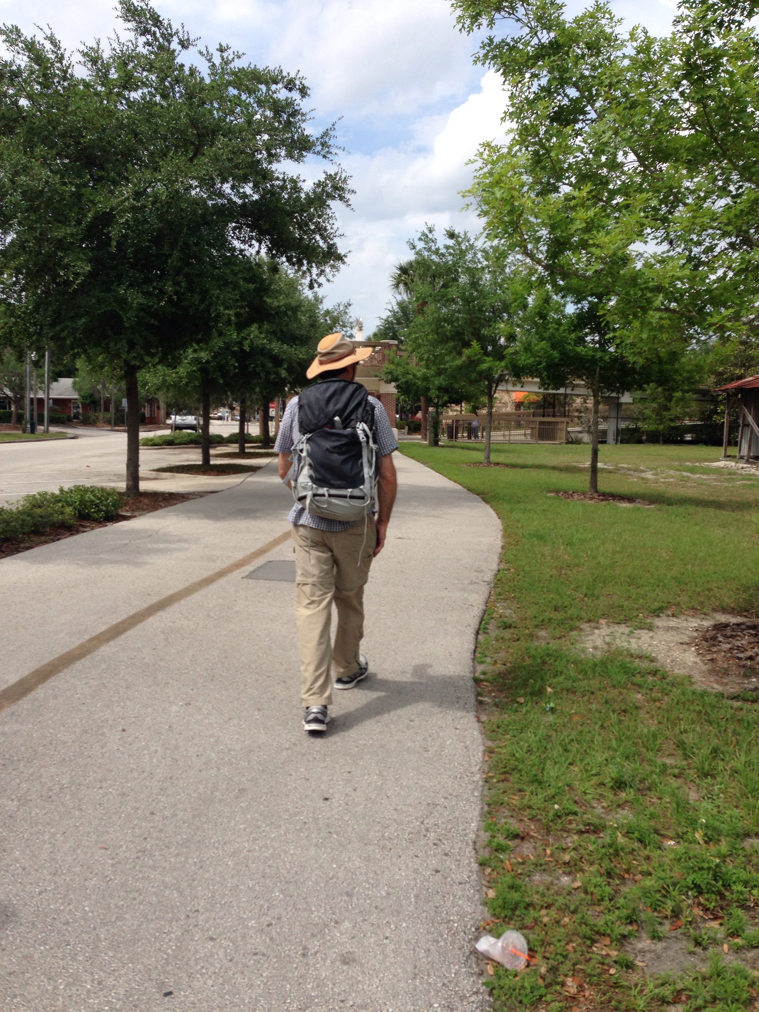
Husband J and I decided a few more miles on the West Orange Trail would be an appropriate testing ground. But this time, instead of starting in charming Winter Garden, we decided to begin our hike 22 miles away at the other end of the trail, just outside of Apopka. We have a goal of ultimately walking the whole thing in one fell swoop, but before we do so we thought we should have walked all its pieces.
The trailhead on the eastern end is nothing short of unimpressive. Literally nothing but a small sign marks the trail, which runs along a busy commuter road, and it’s hard to tell where the regular sidewalk ends and the trail begins. It’s equally mysterious why that particular point was selected – there’s certainly no distinguishing characteristic. There are a couple of strip malls, populated by places like “Beef O’Brady’s,” Pizza Hut, a grocery store and the inevitable 7-11. And no parking – except for the strip malls.
After a couple of miles of cars whizzing past, we were glad to turn down a side street where the trail finally diverged from the roads. It wound back behind several schools in a wide concrete band, at one point on a well-built boardwalk that meanders past a deep gully, unusual for Florida. There were some houses tucked behind it and I couldn’t help but wonder what the bear population was. For those of you not from Florida, black bears have developed their own suburbs in all of Orlando’s outlying areas. As the boardwalk ended, we passed a huge Seventh Day Adventist church and several expanses of open land. It was not clear if they are parks, grounds of commercial establishments, or simply placeholders waiting for development. And there is some topography- there is at least one real hill and by the end of he trail, my Map Your Walk said we’d gained a whopping 65 feet.
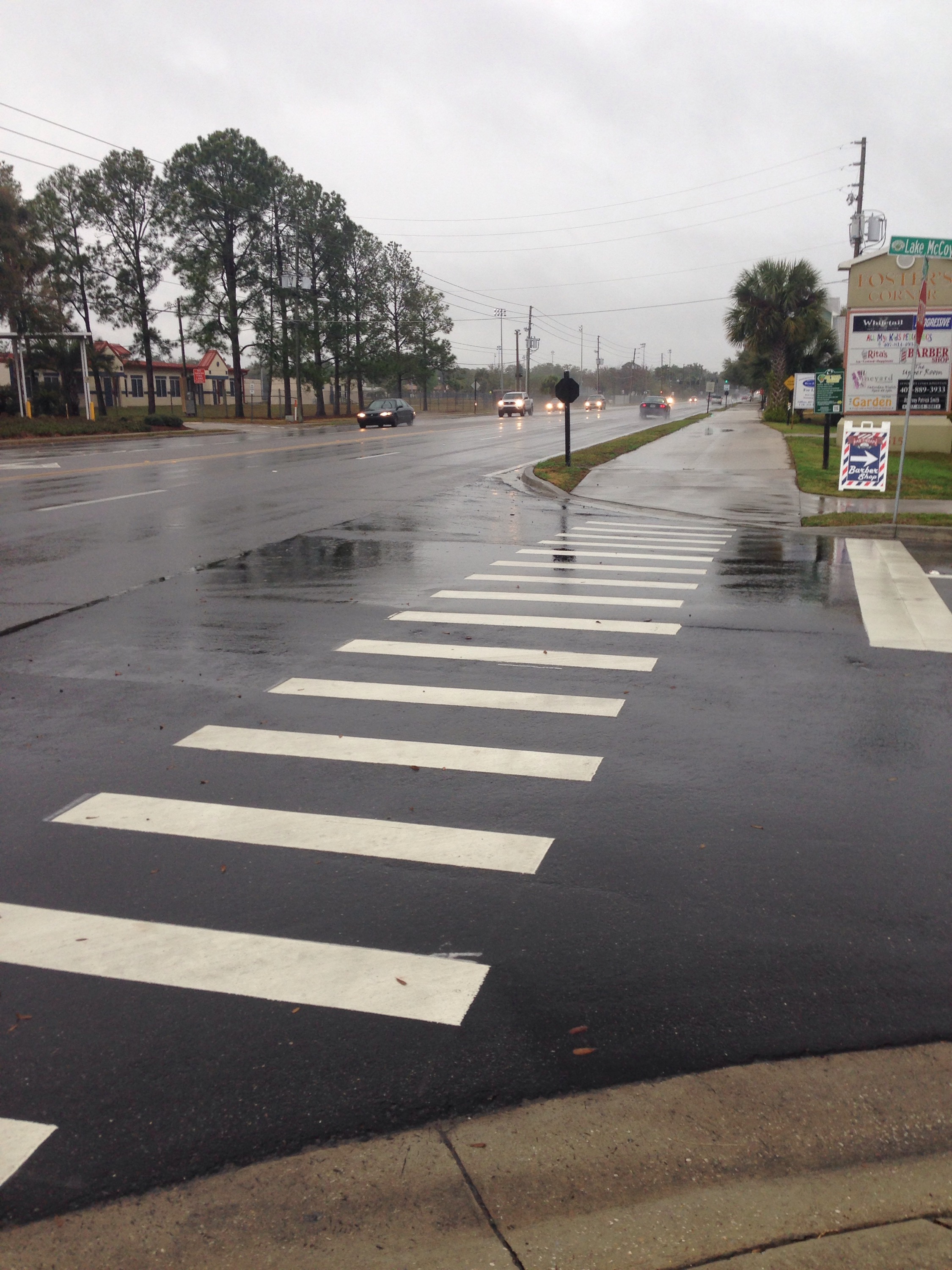
The trail finally reaches the town of Apopka itself. A pedestrian bridge, shown in the top photo, crosses Main Street. There’s a restaurant called the Catfish House right by the bridge – which looks as though it would be an appropriate place for celebration when we finally do the entire trail. And it looks a lot more interesting than the Duncan Donuts, which appears to be the other food choice.
Next West Orange Trail hike – well, we still have about 12 or so miles before we’ve walked all of its bits and pieces. I’m hoping for a little less 4 wheeled traffic on the next part. As for the gear – it worked admirably. Patagonia Alpine climbing guide pants repelled water just as advertised and my new hiking boots – yes, after five years I have a new pair of Renegades by Lowa – continue to get broken in. And just as well – because the weather reports for Iceland – where I will report from next week – indicate snow every day!
Some of these thoughts didn’t surface while actually running, stair climbing or the like, but since those activities occupy a lot of my time, they were certainly in close proximity.
1. Technology baffles. Of all places and times, yesterday at the hair salon – after a morning run (despite appearances, aspiring climbers get their hair done too), my previously faithful iPad informed me that it had finished updating and would I like to activate it. As I hadn’t updated anything, I was a bit taken aback, but followed His Highness’s commands and briefly my iPad started working again….only to give me the same message a few minutes later. This time, however, my attempts at activation were met with the ominous response – “activation failed.” At that point I began to wonder if my iPad had been in communication with a neighboring iPad at the salon and they were engaging in concerted activity. A long visit with Apple phone support, involving iTunes and downloads of software updates, proved unsuccessful – leading to that most
frightening experience of the 21st century – a visit to THE GENIUS BAR AT THE APPLE STORE, presently scheduled for Tuesday. But this morning, I pressed the magic buttons again and amazingly – the iPad seems to be working. We’ll see. I’m not canceling my date with Mr. Genius yet.
Parsley and KaleTurnips from seed…
2. Earth is good. Even though, horror of horrors, our temperatures here in Central Florida dropped into the thirties this week, the vegetable garden is continuing to produce. After a hard and busy week it is amazing the difference that the mere act of pulling weeds can make to your psyche. When people ask me how I can be afraid to peer over a balcony of a New York penthouse, but gazing down the steep pitch of a mountain doesn’t bother me, I answer that it’s the earth. When you’re on a mountain you’re always rooted to the ground. Not so on a steel and concrete structure.
3. Randomness amazes. One of the more interesting features of said vegetable garden is the plethora of plants that come up seemingly out of the blue. But after a few minutes of wonder, you remember, oh yes, I did plant Italian parsley there a couple of years ago. Or, that sorrel must be the remnants of the bitter war I waged with the world’s hugest sorrel plant in 2012 (do you know how few uses there are for sorrel?). As of now, I have onions that sprouted from last year’s crop; some miscellaneous carrots whose seeds had apparently lain dormant for a while; and flat parsley. Remarkably enough, this gardening technique extends to my composter. One advantage to failing to turn over its contents is you never quite know what might start growing. I’m pretty sure I have bean plants coming up.
4. Iceland is around the corner and Ecuador approaches. Next week this time we’ll be getting out the winter gear and we have to put more money down for the Cotopaxi and Chimborazo trips. Eyes on those goals. They keep me going every day, together with a healthy dose of randomness.
When I started this blog last April, one of my first posts was entitled, “Where am I going and where have I been?” It was made up of exactly one photograph, as at that point I was still working my way through the intricacies of things like figuring out that a tag wasn’t a piece of paper with a price written on it (and was a far cry from a backyard game).
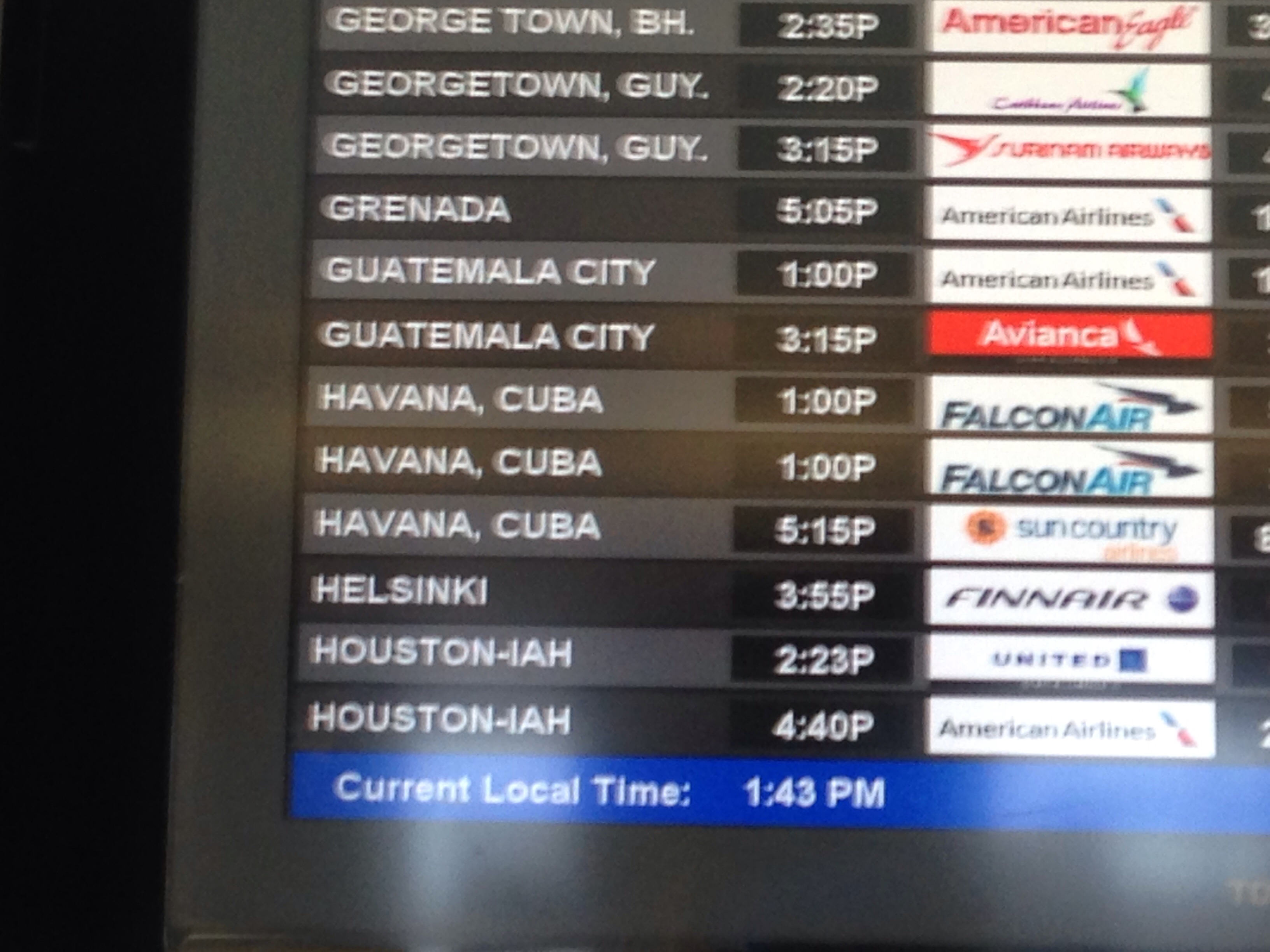
But a layover at the Miami airport this weekend provided the perfect graphic to answer that original question – at least for the next six months. As I looked at exotic destinations on the departures screen, many much more exciting than my 40 minute jaunt back to Orlando, I saw the below:
Where am I going? Quito, listed there near the bottom. (Or Orlando, depending on your time frame, shown just at the top of the screen.) And where have I been? Well, Raleigh-Durham – where I grew up – appearing right under Quito. (Or Orlando, once again, depending on your frame of reference.) For the record, “Raleigh-Durham” is a misnomer – I grew up in Durham!
Airports are like that. You can smell the adventure waiting at the other end of a flight. I still find it remarkable that 100 plus people can be sent 30,000 feet high at over 500 mph. At an airport, you can sum up the where you are and where you want to be in one screen shot.
Another example – note the Havana, Cuba destination. I’m not sure I can recall ever before seeing Havana listed on a departure screen, much less right above Houston, Texas. What better way to show a shift in geo-political realities.
When I was growing up in the 1960s and 1970s, my family always arrived at the airport dressed in Sunday best and several hours before any scheduled departure. My brother and I regarded the waiting at the airport as much a part of the trip as the actual journey. I still remember the iconic TWA terminal at JFK, and how slick and modern Dulles Airport was, rising out of what was then a rural area outside of Washington.
Photo by Joe Ravi, lic. CC-BY-SA3.0
As the reality of the Cotopaxi and Chimborazo climbs sets in (right now I am at the slightly terrified stage), I just need to take it one step at a time. And after the training – the next step is going to be at an airport. And whatever happens, I know that when I set foot in one of those ultra modern terminals, it’s not a terminal in the sense of an end. Yes, it will evoke memories of where I’ve been – but even more excitement over where I’m going.
Training has to be in earnest now. The long Martin Luther King weekend provided the impetus for our first hike with weight since – oh, probably when we were training for Elbrus last year. But with Cotopaxi and still maybe Chimborazo looming a mere six months away, it’s time to ramp up.
Orlando has been working on its urban and semi-urban trails for a number of years, and the West Orange Trail was one of the first. It stretches 22 miles from Killarney to Apopka, running mostly along abandoned railroad tracks. It passes through suburbia, a high end residential enclave, abandoned orange groves, and, every now and then, glimpses of the pine forests and palm hammocks that graced the state before development threatened to turn it into one giant subdivision.
Husband J and I had hiked the segment from Killarney to Winter Garden last year, so we were already familiar with the classic car show that takes place in Winter Garden on Saturdays. People from all walks of life sit on lawn chairs with everything from Model Ts to 1967 Mercury Cougars on display. Somehow I don’t think my 10 year old Sebring convertible would have qualified.
So this time we decided to load up the backpacks with about 25 pounds and walk the next segment, from Winter Garden to about three miles beyond the Chapin Station by Chapin Park, for a nine mile round trip. Before Ecuador this summer we are going to try to walk the whole length in one day. Hey, if the Romans could march over 20 miles every day, why can’t we?
Not really a walk on the wild side
The first part of the trail cuts through several housing developments. One of the most striking features is the lengths and lengths of white vinyl fences that line the trail. The fences finally stop and you’re treated to a view of backyard after backyard – all of which blend into one another with barely any delineation. Talk about peer pressure to mow your lawn! Notably, I saw not one soul sitting outside on any of these neatly manicured grass strips, even on a beautiful Saturday afternoon. Finally, housing developments give way to abandoned orange groves. As we passed the one with the cement plant rising up out of the middle (see photo above), we heard what at first sounded like a loud rant of some hellfire and brimstone preacher. But as we got closer, in the distance we could just hear an amplified broadcast of MLK’s I Have a Dream speech. Somehow very fitting for the weekend, the trail and our training.
West Orange Trail – J’s trademark shadow in the corner
The next segment did move into something approaching nature, although the sound of the highways nearby was never too far away. A hawk almost strafed our heads as we paused on the bridge shown above, and then settled into the trees, its plump belly blending into the mottled deep green black leaves. We passed by a specialty crop garden tended by a local high school, as well as what looked like an uninhabited barnyard with a big sign saying sustainable farming. And at one point, from a warehouse al out hidden by the trees, we could hear the throbbing bass of a rock band practicing. On the way back, it seemed to have transformed into something that sounded like a mariachi band. Same band? Or rented space?
The West Orange Trail even has a few hills – at least by Florida standards. I just kept thinking to myself, “imagine it’s 10 degrees farenheit, it’s a 35 degree slope, and you are at 18,000 feet.” You’ve got to have some imagination to train in Florida.
There’s a hawk somewhere in there – use your imagination!
Powder paint at Gentlemen of the Road – Travel With Friends
Many years ago, when daughter #1 was still being carted around in the plastic contraption we called the rocket seat, we would go out to dinner with our then childless friends, M and S, and drool over all the places we could explore once our parental responsibilities had lessened. But then daughter #2 came along, and M and S had their own equally charming off spring and those days seemed to get further and further away.
Oh, there was the moment when we thought there was a possibility of a two family trip on a Russian icebreaker to see an eclipse in the Arctic Circle. S, who is an amateur astronomer, had seen an ad in one of his magazines that suggested such an adventure could be had for the sum of $1500 a person. Unfortunately, in the cold light of Monday, he realized he had ignored the extra zero in the price.
A couple of years ago we did all make it to St. Augustine for a long weekend to see The Gentlemen of the Road tour (Mumford and Sons etc). A great time, but aside from the paint powder extravaganza shown above, it wasn’t what you would call a particularly adventurous weekend.
Althugh we have yet to convince the Friends that they too can reach summits we have all decided to spend several days in early March in Iceland. The plan started because at that point – for some unknown reason – there was a straight through flight from Sanford, Florida to Reykjavik on Icelandair. We were also all under the impression that Iceland was located closer to where Greenland is and there would be a minimal time difference, making it a good long weekend destination. We’ve now determined there is no direct flight and it is a five hour time difference but we are going just the same. I also bought husband J a globe for Christmas.
I have little idea about Iceland except for an early episode of Anthony Bourdain’s first series, No Reservations, but trips with no expectations are sometimes the best. And I am confident that we can get M and S onto a glacier – at least for a little bit.
So now when I’m training for the June trip to climb Cotopaxi and Chimborazo at least I have something else to occupy myself with – the 7 mile run yesterday was a lot more fun when I thought of volcanoes, hot springs and ice. I decided to ignore the dried cod.
In passing, I’ve previously mentioned a fear of heights – in fact, it played a role in the decision not to climb the Grand Teton. I’ve downplayed it to avoid the inevitable queries about why someone with any such concern would decide mountain climbing was for them. But occasionally that fear rears its head again, like the proverbial dragon waking up in its cave. And I realize that each time I set off for a new summit, vertical drops provide their own very special form of challenge (or torture). It goes back to kindergarten when on my way to the second floor of the building I somehow slipped between the steps of the fire escape style metal staircase, just catching myself before I fell. I was a skinny child. I didn’t say much to anyone about it, but I remember it to this day.
Year later, when I was about 13, my family made a trip to Grandfather Mountain in North Carolina, where my father walked my brother and me over the swinging bridge that crosses a gorge several hundred feet below. I still have never told anyone how completely paralyzed I felt on that bridge, but one of my repeated anxiety dreams (aside from the one where you have to take an exam in a class that you forgot to attend) is of being on a high, narrow bridge with no rails, unable to move forward or back.
So, yesterday when my husband (now known as J) and I decided the time had come to clean the skylights on our house, I clambered up the ladder after him. (The roof really is a bit steeper than the photo shows.) As soon as I put my foot down on the sloping roof every fear I’d had was triggered – what in the world would prevent me from simply sliding right back down and onto the patio below. I started to think about the angles of Cotopaxi – and, if we do it, Chimborazo – and thought, well, if you’re having a hard time on your own roof top you aren’t going to do very well there. So I took a deep breath, trusted in the grip of my tennis shoes, and bribed myself with the promise of the great view I would have of the neighborhood and everyone else’s backyards.
And it worked. By the time we were done I was skipping around on the roof – if not like a mountain goat at least like one of those mules that go up and down the Grand Canyon.
But, you know what? Last night I still dreamed about walking on a narrow ledge at the very top of a multi-level mall. I had to hold on to some sort of rope and half way along the ledge drop one rope and pick up another. I did really well on one side of the mall, but when I had to cross the ledge on the other side, I found myself saying to the anonymous, but stern, guides, I’d just prefer to do this tomorrow.
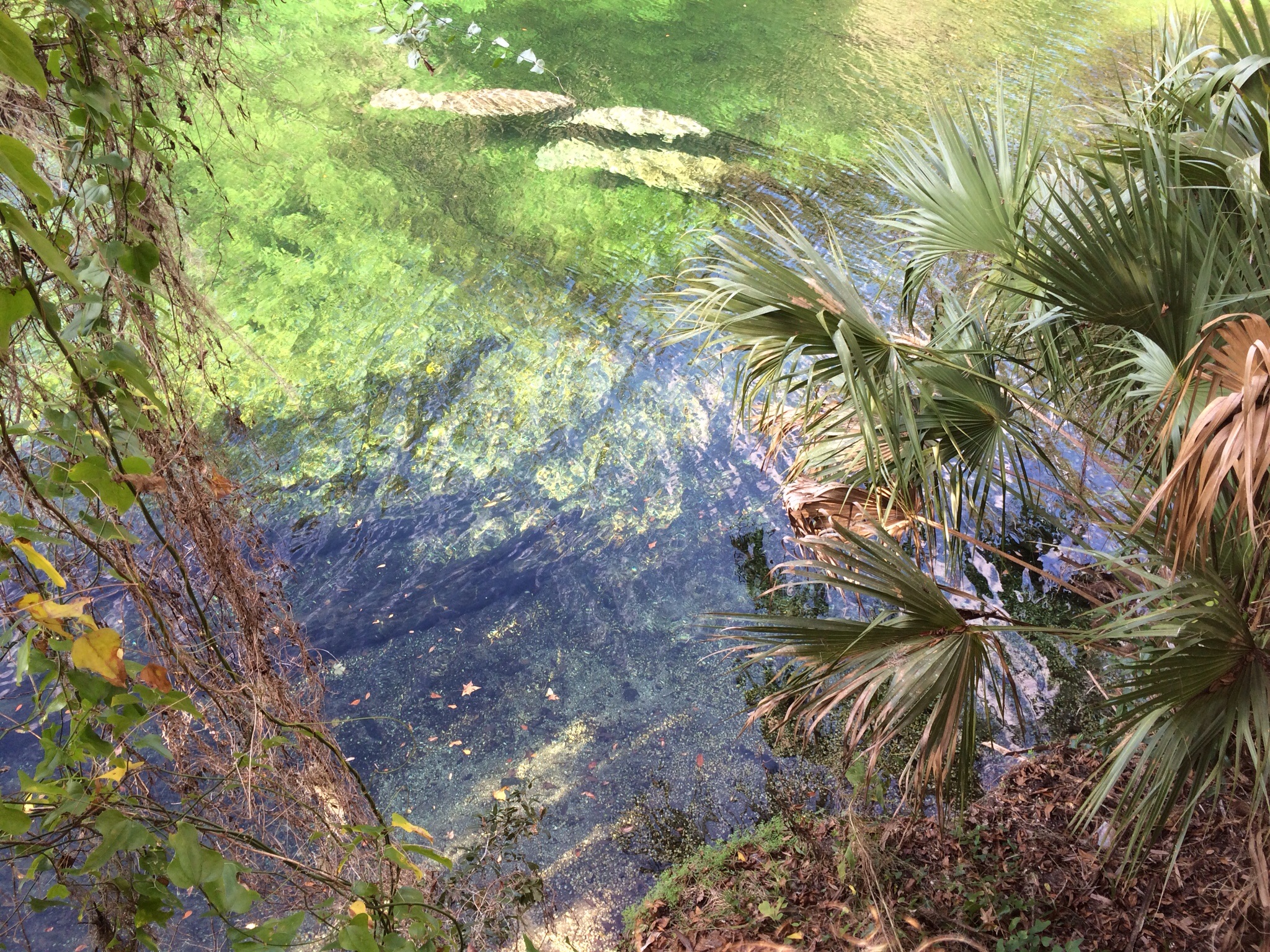
Manatees in the emerald waters of Blue Springs State Park
We celebrated the day before New Year’s Eve with a very tame hike along the boardwalk at Blue Springs State Park to see the manatees. Just daughter #1, her boyfriend, the husband and me. Oh, and in celebration of 2015 and six months of writing this blog, I’ve decided the husband can now have – if not a name – at least an initial. Perhaps a little Kafkaesque, but “J” does have a certain ring to it. Perhaps the daughters will obtain their own initials at some point.
I’d like to say that Blue Springs is a hidden treasure – but it has clearly been discovered, as demonstrated by the hordes of eager manatee watchers who were out in force on an overly hot winter’s day. Blue Springs has always been “discovered”: it has been a tourist spot – or at least, a layover – since the pre-train days of 19th century Central Florida. The house of the original settlers still stands – a couple from Brooklyn, New York, who migrated to Florida to establish what became a steamboat stop on the St. John’s River in the 1870s or so. As steamboats gave way to trains, the place evolved into a weekend resort for hunters and fishers. The tourism that seems so out of place in the apparent wilderness is actually an authentic part of Blue Springs.
Blue Springs is also tremendously accessible to anyone with any physical challenges. A smooth boardwalk runs the length of the river, which not only helps walkers who need some assistance but also protects the plant life. The place itself is one of the most beautiful in Central Florida. The spring – one of the largest in North America – pumps out water from the Florida aquifer at a staggering 100,000,000 gallons per day. The water is a brilliant clear emerald color, and through it you can see long nosed gar wending their way down the river, as well as the large cow-like blobs that are the manatees themselves. Legend has it that manatees were the original mermaids, but it would take many days at sea for one of them to resemble Ariel!
One of my favorite parts of Blue Springs is the fact that somewhere hundreds of feet down the spring connects to the limestone caves that permeate Florida’s substructure. As I understand it, many of these underwater caves are unexplored (and probably can’t be explored). Frankly, as much as I can imagine scaling summits of mountains, the idea of going underwater into a subterranean cave is unfathomable. But just knowing of the existence of those deep dark places – who knows, perhaps inhabited by goblins mining for the fairy queen’s jewels – adds an appropriate level of mystery for this New Year’s Eve.
Because who knows what 2015 will bring? It should bring our climb up Cotopaxi, but that’s just one of the many summits I’m sure I’ll encounter. 2015 is stretching out before me like those underground passageways below Blue Springs – and it will just take a little imagination to realize its possibilities. Here’s to exploration in the New Year!