Now that Labor Day has passed, it is time to return to the backbone of any successful summit bid – and that is the long hard slog of training. I haven’t stopped since Ecuador and our adventures on Cotopaxi, Illiniza Norte and Cayambe, but I have definitely taken it a bit easier.
For example, I treated myself to the luxury of stairs without a 25 pound backpack. I haven’t attempted a seven mile run. And I have not been at all diligent about any weight lifting. It’s been nice.
But, as the Walrus said In Jabberwocky, the time has come. So on Saturday, after much futzing around (you do need to make sure your sunglasses are adjusted just so, headphones properly positioned, etc.), I embarked on a five mile run. I’ve been running four milers, but if we want to have a hope of scaling Mexico’s 18,491 foot Pico de Orizaba in January, I need to be back up there at the seven mile plus level. The run actually felt good. And on Monday, I’m going to reload the pack with the weights from my weight vest and lug it back off to work where my 16 story office building awaits.
In the meantime, I’ve been reading excerpts from a book called Fast After Fifty. It’s aimed at athletes who are trying to maintain or improve after age fifty and emphasizes interval and anaerobic training. But – true confession – I didn’t really do anything particularly athletic until I was almost fifty! So I have some reservations as to how applicable those principles are to me….although that may just be a copout as I have no desire to run as hard as I can for thirty minutes to find my lactic threshold.
At least I can find some inspiration in the movie, Meru, which we saw last night. It’s a documentary based on alpinists Conrad Anker, Jimmy Chin and Renan Ozturk’s two attempts to climb Mt. Meru in the Himalayas – 21,000 feet above the headwaters of the Ganges River. It’s the sort of mountain that makes Everest seem like climbing for dummies. Over the course of the three years between the first failed attempt and the second successful one, one of them was in a near fatal snowboard accident, which resulted in a severely fractured skull, and another narrowly survived an avalanche. But they ultimately made it up what is called the Shark Fin – razer like slabs of granite so unstable Chin said he could feel them move under his fingers.
On the first attempt they got within 500 feet of the summit – but ran out of food due to an unexpected four days waiting out a storm in a small tent half way the mountain.
The physical and mental strength it takes to know when to turn around and when to keep going is huge. I may not be headed to the super high mountains of the Himalayas, but I’m keeping my fingers crossed that my Florida version of training can at least get me ready again for something higher than Mt. Dora. For those of you non-Floridians, that’s what we in Central Florida call a summit – it’s a whopping 184 feet above sea level.
Many things just seem to stop on Labor Day. Including my 24 year old refrigerator that has occupied a convenient niche in our garage for the last several years.
Since I started this blog back in May or so of 2014 I have tried to publish posts once a week – I’m old enough that I tend to regard blogs as the digital equivalent of a weekly print magazine. But occasionally those periods occur where labor (aka work) takes over, becomes all consuming, and unfortunately, training, this blog, and yoga all take a back seat.
But all things pass, and it’s appropriate that they do so in time for Labor Day. It’s time to take a deep breath, and look forward to the fall and next adventures. Just like that first gust of cool wind on a fall day. After a summer of Florida heat and humidity, there’s no describing how refreshing that is. Unfortunately, I know from 25 years here that September isn’t much better than August.
So what is upcoming after the excitement of this summer’s trip to Ecuador? Most immediately, a trip to Maine with daughter #1 and the boyfriend N, and a hike up Puzzle Mountain. And after that….God willing and the creek don’t rise – we are seriously considering a trip to Pico de Orizaba in Mexico the first week of January 2016. It’s the third highest mountain in North America at 18,491 feet. And of course, it’s a volcano. Has anyone out there done this trip? We can certainly use all the help we can get.
In the meantime, this year’s Labor Day has involved refrigerator replacement, re-planting the vegetable garden, and a four mile run. I’ve taken a deep breath. Now it’s time to set our sights on the next summit.
Despite a large number of work duties stretching ahead of me in the next week, I honored my original plan to visit daughter 2, also known as S, for what had to be one of the shortest in and out visits to New Orleans ever.
But as always, despite its brevity, any period of time in NOLA is worth it. This visit was no exception.
Of course, it started with a torrential downpour, and we were soaked after walking the two blocks from where we parked to the Dat Dog on Magazine Street. But as I’d probably brought the rain with me from Florida, this was hardly a novel experience. Plus, when looking for something dry to wear in S’s closet I discovered that she was the culprit who had taken one of my favorite dresses – well, it meant at least there was something to wear that fit.
Magazine Street balcony on a Sunday morning
S is now ensconced in an apartment right on Magazine. It’s in an old, two story building with balconies both at the front and back, one overlooking the street and the other a small rear courtyard. Magazine is one of my favorite New Orleans streets. Less overwhelming than St. Charles, it still has its share of huge, beautiful and sometimes slightly decaying houses, interspersed with bars and restaurants and eclectic shops. Age permeates everything in New Orleans – it’s as though the humidity cushions the city against the rigors of modern life.
After making several fairly unsuccessful house furnishing forays to not very exciting shopping centers, we met up with S’s friends (friend 1 and friend 2) for a great dinner at Dick and Jenny’s. They had just gotten their charbroiled oyster equipment (who knew there was such a thing) and last night was the very first time they’d served charbroiled oysters to guests. Fabulous sums it up.
Dick and Jenny’s is across the street from Tipitina’s, a New Orleans institution for live music. And what had inspired the trip in the first place was going to hear Rickie Lee Jones there. I’ve been a fan since the 1979, when her first album came out, and J and I were originally supposed to see her years ago, before the daughters were even born, at a sunset jazz series in Orlando. But, alas, she canceled (I have a bad history of that – the one time I was finally going to get to see the Greatful Dead the concert was cancelled) – so I’d been waiting for this opportunity for a long time. Her voice still sounded great.
Rickie Lee Jones at Tipitina’s
We rounded out the 24 hours with brunch at the Oak Street Cafe. It was a little surreal. Supposedly it featured live music – which consisted of an older woman mostly lip syncing to recordings from her own CD and doing what can only be described as interpretive dance. It was a bizarre combination of zydeco, funk and folk with bits of live accordion playing every now and then. The completely bald baby, accompanied by mother, father and grandfather, all sitting near us, was enthralled. The father’s and grandfather’s hats made a nice addition too – they were adorned with long feathers sticking up on either side. The whole experience was vaguely tribal.
Now back to work tomorrow. Its own special sort of summit.
On July 3, 2015 J, our guide Ossy, and I stood on top on top of Cotopaxi, one of the highest active volcanoes in the world, blithely ignoring the sulfur fumes that had fortunately blown in a direction away from us. And on August 14, 2015, that very same volcano sent a two mile plume of ash, hot glass and fumes into the air, creating an ash shower for all the surrounding villages, some of which are now being evacuated. (Apparently it is called a “pyroclastic flow.” Great name.)
This same weekend, I’ve read about a mountain guide who suffered a serious spinal injury while rock climbing in Ecuador. I believe that he’s someone we crossed paths with when we were in Ecuador – he was one of the guides working with the Climbing 4 My Donor team that we met both at Rucu Pichincha and Illiniza Norte. (The Climbing 4 My Donor team consisted of heart/lung transplant recipients from the U.K. who were climbing in honor of their donors. They were pretty inspirational.) There is a GoFundMe page for his medical expenses (Sebastian Carrasco).
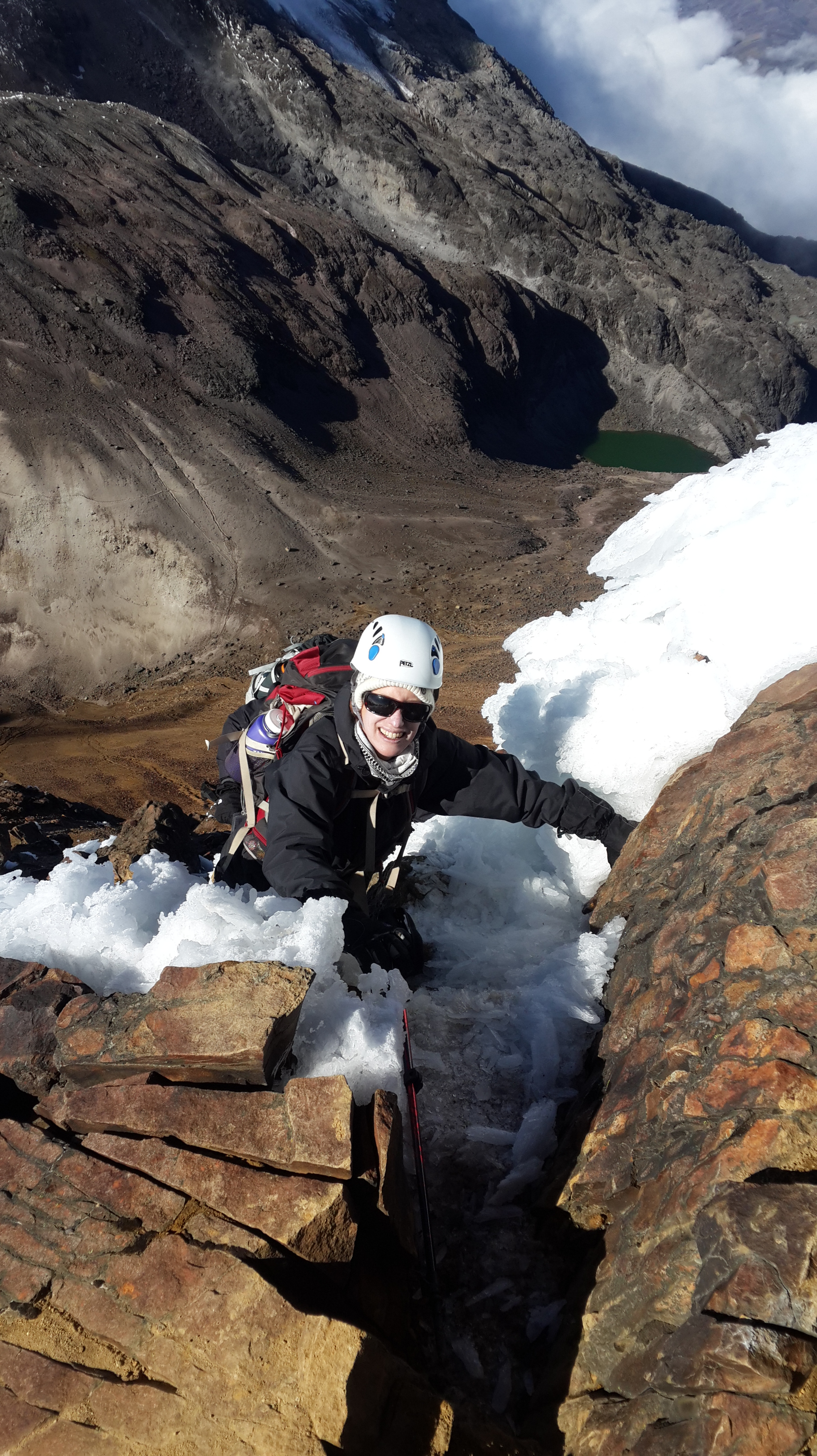
Rock climbing on Illiniza Norte
But recent dangers don’t appear to be limited to the summit. Down here in the swamp, this past week in Central Florida saw an absolutely horrendous accident — a woman swimming at a popular spot on a local river was pulled under by an alligator and lost her arm.
I tend to ignore the fact that my particular version of swamp to summit carries with it some degree of danger. Even these recent events really only affect me in the sense of “oh wow, can you believe we were just there” or “we were just doing that.” I think that’s part of the journey – the danger is a given and it just becomes part of the landscape. It certainly helps ratchet up the adrenaline, but when you’re on the mountain, you’re not thinking danger; you’re just thinking the immediacy of the moment and how to handle that which is in front of you. Rock climbing up Illiniza Norte was a particularly good example of that. In fact, I usually end up feeling more fear of physical failure than I do of external, more objective dangers.
For various reasons my Saturday run this week took me from downtown Orlando along a service road that parallels the now constantly under construction interstate. It’s becoming increasingly overgrown, with many vacant lots. I did briefly wonder whether this was actually the best place to be running by myself. But the answer wasn’t to turn around. I simply ran a bit faster.
It looks a bit like I’m under house arrest and am required to wear an electronic monitoring device. A one inch band of synthetic material wrapped around my non-dominant wrist, topped with a large rectangular watch face. A few weeks ago, my firm started reimbursing everyone $100 for the cost of a Fitbit, as long as you promised to participate in one unspecified company “challenge” in a year and generally to be a healthy person. It was unclear exactly how the latter was to be implemented, but given the difficulty of enforcement, the risk of breach didn’t seem too great, and the lure of $100 quite strong.
So now a considerable number of attorneys and staff alike at my office are roaming the hallways, eyes on their devices, exchanging updates on their latest step counts. You can’t tell if they actually have a destination in mind, or are just adding to their steps. I’ll be curious to see what the correlation is between increased steps and billable hours.
As for me, I couldn’t resist splurging on the Surge. It is the top level Fitbit, and not only counts steps and floors, but also monitors heart rate, your sleep cycle, and tracks exercise, ranging from running (it has a GPS tracker) to yoga. I tried the running tracker yesterday for a four mile run and compared it to Map My Walk – they were almost identical, so it seems the accuracy is pretty good. I also loved the fact I didn’t have to run with my phone in hand as I could glance down at any point and see my pace, time and distance.
I’m about to try the Fitbit at yoga – we’ll see. I’m not quite sure what it’s going to track. Number of sun salutations? Downward dogs?
I also wore it climbing stairs the other day. Every 25 floors or so I got a cheery email from the Fitbit people awarding me a new badge. At 125 floors I received the Roller Coaster. I climbed 140, so I’m guessing I need to do 150 to see what comes next. Maybe the Big Eye?
I’ve found the Fitbit at night is a little distracting. As a restless sleeper, I have woken a couple of times with the imprint of the buckle mashed into my wrist and have had to change arms. But it’s still interesting in the morning to have information like “moved 11 times” in a two hour period.
The strangest thing about my electronic bracelet is at all times to have access to information about my own body that was previously the province only of my body and not in any way the business of my brain. But now those mysteries are revealed. You can check at any given time just exactly what makes your heart beat a little stronger. Who know the effect on the dating industry.
Narcissism? Helpful for training? Increasing the scientific understanding of your own body? Maybe a little of all the above. But, as I try to figure out the next mountain summit, I figure I can use all the help I can get.
For a variety of complicated reasons, husband J and I found ourselves this weekend at the luxurious Ponte Vedra Inn, just south of Jacksonville. Founded in 1928, the inn has the same feel as the Santa Maria Inn in Santa Maria, California – big reception room replete with model sail boats, backgammon tables, and overstuffed furniture designed to look like it’s been in some blue blooded family’s estate forever. Over the fireplace, there’s even a spooky painting of two young boys holding recently caught fish — the colors fade toward the bottom so they seem almost to be floating in some netherworld.
Spooky kids….
So with a fancy spa, a golf course, three pools and a beach with servers eager to bring iced drinks with umbrellas, where more logical to end up than on a seven mile hike by an estuary, our only travel companions a variety of biting flies, gigantic spiders, and most unwelcome of all, ticks.
I’d actually looked up the Guana Tolomato Matanzas National Estuarine Research Reserve (what a name) before we left and we’d already committed to ourselves we were going to do this hike on Saturday morning. We almost lured a couple of friends who were attending the same weekend event but at 7:15 am they thought better of it.
The first challenge was finding the darn place. One of the reviews I had read cryptically mentioned the directions in the hiking app were not correct – which we too discovered as we made our way past the opulent Ponte Vedra oceanfront homes into the reserve. Although there are three parking lots, none of them is the location of the trailheads. But persevere we did, and eventually figured out where the loop hike started. We saw a total of three other people on the trail – and then only at the very beginning. An amazingly uninhabited place — at least by humans.
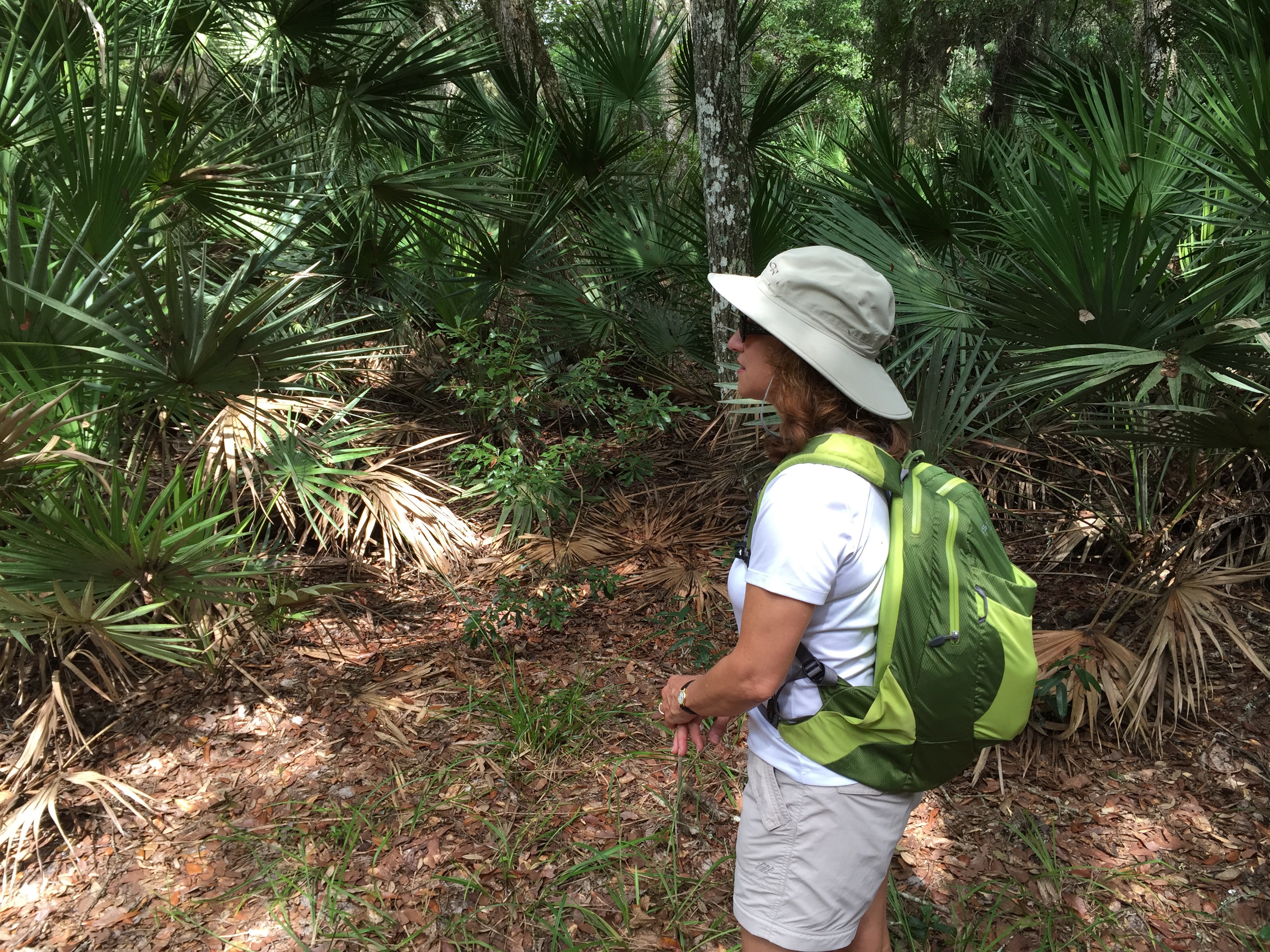
The trail starts off through classic Florida palm hammocks, framed by live oaks and swaying Spanish moss. It was beautifully shady and the temperature wasn’t bad. The shades of green ranged from neon to hunter, and the canopy over the trail made it almost as though we were walking under a pergola in a landscaped park.
We’d covered ourselves in heavy duty bug spray but at a certain point my sweaty body apparently became too much for the flies and ticks to resist and I found myself pursued by an onslaught of flying and jumping creatures. After I literally ran several yards, hiking boots and all, to escape I decided covering up was the only answer. So I dutifully zipped the bottom parts of my hiking pants onto the shorts and donned my long sleeved shirt. I may have looked a bit like one of those eccentric old ladies who wear winter clothes regardless of the season, but the heat was infinitely preferable to the attack of the flies.
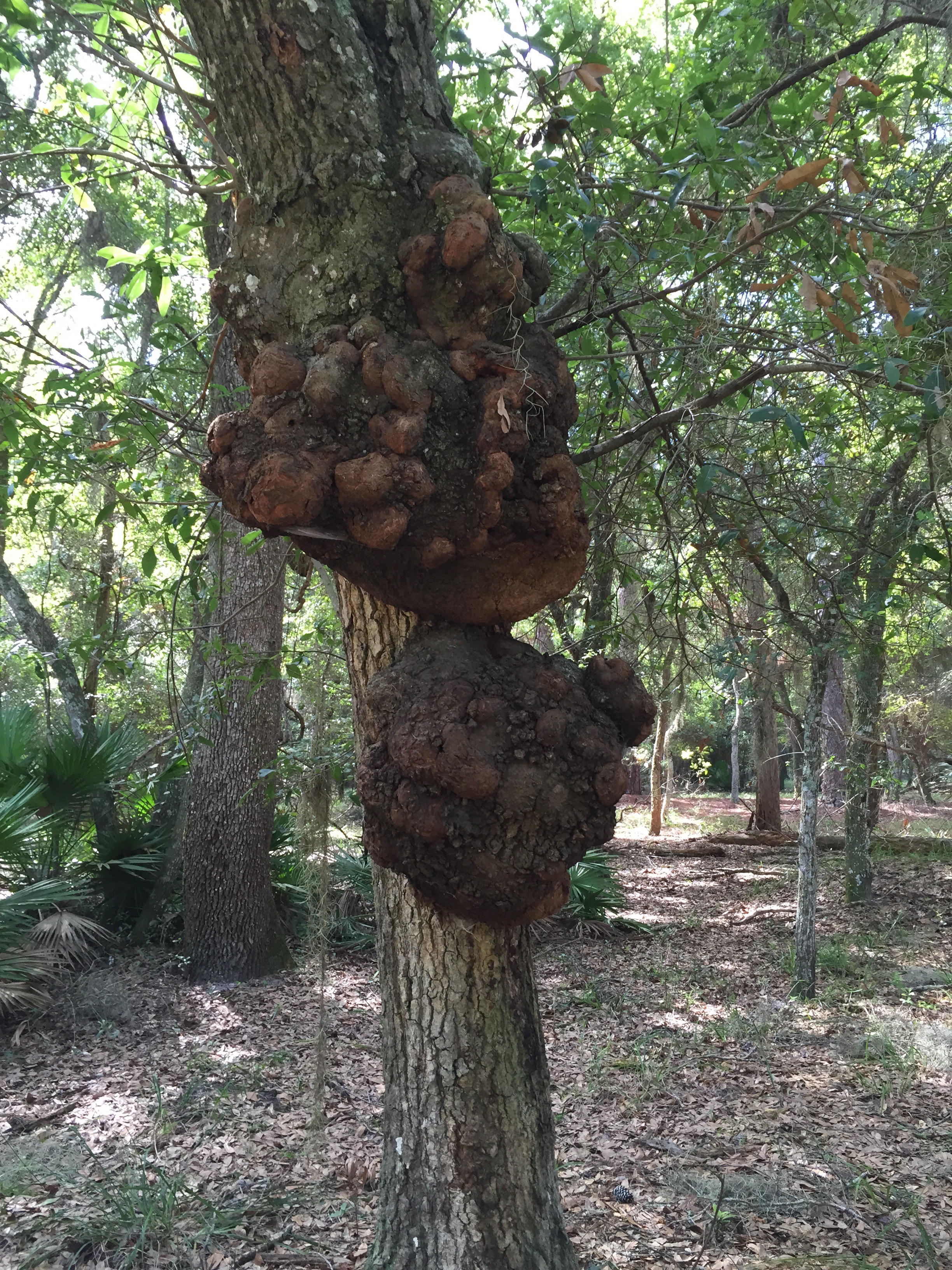
Shortly into the hike we passed a tree with two gigantic growths – if we were in Africa I would have thought they were some sort of termite mound, but here – perhaps overgrown mud dobber nests? Ideas? Photo is below.
The trail then winds its way by the edge of the river – part of the complicated intracoastal waterway system that hugs the east coast from Florida to Maine. The green of the water grasses is pale and you start to see yellow flowers, a welcome sight as summer is not the best time for flowers in the Florida woods.
Most amazing were the huge yellow and black spiders we kept seeing everywhere. Fortunately their elegantly spun webs tended to be set high between the trees, meaning even J only had a few encounters. But the spiders were about two inches in length, and seemed to be quite well fed.
After almost 7 miles there was still a further loop we could have done, but by then the insect wildlife was starting to pursue J, who had made the mistake of hiking without full body armor in his backpack. So we called it a morning and headed back to civilization.
But as I type this on my phone (my iPad having encountered yet another problem that will require a trip to, horror of horrors, the Genius Bar), and look out on the red tile roof of the resort and the sliver of ocean I can see through our window, I do keep thinking how much more I’d really prefer to be looking at the pale green of the river grasses and the deep comforting trunks of the live oaks.
We returned from Cayambe on a Monday, with one day left to eke out every last remaining bit of our Ecuador experience before we returned to hot, humid and flat Florida. Of all the various options Ossy offered, a hike up into the cloud forest in the Pichincha range, into the Yanacocha Reserve, had the most appeal. Plus, he promised hummingbirds.
Now, I’ve had a hummingbird feeder for years. I’ve heard that Florida too has hummingbirds – but each time I spy such a potential winged creature, it turns out to be one of Florida’s special species of gigantic, winged bugs. Of course, the fact I have never bothered to put hummingbird food in the feeder probably doesn’t help.
So off we took, me, husband J, Ossy, and his wife. One fact I hadn’t realized before we left the U.S. was that our trip coincided with Pope Francis’s trip to Ecuador – and specifically Quito. Multiple roads were closed and police were everywhere.
On the way out of Quito we turned on the car radio and heard the Pope saying mass as we looked down on the crowd, half a million strong, in Quito’s Bicentennial Park. A little surreal.
A sea of people at Pope Francis’ visit to Quito
The sunny weather we’d brought from Florida had definitely turned and there was a steady downpour as we drove the winding roads up to the trailhead. Once we arrived at Yanacocha we all donned raingear, and I was profoundly greatful for my absolutely waterproof wind jacket (a Marmot that dates back to 2011) and pants (also Marmlot).
After a mile or so straight uphill through the paramo – the Ecuadorian highlands, we encountered our first swarm of hummingbirds. And I use the word swarm intentionally. There were so many of them darting back and forth to feeders that you could hear their wings. They shot past our heads as if catapulted from some sort of slingshot.
Not only were there small hummingbirds, but we saw several (I think) Great Sapphirewings, one of the largest hummingbirds, about the size of a cardinal, native to Ecuador. We also saw one hummingbird with a needle like beak almost as long as his body.
After we hiked through hummingbird central, we turned a corner – and there, growing on the side, was a fully blooming orchid, exactly (well, bigger and healthier) like one I have at home.
Even though it was still pouring, we ventured up the steeper section of trail as it didn’t seem too slippery. Of course, nothing seems slippery after a glacier. Nonetheless, by this point it had started to hail, and chunks of ice were accumulating and forming small banks of snow. Ossy could have used a machete as there was a fair amount of trail breaking involved as moved further into the dense jungle of cloud forest. Flowers were everywhere, purple lupines, flame colored trumpets, white daisies growing close to the ground, all framed against a canopy of outsized leaves.
We finally reached a turnoff that would have taken us down a steep section to circle back to where we’d started – but that path did seem very muddy and by then we were all pretty well soaked. So we opted for what looked like a wider trail, despite the fact no one present had ever gone on it before. The trail exited the cloud forest and took us back into the highlands – where we continued to climb up and up and up – even though it really seemed we should be going down and down and down. There were ultimately some long switchbacks, and we passed a few people working on the roof of a tumbled down structure of some sort, so we knew that at some point we should rejoin civilization.
Just after that, we suddenly realized we were walking across a field that was surrounded by a barbed wire fence – we were apparently on the wrong side of it. After we scrambled under the barbed wire, we looked back to see a large keep out sign barricading the area we’d been blithely strolling across.
But, our faith in Ossy’s mountain guide instincts was justified. Within another mile of so we hooked up with the “main” road and ended up exiting just a little below the spot we’d parked the car.
It was still raining, and we could all squeeze puddles of water out of everything we had on. J had on his customary too many layers of shirts and was able to lend Ossy one for the drive back. Apparently it’s illegal to drive without a shirt on in Ecuador. And besides, the Pope was there so I suppose it would have been unseemly in any event.
We made a quick pit stop back at the Hacienda Rumiloma to change – and dry off. The next order of business was a trip down into Quito for Chinese food – hot and sour soup never sounded so good. The Pope’s presence and road closings seemed to have resulted in an eerily quiet city, and we were able to park directly in front of the restaurant.
Hummingbirds, orchids, Chinese food, the Pope, and crawling under barbed wire. What better ribbon for wrapping our four Ecuadorean mountains in eight days?
Checking out the route from outside the hut at Cayambe
Four mountains, including one at 19,347 feet and another at 18,996 feet, in eight days, is a lot. I knew I was in trouble when I started to cough the night before we attempted Cayambe. And how did we end up at Cayambe in the first place, you ask? You’ll recall the original plan was to follow our Cotopaxi climb (second highest peak in Ecuador) with Chimborazo, the highest peak and the point on earth closest to the sun.
Well, the worldwide rise in temperatures is affecting Chimborazo as much as the next glacier. Have you seen photos of Kilimanjaro recently? Very different than 2011 when we were there. Warm glaciers create greater risk of avalanches and rock fall (not to mention the difficulties of slushy snow). Chimborazo is also a long drive from Quito and it’s one heckuva big mountain. So, prudence being the better part of valor we decided, with guidance from Ossy, not to let the wax on our wings melt by attempting to fly too close to the sun and instead to try Cayambe, Ecuador’s third highest peak at just under 19,000 feet, as the final mountain of our Ecuador trip.
After our peak (literally) experience on Cotopaxi — even two weeks later I keep re-living it in my head — Cayambe was a logical choice. It’s just a little lower than Cotopaxi, perhaps steeper in spots (but for shorter sections), and has some rock to climb at the beginning. We had summited Cotopaxi at 9:05 am on July 3. After a rest day in Quito on July 4, we left the next morning to drive to the hut at Cayambe. Unlike the other huts at which we stayed, at Cayambe you can “drive” – if that’s the right word – right to the door of the hut.
Road to Cayambe hut – and this was the good part!
The road to Cayambe beats about any road I have ever travelled on for ruts, rocks, and steep precipices. It doesn’t resemble anything on which any self-respecting automobile should drive. We’d all learned our lesson by then about my issues with winding roads and cars, so I sat in the front. Ossy spent a lot of the time sticking his head out the side window to see exactly which snow, mud or ice covered rut would best create traction for the four wheel drive.
Eventually we made our way to the hut and checked in. For the first time during our trip we were sharing the hut with another team, a large group of nine or so climbers with four guides. All males and considerably physically larger than I. As we settled in at a table in the main room we traded stories about what we’d been climbing – and I must say it was 100% satisfying to say “yes” when they asked if we’d summited Cotopaxi, which they hadn’t yet attempted, and to be met with some very bemused looks. For a five foot, one and one-half inch woman (that half inch is very important), I felt a certain instant credibility. As Ossy said though, the pressure on all those guys to summit Cotopaxi had just increased immeasurably!
But Cayambe was the summit that was not to be. I still had not completely recovered from whatever stomach issues had so gravely affected me the night after we climbed Illiniza Norte and had also developed a nagging cough. Plus I think I was still generally burned out from Cotopaxi. I had put my heart and soul into that climb, and I couldn’t help but regard Cayambe as a latecomer to the party.
We followed a similar routine – packed for the next day, went out and looked at the route we’d be taking, ate soup and something sweet, and were in our bunkbeds by 6:30. I slept a couple of hours and we were up at 11:30 – this time with other climbers also packing up and getting ready to go. It did change the serenity of the moment. But, as the only woman, I got to have the entire women’s bathroom all to myself!
The night was spectacular; the moon had waned only a bit and there was scarcely any wind. But the downside of all that was that it was quite warm – in fact, we all wore a layer less than we’d originally planned. And the snow was soft, meaning that once we were on the glacier we were sinking in and exerting a lot more energy than desired. Once we had scaled the rock area – which I had spent way too much time worrying about because it wasn’t that hard – we had to traverse through a scree and rock field and finally reached the glacier, where we could put our crampons on.
But as we roped up and took off I just couldn’t attain the same sort of steady rhythm that I’d been able to manage on Cotopaxi. Although at one point we were among the highest teams I made the mistake of looking up and seeing how incredibly steep and seemingly never ending the slopes above me were, and let myself get distracted by what the other climbers on the mountain were doing. All of which added up to a point where I was feeling dizzy and our pace simply was not what it needed to be if we were to summit early enough to avoid the risk of avalanche as the mountain heated up during the day.
Dawn breaking over Cayambe – photo by Oswaldo Freire
Just then, one of the other teams that had passed us turned around after reaching a ridge line about 400 meters from the summit. We decided to go to the same point and then head back down. It turned out two other teams did make the summit but it took them 8 or so hours – an hour and a half longer than usual, due to the hard climbing conditions.
Our descent went well, even though the scree field we were hoping to slide down instead of rock climb was covered with snow. That meant we had to turn around and walk back up an area we had just hiked down – possibly the most dispiriting moment of the whole climb. But I did well on the rock climbing on the way down, no ropes needed.
Descent down Cayambe – photo by Oswaldo Freire
And on the way down we were treated to a rainbow. Clearly a promise of future summits. Cayambe is still calling to me. I think we’ll be back.
The wind shifted. I’ve always known the wind is important. After all, Mary Poppins arrived with the east wind, and there’s an old saying that if you make a face when the wind changes your face will get stuck that way. But I’d never really experienced just how important a shift in the wind could be until we were right at the lip of the Cotopaxi crater, just below the summit.
After climbing Illiniza Norte, we spent the night at the Hacienda Chilcabamba. I went to bed at 6:30 and slept for about 12 hours – unable to face anything for dinner. I felt about a hundred times better the next day, and we had an easy morning at the hacienda, followed by a large lunch. J and I had a little thatched cottage all to ourselves, with two bedrooms and a sitting area, heated by a wood stove.
Hacienda Chilcabamba
We left in early afternoon to drive to the parking lot for the Cotopaxi hut. This time I sat in the front seat to avoid the gastrointestinal dangers associated with the curving cobbled stone roads. From the parking lot we strapped on our backpacks, which contained only what we needed at the hut and for our summit attempt. We were already wearing our base layers, to minimize having to change. The walk up to the hut is about 45 minutes on a steep dirt road – we reached the top, only for Ossy to realize he’d left his phone in the car and had to go down to get it!
The Cotopaxi hut was redone only a few months ago, and although nicely varnished and with new mattresses, it’s really cold and the roof makes an incredible array of noises in the whistling wind. While the Illiniza Norte roof clanged and sounded as though it might blow off, this roof variably screamed, whistled, hooted and howled. Despite all that, after we’d had bowls of quinoa soup, followed by figs, cheese and sweet biscuits, we still managed to sleep a few hours.
Bedroom at the hut at Cotopaxi
We were supposed to awaken at 11:30 pm but slept through the alarm and ended up getting up at midnight. Just as on Illiniza Norte, we were the only people in the hut. And we soon found out there were only two other climbers on the entire mountain, besides us.
We stuffed some food into ourselves and started climbing about 1 am. The first part is a 45 minute walk up a relatively steep scree field. Once at the top, you’re on the glacier, which meant it was time to rope up and put on crampons.
The old “normal” route has been closed for 2 or 3 years after a climber was killed on it – too many crevasses. Instead you now use the Rompe Corazones – the heartbreaker. There’s an extremely long 2 plus hour stretch that simply goes up without any sort of break. And it’s a killer. I was trying hard to stay hydrated, so each hour when we stopped, the routine was water, a handful of trail mix, and more water. As we gained altitude, the trail mix became GU, and Ossy was literally tearing the top of the packages and holding them as I sucked the sticky sweet electrolytes out.
We climbed up one sheer icy patch where we had to use the front points of our crampons – as if we were scaling a vertical wall. Much of the trek up was simple side by side steps, but even there I kept finding my crampons pointing too far uphill, and I quickly realized how much I had to learn in the way of technique.
Sea of Penitentes
At one point you traverse a sea of Penitentes – formed by the wind, they are peculiar to the Andes in the summer months. Sometimes they are upright, but these were bent by the wind. They look like a field of praying hands, fingers outstretched in supplication. You can walk between or on them, and if on, each step sounds as though you are stepping on a brittle twig – or finger.
The very last bit of Cotopaxi is steep, steep, steep. As we had to do in a couple of prior areas, we used the picks of our ice axes overhand to dig in and help pull ourselves up (normally you’re using your ice axe in your uphill hand like a very sharp ski pole or walking stick).
But just before we reached that point, we saw the only other two climbers on the mountain turn around, apparently overwhelmed by the sulphur fumes spewing out of the crater. You may recall I mentioned that starting in May or so Cotopaxi had reactivated. It is “degassing” (lovely word) and literally tons of fumes are forming into thick heavy clouds over the crater – which is just below the summit.
Despite the retreat of the other climbers, we kept on going. Although the mountain administered a pretty strong dose of sulphur to us – Ossy and J in their throats and me in my eyes – just at that point….the wind shifted. I heard Ossy say that we might have a window and I kept slogging up the close to vertical slope.
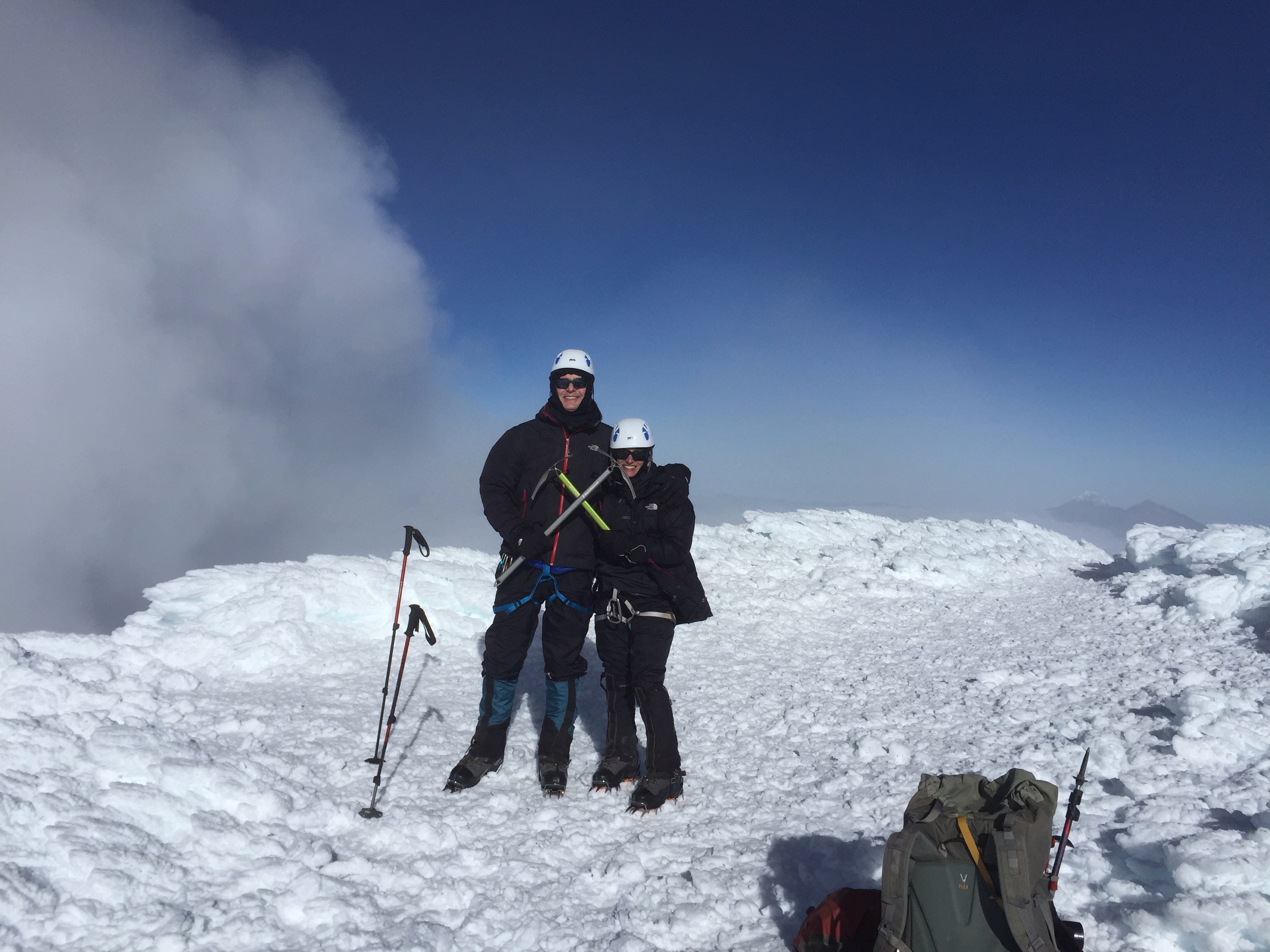
Suddenly I was on a flat area – but surely I couldn’t be there. I was positive there must be another 15 or more minutes of sheer physical and mental pushing left and this was just a fake….but no, I was actually at the summit. There wasn’t anywhere else up to go. I’d seen people on YouTube videos throw themselves down on the ground when they finally arrived, and without even thinking, that’s just what I did too.
Cotopaxi Summit – sulphur cloud in background
We couldn’t stay on the summit for long – just in case the wind shifted again and the crater drenched us with another load of sulphur.
Our descent was noneventful, which is about the best that can be said about descents. We kept up a pretty good pace, with J on the front of the rope, me in the middle, and Ossy bringing up the rear in order to arrest whoever might fall.
It turned out we made it up in 6 hours and 50 minutes, well within the range of normal, and down in 3 hours – also what Ossy wanted us to do.
Once back at the hut the reality of what we had just accomplished finally sank in. All those stairs; all those hot and sweaty runs. The culmination of all of it was that confluence of ice and snow and blue sky. A perfect summit.
Some of you may remember that one reason we ended up in Ecuador instead of the Grand Teton was our conclusion that we preferred mountaineering to rock climbing. (See “Cotopaxi, Ecuador – 180 Degree Turns.”) So it was somewhat inexplicable that I nonetheless found myself on July 1 hanging on for dear life to an ice encrusted basalt wall with my left hand, ski pole in my right and nothing but an almost vertical drop of rocks below. Oh, and this was at about 16,000 feet. And did I mention no ropes?
Illiniza Norte is one of the two Illiniza peaks (the other, obviously, is Sud), and is a common acclimatization hike in preparation for Cotopaxi. It reaches about 16,500 feet, and is the taller of the two forked peaks in the right in the photo. Its sister peak, on the left, is much more technical and is covered in snow.
The Illiniza Peaks
It was about a three hour hike to the mountain hut where we were to stay for our ascent of Illiniza Norte so we left in early morning. After fighting through Quito traffic, we followed modern highways for a while until we abruptly turned off to cobble stone roads, still in the same condition as in the 1940s when Ossy thought they were originally built. Jaw breaking and winding is an understatement. More on that later. We passed through several small villages, stopping at one to drop off things we wouldn’t need on the hike. Once we parked the car near the trailhead, we met up with the two men who took our supplies up to the hut on horses. Each day the horses plod up to the hut with full loads and bring trash back. Despite the routine, they seem quite content with their rather proletariat role in life.
The mountain hut is primitive – but there are flushing toilets, even if you do have to go outside to get to them. There’s a series of about four bunk beds, going up to a triple level, a small eating area and a tiny kitchen. No electricity. We were the only people there, and, in fact, the only climbers on the mountain the next day. That night we were treated to a spectacular sunset with a full moon. The entire Avenue of Volcanoes was visible, including the white capped isosceles triangle of Cotopaxi.
We got up at 5 for an early morning departure. The weather cleared as we hiked. There was more snow than normal, and many of the rocks were encrusted with icicles. I was glad of my climbing helmet since I hit my head several times on wide swathes of ice sticking out from the rocks I was trying to hold on to.
There are several sections of rock, the most difficult probably the one right below the summit. We climbed up through a chimney, along exposed ledges – and all without ropes. Ossy very carefully instructed where to place hands and feet and how to balance – and ultimately we did make it to the summit which is marked by a metal cross. But that wasn’t before a bowling ball sized rock hurtled down from the top in J’s general direction, followed by a smaller one in his more specific direction. Fortunately, no injuries. We now know the best way to react to rockfall (besides not experiencing it in the first place!) is to make yourself as small as possible. Sort of an airline crash position.
Summit of Illiniza Norte – that’s the summit cross that appears to be sticking out of my head
Coming down was exhausting and Ossy roped me in after I slipped twice. I think I’d burned up a lot of nervous energy on the ascent – not to mention physical. And we not only had to descend and get back to the hut – there was still the three hour hike back to the parking lot ahead of us, and then a couple of hours to drive to our next stop, the Hacienda Chilcabamba, outside Cotopaxi National Park.
For someone who actually froze on the stairs of the Eiffel Tower and who still has recurring dreams about being stuck on the old swinging bridge on Grandfather Mountain in North Carolina, reaching this summit was huge. But it also reminded me that figuring out how to get down from summits is just as important as going up them.











 FromSwamptoSummit