Jackson Hole may be best known for skiing, but snowless summer months offer plenty of entertainment.
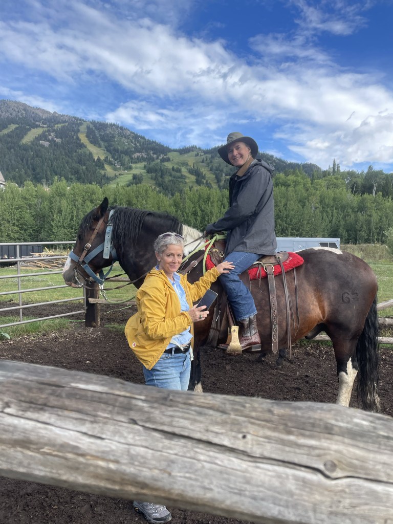
Although we are hardly equestrians, J and I have gone horseback riding during many of our travels. So far we have managed trail rides in South Africa (that one also involved zebras), Hawaii, Russia, Croatia, and Arizona, to name a few. The Tetons seemed an appropriate addition.
We met up with our niece, F (who really does live near Nice, France), as she was the only of our family group willing to brave the large four legged creatures that were to take us up one of the nearby mountains. She rode a very hungry “Chuckles,” J had a chunky “OT” (for Overtime), and I was blessed with Rhinestone. Apparently the trail company has over a thousand horses between Grand Teton National Park and one other location. Beautiful wildflowers, including lots of Indian Paintbrush, which is the Wyoming state flower. My favorite part was when our guide instructed us to get a move on so our horses weren’t spooked by the nearby bear cub who had climbed a tree, with Mama Bear right below.
Next up was a drive around the beautiful Lake Jennie loop. It was rainy but that didn’t keep us from enjoying sandwiches and a beer at Dornans, a long time Jackson establishment. And saw another bear. Bears were sort of a theme in the Tetons.
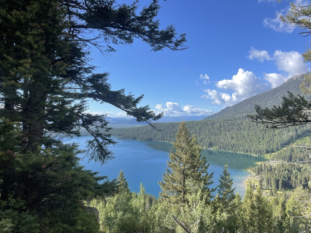
The afternoon saw a short but fun Lake Phelps hike. This part of the park is on the Lawrence Rockefeller Preserve. The Rockefellers, who had built a large estate on the property, donated it all to the park on the condition that all man made structures were to be torn down and the area returned to nature. Towering mountains peering over at a serene mountain lake. And on the way back we encountered a very large moose.
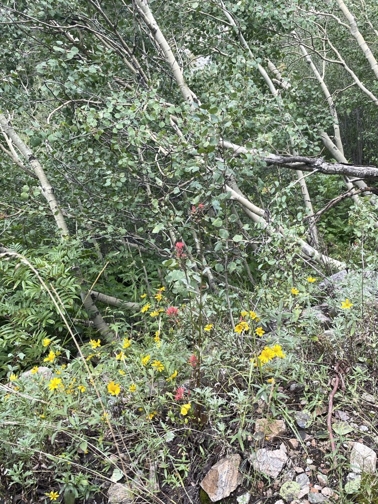
The following day, which was beautifully sunny, our hiking party consisted of my sister in law, T, J and me. I think the others were turned off by the fact the trail bore the auspicious name, Death Canyon. After driving through some of the many road construction sites (it seems as though most of the USA is currently building roads), we entered the park and ventured just beyond Phelps Lake. The trail starts wooded and a bit of an uphill, and then a very steep downhill, which you unfortunately know you will face up on the way back. You cross a number of boulder fields, but the trail is so well constructed you aren’t even aware of the exposure. Meadows of yellow daisies and purple thistles (which are not native, apparently), periwinkle blue flowers that looked like bluebells, and deep purple wild snapdragons. We walked alongside a river that cascaded into waterfalls before encountering a long uphill slog to the saddle right below Static Peak, at the patrol station. We keep going until the IPhone promised us we were at 8000 feet. I’m not sure what our total elevation gain was but it seemed considerable.
We pulled out our Maasai blanket from Tanzania and had a great picnic, which fortified us for a fast downhill followed by the uphill section we knew was coming.
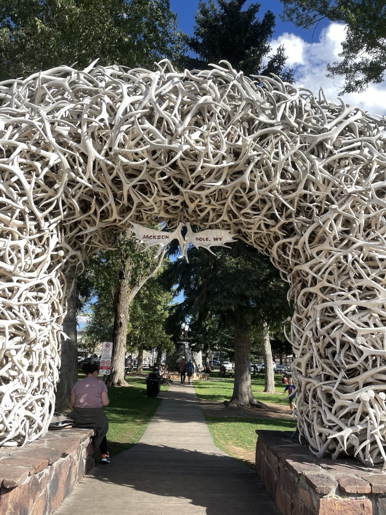
We couldn’t leave Jackson without some exploration of the town. Yes, we did see the iconic antler arches, browsed through a mountaineering store, and took advantage of the Snake River Brewery.
A very fun spot, and even the fact I left a hiking sock in T’s dryer didn’t seem that important. I guess it met up with the hat left in the Yorkshire Dales and the visor left in Hot Springs. I’m considering a blog post called “things I left behind on sabbatical.”
Once we left Golden, CO the temperature had crept far enough below three digits that we had no excuses left. Rooftop tent camping had to begin. After all, we had already lumbered a couple of thousand miles from Florida with the thing stuck on top of our car roof. It was time to do something with it.
Another set point on our road trip was the start date of an AirBnb in Jackson Hole, Wyoming, where we were meeting up with family members. Hence, day 1 of camping had to be somewhere between Golden and there.
We managed to reserve a Hipcamp in Buford Canyon, Wyoming, just west of Cheyenne. After a quick stop at a Colorado grocery store (with the unlikely name of “King Soopers” – but that was actually a Kroger’s), we had miles of driving north through Colorado. The burgeoning development outside of Denver reminds me in an unfortunate way of Florida, but then we shifted into high prairie and desert, multiple shades of yellow. Plus the wind picked up…no wonder Kansas had a song called Dust in the Wind. (Incidentally, the Spotify playlist for Kansas contains only two tolerable songs. It was J’s bright idea that’s what we should listen to while driving across the prairies.)
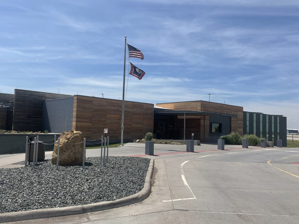
We stopped at the very modern Wyoming State Welcome Center. It’s more like a museum than a welcome center, with lots of interesting displays. The wind blew everything off our picnic table…
We decided to drive through Cheyenne, but there wasn’t much to see other than the capitol building and a very inactive downtown. Even though it was Sunday, I don’t think that was the problem.
Our campsite was about a mile off of the very heavily trafficked I-80. This part of the country is apparently home to the freight train industry with one plus mile long trains. I didn’t even know such things existed.
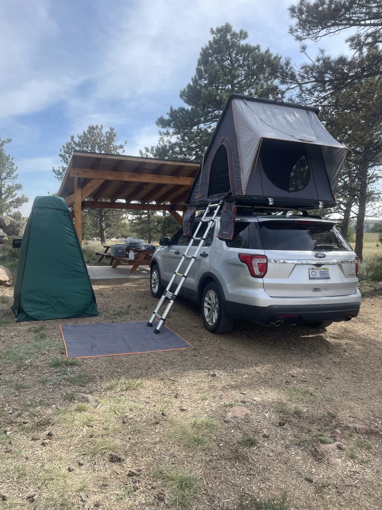
The campsite was absolutely stunning. A beautiful shelter for a picnic table, with a “designed by” plaque commemorating the architect. A spotless composting toilet and two sites with tiny houses. We set up camp, and walked around the interesting rock formations on the property, and over the ladder the owner had placed to allow entry into state land and the canyon itself.
After a brief scare when we couldn’t get the lighter to work we managed a pretty good first night camping dinner of steak and asparagus. The night sky was a spectacular tapestry of silver and black. The only downside was the I-80 traffic and train noise, which was constant. But it was more than made up for by the convenient and beautiful location. Elevation was about 7600-7800, and we could feel it.
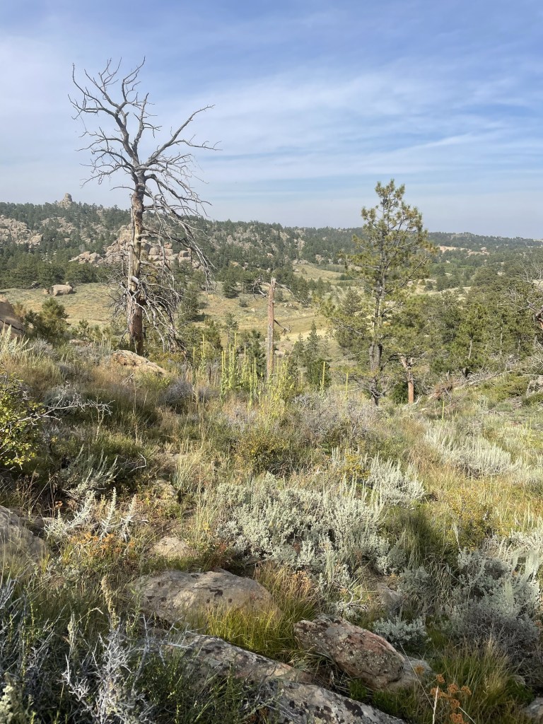
The next day was a long day of driving the length of Wyoming. After we broke down camp, we drove through high desert with the Wind River mountain range on one side. Unfortunately much of the drive was on I-80, with 18 wheelers careening in the wind, and my fingers were sore afterwards from my white knuckled driving.
Some of the area looked like what I would call salt flats. Very desolate, with tiny hamlets of only 100-200 people. I especially liked the truck stop called “Stinker.” We even went through a small town called Eden, which had a few green fields.
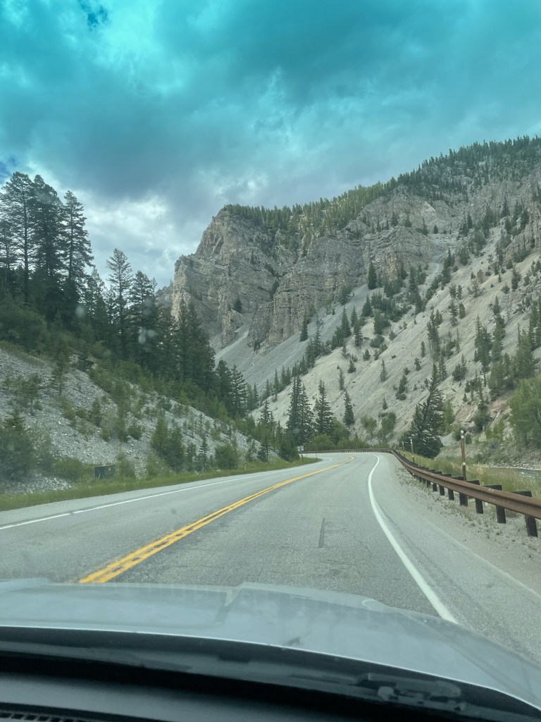
Eventually we climbed higher and higher, suddenly saw evergreens, and the next thing we knew we were approaching the Tetons and Jackson.
We located our AirBnb in Teton Village, a major ski resort with lots of condos. What a change from what we had been driving through. J and I managed to get cleaned up – after a night of camping and days of driving we were pretty grimy – and rendezvoused with family. Time for a few days of real R&R – hiking and the like, and a nice break from the road.
One of the nice things about road trips is the freedom to stop where you want. OK, we did have certain set spots where our arrival time was sacrosanct (e.g., our campsite in Yellowstone), but between here and there there was a bit of flexibility.
One of those unplanned adventures resulted from our last minute decision to visit the Crystal Bridges Museum of American Art located in, of all places, Bentonville, Arkansas. Created by Alice Walton of Wal-Mart fame, it is the repository of an immense collection of American art of all genres and periods, and since there is free admission, it is an enormous gift to the public. One of her goals was to give access to art to those who had not had it before, and the visitors to the museum are a truly eclectic group.
Getting there entailed a trip through the mountain ranges bordering Hot Springs, the first being the Ouachita Mountains (and national forest). A sign aptly described the roads as “steep and crooked.” The mountains were heavily wooded, but occasionally opened up for vistas of multiple levels of ridges. Reminiscent of the Blue Ridge Mountains, except the color scheme was dark green textured against a blue sky. I don’t have any photos of the drive – I was too preoccupied with hanging on for dear life! The Ouachita were followed by another set of mountains – the Boston Mountains (who knows the reason for the name?) – which were still steep but with more gradual curves. The Boston Mountains took us into Bentonville, where we made a beeline for the museum.
Bentonville was surprisingly interesting. The museum area is a city unto itself, replete with apartment buildings, retail, sports fields, something called the Scott Family Museum (or Amazeum?), and, of course, the Wal-Mart Museum. But Crystal Bridges was our goal. It’s being doubled, if not more, in size, so there’s a lot of construction going on. The structure – low buildings bordered by lagoons and flowing water, blends into the landscape like a Frank Lloyd Wright building – sort of the opposite of the Guggenheim in Bilbao. The interior feels warm in tone and the art is thematically organized by great motifs in American art. There are also hiking trails and sculpture gardens, none of which we had time to sample – we had to reach Wichita!
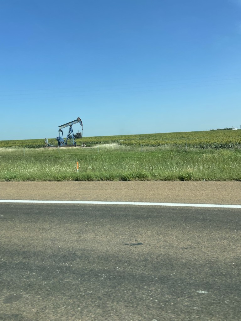
If you wonder why the eagerness to reach Wichita, one of our non-negotiable times was to make it to Golden, Colorado for a party our friends D & D were hosting. And Wichita looked like the mid-point. Miles and miles of corn fields, peppered with occasional oil drills. I never thought of oil drilling as a family business before….but I guess that’s the whole Beverly Hillbillies idea . . . Blue sky backed the fields and prairies. It was an exciting moment when we encountered a curve in the road.
It turns out Kansas has great rest stops – probably because there are so few towns. My favorite was the one apparently erected in honor of the Benders, a 19th century family who lured unsuspecting travelers, and served them a meal in front of a curtain. In the meantime, one of the family would hide behind the curtain, cosh the unfortunate guests, and steal all their possessions. After the mysterious disappearance of a number of travelers the Benders went on the lam and no one knows what happened to them.
We stayed at a motel in Wichita just off the interstate. It was still too hot to pop up the rooftop tent and try our luck. We were so sick of driving by this point that we walked to the “Irish” pub next door. the only thing Irish was Guinness on tap. All the food was Mexican.
We got an early start the next day – there were still a lot of hours to go before Golden. More and more Kansas fields – we stopped in the charming town of Selina, which had some of the best Art Deco architecture I’ve seen anywhere. Lots of restaurants and a 1931 movie theater still operating as a theater. And we were able to purchase a “Tomahawk” steak as a house gift for D & D. Somehow that seemed an appropriate choice coming from Kansas.
Miles and miles more of driving, with little traffic until we hit Denver, where rain and a navigational error didn’t make it any easier.
But we made it to Golden just in time for the party which featured one of D & D’s friends, singer/songwriter Lynn Drury of New Orleans, who performed with the beautiful mountains in the background.
What better spot for a brief hiatus with friends before hitting the Wild West of Wyoming.
Unfortunately, this blog has only taken us thus far to Clarksdale, Mississippi, and there is much more of the country to cover before J and I leave again in a couple of weeks for Europe.
After we woke up in the Mississippi Delta in our gentrified sharecropper’s cabin, we met a ZZ Top looking guy who must have been a home health person because he’d come to check on our neighbors, who seemed to be permanent residents (that is, unless they were traveling with a cat). He immediately asked what we’d heard the night before but recognized that Tuesday wasn’t the best night for music in Clarksdale. His wife was from Wyoming so he provided some travel hints for the upcoming weeks. He clearly resided in Clarksdale just for the music, and we vowed to come back over a weekend or during a festival.
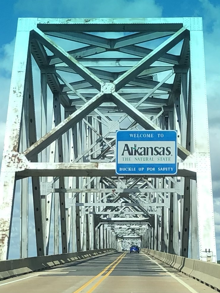
After repacking the Explorer in a more logical fashion, we drove miles upon miles of Mississippi Delta fields of cotton and soy…and finally crossed the Mississippi River itself, which divides Arkansas and Mississippi. The bridge was two lanes, no shoulder, and very high – just like the ones that terrified me as a child when we crossed the Tombigbee or Black Warrior Rivers when going to visit my grandparents. Once across, the roads improved and it seemed – almost imperceptibly – a little less flat.
More and more agriculture but no sight of the opulent plantation towns we’d been traveling through in Mississippi. Our “grey” road finally merged onto I-40 outside of Little Rock. It was awful, and our rapidly learned lesson was to avoid interstates whenever possible on a cross country trip. There was nothing but huge truck traffic, an unfortunate contrast to the rural roads we’d been traveling.
Ultimately we exited I-40 and I-30 (even worse than 40), onto U.S. 70 and into Hot Springs, also the site of Hot Springs National Park (which must be one of a kind). What a place. Verdant green and rolling hills. Apparently my grandfather came here in the 1940s to “take the waters.”
In the 1830s, well before the national park system, the federal government took control of four sections of land as a “national reservation” due to the alleged healing properties of the hot water bubbling up from the ground below (and I can personally vouch for the fact that it is hot). The park itself is shaped like a doughnut, with the town in the center. One side of the Main Street (Central Avenue) is part of the national park, and is lined with seven or more of the original “bath houses” that are still in operation of various kinds. One is still used for spa treatments and bathing, another is a visitor center/museum, another is a brewery, and some are still waiting to see what the future brings.
At one point, the poorer folks were so upset they couldn’t afford the “spas” that they started their own “ral” (short for “neuralgia”) camps to bathe in the 135 degree waters up on the hills above the spas. Ultimately federal troops arrived to stop them from “corrupting” the waters, but in some type of concession, erected some free bath houses.
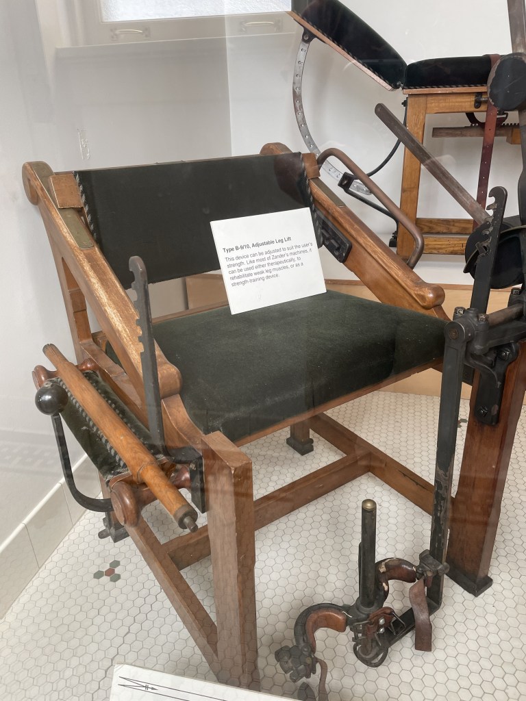
What struck me was how before their time some of these “treatments” were – mechanized machines (tension and resistance) that are only a step removed from the machines we use at the Y today.
After a thorough inspection of the museum, which truly was fascinating, we walked along the Grand Promenade on the hill behind the bath houses, which is of a much more recent vintage, up the Peak Trail to the Mountain Tower. I steeled myself and J and I climbed the 21 flights up the metal staircase to the observation deck. I didn’t look down once. We did take the elevator down.
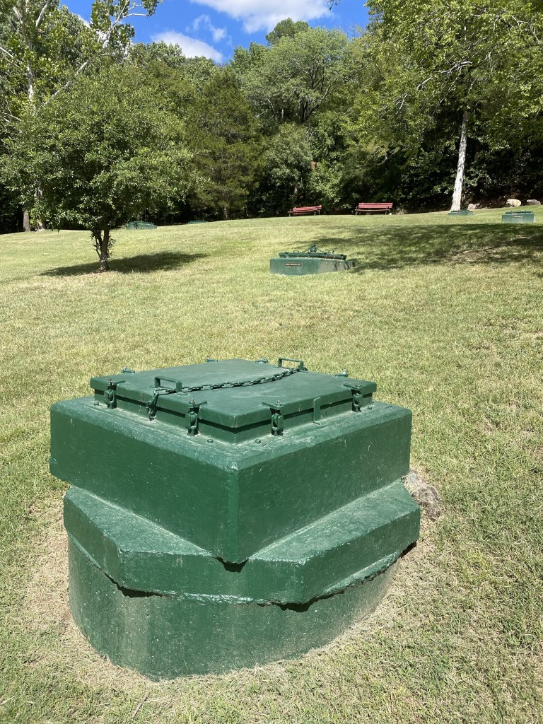
The entire area is checkered with green metal boxes that serve as collection sites for the water. Which, by the way, we tried at the visitor’s center and it tasted like plain H2O.
After a quick descent down the trail, we decided to take advantage of the Superior Bath House Brewing Company, which uses the thermal water to make the beer. I’m pretty sure it is now also are the home of my visor, which was never to be seen again after our visit.
After a beer, we located our AirBnb, not an opulent section of town, but quite nice. Back on the main Street, we stumbled upon the Brick Grill, a very reasonably priced and pleasant restaurant – many here were quite expensive.
Coming up – out of the flatlands and into the “steep and crooked” Ozarks.
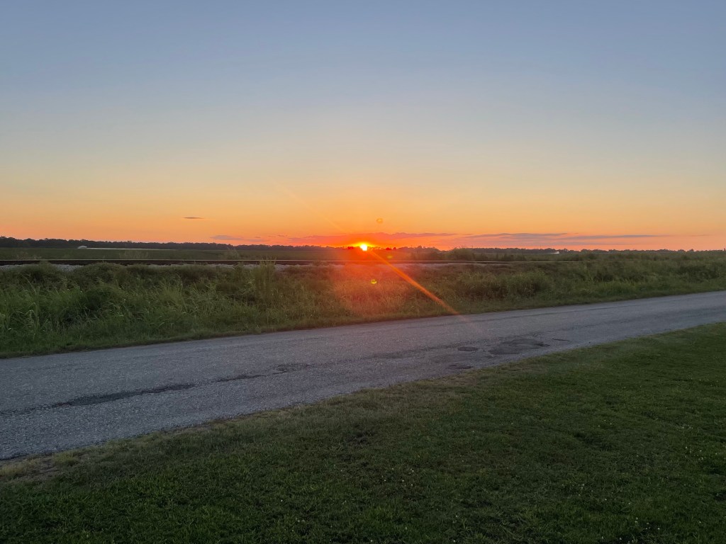
Clarksdale, Mississippi. I was watching the sun set over flat delta cotton fields. Pink blossomed into deep peach while rich grape paintbrushed the sky.
After two weeks at home in Orlando after our England and Spain adventure, we took off again on Sunday, August 13, this time by way of our 2016 Ford Explorer with a rooftop tent, as opposed to the airline that shall not be named. Both J and I lay awake the night before thinking about what we’d forgotten to pack for a four week road trip, what we should be taking instead, etc etc.
We finally got off about 9:15, driving along the turnpike to I-75 into Georgia. The turnpike was as excruciatingly boring as always. Ultimately, we exited I-75 and made our way to US 82, which goes all the way to Tuscaloosa.
After the monotony of the interstate, 82 took us through many small Georgia towns, which made the drive much more interesting. Lots of peanut (I think) fields, a large and elaborately patterned black and gold snake that we narrowly avoided running over, the red brick Andrew Junior College in Cuthbert, Georgia, pecan tree groves, so uniform and graceful.
At some point we realized one of the eight bolts attaching the rooftop tent crossbars to the roof of the Explorer was missing. We stopped at the parking lot of – I kid you not – a BBQ place called “Hog ‘n Bonz” (apparently meant to reference Haagen Dazs?) to replace it. My three pound weight that I’d thrown in at the last minute, with some vague idea I could sit in the passenger seat and do arm exercises (not) served as a surprisingly good mallet to push everything back into place. Regular bolt checking quickly became part of our daily protocol.
We crossed the state line into Eufaula, Alabama – beautiful antebellum homes with a dying downtown. Eventually reached the outskirts of Montgomery – many boarded up and overgrown motels, clearly victims of Covid.
Around Montgomery we encountered a drenching Florida style rainstorm. Surmounting other problems – such as the demise of the weatherstripping around the Explorer’s front windshield (purely cosmetic, or so they say), we finally pulled into the driveway of my uncle R’s house, which, by the way, was designed by a student of Frank Lloyd Wright. That explains all the wood, curved walls, and long lines.
The next day R gave us a detailed walking tour of the huge U of A campus, including the stadium with statues of the winningest coaches, fraternity houses with more columns than you could count, the president’s mansion, and the new school of engineering which is as big as many a college campus.
Most interesting – Bryce Hospital – which was originally a hospital dedicated to the moral treatment of the insane, a revolutionary theory for the mid 19th century. My uncle, an art historian, has done much of the work of mapping the hospital and its environs. Straitjackets and similar restraints were banned, each patient had their own room, and there were beautiful park grounds – the theory being that if you treated patients with dignity and respect in a calming environment they could recover. As they improved, they were moved into increasingly social environments. A surprisingly enlightened approach in days long before drug treatments and the like. The building is now being transformed into a museum and performing arts center.
We also enjoyed a visit to the natural history museum which houses the Hodges meteorite that landed on Elizabeth Fowler Hodges in Oak Grove, Alabama in 1954. She’s the only human known to have survived such an onslaught.
A surprise was the tour of the Gorgas House, lived in by the descendants of the 8th president of the university, until the 1970s or so. It was originally the dining hall for the university and is one of the few buildings to have survived the civil war. Accordingly to the posted chronicles, college students in the antebellum south were hardly paragons of good behavior, especially in the dining hall.
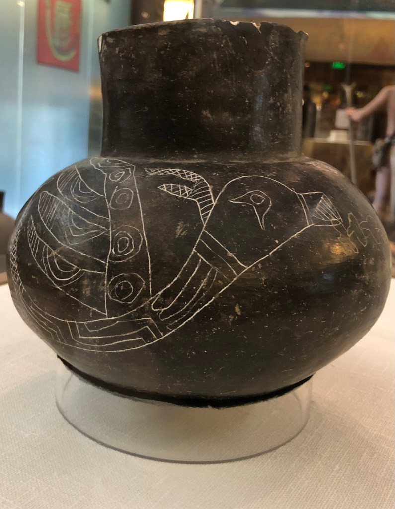
Next stop was Moundville – the site of a large city settled by indigenous people coming up from Central America hundreds of years ago. It ultimately became a political and burial site, and consists of large dirt mounds on which wooden structures rested. It was brutally hot, but we nonetheless climbed one of the mounds to see the view of what must have been a sprawling development. Their ceramics were masterful. Many depict a flying snake that my uncle thought might have reflected imagery of tornadoes common in the area.
As we drove back to Tuscaloosa, I was overwhelmed by the miles and miles of undeveloped, presumably privately owned land. That simply doesn’t exist in Florida.
The next day we headed for the Mississippi Delta, driving through thick Alabama forest, crisscrossing the Tombigbee River to Columbus, Mississippi. It’s chockfull of antebellum homes dating from the 1830s on, and is also the birthplace of Tennessee Williams.
The Southern Writers theme continued with a journey through the hill country to Oxford, Mississippi, where we stopped at William Faulkner’s home, Rowan Oaks. Although the town was crowded with newly arriving freshmen about to embark on their college careers at Ole Miss, we were the only visitors to Mr. Faulkner’s abode. The house was built in the 1830s and he bought it about a 100 years later. It’s very small, although Faulkner added a number of rooms, and has opulent grounds, including a riding stable. Apparently Faulkner’s wife commented on the nature of the light on the porch in August – the genesis of the title of the novel, Light in August. I think I’ll have to go back and re-read his tales of Yoknapatawpha County.
We finally reached the flat, soil rich delta and the Shackup Inn – our home for the night and a location that I discovered on the internet. It’s just outside of Clarksdale, and is a collection of old sharecroppers’ cabins that have been gentrified with electricity and bathrooms, but are totally quirky. Rusting farm equipment, old signs, and a large area for music festivals. We could have stayed in a cotton gin silo, but instead picked a cabin called “Shorty’s.” It’s one of the strangest places I’ve stayed since the barrels on Mt. Elbrus in 2014. ( https://fromswamptosummit.com/2014/07/02/looking-down-the-barrel/ )
We checked in and then drove down a pothole ridden road to Clarksdale itself. Clarksdale prides itself as the home of the blues, and hosts many festivals, but it was a little dead on a Tuesday night. The Delta Blues Museum is magnificent and moving. The entire place was a huge contrast to Columbus – here’s the home of the people on whose backs all that wealth was created. It was a left alone little town, enabling the blues to develop and flourish on their own terms. Photos weren’t allowed in the museum, otherwise I’d have posted a lot!
The temperature finally dropped about ten degrees. After a beautiful sunset, we were looking forward to a spectacular night sky.
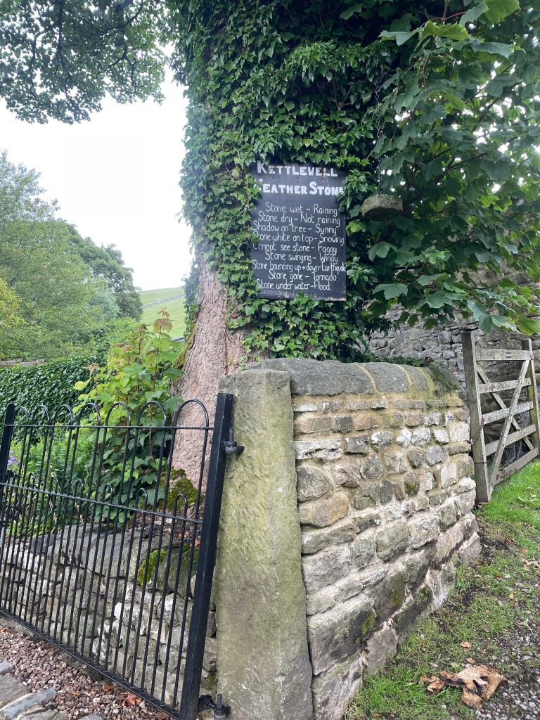
When last I left this blog, J, S, M and I had just completed our 77 mile hike through the Yorkshire Dales. After our celebration in Kettlewell (where I am pretty sure I inadvertently donated my now no longer manufactured hiking baseball hat to the Bluebell Inn) and an overnight in Grassington, the next day we took a horribly crowded train back to King’s Cross in London. Our original train was canceled, which led to mass confusion on the next train for those who had reserved seats versus those who didn’t or originally did or….you get the picture.
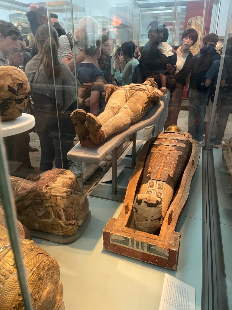
Once in London, M and S’s daughter, B (of Balkans fame) ( https://fromswamptosummit.com/2019/07/20/things-we-brought-to-the-balkans-were-on-our-way/ ) joined us and we all enjoyed a “cruise” down the Thames to Greenwich where S could indulge all of his astronomical interests by standing on either side of the Greenwich meridian at the Royal Observatory. J and I also had a look at the British Museum (incredibly crowded and apparently mummies are much more popular now than when I used to go inspect them in the 1970s). Also, the entire first floor is set up like a quasi shopping mall, which does cast the whole experience in a different light.
Regardless, I loved London as much as ever and J and I spent two of our three nights there going to the theater – Aspects of Love (really strange Andrew Lloyd Webber musical based on a novella by David Garnett) and a classic English comedy/farce, The Play That Goes Wrong.
Our final phase of the trip left a little to be desired. On an airline that shall not be named the following happened:
(1) Reached Orlando at the time of a massive thunderstorm that closed the airport;
(2) Circled Orlando until we were close to running out of fuel;
(3) Landed in Melbourne to refuel;
(4) Sat on tarmac because storm moved to Melbourne and it was too dangerous to refuel;
(5) So many hours had passed our crew was no longer legally able to work;
(6) Alternate crew was to be sent from Orlando via taxi;
(7) Were permitted into a secured hallway of airport (we hadn’t gone through customs) where the local airport officials doled out the world’s worst junk food from large cardboard boxes (think Combos filled with pizza cheese) – it was a bit like being one of the animals at feeding time in the zoo;
(8) After 6 hours in Melbourne the new flight crew arrived (to sardonic applause from the passengers);
(9) Flew 15 minutes at under 6000 feet to Orlando and landed;
(10) Were informed that we were so late that all the customs officers at the glitzy Terminal C had gone home;
(11) Taxied around the airport looking for a parking place (think looking for a spot at the mall during the Christmas shopping season [back when malls were a thing]); and
(12) Were finally welcomed at Terminal A in one of the Spirit gates. You know you’ve reached a new low when that’s your home port.
Regardless, a wholly successful phase one of sabbatical. Phase two was to start only two weeks later. The changing of the guards seems an apt metaphor for phase 2 – our U.S.A. Road Trip.
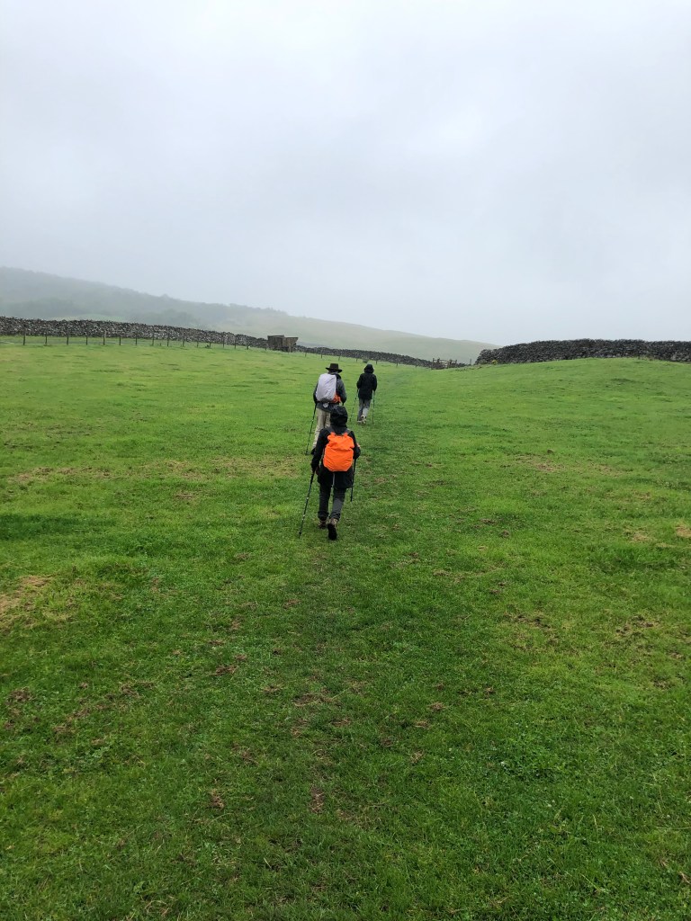
As we’d had several long and steep hiking days, we decided to knock off a couple of miles by avoiding a loop around something called Apedale Moor (which we couldn’t locate on any map anyway) on our way from Reeth to Bolton Castle and on into Aysgarth Falls.
This meant having the nerve to stray from the ever present blue GPS line that was our North Star to take a paved road called Hargill Lane practically the whole way. Just because it was paved, however, did not mean that it didn’t go up and down, and unfortunately, it was a quintessential long slog shin splint generator. Hargill Lane crossed windy, windy moors with absolutely nothing around but sheep and occasional cars that operated at the same speed as all the bus drivers – that is to say, fast.
Eventually the road descended into the conservation area for the Bolton Estate, lands that are still owned by the same family that held them hundreds and hundreds of years ago. There were many beautiful wildflowers, but they were interrupted by lots of warning signs for the quarry works on the other side of the road.
We reached the very well preserved Bolton Castle right at lunch time and had a nice meal in the tea room. The castle, built between 1378 and 1399, is quite intact, and M and I enjoyed the diagram that showed what each level of the structure was used for. There was also a lot of information about the castle’s architect, John Lewyn. Who knew castles had architects!
The walk from the castle to Aysgarth Falls was lovely. We did cross a field with another bull, which was actually starting to lunge at a couple on the other side of a wall who had a dog with them. (Incidentally, everyone in the Dales has dogs, and they are welcome guests in restaurants, pubs, shops, etc.) They had some long story about someone they knew who had recently been charged at by a bull and had to throw his dog over a wall….in any event, it turned out my bull fears were not unwarranted! While the bull was occupied with them, J, M, S and I managed to sneak over another section of the wall, unnoticed.
On the way, we also suddenly heard a huge roar overhead that practically shook the stone walls surrounding the fields. Two Typhoon RAF jets zoomed by, and made several passes. We soon learned that war had not actually broken out while we were in the solitude of the Dales, but that this was a popular location for the RAF to do low altitude training.
The Aysgarth Falls themselves were pretty, but by then we’d seen so many waterfalls, we were somewhat jaded, and just as glad to keep on moving up a steep hill to our next guest house — the newly renovated Aysgarth Falls Hotel. Despite three flights of stairs (thank God for those backpack straps on my suitcase!), it was really nice and we thoroughly enjoyed their pub and dinner and breakfast food.
That was good, because the next and final day turned out to be the most challenging yet.
The plan was to walk from Aysgarth Falls to Kettlewell, where we would meet a taxi at 5:30 that would transport us back to Grassington, for our travel to London the next day. We wisely chose the 12.6 mile route rather than the 15.3…..
We started with some easy walking through fields and what was described as some “unavoidable” road walking. But there was little traffic, and the flowers were pretty as we basically hiked the length of the valley. Despite its remoteness, a number of little cottages bore signs of construction.
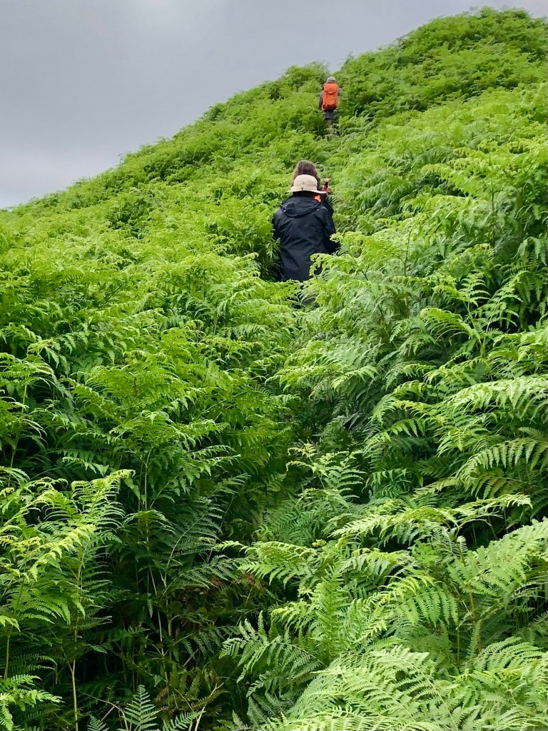
Eventually the valley ended, and so did the road. A very nice farmer gave us directions (the blue line becoming somewhat cryptic at that point), and we were able to cross the river and start what was described as a “big up.”
We were completely distracted from the steepness of our ascent because the almost imperceptible trail started to lead us through fields of five plus foot high ferns. They literally towered over us and I found I was using my body as a battering ram to push through. It felt way more like an Amazon jungle than the Yorkshire Dales.
Part of the way up, we realized there may have been a slightly more trodden path, but we were too busy bushwhacking and trying not to be swallowed by the ferns to have seen it.
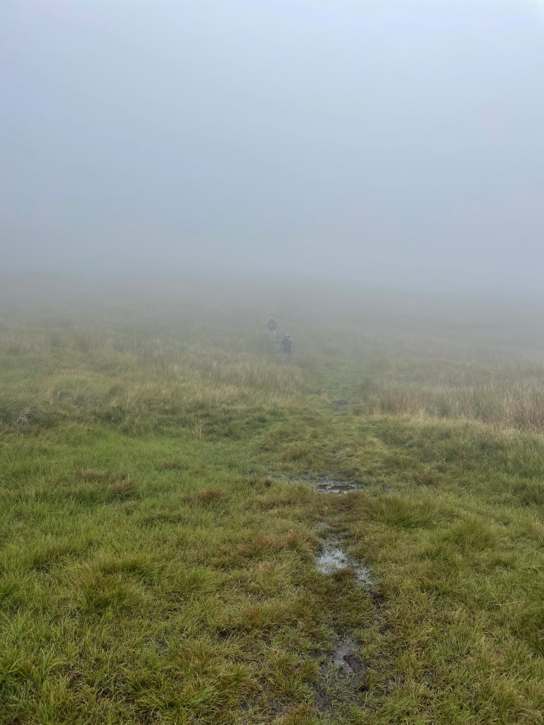
We finally cleared the fern field and continued to ascend. It was a very rapid elevation gain. Suddenly we found that we were no longer below the low hanging cloud we’d been observing all day, but were actually in it!
Yet still we continued to climb up. Visibility was starting to close and navigating the blue line was like flying a plane on instrumentation only. We encountered one group of young scouts using maps who were clearly doing some sort of orienteering exercise….they seemed infinitely better equipped for the challenge than we were.
We had no choice but just to stick to the GPS line as much as we could and aim toward the cairns and waymarkers that we could see. Finally, the scout leader passed us asking if we’d seen his charges anywhere – we were relieved to see him as proof that civilization existed somewhere in the direction we were aimed.
Visibility continued to get worse and the wind was whipping. We stopped for a brief break by a the first stone wall we’d even seen. But by then I was simply dedicated to getting down as fast as we could because it really was starting to feel unsafe. I was beginning to feel like a character in one of those Sierra Club magazine articles about what can go wrong while hiking….they usually end with hypothermia or broken bones.
Anyway, we finally reached what the itinerary termed a “snappy descent.” To the dismay of my fellow hikers, I actually found that part sort of fun – skipping around and over rocks, but with lots of grass cushioning on either side. Plus we were going down.
But we were still in the cloud, and M and S were just dots in the mist. All I could think about was that we had to maintain visual contact. You really could have gotten lost up there.
Finally we were below the cloud, and the world started to come back into focus. We could see the village of Starbotton at the bottom of the peak we were descending, and the wind that had whipped us as we crossed the ridges of the moors died down.
A steep descent down a stone road, and we were back in the valley, only 2 1/2 miles from Kettlewell. We had a quick bite of our sandwiches, and then walked through the fields that lined the valley for a straight shot to Kettlewell.
We had made it – all 77 plus miles! We walked through the village to the Blue Bell Inn where we were to meet the taxi in an hour or so. We had a celebratory drink to toast our most recent adventure. And even the fact that the taxi was an hour and a half late picking us up didn’t really matter.
Rooms at the Herriot Guest House were quite small, but that was by far compensated for by their very good breakfast and homemade jams and marmalade. That provided enough to fortify us for a slightly easier – and hopefully drier – day 3 ahead.
The Mac’s Adventure itinerary called for us to be transported by taxi to Keld, which truly is a blip on the map. The taxi took us through the Buttertubs Pass – a location I was last in with my family in 1972 when we lived in England for my father’s sabbatical.
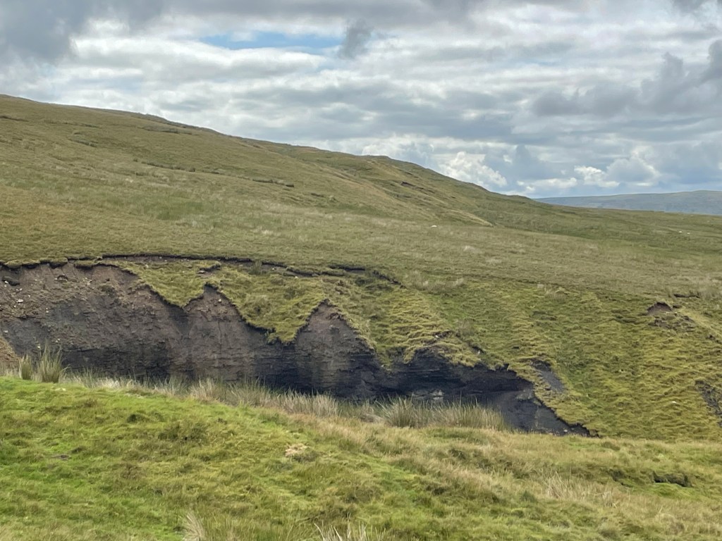
After an early arrival in Keld, we got on the road to walk to the Tan Hill Inn, famous for being the highest pub in England. About a 4.5 mile hike, over lots of moorland and gigantic ravines, where erosion peeled back the top layer of heather to reveal dark soil and rocks. For all of its age, just like the fossilized Jurassic coast in Dorset, this is an ever-changing landscape.
It was rewarding to see the inn suddenly appear in the distance, but the place itself was crowded with day trippers and there was nary a place to sit. Nonetheless, there were picnic tables outside, and we were able to make a nice lunch out of the Double Gloucester cheese and crackers that I had been carrying around since Manchester, alongside the middle aged men’s motorcycle group who were similarly shut out of the pub.
J and I chose to take the longer route back and crossed the valley, which was low and filled with green rushes, over to the next other ridge. The top flattened into a golden prairie-like meadow. We saw at least four or five “bouquets” of pheasants suddenly take off. On the ground they were perfectly camouflaged, soft brown speckles and beige. We would hear five short whistles and suddenly they would take off at top speed, looking for all the world like a group of feather dusters taking flight.
We could never capture a pheasant in flight, but at least I found some feathers!
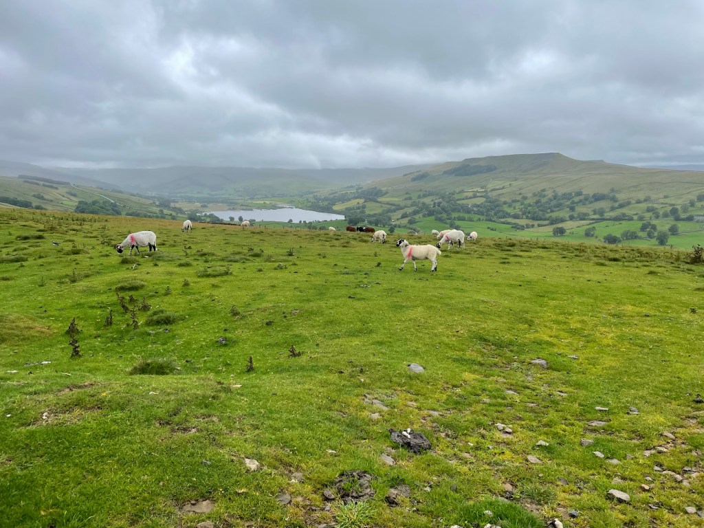
Our path took us by the rather large farming establishment of of the so-called “Yorkshire Shepherdess” of TV fame (although I’d never heard of her). She’s apparently one of those “leave the city behind, become a farmer, and write about it and develop a TV series” people. We did see two men, one on an ATV, which seems to be the farm vehicle of choice here, herd a group of cows into a barn. We had to wait until they were in before we could pass.
I know these are sheep, not cows, but I didn’t have a pic of the cows!
We were almost back in Keld when we managed to make a critical navigation error and ended up going the wrong way toward the small hamlet of West Stonesdale. It’s a true farming community, with working sheep dogs sleeping in their cages, and big agricultural equipment everywhere. Fortunately, I soon realized I was looking at the famous GPS blue line backwards, and we were able to correct our course and make it back to Keld about 5, just as S and M were starting to question where we were.
View from the Keld Lodge
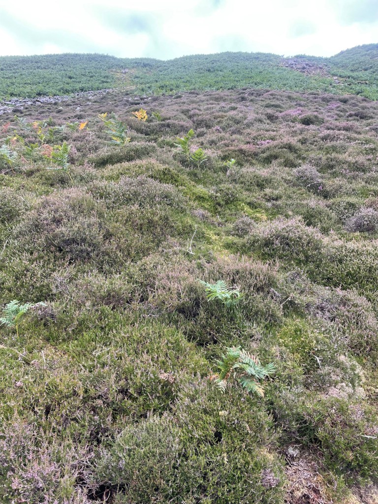
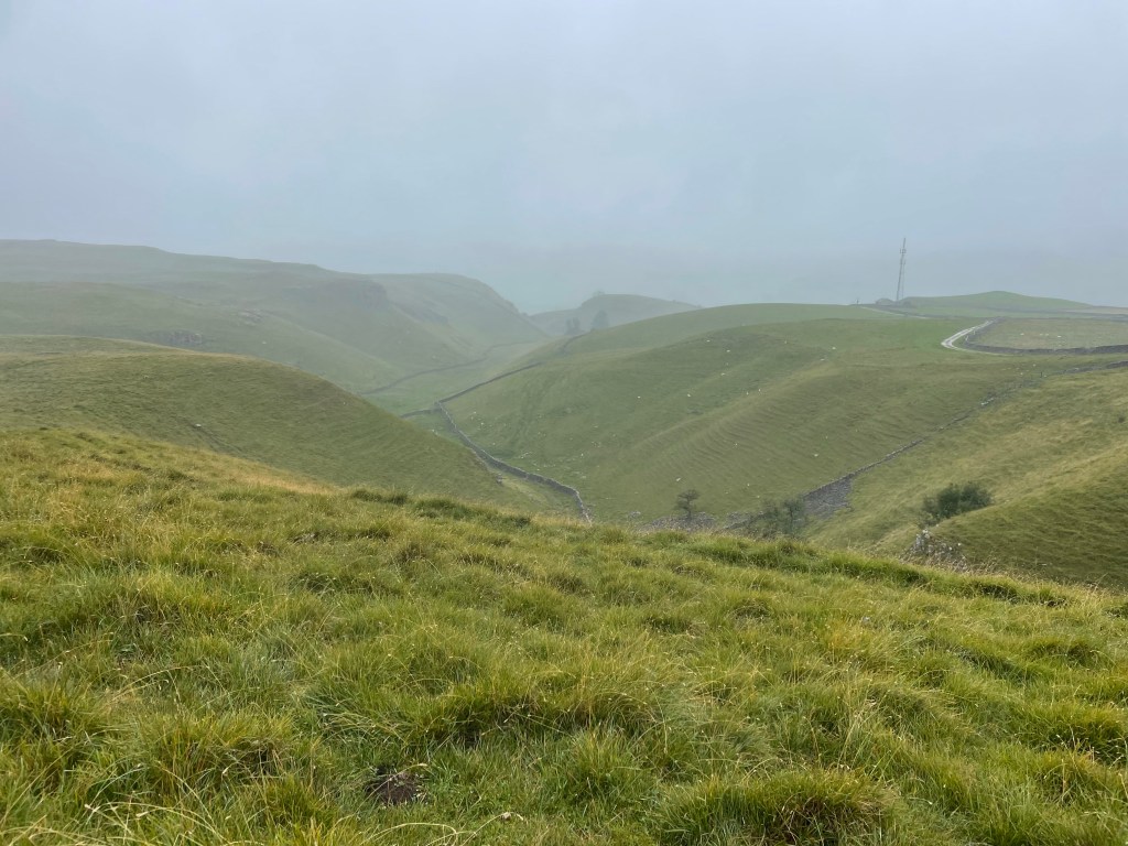
After an overnight at the Keld Lodge, the next day, Day 4, we were to trek to our next destination of Reeth. We had a choice between the “high” route, which would mostly be on the famous Coast to Coast trail, or the low route, which ran along the river. We fortunately chose the high route – and it did indeed provide some of the best summits and sights of the whole trip.
The first part was over moors, which were blanketed in blooming purple and sometimes white heather, waterfalls galore. There were lots of steep sections, including some fun scree fields to scramble through, and I was happy get to use some of my basic mountain skills. They are pretty common sense: always lean into the mountain and your uphill pole.
A steep descent into the valley, and we were in the midst of the ghostly ruins of lead mining works. Lead mining was very big in the Dales back in the 1830s. It’s now just a shadow land, and it’s hard to imagine the hundreds of men that would have lived and commuted to these now remote and desolate areas to work the mines.
It looked like some gravel quarrying still continued and we ascended back up the valley to a moonscape of rock and gravel.
Once we crossed the moonscape, we found a nice spot for lunch, where we chatted with a mother and daughter combo who we had seen in Keld that very morning. They must have been uber athletes based on their speeds up and down.
I bonded with this sheep. It was the cleanest one we saw!
After about 12 miles or so and a few more ascents and descents – and a lot of what we believe to be grouse – we made it to the pretty town of Reeth. As always that final last mile or so is the hardest.
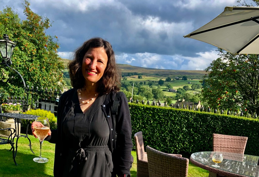
We were staying at the Burgoyne Hotel, which seemed positively opulent after the Herriot Guest House. Nothing like a drink in a front garden after a hard day of hiking.
As foreshadowing, let me start by saying that I spent a lot of time on day 2 of our trek through the Yorkshire Dales thinking of synonyms for the word waterlogged. But I digress.
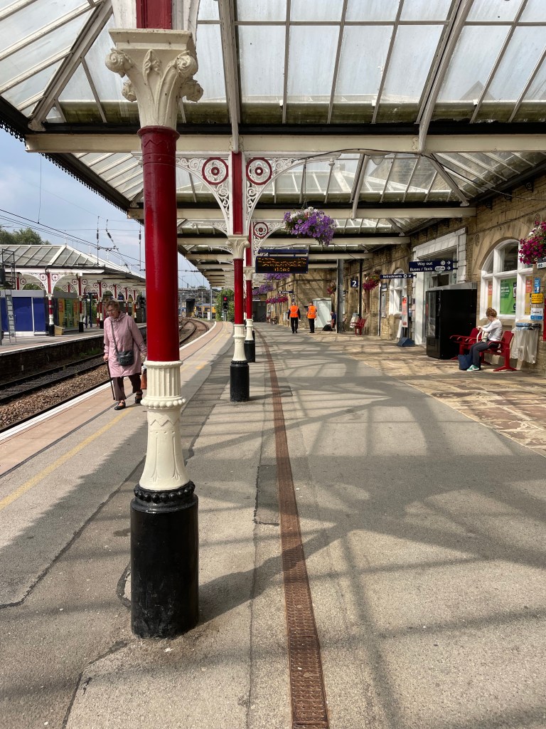
After a two night sojourn in Manchester spent catching up with family friends (by the way, we really liked Manchester and its bustling vibe…), J and I successfully navigated our way to Grassington. This started with two trains, which delivered us to the charming town of Skipton, which had one of the prettiest rail stations we’d seen.
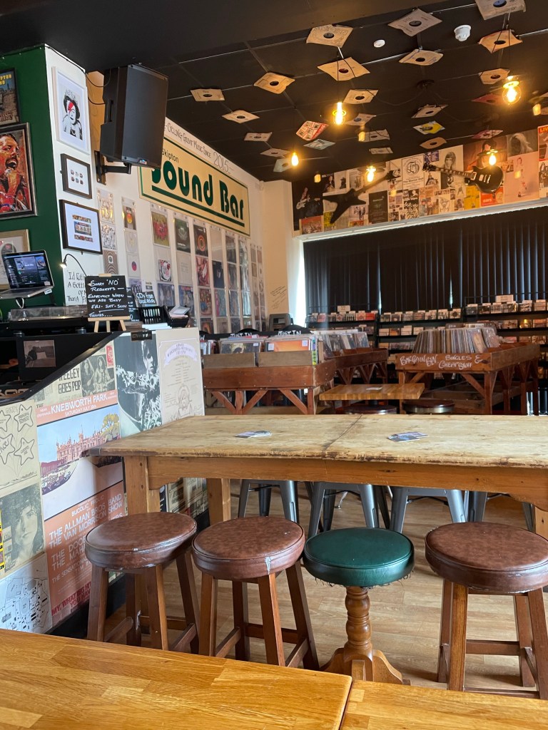
From there we planned a bus ride to Grassington. Of course, the rail station and bus station were not contiguous, so this involved a ten minute jaunt, luggage in tow, but we were able to use our two hours of waiting time to visit the “Sound Bar.” An independently owned combination vinyl record store, coffee shop, and pub that also featured live music on the weekends. The walls were plastered with tickets, posters and other promotional materials for concerts and bands dating back 50 years – really fun spot and not what we expected to find!
Despite the fact that the driver operated the bus to Grassington as though he were auditioning for Mr. Toad’s Wild Ride, he safely delivered us to just outside the Black Horse Hotel where we met up with pals and long time travel partners M and S. They’d arrived a day earlier, fortunately managing to take one of the only trains running on a day of “industrial action” (aka strike day) from London to the north. Unfortunately, the room reserved for J and me had electrical problems. After a couple of hours of waiting around in their very cozy bar, management gave up and sent us across the street to an equally nice inn, the Devonshire, which was graced with a mention somewhere in one of James Herriot’s books.
For those of you not aware, practically all of the Dales is Herriot country – there’s a Herriot Way walk, hotels name their rooms after the characters (both human and animal), and more memorabilia than you can imagine.
After a filling breakfast, the first day of the walk went smoothly. It was only about 11 miles – slightly shorter than the original itinerary because we were to stay in Buckden instead of Cray, which was a couple of miles further down the road. Of course, that did have implications for day 2, as I’m sure any discerning reader will have figured out.
There was a light, misty rain much of the time but it was really nothing more than what you experience with a mister at a Disney theme park. A few steep uphills at the beginning until we reached a ridge line. We then descended through what must have been a planted forest of tall conifers, stripped of their lower branches, and down to a river that was contained in its banks (foreshadowing again – unlike day 2).
We reached the village of Kettlewell where we stopped at the first spot we saw for lunch and an ale (after all, this was billed as an “Ales and Dales” trek). It turned out it was the owner’s first day open, and his manager had quit that very morning. We were happy to support the new endeavor and enjoyed hearing his take on English politics and who should or should not be King….
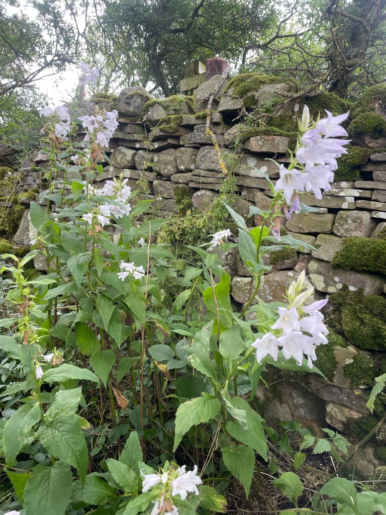
Much of the rest of the walk was on or near the river. It was edged with fantastic wild flowers, thistles, foxgloves, and bluebells. We crossed open fields, or sometimes were sandwiched on narrow paths running between stone walls, flowers and ripening berry brambles on each side.
We reached the tiny village of Buckden (chief feature, a village store that took cash only) in good time. Home for the night was the lovely Buck Inn.
We knew in advance that the repercussion of our shorter day was a longer one….so were prepared for at least 16.5 miles on day 2, and had ordered packed lunches the night before.
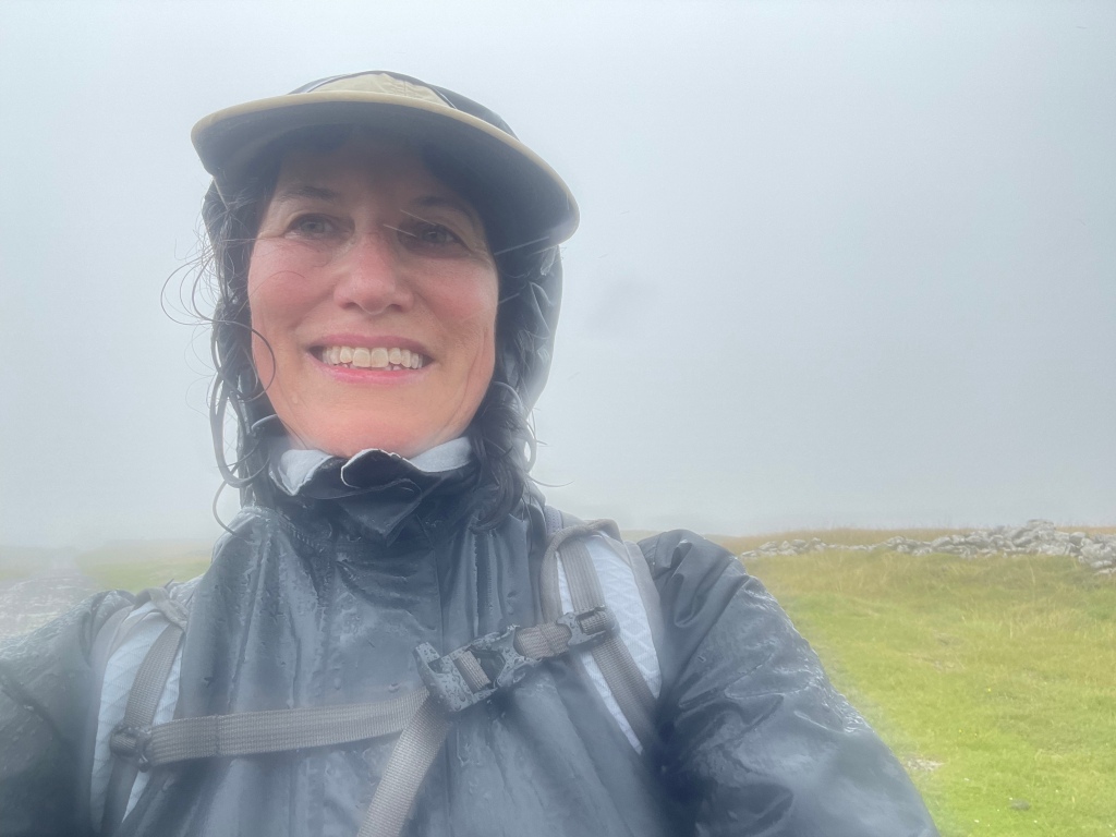
We knew things were not off to a propitious start when, as we were departing, a man in the lobby volunteered that he had just come from Askrigg, and everything on the way was flooded. He also cast some dubious looks at the four Floridians blithely heading off into the Yorkshire Dales….
It was indeed raining, and continued to do so for nearly the whole day, veering from light to stinging. We started with a long uphill slog, and learned the first rule of Mac’s Adventure trekking – NEVER veer from the blue GPS line on the app, NO MATTER WHAT. The sign posting (other than for the well-known, main trails) is awful, and that blue line becomes your Bible (or yellow brick road, whichever metaphor you prefer).
Our first issue really started as we descended into Cray, which was where the original itinerary had called for us to spend the night. We reached a roaring river, which we were apparently to cross with the assistance of stepping stones. But the stones were under the white water rapids of a flooded river, and we were not about to start day 2 with an encounter with the river gods. There was a bridge just a few feet away – but to access it we would have to go through private property that lined the river bank.
There was little choice. To the bemusement of the elderly men on the other side of the river who were eating sandwiches and drinking tea from flasks, and having a good time observing our adventure, we all managed to climb a stone wall, scale the wire at the top (avoiding barbed wire on the sides), and make our way to the bridge. (S had ventured along the river edge, clinging to the wall, to see if there was a way to less obviously trespass, but soon gave up the attempt to avoid lawlessness.)
I wish I had pictures, but we were somewhat preoccupied.
We trudged on some more, and reached a turn off that sent us above the fields into bleak and desolate moors, inhabited only by sheep. We did encounter a group of scouts with an older guide who made dire predictions about the water yet to come. More uphill, reached a stretch of paved road, only to find that portions of it were under up to a foot of water. That required another venture into the fields at the side, although by then we were so wet it hardly made a difference.
From the road we were back onto a bridle way running through the moors. As M pointed out – we were experiencing both swamp and summit simultaneously. Many impromptu waterfalls had formed, and it would have been spectacular without the rain, or the wind that had by then kicked up. The conditions defined the word bleak, and the moors were, to use M’s phrase, both desolate and disorienting.
The moor was interspersed by sheep fields every now and then – but my favorite was the pasture guarded by a very large bull with a ring at the end of his nose. I was first in our little parade, and memories of bull running and Pamplona caused me some anxiety as I considered the effect of my orange back pack. But I moved slowly, J edged in close so the back pack wasn’t as visible, and Senor Bull deigned to let us pass without exacting tribute. Nonetheless, once we’d exited his domain, he stood his ground by the gate, staring at us to make sure we really had left.
The rain lightened and we found ourselves on some country lanes, with a couple of houses that seemed to have been built at the edge of the world, so we pulled out our sandwiches and ate on the go. About mid-afternoon, we finally reached the charming village of Askrigg – home to pretty gardens and a 15th (or earlier) century church, St. Oswald’s.
Exiting Askrigg, we hiked through a lovely enchanted forest high above a rushing river. The path ran along the top bank, a stone wall on one side and trees and river below on the other. It was emerald and mossy green, and surely home to a pantheon of forest fairies.
Path finding through the muddy, sodden fields became more difficult and the wind picked up. Things were not helped by the hundreds (thousands?) of sheep we encountered and we spent a lot of time trying to avoid their leavings. Very occasionally we would go through a “clean field,” i.e., one without sheep!
I thought I could see our destination of Hawes in the distance, but couldn’t know for sure. We hiked and hiked through field after field, finally making a left and seeing a sign marked “Hawes Circular Walk.” It was getting late at that point, and I haven’t been so glad to see a town since J and I descended Stok Kangri in Indian in 2018!
We reached the Herriot Guest House in Hawes completely drenched. Both ourselves and our possessions, despite rain pants and back pack covers (turns out passports dry pretty well). To add insult to injury, somehow the luggage that was being transported from inn to inn had managed to get wet as well.
We changed quickly and went the The White Hart for an excellent (and well-deserved) Sunday Roast.
Sodden, waterlogged, drenched, soaking. I’m sure there are a few adjectives that I’m missing but you get the picture. However, you could equally apply: challenging, invigorating, exhausting, stimulating, and most of all – absorbing.
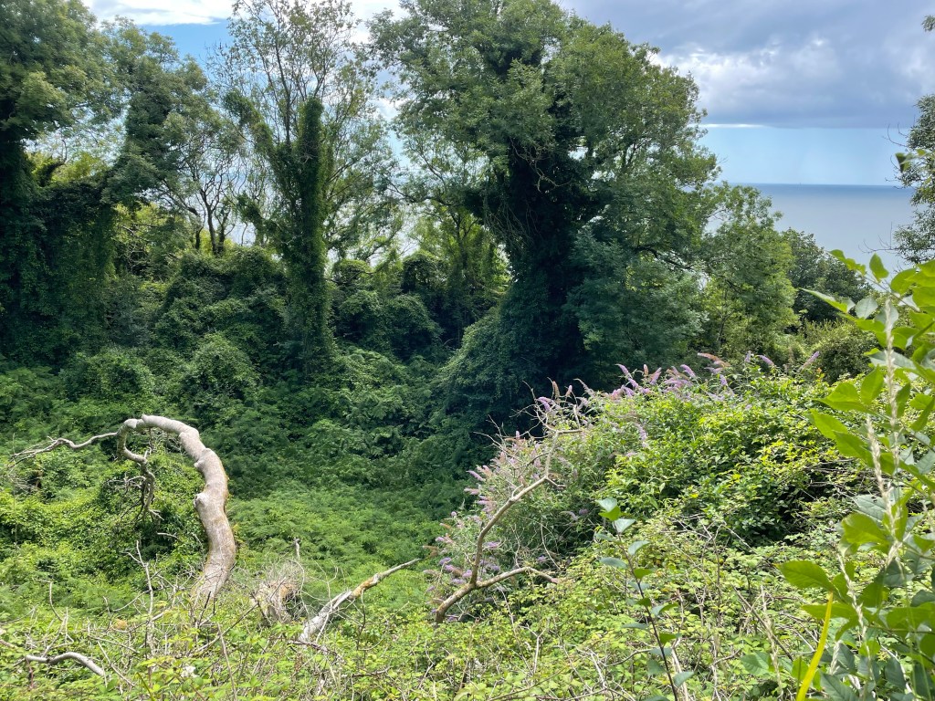
On July 21, 2023 a massive landslide (aka as a “land slip” in England) moved tons and tons of cliff side onto the Seatown beach, dividing it in half. About seven miles away, on Christmas Eve, 1839, the same thing happened; that time dumping 45 acres of meadowland into the ocean at Lyme Regis, creating what is now called the Undercliff. The fallen land has been conserved since the 1960s, and allowed to revert to wilderness, creating a walk way running between the bare chalk walls rising above and the forested ravines below.
It is the area featured in Lyme Regis resident John Fowles’ The French Lieutenant’s Woman. It was Fowles’ description of the Undercliff that drew us to a three night stay at Lyme Regis. Fowles wrote: it is “cut by deep chasms and strange bluffs and towers of chalk and flint, which loom over the lush foliage around them like the walls of ruined castles *** People have been lost in it for hours, and cannot believe, when they see on the map where they have been lost, that their sense of isolation – and if the weather be bad, desolation – could have seemed so great.”
After a first night at the Nag’s Head Inn, whose pub was inhabited by elderly men watching cricket, and dinner at the very nice Royal Lion Hotel (fyi, to get free Wi-Fi you have to sign up for a million mailing lists and my gmail account is paying the price…), the next day was designated for the Undercliff Walk. The Undercliff is also part of the South West Coast Path, so it fit nicely into our theme of walking at least parts of “the greatest hits of English paths.”
The beginning of the walk is very poorly posted. We finally found a small marker by the Lyme Regis Bowling Club, which seemed a popular place to be that particular morning. I had strong memories of my great-uncle taking us to his bowling club in Skegness back in the early 1970s – but now women also get to play! Men and women alike were wearing the requisite (mostly) white outfits.
The walk starts with a never ending series of steps up to what appears to be a top ridge. but at some point you realize that you are really traversing the half way line of the land slip, with cliffs towering both above and below.
After the land slip occurred in 1839, it became a huge tourist attraction. People took boats to gaze upon it from the sea, and a “Landslide Quadrille” was even written in its honor. No one, however, seems to remember the composer!
Since then, woodland and grasslands have grown up. The woods are dense and dark and mysterious. Green tunnels formed by arched trees and wild roses run through the woods. Wildflowers, including white bindweed, yellow wild snapdragons, red berries of Italian arum, and simple wild roses create patterns in the deep carpets of ferns.
Now and then the views opened up, either to see the chalk cliffs above or the ravines below and the sparkling English Channel.
It was very steep and muddy, and even though it didn’t rain, beads of water resident on the high hedgerows created their own fairy mist.
After about 7 miles, we entered into an area of very rare grasslands. If you looked closely, you could find lavender chalk fragrant orchids and pink everlasting peas enjoying the sun brushing the golden fields.
The path turns away from the sea, and ends, oddly enough, with a stroll down the middle of golf links and down a steep hill into the very small harbor town of Seaton. Apparently we began with bowls and ended with golf.
We caught the bus back to Lyme Regis. A double decker bus ride whizzing along the narrow hedge lined lanes is an experience not to be missed.
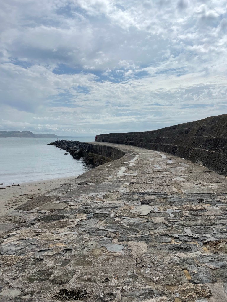
Our final full day in Lyme Regis was dedicated to visiting the Cobb and embarking on a fossil hunt. The Cobb is a stone breakwater that thrusts into the sea to protect the harbor. No one really knows why it is called the Cobb. The first mention of it is in 1294, and after being destroyed on a number of occasions it was almost completely rebuilt in 1817. Fishing boats, mostly for tourist trips, still leave from the Cobb, and we watched fishermen mending their nets.
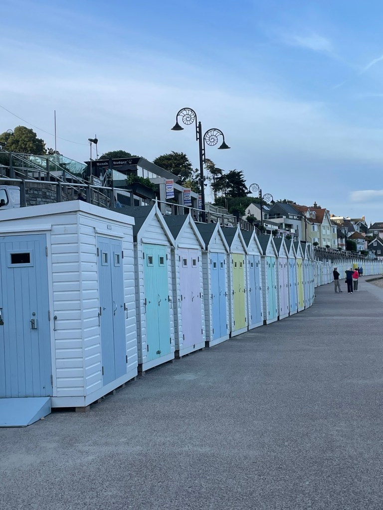
The seaside itself is lined with colorful bathing huts. We were lucky enough to see the interiors of some of them, whose residents had their doors open….featuring kettles for boiling water, shelves for holding snacks, and I’m sure there was local ale somewhere there also. Or at least canned cocktails, which seem to have taken over in England. By the way, look at the lamp posts. They are modeled after fossilized ammonites.
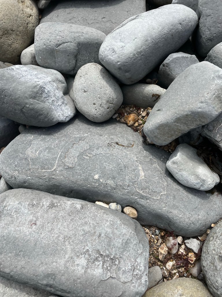
On the other side of the Cobb is rocky Monmouth Beach. Instead of seashell hunters, it is populated by amateur fossil hounds wielding mallets, this being one of the greatest spots to find fossils. Hence the name, Jurassic Coast. (In fact, in the Undercliff the various stone levels are dated, including back to Jurassic times.) Even if you don’t find one yourself (I like to think a half inch, grey ridged rock we found was one), ammonites are etched into all of the big rocks, creating a mural of fossils running along the beach floor.
After a long session of fossil hunting, we walked up the steps to the Jane Austen Garden and the Langmoor and Lister Gardens, which offer stunning sea views. They were surprisingly tropical and and natural – as was the Undercliff itself – as opposed to formal and contained.
Finished up our stay in Lyme Regis with a relaxing afternoon and some great Indian food.
Lyme Regis is full of history and tradition and fossils. But this coast is constantly evolving, as evident from the landslip just a couple of weeks ago. I keep contrasting this natural progression to what’s been happening this summer where much of the coral in parts of South Florida died in two weeks after ocean waters increased to bath water temperatures.
The land slip that formed the Undercliff was a force for creation and change and new life. That’s the sort of evolution that happens when the land is conserved and preserved and allowed to revert back to its raw, beautiful self.