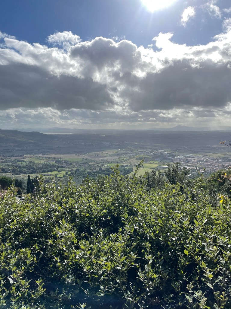
Our first of several days in Tuscany (that is, November 5, 2023, just to give a temporal context) was supposed to be a rest day, given that we had been traveling almost non-stop for a month. But there’s no rest for the weary, and we soon found ourselves heading toward Lake Trisimeno, which we could see in the distance from our Airbnb.
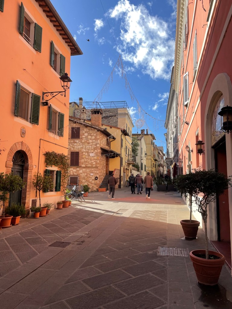
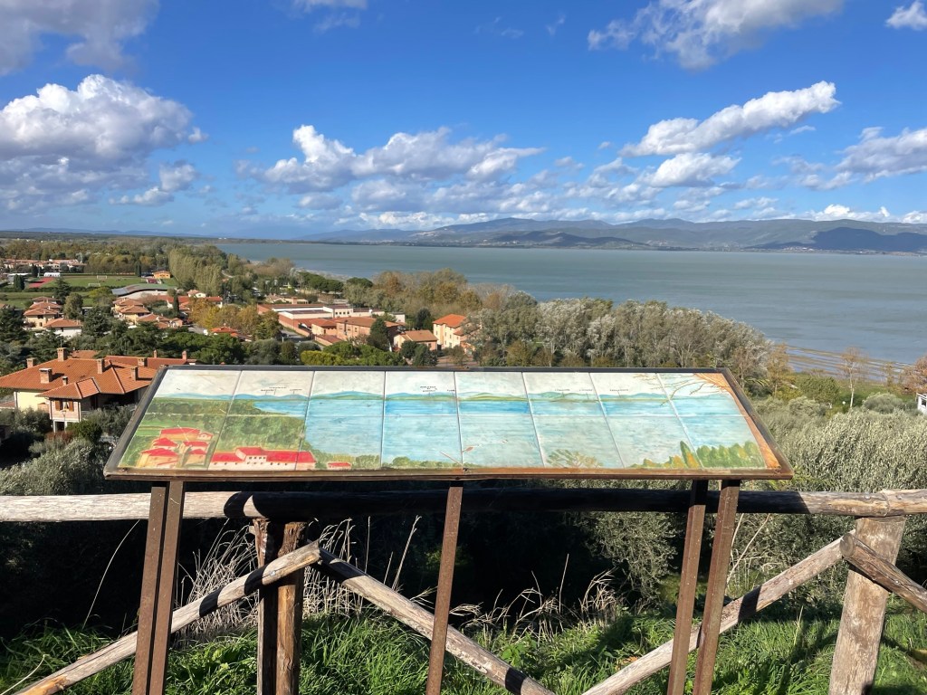
After unsuccessfully looking on the internet for any trails to hike, we simply drove in the direction of Castiglione del Lago, a charming hilltop town. There were hardly any tourists or traffic, despite a very interesting castle where we were able to have a picnic lunch. We walked through the town, enjoying the medieval vibe and the lack of crowds, and then down to the lake where we walked the perimeter for an hour or so. There were lots of cafes, but everything was closed for the season. I’m sure it’s crazy in the summer.
Enjoyed getting to cook again that night – fresh papperdelle with a vegetable sauce and artichokes.
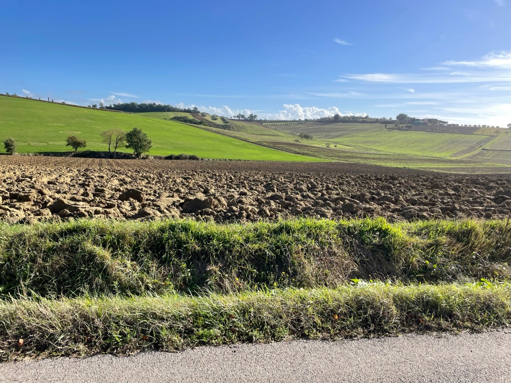
The next day we decided to tour some of the famous hill towns of Tuscany. From Cortona we drove across the valley on some seriously narrow roads with so many vistas of Tuscany hills we kept having to stop to take photos.
Ultimately we reached Pienza. The town is atop a hill, but on a flat plateau so you avoid some of the ups and downs. It too was empty at this time of year; we managed to locate ourselves on the Rick Steves audio tour and found the main square – where the grid lines of the squares line up with the palazzos to form a “Renaissance cube.” We finally found a spot outdoors where you are allowed to eat (very strict rules about this!).
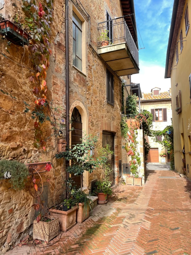
We looked into some interesting – almost stark – Romanesque churches, adorned with peeling frescos on the walls. The town itself was beautifully preserved – narrow lanes, stone buildings, and what I can only call red creeper vines.
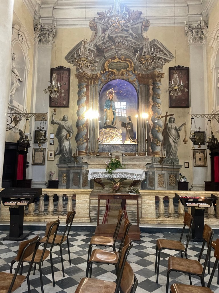
With only a few wrong turns, we drove to Montepulciano. It’s an equally charming, but much larger, hill top town. And not crowded. We were definitely experiencing the joys of the so-called “shoulder season.” We managed to situate ourselves on the map; and visited the Parroccia Santissimo Nom di Gesu – a very ornate church whose painted 3D illusions (trompe l’oeil, to use a little French), were captivating.
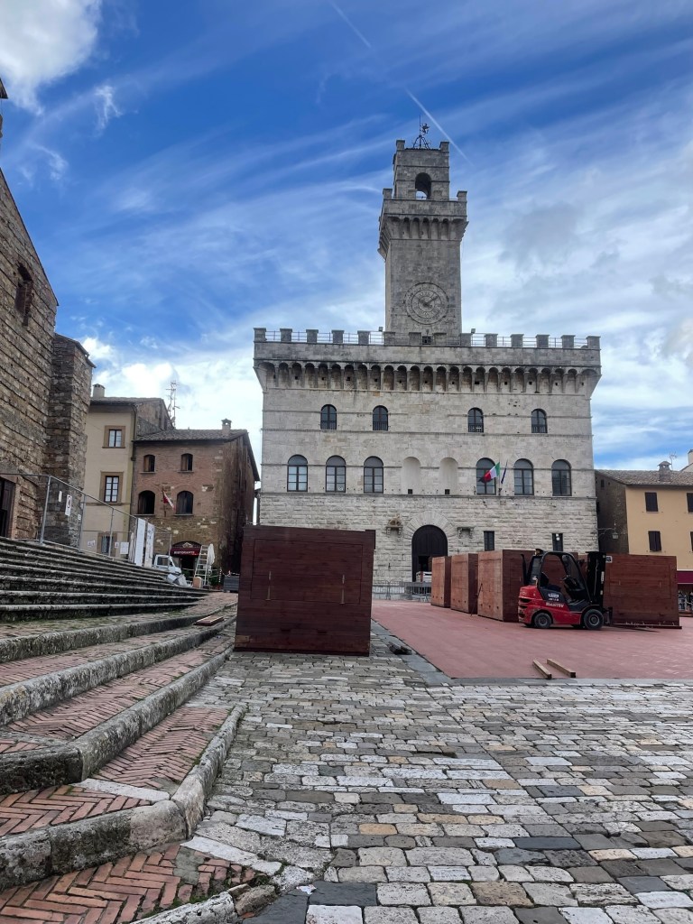
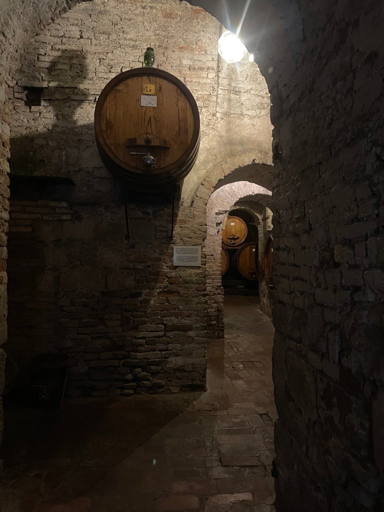
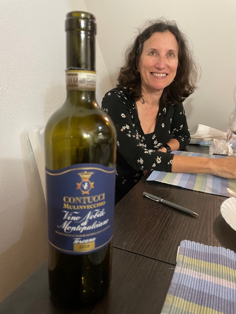
The main duomo, whose facade was never actually finished, was closed and booths outside were being erected for the Christmas market, to the great interest of on lookers. . We also visited the Contucci wine caves, where J bought some very expensive wine. The family still lives in their palazzo on the main square.
I especially liked the contrades building which still posted lists of births and deaths in the neighborhood. Instead of the horse races of Siena, in Montepulciano the contrades push wine casks uphill. Incidentally, this is also the place that J saw $1000 bottles of brunello.
By now it was mid afternoon, and time to make our way back to Cortona. All the wrong turns we made were compensated for by the very expensive bottle of Contucci wine.
Well, I’m not sure how far I can take the title without plagiarizing, but we actually were staying in a farmhouse in an olive grove, just below the hill city of Cortona, site of Under the Tuscan Sun. But it wasn’t all sunshine – this was now November (2023) and there were a fair amount of clouds and drizzle (although nothing to rival the quasi hurricane we’d experienced as we left Florence).
We had a fairly uneventful drive from Siena to Cortona, although our AirBnb proved a little difficult to find. It was too early to check in, so we found parking and traipsed up the hill to the walled town. The Saturday market was in full swing – cheese and meats and vegetables, but lots of clothes, etc as well. It’s a charming town but still full of tourists, even in early November.
It was chilly and rainy, so we found a small lunch place where the local vegetable soup – enhanced by bread floating in the broth – was very welcome. J had a coffee and they brought over a complimentary biscuit and a bowl full of apricots and pomegranate kernels.
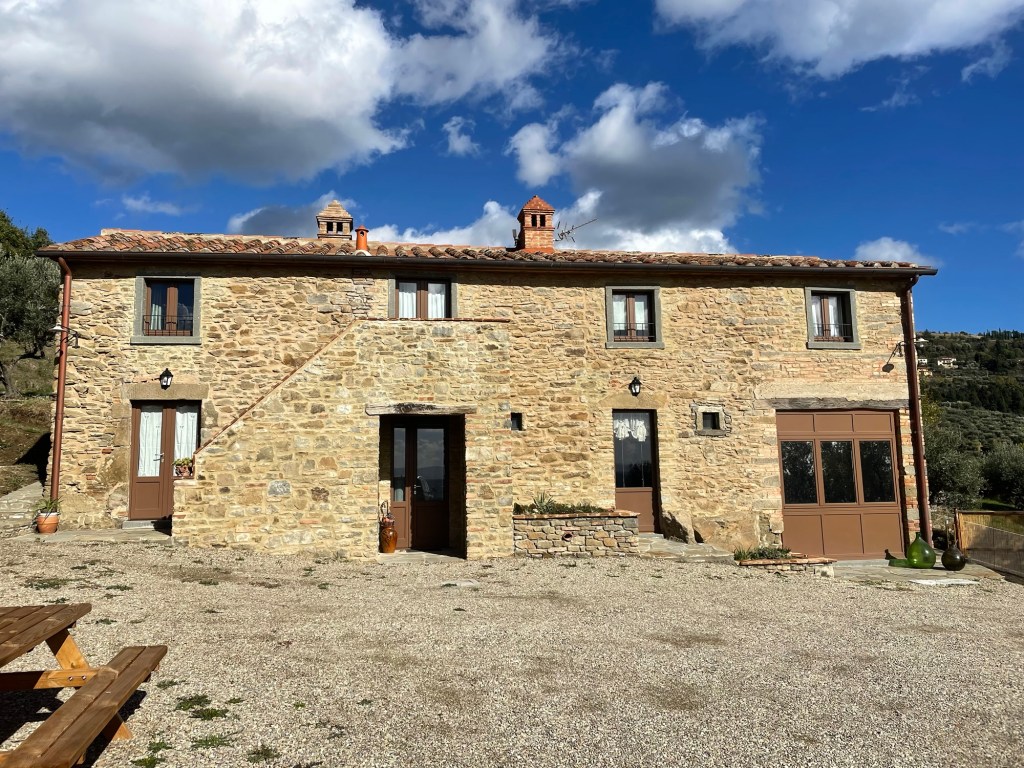
We managed to check into the Airbnb an hour early. It’s up a long dirt driveway that runs through an olive grove. There are a few other houses nearby but it still felt very secluded. We are on the ground floor of a stone farmhouse, and we were the very first guests to stay there.
The mother (no English) and the daughter (some English) welcomed us with a bottle of wine and olive oil that had been pressed the day before from their olive trees. It is olive harvesting season – we have seen lots of electric “shakers” that launch the olives into a net for processing. Olive trees grow like weeks here – their silver sage color is everywhere.
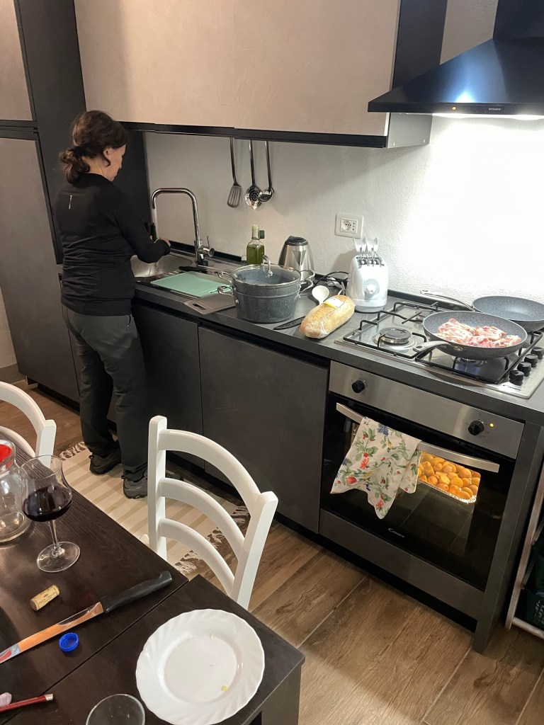
The Airbnb was super nice – a good kitchen, stone walls, spacious, and a TV with Netflix. Something we haven’t had for a very long time. After checking in we went to the nearby Coop grocery store – it was very large and had great produce. We stocked up – it was so nice to have a kitchen again. Prices were very reasonable – sparkling water was a whopping 24 cents.
That night, appropriately enough, we watched Under a Tuscan Sun, which was filmed in Cortona. I made braised chicken, ratatouille, and roast potatoes for dinner, capped off with cantucci and vin santo.
Starting off the year 2025 with a return to fall 2023….and scenes from Siena.
We managed the train from Florence to Siena easily. The fact there were no changes helped. But we weren’t at all sure how to get from the train station to the actual city of Siena, which is perched on top of a hill well above the station. We had read about a series of ramps and escalators, so dutifully took several up (one of which didn’t work) – only to discover that it was school letting out time, there was no way we were going to figure out the bus system, and there was no sign of a taxi rank.
Accordingly, we took the same lengthy series of ramps and escalators back down – and located the taxi rank on a much lower level. The very pleasant taxi driver ultimately found an open gate into the walled city and deposited us at our small hotel – the Palazzo Bulgarini. It turns out that palazzo means building, not palace, which was a little disappointing.
No one answered the bell, so we stopped at the cafe next door where the server said she could help us out. She opened the gate, found an envelope with our names and the name of our room (Iris) on it, and showed us to our room. At least there were fewer stairs than at the Bellevue in Florence.
It was very dark, and there was a rather dank smell, but an absolutely remarkable painted barrel shaped ceiling made up for all that. Fleur de Lis and swans – there was no telling how old the place was, but we were only five minutes from the Il Campo square.
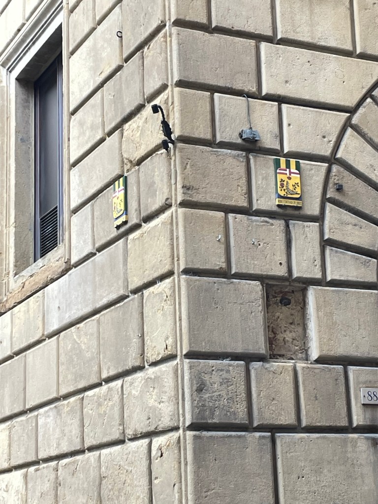
Siena is famous for its Contrades (districts) – we thought we were in the unicorn one but were never quite sure. Once a year the contrades compete in a bareback horse race around I’ll Campo and the horse that wins (with or without a rider) receives a Virgin Mary banner to wave around for the rest of the year. There are 17 contrades and I think 11 get to compete.
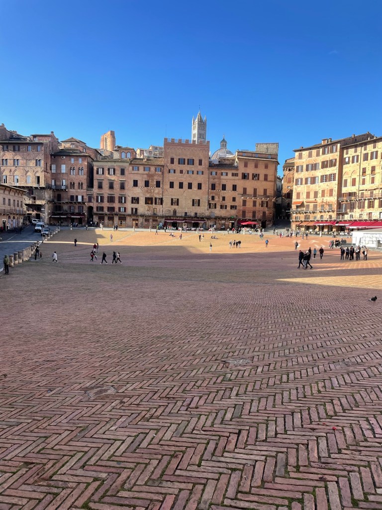
We settled in and then walked through the wind and rain to Il Campo to get our bearings. Il Campo (Piazaa del Campo) is constructed of red brick with steep banks – it’s almost like a public meadow of red brick. Unbeknownst to us, storm Ciaran was hitting Florence and northern Tuscany on its way toward us and the red brick meadow was getting very wet.
We managed to shelter in one of the Il Campo cafes – we sat inside with a beautiful view of the square, nice martinis, and lovely aperitivo that they brought to us gratis. We truly couldn’t figure out why others were sitting outside in the cold. We headed back to the hotel, and found a reasonably priced restaurant on the way, where I enjoyed observing an elegantly coiffed older couple out for the evening ( her four inch high salt and pepper hair literally did not move).
Rick Steves again served as our tour guide the next day. Il Campo to the Duomo. The Duomo was one of the most remarkable churches we’ve seen – detailed floor mosaics and a Michelangelo St. Paul. Amazingly enough, we happened to be there while an organist rehearsed for his concert that night, so were able to experience the church in a musical, as well as visual way.
We exited by the unfinished wing of the church. In 1339, the citizens of Siena decided to build a new nave so they would have the biggest church in all Christendom. A lesson in hubris – the plague ended up killing off most of the population and it was never completed.
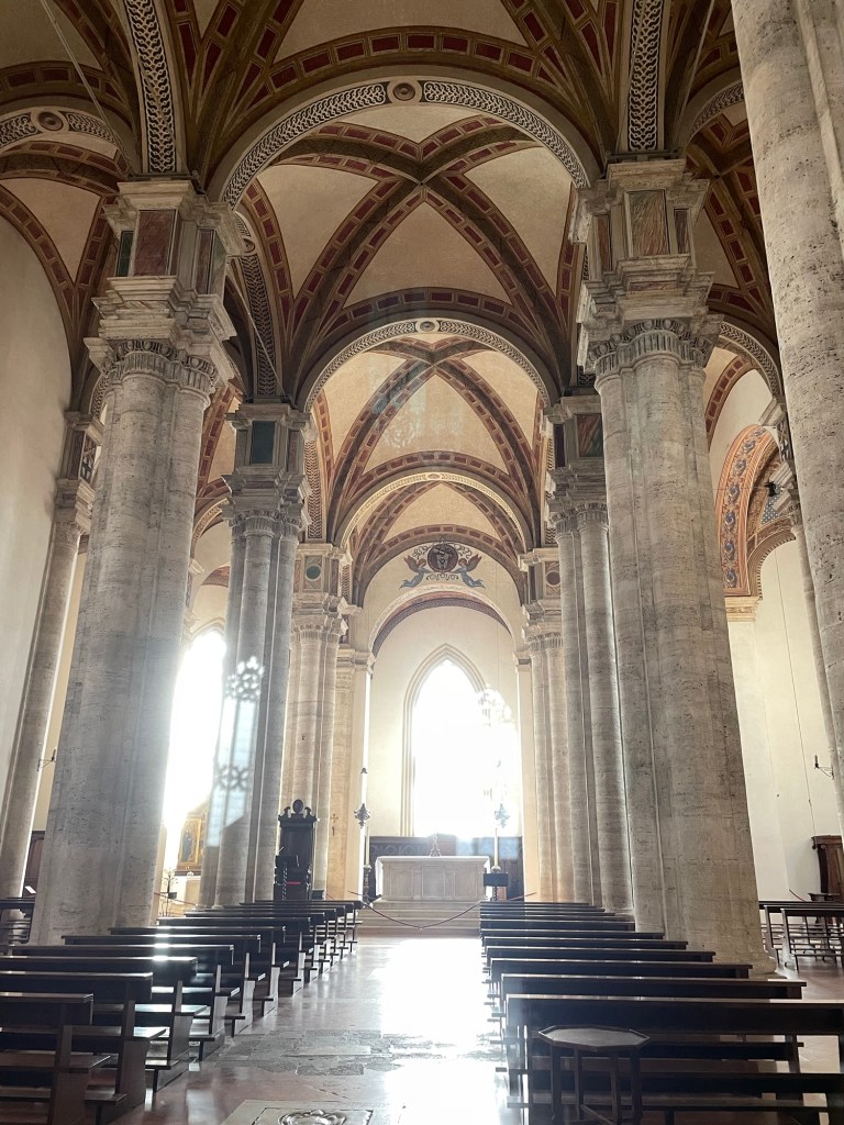
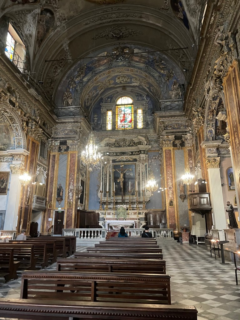
Just as we left, the skies opened. Luckily we found a cozy cafe for lunch and when it cleared up we resumed Rick’s tour. This included the oldest bank in Europe (where the concept of collateral was invented) and the Basilica Cateriniana di San Domenico. It was quite a change from the Duomo. Huge high Romanesque wood ceiling, almost stark – and St. Catherine’s head supposedly housed somewhere behind a mask in the chapel. The stained glass was modern and somehow I found the church more moving than the Duomo. This had been the home of nuns.
We returned to the hotel and were going to try out the nearby craft beer place but the police were there shutting it down. Hmm. Instead we managed to get into a very good restaurant- J had pork chops with oranges and pistachios and I had pici with cheese, greens and sautéed vegetables. There we discovered cantucci with vin santo – biscotti that you dip into a late harvest wine. An Italian version of dunking a donut. And pane cotta with macerated berries. All under fifty euros. Wow.
We had another stormy night. The next morning, the hotel manager was actually at the hotel and was able to get us a taxi. Next thing we knew we were at the car rental place . . . And off to a farmhouse in Tuscany for a few days – where I was looking forward to an actual kitchen.
I promise I’ll finish writing up our adventures in Italy from a year ago – there’s still Tuscany, Umbria, and Rome to explore – not to mention our misadventures in Morocco in May….but now it’s time for a more timely post….an exploration of Puerto Rico at Thanksgiving.
For a number of years, we’ve had a tradition of spending Thanksgiving with daughter A’s in-laws, K and S, as well as A, and her husband N, at various locations throughout the U.S. The gathering spots were historically driven by younger daughter S’s abodes, but unfortunately this time she and T weren’t able to join, given the distance from her new residence in San Francisco, lack of vacation time, and choice of locale.
In fact, choice of locale was dictated by A and N’s experience a couple of years ago staying at a boutique hotel in San Juan and a hostel in Lucina (this may be the wrong name). For our family group, that translated into an AirBnb (designed, strangely enough, by an Italian architect) a couple of blocks from the beach in the quiet neighborhood of Ocean Park, just on the outskirts of San Juan.
It’s a mere hop, skip and a jump from Orlando to San Juan, but the change in climate in this late November was more like a marathon’s distance. No sooner were we off the plane than the warm tropical humidity started to have its relaxing effect. I guess it’s a little like the feel of one of those weighted blankets.
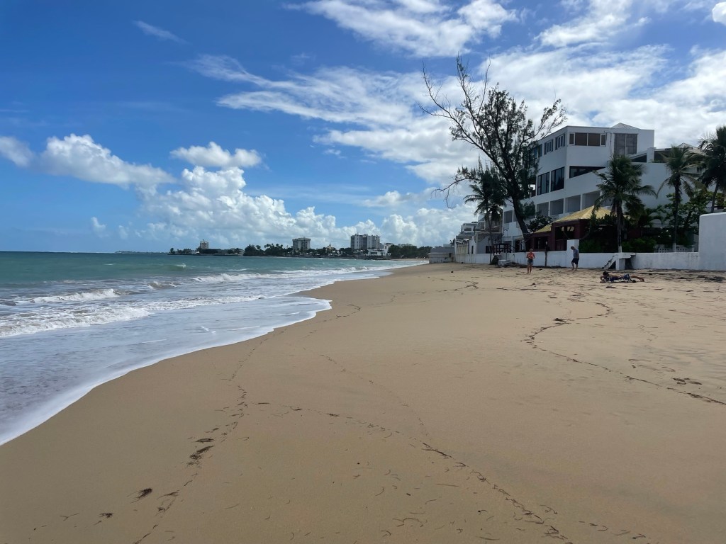
Our first night, Wednesday, we chilled at a local, inexpensive restaurant featuring pizza and quasi-Italian food. The highlight for me was a version of a pisco sour – the glossiness of the egg white set off by a jalapeño syrup. Thanksgiving Day itself was a day simply to relax. The beach was wide and sandy, shaped in a large crescent, which terminated in a sea wall where the high tide pummeled its waves. The only slight disappointment was the absolute dearth of shells, presumably because of what looked like a very large reef or sand bar off the shore. A had waited a little too long to make Thanksgiving dinner reservations so we ended up at a modern, fusion type restaurant just before the kitchen closed at 5 p.m…..I know that aguacate relleno con camarones (avocado stuffed with shrimp) isn’t a conventional turkey dinner, but I did enjoy it. We followed that up with a fun roof top bar experience, looking at the sunset over San Juan.
Friday was a total wild card day. Since we had the luxury of a rental car that would fit all six of us, off we trundled to the pork highway, which sounds a bit more appetizing in Spanish – La Ruta del Lechon. Once you’re off the highway, you’re on a seriously winding road that creeps up through the mountains and that’s lined with restaurants (lechoneras) roasting whole pigs on a spit. While one pig roasts, a man stands at a table wielding a very large machete hacking all edible parts of the roasted pig into bite sized pieces, which are then served with rice and peas, salads, green bananas, plantains, etc. The pork itself is very salty, tender, and extremely good – although I doubt good for you.
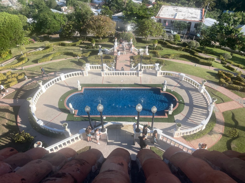
Fully sated, we traveled on across the island toward Ponce, a colonial town, much smaller than San Juan, and which retains a lot of original charm. Before we reached the actual town we stopped at the Castillo Serralles, the 1930s home of a sugar cane and rum baron. The family was originally from Spain, the patriarch returned to Spain and never came back, leaving the business in the hands of his son, whose “Don Q” rum is everywhere in Puerto Rico. It was an interesting structure, although hardly equivalent to the opulence of the Newport mansions that we had last visited with A and N. The fact it was decorated for Christmas and they were also preparing an event space for a wedding was an extra bonus.
The mansion is perched on the top of a hill overlooking the town of Ponce. Ponce has a large central square, lined with colorful buildings many of which are now hotel/casino combos. K and S stopped to order the world’s longest to be made coffees, but the wait was made more enjoyable by watching the town set up for a tree-lighting fiesta. And, it turned out what I thought was some type of device to quickly roast chickens was actually a gambling game that consisted of a table top carousel around which small model horses spun. They looked like chickens on a weird spit. Presumably winning the game required a successful bet on which one stopped first. At least I guess that was part of it – there was also a board with lots of numbers on it that seemed to play a role.
After a very long day of exploration and a yeoman’s day of driving for K, we had dinner back in Ocean Park at a vaguely Mediterranean restaurant. I know roasted pumpkin steak with pomegranate, which sounds strange but was really fabulous.
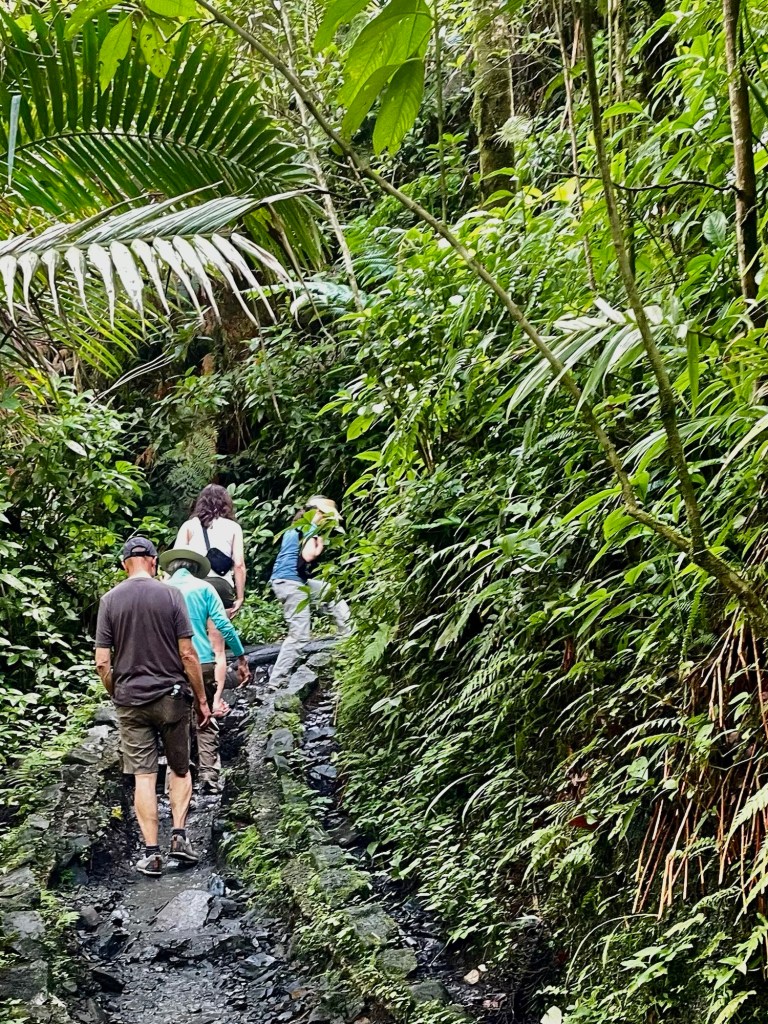
Saturday was another day to explore, but this time we were nature bound. One of the beauties of San Jose is that in under an hour you can be in El Yunque National Forest, a genuine rain forest, with waterfalls and muddy trails to boot. Some of us climbed up the Mt. Britton Tower that provided views of the vast, deeply green forested mountains, with the turquoise Caribbean in the distance. Next hike was the trail up to the Juan Diego Falls. The first part of the hike to the lower pool was fairly easy, but the second part, to the main part of the fall, was quite slippery and steep and required a lot of holding onto tree roots to make one’s way. I heard later that day that a woman had fallen and had to be carried out by ambulance. The waterfall shower at the top, however, was worth it. We had one final hike that day, part of the way up the Caimitillo Trail toward the peak of El Yunque. Lots of interesting flowers and views.
We followed that up with lunch at Lucino (still uncertain of spelling), a collection of multiple food stalls/ restaurants right on the ocean offering about every Puerto Rican delicacy you could imagine.
Evening provided yet another type of experience. K and S had made a reservation at Santaella, clearly one of the trendiest spots in San Juan. Courses ranged from pastelon to shrimp in a garlic sauce served with mofongo (basically mashed plantains) to whole snapper. We followed that up with a walk through La Placita – a Puerto Rican version of Nashville’s honky tonks on Broadway – and ended up at one of the Vanderbilt hotels for a bit more sophisticated drinks and dancing.
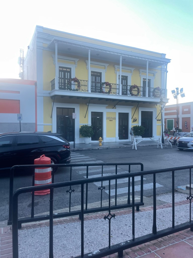
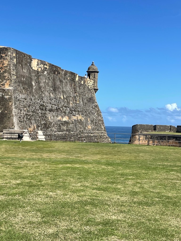
Despite all of our explorations of the island, we still hadn’t seen Old San Juan, much less the famous forts. So our last day started with a visit to Castillo Cristobal (built between 1634 and 1765), the smaller of the two forts (the other one is Castillo San Felipe del Moro) but the one with the better historical presentations. It’s a National Park historic site, so J and I got to use our lifetime senior National Park passes, which certainly do provide some benefits to being in your 60s. While reminiscent of the fort familiar to us in St. Augustine, these are infinitely bigger and more impressive. Apparently Puerto Rico was the prime site for Spain to defend its monopoly on the Americas. El Morro protected the harbor entrance, San Cristobal the land side, and the fortified walls the city (that is, until it got too big and part of the wall had to be torn down).
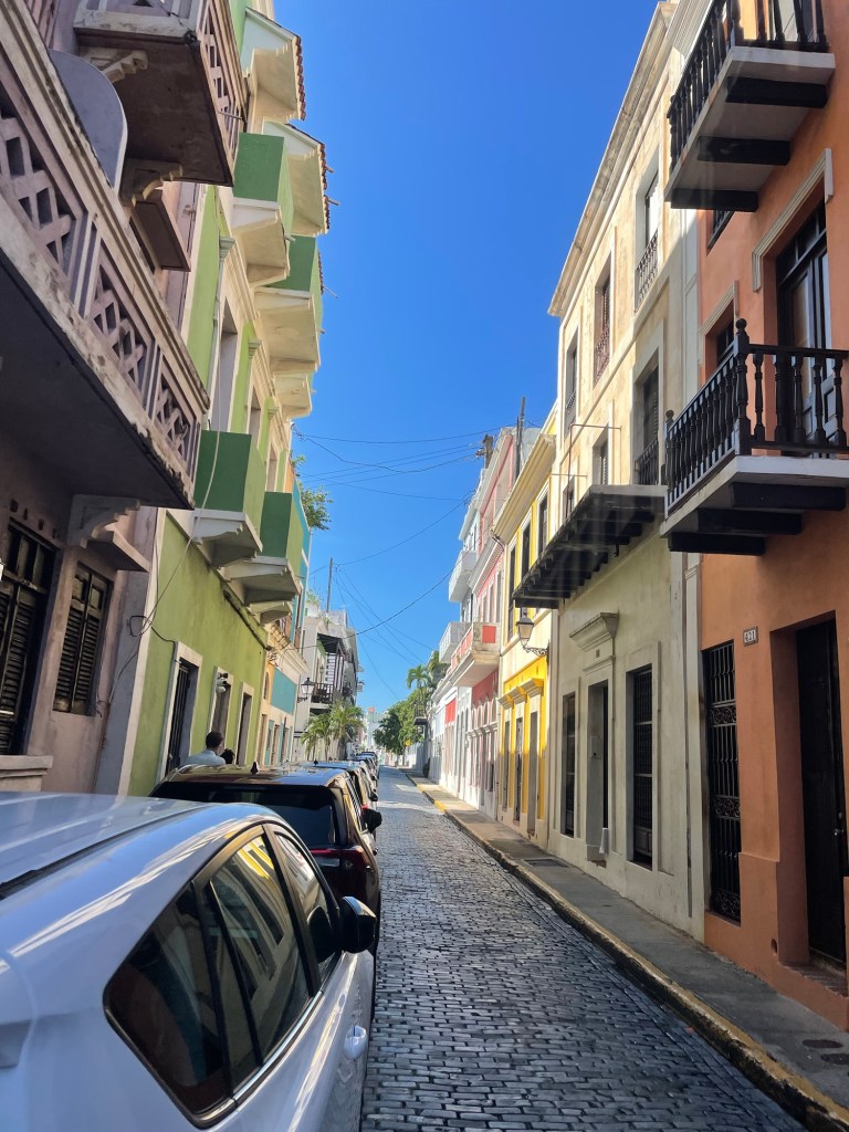
Fort visiting can only last so long, though, and frankly I enjoyed wandering around the streets of Old San Juan and looking at the colorful buildings just as much. Topping the day off with another dip in the Caribbean was the perfect way to conclude another Thanksgiving.
It turns out that souls are in fact supposed to rest in Florence on their special day, and many places were closed, including our breakfast spot. Church bells rang out periodically throughout the day. Fortunately, the laundromat, which by then was a must, was not so affected.
We had an 11:45 reservation at the Uffizi. If I thought the Academie had a large collection, this was that collection on steroids. Once again, my friend Rick’s (by now Rick Steves and I were on a first name basis) audio tour was very helpful. The galleries seemed much more crowded and there were lots of kids, of varying degrees of conduct. Botticelli’s Prima Vera and The Birth of Venus clearly won the popularity contest, and I could not believe how close the fairly obnoxious tour guides were to the paintings.
The most interesting part was to monitor the progression from the flat Middle Ages palate to the Renaissance perspective – it was as though in a heartbeat artists suddenly learned how to reflect 3D on a 2D surface.
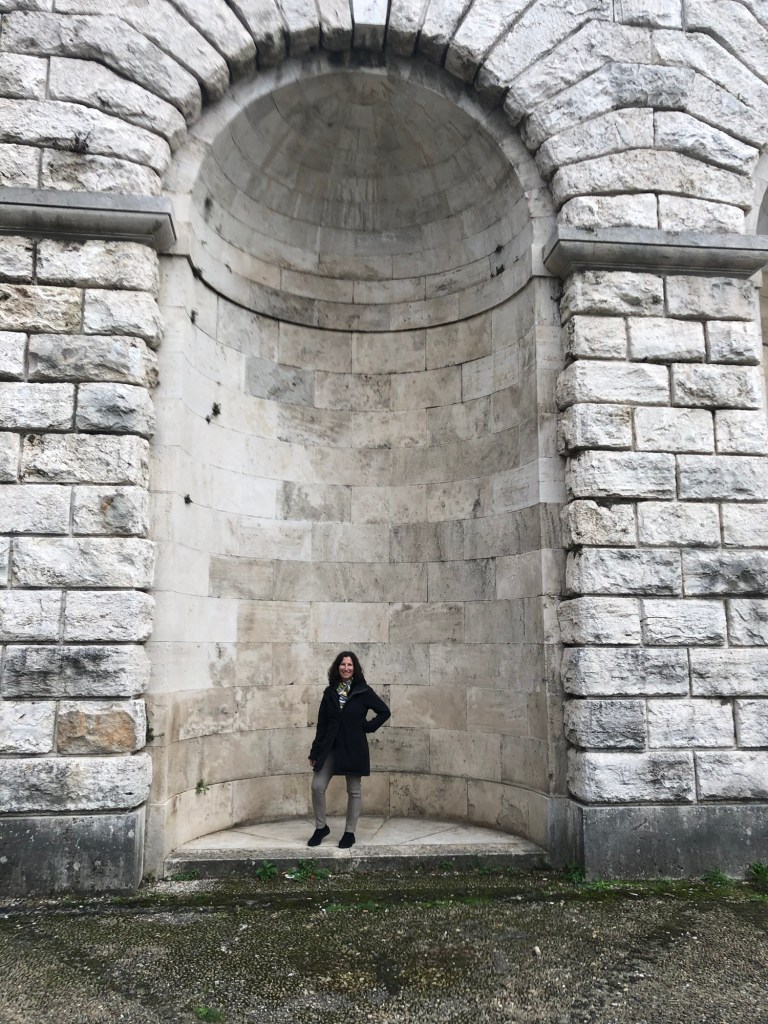
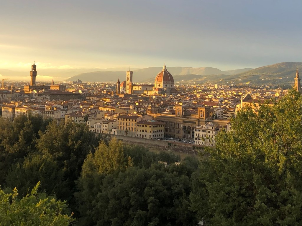
After about three hours we were “museumed” out, and decided to walk across the Ponte Vecchio to Ontarno (the other side of the river). We found a nice cafe for lunch right by the Pritti Palace (we could see the secret passageway where the Medici could stroll), and then walked up the very long steep road to the Abbasid and San Miniato al Monte. It was extremely old, original marble, ceiling and floors, Romanesque arches and amazing views of Florence. Supposedly the patron saint of the church was beheaded and walked there carrying his own head.
Suddenly the sun emerged and we were treated to an illuminated view of the city the surrounding hills, and layer of clouds below, all bathed in a golden light. I also finally found a scarf I liked for only 5 euros.
We walked back much more quickly. Daylights savings time had just ended so the evenings begin early. That evening we went to 100 Poor People, also a recommendation of our hosts, which was a fantastic value. I broke my no veal rule and had osso buca and white beans for 13 euros. A bottle of wine was 8 euros. It was worth breaking my rule.
The next day it was time to embark on the next part of our Italian adventure – Tuscany and Cortona. We took our time getting packed and shortly we were on a very new and nice regional Trenitalia train on our way to Siena. There was a threatening grey sky and the day after we left, Florence and other parts of Tuscany experienced Storm Ciaran, a bomb cyclone that wreaked havoc in the area.
It was time for our first Italian train adventure – Venice to Florence. Our first change of trains was in Bologna, a gritty industrial city, at least as far as we could glean from the very large train station. Fortunately we figured out in time that “est” and “oest” 1 were different ends of the platform, not different platforms, and managed to board our train within the allotted 20 minutes. The trains all seemed very new; only second class seats were available so there were no reserved spots.
The flat plain between Venice and Bologna gave way to the rolling hills of Tuscany – many of which we didn’t see because we were in tunnels going through them. Change of trains #2 occurred in Prato – a much smaller station and easier to manage. It was only 20-30 minutes from there to Florence.
Florence (or Firenze) – uniform, yellowing, four-story buildings, narrow streets. It was easy to project yourself back in time. Our guesthouse, the Bellevue House, was a single floor of one of those buildings, quite close to the station. You could reach it by taking a very small elevator or climbing three long flights of stairs. Needless to say, we chose the stairs. It’s a family owned place – an Italian husband and Australian wife who had great restaurant recommendations. A nice small bathroom, shutters, terrazzo floors and a fresco on the ceiling, a view of courtyards, and most miraculously – screens on the windows.
We walked to the Piazza Santa Maria Novella and environs and enjoyed a martini at one of the bars on the square – more tortilla chips offered as aperitivo!
Then we went to La Grotta di Leo, just a few doors down from the hotel. We splurged on bistecca florentine (new mystery – in the United States, why is florentine associated with spinach?). It was a giant T-bone served with roast potatoes for two. We also discovered the Joshua Tree Pub – a very fun spot on the Via Della Scala.
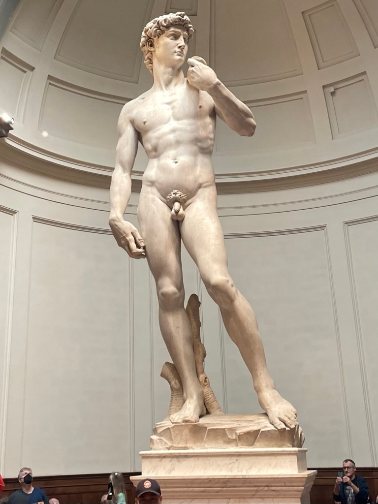
The next day was Halloween. J picked up breakfast at a little snack bar, and then we made our way to the Academie. We had ordered tickets weeks ago on line. The lines were crazy. We had to pick up the tickets at an actual ticket office, and then stand in yet another line for our noon entrance time.
The David was everything I thought it would be, especially his eyes. The collection at the Academie is generally amazing – Michelangelo’s Prisoner series, unfinished, where you could see and sense the marble being formed into figures.
After imbibing massive amounts of art, we walked through various piazzas – the Republica and the Signore, right by the Ponte Vecchio, and enjoyed window shopping in the high end shops. We had a fairly expensive lunch, but it was right on one of the squares and I convinced J to have anchovies on our pizza Napoli.
After fortification, we did Rick Steves’ Renaissance walk, which took us to the outside of the Duomo and campanile, as a well as the octagonal Baptistry with its special ornate doors. Apparently the facade of the actual duomo is of recent origin and the green and white marble does in fact look newer.
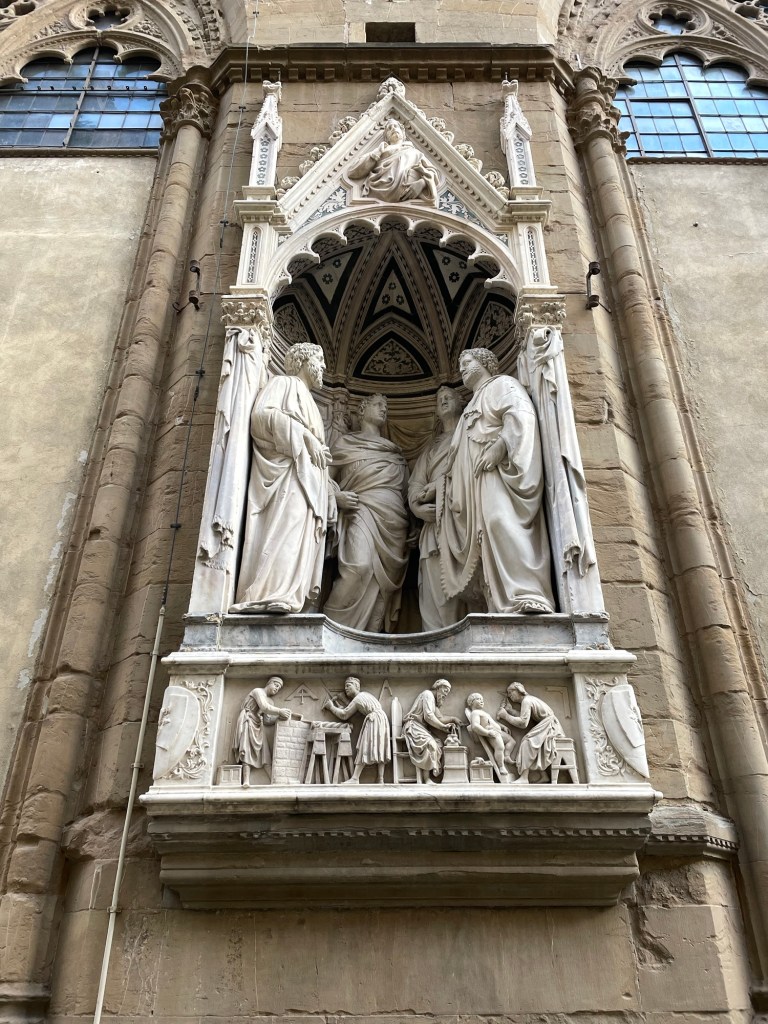
From there we walked to the church (Orsanmichele), adorned with statues in the exterior niches, the Palazzo Vecchione (City Hall, not the bridge), with its paintings of Austrian landscapes above the arches. I guess everyone had to leave their mark on Florence.
We passed by the various outdoor sculptures, including the Rape of the Sabine Women (question whether this would even be allowed in Florida), and finished at the Ponte Vecchio (the bridge).
By then it was getting quite chilly and windy and we headed back to the hotel. We liked the restaurant so much from the night before we went there for a second time, and to celebrate Halloween stopped by the Joshua Tree again. Patrons were in costume, the wait staff was enjoying a Chinese food feast, the Addams Family tv show was playing in the background, dry ice was occasionally released, and a good time was had by all.
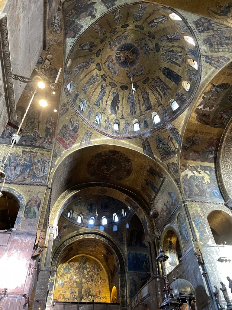
We started our first full day in Venice at St. Mark’s Basilica. It was there that we (or I) started our (or my) addiction to Rick Steves’ free audio tours. I downloaded them onto my phone, and J and I would each have one air pod in as we took the tours at our own pace, stopping as we liked. Highly recommend.
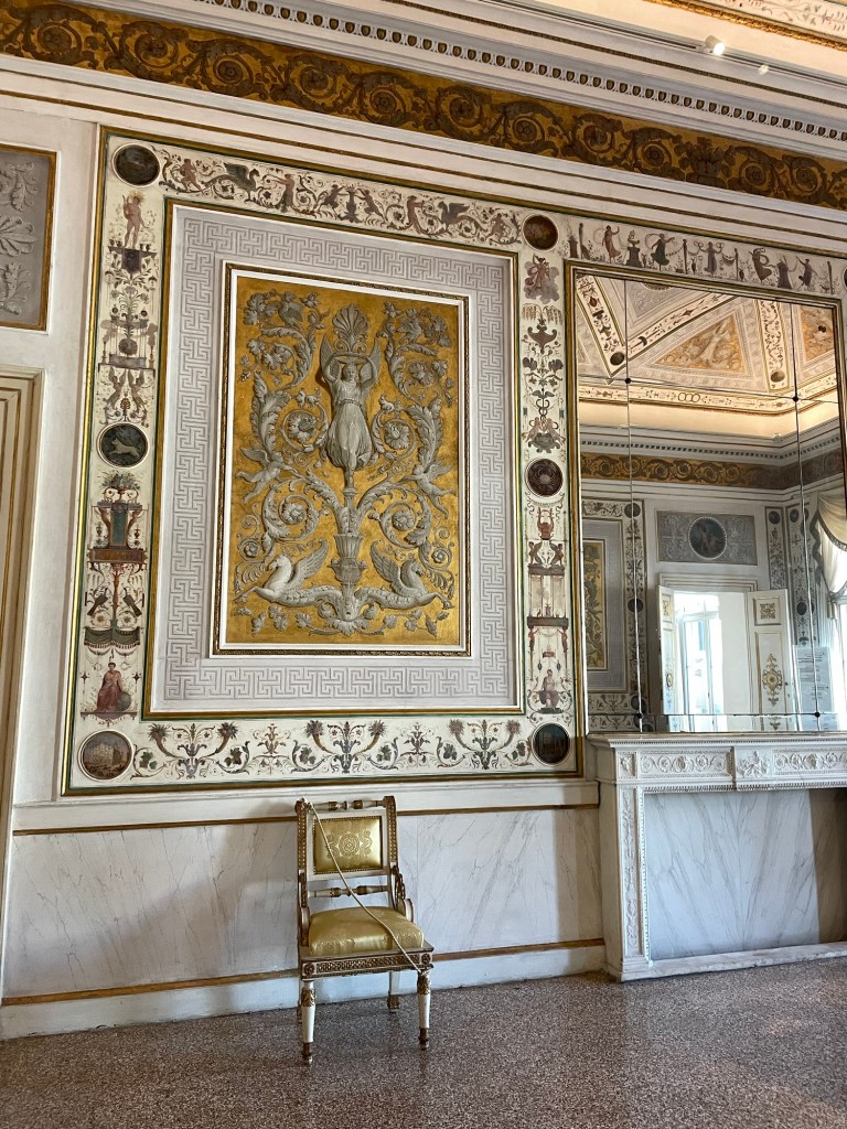
St Mark’s is a wild amalgam of Byzantine and Roman architecture, you name it. We especially enjoyed Rick’s (yes, on a first name basis now) narration of the mosaic that depicted St Mark’s bones being lost in the shuffle of building the church and ultimately discovered in an empty column. We saw the clock tower strike and then visited the Museo Correr, sporting glittery rooms of the French and Austrian regimes.
We wandered through numerous alleyways and between canals and found ourselves at the Church of San Zaccaria (John’s father)…paintings occupying every flat space.
After lunch we visited Doge’s Palace, whose dark, somber, huge rooms stood in stark contrast to the sparkle of the French and Austrians. When Venice was its own kingdom the doges were its rulers, with the role ultimately to become only ceremonial and then expire altogether after Napoleon’s conquest of the city. I now know a lot about the Battle of Lepanto (a 1571 naval defeat of a fleet of the Ottoman Empire), and the sheer volume of Veronese and Tintoretto paintings on walls and ceilings was almost overwhelming. We concluded with a tour of the prison cells and the Bridge of Sighs, where prisoners had their last glimpse of freedom before being confined in their cells.
Dinner that night included Venetian fish specialties – sardines in onions, polenta with two sorts of fish dip, scallops and clams, shrimp, langostinos, and squid.
Our last day in Venice we took a tour to the outlying islands of Murano, Burano, and Torcello. It wasn’t so much a tour as it was an easy way to get to these spots, which are about a 40 minute boat ride away.
We started in Murano. It’s very industrial, and red brick glass factories (query how many really still operate) line the harbor. The sand bars leading the way to the island give a sense of what Venice must have looked like originally. We were immediately ushered into a glass blowing demonstration conducted by two world weary looking guys, one with fully tattooed arms, both smoking cigarettes and looking at their phones, and paying no attention to the tourist throngs. One blew a simple vase, the other, a bit more attentive, blew a horse. A reminder that glass blowing is as much a trade as an art.
To exit the demonstration you had to walk through the factory store, which offered steep discounts, but who really knew what you were buying. We purchased a few small items simply so we could say they were from Murano, and wandered a bit by the canals but it was extremely crowded.
Next was a short hop to Burano, famous for lace making and colorful pastel painted houses. It really is charming, despite all the tourists. We enjoyed a real lace making shop where some pieces are made by multiple ladies, each of whom specializes in one stitch.
About midafternoon, the ferry left for Torcello, which is the least visited of all the islands. A 15 minute walk through a flat agricultural area led us to a very old Byzantine basilica and church. A canal cut through the island, by some very expensive looking inns and it looked as though it was a place for short weekend trips.
The next day was for travel. We had a final breakfast at our nice B and B, together with our fellow guests – a German father – son combo (son ate way more breakfast than anyone else) and a middle aged Italian couple (either she had multiple identical black and white polka dot shirts or she wore the same thing every day) and a single Italian man.
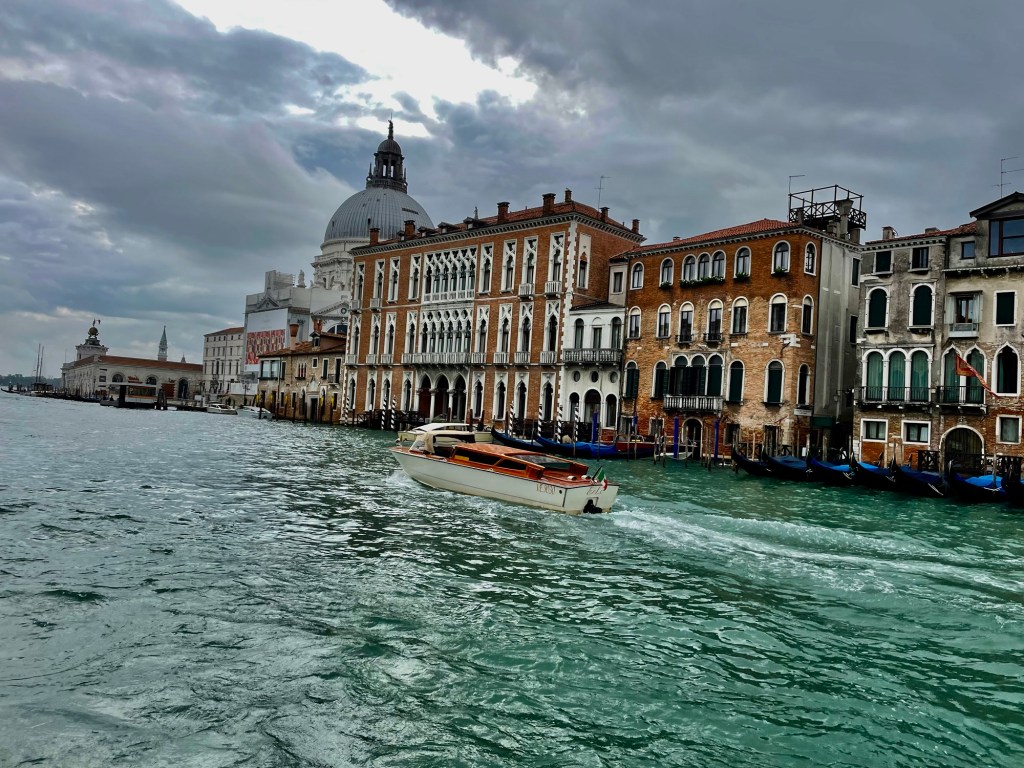
This time we found the scenic vaporetto and journeyed along the faded glory of the Grand Canal….water lapping up on the ground floors of the palazzos. I’m sure this was the inspiration for the crumbling building scene in Inception.
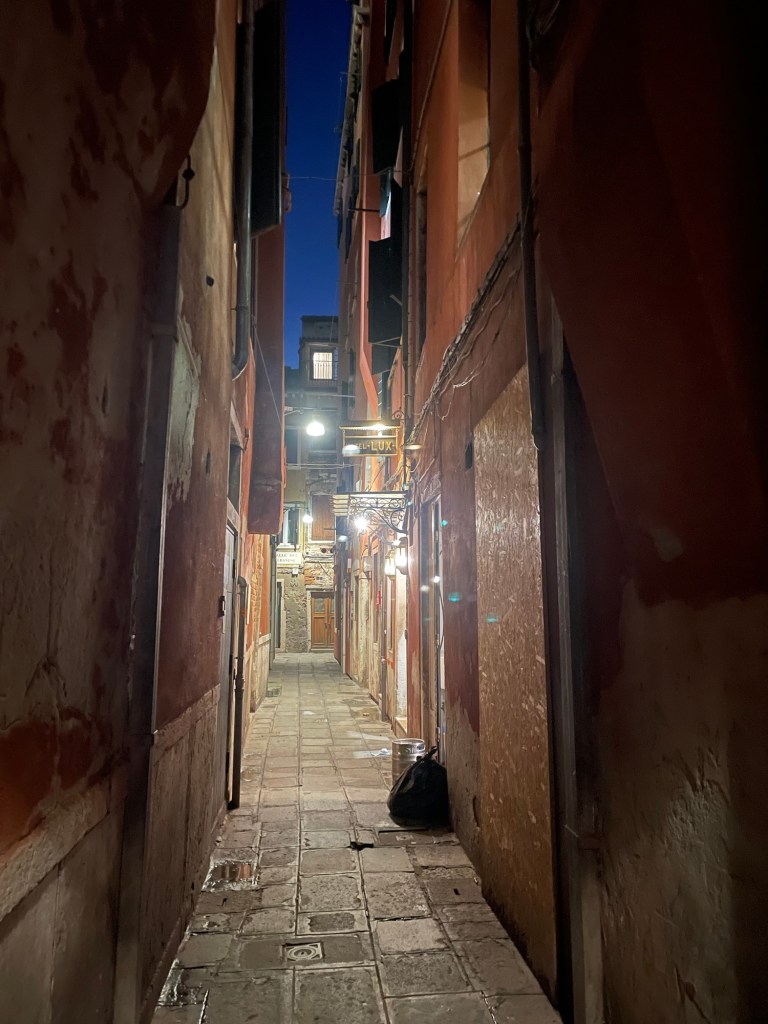
Following our train ride(s) from Milan, we arrived at the Venice train station and managed to find our way to a very crowded vaporetto or “water bus.” Rather than the scenic one that travels the famous Grand Canal, we ended up on the 5.2 route – which goes through the wide part of the canals (or was it a harbor? Hard to tell what the bodies of water are). Our vaporetto took us past docks, ships, all forms of water craft – and finally deposited us at the San Marco/San Zaccaria stop. From there it was an easy walk to the B and B – it was up a narrow alley with one turn at the “mosaic of the doge” embedded on the pavement. Through a gate and up a flight of stairs and there we were greeted by a small guest house with modern furnishings, a nice breakfast, crisp sheets, and terrazzo floors. A distinct contrast to our digs in Milan.
At the suggestion of our host we walked away from the tourist district (to the extent one can escape a tourist district in Venice, but it was late October)…to the Via Garibaldi. There we had an aperitizo at a restaurant on the waterfront, facing a beautiful sunset, with the Church of San Giorgio Maggiore church carved out against an orange sky. That was followed by a dinner of tagliatelle with shrimp for me and pasta seafood for J.
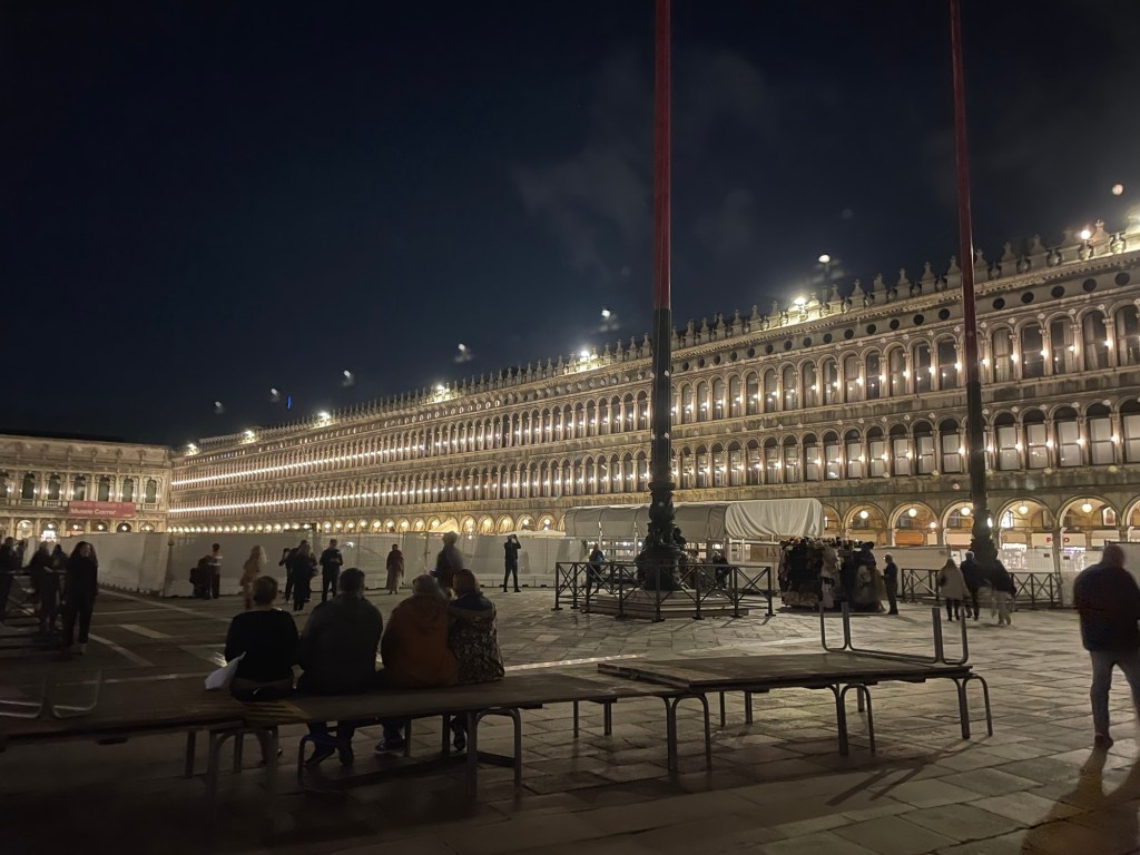
Afterwards, we walked to the beautifully illuminated Piazza San Marco and one of its famous cafes (Quadri), home of one of the “dueling orchestras.” We paid way too much for fabulous martinis but they were accompanied by all sorts of snacks – olives, nuts, peanuts in the shell, crackers, and tortilla chips. Plus the music was very fun, especially the rendition of the James Bond theme music – and people really did dance in the square. The illuminated balls that children were throwing into the air made the whole evening sparkle.
Venice was off to a good start and we had two more days ahead of us.
Star Date – October 25, 2023 – in this alternate universe I’m writing about months later. (Well, it is based on a contemporaneous travel diary.) And to make it even more surreal I’m actually typing this into my phone en route from Morocco to Orlando – which shall be the subject of another post entirely. And, it’s finally getting published months after that, but these are mysteries of time and space into which I shall not delve.
But back to the “present.” We arose early and niece F drove us to the Gare Nice Ville. Although our train tickets to Milan, supposedly safely housed on our phones, didn’t scan, we managed to find an “assistance booth” that let us through the turnstile (with lots of shouting on both ends of the intercom as we tried to communicate). The train was extremely crowded until we reached Monaco, where practically everyone got off. The train passes along a spectacular coastline, although we did spend much of the time worrying about missing our change of trains in Ventimiglia. But when we arrived, the Milan train was right there waiting for us, we were able to locate our carriage and seats, and it continued by the coast and through numerous tunnels until we reached Milan.
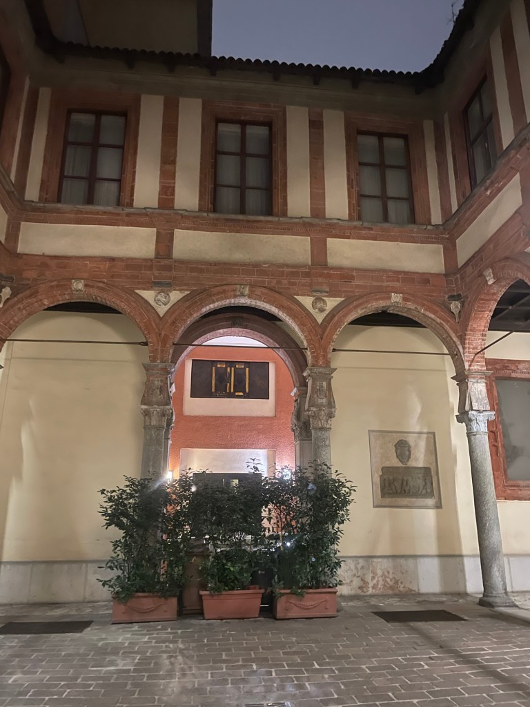
The Courtyard of the AirBnb
We arrived at Milano Centrale – the station was built in 1931 by the Fascist government. It’s huge and imposing and designed to make the individual recognize his or her own insignificance when faced with the grandiose power of the state…we found the metro and exited at the Missori stop. There’s a complicated roundabout and we circumnavigated it a few times before we figured out exactly where we should be going.
We managed to make our way to the corner of the street where our Airbnb was located – there we met up with possibly the most unusual Airbnb proprietor and Airbnb of any of our European travels. Let’s just say a five star rating was paramount for him. The location was unbelievable. We were just off one of the main streets and very close to the Duomo. You enter through a huge gate/door which leads to a quite beautiful courtyard. Parts of the building are allegedly built in the 15th century by Donato Bramante (and I have no reason to doubt that) but certainly there are lots of additions. The building itself is a mix of apartments and commercial ventures, including goldsmiths, one of which was located right by our studio apartment. You could hear human noise from the other apartments but absolutely no sounds from the street.
The place itself was genuinely weird. The shower was on the same level as the bathroom floor so toilet paper had to be removed before turning it on. A bit like a primitive camper. There was a tiny cooking area and there was no way I would have risked lighting the gas stove. The furniture was very old (or antique, however you want to describe it), and clocks with time zones from around the world adorned the walls.
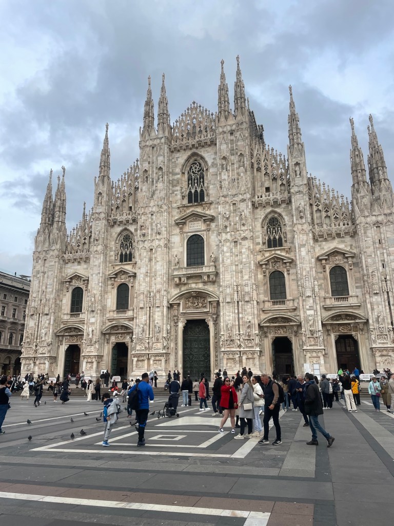
After we had settled in, we walked to the Duomo. It is magnificent- over the top Gothic architecture- but it is self funded and according to our tour guide, not supported by the Vatican. To raise money they project ads on the backside of the building itself. It’s a bit disconcerting. We also strolled through the 19th century galleria – anchored by a huge crystal dome and home to the original Prada.
We had negronis at a cafe by the Duomo and then decided to try Rossini’s, the restaurant right next to the Airbnb, which turned out to be quite good. I had a very unusual beet risotto with cheese and cherry juice – J stuck with spaghetti with clams. And, our Airbnb host, good to his word, said we would get a discount and we did.
The next day we’d arranged for a city tour, on the theory we only had one full day in Milan. Of course, this entailed another trip back to the Duomo, but this time we actually went inside. It’s built from pink/beige marble that has been beautifully cleaned and was 600 years in the making. In the ceiling, there’s supposedly a relic from the cross of the crucifixion and each year the Archbishop of Milan ascends in a cloud type contraption to the roof, presumably to visit it. Interestingly, Milan itself dates back to the Celts (at least according to the proprietor of our AirBnB).
The walking tour continued on to the Castle, which has been both a residence and military enclave. Security was extremely high.
Our final stop was the friary where DaVinci’s Last Supper resides in what was the refectory. You pass through an airlock chamber to view it and only a few people are allowed in at a time. It is remarkable. The table is a continuation of the room and places you in the scene in a three dimensional way that I had heard about but never experienced. And the 20 year restoration that started in 1999 brings the color and realism to life.
After the tour ended, we walked through the very nice Brera area and past La Scala – where unfortunately there was no performance (tickets were unbelievably expensive anyway) and the museum was closed. But we found a nice local lunch place , not far from the famous “finger” sculpture and then I indulged all my cheap shopping desires at an enormous Primark.
After a brief rest, we walked to the Navigli area, the location of the last canals in Milan – it used to have many. Google maps took us through a not very safe looking way (empty dark parks, etc) so we found an alternate route back. But what a scene in the Navigli. Restaurants and bars everywhere offering all you can ear aperitivo – apparently Milan invented happy hour. Despite this, we found a relatively sedate restaurant where I had a traditional Milanese risotto (Arborio rice, saffron and cheese) and good wine from the Piedmont. I had to buy a cheap and not good umbrella from a street vendor since it was raining and mine was somewhere in France. J managed to find a craft beer place on the way back which ameliorated some of the rain.
Next day we packed up and I made a final Primark run for 6 euro wool berets. Perfect for Florida! Made our way to the train station where we had to wait a long time for our platform to be announced. Crazy Wi-Fi – it’s free but you can’t get the required code unless you already have internet!
Despite the fact I’m half English, we seem to have a lot of friends and family in France. I haven’t even mentioned that our AirBnb in Paris was very close to where T’s parents have an apartment. Then we saw K in Orleans. And the next part of our French adventure involved a visit to our niece, who conveniently lives just outside Nice.
After a brisk walk to the train station in Orleans where we caught the tram to the bus stop, we took a Flix bus to the Orly Airport in Paris. The Flixbus was a double decker, and unfortunately our seats, which we had reserved, were on the top level, and I could definitely feel it sway back and forth. We traveled back through flat agricultural fields straight to the L’Aeroport d’Orly. This is very much the domestic and non-glitzy airport, in contrast to Charles de Gaulle. We had a long wait, but a short flight to Nice, where our niece, F, met us at the airport.
We drove through winding wooded roads up to Chateauneuf de Grasse, where her apartment has a beautiful view of the Mediterranean and lots of olive trees. We had dinner at a local restaurant in Valbonne.
We slept late the next day and then drove into Nice. Despite the fact it was Monday, parking was very hard to come by but it did mean we got to see a lot of Nice in our quest for a place to park. We finally found a spot on a street where two gentil hommes sitting outside a bar helped F into a very tight parking place. Nice is filled with lots of old, orange apartment buildings (bourgeois buildings), and the promenade by the ocean sends one back decades in time. We visited a very old Baroque church (whose name I cannot locate anywhere), with lots of chapels dedicated to multiple saints, each of whom had a special prayer just for them. Lunch at an outdoor cafe, where I managed to make an international call and reach the vet to deal with the Kira and what to do with a dead cat issue. Yes, even on sabbatical these everyday issues do surface.
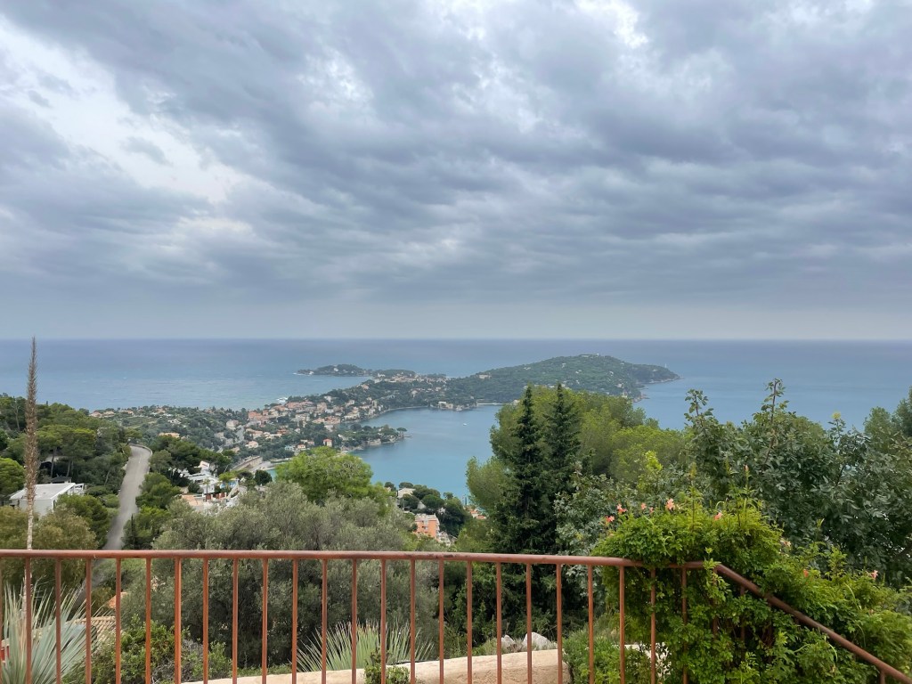
We wandered around Nice a bit more, and then drove to Villefranche to meet F’s friend at her friend’s father’s house. It was located in a gated community up on the cliffs with an amazing view. Her father spoke no English but he spoke French slowly so I was able to pick up at least some of the conversation. After coffee and biscuits, we drove even higher up the mountain, where we could see where much of the James Bond Never Say Never movie was filmed, as well as Tina Turner’s home. Quite an experience.
We had planned to go to Antibes the next day, despite the unsettled weather. Antibes is much smaller than Nice and has a great parking lot. Parking can be important. The Picasso museum was closed for lunch so we went to a much less ornate Romanesque church – all terracotta colors – poked about shops, and had a Lebanese lunch. We got bored waiting in the very long line for the Picasso museum, so instead walked about the harbor and looked at the huge, super luxury yachts, including one called Faith that, according to the internet, is up for charter.
After a trip to the Carefours market, we helped F prepare for her crepe party, and enjoyed meeting more of her friends. They also had some great suggestions for our upcoming trip to Tuscany.
The next morning we had to depart the south of France. For the first time, we couldn’t get our tickets to scan at the train station, but we did manage somehow to find an assistance booth where some automated function let us on. I’m still not sure how we managed it.
The train to Milan, our next stop, ran right along the Mediterranean. It was super crowded until Monaco, where everyone got off, presumably to go gamble. We ourselves disembarked at Ventimiglia, where our next train was waiting for us. Time for Italy, starting in Milan.