OK, so that title was a hook. J and I don’t actually reach Vienna in this post (unless we unknowingly went through a Vienna on the way back to Florida, always a possibility), but this episode does finally return us to Florida after five weeks on the road. But we will make it to Vienna, Austria in the next post, I promise!
The final stage of our road trip meant we had to cross that vast expanse of the United States that lies between South Dakota and North Carolina, where we planned to spend time with friends and family. All I can say is that there’s a lot of United States.
To sum up:
— The Corn Palace in Mitchell, South Dakota. The largest high school basketball arena in South Dakota, completely decorated with dried corn. Apparently George McGovern played there. Who knew? J insisted having his photo taken in the center of the court.
— High prairies in South Dakota turned into rolling hills and a lot more trees during a brief foray into Iowa.
— Omaha, Nebraska has a lot more hills than I expected and it was not at all easy to find (or enter) our AirBnb. Maybe we should have spent another night in the rooftop tent. On the other hand, J loved his 14 ounce ribeye. It turns out I didn’t take a single photo in Omaha.
— Left quad still showing the wear from the Badlands ladder incident and stairs are not going so well…found a large ace bandage that might help…
— From Nebraska into Missouri. Lots of trees and lakes and very beautiful, especially once we got into the Ozark area. Detoured into Kansas City for the precise purpose of going to the Jack Stack steak restaurant.
— Missouri doesn’t believe in leveling roads. The two lane “highways” we were on simply followed the steep rolling hills regardless of pitch up or down. I’ve never been over as many “blind hills.” And there are some great town names – “Tightwad” being one of my favorites. With a street called “Stingy.”
— At the Doolittle campground, outside of Rolla, Missouri, we saw a red fox scamper across the golden, illuminated field behind our campsite.
— Further along in Missouri (it’s a big state), and outside the “Boomland” fireworks center (a truly scary place), we visited a somewhat desolate park that holds itself out as the location of the first steps of the Lewis and Clark expedition.
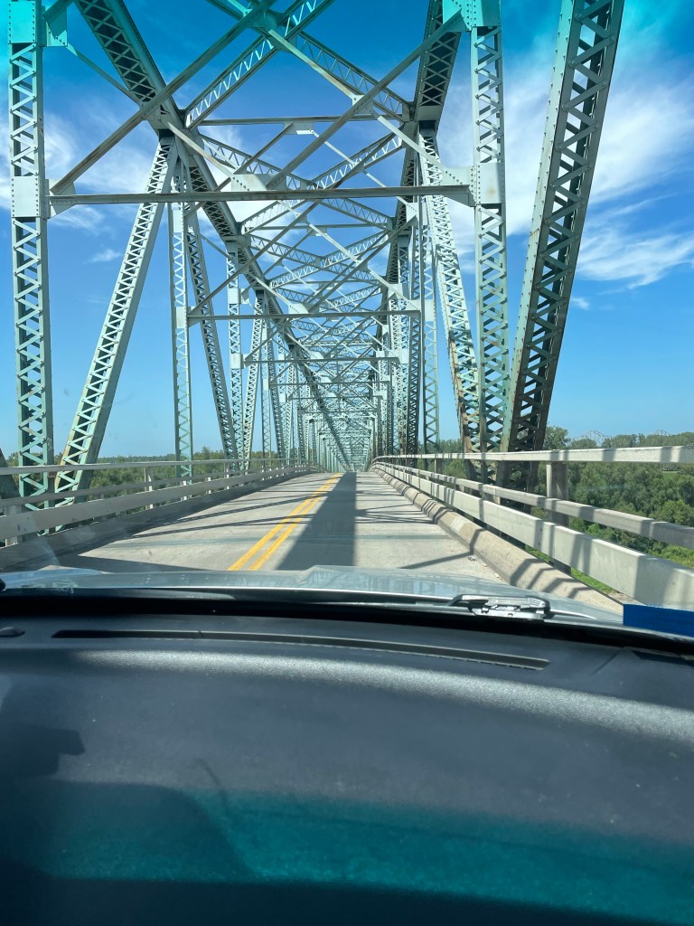
— There are a lot of terrifying bridges in the U.S., especially between Missouri and Kentucky. No shoulders, rusting, and they look like they could collapse at any minute.
— Nashville is a very large city. The “hockeytonks,” as they are called, are crowded day in and day out. After enjoying a lot of music simply from the street side we found a relatively tame venue where we could listen to a very good singer playing acoustic guitar. No luck in finding an unannounced Lucinda Williams or Steve Earle or Jack White show. Oh well.
It was a relief to get to the home of our friends K and B in Banner Elk, N.C. The next week and a half was taken up with family and friends (and the recovery of my leg). Unfortunately the leg issue meant that discretion was the better part of valor, and we didn’t attempt the Grandfather Mountain climb that we’d planned.
On the way back from N.C to Florida we had one last rooftop tent night at Skidaway Island State Park, Georgia, outside of Savannah. It was hot and humid and rained a lot.
But beautiful. Just like our 6,500 miles driving through 16 states and four national parks of the United States.
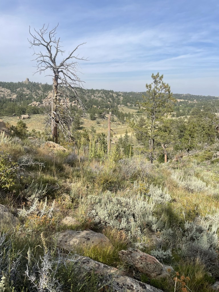
The approach to Badlands took us along State Road 44, a two lane road that eventually cuts across the park. There’s very little traffic. But that apparently didn’t deter the same road construction that we saw across the entire country. We experienced a 15 plus minute delay when one lane closed down, and a lead vehicle ceremoniously ushered us along about a three mile strip of highway – where we met the sole car that was waiting to go the other direction.
We finally reached the Interior Motel and Campsite in Interior, South Dakota, just outside of the park, about 6:30. It was nice. Several other rooftop tents, toilets and showers, an above ground pool, and a view of the Badlands. There were a few cars speeding along the adjacent highway, but somehow that was comforting in this otherwise extremely desolate place. Plus, the road was a elevated above the campground, giving it sort of a Jetson like feel. A full moon tonight and plans to focus on hiking, not driving, the next day.
I woke up about 5:30 a.m., probably due to the sunrise. great swathes of apricot overlying the wine dark purple of night, and the morning star piercing through all of it.
Apparently they don’t worry too much about park admissions on Tuesdays, and we didn’t even have to show our park passes. We stopped first at the visitors’ center and got some advice about trails, and also looked at the extremely interesting working fossil laboratory and heard a lot about a recently discovered Saber tooth tiger.
From there, we started the first of our hikes. The Window – a very easy boardwalk – and the Door, a bit more of a hike, culminating in a natural door that frames a view of the wall of jagged white peaks of stone. Traversing through it was almost like walking through a hard iced cake.
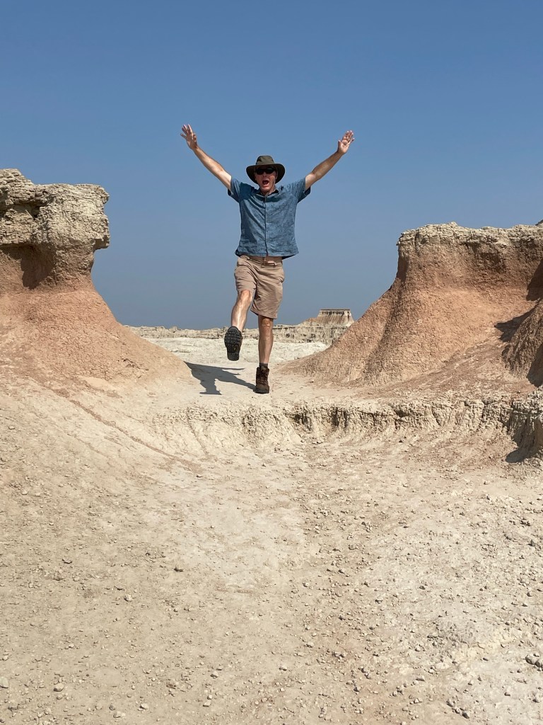
The Notch hike was next. The beginning has one steep section with a ladder going up. We rejected the ladder and instead scrambled up along side it. Fairly wide ledges led out to a spectacular overlook of the valley. It was very not, near noon and 90 degrees in the shade. On the return, we chose the ladder route. Mistake. Looking through the ladder with nothing below triggered all my fear responses – I was so tense I basically slid down without ever letting go and messed up my left quad – which plagued me for the rest of the trip. My legs were shaking when we got to the bottom.
After a quick lunch in the air conditioned Explorer, we journeyed on to the Saddle Pass. It was a true scramble – steep and slippery up the rock formations themselves, culminating on the flat upper green prairie and a number of trailheads. At the ranger’s suggestion, we then went off track and climbed the highest peak to a little throne at the very top. Amazing how touching the rock – as opposed to being on a ladder = makes it so much easier!
By then we were more than hot and sweaty. Did I mention temps were well over 90 degrees? We drove a little more of the Loop Road to the Fossil Exhibit boardwalk, an area of mammals fossilized more than 30 plus million years ago.
We finally hightailed it out of the park to see the small hamlet of Interior, South Dakota. There are two churches and a bar. We stopped at the bar. At the Wagon Wheel the bartender explained to us the story behind the poster of the naked woman riding a Radar the Bull (with a ring in its nose). She looked like a bovine Lady Godiva. Apparently Radar was a frequent visitor to the bar at one point. Between fossils (Lyme Regis) and the bull (my encounter with one in the Yorkshire Dales) I had flashbacks to our UK trip.
Spent the rest of the day at the campsite, plotting our next moves while being entertained by the couple in a nearby campsite who appear to be living out of their van while practicing for the their next singing gig.
After leaving Yellowstone, we had to drive practically the full length of Wyoming, along the northern side. The landscape varied between high prairies and rolling hills, and ultimately morphed into higher hills and mounds of orange, white, and green.
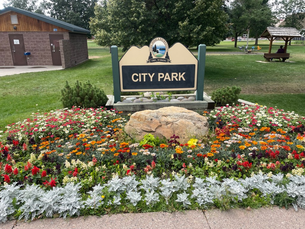
We stopped for lunch at the City Park in Cody, Wyoming, across the street from the high school. The whole town seemed right out of the 1950s, and I kept wondering what it would be like to grow up there. The city park was very nice; people having picnics, a Sunday, quiet.
After Cody, things got wilder. Some very desolate two lane roads (the routes Google Maps picks out are interesting, to say the least). After the colorful mounds (if they had been green they reminded me of Moundville, in Alabama), we started to climb up and up into the incredible Big Horn National Forest. Massive gorges, edged by towering rust grey walls, outlines of rock structures that looked like imaginary cities against the sky. We reached well over 9000 feet elevation, and the good old Explorer just kept chugging along.
Finally we left the Big Horn area, and returned to long straightaways – only to encounter yet more mountains. We finally crossed the border into South Dakota…where gambling is legal.
Deadwood, very close to Sturgis, site of motorcycle rallies, can only be described as insane. No other word for it. We stayed at the historic Franklin Hotel, which was a world class celebrity spot from 1903 to 1929. It was then converted into apartments until it was rehabbed in the 2000s.
The bottom floor is an opulent 1900s recreation with casino, but the rooms are likely as they were in the apartment days. The same wainscoting, fixtures, and tiles. A very comfortable king size bed and it was pretty great to take a shower after three full days of camping. Free parking and a coupon for a free drink in the casino. Dinner was in the basement restaurant, which was very crowded, but it was reasonably priced and actually very good. We also had a great server, who told us all about the wildlife loop at Custer State Park.
After breakfast, we strolled down the main drag. Deadwood is not only the site of the TV series, but was THE place to party for miners in the 1870s who had struck gold in South Dakota. According to the New York Times in 1877 – it was full of flim flam men, brothels, and gambling. Currently, there are lots of historic hotels, western wear, and casinos. Every shop has a bar, and people start drinking very early. It’s a unique vibe, to say the least.
We left Deadwood to drive through the plains to Rapid City, where we made a Walmart grocery store shop. I’m a lot more of a Walmart fan after this trip.
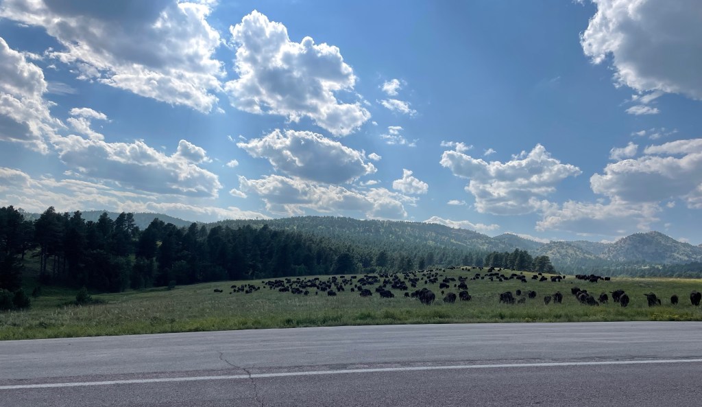
We finally reached Custer State Park, and had lunch at the nice visitors center. Wooded, evergreen black hills, interspersed with grassy plains. Very bucolic. On our way to the wildlife loop, a huge herd of bison crossed the road right in front of us. We immediately say a pronghorn (antelope), more bison, a mule deer, wild donkeys (left over from an old tourist attraction), and lots of prairie dogs.
After Custer State Park, we decided we couldn’t stand the shame of admitting we hadn’t seen Mt. Rushmore, even though we had not planned to visit. So, with me at the wheel, we took the Iron Mountain Road to Mt. Rushmore. The road is crazily and intentionally curvy. It’s the counterpart of the Needles Highway. You go through three tunnels, and at the third the four heads of presidents carved into Mt. Rushmore are perfectly framed. It is remarkable, regardless of your views of taking a natural (and sacred) landscape and carving presidents’ heads into them. The little town at its base is the epitome of tacky tourism.
After the hairpin turns and corkscrew bridges, it was a positive relief to be back on the interstate. But it wasn’t long before we were back on S.D. 44 – over prairies, and suddenly, in the distance, white jagged walls emerged in the distance. If I wasn’t fairly confident we were on Earth, it really could have been a scene from another planet. We were about to reach Badlands National Park.
We awakened on day two of our Yellowstone adventure to a view of two elks grazing and head butting only ten yards from our rooftop tent. You could actually hear their antlers clacking against each other. It didn’t look like serious business – they’d go at it, like very large puppies, for a bit, and then tire of that game and eat some more grass. Eventually they meandered out of the campground, as comfortable as you please.
This was our day for the “must see” Old Faithful, which required a trip to the western side of the park. There’s a great visitors’ center, with good explanations of volcanoes – especially how we were sitting right on top of one. We then took a decent hike up to an observation spot to see Old Faithful itself. Fortunately, we saw a pretty good eruption. We saw it erupt a second time later in the day, and it simply sputtered.
Next stop was the “prismatic falls.” A navigational error ensued, and we turned off the road too early, which took us along a rather odd hike on the perimeter of the area toward the Fairy Falls. We could see people in the distance on boardwalks, but had no way to get there. Nonetheless, we could still see the billowing multi-colored smoke – pink and turquoise. We were going to try to get to the actual location, but the traffic was simply too much. A lot of Yellowstone is still digging out from the floods of last year, and although the crowds weren’t bad, a weekend day was all that was needed for the traffic snarls to start.
A big rain storm had started so we headed to the Lake Village lodge again to wait it out. There, sitting on the porch, we met someone who was born in Derbyshire, of all places, then moved to the U.S. with his family, and now was a film editor on one of my favorite TV shows, Naked and Afraid! It was he who told us about Deadwood….
After a “grocery store” trip (to the extent a national park general store can be described as a grocery store) we had our last camping night in Yellowstone, and celebrated with an odd concoction of mac’n cheese, precooked bacon, and green beans. As I was cooking I noticed a fellow camper who’d left his chair too close to his campfire on that very windy evening – fortunately I was able to call out to him before it got incinerated. I felt like a veritable Smoky Bear!
The next morning we managed to pack up all the debris we’d been accumulating. Those bear box pantries are a real luxury. We left camp by 10 a.m. and drove to Fishing Bridge, just north of Lake Village and out of Yellowstone via the East Entrance. There was a lot of elevation gain, and evidence of many forest fires, lots of downed, white trees.
There was a full day of driving ahead of us. Our route was going to take us through Cody, into the Big Horn National Forest area, and finally into Deadwood which was as peculiar a place as its name implies.
Yellowstone National Park is GIGANTIC. There’s no other way to put it, except to use capital letters. And especially when you have just arrived from the much smaller Grand Teton National Park.
It’s an easy trip from Jackson up to Yellowstone. You drive through the eastern side of the Grand Teton National Park (beautiful views of the Grand Teton peak itself, which does tower above the others). We had previously explored the western side so it was interesting to see the other part of the park. The granite mountains looked like rows of jagged shark teeth biting the blue sky.
After a while, the Tetons peter out, and you leave the park for a few miles – only to enter Yellowstone, the oldest of all the national parks (although I think Hot Springs also claims that honor…). It is gorgeous. We drove along a river and through a canyon, on to West Thumb, which is part of the massive Yellowstone Lake. Nothing here is small.
We finally reached the Bay Bridge Campground, where the person checking us in was from Melbourne, Florida! In keeping with everything in Yellowstone, the campground was huge, but each site was a good size and it was a great place for people watching. For example, the European threesome of two men and a woman – one of whom jumped rope for at least 30 minutes before dinner while the woman looked on wearing a fur vest. We even saw a few other rooftop tents.
We set up camp at what was to be our home for the next three nights, taking particular advantage of the built in bear box, which made a great pantry. We then drove to the Lake Lodge, the closest of the lodges where we sat on the porch with a drink (and Wi-Fi) enjoying the views of the lake.
Sleep that night was not easy. It started off with the sound of some creature making high pitched noises and grating sounds. I was terrified that the empty water cooler (BTW, a completely useless purchase, gallon jugs work way better) was being dragged around by some unspecified creature of the night. J asked if we should look out of the tent to see what was going on, and my response was “absolutely not.”
The next morning I noticed one of the logs that delineated the parking area by our site bore fresh (and large) scratch marks, and heard one of our neighbors saying they had seen a mother bear and her cub visiting the campground right by our tents. This was not reassuring.
Our first day we decided to explore the northern loop, parts of which are among the least traveled. This took us by the Mud Volcano – a nice boardwalk passing over the steaming and roiling fumeroles and mud pots. You have the sense of earth moving under your feet.
From there, we drove through the Hayden Valley, lush green and yellow grasses – flat plains with brown mountains in the background. The yellow tones coordinated well with the sulphur from the geothermal activity. There we saw a herd of bison wading in the ponds. We stayed at the prescribed distance, mindful of the five people last year who were gored by bison.
Canyon Village was our next stop. It’s a very large “town” in that part of the park where we indulged in some souvenir shopping, followed by a drive along a very windy road and a high pass to Tower Roosevelt, on the way to Mammoth Springs.
The one thing not to go see in Yellowstone- the petrified redwood tree. After seeing numerous signs advertising it, I had visions of a preserved and immense tree….only to find something that looks like a stump of tree rock at the end of a dirt road.
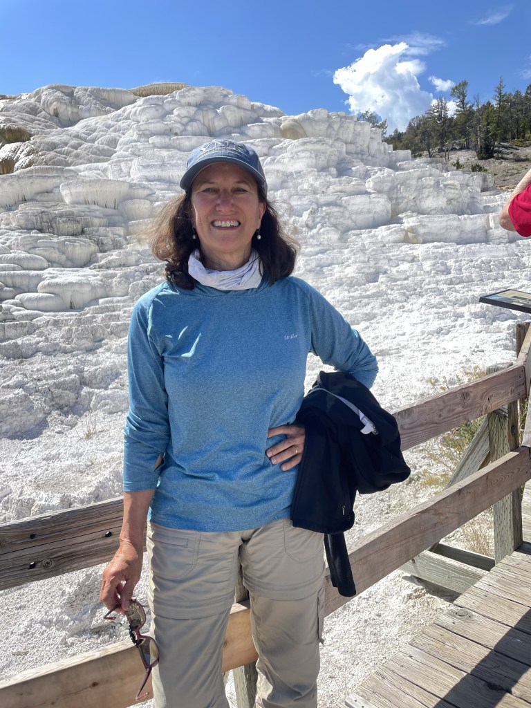
Mammoth Hot Springs consists of hot springs bubbling up into layers of calcium that form terraces of white travertine. It’s a lot like Pamukkale in Turkey, which we saw in 1989. In the 19th century people would dip objects into the hot springs to coat them in travertine and apparently you can still find some of these objects in antique shops. They don’t let you do that anymore.
From the marbled Mammoth Springs we worked our way to the Grand Canyon of Yellowstone. It is an amazing gorge, turquoise water below, a huge waterfall, and gradated orange and grey cliffs. It’s possibly the most beautiful area in the whole park.
And on the way back we encountered a female elk crossing the road right in front of us. That was a precursor to the next day.
Jackson Hole may be best known for skiing, but snowless summer months offer plenty of entertainment.
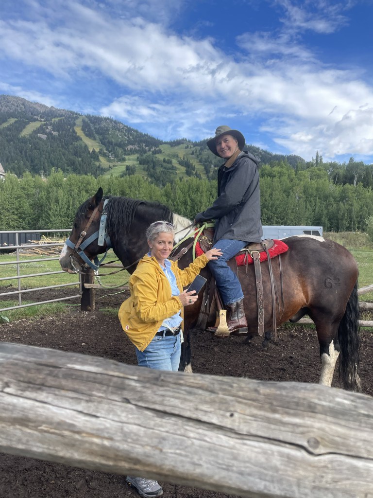
Although we are hardly equestrians, J and I have gone horseback riding during many of our travels. So far we have managed trail rides in South Africa (that one also involved zebras), Hawaii, Russia, Croatia, and Arizona, to name a few. The Tetons seemed an appropriate addition.
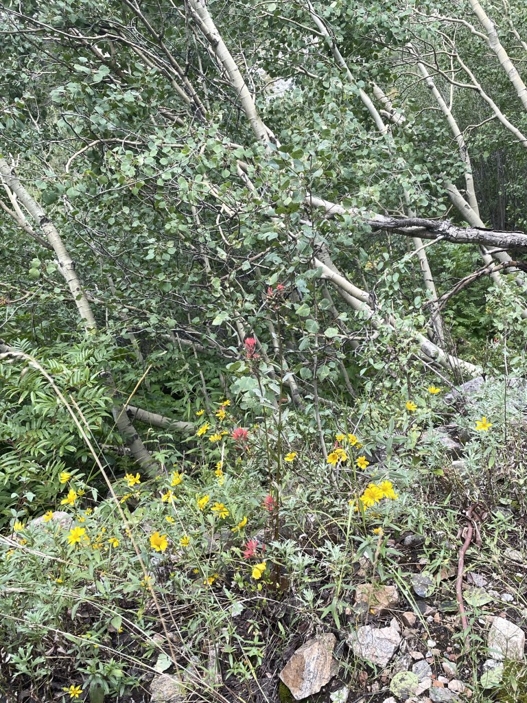
We met up with our niece, F (who really does live near Nice, France), as she was the only of our family group willing to brave the large four legged creatures that were to take us up one of the nearby mountains. She rode a very hungry “Chuckles,” J had a chunky “OT” (for Overtime), and I was blessed with Rhinestone. Apparently the trail company has over a thousand horses between Grand Teton National Park and one other location. Beautiful wildflowers, including lots of Indian Paintbrush, which is the Wyoming state flower. My favorite part was when our guide instructed us to get a move on so our horses weren’t spooked by the nearby bear cub who had climbed a tree, with Mama Bear right below.
Next up was a drive around the beautiful Lake Jennie loop. It was rainy but that didn’t keep us from enjoying sandwiches and a beer at Dornans, a long time Jackson establishment. And saw another bear. Bears were sort of a theme in the Tetons.
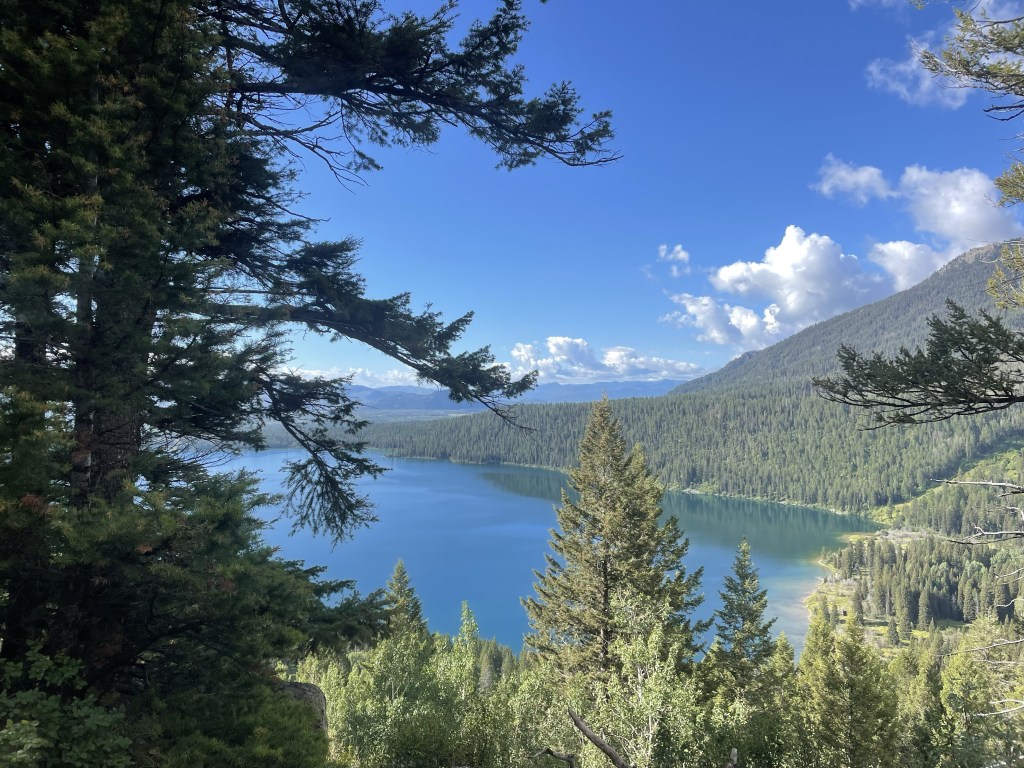
The afternoon saw a short but fun Lake Phelps hike. This part of the park is on the Lawrence Rockefeller Preserve. The Rockefellers, who had built a large estate on the property, donated it all to the park on the condition that all man made structures were to be torn down and the area returned to nature. Towering mountains peering over at a serene mountain lake. And on the way back we encountered a very large moose.
The following day, which was beautifully sunny, our hiking party consisted of my sister in law, T, J and me. I think the others were turned off by the fact the trail bore the auspicious name, Death Canyon. After driving through some of the many road construction sites (it seems as though most of the USA is currently building roads), we entered the park and ventured just beyond Phelps Lake. The trail starts wooded and a bit of an uphill, and then a very steep downhill, which you unfortunately know you will face up on the way back. You cross a number of boulder fields, but the trail is so well constructed you aren’t even aware of the exposure. Meadows of yellow daisies and purple thistles (which are not native, apparently), periwinkle blue flowers that looked like bluebells, and deep purple wild snapdragons. We walked alongside a river that cascaded into waterfalls before encountering a long uphill slog to the saddle right below Static Peak, at the patrol station. We keep going until the IPhone promised us we were at 8000 feet. I’m not sure what our total elevation gain was but it seemed considerable.
We pulled out our Maasai blanket from Tanzania and had a great picnic, which fortified us for a fast downhill followed by the uphill section we knew was coming.
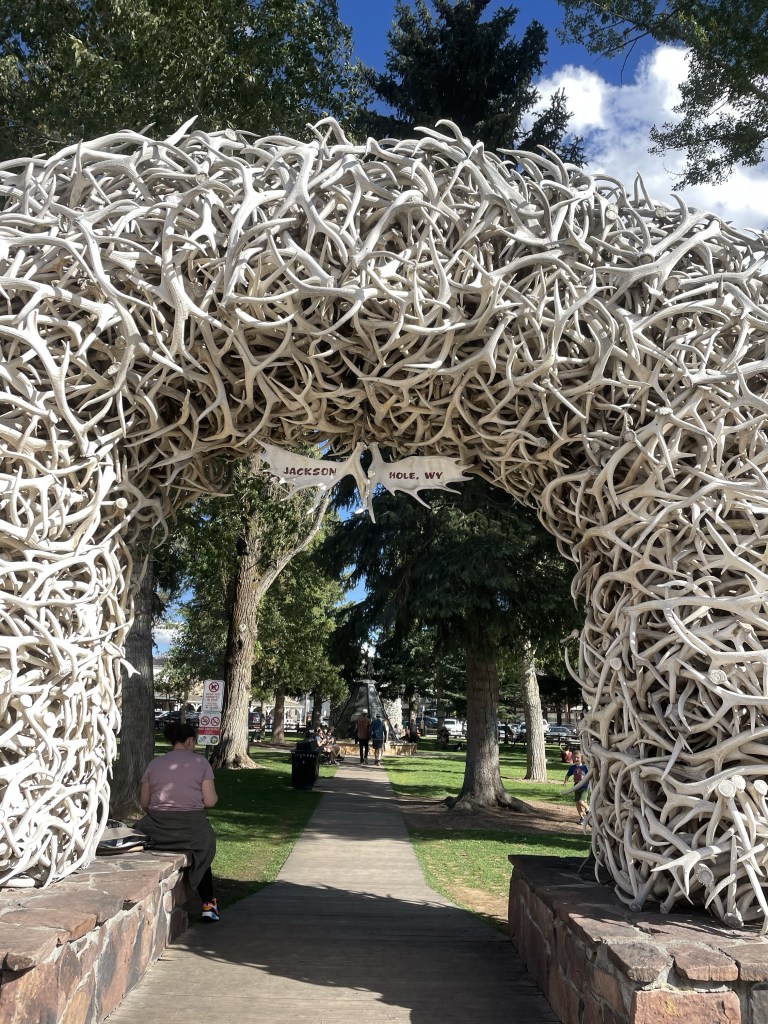
We couldn’t leave Jackson without some exploration of the town. Yes, we did see the iconic antler arches, browsed through a mountaineering store, and took advantage of the Snake River Brewery.
A very fun spot, and even the fact I left a hiking sock in T’s dryer didn’t seem that important. I guess it met up with the hat left in the Yorkshire Dales and the visor left in Hot Springs. I’m considering a blog post called “things I left behind on sabbatical.”
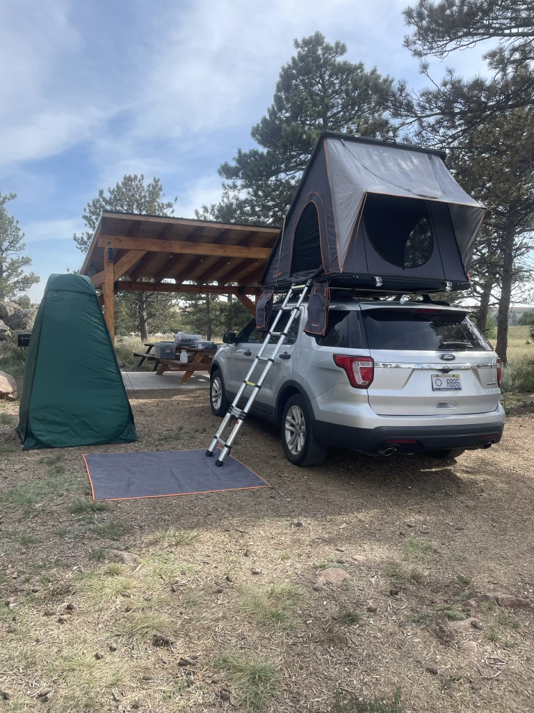
Once we left Golden, CO the temperature had crept far enough below three digits that we had no excuses left. Rooftop tent camping had to begin. After all, we had already lumbered a couple of thousand miles from Florida with the thing stuck on top of our car roof. It was time to do something with it.
Another set point on our road trip was the start date of an AirBnb in Jackson Hole, Wyoming, where we were meeting up with family members. Hence, day 1 of camping had to be somewhere between Golden and there.
We managed to reserve a Hipcamp in Buford Canyon, Wyoming, just west of Cheyenne. After a quick stop at a Colorado grocery store (with the unlikely name of “King Soopers” – but that was actually a Kroger’s), we had miles of driving north through Colorado. The burgeoning development outside of Denver reminds me in an unfortunate way of Florida, but then we shifted into high prairie and desert, multiple shades of yellow. Plus the wind picked up…no wonder Kansas had a song called Dust in the Wind. (Incidentally, the Spotify playlist for Kansas contains only two tolerable songs. It was J’s bright idea that’s what we should listen to while driving across the prairies.)
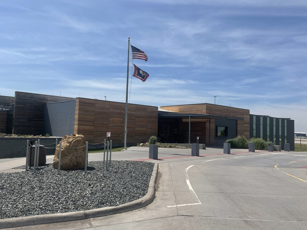
We stopped at the very modern Wyoming State Welcome Center. It’s more like a museum than a welcome center, with lots of interesting displays. The wind blew everything off our picnic table…
We decided to drive through Cheyenne, but there wasn’t much to see other than the capitol building and a very inactive downtown. Even though it was Sunday, I don’t think that was the problem.
Our campsite was about a mile off of the very heavily trafficked I-80. This part of the country is apparently home to the freight train industry with one plus mile long trains. I didn’t even know such things existed.
The campsite was absolutely stunning. A beautiful shelter for a picnic table, with a “designed by” plaque commemorating the architect. A spotless composting toilet and two sites with tiny houses. We set up camp, and walked around the interesting rock formations on the property, and over the ladder the owner had placed to allow entry into state land and the canyon itself.
After a brief scare when we couldn’t get the lighter to work we managed a pretty good first night camping dinner of steak and asparagus. The night sky was a spectacular tapestry of silver and black. The only downside was the I-80 traffic and train noise, which was constant. But it was more than made up for by the convenient and beautiful location. Elevation was about 7600-7800, and we could feel it.
The next day was a long day of driving the length of Wyoming. After we broke down camp, we drove through high desert with the Wind River mountain range on one side. Unfortunately much of the drive was on I-80, with 18 wheelers careening in the wind, and my fingers were sore afterwards from my white knuckled driving.
Some of the area looked like what I would call salt flats. Very desolate, with tiny hamlets of only 100-200 people. I especially liked the truck stop called “Stinker.” We even went through a small town called Eden, which had a few green fields.
Eventually we climbed higher and higher, suddenly saw evergreens, and the next thing we knew we were approaching the Tetons and Jackson.
We located our AirBnb in Teton Village, a major ski resort with lots of condos. What a change from what we had been driving through. J and I managed to get cleaned up – after a night of camping and days of driving we were pretty grimy – and rendezvoused with family. Time for a few days of real R&R – hiking and the like, and a nice break from the road.
One of the nice things about road trips is the freedom to stop where you want. OK, we did have certain set spots where our arrival time was sacrosanct (e.g., our campsite in Yellowstone), but between here and there there was a bit of flexibility.
One of those unplanned adventures resulted from our last minute decision to visit the Crystal Bridges Museum of American Art located in, of all places, Bentonville, Arkansas. Created by Alice Walton of Wal-Mart fame, it is the repository of an immense collection of American art of all genres and periods, and since there is free admission, it is an enormous gift to the public. One of her goals was to give access to art to those who had not had it before, and the visitors to the museum are a truly eclectic group.
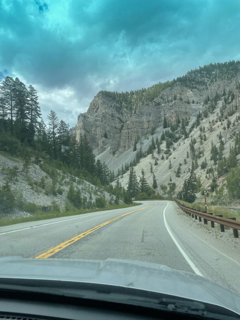
Getting there entailed a trip through the mountain ranges bordering Hot Springs, the first being the Ouachita Mountains (and national forest). A sign aptly described the roads as “steep and crooked.” The mountains were heavily wooded, but occasionally opened up for vistas of multiple levels of ridges. Reminiscent of the Blue Ridge Mountains, except the color scheme was dark green textured against a blue sky. I don’t have any photos of the drive – I was too preoccupied with hanging on for dear life! The Ouachita were followed by another set of mountains – the Boston Mountains (who knows the reason for the name?) – which were still steep but with more gradual curves. The Boston Mountains took us into Bentonville, where we made a beeline for the museum.
Bentonville was surprisingly interesting. The museum area is a city unto itself, replete with apartment buildings, retail, sports fields, something called the Scott Family Museum (or Amazeum?), and, of course, the Wal-Mart Museum. But Crystal Bridges was our goal. It’s being doubled, if not more, in size, so there’s a lot of construction going on. The structure – low buildings bordered by lagoons and flowing water, blends into the landscape like a Frank Lloyd Wright building – sort of the opposite of the Guggenheim in Bilbao. The interior feels warm in tone and the art is thematically organized by great motifs in American art. There are also hiking trails and sculpture gardens, none of which we had time to sample – we had to reach Wichita!
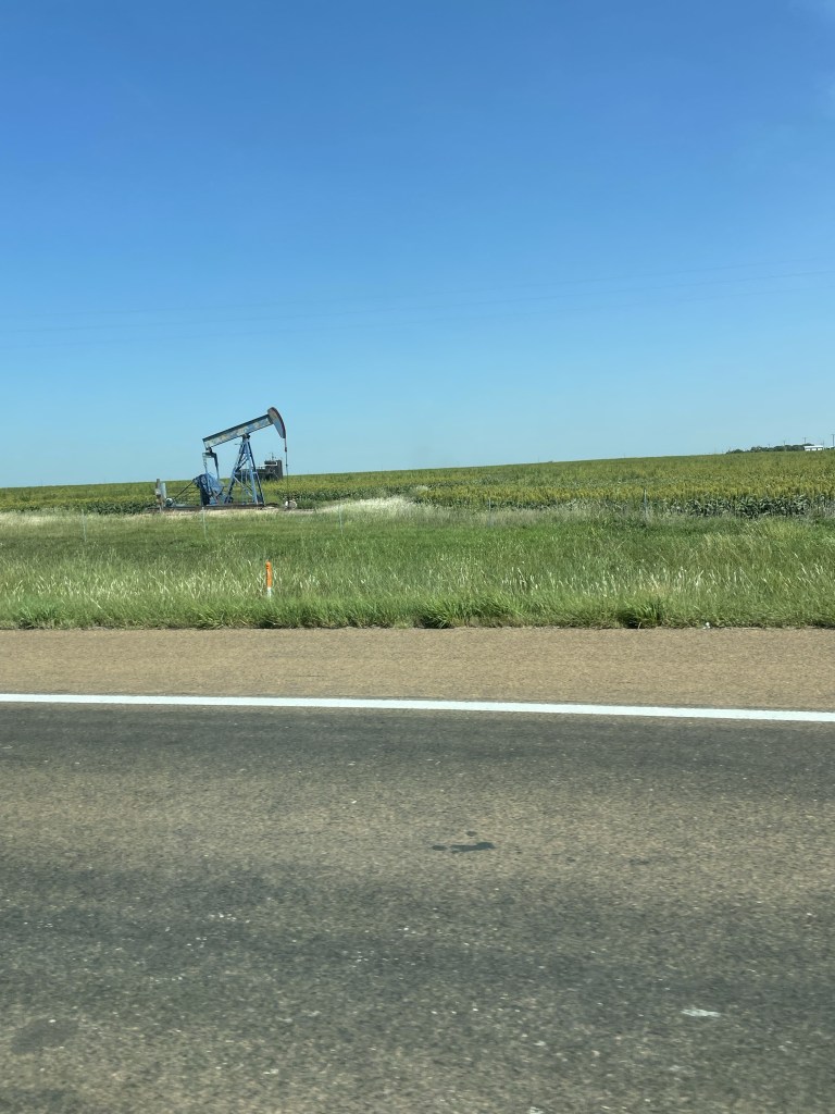
If you wonder why the eagerness to reach Wichita, one of our non-negotiable times was to make it to Golden, Colorado for a party our friends D & D were hosting. And Wichita looked like the mid-point. Miles and miles of corn fields, peppered with occasional oil drills. I never thought of oil drilling as a family business before….but I guess that’s the whole Beverly Hillbillies idea . . . Blue sky backed the fields and prairies. It was an exciting moment when we encountered a curve in the road.
It turns out Kansas has great rest stops – probably because there are so few towns. My favorite was the one apparently erected in honor of the Benders, a 19th century family who lured unsuspecting travelers, and served them a meal in front of a curtain. In the meantime, one of the family would hide behind the curtain, cosh the unfortunate guests, and steal all their possessions. After the mysterious disappearance of a number of travelers the Benders went on the lam and no one knows what happened to them.
We stayed at a motel in Wichita just off the interstate. It was still too hot to pop up the rooftop tent and try our luck. We were so sick of driving by this point that we walked to the “Irish” pub next door. the only thing Irish was Guinness on tap. All the food was Mexican.
We got an early start the next day – there were still a lot of hours to go before Golden. More and more Kansas fields – we stopped in the charming town of Selina, which had some of the best Art Deco architecture I’ve seen anywhere. Lots of restaurants and a 1931 movie theater still operating as a theater. And we were able to purchase a “Tomahawk” steak as a house gift for D & D. Somehow that seemed an appropriate choice coming from Kansas.
Miles and miles more of driving, with little traffic until we hit Denver, where rain and a navigational error didn’t make it any easier.
But we made it to Golden just in time for the party which featured one of D & D’s friends, singer/songwriter Lynn Drury of New Orleans, who performed with the beautiful mountains in the background.
What better spot for a brief hiatus with friends before hitting the Wild West of Wyoming.
Unfortunately, this blog has only taken us thus far to Clarksdale, Mississippi, and there is much more of the country to cover before J and I leave again in a couple of weeks for Europe.
After we woke up in the Mississippi Delta in our gentrified sharecropper’s cabin, we met a ZZ Top looking guy who must have been a home health person because he’d come to check on our neighbors, who seemed to be permanent residents (that is, unless they were traveling with a cat). He immediately asked what we’d heard the night before but recognized that Tuesday wasn’t the best night for music in Clarksdale. His wife was from Wyoming so he provided some travel hints for the upcoming weeks. He clearly resided in Clarksdale just for the music, and we vowed to come back over a weekend or during a festival.
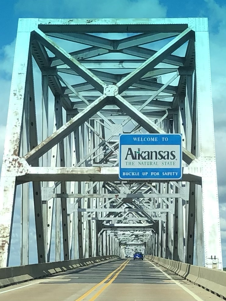
After repacking the Explorer in a more logical fashion, we drove miles upon miles of Mississippi Delta fields of cotton and soy…and finally crossed the Mississippi River itself, which divides Arkansas and Mississippi. The bridge was two lanes, no shoulder, and very high – just like the ones that terrified me as a child when we crossed the Tombigbee or Black Warrior Rivers when going to visit my grandparents. Once across, the roads improved and it seemed – almost imperceptibly – a little less flat.
More and more agriculture but no sight of the opulent plantation towns we’d been traveling through in Mississippi. Our “grey” road finally merged onto I-40 outside of Little Rock. It was awful, and our rapidly learned lesson was to avoid interstates whenever possible on a cross country trip. There was nothing but huge truck traffic, an unfortunate contrast to the rural roads we’d been traveling.
Ultimately we exited I-40 and I-30 (even worse than 40), onto U.S. 70 and into Hot Springs, also the site of Hot Springs National Park (which must be one of a kind). What a place. Verdant green and rolling hills. Apparently my grandfather came here in the 1940s to “take the waters.”
In the 1830s, well before the national park system, the federal government took control of four sections of land as a “national reservation” due to the alleged healing properties of the hot water bubbling up from the ground below (and I can personally vouch for the fact that it is hot). The park itself is shaped like a doughnut, with the town in the center. One side of the Main Street (Central Avenue) is part of the national park, and is lined with seven or more of the original “bath houses” that are still in operation of various kinds. One is still used for spa treatments and bathing, another is a visitor center/museum, another is a brewery, and some are still waiting to see what the future brings.
At one point, the poorer folks were so upset they couldn’t afford the “spas” that they started their own “ral” (short for “neuralgia”) camps to bathe in the 135 degree waters up on the hills above the spas. Ultimately federal troops arrived to stop them from “corrupting” the waters, but in some type of concession, erected some free bath houses.
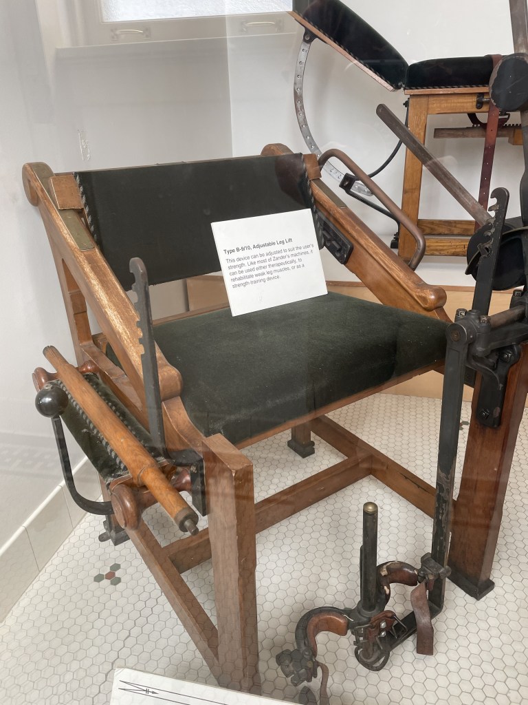
What struck me was how before their time some of these “treatments” were – mechanized machines (tension and resistance) that are only a step removed from the machines we use at the Y today.
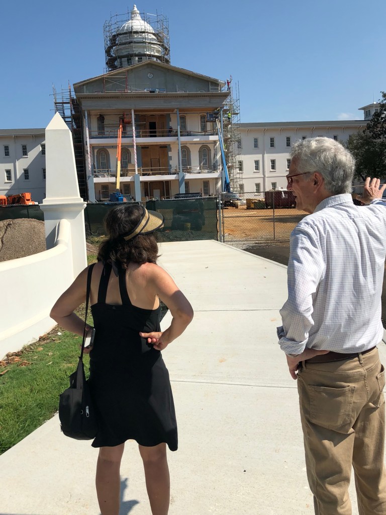
After a thorough inspection of the museum, which truly was fascinating, we walked along the Grand Promenade on the hill behind the bath houses, which is of a much more recent vintage, up the Peak Trail to the Mountain Tower. I steeled myself and J and I climbed the 21 flights up the metal staircase to the observation deck. I didn’t look down once. We did take the elevator down.
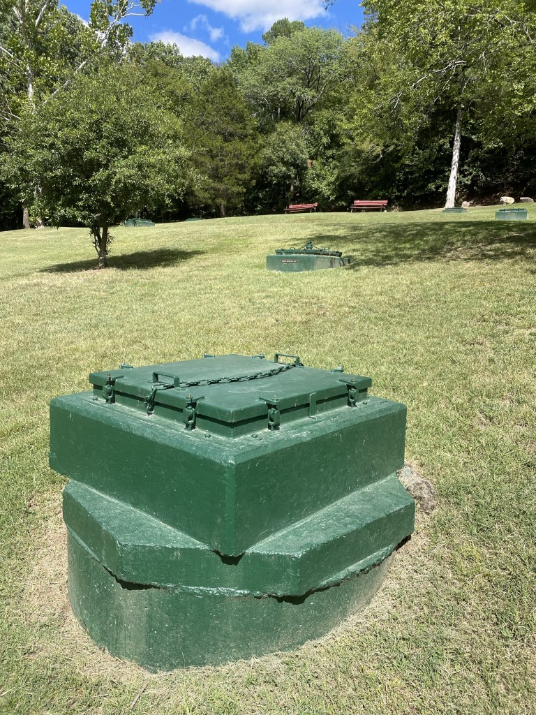
The entire area is checkered with green metal boxes that serve as collection sites for the water. Which, by the way, we tried at the visitor’s center and it tasted like plain H2O.
After a quick descent down the trail, we decided to take advantage of the Superior Bath House Brewing Company, which uses the thermal water to make the beer. I’m pretty sure it is now also are the home of my visor, which was never to be seen again after our visit.
After a beer, we located our AirBnb, not an opulent section of town, but quite nice. Back on the main Street, we stumbled upon the Brick Grill, a very reasonably priced and pleasant restaurant – many here were quite expensive.
Coming up – out of the flatlands and into the “steep and crooked” Ozarks.
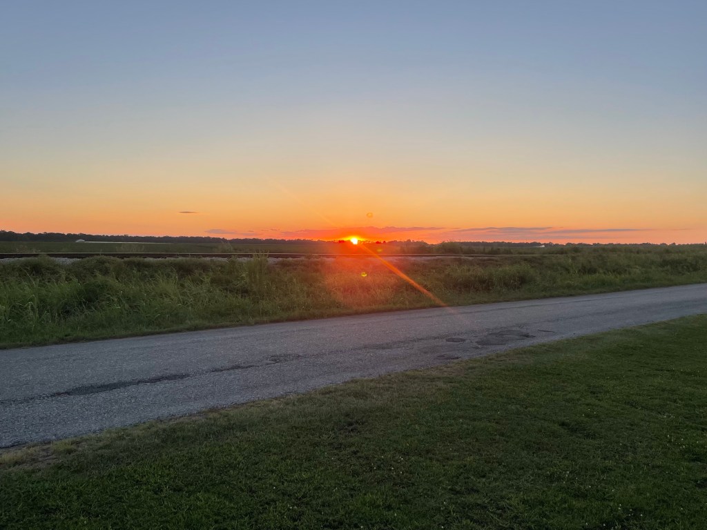
Clarksdale, Mississippi. I was watching the sun set over flat delta cotton fields. Pink blossomed into deep peach while rich grape paintbrushed the sky.
After two weeks at home in Orlando after our England and Spain adventure, we took off again on Sunday, August 13, this time by way of our 2016 Ford Explorer with a rooftop tent, as opposed to the airline that shall not be named. Both J and I lay awake the night before thinking about what we’d forgotten to pack for a four week road trip, what we should be taking instead, etc etc.
We finally got off about 9:15, driving along the turnpike to I-75 into Georgia. The turnpike was as excruciatingly boring as always. Ultimately, we exited I-75 and made our way to US 82, which goes all the way to Tuscaloosa.
After the monotony of the interstate, 82 took us through many small Georgia towns, which made the drive much more interesting. Lots of peanut (I think) fields, a large and elaborately patterned black and gold snake that we narrowly avoided running over, the red brick Andrew Junior College in Cuthbert, Georgia, pecan tree groves, so uniform and graceful.
At some point we realized one of the eight bolts attaching the rooftop tent crossbars to the roof of the Explorer was missing. We stopped at the parking lot of – I kid you not – a BBQ place called “Hog ‘n Bonz” (apparently meant to reference Haagen Dazs?) to replace it. My three pound weight that I’d thrown in at the last minute, with some vague idea I could sit in the passenger seat and do arm exercises (not) served as a surprisingly good mallet to push everything back into place. Regular bolt checking quickly became part of our daily protocol.
We crossed the state line into Eufaula, Alabama – beautiful antebellum homes with a dying downtown. Eventually reached the outskirts of Montgomery – many boarded up and overgrown motels, clearly victims of Covid.
Around Montgomery we encountered a drenching Florida style rainstorm. Surmounting other problems – such as the demise of the weatherstripping around the Explorer’s front windshield (purely cosmetic, or so they say), we finally pulled into the driveway of my uncle R’s house, which, by the way, was designed by a student of Frank Lloyd Wright. That explains all the wood, curved walls, and long lines.
The next day R gave us a detailed walking tour of the huge U of A campus, including the stadium with statues of the winningest coaches, fraternity houses with more columns than you could count, the president’s mansion, and the new school of engineering which is as big as many a college campus.
Most interesting – Bryce Hospital – which was originally a hospital dedicated to the moral treatment of the insane, a revolutionary theory for the mid 19th century. My uncle, an art historian, has done much of the work of mapping the hospital and its environs. Straitjackets and similar restraints were banned, each patient had their own room, and there were beautiful park grounds – the theory being that if you treated patients with dignity and respect in a calming environment they could recover. As they improved, they were moved into increasingly social environments. A surprisingly enlightened approach in days long before drug treatments and the like. The building is now being transformed into a museum and performing arts center.
We also enjoyed a visit to the natural history museum which houses the Hodges meteorite that landed on Elizabeth Fowler Hodges in Oak Grove, Alabama in 1954. She’s the only human known to have survived such an onslaught.
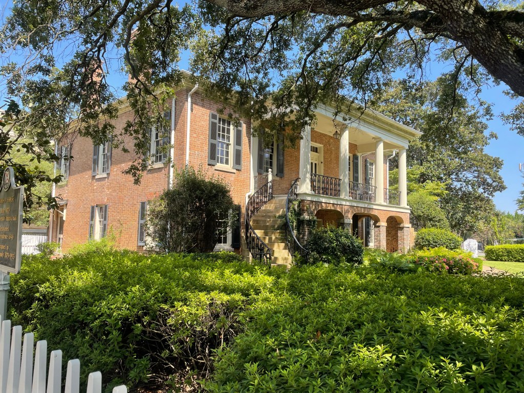
A surprise was the tour of the Gorgas House, lived in by the descendants of the 8th president of the university, until the 1970s or so. It was originally the dining hall for the university and is one of the few buildings to have survived the civil war. Accordingly to the posted chronicles, college students in the antebellum south were hardly paragons of good behavior, especially in the dining hall.
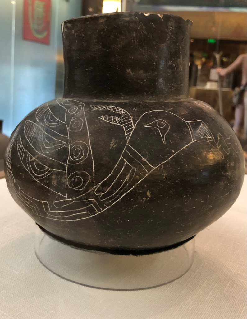
Next stop was Moundville – the site of a large city settled by indigenous people coming up from Central America hundreds of years ago. It ultimately became a political and burial site, and consists of large dirt mounds on which wooden structures rested. It was brutally hot, but we nonetheless climbed one of the mounds to see the view of what must have been a sprawling development. Their ceramics were masterful. Many depict a flying snake that my uncle thought might have reflected imagery of tornadoes common in the area.
As we drove back to Tuscaloosa, I was overwhelmed by the miles and miles of undeveloped, presumably privately owned land. That simply doesn’t exist in Florida.
The next day we headed for the Mississippi Delta, driving through thick Alabama forest, crisscrossing the Tombigbee River to Columbus, Mississippi. It’s chockfull of antebellum homes dating from the 1830s on, and is also the birthplace of Tennessee Williams.
The Southern Writers theme continued with a journey through the hill country to Oxford, Mississippi, where we stopped at William Faulkner’s home, Rowan Oaks. Although the town was crowded with newly arriving freshmen about to embark on their college careers at Ole Miss, we were the only visitors to Mr. Faulkner’s abode. The house was built in the 1830s and he bought it about a 100 years later. It’s very small, although Faulkner added a number of rooms, and has opulent grounds, including a riding stable. Apparently Faulkner’s wife commented on the nature of the light on the porch in August – the genesis of the title of the novel, Light in August. I think I’ll have to go back and re-read his tales of Yoknapatawpha County.
We finally reached the flat, soil rich delta and the Shackup Inn – our home for the night and a location that I discovered on the internet. It’s just outside of Clarksdale, and is a collection of old sharecroppers’ cabins that have been gentrified with electricity and bathrooms, but are totally quirky. Rusting farm equipment, old signs, and a large area for music festivals. We could have stayed in a cotton gin silo, but instead picked a cabin called “Shorty’s.” It’s one of the strangest places I’ve stayed since the barrels on Mt. Elbrus in 2014. ( https://fromswamptosummit.com/2014/07/02/looking-down-the-barrel/ )
We checked in and then drove down a pothole ridden road to Clarksdale itself. Clarksdale prides itself as the home of the blues, and hosts many festivals, but it was a little dead on a Tuesday night. The Delta Blues Museum is magnificent and moving. The entire place was a huge contrast to Columbus – here’s the home of the people on whose backs all that wealth was created. It was a left alone little town, enabling the blues to develop and flourish on their own terms. Photos weren’t allowed in the museum, otherwise I’d have posted a lot!
The temperature finally dropped about ten degrees. After a beautiful sunset, we were looking forward to a spectacular night sky.