
The swamp has featured heavily in this blog recently. House flood and storms. But at a particularly low point, intrepid hiking friend S found a 30,000 acre wilderness – the Tosohatchee Wilderness Preserve – where we could try to escape the urban grind we’d all found ourselves in.
I was in a particularly sour mood. When you can’t even find your hiking poles you know you are at difficult point. Things started to look up when, after 45 minutes of driving through what can only be described as redneck Florida (I mean that as charitably as possible) we reached the entrance to the wilderness area. There was an ominous sign stating a hunt was in process, but we never heard any gunshot and presumably the hunters were carrying out their activities elsewhere. After all, it is 30,000 acres.
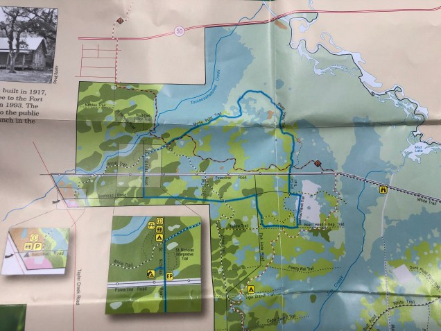
We picked up a map at the entrance but didn’t look at it until much later, relying instead on the black and white map S had printed off the internet. Turns out that made a difference, as you’ll see later.

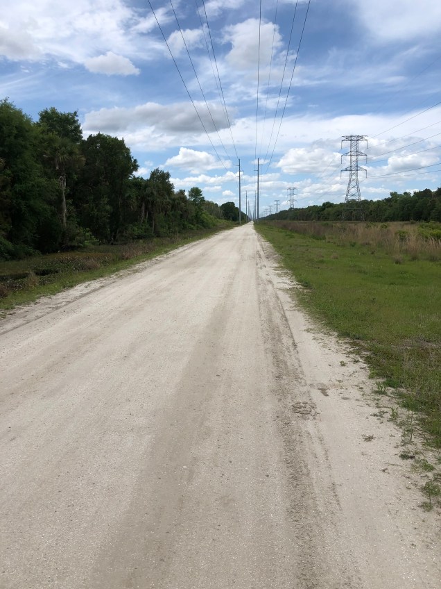
We’d chosen a route that was part of the Florida Trail, a 1,000 mile path that runs from Miami to Pensacola almost continuously (well, except for 300 miles). Somehow it doesn’t have the cachet of the Appalachian or Pacific Crest Trails. Nonetheless, we’re from Florida and it’s ours, damn it.
The trail was quite well marked, in stark contrast to the Rock Springs Preserve where we spent hours tromping around the wilderness in no apparent direction. See Lost in the Woods – A Florida Hike. And, where it was dry, it was a nice, well maintained path.
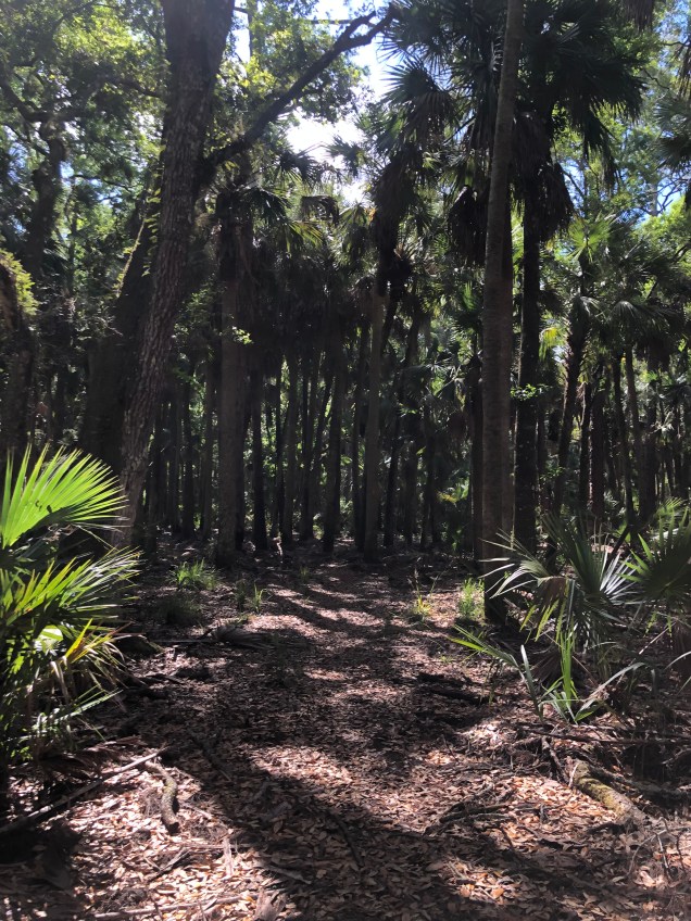
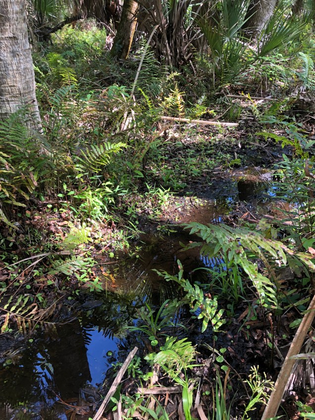
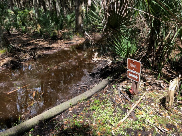
You hear the key words – where it was dry. After meandering through a spectacular shaded forest of palm hammocks and live oaks, interspersed with open sections of slash pines, we ended up in a literal swamp. The trail simply went right through it. We could only assume that it was the remnant of a huge storm earlier in the week, because surely no one would route a trail through a swamp, would they? The water varied from a few inches to quite a bit deeper – and was remarkably clear. We soon discovered that if we aimed toward the clumps of grass there was a good chance it would be shallower – although you did risk the possibility of a suction like effect from the mud and muck. I simply chose not to think about snakes.

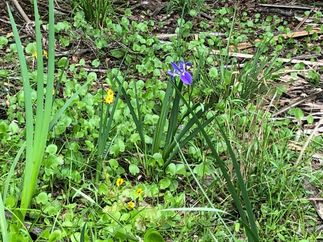
We alternated between swamp and patches of dry trail, and eventually emerged into what truly looked like a fairy glen. An open, almost circular area with wildflowers poking through coarse green grass. A spot where you could easily imagine the little folk engaging in their fairy festivities. And a good spot for some yoga. It’s also the spot where I realized the reason my pack was sloshing around and seemed so heavy was that I had forgotten I was carrying around about 10 pounds of water from my last training hike!


And, lest I forget – the flowers! Spring has sprung in Central Florida, and wildflowers were running amok. Wild iris (that sure look a lot like the Apostle Iris we paid good money for!), periwinkles, daisies, Florida style blue bells, thistles.


After a brief respite in the fairy glen, we were back at it. But by then we’d looked at the color map. As we studied the next section, we realized that the trail we’d just walked along didn’t run through the green part- it went straight through a whole lot of blue! In other words, this was no left over from a storm – the trail simply went straight through the swamp. S said he thought he’d sensed a current. I almost titled this post “Fording the Florida Trail” (M’s suggestion).
Armed with that information and having learned trails really do go through swamps, we selected what looked like a more reasonable – or at least drier – way back. But after walking for a while down a dirt road and arriving at Second Cut Trail – we saw it went straight into and along a canal, with no end in sight. Back to the road.
We turned off onto the next possible path back through the woods and went about ten minutes. At that point it became clear that even though well-marked we were basically bushwhacking through overgrowth and stomping through a mixture of mud and pond – and we hadn’t even reached the blue area on the map. Back to the road again.
Ultimately we reached a horse trail that was relatively above water. While longer, I’m sure we made better time.
After 9 miles and about 5 hours – this was slow going – we were back at the car. Someone had stopped us just before we reached the parking area to ask for directions, and S, Good Samaritan that he is, gave them the color map, assuming there would be more back at the entrance. There weren’t.
Guess that means we’ll have more unexpected trips through the blue areas. We definitely plan to go back. After all, where else do you start for a summit but in the swamp?


One thought on “The Lost in Florida Series – The Tosohatchee Wilderness”