Visiting a Castle and Into the Clouds…Reeth to Aysgarth Falls to Kettlewell, Yorkshire Dales, U.K.

As we’d had several long and steep hiking days, we decided to knock off a couple of miles by avoiding a loop around something called Apedale Moor (which we couldn’t locate on any map anyway) on our way from Reeth to Bolton Castle and on into Aysgarth Falls.

This meant having the nerve to stray from the ever present blue GPS line that was our North Star to take a paved road called Hargill Lane practically the whole way. Just because it was paved, however, did not mean that it didn’t go up and down, and unfortunately, it was a quintessential long slog shin splint generator. Hargill Lane crossed windy, windy moors with absolutely nothing around but sheep and occasional cars that operated at the same speed as all the bus drivers – that is to say, fast.

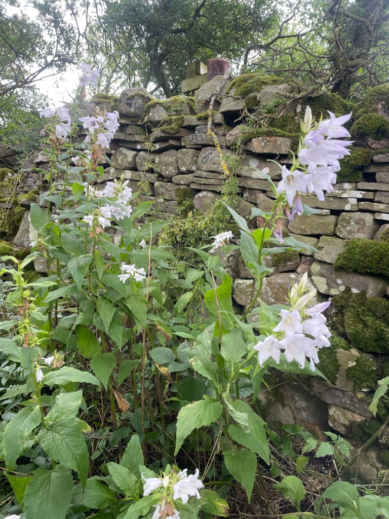
Eventually the road descended into the conservation area for the Bolton Estate, lands that are still owned by the same family that held them hundreds and hundreds of years ago. There were many beautiful wildflowers, but they were interrupted by lots of warning signs for the quarry works on the other side of the road.

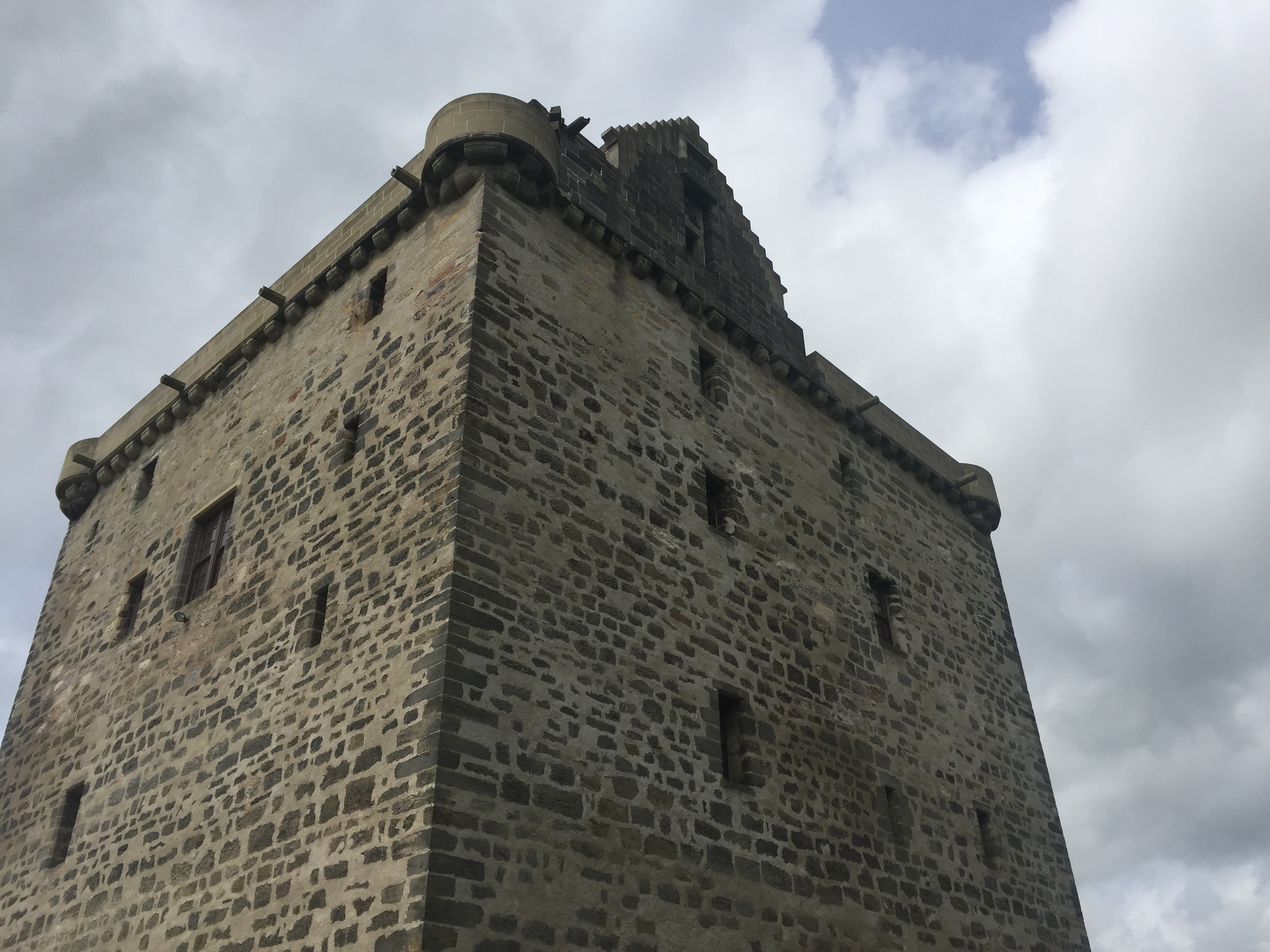
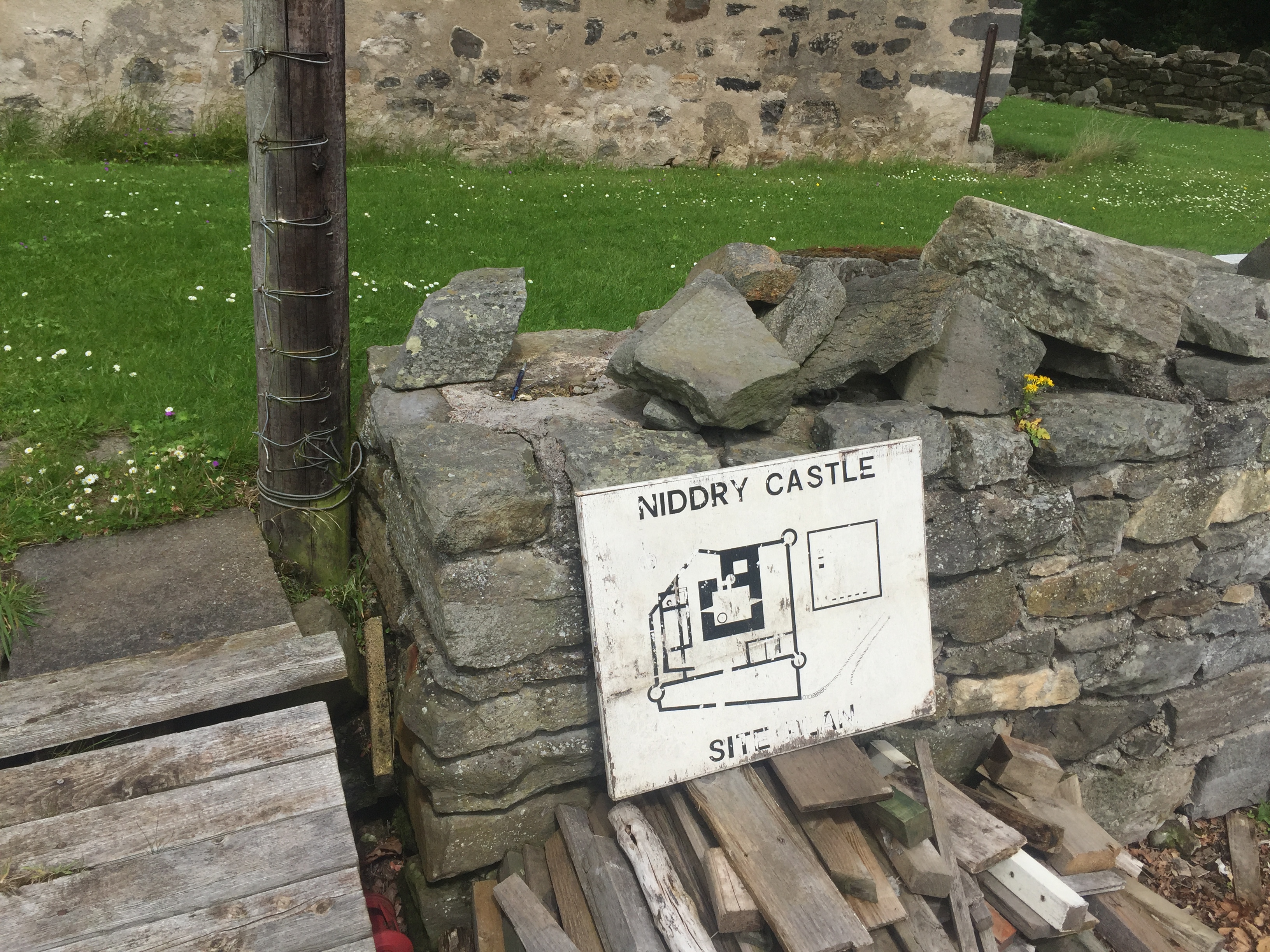
We reached the very well preserved Bolton Castle right at lunch time and had a nice meal in the tea room. The castle, built between 1378 and 1399, is quite intact, and M and I enjoyed the diagram that showed what each level of the structure was used for. There was also a lot of information about the castle’s architect, John Lewyn. Who knew castles had architects!

The walk from the castle to Aysgarth Falls was lovely. We did cross a field with another bull, which was actually starting to lunge at a couple on the other side of a wall who had a dog with them. (Incidentally, everyone in the Dales has dogs, and they are welcome guests in restaurants, pubs, shops, etc.) They had some long story about someone they knew who had recently been charged at by a bull and had to throw his dog over a wall….in any event, it turned out my bull fears were not unwarranted! While the bull was occupied with them, J, M, S and I managed to sneak over another section of the wall, unnoticed.

On the way, we also suddenly heard a huge roar overhead that practically shook the stone walls surrounding the fields. Two Typhoon RAF jets zoomed by, and made several passes. We soon learned that war had not actually broken out while we were in the solitude of the Dales, but that this was a popular location for the RAF to do low altitude training.

The Aysgarth Falls themselves were pretty, but by then we’d seen so many waterfalls, we were somewhat jaded, and just as glad to keep on moving up a steep hill to our next guest house — the newly renovated Aysgarth Falls Hotel. Despite three flights of stairs (thank God for those backpack straps on my suitcase!), it was really nice and we thoroughly enjoyed their pub and dinner and breakfast food.

That was good, because the next and final day turned out to be the most challenging yet.

The plan was to walk from Aysgarth Falls to Kettlewell, where we would meet a taxi at 5:30 that would transport us back to Grassington, for our travel to London the next day. We wisely chose the 12.6 mile route rather than the 15.3…..

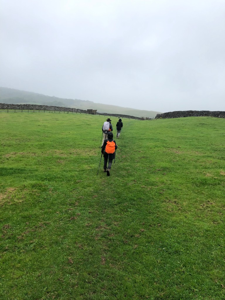
We started with some easy walking through fields and what was described as some “unavoidable” road walking. But there was little traffic, and the flowers were pretty as we basically hiked the length of the valley. Despite its remoteness, a number of little cottages bore signs of construction.

Eventually the valley ended, and so did the road. A very nice farmer gave us directions (the blue line becoming somewhat cryptic at that point), and we were able to cross the river and start what was described as a “big up.”

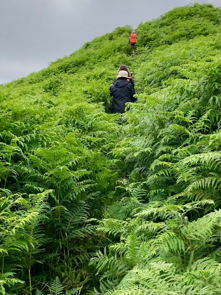
We were completely distracted from the steepness of our ascent because the almost imperceptible trail started to lead us through fields of five plus foot high ferns. They literally towered over us and I found I was using my body as a battering ram to push through. It felt way more like an Amazon jungle than the Yorkshire Dales.

Part of the way up, we realized there may have been a slightly more trodden path, but we were too busy bushwhacking and trying not to be swallowed by the ferns to have seen it.

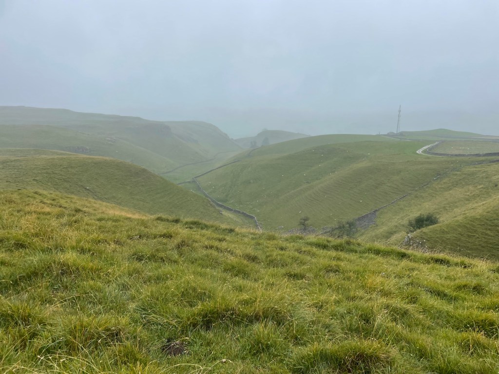
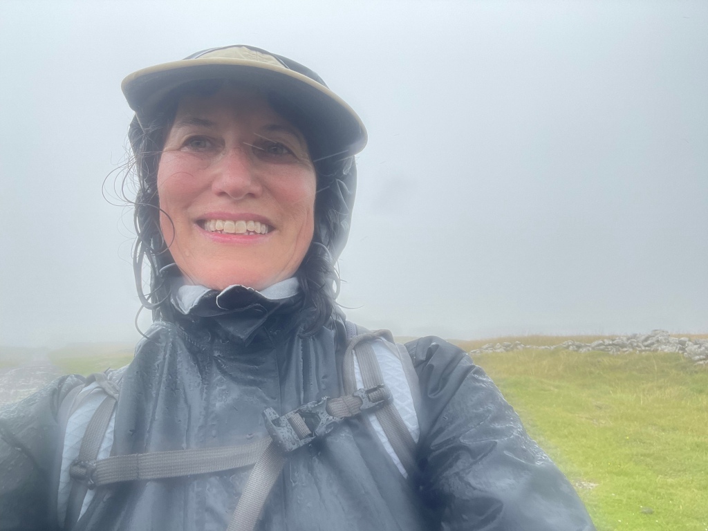
We finally cleared the fern field and continued to ascend. It was a very rapid elevation gain. Suddenly we found that we were no longer below the low hanging cloud we’d been observing all day, but were actually in it!

Yet still we continued to climb up. Visibility was starting to close and navigating the blue line was like flying a plane on instrumentation only. We encountered one group of young scouts using maps who were clearly doing some sort of orienteering exercise….they seemed infinitely better equipped for the challenge than we were.

We had no choice but just to stick to the GPS line as much as we could and aim toward the cairns and waymarkers that we could see. Finally, the scout leader passed us asking if we’d seen his charges anywhere – we were relieved to see him as proof that civilization existed somewhere in the direction we were aimed.

Visibility continued to get worse and the wind was whipping. We stopped for a brief break by a the first stone wall we’d even seen. But by then I was simply dedicated to getting down as fast as we could because it really was starting to feel unsafe. I was beginning to feel like a character in one of those Sierra Club magazine articles about what can go wrong while hiking….they usually end with hypothermia or broken bones.

Anyway, we finally reached what the itinerary termed a “snappy descent.” To the dismay of my fellow hikers, I actually found that part sort of fun – skipping around and over rocks, but with lots of grass cushioning on either side. Plus we were going down.

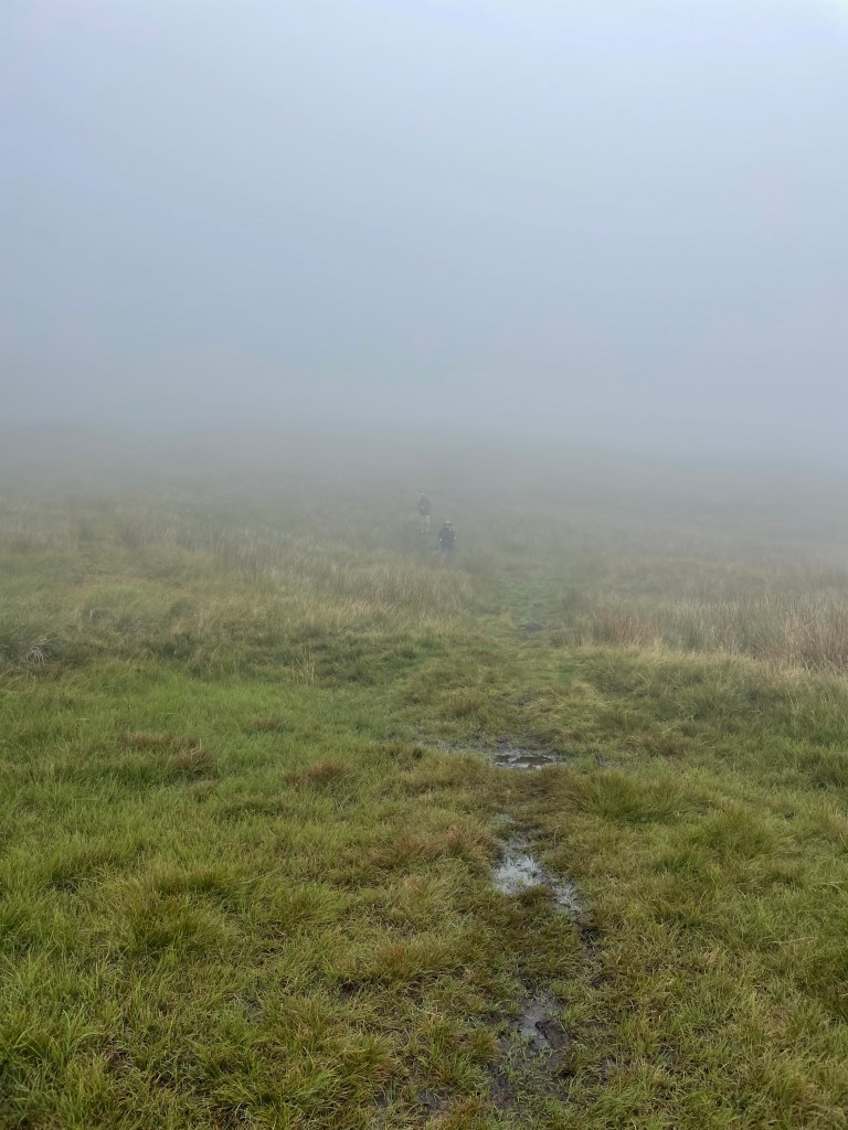
But we were still in the cloud, and M and S were just dots in the mist. All I could think about was that we had to maintain visual contact. You really could have gotten lost up there.

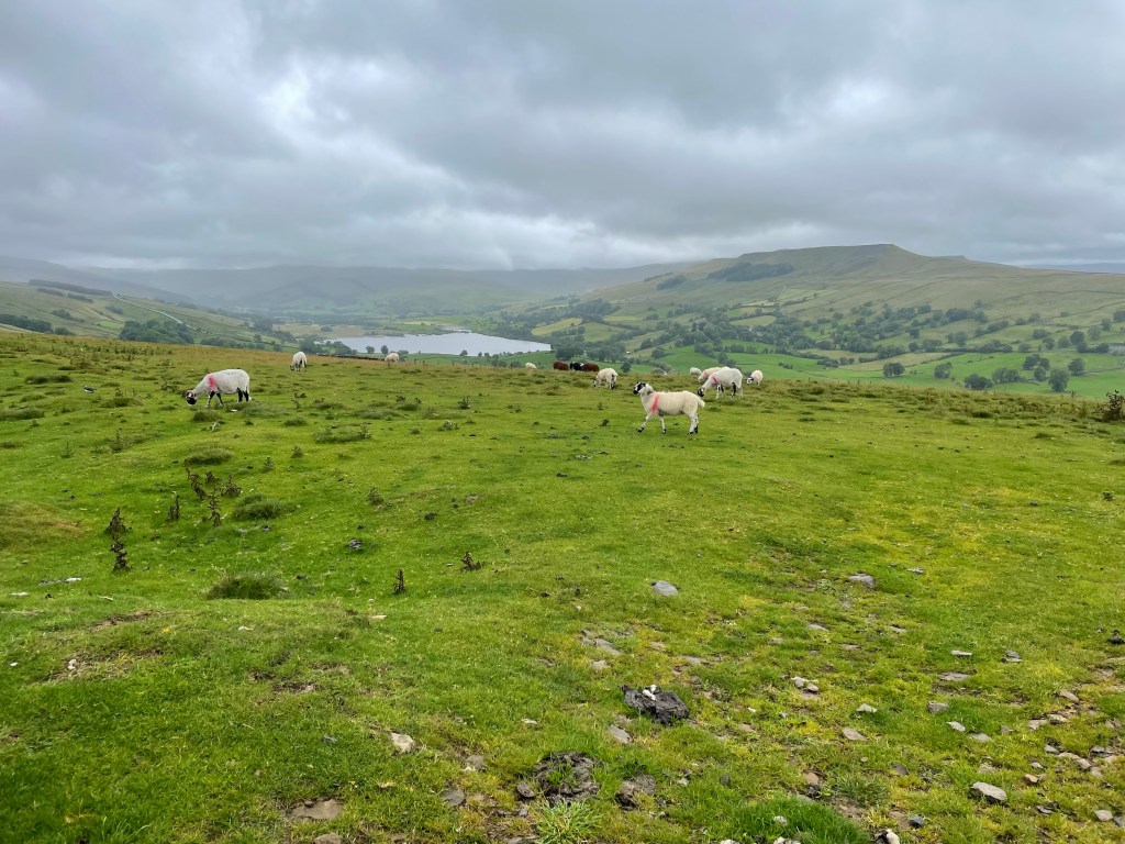
Finally we were below the cloud, and the world started to come back into focus. We could see the village of Starbotton at the bottom of the peak we were descending, and the wind that had whipped us as we crossed the ridges of the moors died down.

A steep descent down a stone road, and we were back in the valley, only 2 1/2 miles from Kettlewell. We had a quick bite of our sandwiches, and then walked through the fields that lined the valley for a straight shot to Kettlewell.

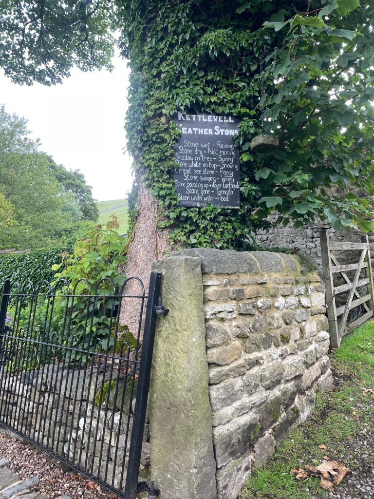
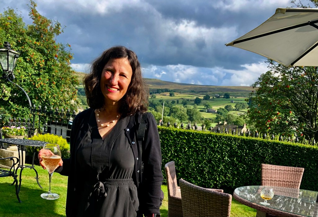
We had made it – all 77 plus miles! We walked through the village to the Blue Bell Inn where we were to meet the taxi in an hour or so. We had a celebratory drink to toast our most recent adventure. And even the fact that the taxi was an hour and a half late picking us up didn’t really matter.

Bouquets of Pheasants and Ruins of Mines – The Keld Loop and a Journey to Reeth, Yorkshire Dales, U.K.

Rooms at the Herriot Guest House were quite small, but that was by far compensated for by their very good breakfast and homemade jams and marmalade. That provided enough to fortify us for a slightly easier – and hopefully drier – day 3 ahead.

The Mac’s Adventure itinerary called for us to be transported by taxi to Keld, which truly is a blip on the map. The taxi took us through the Buttertubs Pass – a location I was last in with my family in 1972 when we lived in England for my father’s sabbatical.

After an early arrival in Keld, we got on the road to walk to the Tan Hill Inn, famous for being the highest pub in England. About a 4.5 mile hike, over lots of moorland and gigantic ravines, where erosion peeled back the top layer of heather to reveal dark soil and rocks. For all of its age, just like the fossilized Jurassic coast in Dorset, this is an ever-changing landscape.

It was rewarding to see the inn suddenly appear in the distance, but the place itself was crowded with day trippers and there was nary a place to sit. Nonetheless, there were picnic tables outside, and we were able to make a nice lunch out of the Double Gloucester cheese and crackers that I had been carrying around since Manchester, alongside the middle aged men’s motorcycle group who were similarly shut out of the pub.

J and I chose to take the longer route back and crossed the valley, which was low and filled with green rushes, over to the next other ridge. The top flattened into a golden prairie-like meadow. We saw at least four or five “bouquets” of pheasants suddenly take off. On the ground they were perfectly camouflaged, soft brown speckles and beige. We would hear five short whistles and suddenly they would take off at top speed, looking for all the world like a group of feather dusters taking flight.

We could never capture a pheasant in flight, but at least I found some feathers!

Our path took us by the rather large farming establishment of of the so-called “Yorkshire Shepherdess” of TV fame (although I’d never heard of her). She’s apparently one of those “leave the city behind, become a farmer, and write about it and develop a TV series” people. We did see two men, one on an ATV, which seems to be the farm vehicle of choice here, herd a group of cows into a barn. We had to wait until they were in before we could pass.

I know these are sheep, not cows, but I didn’t have a pic of the cows!

We were almost back in Keld when we managed to make a critical navigation error and ended up going the wrong way toward the small hamlet of West Stonesdale. It’s a true farming community, with working sheep dogs sleeping in their cages, and big agricultural equipment everywhere. Fortunately, I soon realized I was looking at the famous GPS blue line backwards, and we were able to correct our course and make it back to Keld about 5, just as S and M were starting to question where we were.

View from the Keld Lodge

After an overnight at the Keld Lodge, the next day, Day 4, we were to trek to our next destination of Reeth. We had a choice between the “high” route, which would mostly be on the famous Coast to Coast trail, or the low route, which ran along the river. We fortunately chose the high route – and it did indeed provide some of the best summits and sights of the whole trip.

The first part was over moors, which were blanketed in blooming purple and sometimes white heather, waterfalls galore. There were lots of steep sections, including some fun scree fields to scramble through, and I was happy get to use some of my basic mountain skills. They are pretty common sense: always lean into the mountain and your uphill pole.

A steep descent into the valley, and we were in the midst of the ghostly ruins of lead mining works. Lead mining was very big in the Dales back in the 1830s. It’s now just a shadow land, and it’s hard to imagine the hundreds of men that would have lived and commuted to these now remote and desolate areas to work the mines.

It looked like some gravel quarrying still continued and we ascended back up the valley to a moonscape of rock and gravel.

Once we crossed the moonscape, we found a nice spot for lunch, where we chatted with a mother and daughter combo who we had seen in Keld that very morning. They must have been uber athletes based on their speeds up and down.

I bonded with this sheep. It was the cleanest one we saw!

After about 12 miles or so and a few more ascents and descents – and a lot of what we believe to be grouse – we made it to the pretty town of Reeth. As always that final last mile or so is the hardest.

We were staying at the Burgoyne Hotel, which seemed positively opulent after the Herriot Guest House. Nothing like a drink in a front garden after a hard day of hiking.

All Creatures Wet and Cold and An Encounter With a Bull – Grassington to Buckden to Hawes, Yorkshire, U.K.

As foreshadowing, let me start by saying that I spent a lot of time on day 2 of our trek through the Yorkshire Dales thinking of synonyms for the word waterlogged. But I digress.

After a two night sojourn in Manchester spent catching up with family friends (by the way, we really liked Manchester and its bustling vibe…), J and I successfully navigated our way to Grassington. This started with two trains, which delivered us to the charming town of Skipton, which had one of the prettiest rail stations we’d seen.

From there we planned a bus ride to Grassington. Of course, the rail station and bus station were not contiguous, so this involved a ten minute jaunt, luggage in tow, but we were able to use our two hours of waiting time to visit the “Sound Bar.” An independently owned combination vinyl record store, coffee shop, and pub that also featured live music on the weekends. The walls were plastered with tickets, posters and other promotional materials for concerts and bands dating back 50 years – really fun spot and not what we expected to find!

Despite the fact that the driver operated the bus to Grassington as though he were auditioning for Mr. Toad’s Wild Ride, he safely delivered us to just outside the Black Horse Hotel where we met up with pals and long time travel partners M and S. They’d arrived a day earlier, fortunately managing to take one of the only trains running on a day of “industrial action” (aka strike day) from London to the north. Unfortunately, the room reserved for J and me had electrical problems. After a couple of hours of waiting around in their very cozy bar, management gave up and sent us across the street to an equally nice inn, the Devonshire, which was graced with a mention somewhere in one of James Herriot’s books.

For those of you not aware, practically all of the Dales is Herriot country – there’s a Herriot Way walk, hotels name their rooms after the characters (both human and animal), and more memorabilia than you can imagine.

After a filling breakfast, the first day of the walk went smoothly. It was only about 11 miles – slightly shorter than the original itinerary because we were to stay in Buckden instead of Cray, which was a couple of miles further down the road. Of course, that did have implications for day 2, as I’m sure any discerning reader will have figured out.

There was a light, misty rain much of the time but it was really nothing more than what you experience with a mister at a Disney theme park. A few steep uphills at the beginning until we reached a ridge line. We then descended through what must have been a planted forest of tall conifers, stripped of their lower branches, and down to a river that was contained in its banks (foreshadowing again – unlike day 2).

We reached the village of Kettlewell where we stopped at the first spot we saw for lunch and an ale (after all, this was billed as an “Ales and Dales” trek). It turned out it was the owner’s first day open, and his manager had quit that very morning. We were happy to support the new endeavor and enjoyed hearing his take on English politics and who should or should not be King….

Much of the rest of the walk was on or near the river. It was edged with fantastic wild flowers, thistles, foxgloves, and bluebells. We crossed open fields, or sometimes were sandwiched on narrow paths running between stone walls, flowers and ripening berry brambles on each side.

We reached the tiny village of Buckden (chief feature, a village store that took cash only) in good time. Home for the night was the lovely Buck Inn.

We knew in advance that the repercussion of our shorter day was a longer one….so were prepared for at least 16.5 miles on day 2, and had ordered packed lunches the night before.

We knew things were not off to a propitious start when, as we were departing, a man in the lobby volunteered that he had just come from Askrigg, and everything on the way was flooded. He also cast some dubious looks at the four Floridians blithely heading off into the Yorkshire Dales….

It was indeed raining, and continued to do so for nearly the whole day, veering from light to stinging. We started with a long uphill slog, and learned the first rule of Mac’s Adventure trekking – NEVER veer from the blue GPS line on the app, NO MATTER WHAT. The sign posting (other than for the well-known, main trails) is awful, and that blue line becomes your Bible (or yellow brick road, whichever metaphor you prefer).

Our first issue really started as we descended into Cray, which was where the original itinerary had called for us to spend the night. We reached a roaring river, which we were apparently to cross with the assistance of stepping stones. But the stones were under the white water rapids of a flooded river, and we were not about to start day 2 with an encounter with the river gods. There was a bridge just a few feet away – but to access it we would have to go through private property that lined the river bank.

There was little choice. To the bemusement of the elderly men on the other side of the river who were eating sandwiches and drinking tea from flasks, and having a good time observing our adventure, we all managed to climb a stone wall, scale the wire at the top (avoiding barbed wire on the sides), and make our way to the bridge. (S had ventured along the river edge, clinging to the wall, to see if there was a way to less obviously trespass, but soon gave up the attempt to avoid lawlessness.)

I wish I had pictures, but we were somewhat preoccupied.

We trudged on some more, and reached a turn off that sent us above the fields into bleak and desolate moors, inhabited only by sheep. We did encounter a group of scouts with an older guide who made dire predictions about the water yet to come. More uphill, reached a stretch of paved road, only to find that portions of it were under up to a foot of water. That required another venture into the fields at the side, although by then we were so wet it hardly made a difference.

From the road we were back onto a bridle way running through the moors. As M pointed out – we were experiencing both swamp and summit simultaneously. Many impromptu waterfalls had formed, and it would have been spectacular without the rain, or the wind that had by then kicked up. The conditions defined the word bleak, and the moors were, to use M’s phrase, both desolate and disorienting.

The moor was interspersed by sheep fields every now and then – but my favorite was the pasture guarded by a very large bull with a ring at the end of his nose. I was first in our little parade, and memories of bull running and Pamplona caused me some anxiety as I considered the effect of my orange back pack. But I moved slowly, J edged in close so the back pack wasn’t as visible, and Senor Bull deigned to let us pass without exacting tribute. Nonetheless, once we’d exited his domain, he stood his ground by the gate, staring at us to make sure we really had left.

The rain lightened and we found ourselves on some country lanes, with a couple of houses that seemed to have been built at the edge of the world, so we pulled out our sandwiches and ate on the go. About mid-afternoon, we finally reached the charming village of Askrigg – home to pretty gardens and a 15th (or earlier) century church, St. Oswald’s.

Exiting Askrigg, we hiked through a lovely enchanted forest high above a rushing river. The path ran along the top bank, a stone wall on one side and trees and river below on the other. It was emerald and mossy green, and surely home to a pantheon of forest fairies.

Path finding through the muddy, sodden fields became more difficult and the wind picked up. Things were not helped by the hundreds (thousands?) of sheep we encountered and we spent a lot of time trying to avoid their leavings. Very occasionally we would go through a “clean field,” i.e., one without sheep!

I thought I could see our destination of Hawes in the distance, but couldn’t know for sure. We hiked and hiked through field after field, finally making a left and seeing a sign marked “Hawes Circular Walk.” It was getting late at that point, and I haven’t been so glad to see a town since J and I descended Stok Kangri in Indian in 2018!

We reached the Herriot Guest House in Hawes completely drenched. Both ourselves and our possessions, despite rain pants and back pack covers (turns out passports dry pretty well). To add insult to injury, somehow the luggage that was being transported from inn to inn had managed to get wet as well.

We changed quickly and went the The White Hart for an excellent (and well-deserved) Sunday Roast.

Sodden, waterlogged, drenched, soaking. I’m sure there are a few adjectives that I’m missing but you get the picture. However, you could equally apply: challenging, invigorating, exhausting, stimulating, and most of all – absorbing.

Scotland to Scarborough – You Take the High Road and I’ll Take the Low

image
Niddrie Castle

Actually I’m not sure whether we took the high or the low road journeying from Aviemore to Scarborough – all we were certain of after six plus long hours of driving is that Google Maps had directed us in an incredibly inefficient manner.

Of course, some of it was likely our own fault. As we contemplated the comfort of traveling on four wheels instead of two legs – after 70 miles of walking that was the equivalent of a luxury jet liner – a side trip to a Scottish castle seemed in order. We had two in mind – the first was one that we found listed online and seemed to be on the way; the second, Niddrie Castle, was by reputation in the area S’s boyfriend P’s family hailed from in Scotland. But the best laid plans….

It turned out Castle #1, as I’ll call it, had, unbeknownst to the writers of the castle Internet site, been turned into an event venue. The rather imposing entrance into the grounds, was zealously guarded by a large sign welcoming all comers to Allie and Colin’s wedding. We contemplated having one of the young couples masquerade as Allie and Colin and make off with the wedding presents, but ultimately ruled it out as too risky.

So, on to Castle #2. It turned out to be in a small village just outside of Edinburgh whose main geographic feature was an enormous landfill hill set beside a golf course. Getting there required going completely off GPS and driving along remarkably narrow roads that permitted no turn arounds (and needless to say, we managed to go the wrong direction on several).

image

Niddrie Castle is the first very old castle that I have actually seen inhabited. All that’s standing is a rectangular building-  but there were most definitely signs of dwellers. Outside the castle was a large, posted map of the castle plans, and we saw signs of some sort of renovation but of  what wasn’t clear. You could walk the entire way around the castle and that path linked up to a nature trail running through the golf course. We had lunch out of the trunks of the cars in a muddy driveway just by the castle – it felt a bit as if we were eating in someone’s back yard, but I think P was happy to have seen it.

image

By then we had many miles left to go before we reached Scarborough, and somehow were routed through Glasgow which made little sense. Perhaps one of those occasions when an old fashioned map might have worked best? At least that would show us what was and wasn’t out of the way!

In any event, our route took us through the idyllic villages of the North Yorkshire moors…all of which required us to slow down to a crawl. And since we had heard of tickets by mail we were quite cognizant of obeying the traffic laws.  But the most slowed down spot resulted from our encounter with several wooden gypsy caravans pulled off the side of the road. The horses were taking a break, and the travelers, as they’re known in England, were sitting outside on lawn chairs. It was as though we had travelled miles back in time as well as along the road.

A few days later, we learned that there was a travelers horse show in Scarborough, where horses are bought and sold and traded, and presumably that’s where the caravans were headed.

image

About 8 pm or so we pulled into Scarborough to our AirBnb. An Edwardian house, replete with a billiards table and multiple bedrooms. What more could one want than for half of us to get fish ‘n chips from a shop heated to about 900 degrees and the rest of us locate Indian food, also about 900 degrees. Life was good.