It turns out that souls are in fact supposed to rest in Florence on their special day, and many places were closed, including our breakfast spot. Church bells rang out periodically throughout the day. Fortunately, the laundromat, which by then was a must, was not so affected.
We had an 11:45 reservation at the Uffizi. If I thought the Academie had a large collection, this was that collection on steroids. Once again, my friend Rick’s (by now Rick Steves and I were on a first name basis) audio tour was very helpful. The galleries seemed much more crowded and there were lots of kids, of varying degrees of conduct. Botticelli’s Prima Vera and The Birth of Venus clearly won the popularity contest, and I could not believe how close the fairly obnoxious tour guides were to the paintings.
The most interesting part was to monitor the progression from the flat Middle Ages palate to the Renaissance perspective – it was as though in a heartbeat artists suddenly learned how to reflect 3D on a 2D surface.
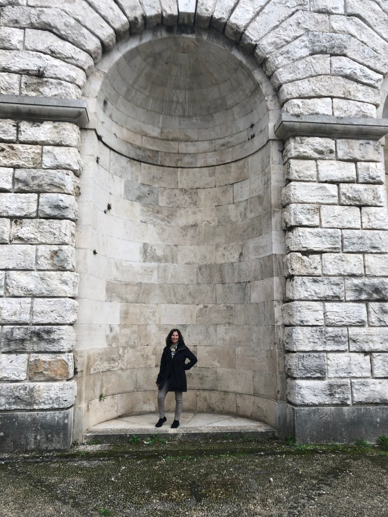
After about three hours we were “museumed” out, and decided to walk across the Ponte Vecchio to Ontarno (the other side of the river). We found a nice cafe for lunch right by the Pritti Palace (we could see the secret passageway where the Medici could stroll), and then walked up the very long steep road to the Abbasid and San Miniato al Monte. It was extremely old, original marble, ceiling and floors, Romanesque arches and amazing views of Florence. Supposedly the patron saint of the church was beheaded and walked there carrying his own head.
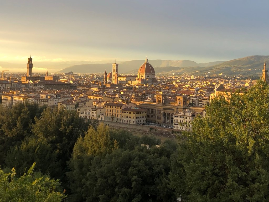
Suddenly the sun emerged and we were treated to an illuminated view of the city the surrounding hills, and layer of clouds below, all bathed in a golden light. I also finally found a scarf I liked for only 5 euros.
We walked back much more quickly. Daylights savings time had just ended so the evenings begin early. That evening we went to 100 Poor People, also a recommendation of our hosts, which was a fantastic value. I broke my no veal rule and had osso buca and white beans for 13 euros. A bottle of wine was 8 euros. It was worth breaking my rule.
The next day it was time to embark on the next part of our Italian adventure – Tuscany and Cortona. We took our time getting packed and shortly we were on a very new and nice regional Trenitalia train on our way to Siena. There was a threatening grey sky and the day after we left, Florence and other parts of Tuscany experienced Storm Ciaran, a bomb cyclone that wreaked havoc in the area.
It was time for our first Italian train adventure – Venice to Florence. Our first change of trains was in Bologna, a gritty industrial city, at least as far as we could glean from the very large train station. Fortunately we figured out in time that “est” and “oest” 1 were different ends of the platform, not different platforms, and managed to board our train within the allotted 20 minutes. The trains all seemed very new; only second class seats were available so there were no reserved spots.
The flat plain between Venice and Bologna gave way to the rolling hills of Tuscany – many of which we didn’t see because we were in tunnels going through them. Change of trains #2 occurred in Prato – a much smaller station and easier to manage. It was only 20-30 minutes from there to Florence.
Florence (or Firenze) – uniform, yellowing, four-story buildings, narrow streets. It was easy to project yourself back in time. Our guesthouse, the Bellevue House, was a single floor of one of those buildings, quite close to the station. You could reach it by taking a very small elevator or climbing three long flights of stairs. Needless to say, we chose the stairs. It’s a family owned place – an Italian husband and Australian wife who had great restaurant recommendations. A nice small bathroom, shutters, terrazzo floors and a fresco on the ceiling, a view of courtyards, and most miraculously – screens on the windows.
We walked to the Piazza Santa Maria Novella and environs and enjoyed a martini at one of the bars on the square – more tortilla chips offered as aperitivo!
Then we went to La Grotta di Leo, just a few doors down from the hotel. We splurged on bistecca florentine (new mystery – in the United States, why is florentine associated with spinach?). It was a giant T-bone served with roast potatoes for two. We also discovered the Joshua Tree Pub – a very fun spot on the Via Della Scala.
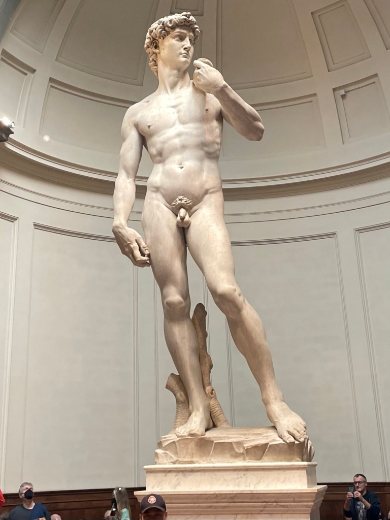
The next day was Halloween. J picked up breakfast at a little snack bar, and then we made our way to the Academie. We had ordered tickets weeks ago on line. The lines were crazy. We had to pick up the tickets at an actual ticket office, and then stand in yet another line for our noon entrance time.
The David was everything I thought it would be, especially his eyes. The collection at the Academie is generally amazing – Michelangelo’s Prisoner series, unfinished, where you could see and sense the marble being formed into figures.
After imbibing massive amounts of art, we walked through various piazzas – the Republica and the Signore, right by the Ponte Vecchio, and enjoyed window shopping in the high end shops. We had a fairly expensive lunch, but it was right on one of the squares and I convinced J to have anchovies on our pizza Napoli.
After fortification, we did Rick Steves’ Renaissance walk, which took us to the outside of the Duomo and campanile, as a well as the octagonal Baptistry with its special ornate doors. Apparently the facade of the actual duomo is of recent origin and the green and white marble does in fact look newer.
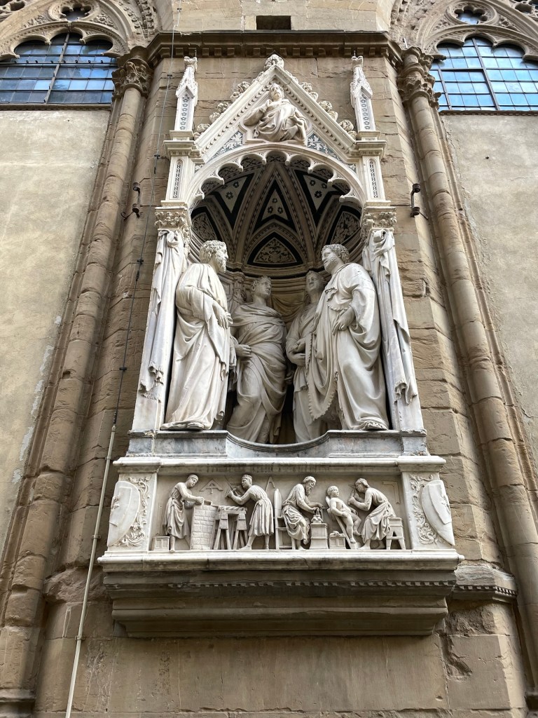
From there we walked to the church (Orsanmichele), adorned with statues in the exterior niches, the Palazzo Vecchione (City Hall, not the bridge), with its paintings of Austrian landscapes above the arches. I guess everyone had to leave their mark on Florence.
We passed by the various outdoor sculptures, including the Rape of the Sabine Women (question whether this would even be allowed in Florida), and finished at the Ponte Vecchio (the bridge).
By then it was getting quite chilly and windy and we headed back to the hotel. We liked the restaurant so much from the night before we went there for a second time, and to celebrate Halloween stopped by the Joshua Tree again. Patrons were in costume, the wait staff was enjoying a Chinese food feast, the Addams Family tv show was playing in the background, dry ice was occasionally released, and a good time was had by all.
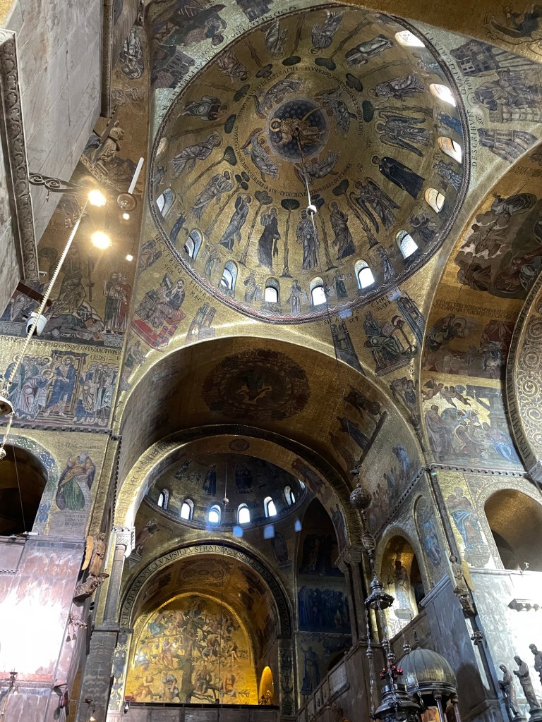
We started our first full day in Venice at St. Mark’s Basilica. It was there that we (or I) started our (or my) addiction to Rick Steves’ free audio tours. I downloaded them onto my phone, and J and I would each have one air pod in as we took the tours at our own pace, stopping as we liked. Highly recommend.
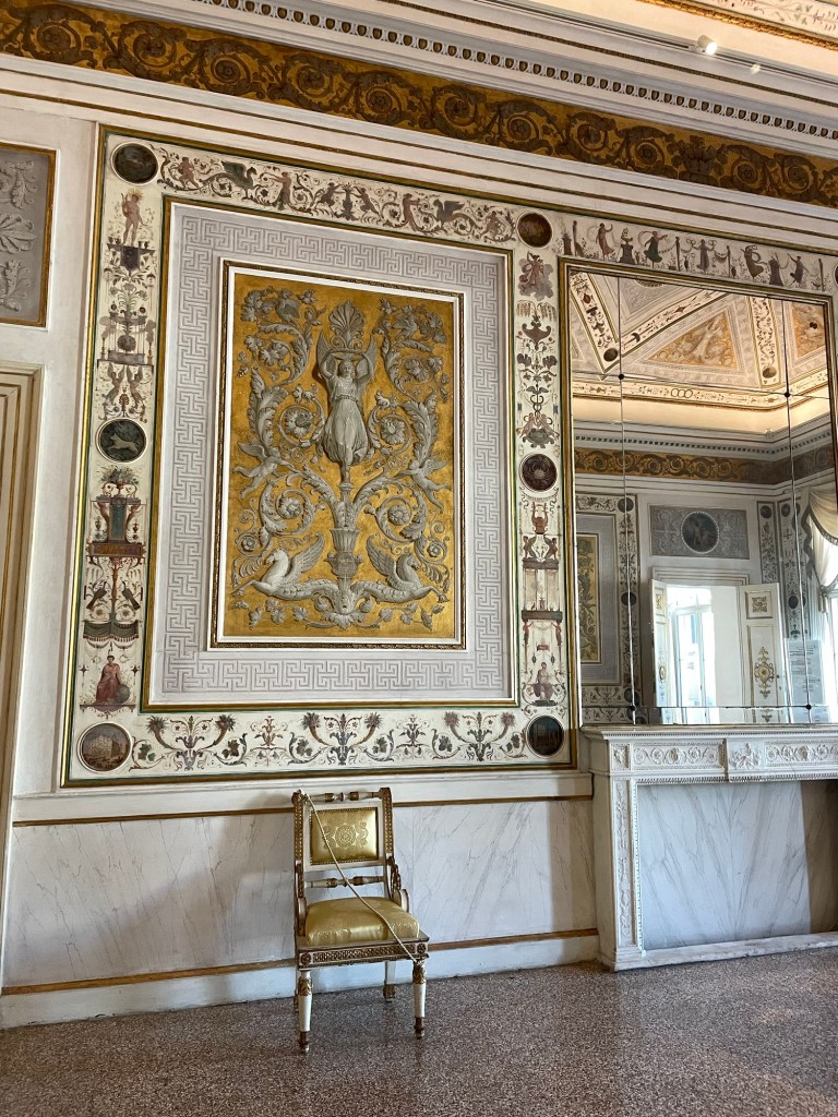
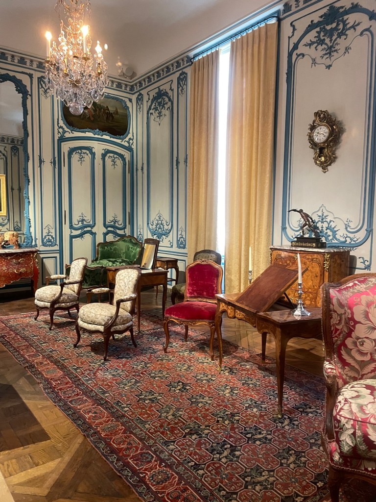
St Mark’s is a wild amalgam of Byzantine and Roman architecture, you name it. We especially enjoyed Rick’s (yes, on a first name basis now) narration of the mosaic that depicted St Mark’s bones being lost in the shuffle of building the church and ultimately discovered in an empty column. We saw the clock tower strike and then visited the Museo Correr, sporting glittery rooms of the French and Austrian regimes.
We wandered through numerous alleyways and between canals and found ourselves at the Church of San Zaccaria (John’s father)…paintings occupying every flat space.
After lunch we visited Doge’s Palace, whose dark, somber, huge rooms stood in stark contrast to the sparkle of the French and Austrians. When Venice was its own kingdom the doges were its rulers, with the role ultimately to become only ceremonial and then expire altogether after Napoleon’s conquest of the city. I now know a lot about the Battle of Lepanto (a 1571 naval defeat of a fleet of the Ottoman Empire), and the sheer volume of Veronese and Tintoretto paintings on walls and ceilings was almost overwhelming. We concluded with a tour of the prison cells and the Bridge of Sighs, where prisoners had their last glimpse of freedom before being confined in their cells.
Dinner that night included Venetian fish specialties – sardines in onions, polenta with two sorts of fish dip, scallops and clams, shrimp, langostinos, and squid.
Our last day in Venice we took a tour to the outlying islands of Murano, Burano, and Torcello. It wasn’t so much a tour as it was an easy way to get to these spots, which are about a 40 minute boat ride away.
We started in Murano. It’s very industrial, and red brick glass factories (query how many really still operate) line the harbor. The sand bars leading the way to the island give a sense of what Venice must have looked like originally. We were immediately ushered into a glass blowing demonstration conducted by two world weary looking guys, one with fully tattooed arms, both smoking cigarettes and looking at their phones, and paying no attention to the tourist throngs. One blew a simple vase, the other, a bit more attentive, blew a horse. A reminder that glass blowing is as much a trade as an art.
To exit the demonstration you had to walk through the factory store, which offered steep discounts, but who really knew what you were buying. We purchased a few small items simply so we could say they were from Murano, and wandered a bit by the canals but it was extremely crowded.
Next was a short hop to Burano, famous for lace making and colorful pastel painted houses. It really is charming, despite all the tourists. We enjoyed a real lace making shop where some pieces are made by multiple ladies, each of whom specializes in one stitch.
About midafternoon, the ferry left for Torcello, which is the least visited of all the islands. A 15 minute walk through a flat agricultural area led us to a very old Byzantine basilica and church. A canal cut through the island, by some very expensive looking inns and it looked as though it was a place for short weekend trips.
The next day was for travel. We had a final breakfast at our nice B and B, together with our fellow guests – a German father – son combo (son ate way more breakfast than anyone else) and a middle aged Italian couple (either she had multiple identical black and white polka dot shirts or she wore the same thing every day) and a single Italian man.
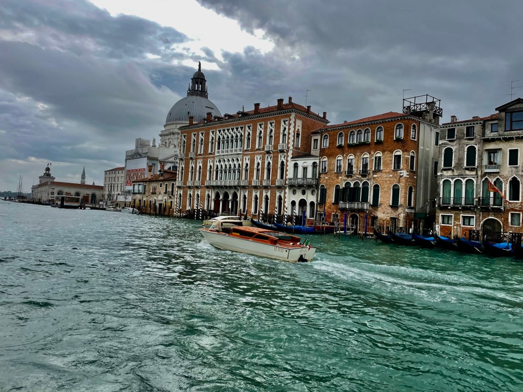
This time we found the scenic vaporetto and journeyed along the faded glory of the Grand Canal….water lapping up on the ground floors of the palazzos. I’m sure this was the inspiration for the crumbling building scene in Inception.
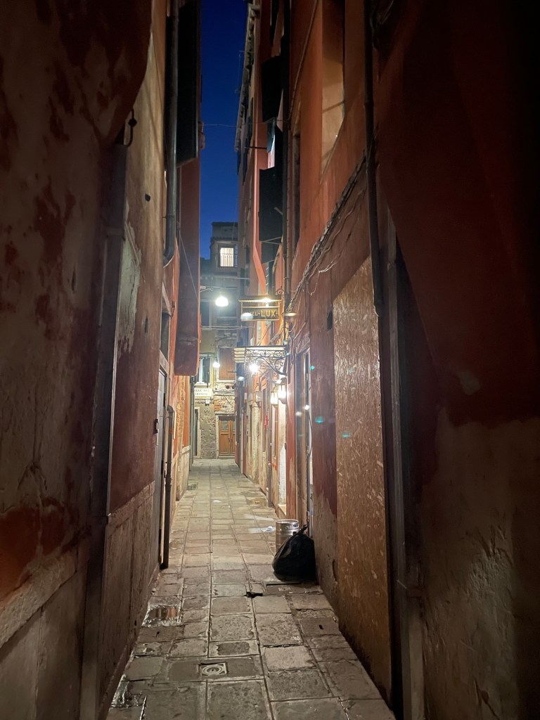
Following our train ride(s) from Milan, we arrived at the Venice train station and managed to find our way to a very crowded vaporetto or “water bus.” Rather than the scenic one that travels the famous Grand Canal, we ended up on the 5.2 route – which goes through the wide part of the canals (or was it a harbor? Hard to tell what the bodies of water are). Our vaporetto took us past docks, ships, all forms of water craft – and finally deposited us at the San Marco/San Zaccaria stop. From there it was an easy walk to the B and B – it was up a narrow alley with one turn at the “mosaic of the doge” embedded on the pavement. Through a gate and up a flight of stairs and there we were greeted by a small guest house with modern furnishings, a nice breakfast, crisp sheets, and terrazzo floors. A distinct contrast to our digs in Milan.
At the suggestion of our host we walked away from the tourist district (to the extent one can escape a tourist district in Venice, but it was late October)…to the Via Garibaldi. There we had an aperitizo at a restaurant on the waterfront, facing a beautiful sunset, with the Church of San Giorgio Maggiore church carved out against an orange sky. That was followed by a dinner of tagliatelle with shrimp for me and pasta seafood for J.
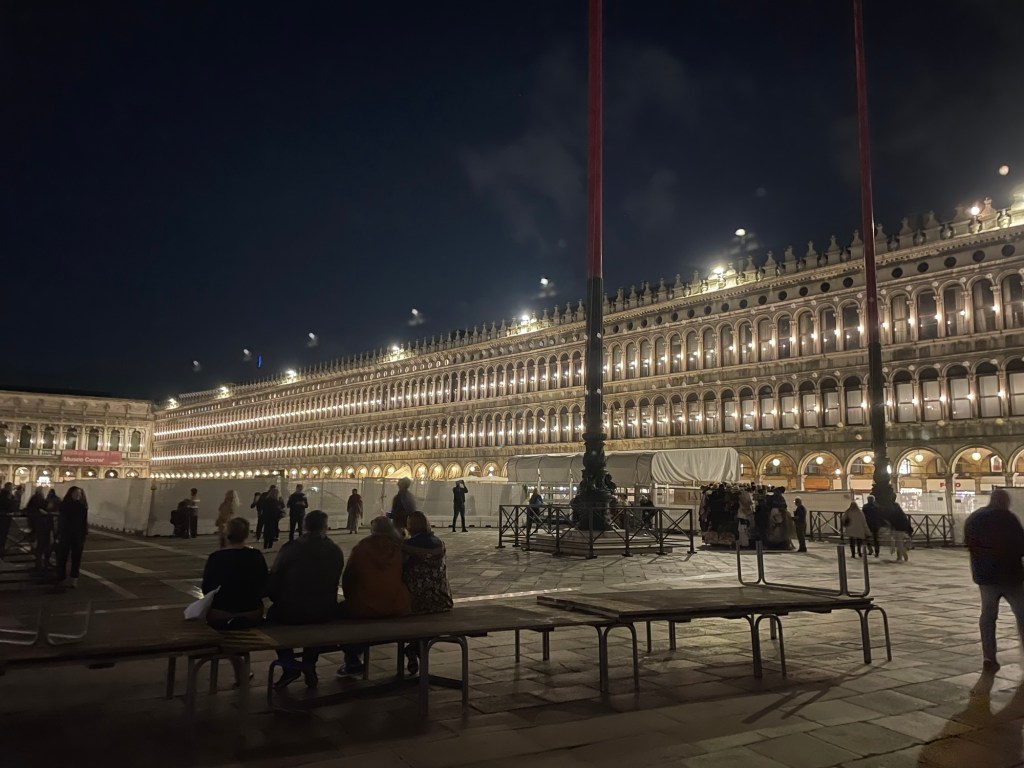
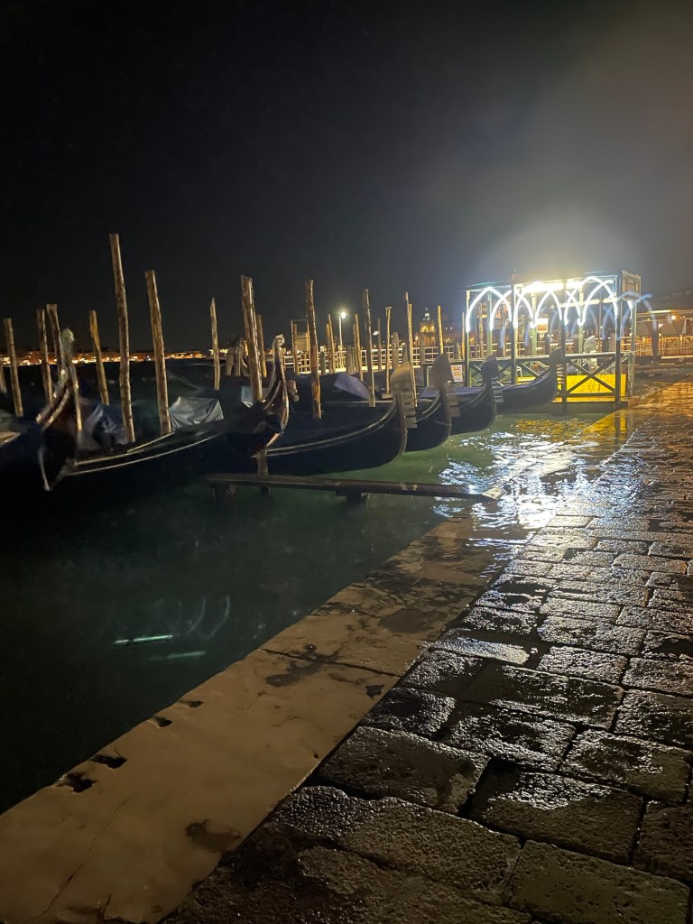
Afterwards, we walked to the beautifully illuminated Piazza San Marco and one of its famous cafes (Quadri), home of one of the “dueling orchestras.” We paid way too much for fabulous martinis but they were accompanied by all sorts of snacks – olives, nuts, peanuts in the shell, crackers, and tortilla chips. Plus the music was very fun, especially the rendition of the James Bond theme music – and people really did dance in the square. The illuminated balls that children were throwing into the air made the whole evening sparkle.
Venice was off to a good start and we had two more days ahead of us.
Star Date – October 25, 2023 – in this alternate universe I’m writing about months later. (Well, it is based on a contemporaneous travel diary.) And to make it even more surreal I’m actually typing this into my phone en route from Morocco to Orlando – which shall be the subject of another post entirely. And, it’s finally getting published months after that, but these are mysteries of time and space into which I shall not delve.
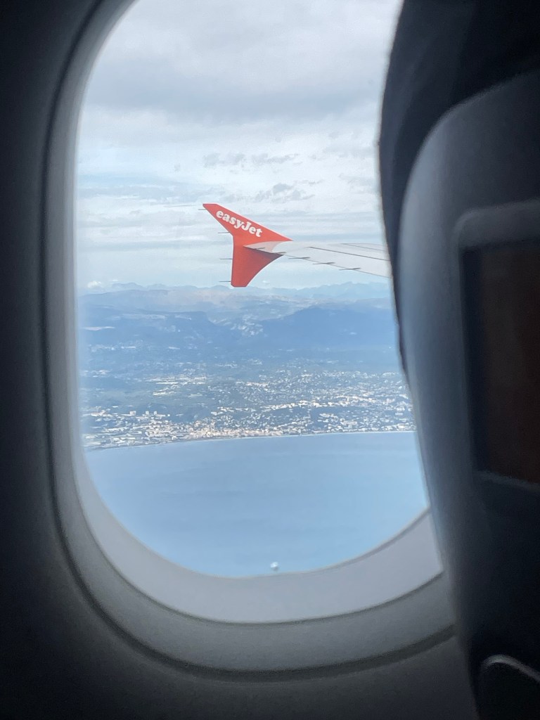
But back to the “present.” We arose early and niece F drove us to the Gare Nice Ville. Although our train tickets to Milan, supposedly safely housed on our phones, didn’t scan, we managed to find an “assistance booth” that let us through the turnstile (with lots of shouting on both ends of the intercom as we tried to communicate). The train was extremely crowded until we reached Monaco, where practically everyone got off. The train passes along a spectacular coastline, although we did spend much of the time worrying about missing our change of trains in Ventimiglia. But when we arrived, the Milan train was right there waiting for us, we were able to locate our carriage and seats, and it continued by the coast and through numerous tunnels until we reached Milan.
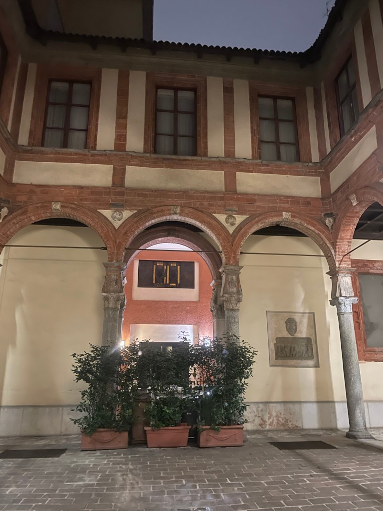
The Courtyard of the AirBnb
We arrived at Milano Centrale – the station was built in 1931 by the Fascist government. It’s huge and imposing and designed to make the individual recognize his or her own insignificance when faced with the grandiose power of the state…we found the metro and exited at the Missori stop. There’s a complicated roundabout and we circumnavigated it a few times before we figured out exactly where we should be going.
We managed to make our way to the corner of the street where our Airbnb was located – there we met up with possibly the most unusual Airbnb proprietor and Airbnb of any of our European travels. Let’s just say a five star rating was paramount for him. The location was unbelievable. We were just off one of the main streets and very close to the Duomo. You enter through a huge gate/door which leads to a quite beautiful courtyard. Parts of the building are allegedly built in the 15th century by Donato Bramante (and I have no reason to doubt that) but certainly there are lots of additions. The building itself is a mix of apartments and commercial ventures, including goldsmiths, one of which was located right by our studio apartment. You could hear human noise from the other apartments but absolutely no sounds from the street.
The place itself was genuinely weird. The shower was on the same level as the bathroom floor so toilet paper had to be removed before turning it on. A bit like a primitive camper. There was a tiny cooking area and there was no way I would have risked lighting the gas stove. The furniture was very old (or antique, however you want to describe it), and clocks with time zones from around the world adorned the walls.
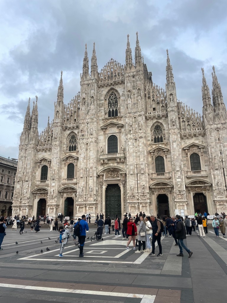
After we had settled in, we walked to the Duomo. It is magnificent- over the top Gothic architecture- but it is self funded and according to our tour guide, not supported by the Vatican. To raise money they project ads on the backside of the building itself. It’s a bit disconcerting. We also strolled through the 19th century galleria – anchored by a huge crystal dome and home to the original Prada.
We had negronis at a cafe by the Duomo and then decided to try Rossini’s, the restaurant right next to the Airbnb, which turned out to be quite good. I had a very unusual beet risotto with cheese and cherry juice – J stuck with spaghetti with clams. And, our Airbnb host, good to his word, said we would get a discount and we did.
The next day we’d arranged for a city tour, on the theory we only had one full day in Milan. Of course, this entailed another trip back to the Duomo, but this time we actually went inside. It’s built from pink/beige marble that has been beautifully cleaned and was 600 years in the making. In the ceiling, there’s supposedly a relic from the cross of the crucifixion and each year the Archbishop of Milan ascends in a cloud type contraption to the roof, presumably to visit it. Interestingly, Milan itself dates back to the Celts (at least according to the proprietor of our AirBnB).
The walking tour continued on to the Castle, which has been both a residence and military enclave. Security was extremely high.
Our final stop was the friary where DaVinci’s Last Supper resides in what was the refectory. You pass through an airlock chamber to view it and only a few people are allowed in at a time. It is remarkable. The table is a continuation of the room and places you in the scene in a three dimensional way that I had heard about but never experienced. And the 20 year restoration that started in 1999 brings the color and realism to life.
After the tour ended, we walked through the very nice Brera area and past La Scala – where unfortunately there was no performance (tickets were unbelievably expensive anyway) and the museum was closed. But we found a nice local lunch place , not far from the famous “finger” sculpture and then I indulged all my cheap shopping desires at an enormous Primark.
After a brief rest, we walked to the Navigli area, the location of the last canals in Milan – it used to have many. Google maps took us through a not very safe looking way (empty dark parks, etc) so we found an alternate route back. But what a scene in the Navigli. Restaurants and bars everywhere offering all you can ear aperitivo – apparently Milan invented happy hour. Despite this, we found a relatively sedate restaurant where I had a traditional Milanese risotto (Arborio rice, saffron and cheese) and good wine from the Piedmont. I had to buy a cheap and not good umbrella from a street vendor since it was raining and mine was somewhere in France. J managed to find a craft beer place on the way back which ameliorated some of the rain.
Next day we packed up and I made a final Primark run for 6 euro wool berets. Perfect for Florida! Made our way to the train station where we had to wait a long time for our platform to be announced. Crazy Wi-Fi – it’s free but you can’t get the required code unless you already have internet!
Despite the fact I’m half English, we seem to have a lot of friends and family in France. I haven’t even mentioned that our AirBnb in Paris was very close to where T’s parents have an apartment. Then we saw K in Orleans. And the next part of our French adventure involved a visit to our niece, who conveniently lives just outside Nice.
After a brisk walk to the train station in Orleans where we caught the tram to the bus stop, we took a Flix bus to the Orly Airport in Paris. The Flixbus was a double decker, and unfortunately our seats, which we had reserved, were on the top level, and I could definitely feel it sway back and forth. We traveled back through flat agricultural fields straight to the L’Aeroport d’Orly. This is very much the domestic and non-glitzy airport, in contrast to Charles de Gaulle. We had a long wait, but a short flight to Nice, where our niece, F, met us at the airport.
We drove through winding wooded roads up to Chateauneuf de Grasse, where her apartment has a beautiful view of the Mediterranean and lots of olive trees. We had dinner at a local restaurant in Valbonne.
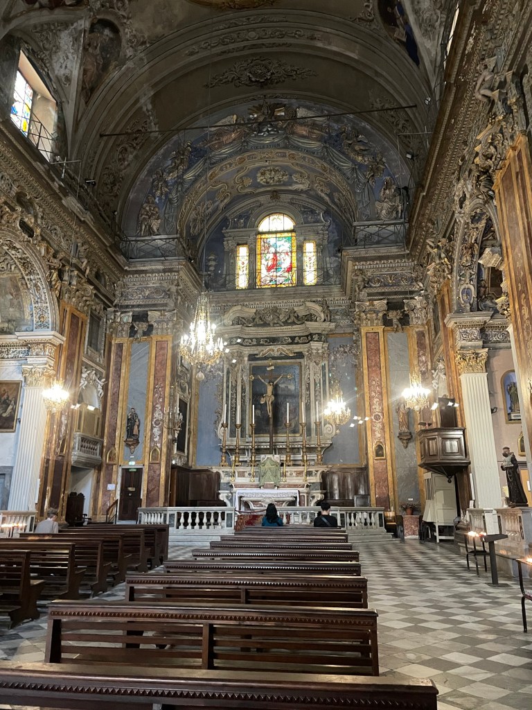
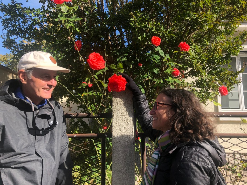
We slept late the next day and then drove into Nice. Despite the fact it was Monday, parking was very hard to come by but it did mean we got to see a lot of Nice in our quest for a place to park. We finally found a spot on a street where two gentil hommes sitting outside a bar helped F into a very tight parking place. Nice is filled with lots of old, orange apartment buildings (bourgeois buildings), and the promenade by the ocean sends one back decades in time. We visited a very old Baroque church (whose name I cannot locate anywhere), with lots of chapels dedicated to multiple saints, each of whom had a special prayer just for them. Lunch at an outdoor cafe, where I managed to make an international call and reach the vet to deal with the Kira and what to do with a dead cat issue. Yes, even on sabbatical these everyday issues do surface.
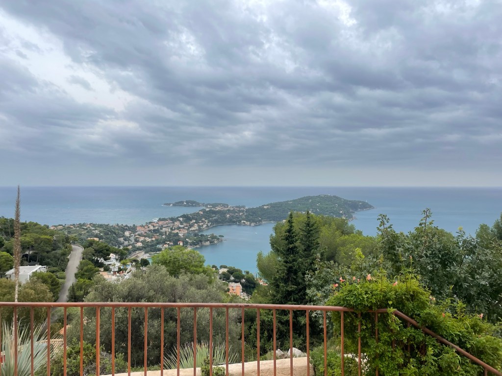
We wandered around Nice a bit more, and then drove to Villefranche to meet F’s friend at her friend’s father’s house. It was located in a gated community up on the cliffs with an amazing view. Her father spoke no English but he spoke French slowly so I was able to pick up at least some of the conversation. After coffee and biscuits, we drove even higher up the mountain, where we could see where much of the James Bond Never Say Never movie was filmed, as well as Tina Turner’s home. Quite an experience.
We had planned to go to Antibes the next day, despite the unsettled weather. Antibes is much smaller than Nice and has a great parking lot. Parking can be important. The Picasso museum was closed for lunch so we went to a much less ornate Romanesque church – all terracotta colors – poked about shops, and had a Lebanese lunch. We got bored waiting in the very long line for the Picasso museum, so instead walked about the harbor and looked at the huge, super luxury yachts, including one called Faith that, according to the internet, is up for charter.
After a trip to the Carefours market, we helped F prepare for her crepe party, and enjoyed meeting more of her friends. They also had some great suggestions for our upcoming trip to Tuscany.
The next morning we had to depart the south of France. For the first time, we couldn’t get our tickets to scan at the train station, but we did manage somehow to find an assistance booth where some automated function let us on. I’m still not sure how we managed it.
The train to Milan, our next stop, ran right along the Mediterranean. It was super crowded until Monaco, where everyone got off, presumably to go gamble. We ourselves disembarked at Ventimiglia, where our next train was waiting for us. Time for Italy, starting in Milan.
All good things must come to an end, but our Paris visit definitely did so too soon. Nonetheless, we enjoyed le petit dejuner at Le Weekend (by the way, cafe crème is cafe au lait, and like London, all coffee is expensive). Walked to the St. Placide metro to the Austerlitz Gare, where we had quite a wait for our train. It’s not a great station, very low ceilings and not many amenities, but it was easy to find our train.
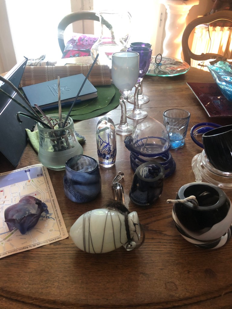
We reached Orleans in just over an hour, traveling through flat, agricultural countryside. Our long time family friend K met us at the station, and we made the brisk, 15 minute walk to her house, which is near the center of town. Her home was built around 1911, and has a huge yard, dominated by an ancient linden tree, and is filled with interesting items ranging from her days as a glass blower to antique furniture from her family to souvenirs of her days in Nepal, Senegal, and India.
Orleans is charming and quite lively. Very uniform, cream colored buildings line the straight boulevard that starts at the Cathedral, but other areas are filled with half timbered medieval structures, recently restored. The outdoor market was incredible – cheese, sausage, vegetables, seafood. K bought four different sorts of oysters for the next day.
We walked down to the Loire, but by then it was pouring (hence, a shortage of photos….). K cooked mussels in white wine for dinner, accompanied by a salad of mache and mushrooms.
The next day we awoke to a message from our house sitter that our cat, Kira, had passed away. While it wasn’t a total surprise, it was sad and K popped open a champagne bottle in her honor at breakfast (well, it was more like brunch time).
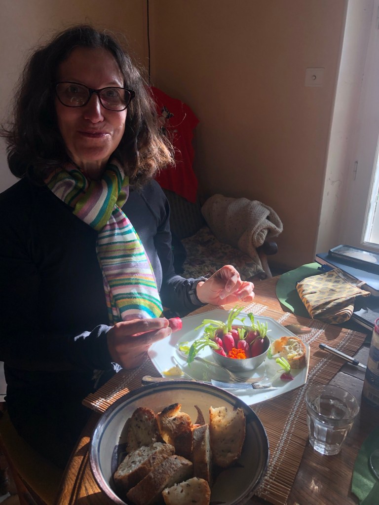
We took another walk to explore more parts of Orleans, and after the weather turned cold, we feasted on oysters (sizes 2, 3, and 4 from Brittany, Normandy, and Cler [?]), accompanied by radishes dipped in salt and bread and butter. Watching K shuck them was poetry in motion. (Besides being an artist, K is also a gourmet chef.)
After recovering from eating three dozen oysters between three people, we walked back into town. It was a Saturday night and a lively scene despite the rain. We eventually stopped at a Brittany creperie for galettes – crepes made from buckwheat. They are thicker than what we think of as a crepe in America, and folded at the corners to create a square. A Galette Complet includes a fried egg, jambon (ham), and Swiss cheese.
There’s nothing like a visit with friends in France.
I sum up Vienna versus Paris this way. In Vienna, all the pedestrians dutifully waited at crosswalks for the traffic lights to change, even if there were no cars in sight. In Paris, they didn’t.
It was now October 18, and we were back on Austrian Air, on a flight to Charles de Gaulle Airport. After taking a very local train (RER) from the airport to the city, we found the metro to Saint-Placide metro station. From there, it was a short walk to our AirBnB, in the 6th Arrondisement and right by Le Bon Marche.
It is a lovely neighborhood, with lots of cafes, high end clothing stores, and the like. It was cool and rainy. We did encounter a few issues getting into the apartment, which ranged from where the key was to how to unlock the second of the two front entrances to which of several doors was the actual one to the apartment. We ruled out the one with the barking dog behind it. We finally made it in, only to find the wi-fi advertised on the website was nonexistent. But despite all that, and a shower that tended to flood the bathroom, it was nicely done up inside, and the location made up for everything.
That night we went to Relais d’Entrecote, at the recommendation of T, daughter S’s boyfriend, who is half French and knows Paris well. All they serve is steak frites, and your only choices are the degree of doneness, your wine, and your dessert. Another contrast to Austria, where no one seems to order bottles of wine. You start off with a lovely lettuce and walnut salad, and then, after you finish your first serving of steak (thinly sliced, with a herb sauce) and frites, another is immediately plopped on your plate. We did choose a dessert, ice cream doused with Grand Mariner and whipped cream. It all made up for a cold and rainy walk back to the AirBnB.
The weather the next day was much better than we had feared. After breakfast at Le Bon Marche (where I had the best croissant I have ever eaten), we took a long walk through the Rive Gauche and Latin Quarter (remembering our stay there in 1985), to the under construction Notre Dame, which is still recovering from the fire in 2019. We passed by the Hotel de Ville (City Hall) and through the Marais to the free Musee Carnavalet (History of the City of Paris).
It is a marvelous museum. Housed in two palaces, it spans prehistoric and Roman times (when Paris was Lutetia) to the 19th century. The most amazing part was the recreation of rooms from various houses and hotels. So many of them, faux marble panels, painted walls of still lifes.
Once we were exhausted, we walked across the river and had lunch at a cafe facing Notre Dame from across the river. Police sirens were constant. It turned out there had been a spate of bomb hoaxes causing evacuations of the Louvres, the airport, Versailles, etc.
We walked back to the AirBnb, stopping at the Eglise Saint-Severin and the Bon Marche. After managing to make ourselves somewhat presentable in our by-then rather travel worn clothes, we walked to Le Deux Magots for a pre-dinner drink. It started to rain, but we were under an umbrella, and the weather didn’t daunt us from enjoying the free olives and the live jazz band. Apparently the current owner is trying to make the place less touristy.
We had dinner at Sevilla, again at T and S’s recommendation. Our reservation was “early” – at 9:30 p.m. – another contrast to Austria where the restaurants were closed by that time! Starters were sea bass, Ceviche, “piglet” and sweet potato main for J, and roast cod for me. Cocktails and wine and dessert. Actually I’m not totally sure what is pictured in the photo below.
The hike was over and it was time to walk to the train station in Bad Goisern for our journey to Vienna. A quick change of trains and after two and a half hours we were back in the city center.
This time we stayed at the Hotel Josefshof, a very different experience than the Superbude, both in location and ambience. It’s an old building, and everything inside is modeled after Klimt designs, even down to a gold sink and a Klimt drawing on the glass door to the bathroom. It is in the Josephstadt area, just off the outer ring road.
After checking in, we did a gigantic walk along the ring roads. The buildings are massive, and I’ve never seen so many statues on top of buildings – a veritable army of gods, goddesses, emperors, and war heroes staring down at you. We explored multiple, high end shopping areas – very high design, plus Hermes, Luis Vuitton, etc etc. The Fersatt (sp?) passageway was particularly amazing. There were lots of museums I wish we’d had time to see, such as the Sisi Museum and the Imperial Apartments. By then it was so late it made no sense to return to the hotel; instead we found an Italian restaurant.
From there, we walked to the KarlsKirche, named for the emperor Charles. It’s a masterpiece of Counter Reformation architecture – all marble rust and cream interior, with Asian, Byzantine, Roman, and Greek references. Definitely an attempt to wow the masses. A pool outside reflected the glowing dome, giving the whole place a movie set like quality. The kids playing funky electric music provided a stark contrast to the concert we were going to in the church – Orchestra 1756, performing Vivaldi’s Four Seasons on original instruments. By the way, the Viennese somehow lost Vivaldi’s grave….which turned out to be a theme of much of the rest of the trip. He wasn’t the only one whose remains went missing.
The next day was for travel. After coffee and pastries, we took the underground to the main station, HBF, a train to the airport, and boarded our plane for the Charles de Gaulle airport in Paris. One more train into Paris itself – and our French adventure was about to begin.
The 24/7 church bells clanging next to our hotel in Strobl didn’t keep us up quite as much on our last night there, so we were a bit better rested for our trek to our next stop, Bad Ischl. The weather was cool, and great for hiking. Our walk started off along the banks of the River Ischl – lots of flood control and hydropower. Some pretty woodland sections but not nearly as dramatic as the fairy dells we discovered the day before.
The hike passed through a number of small villages. The houses here, even if old, look so much newer than those in England. White stucco with dark wood work and balconies.
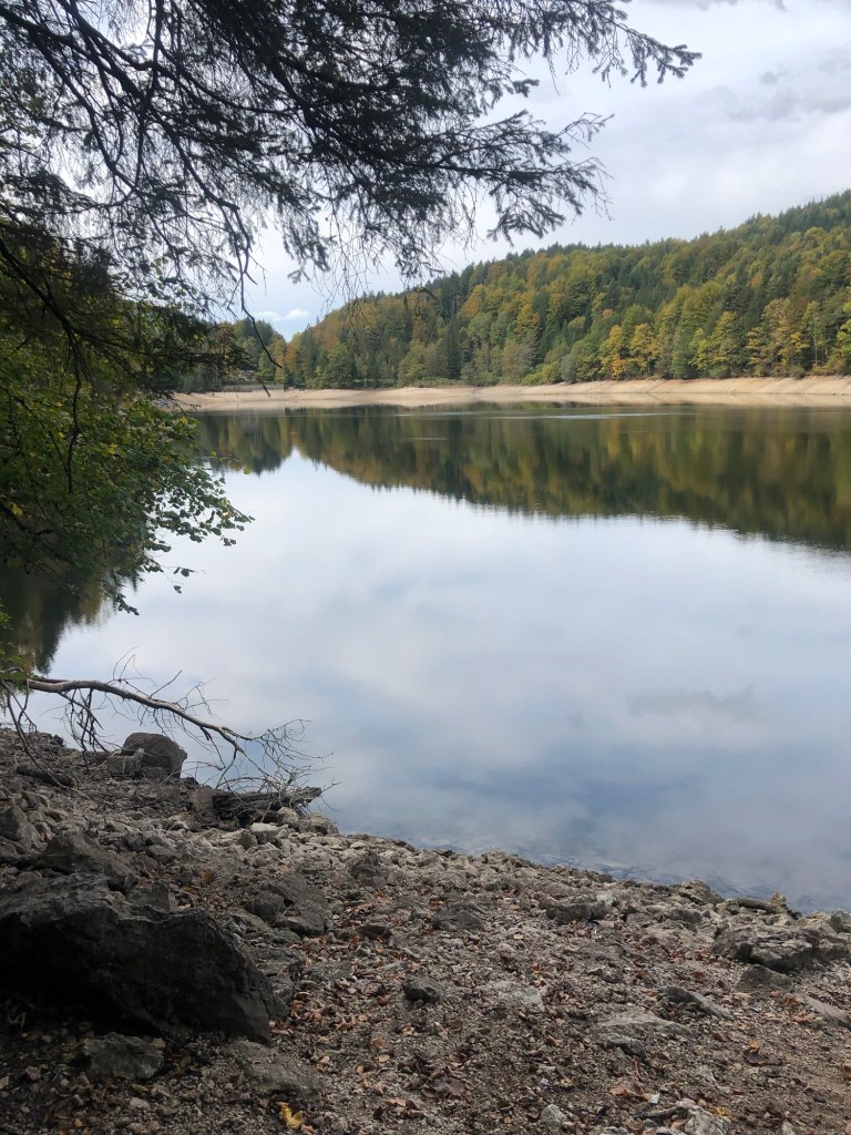
We finally reached Nunsensee (Lake), which looked almost like a dugout reservoir. We were worried about rain so we didn’t even stop for lunch and reached Bad Ischl close to 2 p.m. A church greeted us at the outskirts. I wanted to go in, but two people were in there, clearly praying. The flowers in the terraced gardens were all labeled.
Bad Ischl is an old spa town of the Habsburg regime, located by the river. The Goldeness-Schiff hotel, where we were staying, faces the River Traun, which is part of the River Ischl. (The water geography seemed very complicated.) The hotel was very modern; we had a small room without a view, but perfectly adequate. They gave us a coupon for a free drink for agreeing not to have daily cleaning. No decision there!
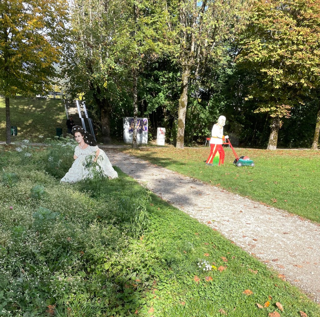
We decided against a visit to Kaiservilla, the summer residence of Emperor Franz Joseph I, and Empress Elisabeth of Austria (known as Sisi). It was very expensive and we only had an hour before closing, so instead we chose to have a drink at an open air cafe (under the awning, while it rained around us), and enjoy window shopping (especially the modern takes on traditional Austrian dress). We also spent time in Sisi Park. Bad Ischl pays homage to her (and her husband) in many ways (for example, cartoonish metal sculptures of them gardening in the park…).
Dinner was at the Spoarhead Gastropoda. Very nice and a nice server, who managed well with few other servers, and appreciated our patience. I always feel like an ambassador for the U.S. on these trips. Chicken Paprika for J and couscous chicken bowl for me. Austria closes down early. We were back in our room by 8:30.
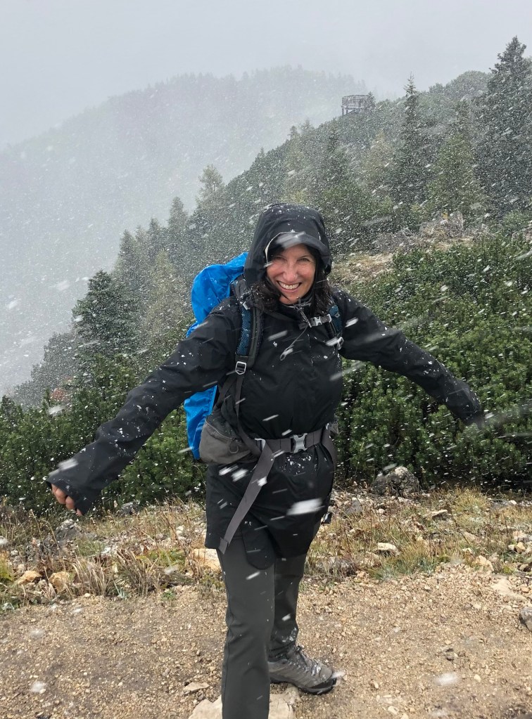
Sunday dawned to a very elegant breakfast, with Prosecco on tap! I wish I had felt like trying it, just to say I’d done so. And a fresh squeezed orange juice maker – I’ve never seen one of those before. We again were anxious about the weather so we skipped the local hill walk that was on our itinerary and instead walked along the banks of the Traun, by lots of sports fields, to the almost empty gondola station. The gondola took us up almost 4000 feet in just 10-15 minutes. Wow! At least the gondola came to a nice slow speed at the top so we could step off.
It was very cloudy, misty, and the “hut” where we’d hoped to have lunch was closed (as was most everything on Sunday). We took off up the mountain to the Katrinkogel, with only a few others hikers around. Tall evergreens gave way to short ones – and then it started to hail (small round pellets), shortly turning into genuine snow. It was very arid, dry and felt much better than rain. While this wasn’t a hard trail, there were certainly lots of steps.
After snowy views on Katrina, we backtracked and took another spur trail to the higher Elferkogel – we were the only people up there. Evergreens beautifully snow tipped and energy emanating from the crisp air. On the way down the clouds started to clear, and once on the gondola the views were great.
We walked back the same way to the hotel. It was clouding up so we still didn’t want to risk the other hill. We found zero places to eat. Everything was closed. Eventually we made it back to the hotel and ventured out to the nearby cafe for a beer – they didn’t even serve food. We were under an umbrella, but then the skies simply opened. We spent the last part of the afternoon in the our room planning the Italy portion of the trip. A nice dinner at the hotel restaurant – it seemed quite popular, but of course, it was one of the only places open.
On Monday, after another nice breakfast (Prosecco was on tap even on a Monday!), we packed and took the train to the train station for Hallstatt, which is a UNESCO world heritage sight. From the station you catch a ferry to the other side of Hallstadtsee, where the actual village is located. There’s a replica of this place in China, and there were tons of Asian tourists, even out of season.
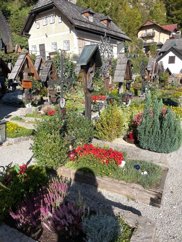
The town, built on the side of a cliff, is spectacular and filled with flowers. Salt mining was its claim to fame. The 19th century Lutheran church (first non-Catholic church I’ve seen ) by the dock has a large poster explaining that’s where the unfortunate Protestants were sent during the Counter Reformation. The Catholic Church is high up on the hill, surrounded by a cemetery, each grave with its own flower plot.
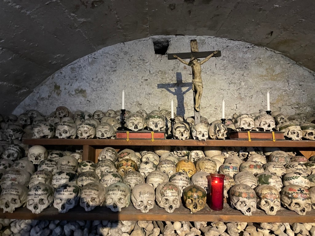
But Hallstatt is best known for the Charnel House. We saw the entrance by the cemetery and decided to pay the 2 euros to go in, little knowing that we were about to walk into an ossuary for skulls. When the graveyard became too congested, the families brought the skulls into the ossuary. (Not sure what happened to the rest of the remains.) But rather than just plop the skulls down, they were painted with family crests, dates, and remembrances. I actually found it surprisingly peaceful. J, on the other hand, found it quite creepy.
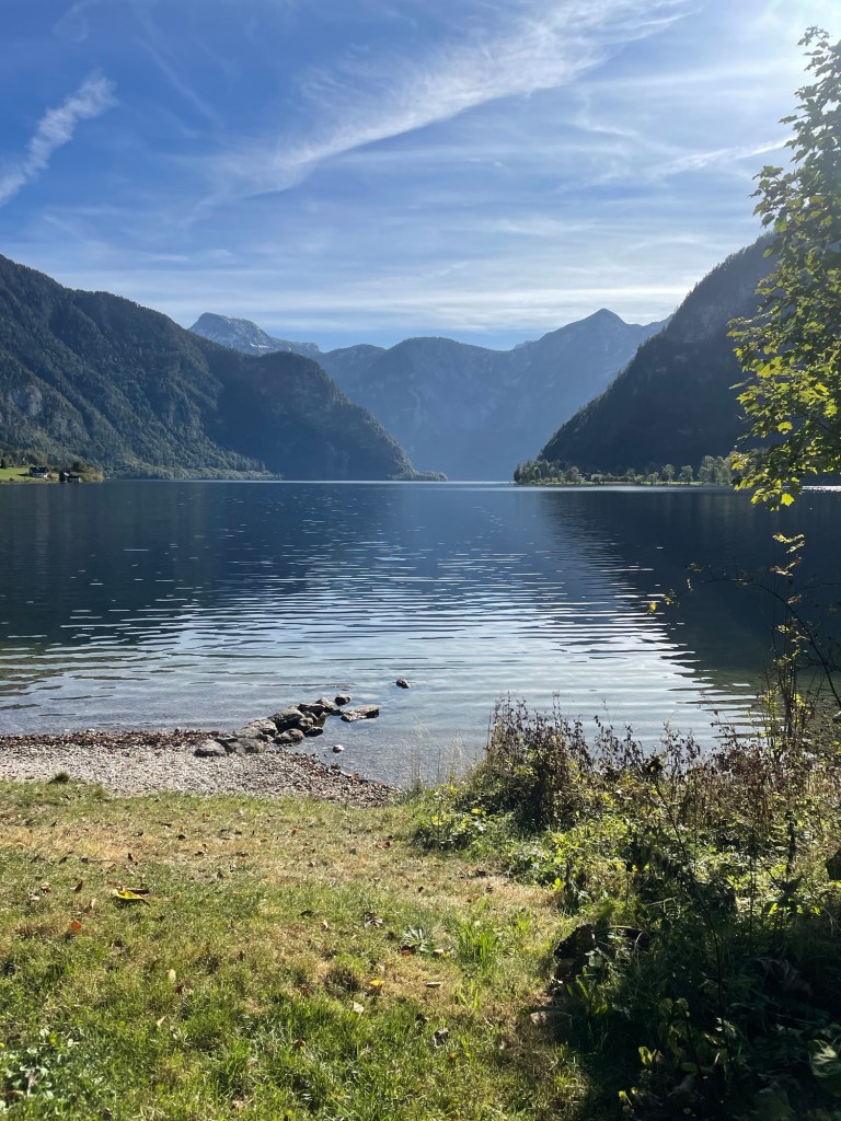
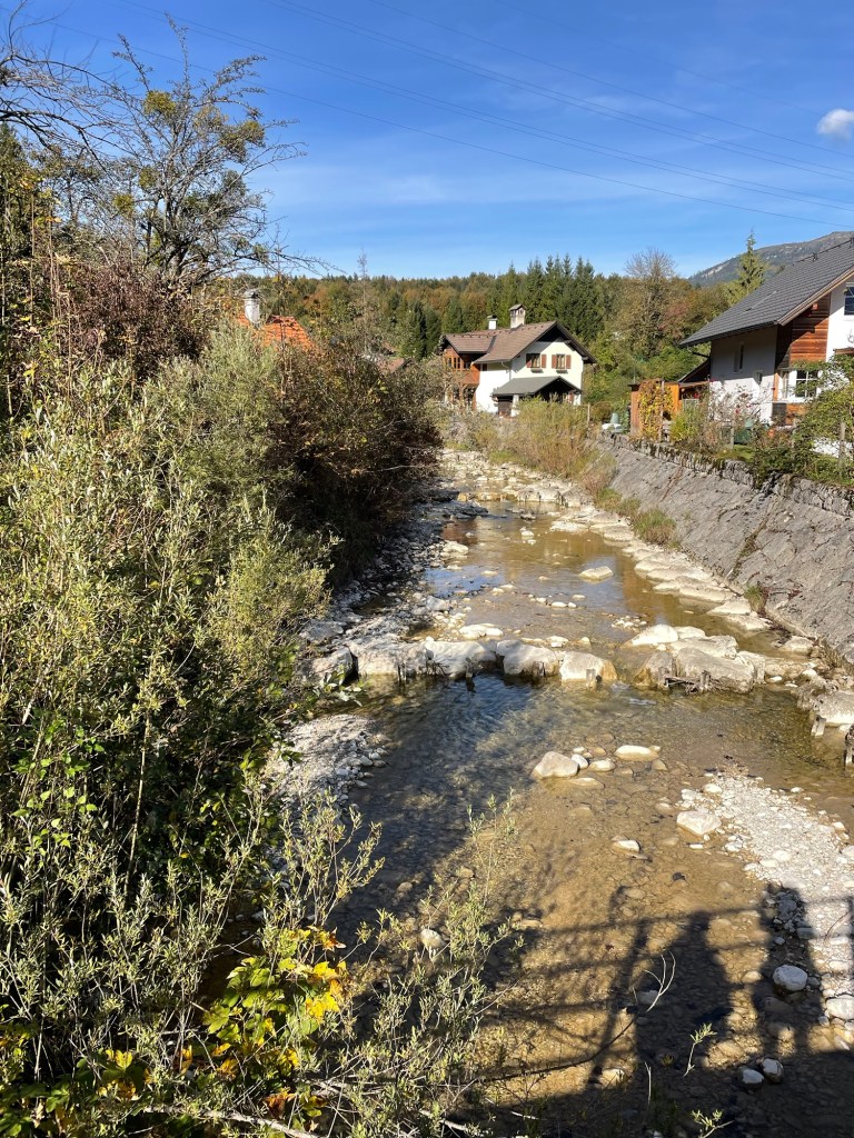
We then ferried back across the lake to start our seven mile walk to Bad Goisern, our next stop. The first part was around the lake – beautiful views, and much of the trail hangs off the cliffs over the lake. Mountains towering over the lake, and you could actually see a nearby glacier. The trail paralleled the railroad track near the lake. Lots of very small yellow finches accompanied us. There were some beautiful private homes. I can’t judge wealth in this country, but at least in the rural parts, it’s hard to see anything I would characterize as poverty.
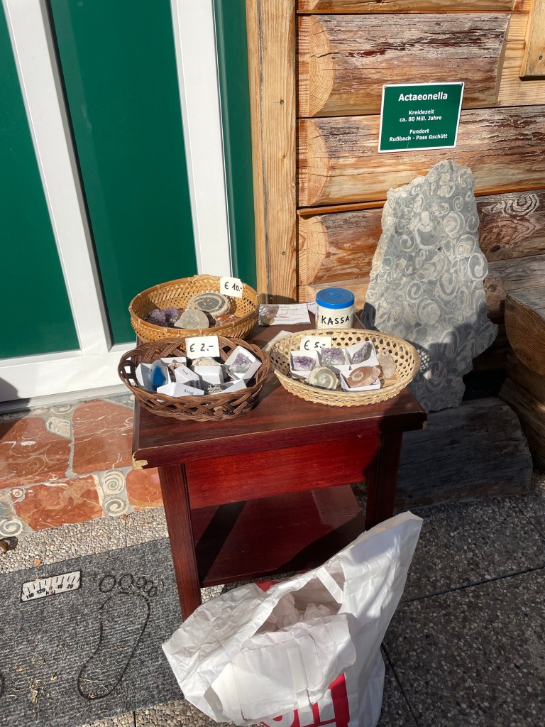
Eventually, we left the lakeshore to walk along the banks of the River Traun, which feeds into the lake. My favorite bit was the tiny village of Undersee. There, along the street in front of someone’s house, was a table of gems and fossils for sale on the honor system. I bought a beautiful ammonite for five euros.
A very nice, easy walk.
Bad Goisern is a real, little town, not just a tourist place. We stayed at the 17th century Hotel Moserwirt, in a large corner room that even had a balcony. After a grocery store trip, we had a lovely drink on the balcony with the late afternoon sun illuminating the mountains. The day was topped off with a dinner of venison and pork at the hotel restaurant.
We’d finished our Austrian hike. Now back to Vienna, and then to Nice.