
According to one of our guides, the mountain of Malinche, officially 14,636 feet but higher when measured by GPS, is home to one of the world’s highest forests. It’s a mix of tree and rocky trail, shielded forest glades and exposed ridges. Almost a metaphor for our entire trip to Mexico. The name given he mountains by the Tlaxcaltecs was Matlalcueyetl, which means “lady of the green skirts,” a goddess of rain and wind.
After our visit to the Teotihuacan pyramids, we drove several hours further, southeast toward Malinche, located in the state of Tlaxcala. On the way, stopped for lunch at restaurant where lamb tacos and rabbit were high on the list of menu choices. Venturing further and further into rural Mexico was a time machine experience. We soon left behind the truck stops – rows and rows of non chain cafes (except for the ubiquitous Oxxo – the Mexican version of 7-11) – and were driving through fields of nopales – the cactus that is the base for incredible salads.
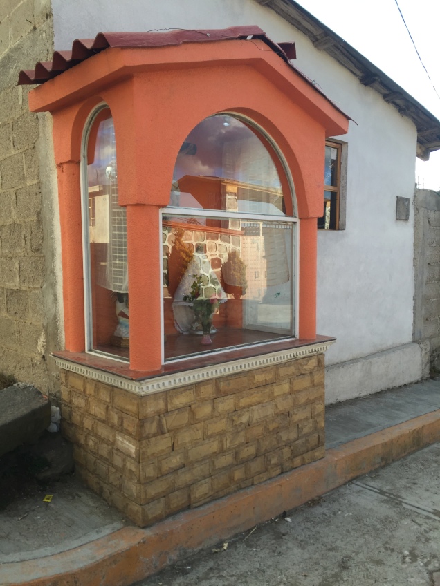
There wasn’t a tractor to be seen. Men were plowing the land with horses and donkeys. Each small village had several shrines on the side of the road occupied by ornately dressed saints. And there were similar smaller shrines adorning the gates of many houses.
Eventually we reached the IMSS cabins in the park surrounding Malinche, at an altitude of about 10,000 feet. As I understand it, they are operated by the ministry of health or some other equally unlikely branch of government. They are two room cabins with a bathroom, nice tile but some unusual features. A refrigerator, but no stove? The bathroom leading off of the bedroom, railroad car style? One electrical outlet? No heat of course, and we were all wearing our lightweight down jackets (which had become like a second skin by the end of the trip).
We had quesadillas made with Oaxaca cheese for dinner, and went to bed early in preparation for a before dawn start up Malinche.
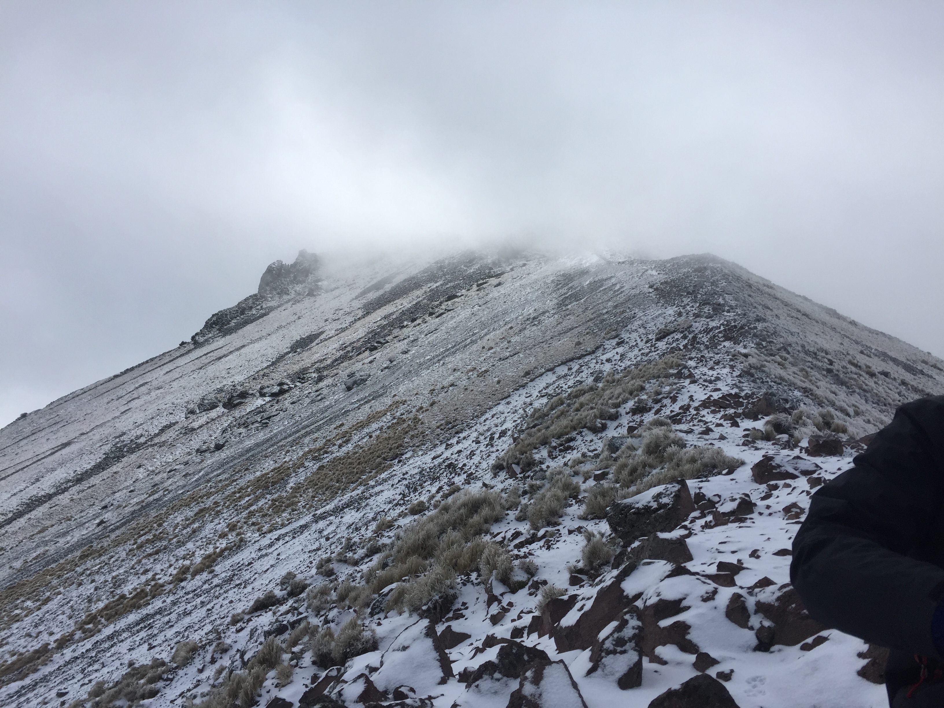
We started walking about 6, accompanied by three dogs who were our travel companions all the way to the summit. They clearly did this everyday, and seemed to be in excellent shape, so their presence didn’t cause my animal loving heart any angst. The first part of the Malinche hike is through beautiful forest that we could just make out by the glow of our headlamps. As the sun rose, the trail got progressively steeper. There had been frost, and drops of water sparkled on the grasses and bluebells still blooming here and there.
Eventually we reached the tree line, crossed a brief grassy section and moved onto steep rock and scree. Close to the top, you traverse a ridge, narrow in some points, and finally up a steep rocky section to the summit.

The wind died down just a bit so we, together with our dog companions and a couple of other climbers, could enjoy the partial views we got when the sun briefly appeared. It was surprisingly comfortable in the grey cloud at the summit – as if we were in a nest of cotton, safe at the top of our mountaintop tree. The dogs scratched the snow away and made beds for themselves on the warmer dirt. They were getting ready for the long trek down.

It took us about 5 hours to reach the summit – appoximately 4500 feet of elevation gain. We came down fast, running at times, in just under three hours.
Once down, we drove a short distance to the Hacienda Santa Barbara. Built in the 1600s, the hacienda is huge, yet only a few rooms are available for guests. J and I were in a large room, high ceilings and a small bathroom inserted into one corner. Heated by only a very small stove, we definitely needed all the blankets from the two beds. The floor was stone, and the window – which locked by way of a giant beam that slid across it – looked out in more ruins of outbuildings. Meals were in a dining room occupied by one large long table. And in the morning we had atole, as well as coffee, a hot drink made from corn and tasting like chocolate. Dinner was chiles rellenos, hot enough to warm us up even in that frigid dining room.


It was now Tuesday night. We knew Pico de Orizaba awaited.
.

Great post! Few people think of mountaineering when they consider Mexico. What’s your next adventure?
LikeLike
Still in the planning stages…a multi day hike in the U.K. this summer, perhaps. Lower altitude but no less of an adventure, I suspect.
LikeLike
I might be jealous of your adventures.
LikeLiked by 1 person