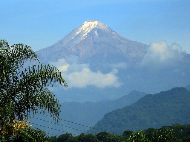
Over the last few months I’ve been publishing posts that refer to Pico de Orizaba, our next climbing destination, as though it’s a location at the forefront of everyone’s personal geography. That certainly can’t be the case – this particular mountain wasn’t close to the forefront of my mind until we started to try to find a big mountain that could be climbed in winter and in under seven days. When you live in Florida, the choices are limited.
So after looking at our options, we settled on the Orizaba Express trip, again through Mountain Madness, the company that has successfully and safely led us up Mt. Elbrus in Russia and Cotopaxi, Illiniza Norte and Cayambe in Ecuador.
Pico de Orizaba is a strato volcano 120 miles outside of Mexico City, on the border of Veracruz and Puebla, by the town of Orizaba. According to Wikipedia, fount of all knowledge, it has gone by a number of names. Non-Nahuatl speakers in the area call it Istaktepetl or “White Mountain.” During the Pre-Columbian Era it was referred to as Poyautécatl, which means “the ground that reaches the clouds.”
My favorite of its names is Citlaltépetlas, which is what it was called in the Náhuatl language when the Spanish arrived in this part of the world, and means “Star Mountain.”
During the colonial era, the mountain was known by the rather boring appellation, Cerro de San Andrés, due to the nearby settlement of San Andrés Chalchicomula at its base.
It is the third highest mountain in North America (behind Denali and Mt. Logan), one of the volcanic Seven Summits, and the second most prominent volcano in the world, after Kilimanjaro. Pico de Orizaba measures 18,491 feet high, a statistic I find particularly notable because one of our teammates on Mt. Elbrus was part of the group that measured the mountain using GPS some years ago.
After arriving on AeroMexico, according to our trip itinerary, we will start acclimatizing in Mexico City, around 7,341 feet. From there we journey to the pyramids of Teotihuacan, and the next day climb Malinche, 14,640 feet. After that we travel to Tlachichuca, and – somewhat ominously – “transfer to four wheel drive” for the trip to the hut at Piedra Grande (13,972′). Our final acclimatization hike is to the toe of the Jamapa glacier at about 16,000′ and back down to the hut. Summit day involves elevation gain of about 4,500′ – which is a lot, and may be one of the biggest elevation gains we will have done in one day. To reach the summit, you traverse a rocky section named after one of my favorite words, the Labyrinth. The section right below the caldera looks really quite steep – definitely an area for ice axes. If it’s anything like Cotopaxi, I anticipate collapsing at the top – assuming the gods bless us with good weather and the mountain lets us summit.
We’ll have a night in Tlachichuca and one final night in Mexico City – and then it will be back to Orlando on an airline I had never even heard of until yesterday, Volaris. I realized one of the reasons it’s so cheap is that you have to pay to select seats – but they let you have a free checked bag!
I’ve been looking for free images of the Labyrinth, but couldn’t locate any. Perhaps a testament to the comparative obscurity of this mountain. But I love that it’s a mountain of many names. As I said above, and as many a mountain guide has told me – you don’t climb a mountain; it lets you climb it. And I hope that Pico de Orizaba will look favorably on us in just a few weeks.

Beautiful mountain. Is it an active volcano? Just wondering if you will make it erupt–as in Ecuador.
LikeLike
I think it hasn’t erupted for a few hundred years – I’m hoping we aren’t an impetus!
LikeLike